|
|
|
Arabian American Oil Company.
Aramco World. New York, Aramco, 1960-1965.
Small folio (215 x 280 mm). 12 issues. Original printed wrappers. Stapled. Set of 12 issues of the popular Aramco magazine. In November 1949 the Arabian American Oil Company launched "Aramco World" as an interoffice newsletter that linked the company's U.S. offices with "the field" - primarily Dhahran, in the Eastern Province of Saudi Arabia. The journal quickly grew into a bi-monthly educational magazine featuring historical, geographical and cultural articles that helped the American employees and their families appreciate an unfamiliar land. - The present collection comprises vol. 11, no. 5; vol. 14, nos. 5-8; vol. 15, nos. 1-3 and 5-6; vol. 16, nos. 1 and 2. - 11 issues addressed to Michigan resident Florence E. Lostuzzi on verso.
|
|
|
Arabian American Oil Company.
Corporate insurance, retirement, savings and medical plans. No place, Aramco, 1967.
8vo. 5 booklets: (2), 14; 5, (3); (4), 15, (1); (4), 29, (3); (4), 20 pp. Original printed wrappers. Stapled. Set of booklets on Aramco benefit plans, informing employees of terms and conditions of life insurance, retirement income, a medical payment plan, and a savings plan offered by the company, the latter seeking "to encourage Employees to save part of their earnings systematically so they will have additional financial security in the later years of their lives". - Front cover of one booklet scratched with loss to text; front cover of another somewhat foxed.
|
|
|
Arabian American Oil Company.
Handbooks for American employees. Vols. I & II. [New York?], Aramco, 1952.
4to. 2 vols.: VIII (but: X), 112 pp., final blank leaf; I-(XIV), 179 pp., final blank page. With numerous black and white photographic illustrations as well as several colour-printed illustrations, maps and charts in the text. Contemporary printed wrappers. Spiral binding. Second edition. The well-known handbook series prepared by the Arabian American Oil Company for the benefit of their staff as operations began to expand after WWII. First published as a set of five booklets in 1950. Although intended for the instruction of Aramco's own employees, the series "attracted widespread interest outside the company and the demand of copies was so great that two years later, in January 1952, a revised hardbound edition was published" (Nawwab). The present spiral-bound second edition was apparently produced simultaneously. Subsequent editions in a single volume appeared in 1960 and 1968. - Part I discusses the history of oil production and the role of the United States, in particular the evolution of Aramco oil exploration in Saudi Arabia, emphasizing the company's pioneering role in the country. Part II describes the work and life of Aramco employees in Saudi Arabia. Parts III-V provide some background on Arabia and the Middle East, including information on the Saudi government, as well as on Arabian culture and customs. - Apart from refineries, tanks, drilling operations, oil wells, the city of Jeddah, the Dammam oil field, Dhahran Camp, the Ras Tanura refinery, and the construction of pipelines in the desert, the photographs include pictures of royal visits to Aramco operations, showing King Ibn Saud and Crown Prince Saud in Dhahran in 1947, as well as the Sheikh of Bahrein in 1939, mosques and scenes of the Hajj, life at the Dhahran expats' camp, local farmers and fishers, as well as Arabian hospitality and wildlife. Further, the illustrations comprise charts showing the changes in U.S. consumer demand between 1908 and 1948 and U.S. production increase from 1859, as well as maps of the American interest in the Middle East and a world map displaying oil reserves and the inter-regional movements of petroleum in 1948. - Extremities slightly worn; some tears to first volume. Interior crisp and clean. OCLC 83399405.
|
|
|
Arabian American Oil Company.
Handbooks for American employees. Vols. I & II. [New York?], Aramco, 1952.
4to. 2 vols.: VIII (recte: X), 112 pp., final blank leaf; I-(XIV), 179 pp., final blank page. With numerous black-and-white photographic illustrations as well as several colour-printed illustrations, maps and charts in the text. Contemporary printed wrappers. Spiral binding. Second edition. The well-known handbook series prepared by the Arabian American Oil Company for the benefit of their staff as operations began to expand after WWII. First published as a set of five booklets in 1950. Although intended for the instruction of Aramco's own employees, the series "attracted widespread interest outside the company and the demand of copies was so great that two years later, in January 1952, a revised hardbound edition was published" (Nawwab). The present spiral bound second edition was apparently produced simultaneously. Subsequent editions in a single volume appeared in 1960 and 1968. - Part I discusses the history of oil production and the role of the United States, in particular the evolution of Aramco oil exploration in Saudi Arabia, emphasizing the company's pioneering role in the country. Part II describes the work and life of Aramco employees in Saudi Arabia. Parts III-V provide some background on Arabia and the Middle East, including information on the Saudi government, as well as the Arabian culture and customs. - Apart from refineries, tanks, drilling operations, oil wells, the city of Jeddah, the Dammam oil field, Dhahran Camp, the Ras Tanura refinery, and the construction of pipelines in the desert, the photographs include pictures of royal visits to Aramco operations, showing King Ibn Saud and Crown Prince Saud in Dhahran in 1947, as well as the Sheikh of Bahrein in 1939, mosques and scenes of the Hajj, life at the Dhahran expats' camp, local farmers and fishers, as well as Arabian hospitality and wildlife. Further, the illustrations comprise charts showing the changes in U.S. consumer demand between 1908 and 1948 and U.S. production increase from 1859, as well as maps of the American interest in the Middle East and a world map displaying oil reserves and the inter-regional movements of petroleum in 1948. - Extremities slightly worn. Interior crisp and clean. OCLC 83399405.
|
|
|
Arabian American Oil Company.
Identification card. No place, 1. II. 1964.
Oblong 12mo (60 x 102 mm). 2 pp. Insurance ID for the Aramco employee Orlin Orace Thomas, verifying his claim to have medical expenses covered under the Aramco medical payment plan. - Right corners slightly worn.
|
|
|
Arabian American Oil Company.
Operation Tapline. New York, Aramco, [December 1957].
560 x 430 mm. Folding poster with several black-and-white photographic illustrations. First edition. Scarce Aramco poster on the benefits of the Trans-Arabian Pipeline (Tapline) established in 1950. Celebrating seven years in the business, it presents the busy workforce behind the Tapline as well as the jobs it created, proving "that nationals of many countries and varying backgrounds can be welded into a harmonious, efficient work force". Among the images are the terminal at Sidon, pumping units, new townsites that emerged around Tapline pump stations, and medial care for Tapline employees. - Occasional light browning along folding lines. - All early issues of the eductional Aramco posters as reprinted in 1969 are rare.
|
|
|
Arabian American Oil Company.
Ras Tanura. Headquarters for Aramco's Refinery and Terminal. Saudi Arabia, Aramco, June 1963.
8vo. (2), 18 pp. each in English and Arabic. With several black-and-white photographic illustrations. Original printed wrappers. Stapled. Exceedingly rare booklet about the Aramco compound at Ras Tanura, describing the facilities and the various steps of oil production, including emphasis on the safety record of Ras Tanura: "Employees working in the District have received the highest award for safety granted by the United States National Safety Council". The illustrations include impressive aerial views of the refinery as well as images of workers seeing to ensure smooth operations of the facilities. - Wrappers slightly spotted. Not in OCLC.
|
|
|
Arabian American Oil Company.
Report of operations to the Saudi Arab government by the Arabian American Oil Company. [Dhahran, Aramco], 1951.
4to. (6), 59, (2) pp. each in English and Arabic. With numerous black-and-white and colour photographic illustrations. Original printed wrappers. Stapled. Illustrated report on the activities of Aramco for 1951 - the year of the completion of the Dammam-Riyadh railroad as well as of the discovery of the Sufaniya and Uthmaniyah oil fields. The personal copy of Aramco official Robert King Hall, a director of training, with his handwritten ownership to title-page. - The report discusses petroleum operations and facilities, industrial training of employees, the construction of pipelines, plants, tanks and loading facilities, as well as roads and housing. It points out the merit of Aramco medical facilities, as well as the progress of Saudi infrastructure. Further, the report includes well statistics and a double-page illustration showing two camels and a bedouin admiring an Aramco oil rig. - Extremities slightly rubbed. Cf. OCLC 2416997.
|
|
|
Arabian American Oil Company.
Report of operations to the Saudi Arab government by the Arabian American Oil Company. 1953. [Dharan, Aramco, 1954].
Folio. VI, 59, (2), 59 pp. Colour illustrations throughout. Original illustrated colour wrappers. Stapled. 1953 issue of the "Taqrir an sair al-amal marfu ila Hukuma al-Arabiya as-Suudiya min qibal Sarikat az-Zait al-Arabiya al-Amrikiya", printed in Arabic and English throughout. Profusely illustrated, the annual journal issued by ARAMCO reported on the year's work and activities in the form of essays and statistical figures. A few years previously, Aramco had moved their headquarters from New York to Dhahran, jointly with King Abdul Aziz Ibn Saud managing to negotiate a larger share of the profits for the Saudi Arab Government. The principal oil fields at the time were Ghawar and Safaniya, soon to be confirmed the largest onshore and the largest offshore field in the world, respectively. - Some notes in ink to Arabic title-page. In good condition. Cf. OCLC 2416997.
|
|
|
Arabian American Oil Company.
Report of operations to the Saudi Arab government by the Arabian American Oil Company. 1954. [Dhahran, Aramco, 1955].
Folio. VII, (1), 52, 52 pp. Colour illustrations throughout. Original illustrated colour wrappers. Stapled. Yearly report of the Arabian American Oil Company (now Aramco), covering the year 1954, when the production reached a "new high in the Company's history", something "achieved despite the increasingly keen competition resulting from a substantial surplus of producing capacity in the Middle East" (p. VI). Contains tables showing the company's produce, photos of oil fields and drilling stations, sections on transportation, personnel, marketing, safety, the local economy, etc. The text is included in both English and Arabic. - In very good condition. Cf. OCLC 2416997.
|
|
|
Arabian American Oil Company.
Safety poster for bus drivers. Saudi Arabia, Aramco Transportation, Graphic Arts, no date.
280 x 330 mm. Graphic poster. In English and Arabic. Rare poster with safety instructions for Aramco bus drivers. Prepared by the Transportation Department, it reminds the drivers that "one bus should never pass another", as well as to "keep plenty of space between buses": "The lives of your passengers are in your hands". Apart from the safety rules in English and Arabic, the poster shows sketches of six fully occupied coaches. - Very well preserved.
|
|
|
Arabian American Oil Company.
Safety posters. Dammam, Aramco Loss Prevention, 1984-1989.
455 x 575 mm and 435 x 560 mm. 14 folding posters: 13 graphic posters and 1 photographic poster. With instructions in English and Arabic. A collection of Aramco safety posters featuring bright illustrations, bold colors, and techniques that give a nod to popular culture. The earliest poster in the set, dating from June 1984 ("Stop accidents before they stop you"), was designed by Ninoy Lumboy - perhaps the most productive artist of Aramco safety posters in the 1980s. "For the three years from 1982 to 1984 he designed almost every poster published by the Loss Prevention Department. While Lumboy was prolific, he was also amazingly inventive, merging elements of the cubism and impressionism art movements with pop art to create colorful and striking posters. He described his technique as 'crosshatchism' - a method of painting where an artwork is rendered with multiple layers of intersecting sets of parallel lines" (Bartlett). - Other than the Lumboy-poster, only 2 posters bear their artist's name or at least initials: Jenny Dahroug ("Wear hearing protection"), and J.v.D. ("Hand tool tips"). The remainder of the set are anonymous creations not ranging behind the above-mentioned in effort or style. Also, the set includes one photo poster featuring Aramco employees as models - a technique "that would become standard practice for the company's safety publications" (ibid.) from 1986 onwards. The present specimen shows two uniformed guards strapping into their car seats, ready to respond to a call, captioned with the slogan "The danger may not always be obvious. Buckle up". - Margins slightly worn. A unique ensemble. Bartlett, Saudi Aramco and the Art of Safety, 227 & 238.
|
|
|
Arabian American Oil Company.
Set of booklets on the company's benefit plans. Dhahran and no place, 1974-1976.
4to and oblong 8vo. 4 brochures and a folder, the latter comprising (55) ff. Prospectuses for Aramco benefit plans, briefing the employees on terms and conditions of life insurance, retirement income, social security benefits, a medical payment plan, a savings plan, disability plans, and the compensation plan for expats. The latter includes the photocopy of a typed letter signed by Aramco official W. E. Whitley, inviting an employee to attend a meeting on the compensation plan at the Dhahran training center. - Some margins slightly worn.
|
|
|
Arabian American Oil Company.
The Industrious Saudi Arabs. New York, Aramco, [1969].
560 x 430 mm. Folding poster with several black-and-white photographic illustrations. Aramco poster celebrating technological advances in Saudi Arabia triggered by their cooperation with America. Featuring pictures taken by Aramco employees, it presents the Saudi Arabians' industrial achievements and their growing infrastructure, including railways, loading cranes, accurate scales, gas stations, and machines manufacturing blocks of concrete. The text accompanying the images bursts with praise for the Saudi spirit: "For over two decades now the Saudi Arabs have been building their ancient land into a modern nation [...] The drilling bit that bored down into the desert did more than strike oil - it quickened the life blood of a whole nation".
|
|
|
Arabian American Oil Company.
Transportation in Arabia. New York, Aramco, [1969].
560 x 430 mm. Folding poster with several black-and-white photographic illustrations. Aramco poster celebrating technological advances in the Arab world. Featuring pictures taken by Aramco employees, it presents the various modes of transportation in Saudi Arabia, emphasizing the symbiosis of progress and tradition: "Present-day Arabia is a meeting place of ancient and modern ways. Arab Bedouins and camels, reminiscent of Biblical days, are often seen side by side with modern airplanes and oil rigs". The images show pack animals, sail boats, cars, buses, tankers, trains and airplanes.
|
|
|
ARABIAN GULF CARTOGRAPHY
Bandar Abbas GSGS NG40.
London: Geographical Section General Staff 1963. Scarce charts of Bahrain and the Straits of Hormuz A rare and historically interesting pair of adjacent maps of the Arabian Gulf covering six degrees of longitude each the geographical area encompassing the whole of Qatar Bahrain and part of what was to become the United Arab Emirates Al-Hofuf being the major city in the Al-Ahsa Oasis Eastern Province Saudi Arabia; sixth and fifth editions respectively. Maps of the period issued by the GSGS Geographical Section General Staff use a 7-colour tint scale to distinguish altitude and a glossary that highlights towns of significance and other standout features which provided steady references for army personnel to aid navigation in the challenging conditions of the region. The Bander Abbas map was compiled by the US Army Map Service Corps of Engineers from a number of sources including USAF Aeronautical Approach Charts of 1951-55 and the US Geological Survey of the Arabian Peninsula 1958. The Hofuf chart is based inter alia on 512 Field Survey Royal Engineers charts 1942-4. WorldCat lists just three individual copies for Hofuf NG39 SUNY at Buffalo University of Notre Dame and Eastern Illinois University alongside four copies of Bandar Abbas NG40 University of Exeter University of Notre Dame Eastern Illinois University and University of South Florida. It should be noted that major national institutions - BL for example - will have holdings of these maps within the complete GSGS series. Most copies would be discarded on supersession making these an important record of cartographic progress in the region. Two two-colour printed maps 1:1000000 scale 690 x 610 & 750 x 610 mm respectively. Ex- libris stamp of Arizona State Library both stamped "superseded" in blank margin and "withdrawn" on verso some pencilled marginalia; both in excellent condition. unknown
Referenz des Buchhändlers : 153757

|
|
|
ARABIAN GULF AVIATION
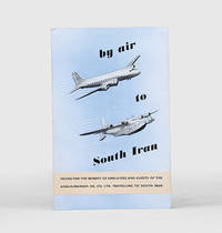
By Air to South Iran.
Malta: Trade Commissioner to the Malta Government 1955. A rare promotional guide to the air route from London to Basra produced for travellers destined for the Anglo-Iranian Oil Company's refinery at Abadan in Iran. A map shows the route passing through the eastern Mediterranean and Egypt before arriving in Iraq. The text attempts to give the impression of a well-organized journey: "At Basra you will be met by a representative of the Company who will help you with the Customs and other formalities. After a meal at the Airport Hotel you will find that arrangements have been made for your onward journey to your destination". The map to the verso shows critical infrastructure across the Middle East including oil pipelines and railways. Octavo. With 4 photographs and 2 colour maps. Folding colour printed pamphlet 140 x 215 mm when folded 420 x 215 mm when open. Minor scuffing creased at centre a touch foxed at front. A very good copy. unknown
Referenz des Buchhändlers : 171428
|
|
|
ARABIAN GULF CARTOGRAPHY
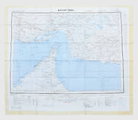
Fabric map: Bandar Abbas and Hofuf GSGS No. Misc. 350.
London: War Office; Printed for D. Survey WO and AM by Balding and Mansell Ltd 1957. A bright example of this detailed Gulf map Classified "restricted" and issued for military use at the time of the Jebel Akhdar War this double-sided sheet shows much of the modern-day UAE extending northwards from the latitude of Abu Dhabi and the Buraimi Oasis as well as the eastern Arabian Peninsula from the Trucial Coast to Jubail. As with other contemporary GSGS maps the sheet covers six degrees of longitude and highlights towns of significance and other standout features for example oil pipelines and wells water systems and roads and railways. Rayon sheet 630 x 710 mm printed both sides in colour folded as issued. A fine example. unknown
Referenz des Buchhändlers : 182684
|
|
|
ARABIAN GULF ECOLOGY
Final Act of the Kuwait Regional Conference of Plenipotentiaries on the Protection and Development of the Marine Environment and the Coastal Areas.
Perhaps Kuwait: United Nations Environment Programme 1978. First and sole edition untraced in Middle Eastern libraries of this plan enshrining environmental protection as a priority for future development along the Arabian coast. The regional conference highlighted the dangers posed by oil spills and committed to pollution-control measures for future projects. Participants included delegates from Bahrain Iran Iraq Kuwait Oman Qatar Saudi Arabia and the UAE. Attendees also agreed on a regional trust fund funded in different proportions by eight governments including the UAE and Saudi Arabia to finance initiatives. In the United Kingdom copies can be found at the universities of Oxford Durham and Southampton. We have also located three each in the US and Canada two in Germany two in Switzerland and one each in Austria and Sweden. Octavo. Original pale blue wrappers wire-stitched as issued front cover lettered in black. Light peripheral toning to covers small rust mark at top corner of front cover back cover slightly creased: a very good copy. unknown
Referenz des Buchhändlers : 172055
|
|
|
ARABIAN GULF
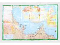
Kh ritat al-turuq f al-Khal j.
Saudi Arabia: Kruger for I.P.A. International Bookshops Dharan Airport 1977. Road construction faster than map production A folding road map of the Gulf and an interesting snapshot of its natural and human geography in the 1970s with 25 attractive photographs of Dubai. The map extends from Kuwait to Oman's Jabal al-Akhdar showing primary metalled roads roads under construction secondary roads towns wadis oil wells and pipelines oilfields and the morphology of the terrain. It also features 7 inset maps of the city centres of Manama Doha Abu Dhabi Kuwait Dubai Mutrah and Muscat. The small print in the reference section explains that "all roads under construction are being completed as the progress was faster than our production". The photos of Dubai include views of Dubai Creek dhows dromedaries and camels local inhabitants and the main heritage sites. Colour printed map folded 295 x 157 mm; unfolded 585 x 910 mm. Text in Arabic and English. Seven inset maps of Gulf capital cities verso with 25 colour photograph views of Dubai by Said Salah. Original colour self-wrappers printed in yellow black and white on a red and green ground. A few tiny chips or light wear to some folds couple of minor creases to outer corners: a very good exemplar. unknown
Referenz des Buchhändlers : 181557
|
|
|
ARABIAN GULF CARTOGRAPHY; OMAN
Muscat - Masira North F40 GSGS NG40.
London: Geographical Section General Staff 1956 & 1957. Scarce maps of Oman and south-east Arabia dating to the Jebel Akhdar War A pair of decidedly uncommon and impressively sized regional maps both second editions Muscat-Musira following the first of 1945 S. E. Arabia first published in 1956. The Muscat-Masira map drawn up by D Survey of the Ministry of Defence reaches as far north as Khaburah Oman on the coast south beyond Masirah Island and westward reaching beyond Lahus and Hadhi. It is based on several mappings including Bertram Thomas's map of Rub' al Khali the "Empty Quarter" 1931 the sand desert covering most of the southern third of the Arabian Peninsula Samuel Barrett Miles 1910 map of Oman and Captain F. F. Hunter's map of Arabia 1935 revision. The aeronautical chart goes into greater detail reaching beyond Sur in the North South to Masirah Island and Manadhif and West to Uruq ash Shaybah UAE; this was drawn up by No. 1 SPC.RE i.e. Survey Production Centre Royal Engineers and is based largely on the USAF Aeronautical Approach Charts 1956 and World Aeronautical Chart 563 1951. During the mid to late-1950s Britain was involved in a number of disputes in Oman perhaps the most serious involving the Imam Ghalib al-Hinai and his brother Talib bin Ali who led the Imamate's revolt against Sultan Said bin Taimur which resulted in the Jebel Akhdar or Oman War 1954-1959. In this the RAF played a leading role not least because aircraft could at the same time expedite oil exploration operations in the interior of Oman. Pembrokes light transport aircraft and heavier Avro Ansons from 1417 Communication Flight RAF carried out reconnaissance "and other tasks during this operation against the Imamate and were the first aircraft ever to land at Nizwa marked "Nazwa" on the chart on a roughly cleared strip which proved extremely hazardous for the pilots but which was later transformed into a passable airfield" Lee p. 22. The present chart has two pencilled lines radiating from Masira airfield one of which passes through Nizwa near which is marked the "approx. position" of an airstrip. The chart bear the proviso that they should "not be taken as an authority on names" and that "the alignment of all tracks is approximate". Users were also directed to update information and highlight errors which were to be directly sent to the Director of the Military Survey in the War Office. There are noticeable graphical variations between the chart and map as fitting their usage. Before the Second World War pilots flew using landmarks - such as train tracks or roads - as pointers which meant that they relied on perfect weather conditions. However technological advances in aviation alongside the use of radio for more accurate navigation meant that to a degree pilots could work in more challenging conditions. This meant that maps with their focus on terrain and details relevant from the perspective of ground troops would become irrelevant when observed from a plane's altitude. Therefore a number of countries started to produce charts highlighting key information by reducing the contour structure and focusing on key landmarks necessary for aviators. The Muscat-Masira map uses a five-colour tint scale to distinguish altitude includes a glossary and key the latter identifying towns given four categories of importance significant ruins geographical features such as mountains hills marshes saddles and passes rivers water holes and man-made features such as railways roads tracks telegraph lines pipelines and pumping stations mosques and temples; tribal and regional names are also given. However reflecting the simplification required by pilots the S. E. Arabia chart only uses fives tones to highlight land mountains paths and the sea. These maps intended for use in the field would have had a high rate of attrition; WorldCat locates just a handful of copies of the Muscat-Masira map whilst S.E. Arabia 4802 is well represented institutionally but decidedly uncommon on the market. Two colour printed maps the first 1: 1000000 scale 860 x 640 mm the second 1:500000 scale 1100 x 825 mm. Both with creases from old folds and some minor marginal splits and spots the second with pencil lines marking a flight route from Masira Island and a notation in the margin; both remain very good. Sir David Lee The RAF in the Mediterranean and Middle East 1945-71 1978. unknown
Referenz des Buchhändlers : 153759

|
|
|
Arabian Gulf
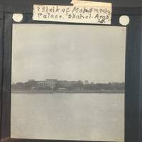
Sheik of Mohammerah Palace Shah-et-Arab in the Persian Gulf
Vintage Optical Lantern images of the Persian Gulf circa late 19 cent Glass size is about 3.25" x 3.25" . Vintage Image of the Persian gulf and The Sheik of Mohammerah Palace at Shah-et-Arab. A boat is docked in calm water along the bridge while a spray of palm leaves waves at the edge of a palace. The handwritten label reads "Sheik of Mohammerah Palace. Shah-et-Arab." The Shatt al-Arab also known as Arvand Rud River is a river formed by the confluence of the Euphrates and the Tigris. Mohammerah is city and port presently known as Khorramshahr a city in southwestern Iran. It lies on the right bank of the KÄrÅ«n River where it enters the Shatt al-Arab. The city occupies the site of the old Ê¿AbbÄsid port of Mohammerah but it was already in existence at the time of Alexander the Great. Since In 1847 it was ruled by a sheik known as the Emir of Mohammerah who was chief of the local Banu Ka'b tribe and built a large Palace known as Qasr al-Failiyah in Mohammera with very large arches that can be seen on the image. Very few historical artifacts exist from the times of Shaikh Khaz'al bin JÄbir bin MirdÄw al-Ka'bÄ« 1861-1936. After oil was discovered by the Anglo-Iranian Oil Company BP today in Khuzestan in 1908 Britain at first strengthened its ties to Shaikh Khaz'al. But after WWI The British stopped supporting him and in 1924 Mohammerah came under the control of the central government of Iran and was renamed Khorramshahr by Rez Shah of Iran. The cheikh was taken to Tehran and stayed in house arrest until his death in 1936. Out of all the sheikdoms around the gulf Abu Dhabi Dubai Sharjah Ajman Umm Al Quwain and Fujairah he is the only Emir to have lost his sheikdom. The southern end of the river constitutes the border between Iraq and Iran and discharges into the Gulf and has been the cause of multiple wars due to its huge oil reserves including the Iran-Iraq war. Scarce and in very good condition. unknown
Referenz des Buchhändlers : 17118
|
|
|
Arabian Oil Company.
Al Khafji. Khafji, Publish Relations Department, October 1986 - February 1987.
4to. 4 issues. 56 pp. each. Original printed wrappers. Stapled. Popular illustrated magazine published by the Arabian Oil Company. A set of 4 issues discussing aspects of Arabian engineering, agriculture, and the advances in science and medicine, as well as cultural and spiritual affairs. - Margins slightly worn.
|
|
|
Arabian Peninsula - Oman.
[Map of the Eastern Arabian Peninsula]. No place or date (but probably 1970s).
32 photocopies in polypouch binder (ca. 23 x 34 cm). Highly detailed and extensively hand-annotated map of the eastern end of the Peninsula, photocopied from the one-million scale pilots' ONC maps (Operational Navigation Chart) as a set of 32 sheets and self-assembled by a traveller to the region. Covers Oman, including the eastern portion of the United Arab Emirates and Saudi Arabia. The repeated notations, "maximum elevation believed not to exceed 200 feet" and "limits of reliable relief information" bear witness to the measure in which the inner Peninsula still constituted frontier country in the later 20th century.
|
|
|
Arabian Peninsula. - [Brown, Glen Francis].
[United States Geological Survey of the Kingdom of Saudi Arabia]. Arabian Peninsula. Map I-270 B-2. Washington, D.C., The Survey (U.S. Geological Society), 1967.
Large chromolithographed map (122 x 139 cm). Scale 1:2,000,000. Second edition. A highly detailed map of the complete Peninsula, the first modern map in 1:2,000,000 scale. Based on the groundbreaking series prepared by the U.S. Geological Survey and the Arabian American Oil Company under the joint sponsorship of Saudi Arabia and the U.S. State Department, "a unique experiment in geological cooperation among several governments, petroleum companies, and individuals" (Seager/Johnston). Also includes the territories of today's Kuwait, Qatar, Bahrain, United Arab Emirates, Oman, and Yemen. "The plan for a cooperative mapping project was originally conceived in July 1953 [... By 1955] there was established a cooperative agreement between the Kingdom of Saudi Arabia, the U.S. Department of State, and the Arabian-American Oil Co. to make available the basic areal geology as mapped by Aramco and the U.S. Geological Survey" (ibid.). The plan provided for 21 maps on a 1:500,000 scale in both geologic and geographic versions; "a peninsular geologic map on a scale of 1:2,000,000 was to conclude the project [...] The first geographic quadrangle was published in July 1956 and the last in September 1962. While preparation of the geographic sheets was in progress, a need arose for early publication of a 1:2,000,000-scale peninsular geographic map. Consequently, a preliminary edition was compiled and published in both English and Arabic in 1958" (ibid.). This revised, final version ("I-270 B-2") that first appeared in 1963 incorporated additional photographic, topographic and cultural data. The present map, printed in 1967, is a re-issue of the 1963 edition, merely differing in the date. Includes a key with symbols for water pipelines, desert watering points, oil fields, pumping stations, refineries, and a glossary of Arabic names. - "Although the search for oil, gas and minerals was ultimately to drive geological survey work across the region [...], in its early years it was the need for water that was the catalyst for Saudi Arabia's resource exploration. In 1944 King 'Abd al-'Aziz approached the United States for a technical expert who could assist with the identification and plotting of the kingdom's natural resources, particularly its groundwater reserves. The individual who arrived, Glen F. Brown, was one of the pioneers of a partnership between the United States Geological Survey (USGS) and the government of Saudi Arabia that was to span the next five decades and play an important role in the development of the kingdom [...] By 1954 the Saudi Ministry of Finance, USGS and Aramco were working together to produce the first full series of geographic and geologic maps of the country. The first of their type in the Peninsula, these were published [...] in both Arabic and English versions, and the information they contained formed the basis of subsequent Saudi national development plans. To this day, all modern maps of the kingdom trace their roots back to these first publications" (Parry). - Several small tears and paper loss to right and upper margin; occasional small holes. James V. Parry, "Mapping Arabia", in: Saudi Aramco World 2004/1, p. 20ff. OCLC 6681002. O. A. Seager/W. D. Johnston, Foreword to the Geology of the Arabian Peninsula series (U.S. Geological Survey Professional Paper 560-A-D, 1966).
|
|
|
Arabian Peninsula. - Brown, Glen F[rancis].
[United States Geological Survey of the Kingdom of Saudi Arabia]. Arabian Peninsula. Map I-270 B-1. Washington, D.C., The Survey (U.S. Geological Society), 1958.
1380:1216 mm. Lambert conformal conic projection, constant ratio linear horizontal scale 1:2,000,000. Relief shown by hachures and spot heights. Folded. A highly detailed map of the complete Peninsula, the first modern map in 1:2,000,000 scale: the rare preliminary edition, issued five years before the officical release. Based on the groundbreaking series prepared by the U.S. Geological Survey and the Arabian American Oil Company under the joint sponsorship of Saudi Arabia and the U.S. State Department, "a unique experiment in geological cooperation among several governments, petroleum companies, and individuals" (Seager/Johnston). Also includes the territories of today's Kuwait, Qatar, Bahrain, United Arab Emirates, Oman, and Yemen. "The plan for a cooperative mapping project was originally conceived in July 1953 [... By 1955] there was established a cooperative agreement between the Kingdom of Saudi Arabia, the U.S. Department of State, and the Arabian-American Oil Co. to make available the basic areal geology as mapped by Aramco and the U.S. Geological Survey" (ibid.). The plan provided for 21 maps on a 1:500,000 scale in both geologic and geographic versions; "a peninsular geologic map on a scale of 1:2,000,000 was to conclude the project [...] The first geographic quadrangle was published in July 1956 and the last in September 1962. While preparation of the geographic sheets was in progress, a need arose for early publication of a 1:2,000,000-scale peninsular geographic map. Consequently, a preliminary edition was compiled and published in both English and Arabic in 1958" (ibid.). While the revised, final version that appeared in 1963 ("I-270 B-2") would incorporate some additional photographic, topographic and cultural data, the exceedingly uncommon present, preliminary edition is surprisingly complete in virtually all respects - a testament to the precision with which Aramco's cartographers proceeded from the very first. Includes a key with symbols for water pipelines, desert watering points, oil fields, pumping stations, refineries, and a glossary of Arabic names. - "Although the search for oil, gas and minerals was ultimately to drive geological survey work across the region [...], in its early years it was the need for water that was the catalyst for Saudi Arabia's resource exploration. In 1944 King 'Abd al-'Aziz approached the United States for a technical expert who could assist with the identification and plotting of the kingdom's natural resources, particularly its groundwater reserves. The individual who arrived, Glen F. Brown, was one of the pioneers of a partnership between the United States Geological Survey (USGS) and the government of Saudi Arabia that was to span the next five decades and play an important role in the development of the kingdom [...] By 1954 the Saudi Ministry of Finance, USGS and Aramco were working together to produce the first full series of geographic and geologic maps of the country. The first of their type in the Peninsula, these were published [...] in both Arabic and English versions, and the information they contained formed the basis of subsequent Saudi national development plans. To this day, all modern maps of the kingdom trace their roots back to these first publications" (Parry). - In excellent condition. James V. Parry, "Mapping Arabia", in: Saudi Aramco World 2004/1, p. 20ff. OCLC 30099393. O. A. Seager/W. D. Johnston, Foreword to the Geology of the Arabian Peninsula series (U.S. Geological Survey Professional Paper 560-A-D, 1966).
|
|
|
Arabian Peninsula. - Brown, Glen F[rancis].
[United States Geological Survey of the Kingdom of Saudi Arabia]. Arabian Peninsula. Map I-270 B-1. Washington, D.C., The Survey (U.S. Geological Society), 1958.
1380 × 1216 mm. Lambert conformal conic projection, constant ratio linear horizontal scale 1:2,000,000. Relief shown by hachures and spot heights. Framed and glazed. A highly detailed map of the complete Peninsula, the first modern map in 1:2,000,000 scale: the rare preliminary edition, issued five years before the officical release. Based on the groundbreaking series prepared by the U.S. Geological Survey and the Arabian American Oil Company under the joint sponsorship of Saudi Arabia and the U.S. State Department, "a unique experiment in geological cooperation among several governments, petroleum companies, and individuals" (Seager/Johnston). Also includes the territories of today's Kuwait, Qatar, Bahrain, United Arab Emirates, Oman, and Yemen. "The plan for a cooperative mapping project was originally conceived in July 1953 [... By 1955] there was established a cooperative agreement between the Kingdom of Saudi Arabia, the U.S. Department of State, and the Arabian-American Oil Co. to make available the basic areal geology as mapped by Aramco and the U.S. Geological Survey" (ibid.). The plan provided for 21 maps on a 1:500,000 scale in both geologic and geographic versions; "a peninsular geologic map on a scale of 1:2,000,000 was to conclude the project [...] The first geographic quadrangle was published in July 1956 and the last in September 1962. While preparation of the geographic sheets was in progress, a need arose for early publication of a 1:2,000,000-scale peninsular geographic map. Consequently, a preliminary edition was compiled and published in both English and Arabic in 1958" (ibid.). While the revised, final version that appeared in 1963 ("I-270 B-2") would incorporate some additional photographic, topographic and cultural data, the exceedingly uncommon present, preliminary edition is surprisingly complete in virtually all respects - a testament to the precision with which Aramco's cartographers proceeded from the very first. Includes a key with symbols for water pipelines, desert watering points, oil fields, pumping stations, refineries, and a glossary of Arabic names. - "Although the search for oil, gas and minerals was ultimately to drive geological survey work across the region [...], in its early years it was the need for water that was the catalyst for Saudi Arabia's resource exploration. In 1944 King 'Abd al-'Aziz approached the United States for a technical expert who could assist with the identification and plotting of the kingdom's natural resources, particularly its groundwater reserves. The individual who arrived, Glen F. Brown, was one of the pioneers of a partnership between the United States Geological Survey (USGS) and the government of Saudi Arabia that was to span the next five decades and play an important role in the development of the kingdom [...] By 1954 the Saudi Ministry of Finance, USGS and Aramco were working together to produce the first full series of geographic and geologic maps of the country. The first of their type in the Peninsula, these were published [...] in both Arabic and English versions, and the information they contained formed the basis of subsequent Saudi national development plans. To this day, all modern maps of the kingdom trace their roots back to these first publications" (Parry). - Some insignificant browning; a few slight edge defects professionally repaired. Altogether in fine condition. James V. Parry, "Mapping Arabia", in: Saudi Aramco World 2004/1, p. 20ff. OCLC 30099393. O. A. Seager/W. D. Johnston, Foreword to the Geology of the Arabian Peninsula series (U.S. Geological Survey Professional Paper 560-A-D, 1966).
|
|
|
Aramco - Loss prevention.
A man's best friend is his hard hat! Dammam, Altraki printing press, October 1976.
575 x 425 mm. Colour lithograph, signed "Ibrahim K.". Mounted on styrofoam board. Bilingual safety poster in Arabic and English. - Traces of folds.
|
|
|
Aramco - Loss prevention.
Clean up! Dammam, Altraki printing press, March 1976.
580 x 420 mm. Colour lithograph, signed "Ibrahim K.". Mounted on styrofoam board. Bilingual safety poster in Arabic and English. - Traces of folds.
|
|
|
Aramco - Loss prevention.
Electricity can kill you. Call an expert. Dammam, Altraki printing press, May 1976.
580 x 420 mm. Colour lithograph, signed "Ibrahim K.". Mounted on styrofoam board. Bilingual safety poster in Arabic and English. - Traces of folds.
|
|
|
Aramco - Loss prevention.
Handle dangerous chemicals with care. Dammam, Altraki printing press, September 1976.
575 x 420 mm. Colour lithograph, signed "Ibrahim K.". Mounted on styrofoam board. Bilingual safety poster in Arabic and English. - Traces of folds.
|
|
|
Aramco - Loss prevention.
Protect against summer heat. Jeddah, Dar al-Asfahani and Co., May 1973.
560 x 430 mm. Colour lithograph, signed "Ibrahim K.". Mounted on styrofoam board. Bilingual safety poster in Arabic and English. - Traces of folds.
|
|
|
Aramco - Loss prevention.
Protect your eyes! Wear safety glasses or goggles. Dammam, Altraki printing press, October 1976.
570 x 430 mm. Colour lithograph, signed "Ibrahim K.". Mounted on styrofoam board. Bilingual safety poster in Arabic and English. - Traces of folds, some brownstaining to lower right corner.
|
|
|
Aramco - Loss prevention.
Protect your lungs and save your life. Dammam, Altraki printing press, August 1976.
580 x 420 mm. Colour lithograph, signed "Ibrahim K." Mounted on styrofoam board. Bilingual safety poster in Arabic and English. - Traces of folds, some brownstaining to lower right corner.
|
|
|
Aramco - Loss prevention.
Save a life. Learn mouth-to-mouth resuscitation. Jeddah, Dar al-Asfahani and Co., June 1975.
555 x 430 mm. Colour lithograph, signed "Arab Jawa". Mounted on styrofoam board. Bilingual safety poster in Arabic and English. - Traces of folds.
|
|
|
Aramco - Loss prevention.
Take special care when parking on a hill! Dammam, Altraki printing press, December 1976.
570 x 425 mm. Colour lithograph, signed "Ibrahim K.". Mounted on styrofoam board. Bilingual safety poster in Arabic and English. - Traces of folds.
|
|
|
Aramco - Loss prevention.
Use a safety shower to wash off dangerous chemicals. Jeddah, Dar al-Asfahani and Co., August 1975.
560 x 430 mm. Colour lithograph. Mounted on styrofoam board. Bilingual safety poster in Arabic and English. - Traces of folds.
|
|
|
Aramco - Loss prevention.
Wash your hands before eating or sleeping. Dammam, Altraki printing press, August 1976.
570 x 430 mm. Colour lithograph. Mounted on styrofoam board. Bilingual safety poster in Arabic and English. - Traces of folds.
|
|
|
Aramco - Loss prevention.
Watch out for children! Drive with care. Dammam, Altraki printing press, 1976.
565 x 425 mm. Colour lithograph, signed "A. Jawa". Mounted on styrofoam board. Bilingual safety poster in Arabic and English. - Traces of folds. Numbered "B61-2" in blue pen below the horizonat fold on the right.
|
|
|
Aramco - Loss prevention.
Wet roads? Slow down! Dammam, Altraki printing press, December 1976.
570 x 420 mm. Colour lithograph, signed "Ibrahim K.". Mounted on styrofoam board. Bilingual safety poster in Arabic and English. - Traces of folds.
|
|
|
Aramco.
Two photos of Aramco airplanes. [Probably Dhahran, ca. 1950s].
100 x 74 mm and 95 x 70 mm. Two Douglas DC-3 aircraft (registrations N720A and N726A) in their 1950s or early 1960s Aramco livery.
|
|
|
Ardoynis, Santes de.
De venenis. Venice, Bernardino Rizzo for Johannes Dominicus de Nigro, 19. VII. 1492.
Folio (420 x 280 mm). (4), 101, (1) ff. Later calf with gold- and blind-tooling. First edition of a work on poisons, compiled by Sante Arduino (or Ardoini) of Pesaro. "[T]he elaborate compendium on poisons in eight books which Sante Ardoini of Pesaro compiled in the years, 1424-1426, from Greek, Arabic and Latin works on medicine and nature, and which was printed at Venice in 1492, and at Basel in 1518 and 1562 [...] Although Ardoini quotes previous authors at great length, his work is no mere compilation, since he does not hesitate to disagree with such medical authorities of Peter of Abano and Gentile da Foligno, and refers to his own medical experience or observation of nature at Venice and to what fisherman or collectors of herbs have told him. He also seems to have known Arabic, and his occasional practice of giving the names of herbs in several Italian dialects is of some linguistic value" (Thorndike). Arduino makes extensive use of the works by Avicenna (Ibn Sina), who "held a high place in Western European medical studies, ranking together with Hippocrates and Galen as an acknowledged authority" (Weisser). Among the numerous other sources he used are Galen, Avenzoar (Ibn Zuhr), Rasis (al-Razi), Andromachus, Albucasis (Al-Zahrawi), Serapion the Younger and Dioscorides. - A very good copy, with only a few marginal waterstains. Binding slightly rubbed along the extremities and with a few scratches on boards. Hain-Copinger 1554. Goff A-950. Ohly-Sack 233. Walsh 2186. Proctor 4963. BMC V, 403. GW 2318. Thorndike III, 545. ISTC ia00950000.
|
|
|
Argensola, Bartolome Leonardo de.
Conquista de las islas Malucas. [Madrid, Alonso Martin, 1609].
Small folio (222 x 296 mm). (12), 407 (but: 411; 316-319 numbered twice), (1) pp. Engraved figurative title (lower border cropped with loss of imprint, as common). 18th century red gilt morocco, boards with richly gilt floral décor, gilt edges of covers, richly gilt spine in seven compartments with raised bands, black title label, speckled edges. Marbled endpapers. In modern custom-made chemise of auburn cloth and a cloth case with spine in red morocco and five raised bands, title in gold. First edition of the author's principal work, very rare, especially with the engraved title. The book mostly discusses the Philippines and the Moluccas, but also deals with China, Java, Sumatra, and Ceylon, with references to "los estrechos Persico y Arabico" (p. 12). The Portuguese naval commander Afonso de Albuquerque had conquered Malacca in the early 16th century, several decades after Arab merchants had introduced Islam to the islands. - "Few narratives are written with so much judgment and elegance [...] One of the most important works for the history of the Philippine islands [...] The book also contains matter relating to Sir Francis Drake and American voyages, and to the history of Spanish and Portuguese exploration in the Indies" (Cox). "Very lucidly and elegantly written" (cf. Ebert). "Copies with the engraved title are rare, and still more difficult to find are copies in which the printer's name and date of printing are preserved at its bottom" (cf. Salvá). "For the compilation of this work, the author had the command of all authentic manuscript relations, which were either in official custody, or in private hands, besides the testimony of such persons then living as had been eyewitnesses to any part of what he delivers" (Griffin). - Boards somewhat worn and rubbed, a few spots, some small cracks in the joints, slight defects at head and foot of spine, but altogether a beautifully preserved copy. Final leaf laid down, some small, inconspicuously repaired wormholes near headlines. Some occasional foxing and browning; pages 65-68 with a remargined flaw at the edge (no loss to text). Provenance: Engraved bookplate of Jeremiah Hill (early 18th century). Later in the famous library of Sir Thomas Phillips (1792-1872, with shelfmark and inscription "MHC" in pencil). Sold at Sotheby's June 23, 1988 for £3,800 (lot 110); latterly in the private collection of the Swedish antiquarian bookdealer Björn Löwendahl (1941-2013). Palau 16089. Cat. Nederl. Scheepv. Mus. 494. Cox I, 284. Brunet I, 419. Ebert 994. Graesse I, 193. Griffin/Ph. 23. Penney 304. Maggs (Spanish Books) 54a. Pardo de Tavera 121. Reiss & Auvermann 40 (Travel & Exploration) 408. Sabin 1946. Salvá 3349.
|
|
|
Arif Pacha, Muchir.
Les Anciens Costumes de l'Empire Ottoman, depuis l'origine de la monarchie jusqu'a la reforme du Sultan Mahmoud. Paris, Lemercier, 1863.
Folio (548 x 400 mm). Vol. I (all published). Lithographic portrait of Arif Pasha, on India paper mounted, drawn on stone by M. Julien, 16 tinted lithographic plates after Arif (lacking lithographic title, toning to text). Contemporary black half morocco over black cloth-covered boards with gilt title to spine. First edition of the valuable and beautifully illustrated survey of the costume worn at the court of the Ottoman Empire, published with the text in both French and Turkish. Ministers, state officials and military officers (including intelligence service) are shown in full costume with their functions captioned in Arabic and French below. Although the lithographic title states 'Tome 1er', no further volume was published in either language. - Arif Pasha fought against the Greeks at Athens and at Euboea (1826-28), and in Syria against Mehmet Ali. His career included a number of missions for the Sultan and his appointment in 1861 as governor of the province of Silistria. Atabey 30. Blackmer 43. Lipperheide 1440m. Colas I, 148.
|
|
|
Arif Pacha, Muchir.
Les Anciens Costumes de l'Empire Ottoman, depuis l'origine de la monarchie jusqu'a la reforme du Sultan Mahmoud. Paris, Lemercier, 1863.
Folio (548 x 400 mm). Vol. I (all published). Lithographic calligraphic title, portrait of Arif Pasha, drawn on stone by M. Julien, 16 tinted lithographic plates after Arif, coloured and finished by hand. Modern cloth. First edition of this valuable and beautifully illustrated survey of the costumes worn at the court of the Ottoman Empire, published with the text in both French and Turkish. Ministers, state officials and military officers (including intelligence service) are shown in full costume with their functions captioned in Arabic and French below. Although the lithographic title states 'Tome 1er', no further volume was published in either language. - Arif Pasha fought against the Greeks at Athens and at Euboea (1826-28), and in Syria against Mehmet Ali. His career included a number of missions for the Sultan and his appointment, in 1861, as governor of the province of Silistria. - A little marginal soiling, a few closed tears, portrait lacking tip of lower corner, but overall a good, complete copy of the rare coloured issue. Atabey 30. Blackmer 43. Lipperheide 1440m. Colas I, 148.
|
|
|
Armillary sphere with celestial globe.
Rotating celestial globe, surrounded by four pivotable concentric rings, the uppermost with ornamental mount. Arabic, [1713 CE] = 1125 H.
Engraved and etched gilt brass with lettering in Arabic. Total height from ring to base 53 cms. Exceptionally large armillary sphere with rich calligraphical and ornamental decoration as an image of the universe. The celestial sphere is surrounded in the centre by rings with the signs of the zodiac (outside) and various planet symbols. The names of the zodiac signs and months are engraved in Arabic. Signed and dated by the artist, an "Alexander", in the year H 1125. A nearly identical object is kept at the Globe Museum of the Austrian National Library at Vienna (item GL. 214), there classified as "Persian/Arabic". While simple celestial globes are not uncommon in the trade, elaborate specimens of the present size (53 cms) are very rare. - Slightly soiled and corroded, but almost not rubbed.
|
|
|
ARMOUR Tommy -
How to play Your Best Golf all the Time.
New York, Simon & Schuster, 1953, 8vo (cm. 15 x 22,5) legatura editoriale con sovraccopertina illustra a a colori (con qualche strappetto ai margini) pp. 152 con molti disegni nel testo.

|
|
|
ARMOUR**, TOMMY:
A Round of Golf with Tommy Armour.
<p>UKslim 8vo HBdw/djillustrated1st edn. Preceded by the US1st edn issued a year earlier in 1959. Author's 2nd book/title following on from his first and best-seller 'How to Play Your Best Golf All the Time'. FINE/VG. Owner's neat ink namedate inscrptn to reverse of ffe and no price-clip to dw/dj. Bright crisp generally clean matt colour pictorial artwork non-credited illustrated front panelspine of dw/dj with red and black lettering; with negligible shelf-wear or creasing to edges and corners - no major nicks or tears present. Head of spine/backstrip of dw/dj bumpedcreased and minimally rubbed and rear inner flap with an accidental approx 1/2" internal vertical crease to it's entire length. Topfore-edges slightly aged/toned but still generally bright and clean; contents bright tight clean solid and sound - near pristine - no dog-ear reading creases to any pages' corners appears unread apart from my collation. Publisher's bright clean but slightly sunned sharp-cornered original plain green cloth boards with a black ink golf club 2 hand-grip vignette to front board's lower right-hand corner and bright crisp blocked gilt titlepublisher letters to printed gilt double-line edged dark green box/label on spine/backstrip and clean multi-green coloured golf links illustrated endpapers. Part of the dw/dj illustration/design has 'ghosted' or bled throughto the front board beneath. UKslim 8vo HBdw/djillustrated1st edn 1-143pp paginated includes 15 chapters4-colour block green pale green black and white illustrations by Merrit D. Cutler as chapter head pieces part-page and full-page illustrations and technique diagrams throughout the text and the book; plus unpaginated half-title page publisher advert for Armour first best-seller book with full page colour illustration to it's reverse by Cutler title page a dedication a Contents list/table title separator page a Note about author and 2pp blanks at the rear. Described hard but fairly and honestly - not as bad as it reads or would sound! See my book ID rja651616 for his 3rd book - 'Tommy Armour's ABC's OF GOLF'a UK8vo HBdw/dj1st edn. A BOOK FOR EVERY GOLFER by one of the acknowledged Masters of the Game. Nine holes of a friendly foursome described stroke by stroke with instruction and advice both technical and strategic given to the players who are of very different prowess the whole lit up by anecdotes from Tommy Armour's personal experience to illustrate his points. Instructive entertaining and splendidly illustrated by Merrit D. Cutler. Please contact seller @ rpaxtonden@blueyonder.co.uk because of the value of this item for correct insuredor uninsured at own risk shipping/Pp quotes - particularly ALL overseas buyers - BEFORE ordering through the order page! N.B. ALL buyers please note stocks' shipping quotes are adjusted for any refunds AFTER receipt of order and BEFORE the despatch of the order especially if the item is offered either Pp included/FREE. <br /> N.B. US/Canada customers please be aware: Standard US AIRMAIL to these destinations can now in some cases cost more than the price of the book! If speed is not of the essence then Economy rate is recommended - at approx. anything from a 1/3rd to 1/2 of the standard US AIR quote/rate - sometimes arriving sooner than the 42 days - but not always.</p> LONDON.HODDER & STOUGHTON.1960. hardcover
Referenz des Buchhändlers : rja651716
|
|
|
Armstrong, Harold Courtenay.
Le Maître de l'Arabie: Ibn Séoud. Paris, Payot, 1935.
8vo. 279, (1), (6, publisher's catalogue) pp., final blank leaf. With 5 maps in the text. Original illustrated green wrappers. First French translation, by Geneviève and Pierre-François Caillé, of Captain Armstrong's 1934 biography of Abdulaziz Ibn Saud (1875-1953), the founder and first monarch of Saudi Arabia, "Lord of Arabia, Ibn Saud", revised and expanded with a new chapter by the author. - From the library of Vittorio Emanuele III, King of Italy, with shelfmark label of the royal library to spine. An excellent copy.
|
|
|
Arnett, Chris
The Terror of the Coast: Land Alienation and Colonial War on Vancouver Island and the Gulf Islands, 1849-1863
382 pages. Bibliography. Extensive footnotes. Black and white illustrations. "Previously ignored, the war between the 'people of the land' and the colonial government remains of utmost significance in today's world of unsettled First Nations' land claims. After the war of 1863 aboriginal land continued to be alienated, and Native jurisdiction eroded, throughout British Columbia - leaving an inequity which remains unresolved almost a century and a half later." - from back cover. Clean, bright and unmarked with very light wear. A high quality copy. May shock readers who think of area history in terms of only fishing, logging and mining. Book

|
|
|

 Per e-mail erhalten
 Als pdf-Dokument herunterladen
 RSS feed
 Permanenter link


