|
Vandermaelen, Philippe
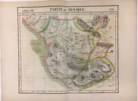
Partie du Mexique Amer. Sep. No. 47 Utah and the Southwest
Very Good. Brussels Ph. Vandermaelen 1827. Scarce 1827 map from the famed "Atlas Universal de Geographie Physique Politique Statistique et Mineralogique" compiled and published by Philippe Vandermaelen. Hand colored. Map measures 21 x 29 inches. Map has light soiling minor chipping along bottom edge and was at one time rolled. Overall very good. Although many of the landmarks are erroneously located this was one of the earliest printed maps of the Utah area and shows great detail compared to others of the time period. Lac de Timpanogos Teguayo Lac Sale and Rio de St Buenaventura are seen along with Orajbe Oraibi in northern Arizona Sierra de los Guacaros Rio Nabajoa and Rio Zaguanganas possibly the Colorado and Green Rivers. Native American tribes are noted on the map such as Indiens Yutas Tabeguachis Indiens Moqui and Indiens Nabajou. The text at the left of the map provides statistics and history of Mexico. Philippe Vandermaelen's "Atlas Universal" was a remarkable achievement in the field of cartography. The Atlas was compiled into a 6 volume set and contained 380 map sheets and 40 pages of statistical tables Princeton University. Mapping the world on a large uniform scale and using the then-new printing process of lithography the Atlas provided the most detailed and complete view of the globe at the time. . unknown
Référence libraire : 024185
|
|
|
VANDERMAELEN, Philippe Marie
Partie Du Mexique; Amer. Sep. No. 64
Brussels 1827. Map. Lithograph with original hand coloring. 18" x 21".<br/> <br/> Beautiful depiction of Western Mexico with a focus on elevation from Mazatlan to Manzanillo -Mexico's busiest Pacific port. Phillippe Marie Vandermaelen 1795-1869 was a Belgian cartographer and publisher. His Atlas universal was both the first lithograph atlas and the first atlas to map the world on a uniform scale. The maps were meant to join together to form a huge globe. This map is a fine example of his work.<br/> <br/> unknown
Référence libraire : 279853
|
|
|
VANDERMAELEN, Philippe Marie
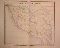
Partie du Perou Amer. Mer. No. 20
Brussels: Phillippe Marie Vandermaelen 1827. unbound. very good. Map. Lithograph with original hand outline. Image measures 19" x 21.5".<br/> <br/> Beautiful map of southern portion of Peru with Lake Titicaca in great detail. Also included is Cuzco the historic capital city of the Incan Empire where Machu Picchu was "discovered" in 1911. Double page with centerfold. From Vandermaelen's 6 volume "Atlas universel de geographie physique politique statistique et mineralogique sur l'echelle de 1/16411836". Can be combined as gores to form an immense globe. The atlas was the first to map the world on a uniform scale.<br/> <br/> Phillippe Marie Vandermaelen unknown
Référence libraire : 204788
|
|
|
Vandermaelen, Philippe
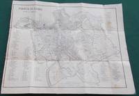
Pianta di Roma Antica e Moderna
Paris: Selves Fils 1823. No printed date circa 1823. Folding linen backed uncoloured map of Rome. Map measures 53x40.cm plus marging in 15 secitions. Map has surface wear mainly to folds some light stain marking abrasion wear on margins. Generally map in good condition. F. Near Very Good. Selves Fils unknown
Référence libraire : 016312
|
|
|
Vandermaelen, Philippe Marie Guillaume
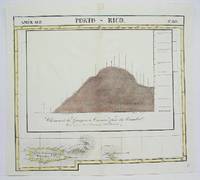
Porto - Rico No.69
Brussels 1825. Very Goodminor worming appear at the upper and lower portion of the map along the central fold proficiently repaired. Notes: The first atlas of the world on a uniform scale. If assembled as a globe gores forms a very large globe. Size : 480x535 mm 18.875x21 Inches Coloring: Original Outline Coloring Category: Maps West Indies Dominican Republic / Haiti & Puerto Rico; unknown
Référence libraire : M4499
|
|
|
Vandermaelen, Philippe Marie Guillaume
Presqu'Ile D'Alaska No. 21
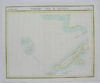
Brussels 1825. Very Good minor worming on upper portion of the map not affecting the map proficiently repaired. Notes: The first atlas of the world on a uniform scale. If assembled as a globe gores forms a very large globe. Size : 475x580 mm 18.75x22.875 Inches Coloring: Original Outline Coloring Category: Maps Polar Arctic Regions Alaska Greenland Iceland; unknown
Référence libraire : M4497
|
|
|
VANDERMAELEN, Philippe
Riyadh. Partie du Pays de Nedjd.
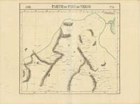
Brussels 1825. THE FIRST MAP TO CALL RIYADH BY ITS MODERN NAME. Original lithographed map 53 x 70.5 cm with contemporary hand-colour in outline. Published in the first atlas to cover the landmasses of the entire world on a uniform scale constructed as a modified conical projection and if assembled forming a globe with a diameter of 7.75 metres although only one such was known to have been made by the author himself and requiring a specially designed room. It offered the largest picture of the earth's surface available in the nineteenth century and was the first atlas to be produced throughout by lithography. It is also significant for being the first large-scale European mapping of the Arabian peninsula based on the very latest authorities. This particular map of Arabia is the first map to call Riyadh by its modern name here El-Ryad. [Brussels, 1825]. unknown
Référence libraire : 65397
|
|
|
VANDERMAELEN, Philippe Marie
Senegal. Afrique. No. 19
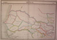
Brussels: Vandermaelen Philippe Marie 1827. unbound. very good. Map. Large format lithograph of West Africa with original hand coloring. Image measures 18.5" x 22.25".<br/> <br/> Includes Senegal and Gambia. Double page with centerfold. From Vandermaelen's 6 volume "Atlas universel de geographie physique politique statistique et mineralogique sur l'echelle de 1/16411836". Can be combined as gores to form an immense globe. The atlas was the first to map the world on a uniform scale.<br/> <br/> Vandermaelen, Philippe Marie unknown
Référence libraire : 202219
|
|
|
Vandermaelen, Philippe Marie Guillaume
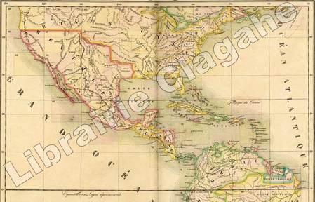
Tableau Provisoire d'Assemblage d'une Partie de l'Amerique sep. & d'une Partie de l'Amerique Meridionale.
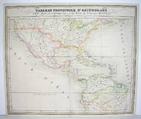
Bruxelles 1827. Good; some restoration in lower left corner. Notes: From Vandermaelen's "Atlas Universel de Geographie Physique Politique Statistique et Mineralogique" Brusseles 1827. Size : 478x567 mm 18.75x22.25 Inches Coloring: Original Outline Coloring Category: Maps North America;; Maps Central America unknown
Référence libraire : M2740
|
|
|
Vandermaelen Philippe
Amer. Sep. Haiti ou St. Domingue. No. 68. with Curacao. No. 74
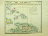
Bruxelles: Ph. Vandermaelen 1827. First edition. Very good bright copies a few minor spots or marginal finger soiling. 2 sheets. Hand-colored lithographic maps. 46 x 53 cm and 50 x 56 cm. Large scale map of Haiti; map 68 also includes parts of Cuba and the Bahamas and has a text box entitled: Iles Bahamas ou Lucayes; map 74 includes the southern and remaining portion of Haiti plus Aruba Bonaire and small parts of Puerto Rico and Venezuela. Text box entitled: Republique d'Haiti. Redigee par A. Delavault. Sheets from Phillipe Vandermaelen Atlas universel de geographie physique politique statistique et mineralogique. a magnificent and ground breaking six volume atlas of the entire world which was the first Atlas to use lithography to show the entire world using such a large uniform scale approximately 26 miles to the inch and which was designed to be joined together into a three-dimensional globe with a diameter of approximately 25 feet. [Ph. Vandermaelen] unknown books
Référence libraire : 40377
|
|
|
Vandermaelen Philippe
Amer. Sep. Partie de la Vieille Californie. No. 47
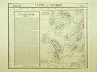
Bruxelles: Ph. Vandermaelen 1827. First edition. A very good sharp copy. 1 sheet. Hand-colored lithographic map. 47 x 57 cm. Shows the ranges of eight Indian tribes. Covers parts of Utah Colorado and northern Arizona and New Mexico. Includes text: Note sur le Mexique. At a time when American map publishers were virtually ignoring the western United States Vandermaelen's large scale work -which includes sections of Utah Wyoming Arizona and Nevada then still considered part of Mexico along with the location of Indian tribes and shows Lake Timpanagos- was a landmark in the history the cartography of the Transmississippi West. Large text box on the left entitled: Note sur le Mexique by A. Delavault. From Phillipe Vandermaelen Atlas universel de geographie physique politique statistique et mineralogique. a magnificent and ground breaking six volume atlas of the entire world which was the first atlas to use lithography to show the entire world using such a large uniform scale approximately 26 miles to the inch and which was designed to be joined together into a three-dimensional globe with a diameter of approximately 25 feet. Wheat Transmississippi 378. Sabin 43762. Phillips 749. [Ph. Vandermaelen] unknown books
Référence libraire : 40379
|
|
|
Vandermaelen Philippe
Complete Map of Brazil. Amer. Merid. Partie du Bresil. 17 Maps
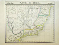
Bruxelles: Ph. Vandermaelen 1827. First edition. A very good sharp set housed in a clamshell box. 17 sheets. Hand-colored lithographic maps. 47 x 57 cm. The Empire of Brazil on a grand scale printed shortly after Pedro declared the independence of Brazil but before the conclusion of the Cisplatine War against the United Provinces of the RÃo de la Plata Argentina which cost her Uruguay. Sheets from Phillipe Vandermaelen Atlas universel de geographie physique politique statistique et mineralogique. a magnificent and ground breaking six volume atlas of the entire world which was the first Atlas to use lithography to show the entire world using such a large uniform scale approximately 26 miles to the inch and which was designed to be joined together into a three-dimensional globe with a diameter of aboout 25 feet. Includes all of Brazil with some surrounding areas: 1. Amer. Merid. no. 9. Partie de la Colombie et du Bresil. Parts of Peru Colombia and Brazil. 2. Amer. Merid. 10. Partie du Bresil. Amazonas region Brazil. 3. Amer. Merid. 11. Partie du Bresil. Parts of Amazonas Para and Amapa. 4. Amer. Merid. 12. Partie du Bresil. Covers parts of Para and Maranhao. 5. Amer. Merid. 13. Partie du Bresil. Parts of Piaui Ceara and Rio Grande do Norte. Text: Note sur le Bresil . Pour la suite voyez la carte no. 32. 6. Amer. Merid. 15. Partie du Perou et du Bresil. Parts of Peru Brazil and northern Bolivia. 7. Amer. Merid. 16. Partie du Bresil. Parts of Brazil and northern Bolivia. 8. Amer. Merid. 17. Partie du Bresil. Parts of Mato Grosso Tocantins Amazonas and Para. 9. Amer. Merid. 18. Partie du Bresil. Parts Tocantins Bahia Maranhao and Piaui. 10. Amer. Merid. 19. Partie du Bresil. Parts of northeastern Brazil. 11. Amer. Merid. 22. Partie du Bresil. Part of Santa Cruz Bolivia and Mato Grosso and Mato Grosso do Sul Brazil. 12. Amer. Merid. 23. Partie du Bresil. Parts of Goias Federal District Minas Gerais and Tocantins. 13. Amer. Merid. 24. Partie du Bresil. Parts of Bahia and Minas Gerais with coast soundings. 14. Amer. Merid. 27. Partie du Bresil. Part of southern Brazil. 15. Amer. Merid. 28. Partie du Bresil. Parts of Sao Paulo Minas Gerais Espirito Santo and Rio de Janeiro states. 16. Amer. Merid. 32. Partie du Bresil. Part of southern Brazil. Text box: Note sur le Bresil. Pour le commencement voyez la carte no. 13. 17. Amer. Merid. 35. Partie du Bresil. Parts of Uruguay Rio Grande do Sul Brazil and Buenos Aires province Argentina an eighteenth sheet No.36 was labeled 'Partie du Bresil but in fact only included parts of Argentina and Chile. If joined together the map would measure approximately 9 x 7 feet. Phillips 749. Amer. Geol. Soc. Catalogue of Maps of Hispanic America: III p. 172. Sabin 43762. [Ph. Vandermaelen] unknown books
Référence libraire : 40380
|
|
|
VANDERMAELEN Philippe Marie
Partie Du Mexique; Amer. Sep. No. 64
Brussels 1827. Map. Lithograph with original hand coloring. 18" x 21".<br/><br/> Beautiful depiction of Western Mexico with a focus on elevation from Mazatlan to Manzanillo -Mexico's busiest Pacific port. Phillippe Marie Vandermaelen 1795-1869 was a Belgian cartographer and publisher. His Atlas universal was both the first lithograph atlas and the first atlas to map the world on a uniform scale. The maps were meant to join together to form a huge globe. This map is a fine example of his work.<br/><br/> unknown books
Référence libraire : 279853
|
|
|
Vandermaelen Philippe. Humboldt Alexander von
Amer. Sep. Partie de la Vieille Californie. No. 58. and No. 65
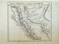
Bruxelles: Ph. Vandermaelen 1827. First edition. Very good bright copies a few minor spots or marginal finger soiling. 2 sheets. Hand-colored lithographic maps. 46 x 51 cm and 46 x 54 cm. Large scale map of Baja. Map 58 includes parts of Baja California Sonora Sinaloa and Chihuahua. Map 65 includes the tip of Baja California and the "Iles Revillagigedo" and a text box: Note sur le Mexique . de Humboldt. Sheets from Phillipe Vandermaelen Atlas universel de geographie physique politique statistique et mineralogique. a magnificent and ground breaking six volume atlas of the entire world which was the first Atlas to use lithography to show the entire world using such a large uniform scale approcimately 26 miles to the inch and which was designed to be joined together into a three-dimensional globe with a diameter of approximately 25 feet. Phillips 749. Sabin 43762. [Ph. Vandermaelen] unknown books
Référence libraire : 40378
|
|
|
Vandermaelen, Philippe Marie Guillaume :
Atlas Universel de géographie physique, politique, statistique et minéralogique, sur l'échelle de 1/1641836 ou d'une ligne par 1900 toises. D'après les meilleurs cartes, observations astronomiques et voyages dans les divers pays de la terre. Lithographié par H. Ode.
Bruxelles, PMG Vandermaelen éditeur, 1827 ; cinq tomes (Europe, Asie, Afrique, Amérique Septentrionale, Amérique Méridionale), in-folio atlantique (52,5 x 36 cm) ; demi-veau havane à petits coins verts, dos à faux-nerfs dorés, palette décorative dorée en tête et en pied, titre doré, tranches marbrées (reliure uniforme de l'époque) ; 1- Europe : (4), 43 pp., (1) p., tableau comparatif des principales hauteurs du globe (illustré en couleurs), carte d'assemblage de l'Europe et 29 cartes doubles. 2- Asie : (6) pp., carte d'assemblage de l'Asie et 111 cartes doubles. 3- Afrique : (4) pp., tableau d'assemblage de l'Afrique et 60 cartes doubles. 4- Amérique Septentrionale : (4), tableau d'assemblage et tableau provisoire d'assemblage d'une partie de l'Amérique Seple et d'une partie de l'Amérique Méridionale et 77 cartes doubles. 5- Amérique Méridionale : (4), carte d'assemblage d'Amérique Méridionale et 44 cartes doubles. Toutes les cartes sont en couleurs à quelques rares exceptions près et montées sur onglets.
Référence libraire : 9452
|
|
|
Vandersteen Willy Cambré Charel Nihoul Philippe Legendre Marc
Amphoria Tome 1 : Bob
Paquet 2014 56 pages 22x30x1cm. 2014. Broché. 56 pages.
Référence libraire : 100095466

|
|
|
Vandersteen Willy Cambré Charel Nihoul Philippe Legendre Marc
Amphoria Tome 1 : Bob
Paquet 2014 56 pages 22x30x1cm. 2014. Broché. 56 pages.
Référence libraire : 300031393

|
|
|
Vandersteen Willy Cambré Charel Nihoul Philippe Legendre Marc
Amphoria Tome 1 : Bob
Paquet 2014 56 pages 22x30x1cm. 2014. Broché. 56 pages.
Référence libraire : 500015820

|
|
|
Vandevelde, Philippe "Tome", Meyer, Ralph (Illustrator)
Sleep Little Baby: Gesamtausgabe
Schreiber Leser 2020. hardcover. gebraucht wie neu Alterbedingte Gebrauchsspuren! . 2200 x 180 x 3040 Schreiber + Leser hardcover
Référence libraire : 195276 ISBN : 3965820281 9783965820289
|
|
|
Vandiver, Pamela B (Editor)/ Li, Weidong (Editor)/ Sciau, Philippe (Editor)/ Maines, Christopher (Editor)
Materials Issues in Art and Archaeology: Vol 10
Cambridge Univ Pr 2020. Hardcover. New. 391 pages. 9.00x6.00x1.00 inches. Cambridge Univ Pr hardcover
Référence libraire : x-1605116335 ISBN : 1605116335 9781605116334
|
|
|
Vandooren Philippe
Quand chante l'oiseau-bonheur
Plon 1980 158 pages 18x11x1cm. 1980. Broché. 158 pages.
Référence libraire : 180223

|
|
|
Vaneigem Raoul and Internationale Situationniste trans. Christopher Gray and Philippe Visac
The Totality for Kids
<p>First English-language translation of Banalaités de Base. Unpaginated 31 pp. brochure. 8vo. Very good. Printed stiff wrappers saddle-stapled. 782</p><p><i>"The following text first appeared in Internationale Situationniste nos. 7 & 8. 1962-1963 under the title Banalaités de Base. The introduction was originally printed at the beginning of the second part as a synopsis of the first. Since England is as yet unfamiliar with situationist ideas and since the argument is very closely developed this synopsis has been used as a general introduction. No copyright was held on the original text and no copyright is held on this translation. Anyone can do whatever they like with it."</i></p> Christopher Gray / Equity Printers paperback books
Référence libraire : 782

|
|
|
Vaneigem, Raoul and Internationale Situationniste (trans Christopher Gray and Philippe Visac)
The Totality for Kids
<p>First English-language translation of Banalaités de Base. Unpaginated 31 pp. brochure. 8vo. Very good. Printed stiff wrappers saddle-stapled. 782</p><p><i>"The following text first appeared in Internationale Situationniste nos. 7 & 8. 1962-1963 under the title Banalaités de Base. The introduction was originally printed at the beginning of the second part as a synopsis of the first. Since England is as yet unfamiliar with situationist ideas and since the argument is very closely developed this synopsis has been used as a general introduction. No copyright was held on the original text and no copyright is held on this translation. Anyone can do whatever they like with it."</i></p> Christopher Gray / Equity Printers paperback
Référence libraire : 782
|
|
|
Vanhemelryck Fernand
Europa tegen de Turken de kruistocht van Filips de Goede
2009 Davidsfonds Uitgeverij Soft cover Good
Référence libraire : 023497
|
|
|
Vanhemelryck Fernand
Europa tegen de Turken de kruistocht van Filips de Goede
2009 Davidsfonds Uitgeverij Soft cover Good 1st Edition
Référence libraire : 030649

|
|
|
VANHULST Henri, VAN TIGGELEN Philippe John, WANGERMEE Robert, et autres
La musique dans la vie
Bruxelles, Crédit Communal, 1985. 22 x 30, 117 pp., 122 illustrations en N/B, 8 planches en couleurs, broché, couverture à rabats, très bon état.
Référence libraire : 96656
|
|
|
Vanhulst, Henri Van Tiggelen, Philippe John Verdebout, Luc [Wangerm e, Robert
muziek in het leven.
, Gemeentekrediet , 1985 Paperback, 119 pagina's, NL, 295 x 210 mm, goed, met ill. in kleur en z/w.
Référence libraire : 60089
|
|
|
VANIER Nicolas
LOUP
Paris XO Éditions : / Nathan 2009 In Quarto , Oblong L'album jeunesse du film avec un ajout en fin d'ouvrage sur les Evènes au coeur de la Sibérie éleveurs de rennes . Magnifiques illustrations en couleurs . Album jeunesse . - 44 p. , 650gr.
Référence libraire : 021141 ISBN : 2092525379

|
|
|
VANIER NICOLAS & CHATRIER JEAN PHILIPPE
LOUP - ROMAN.
FRANCE LOISIRS / XO EDITIONS. 2009. In-8. Relié. Bon état, Couv. convenable, Dos satisfaisant, Intérieur frais. 477 pages - jaquette en bon état - petite annotation sur la page de faux titre.. Avec Jaquette. . . Classification Dewey : 840.092-XXI ème siècle
Référence libraire : R240105898
|
|
|
VANIER, Nicolas / GRANIER, Laurent / LANSAC, Philippe / SON, Megan:
Alaska sur les traces des pionniers.
Arthaud, 2004, in-4to, 155 p., richement ill. de photographies couleurs, cartonnage original avec jaquette ill.
Référence libraire : 124105aaf
|
|
|
Vanloo (Robert) - Klein (Philippe)
Les Bijoux rose-Croix 1760-1890
Dervy 2003 In-8 broché. Occasion comme neuf.
Référence libraire : 52494
|
|
|
VANLYNSEELE Joseph & DEVILLARD Philippe
Carnet des familles nobles ou d'apparence en 1956, en 1957, en 1958 & en 1959
Paris, Les Cahiers Nobles 1957- 4 ouvrages reliés en un volume physique, [52] + [62] + [64] + [71] pp., tirage numéroté et limité à 666 exemplaires : ceci porte resp. le no.494-348-166-560, 28cm., publié dans la série "Les cahiers nobles" tomes 7-14-19-22, jolie reliure demi-toile rouge, titre doré au dos, plats décorés, brochures originales conservées et reliées, texte et intérieur sont frais, très bon état, poids: 1.3 kg., G115710
Référence libraire : G115710
|
|
|
Vanoyeke Violaine Engerer Philippe
Le sottisier des politiques: Gaffes piques et perles des hommes politiques
Hors Collection 2007 17x1 8x22 4cm. 2007. Broché.
Référence libraire : 500269229

|
|
|
VANRIE André (VAN HALTEREN Pierre, préface & DASNOY Philippe, introduction)
Bruxelles en gravures
s.l., Editions Erasme 1978 116pp.avec ills., reliure toile, jaq., 32cm., bel état
Référence libraire : B46582
|
|
|
Vapnarsky, Valentina (Editor)/ Michelet, Dominique (Editor)/ Monod Becquelin, Aurore (Editor)/ Nondedeo, Philippe (Editor)
Temporalities in Mesoamerican Ritual Practices
Univ Pr of Colorado 2025. Paperback. New. 420 pages. 9.00x6.00x1.00 inches. Univ Pr of Colorado paperback
Référence libraire : x-1646426819 ISBN : 1646426819 9781646426812
|
|
|
Vaquette ( Philippe )
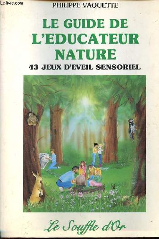
Le guide de l'éducateur nature : 43 jeux d'éveil sensoriel
Le Souffle d'or 1992, in-8 broché, 268pp, illustré - bon état
Référence libraire : 35229
|
|
|
Vaquette Philippe
Le guide de l'éducateur nature 43 jeux d'éveil sensoriel à la nature pour enfants de 5 à 12 ans.
Le souffle d'or. 1987. In-8. Broché. Etat d'usage, Couv. convenable, Dos satisfaisant, Quelques rousseurs. 280 pages - nombreuses illustrations, dessins en noir et blanc dans le texte.. . . . Classification Dewey : 577-Ecologie
Référence libraire : R160224566 ISBN : 290467019
|
|
|
VAQUETTE Philippe
Le Guide de L'éducateur Nature : 43 Jeux D'éveil Sensoriel
Barret-Le-Bas Le Souffle D'or 1996 Grand In 8 . - 240 p. , 700 gr.
Référence libraire : 013576

|
|
|
Varaigne (Philippe)
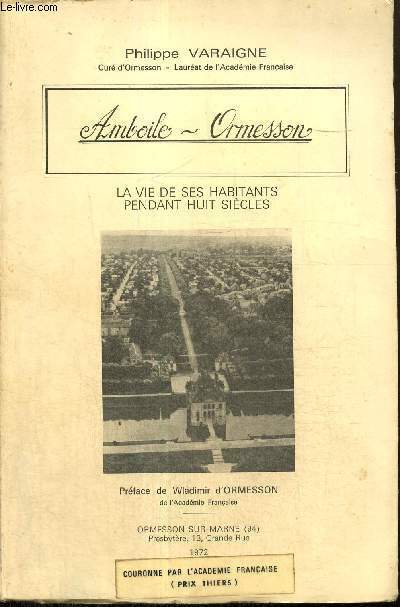
Amboile - Ormesson. La Vie de ses Habitants Pendant Huit Siècles
Ormesson sur Marne, chez l'auteur, 1972, in-8, 266pp, broché, très bel exemplaire abondamment illustré Préface de Wladimir d'Ormesson 266pp
Référence libraire : 2003
|
|
|
VARAIGNE (Philippe)
Amboile-Ormesson. La vie de ses habitants pendant huit siècles.
Ormesson-sur-Marne, 1972. in-8 br., 266 pp., 60 fig. in fine. Envoi de l'auteur.
Référence libraire : 574346
|
|
|
VARAIGNE (Philippe).
Amboile-Ormesson. La vie de ses habitants pendant huit siècles.
Ormesson-sur-Marne, Presbytère, chez l'auteur, 1972, gr. in-8°, vi-266 pp, préface de Wladimir d'Ormesson, 60 illustrations et plans (dont 38 sur 24 pl. hors texte), sources, biblio, broché, couv. illustrée, bon état (prix "Thiers" de l'Académie française). Edition originale
Référence libraire : 117735
|
|
|
VARAIGNE (Philippe).
Un curieux procès en 1765. L'affaire du sieur Papin curé d'Ormesson de 1754 à 1752.
Paris, Edition du Scorpion, 1966 petit in-8, 188 pp., 1 f., broché
Référence libraire : 2582
|
|
|
Varaigne Philippe
Amboile- Ormesson la vie pendant huit siècles
Ormesson 1972 266 pages in8. 1972. Broché. 266 pages. Couverture arrêtes usagées intérieur bon
Référence libraire : 515726

|
|
|
Varaigne Philippe
Amboile-Ormesson, la vie de ses habitants pendant huit siècles
Ormesson-sur-Marne. 1972. In-8. Broché. Etat d'usage, Couv. légèrement passée, Dos plié, Intérieur frais. 266 pages. Papier non coupé. Nombreuses photos monochromes hors texte à la fin de l'ouvrage. Dédicace de l'auteur au stylo bleu en page de faux titre. Deux photos disponibles.. . . . Classification Dewey : 97.2-Dédicace, envoi
Référence libraire : RO80256021
|
|
|
VARAIGNE Philippe
Amboile-Ormesson, La Vie De Ses Habitants Pendant Huit Siècles
Ormesson Imprimerie Gibert-clarey 1972 In-8 VI-266 pp, préface de Wladimir d'Ormesson, monographie par le curé de la paroisse
Référence libraire : 28750
|
|
|
VARAIGNE PHILIPPE
UN CURIEUX PROCES EN 1765, L'AFFAIRE DU SIEUR PAPIN, CURE D'ORMESSON DE 1754 à 1782
Le Scorpion. 1960. In-12. Broché. Bon état, Couv. convenable, Dos satisfaisant, Non coupé. 188 pages.. . . . Classification Dewey : 944.03-Histoire de France de 1589 à 1789
Référence libraire : RO40257099
|
|
|
VARAIGNE, Abbé Philippe.
Wissous et son Eglise. Préface de Jean dela Monneraye. Ouvrage orné de 40 gravures.
Tours, Imprimerie Gilbert-Clarey,1955; 1 volume grand in-8° broché,couveture vert d'eau imprimé et illustrée d'une vignette en noir; VIII,160pp.; 40 illustrations : dans le texte d'après des documents anciens et hors texte de photographies en noir.Couverture jaunie, rares piqûres.
Référence libraire : cROU-1999
|
|
|
VARAUD PHILIPPE
DROLES DE RAMES
EPIGONES. 1991. In-8. Cartonné. Bon état, Couv. convenable, Dos satisfaisant, Intérieur frais. 29 pages. Nombreux dessins en noir et blanc et en couleurs dans le texte de Jean-Alexandre ARQUES. Ouvrage de bibliothèque avec une couverture plastique transparente sur la couverture originale.Tampons de bibliothèque sur la page de titre. Une étiquette de code en pied du dos et en pied de la première de couverture.. . . . Classification Dewey : 790-Loisirs et arts du spectacle
Référence libraire : R160139234
|
|
|
VARAUD PHILIPPE
EN ROUE LIBRE
EPIGONES. 1992. In-8. Cartonné. Bon état, Couv. convenable, Dos satisfaisant, Intérieur acceptable. 29 pages. Nombreuses illustrations en couleurs dans le texte. Ouvrage de bibliothèque avec une couverture plastique transparente sur la couverture originale.Tampons de bibliothèque sur la page de titre. Une étiquette de code en pied du dos et en pied de la première de couverture. Légères mouillures sans taches en pied des pages.. . . . Classification Dewey : 790-Loisirs et arts du spectacle
Référence libraire : R160139233
|
|
|
Varenne Alex et De Saxe Philippe
La correction ou la confusion des sens
Albin Michel. Janvier 1998. In-4. Relié. Très bon état, Couv. convenable, Dos satisfaisant, Intérieur frais. 124 pages augmentées de nombreuses illustrations en noir et blanc hors texte.. . . . Classification Dewey : 843.0693-BD adultes
Référence libraire : RO40047345

|
|

 Recevoir par e-mail
 Télécharger en PDF
 Flux RSS
 Lien permanent


