|
Mitchell Samuel Augustus Jr.
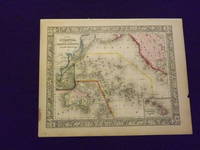
Map of Oceanica Exhibiting its Various Divisions and Island Groups.
<p>Unbound colored engraved map decorative boarder 14" x 11". Slight browning and aging a little staining in margins a couple of edge chips; overall bright and clean and in very good condition. Maps are wrapped with acid free board or in rigid sleeves. The Mitchell family started to produce atlases in 1846 and continued into the early 1890s. Around 1860 S. Augustus Mitchell Jr. took over and the atlas would be called Mitchell's New General Atlas. This is a very colorful map of Oceanica South Pacific from the 1864 installment of that atlas. The map includes the Polynesian Islands Australia part of the Chinese coast; part of the western portion of North America and the Sandwich Islands is shown in a small inset. Extra postage may be required. Ristow 311-313. </p> books
Referencia librero : 103248
|
|
|
Mitchell Samuel Augustus Jr.
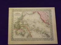
Map of Oceanica Exhibiting its Various Divisions and Island Groups.
<p>Unbound colored engraved map decorative boarder 14" x 11". Slight browning and aging; overall generally bright and clean and in very good condition. Maps are wrapped with acid free board or in rigid sleeves. The Mitchell family started to produce atlases in 1846 and continued into the early 1890s. Around 1860 S. Augustus Mitchell Jr. took over and the atlas would be called Mitchell's New General Atlas. This is a very colorful map of Oceanica South Pacific from the 1864 installment of that atlas. The map includes the Polynesian Islands Australia part of the Chinese coast; part of the western portion of North America and the Sandwich Islands is shown in a small inset. Extra postage may be required. Â Ristow 311-313. </p> books
Referencia librero : 103249
|
|
|
MITCHELL Samuel Augustus Jr.
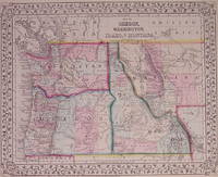
Map of Oregon Washington Idaho and part of Montana
Philadelphia: Mitchell Samuel Augustus Jr. 1871. unbound. very good. Map. Engraving with original hand coloring. Image measures 10.75" x 13.25".<br/><br/> S. Augustus Mitchell Jr. continued his father's successful mapmaking and publishing business and was one of the most prolific and renowned 19th century American publishers.<br/><br/> Mitchell, Samuel Augustus Jr. unknown books
Referencia librero : 203192
|
|
|
Mitchell Samuel Augustus Jr.
Map of Persia Turkey in Asia Afghanistan and Beloochistan.
<p>Unbound colored engraved map decorative boarder 14"x 11". Slight browning and aging; overall bright and clean and in very good shape. Maps are wrapped with acid free board or in rigid sleeves. The Mitchell family started to produce atlases in 1846 and continued into the early 1890s. Around 1860 S. Augustus Mitchell Jr. took over and the atlas would be called Mitchell's New General Atlas. This is a very colorful map of part of the Middle East from the 1864 installment of that atlas. The map includes an inset showing Palestine and the Holy Land. Extra postage may be required. Ristow 311-313. </p> books
Referencia librero : 103231
|
|
|
Mitchell Samuel Augustus Jr.
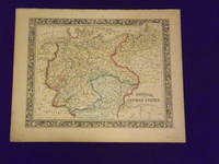
Map of Prussia and the German States.
Unbound colored engraved map decorative boarder 14"x 11". Slight toning and aging top margin a little rough at the edge but not significant; overall bright and clear and in very good shape. Maps are wrapped with acid free board or in rigid sleeves. The Mitchell family started to produce atlases in 1846 and continued into the early 1890s. Around 1860 S. Augustus Mitchell Jr. took over and the atlas would be called Mitchell's New General Atlas. This is an attractive fairly colorful map of Prussia from the 1861 Mitchell atlas. The map shows part of Poland and Switzerland and has a very sharp and attractive boarder. Ristow 311-313. books
Referencia librero : 106135
|
|
|
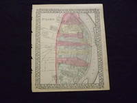
Mitchell Samuel Augustus Jr.
Map of St. Louis.
<p>Unbound colored engraved map decorative border 14 "x 11 ". Some browning and aging bottom margin narrow left margin has rough edge with some nicks and chips; still bright and clean and in very good shape. Maps are wrapped with acid free board or in rigid sleeves. The Mitchell family started to produce atlases in 1846 and continued into the early 1890s. Around 1860 S. Augustus Mitchell Jr. took over and the atlas would be called Mitchell's New General Atlas. This is a fairly detailed map of St. Louis from the 1870 installment of that atlas. Colorful and contains considerable street detail. May require extra postage. Ristow 311-313. </p> books
Referencia librero : 103221
|
|
|
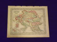
Mitchell Samuel Augustus Jr.
Map of the Austrian Empire Italian States Turkey in Europe and Greece.
Unbound colored engraved map decorative border 14"x 11". Slight toning and aging top margin a little rough on the edge; overall bright clear and crisp and in very good shape. Maps are wrapped with acid free board or in rigid sleeves. The Mitchell family started to produce atlases in 1846 and continued into the early 1890s. Around 1860 S. Augustus Mitchell Jr. took over and the atlas would be called Mitchell's New General Atlas. This is a very attractive single page colored map of mostly modern day Germany Italy and Turkey from the 1870 installment of that atlas. American maps with a complete picture of Italy are often hard to find. Ristow 311-313. books
Referencia librero : 106140
|
|
|
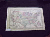
Mitchell Samuel Augustus Jr.
Map of the United States and Territories.
<p> Unbound colored engraved map decorative boarder 22 1/2" x 14 1/2". Slight toning and aging just a little darkening in margins; overall bright and clear and in very good condition. Maps are wrapped with acid free board or in rigid sleeves. The Mitchell family started to produce atlases in 1846 and continued into the early 1890s. Around 1860 S. Augustus Mitchell Jr. took over and the atlas would be called Mitchell's New General Atlas. This is an attractive double page map of the United States from the 1869 installment. The Indian Territory is highlighted and the Island of Newfoundland is illustrated in a small inset. Extra postage may be required. Ristow 311-313. </p> books
Referencia librero : 103260
|
|
|
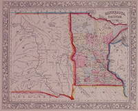
MITCHELL Samuel Augustus Jr.
Minnesota and Dacotah
Philadelphia: Mitchell Samuel Augustus Jr. 1862. unbound. very good. Map. Engraving with original hand coloring. Image measures 10.75" x 13.25".<br/><br/> Nice map of Minnesota and the eastern portion of the Dakotas showing towns major routes railroads and waterways. Minnesota is divided into counties and the Dakotas are shown as Dacotah Territory. Minor stains to margins small chip to lower left corner. S. Augustus Mitchell Jr. continued his father's successful mapmaking and publishing business and was one of the most prolific and renowned 19th century American publishers.<br/><br/> Mitchell, Samuel Augustus Jr. unknown books
Referencia librero : 202904
|
|
|
MITCHELL Samuel Augustus Jr.
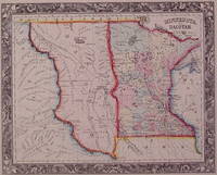
Minnesota and Dacotah
Philadelphia: Mitchell Samuel Augustus Jr. 1860. unbound. very good. Map. Engraving with original hand coloring. Image measures 10.75" x 13.25".<br/><br/> Great map of Minnesota and part of the Dakotas. Minnesota is divided into counties and the western boundary of the Dakotas runs along the Missouri River. Shows towns major routes railroads and waterways. Minor tears and chips to edges. S. Augustus Mitchell Jr. continued his father's successful mapmaking and publishing business and was one of the most prolific and renowned 19th century American publishers.<br/><br/> Mitchell, Samuel Augustus Jr. unknown books
Referencia librero : 202878
|
|
|
Mitchell Samuel Augustus Jr.
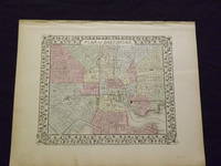
Plan of Baltimore.
<p>Unbound colored engraved map decorative border 14" x 11". Slight browning and aging top edge just a little rough; otherwise bright and clean and very good. Maps are wrapped with acid free board or in rigid sleeves. The Mitchell family started to produce atlases in 1846 and continued into the early 1890s. Around 1860 S. Augustus Mitchell Jr. took over and the atlas would be called Mitchell's New General Atlas. This is a detailed single page map of Baltimore from the 1870 installment of this atlas. The map shows a lot of street detail with nice coloring. Extra postage may be required. Ristow 311-313. </p> books
Referencia librero : 103223
|
|
|
Mitchell Samuel Augustus Jr.
Plan of Baltimore.
<p>Unbound colored engraved map decorative border 14" x 11". Slight browning and aging; otherwise bright and clean and very good. Maps are wrapped with acid free board or in rigid sleeves. The Mitchell family started to produce atlases in 1846 and continued into the early 1890s. Around 1860 S. Augustus Mitchell Jr. took over and the atlas would be called Mitchell's New General Atlas. This is a detailed single page map of Baltimore from the 1870 installment of this atlas. The map shows a lot of street detail with nice coloring. Extra postage may be required. Ristow 311-313. # 103226</p> books
Referencia librero : 103226
|
|
|
Mitchell Samuel Augustus Jr.
Plan of Baltimore.
<p>Mitchell Samuel Augustus Jr. Plan of Baltimore. Philadelphia: 1860. Unbound colored engraved map decorative border 14" x 11". Slight browning and aging; otherwise bright and clean and very good. Maps are wrapped with acid free board or in rigid sleeves. The Mitchell family started to produce atlases in 1846 and continued into the early 1890s. Around 1860 S. Augustus Mitchell Jr. took over and the atlas would be called Mitchell's New General Atlas. This is a detailed single page map of Baltimore from the 1860 installment of this atlas. The map shows a lot of street detail with nice coloring. Extra postage may be required. Ristow 311-313. # 103229</p> books
Referencia librero : 103229
|
|
|
MITCHELL Samuel Augustus Jr.
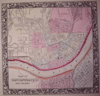
Plan of Cincinnati and Vicinity
Philadelphia: Mitchell Samuel Augustus Jr. 1860. unbound. very good. Map. Engraving with original hand coloring. Image measures 10.5" x 11.25".<br/><br/> Great city plan of Cincinnati showing streets several notable buildings the Ohio River and railroads. Small tear to upper right edge. S. Augustus Mitchell Jr. continued his father's successful mapmaking and publishing business and was one of the most prolific and renowned 19th century American publishers.<br/><br/> Mitchell, Samuel Augustus Jr. unknown books
Referencia librero : 203533
|
|
|
Mitchell Samuel Augustus Jr.
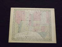
Plan of Philadelphia.
<p>Unbound colored engraved map decorative boarder 14" x 11". Slight browning and aging; overall bright and clean and in very good shape. Maps are wrapped with acid free board or in rigid sleeves. The Mitchell family started to produce atlases in 1846 and continued into the early 1890s. Around 1860 S. Augustus Mitchell Jr. took over and the atlas would be called Mitchell's New General Atlas. This is a colorful map of the city of Philadelphia from the 1869 installment of that atlas. Unlike later Mitchell atlases which often include Camden New Jersey this map features only Philadelphia. Extra postage may be required. Ristow 311-313. </p> books
Referencia librero : 103222
|
|
|
Mitchell Samuel Augustus Jr.
Plan of the City of Detroit.
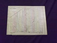
<p>Unbound colored engraved map 12" x 15". Bottom margin narrow and chip has removed some of the copyright information but below neat line a little darkening and aging; Slight toning and aging; otherwise about very good. Maps are wrapped with acid free board or in rigid sleeves. The Mitchell family started to produce atlases in 1846 and continued into the early 1890s. Around 1860 S. Augustus Mitchell Jr. took over and the atlas would be called Mitchell's New General Atlas. This is an attractive single page map of the City of Detroit from the 1882 installment of this atlas. Stand-alone maps of Detroit are not that common in the Mitchell atlas series. Ristow 311-313. Phillips 907. </p> Bradley, books
Referencia librero : 106076
|
|
|
MITCHELL Samuel Augustus Jr.
Plan of the City of Philadelphia and Camden
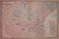
Philadelphia: Mitchell Samuel Augustus Jr. 1877. unbound. very good. Map. Engraving with original hand coloring. Image measures 11" x 13".<br/><br/> Fantastic double page city plan of Philadelphia showing streets wards parks notable buildings waterways and railroads. In excellent condition. S. Augustus Mitchell Jr. continued his father's successful mapmaking and publishing business and was one of the most prolific and renowned 19th century American publishers.<br/><br/> Mitchell, Samuel Augustus Jr. unknown books
Referencia librero : 203647
|
|
|
MITCHELL Samuel Augustus Jr.
St. Louis
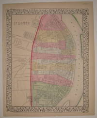
Philadelphia: Mitchell Samuel Augustus Jr. 1867. unbound. very good. Map. Engraving with original hand coloring. Image measures 13.75" x 11".<br/><br/> Nice map of St. Louis colored according to wards. Shows streets railroads and public parks. In very good condition with a small tear and chi to bottom edge. S. Augustus Mitchell Jr. continued his father's successful mapmaking and publishing business and was one of the most prolific and renowned 19th century American publishers.<br/><br/> Mitchell, Samuel Augustus Jr. unknown books
Referencia librero : 227682
|
|
|
MITCHELL Samuel Augustus Jr.
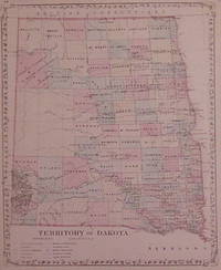
Territory of Dakota
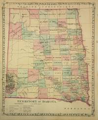
Philadelphia: Samuel Augustus Mitchell Jr. 1879. unbound. Map. Lithograph with original hand coloring. Image measures 14.25 x 11.75".<br/><br/> This 1879 map by Mitchell depicts the Dakota Territory before it was divided into two separate states of North Dakota and South Dakota. It shows details to the level of counties towns railways roads Indian Reservations mountains and other topographical features. <br><br>The map is in good condition with minor foxing. Samuel Augustus Mitchell Sr. 1792-1868 was one of the leaders in American cartography of the 19th century and pioneered the conversion of engraved map plates to more affordable lithographic plates. His son Samuel Augustus Mitchell Jr. continued his father's successful mapmaking and publishing business and was one of the most prolific and renowned 19th century American publishers.<br/><br/> Samuel Augustus Mitchell Jr. unknown books
Referencia librero : 269792
|
|
|
MITCHELL Samuel Augustus Jr.
Territory of Dakota
Philadelphia: Mitchell Samuel Augustus Jr. 1880. unbound. very good. Map. Engraving with original hand coloring. Image measures 14.25" x 11.5".<br/><br/> Nice clear map of the Dakotas divided into counties and townships showing towns major routes railroads waterways and Indian reservations. In excellent condition. S. Augustus Mitchell Jr. continued his father's successful mapmaking and publishing business and was one of the most prolific and renowned 19th century American publishers.<br/><br/> Mitchell, Samuel Augustus Jr. unknown books
Referencia librero : 202875
|
|
|
MITCHELL Samuel Augustus Sr
A Concise View of the Number Resources and Industry of the American People
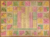
Philadelphia: S. Augustus Mitchell 1842. unbound. Map. Lithograph with original hand coloring. Sheet measures 25.5" x 34.75.<br/><br/> This 1842 case map by Samuel Augustus Mitchell offers a wealth of information about the United States. The centre of the page includes statistical data from 1840 relating to population manufacturing canals exports railroads agriculture mining rivers etc. This information is surrounded by 32 maps of major cities. Some of these include Cincinnati Detroit New York Charleston Washington New Orleans Hartford and Richmond among others. Each map is surrounded by an ornate border. This map is the pocket map version of a larger wall map. In good condition with some wear along the original folds. Some foxing and toning at places. Lined with Japanese tissue.<br><br>Samuel Augustus Mitchell Sr. 1792-1868 is one of the pioneers in American cartography of the 19th century and led the conversion of engraved map plates to more affordable lithographic plates. Bold design and hard to find.<br/><br/> S. Augustus Mitchell unknown books
Referencia librero : 270733
|
|
|
MITCHELL Samuel Augustus Sr
A New Map of Georgia with its Roads & Distances
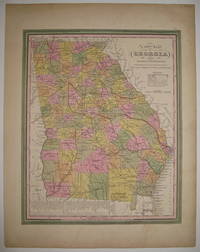
Philadelphia: S. Augustus Mitchell 1846. unbound. very good. Map. Lithograph with original hand coloring. Image measures 13 7/8" x 11 3/8".<br/><br/> Great map of Georgia showing all counties railroads major routes and waterways. A table at the bottom of the page lists steam boat routes. Minor overall toning one small tear to bottom edge and a crease to upper left corner. Samuel Augustus Mitchell Sr. 1792-1868 is one of the pioneers in American cartography of the 19th century.<br/><br/> S. Augustus Mitchell unknown books
Referencia librero : 219154
|
|
|
MITCHELL Samuel Augustus Sr
A New Map of Maine
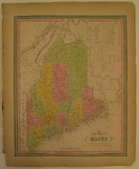
Philadelphia: H. N. Burroughs 1846. First. unbound. Map. Lithograph with original hand coloring. Image measures 14 7/8" x 12".<br/><br/> Excellent map of Maine showing all counties railroads major routes and waterways. Two tables at the top of the page list population over time. Small chips to lower margin not affecting the image. Samuel Augustus Mitchell Sr. 1792-1868 is one of the pioneers in American cartography of the 19th century. From the first edition of Mitchell's seminal New Universal Atlas.<br/><br/> H. N. Burroughs unknown books
Referencia librero : 232149
|
|
|
MITCHELL Samuel Augustus Sr
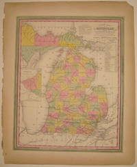
A New Map of Michigan with its Canals Roads & Distances
Philadelphia: H. N. Burroughs 1846. First. unbound. Map. Lithograph with original hand coloring. Image measures 14 3/8" x 11 7/16".<br/><br/> Wonderfully graphic and colorful map of Michigan amidst four Great Lakes. The map includes towns and roads in addition to canals drawn in blue and railroads drawn in orange. A small inset on the left depicts the western part of the state. Beneath the title two tables list steam boat routes from Detroit to Fort Gratiot and Fort Howard. The map is in good condition with only minor chips along the binding edge of the paper outside the margin. Samuel Augustus Mitchell Sr. 1792-1868 published this map as part of the first edition of his seminal New Universal Atlas. Mitchell is one of the pioneers in American cartography of the 19th century and led the conversion of engraved map plates to more affordable lithographic plates. First edition if this classic map.<br/><br/> H. N. Burroughs unknown books
Referencia librero : 232287
|
|
|
MITCHELL Samuel Augustus Sr
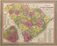
A New Map of South Carolina with its Canals Roads & Distances from place to place along the Stage & Steam Boat Routes
Philadelphia: S. Augustus Mitchell 1848. unbound. Map. Lithograph with original hand coloring. Image measures 11 1/4" x 14".<br/><br/> Beautifully detailed first edition map of South Carolina divided into counties. The map delineates towns waterways railroads and major routes as explained in a small key at the bottom right. Canals and railroads are marked. Also included are insets of Charleston and a table of distances. The map is in good condition with minor toning. <br><br>Samuel Augustus Mitchell Sr. 1792-1868 published this map as part of the 1848 edition of his seminal New Universal Atlas. Mitchell is one of the pioneers in American cartography of the 19th century and led the conversion of engraved map plates to more affordable lithographic plates.<br/><br/> S. Augustus Mitchell unknown books
Referencia librero : 293169
|
|
|
MITCHELL Samuel Augustus Sr
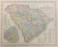
A New Map of South Carolina with its Canals Roads & Distances from place to place along the Stage & Steam Boat Routes
Philadelphia: S. Augustus Mitchell 1856. unbound. Map. Lithograph with original hand coloring. Image measures 11 1/4" x 14 1/4".<br/><br/> Beautifully detailed first edition map of South Carolina divided into counties. The map delineates towns waterways railroads and major routes as explained in a small key at the bottom right. Canals and railroads are marked. Also included are insets of Charleston and a table of distances. The map is in good condition.<br><br>Samuel Augustus Mitchell Sr. 1792-1868 published this map as part of the 1856 edition of his seminal New Universal Atlas. Mitchell is one of the pioneers in American cartography of the 19th century and led the conversion of engraved map plates to more affordable lithographic plates.<br/><br/> S. Augustus Mitchell unknown books
Referencia librero : 293171
|
|
|
MITCHELL Samuel Augustus Sr
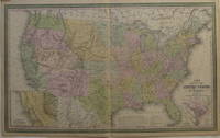
A New Map of the United States of America
Philadelphia: Cowperthwait Desilver & Butler 1855. unbound. very good. Young J.H. Map. Engraving and lithograph with original hand coloring. Image measures 16" x 26.25".<br/><br/> Beautifully detailed map of the United States including insets of the Gold Region of California and the District of Columbia. Shows states and territories towns and cities major routes historic trails topographical features and mountain heights waterways battle sites and railroads completed and projected. Light creases to right corners. Samuel Augustus Mitchell Sr. 1792-1868 is one of the pioneers in American cartography of the 19th century.<br/><br/> Cowperthwait, Desilver & Butler unknown books
Referencia librero : 207430
|
|
|
MITCHELL Samuel Augustus Sr
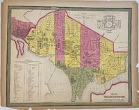
City of Washington
Philadelphia: Mitchell Samuel Augustus 1847. unbound. Map. Engraving and lithograph with original hand coloring. Image measures 13 5/8" x 17 1/8"<br/><br/> Fantastic town plan of Washington D.C. Shows streets and avenues wards waterways and railroads with notable buildings and institutions listed in a numbered key. Includes a plan of the main floor of the Capitol. Overall in very good condition with small chips to bottom corners. Samuel Augustus Mitchell Sr. 1792-1868 is one of the pioneers in American cartography of the 19th century.<br/><br/> Mitchell, Samuel Augustus unknown books
Referencia librero : 298542
|
|
|
MITCHELL Samuel Augustus Sr
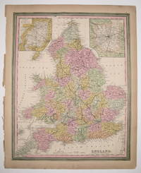
England
Philadelphia: H. N. Burroughs 1846. First. unbound. Map. Lithograph with original hand coloring. Image measures 15.75" x 12.5".<br/><br/> This map of England shows capitals cities towns railroads and canals. Counties are hand-colored and labeled with text fit into their individual shapes giving the map a somewhat idiosyncratic look. At the top of the map a small bit of Scotland appears uncolored with Edinburgh labeled in the map's pink border. The Scottish city is flanked on either side by insets showing the environs of Liverpool at left and London at right. A small inset in the lower left of the map depicts the Scilly Isles. The map appeared in Mitchell's first edition of his seminal New Universal Atlas. It in good condition with very minimal chips or tears. Browned margins. Samuel Augustus Mitchell Sr. 1792-1868 is one of the pioneers in American cartography of the 19th century and led the conversion of engraved map plates to more affordable lithographic plates. This map provides a condensed yet comprehensive view of mid-19th century England.<br/><br/> H. N. Burroughs unknown books
Referencia librero : 236206
|
|
|
MITCHELL Samuel Augustus Sr
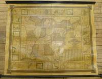
Mitchell's National Map of the American Republic or United States of North America. Together with Maps of the Vicinities of 32 of the Principle Cities and Towns in the Union
Philadelphia: S. Augustus Mitchell 1844. unbound. Map. Wall map on linen with wooden scrolls. 31.5" x 48.75"<br/><br/> Large scale map of the eastern United States surrounded with insets of major harbors and towns. Elaborate border design with national coat of arms placed in the each corner contributes to its official quality. Population tables listed in three different insets plus an inset map of the Treaty of 1842 also called Webster-Ashburton Treaty settling a border dispute between Maine and New Brunswick. Large Iowa Territory and Minnesota is not yet named showing impending Westward expansion. From the "National Map Series" that Mitchell produced by subscription over a series of years. Original color but heavily varnished as issued. Samuel Augustus Mitchell Sr. 1792-1868 is one of the pioneers in American cartography of the 19th century and led the conversion of engraved map plates to more affordable lithographic plates. Drawn by James Henry Young 1817-1866 and engraved by J.H. Brightly both collaborated with Mitchell on this series of maps.<br/><br/> S. Augustus Mitchell unknown books
Referencia librero : 260312
|
|
|
MITCHELL Samuel Augustus Sr
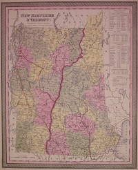
New Hampshire & Vermont
Philadelphia: Mitchell Samuel Augustus 1850. unbound. very good. Map. Engraving and lithograph with original hand coloring. Image measures 15" x 12".<br/><br/> Classic map of New Hampshire and Vermont divided into counties. Details towns major routes railroad waterways and topography. A table at right lists populations of individual counties and towns. Small chip to lower right corner. Samuel Augustus Mitchell Sr. 1792-1868 is one of the pioneers in American cartography of the 19th century.<br/><br/> Mitchell, Samuel Augustus unknown books
Referencia librero : 203546
|
|
|
MITCHELL Samuel Augustus Sr
Persia Arabia &c
Philadelphia: Thomas Cowperthwait & Co 1852. unbound. Map. Lithograph with original hand coloring. Image measures 11 1/2" x 14".<br/><br/> Beautifully detailed map of Arabia and surrounding Countries. The map delineates important towns and major routes as explained in a small key at the bottom center. This particular map comes from the 1848 edition of Mitchell's seminal "New Universal Atlas" published by Thomas Cowperthwait & Co. The map is in good condition with some margin staining and some edge wear not affecting printed image. <br><br>Samuel Augustus Mitchell Sr. 1792-1868 is one of the leaders in American cartography of the 19th century and pioneered the conversion of engraved map plates to more affordable lithographic plates. His son Samuel Augustus Mitchell Jr. continued his father's successful mapmaking and publishing business and was one of the most prolific and renowned 19th century American publishers.<br/><br/> Thomas Cowperthwait & Co unknown books
Referencia librero : 298736
|
|
|
MITCHELL Samuel Augustus Sr
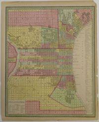
Philadelphia
Philadelphia: Mitchell Samuel Augustus 1853. unbound. Map. Engraving and lithograph with original hand coloring. Image measures 15.75" x 12.75".<br/><br/> Beautiful town plan of Philadelphia. Shows streets notable buildings and institutions listed in numbered key parks railroad and wards. Small tear bottom center margin chips along right and left margins and top right corner none affecting image. Samuel Augustus Mitchell Sr. 1792-1868 is one of the pioneers in American cartography of the 19th century.<br/><br/> Mitchell, Samuel Augustus unknown books
Referencia librero : 256832
|
|
|
MITCHELL Samuel Augustus Sr
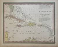
West Indies
Philadelphia: H. N. Burroughs 1846. unbound. Map. Lithograph with original hand coloring. Image measures 15.75" x 12.5".<br/><br/> This map of the West Indies extends from the southern tip of Florida to the northern coast of South America and from the western tip of Cuba to Barbados in the east. The index includes capitals cities and towns labeled in a stylized manner that complements the region's scattered arrangement of islands. Above the title is a paragraph describing the region and its constituent islands. Below the title islands are attributed to the appropriate European colonial powers. The map appeared in Mitchell's first edition of his seminal New Universal Atlas. Samuel Augustus Mitchell Sr. 1792-1868 is one of the pioneers in American cartography of the 19th century and led the conversion of engraved map plates to more affordable lithographic plates. This map provides a clear overview of the West Indies.<br/><br/> H. N. Burroughs unknown books
Referencia librero : 297531
|
|
|
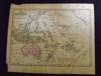
Mitchell Samuel Augustus.
Map of Oceanica.
Engraved colored map 9" x12" Box like cartouche with map information. Some light aging and browning a couple of small holes in top margin where it was bound not affecting image a couple of margin chips creasing in the lower right portion of the map affecting the lettering more than image; otherwise good. Pricing will reflect creasing. Interesting and early small map of Oceanica. From a school and family geography. books
Referencia librero : 106607
|
|
|
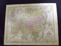
Mitchell Samuel Augustus.
Map of Asia.
<p>Engraved colored map 9" x11 1/2" Box like cartouche with map information. Some slight soiling toning and browning right margin a little uneven small holes in upper margin where it was bound not affecting image; otherwise very good. Not a bad looking little map with plenty of detail and some decent color. Small insert box featuring a map of Palestine. From a school and family geography. </p> S. Augustus Mitchell, books
Referencia librero : 106601
|
|
|
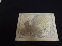
Mitchell Samuel Augustus.
Map of Europe.
<p>Engraved colored map 9" x12" Box like cartouche with map information. Some soiling aging and browning a couple of small holes in top margin where it was bound not affecting image otherwise very good. Interesting and detailed small map of Europe. From a school and family geography. </p> S. Augustus Mitchell, books
Referencia librero : 106606
|
|
|
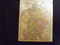
Mitchell Samuel Augustus.
Map of Germany Switzerland and Northern Italy.
<p>Engraved colored map 9" x11 1/2" Box like cartouche with map information. Some soiling aging and browning small holes in right margin where map was bound not affecting image otherwise very good. Attractive little map with plenty of detail and some decent color. From a school and family geography. </p> S. Augustus Mitchell, books
Referencia librero : 106608
|
|
|
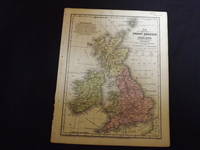
Mitchell Samuel Augustus.
Map of Great Britain and Ireland.
<p>Engraved colored map 9" x11 1/2" Box like cartouche with map information. Some soiling perhaps a little margin foxing small holes in left margin where map was bound not affecting image some aging and browning otherwise very good. Attractive little map with plenty of detail and some decent color. From a school and family geography. </p> S. Augustus Mitchell, books
Referencia librero : 106603
|
|
|
Mitchell Samuel Augustus.
Map of New England.
Engraved double-page colored map 11 ½" x17 1/2" Box like cartouche with map information. Some soiling aging and browning a little creasing at fold; otherwise very good. Nice early map of New England with two inserts for Boston and Providence. From a school and family geography. S. Augustus Mitchell, books
Referencia librero : 106605

|
|
|
Mitchell Samuel Augustus.
Map of North America.
Engraved colored map 8" x11 1/2" Box like cartouche with map information. Some slight soiling toning and browning right margin a little uneven; otherwise very good. Not a bad looking little map with plenty of detail and some decent color. From a school and family geography. S. Augustus Mitchell, books
Referencia librero : 106560
|
|
|
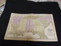
Mitchell Samuel Augustus.
Map of Southern States
<p>Engraved colored double-page map 12" x17 1/2" Box like cartouche with map information. Some soiling a little margin foxing some aging and browning slight split at center otherwise very good. Interesting and detailed map of the southern states during the early years of American development. From a school and family geography. </p> S. Augustus Mitchell, books
Referencia librero : 106604
|
|
|
Mitchell Samuel Augustus.
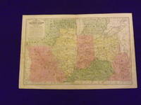
Map of the Chief Western States and Part of Virginia.
Engraved colored map 11" x17" cartouche with map information. Some slight soiling toning and browning small archival tape repair on reverse near split insignificant perhaps faint staining in the lower left margin decent margins; map is generally bright and clean. This is an interesting early Mitchell map of the Western States and Territories from the Mitchell's School & Family Geography. The states furthest west at this point are Illinois and Indiana. Iowa and Wisconsin are still shown as territories. S. Augustus Mitchell, books
Referencia librero : 102173
|
|
|
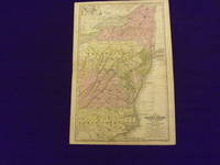
Mitchell Samuel Augustus.
Map of the Middle States and Part of the Southern.
Engraved colored map 11" x17" cartouche with map information. Some slight soiling toning and browning archival tape repairs on reverse near split relatively decent margins; map is generally bright and clean. Early Mitchell map of the Middle States the Mitchell's School & Family Geography. New York Pennsylvania and Virginia are the most visible but a significant portion of North Carolina is also shown. S. Augustus Mitchell, books
Referencia librero : 102174
|
|
|
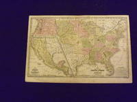
Mitchell Samuel Augustus.
Map of the United States and Texas.
Engraved colored map 11" x16" smaller map inset included. Some soiling toning and browning a little occasional foxing a couple places with small miss coloring very slight decent margins; very good otherwise. This is a historically significant early Mitchell map of the United States from the Mitchell's School & Family Geography. Texas is shown as a separate country and part of the map is an inset featuring Mexico and Guatemala. Iowa Wisconsin Oregon Missouri are territories and not yet states. A somewhat sizeable section of land is presented as the Indian Territory. S. Augustus Mitchell, books
Referencia librero : 102172
|
|
|
Mitchell Samuel Augustus.
Mitchell's Travellers Guide Through the United States. A Map of Roads Distances Steamboat & Canal Routes…
<p>Engraved Hand colored folding map 43.5 x 54.5 cm 17" x 21 1/2" folding into original gilt lettered and decorated morocco covers covers are 5 1/2" x 3 1/4" includes folding index sheet. Map is boxed in a cloth and marble board box with paper label on spine. Spine is worn covers a little bit rubbed some light and unobtrusive dampstaining 4" split and one fold in the ocean some darkening but generally bright; otherwise very good. Samuel Augustus Mitchell 1792-1868 founded one of the most influential map publishing companies in America which would last for over 60 years. After trying his hand at teaching Mitchell turned to map publishing and produces his first atlas in 1831. The following year he produced the first edition of the present work in 1832. This map was engraved by J.H. Young and provides a detailed view of what is now the eastern United States. The map comes with a folding index that includes information on steamboat and canal routes. This guide would be published for about 20 years. Ristow 303-204.</p> S. Augustus Mitchell, books
Referencia librero : 106021
|
|
|
Mitchell Samuel L.
A discourse on the character and services of Thomas Jefferson more especially as a promoter of natural and physical science
New York: G. & C. Carvill 1826. First edition 8vo pp. 67 1; removed from binding wanting wrappers; old pressure stamp on title page else very good. Mitchell 1764-1831 a.k.a. "living encyclopaedia" and "Congressional Dictionary" was an American physician and naturalist educated in Edinburgh who taught at Columbia and later at the College of Physicians and Surgeons of New York. He also served in Washington as both a Representative and a Senator and was a great admirer of Jefferson. American Imprints 25406; Sabin 49741. <br/><br/> G. & C. Carvill unknown books
Referencia librero : 55011

|
|
|
MITCHELL Samuel Latham 1764 1831
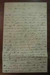
Autographed Letter Signed
1826. unbound. 2 pages 12.5 x 8 inches no place December 7 1826. In this somewhat quirky letter he writes to a friend who has sent him a deformed apple that resembles a chicken in part: ".This production of nature puts the beholder in mind from its size and figure of a chicken coming forth from its native eggshell. Perhaps no such anomaly has occurred before." Signed "Samuel L. Mitchell." Natural folds; faint ink bleeding. Very good- condition.<br/><br/> Mitchell an American physician botanist politician and promoter of science was appointed in 1788 one of the commissioners to negotiate with the six nations for the purchase of lands in Western New York.<br/><br/> unknown books
Referencia librero : 177325
|
|
|
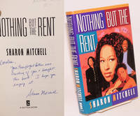
Mitchell Sharon
Nothing But the Rent
New York: Dutton 1998. Hardcover. 323p. personal inscription signed by the author very good first edition in boards and unclipped dj. Set in Boston. First novel by the African American author. Dutton hardcover books
Referencia librero : 223748 ISBN : 0525943064 9780525943068
|
|
|
MITCHELL Sharon.
Sheer Necessity.
NY: Dutton 1999. First edition. Fine in fine dust jacket. NY: Dutton, unknown books
Referencia librero : 20293
|
|

 Recibir por correo electrónico
 Descargar en documento PDF
 Flujo RSS
 Link permanente


