|
MITCHELL, Samuel Augustus Jr
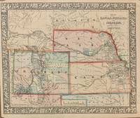
Map of Kansas Nebraska and Colorado. Showing also the Southern Portion of the Dacotah.; with attached Dachotah
Philadelphia: Mitchell Samuel Augustus Jr. 1866. unbound. Map. Steel engraving with original hand coloring. Image measures 11.5" x 14".<br/> <br/> Classic 1866 map of the west with Kansas Nebraska Colorado part of the Dakotas. Counties major towns and cities routes railroads waterways and Indian tribes and reservations are carefully noted. A few stains and narrow margins but otherwise in good condition. <br> <br> Samuel Augustus Mitchell Sr. 1792-1868 was one of the leaders in American cartography of the 19th century and pioneered the conversion of engraved map plates to more affordable lithographic plates. His son Samuel Augustus Mitchell Jr. continued his father's successful mapmaking and publishing business and was one of the most prolific and renowned 19th century American publishers.<br/> <br/> Mitchell, Samuel Augustus Jr. unknown
Referenz des Buchhändlers : 308737
|
|
|
MITCHELL, Samuel Augustus Jr
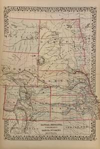
Map of Kansas Nebraska and Colorado. Showing also the Southern Portion of the Dacotah
Philadelphia: Mitchell Samuel Augustus Jr. 1873. unbound. Map. Steel engraving with original hand coloring. Image measures 11.5" x 14".<br/> <br/> Creative map of the great planes/flatlands with Kansas Nebraska Colorado part of the Dakotas Wyoming and Montana. Some state spill over the border and extend off the page. Counties major towns and cities routes railroads waterways and Indian tribes and reservations are carefully noted.<br> <br> Samuel Augustus Mitchell Sr. 1792-1868 was one of the leaders in American cartography of the 19th century and pioneered the conversion of engraved map plates to more affordable lithographic plates. His son Samuel Augustus Mitchell Jr. continued his father's successful mapmaking and publishing business and was one of the most prolific and renowned 19th century American publishers.<br/> <br/> Mitchell, Samuel Augustus Jr. unknown
Referenz des Buchhändlers : 308739
|
|
|
Mitchell, Samuel Augustus Jr
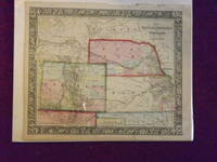
Map of Kansas Nebraska Colorado and Part of Dacotah.
<p>Unbound colored engraved map decorative border 14"x 11". Slight toning and aging; a few chips and tears on top margin overall bright and clear and in very good shape. Maps are wrapped with acid free board or in rigid sleeves. The Mitchell family started to produce atlases in 1846 and continued into the early 1890s. Around 1860 S. Augustus Mitchell Jr. took over and the atlas would be called Mitchell's New General Atlas. This is a very colorful and attractive map of Kansas and a couple of western states from the 1865 installment of that atlas. While the map shows mostly Kansas Nebraska and Colorado it also presents a portion of Dakota and Wyoming. For some of these territories this is an early representation. Ristow 311-313. </p>
Referenz des Buchhändlers : 106068
|
|
|
Mitchell, Samuel Augustus Jr
Map of Kansas Nebraska Colorado and Part of Dacotah
<p>Philadelphia 1969. Unbound colored engraved map decorative border 14"x 11". Slight toning and aging; overall bright and clear and in very good shape. Maps are wrapped with acid free board or in rigid sleeves. The Mitchell family started to produce atlases in 1846 and continued into the early 1890s. Around 1860 S. Augustus Mitchell Jr. took over and the atlas would be called Mitchell's New General Atlas. This is a very colorful and attractive map of Kansas and a couple of western states from the 1869 installment of that atlas. While the map shows mostly Kansas Nebraska and Colorado it also presents a portion of Dakota and Wyoming. Ristow 311-313</p>
Referenz des Buchhändlers : 101135
|
|
|
Mitchell, Samuel Augustus
MAP OF KANSAS NEBRASKA AND COLORADO. SHOWING ALSO THE EASTERN PORTION IDAHO. 1861
Philadelphia: : S. Augustus Mitchell 1863. 10-3/4" x 13-1/2"- 27.3 x 34.2 cm. Lithograph with original hand colouring. Minor browning and chipping o margins else very good. A detailed and decorative map of Idaho Nebraska Colorado and Kansas with scrolling foliate border. Shows towns cities mountain passes Native Indian reservations topographical features etc. S. Augustus Mitchell, unknown
Referenz des Buchhändlers : 1455
|
|
|
Mitchell, Samuel Augustus
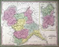
Map of Kingdom of Sardinia with inset map of Island of Sardinia
Philadelphia:: Thomas Cowperthwait & Co. 1850. First edition. Near Fine. Near Fine Condition. Original hand-colored lithograph. Folio image size: 40 x 32 cm. Sheet size: 43 x 35 cm. French matted in Ivory Rag board to 56.5 x 49.5 cm. A brightly hand-colored detailed map of the Kingdom of Sardinia with an inset of the Island of Sardinia all set within a decorative border from A New Universal Atlas produced by one of America's most prolific cartographic firms of the nineteenth century: Samuel Augustus Mitchell Connecticut 1792-1868 and his son S. Augustus Mitchell Jr. Although uncredited this map is most likely by J.H. Young the chief engraver for the Mitchell family throughout their publishing decades. The map is in near fine condition with minor edge repairs. Single sheet matted in rag board Thomas, Cowperthwait & Co. , unknown
Referenz des Buchhändlers : 7181
|
|
|
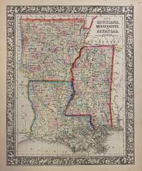
MITCHELL, Samuel Augustus Jr
Map of Louisiana Mississippi and Arkansas
Philadelphia: Mitchell Samuel Augustus Jr. 1866. unbound. Map. Engraving with original hand coloring. Image measures 13 1/2" x 10 3/4".<br/> <br/> Nice map of Louisiana Mississippi and Arkansas divided into counties. Shows towns major routes and waterways. Minor chips and tears to margin not affecting the image. <br> <br> Samuel Augustus Mitchell Sr. 1792-1868 was one of the leaders in American cartography of the 19th century and pioneered the conversion of engraved map plates to more affordable lithographic plates. His son Samuel Augustus Mitchell Jr. continued his father's successful mapmaking and publishing business and was one of the most prolific and renowned 19th century American publishers.<br/> <br/> Mitchell, Samuel Augustus Jr. unknown
Referenz des Buchhändlers : 302552
|
|
|
Mitchell, Samuel Augustus Jr
Map of Louisiana Mississippi and Arkansas
Philadelphia 1861. Unbound colored engraved map decorative boarder 14"x 11". Slight toning and aging a few small holes in the outer margin; bright and clear and in otherwise very good shape. Maps are wrapped with acid free board or in rigid sleeves. The Mitchell family started to produce atlases in 1846 and continued into the early 1890s. Around 1860 S. Augustus Mitchell Jr. took over and the atlas would be called Mitchell's New General Atlas. This is an attractive colorful map of Louisiana Mississippi and Arkansas from the 1861 installment of that atlas. Good detail and a fairly early map from this series. Ristow 311-313 unknown
Referenz des Buchhändlers : 101038
|
|
|
Mitchell, Samuel Augustus Jr
Map of Louisiana Mississippi and Arkansas
Philadelphia 1864. Unbound colored engraved map decorative boarder 14"x 11". Slight toning and aging a few small holes in the outer margin; bright and clear and in otherwise very good shape. Maps are wrapped with acid free board or in rigid sleeves. The Mitchell family started to produce atlases in 1846 and continued into the early 1890s. Around 1860 S. Augustus Mitchell Jr. took over and the atlas would be called Mitchell's New General Atlas. This is an attractive colorful map of Louisiana Mississippi and Arkansas from the 1861 installment of that atlas. Good detail and a fairly early map from this series. Ristow 311-313 unknown
Referenz des Buchhändlers : 101039
|
|
|
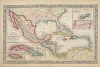
MITCHELL, Samuel Augustus Jr
Map of Mexico Central America and the West Indies
Philadelphia: Mitchell Samuel Augustus Jr. 1860. unbound. W. Williams. Map. Engraving with original hand coloring. Image measures 13.25" x 21".<br/> <br/> Beautiful first edition map of Mexico Central America and the Caribbean published in 1860. Centered on the Gulf of Mexico. Includes four insets: Map of the island of Jamaica Mpa of the Island of Cuba Map of the Bermuda Islands and Map of the Panama Railroad. This map is in very good condition. Folded as issued. Minor chipping to bottom of centerfold not affecting the image. <br> <br> Samuel Augustus Mitchell Sr. 1792-1868 was one of the leaders in American cartography of the 19th century and pioneered the conversion of engraved map plates to more affordable lithographic plates. His son Samuel Augustus Mitchell Jr. continued his father's successful mapmaking and publishing business and was one of the most prolific and renowned 19th century American publishers.<br/> <br/> Mitchell, Samuel Augustus Jr. unknown
Referenz des Buchhändlers : 326133
|
|
|
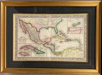
Mitchell, Samuel Augustus Jr [Constructed & Engraved by W Williams, Philadelphia Entered ... 1860 by S Augustus Mitchell, Jr ...
Map of Mexico Central America and the West Indies. with four insets 49. Map of the Island of Cuba. 50. Map of the Island of Jamaica. 51. Map of the Bermuda Islands. 52. Map of the Panama Railroad."
Philadelphia: S.A. Mitchell Jr. 1865. Second state. pg #48 in upper right corner. Steel Engraving hand colored. Near Fine. Single leaf with center fold. 34cm x 54cm measurements to outer edge of decorative border. Steel engraving with elaborate hand coloring. Professionally framed with frame measurements of 54cm x 73cm gilt frame glazed with optically correct glass. A very handsome package; Mitchell's "Map of Mexico Central America and the West Indies." professionally framed. Map condition is near fine with brilliant color and only superficial wear. Source: Mitchell's New General Atlas Philadelphia: Published By S. Augustus Mitchell Jr. No. 31 South Sixth Street. 1865. <br/><br/> S.A. Mitchell Jr. unknown
Referenz des Buchhändlers : 005102
|
|
|
Mitchell, Samuel Augustus Jr
Map of Mexico Central America and the West Indies
Philadelphia: Bradley 1882. Unbound colored engraved map 22 1/2"x 14 1/2". Some toning and aging a little darkening at fold; otherwise very good. Maps are wrapped with acid free board or in rigid sleeves. The Mitchell family started to produce atlases in 1846 and continued into the early 1890s. Around 1860 S. Augustus Mitchell Jr. took over and the atlas would be called Mitchell's New General Atlas. This is an attractive double page map of Central America from the 1882 installment of that atlas. Bermuda Jamaica a map of the Panama Railroad and a map of the proposed Panama Canal route are highlighted within insets. Ristow 311-313 Phillips 907 Bradley unknown
Referenz des Buchhändlers : 101042
|
|
|
Mitchell, Samuel Augustus Jr
Map of Mexico Central America and the West Indies
<p>Philadelphia 1865. Unbound colored engraved map decorative boarder 22 1/2"x 14 1/2". Slight toning and aging; overall bright and clean and in very good condition. Maps are wrapped with acid free board or in rigid sleeves. The Mitchell family started to produce atlases in 1846 and continued into the early 1890s. Around 1860 S. Augustus Mitchell Jr. took over and the atlas would be called Mitchell's New General Atlas. This is an attractive double page map of Central America from the 1865 installment of that atlas. Bermuda Jamaica a map of the Panama Railroad and a map of Cuba are highlighted within insets. May require extra postage.Ristow 311-313 Phillips 907</p>
Referenz des Buchhändlers : 101130
|
|
|
Mitchell, Samuel Augustus Jr
Map of Mexico Central America and the West Indies
Philadelphia 1870. Unbound colored engraved map decorative border double page 22" x 14". Slight toning and aging; overall bright and clear and in very good shape. Maps are wrapped with acid free board or in rigid sleeves. The Mitchell family started to produce atlases in 1846 and continued into the early 1890s. Around 1860 S. Augustus Mitchell Jr. took over and the atlas would be called Mitchell's New General Atlas. This is an attractive double page map of Central America from the 1870 installment of that atlas. Bermuda Jamaica a map of the Panama Railroad and a map of Cuba are highlighted within insets. Ristow 311-313 Phillips 907 unknown
Referenz des Buchhändlers : 101214
|
|
|
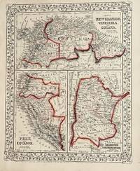
Mitchell, S Augustus
Map of New Granada Venezuela and Guina
Philadelphia: Mitchell S. Augustus 1867. 1867 edition. 13 1/2 x 10 3/4 inches. Very Good. Mitchell S. Augustus. Contemporary colored lithograph map of Soth American countries. Suitable for framing. Mitchell, S. Augustus unknown
Referenz des Buchhändlers : 15
|
|
|
Mitchell, Samuel Augustus
Map of New England.
Engraved double-page colored map 11 ½" x17 1/2" Box like cartouche with map information. Some soiling aging and browning a little creasing at fold; otherwise very good. Nice early map of New England with two inserts for Boston and Providence. From a school and family geography. S. Augustus Mitchell,
Referenz des Buchhändlers : 106605

|
|
|
Mitchell, Samuel Augustus Jr
Map of New Granada Venezuela and Guiana/Peru and Equador/Argentine Confederation.
<p>Unbound colored engraved map decorative boarder 14"x 11". Slight toning and aging a few margin chips on margin edge; overall bright and clear and in very good shape. Maps are wrapped with acid free board or in rigid sleeves. The Mitchell family started to produce atlases in 1846 and continued into the early 1890s. Around 1860 S. Augustus Mitchell Jr. took over and the atlas would be called Mitchell's New General Atlas. This is a colorful map of several South American countries including Peru Venezuela and Argentina from the 1861 installment of that atlas. The map is colorful and has a fair amount of detail. Ristow 311-313.</p>
Referenz des Buchhändlers : 106100
|
|
|
Mitchell, S Augustus
Map of New Mexico & Arizona.
Philadelphia Pa.: S. Augustus Mitchell 1887. County and Township map. 15 x 21 inches. Engraved. Colored. Philadelphia, Pa.: S. Augustus Mitchell, 1887. unknown
Referenz des Buchhändlers : 50-0562
|
|
|
Mitchell, Samuel Augustus Jr
Map of North and South Carolina
Unbound colored engraved map decorative boarder 14" X 11". Slight darkening and aging; overall bright and clear and in very good shape. Maps are wrapped with acid free board or in rigid sleeves. The Mitchell family started to produce atlases in 1846 and continued into the early 1890s. Around 1860 S. Augustus Mitchell Jr. took over and the atlas would be called Mitchell's New General Atlas. This is an attractive and colorful map of North and South Carolina from the 18769installment. The map has a fair amount of detail and an inset of Charleston Harbor and another of Charleston.Ã Â Ristow 311-313.
Referenz des Buchhändlers : 106739
|
|
|
Mitchell, S Augustus, Jr
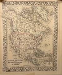
Map of North America.; Showing its Political Divisions and Recent Discoveries in the Polar Regions. Engraved by W. Williams Philadelphia Published in Mitchell's New General Atlas 1874
Philadelphia: S. A. Mitchell Jr. 1874. Later Edition. Very Good. 13.5x10.5in 34.3x26.7cm neatline 15x12in 38.1x31cm sheet; Hand colored map of North and Central America with part of South America with settlements rivers and mountains by hachures meridian of Washington and Greenwich route of the Investigator Captain McClure. on discovery of the Northwest passage from the Bering strait route of Dr. Kane voyage to west coast of Greenland; a strong impression with overall age toning of map some offset shadows in top and bottom margin. Rumsey 3801.008 CS. Samuel Augustus Mitchell Jr. --- was a publisher of maps and atlases. His Father 1790-1880 was a teacher geographer and publisher of maps atlases travel guides textbooks and other related geography works. The publishing company was transferred to his son in 1860 and Mitchell continued to publish popular atlases. In 1860 the "New General Atlas" was published with 81 colored maps on 47 plates. He continued to update almost annually the atlas with additional maps and narratives.<br /> <br /> This map was from the library of Dr. G. Warren Smith 1941-2021 of Pennsylvania. He had a long career as university professor and administrator and was a collector of over 6000 books maps illustrations and artifacts relating to the Arctic Alaska and Pacific Northwest. S. A. Mitchell Jr. unknown
Referenz des Buchhändlers : 14149
|
|
|
Mitchell, Samuel Augustus
Map of North America.
Engraved colored map 8" x11 1/2" Box like cartouche with map information. Some slight soiling toning and browning right margin a little uneven; otherwise very good. Not a bad looking little map with plenty of detail and some decent color. From a school and family geography. S. Augustus Mitchell,
Referenz des Buchhändlers : 106560
|
|
|
Mitchell, Samuel Augustus Jr
Map of North America.
<p>Unbound colored engraved map decorative boarder 14" x 11". Slight toning browning and aging; overall very bright and clear and in very good shape. Maps are wrapped with acid free board or in rigid sleeves. The Mitchell family started to produce atlases in 1846 and continued into the early 1890s. Around 1860 S. Augustus Mitchell Jr. took over and the atlas would be called Mitchell's New General Atlas. This is a colorful map of North America from the 1869 installment of that atlas. The map is bright and crisp and includes Russian America Alaska Greenland and Central America. Extra postage may be required. Ristow 311-313.</p>
Referenz des Buchhändlers : 103215
|
|
|
Mitchell, Samuel Augustus Jr
Map of Northwestern America Alaska Showing the Territory Ceded by Russia to the United States.
<p>Unbound colored engraved map decorative boarder 14" x 11". Slight toning browning and aging some chips and tears at top edge bottom margin somewhat narrow; overall very bright and clear and in very good shape. Maps are wrapped with acid free board or in rigid sleeves. The Mitchell family started to produce atlases in 1846 and continued into the early 1890s. Around 1860 S. Augustus Mitchell Jr. took over and the atlas would be called Mitchell's New General Atlas. This is a colorful map of Alaska is from the 1870 installment of that atlas. The map is bright and crisp and shows part of Siberia and the Aleutian Islands and part of Prince Albert Island is also visible. Extra postage may be required. Ristow 311-313.</p>
Referenz des Buchhändlers : 103216
|
|
|
Mitchell, Samuel Augustus Jr
Map of North and South Carolina.
Unbound colored engraved map decorative boarder 14" X 11". Slight toning and agin some writing in right margin; overall bright and clear and in very good shape. Maps are wrapped with acid free board or in rigid sleeves. The Mitchell family started to produce atlases in 1846 and continued into the early 1890s. Around 1860 S. Augustus Mitchell Jr. took over and the atlas would be called Mitchell's New General Atlas. This is an attractive and colorful map of North and South Carolina from the 1882 installment. The map has a fair amount of detail and an inset of Charleston Harbor and another of Charleston. Ristow 311-313.
Referenz des Buchhändlers : 106158
|
|
|
Mitchell, Samuel Augustus Jr
Map of North and South Carolina.
Unbound colored engraved map decorative boarder 14" X 11". Slight darkening and aging some some chipping in top margin edge; overall bright and clear and in very good shape. Maps are wrapped with acid free board or in rigid sleeves. The Mitchell family started to produce atlases in 1846 and continued into the early 1890s. Around 1860 S. Augustus Mitchell Jr. took over and the atlas would be called Mitchell's New General Atlas. This is an attractive and colorful map of North and South Carolina from the 1870 installment. The map has a fair amount of detail and an inset of Charleston Harbor and another of Charleston. Ristow 311-313.
Referenz des Buchhändlers : 106161
|
|
|
Mitchell, Samuel Augustus Jr
Map of North America
<p>Philadelphia 1870. Unbound colored engraved map decorative boarder 14"x 11". Slight toning and aging minor staining in margins; overall very bright and clear and in very good shape. Maps are wrapped with acid free board or in rigid sleeves. The Mitchell family started to produce atlases in 1846 and continued into the early 1890s. Around 1860 S. Augustus Mitchell Jr. took over and the atlas would be called Mitchell's New General Atlas. This is a colorful map of North America from the 1870 installment of that atlas. The map is bright and crisp and includes Russian America Alaska Greenland and Central America. May require extra postage.Ristow 311-313</p>
Referenz des Buchhändlers : 101212
|
|
|
Mitchell, Samuel Augustus Jr
Map of North America
<p>Philadelphia 1861. Unbound colored engraved map decorative boarder 14"x 11". Slight toning and aging; overall very bright and clear and in very good shape. Maps are wrapped with acid free board or in rigid sleeves. The Mitchell family started to produce atlases in 1846 and continued into the early 1890s. Around 1860 S. Augustus Mitchell Jr. took over and the atlas would be called Mitchell's New General Atlas. This is a colorful map of North America from the 1861 installment of that atlas. The map is bright and crisp and includes Russian America Alaska Greenland and Central America. May require extra postage.Ristow 311-313</p>
Referenz des Buchhändlers : 101205
|
|
|
Mitchell, Samuel Augustus Jr
Map of Oceanica Exhibiting its Various Divisions and Island Groups.
<p>Unbound colored engraved map decorative border 14" x 12". Slight toning and aging top edge a little rough some staining or browning in top margin; but still bright and clean. Maps are wrapped with acid free board or in rigid sleeves. The Mitchell family started to produce atlases in 1846 and continued into the early 1890s. Around 1860 S. Augustus Mitchell Jr. took over and the atlas would be called Mitchell's New General Atlas. This is a very attractive colorful single page map of the Pacific islands including Australia Japan and New Zealand. The Sandwich Islands is shown in a small inset. This map is from the 1861 installment of the Mitchell atlas. Some extra postage may be required. Ristow 311-313. </p>
Referenz des Buchhändlers : 103166
|
|
|
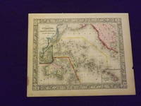
Mitchell, Samuel Augustus Jr
Map of Oceanica Exhibiting its Various Divisions and Island Groups.
<p>Unbound colored engraved map decorative boarder 14" x 11". Slight browning and aging a little staining in margins a couple of edge chips; overall bright and clean and in very good condition. Maps are wrapped with acid free board or in rigid sleeves. The Mitchell family started to produce atlases in 1846 and continued into the early 1890s. Around 1860 S. Augustus Mitchell Jr. took over and the atlas would be called Mitchell's New General Atlas. This is a very colorful map of Oceanica South Pacific from the 1864 installment of that atlas. The map includes the Polynesian Islands Australia part of the Chinese coast; part of the western portion of North America and the Sandwich Islands is shown in a small inset. Extra postage may be required. Ristow 311-313. </p>
Referenz des Buchhändlers : 103248
|
|
|
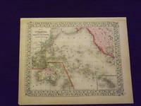
Mitchell, Samuel Augustus Jr
Map of Oceanica Exhibiting its Various Divisions and Island Groups.
<p>Unbound colored engraved map decorative boarder 14" x 11". Slight browning and aging; overall generally bright and clean and in very good condition. Maps are wrapped with acid free board or in rigid sleeves. The Mitchell family started to produce atlases in 1846 and continued into the early 1890s. Around 1860 S. Augustus Mitchell Jr. took over and the atlas would be called Mitchell's New General Atlas. This is a very colorful map of Oceanica South Pacific from the 1864 installment of that atlas. The map includes the Polynesian Islands Australia part of the Chinese coast; part of the western portion of North America and the Sandwich Islands is shown in a small inset. Extra postage may be required. Ristow 311-313. </p>
Referenz des Buchhändlers : 103249
|
|
|
Mitchell, Samuel Augustus Jr
Map of Ontario in Counties.
<p>Unbound colored engraved map decorative border 14" x 11". Slight toning browning and aging a little soiling in upper margin a couple of chips in upper margin; otherwise bright and clean. Maps are wrapped with acid free board or in rigid sleeves. The Mitchell family started to produce atlases in 1846 and continued into the early 1890s. Around 1860 S. Augustus Mitchell Jr. took over and the atlas would be called Mitchell's New General Atlas. This is an attractive colorful map of Ontario from the 1870 installment of that atlas. The map provides good county detail and part of Quebec New York and Pennsylvania are visible. Extra postage may be required. Ristow 311-13.</p>
Referenz des Buchhändlers : 106799
|
|
|
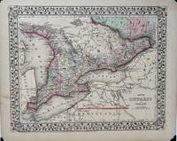
MITCHELL, JR, SAugustus S A
Map of Ontario in Counties
Philadelphia: S. Augustus Mitchell Jr. 1869. Map no binding. Near fine. MAP. Mitchell's New General Atlas. 10 ¾" x 13 1/2" 9 1/8" x 11 7/8"; engraved map showing the Canadian province of Ontario vining border; hand-colored; light age-toning of paper; near fine. A nicely detailed hand-colored map of Ontario showing Lake Huron to the west Quebec to the north and east and bordered by Lake Erie in the southwest and Lake Ontario in the south. New York state Pennsylvania and Ohio all in the U.S. lie to the south of Lakes Erie and Ontario. Michigan lies to the far west. Georgian Bay Saginaw Bay Manitoulin Bay and Nottawasaga Bay are identified. Lake Nipissing and Lake St. Clair are labeled. S. Augustus Mitchell, Jr. unknown
Referenz des Buchhändlers : 1846
|
|
|
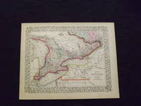
Mitchell, Samuel Augustus Jr
Map of Ontario in Counties.
<p>Unbound colored engraved map decorative border 14" x 11". Slight toning browning and aging; otherwise bright and clean. Maps are wrapped with acid free board or in rigid sleeves. The Mitchell family started to produce atlases in 1846 and continued into the early 1890s. Around 1860 S. Augustus Mitchell Jr. took over and the atlas would be called Mitchell's New General Atlas. This is an attractive colorful map of Ontario from the 1869 installment of that atlas. The map provides good county detail and part of Quebec New York and Pennsylvania are visible. Extra postage may be required. Ristow 311-313.</p>
Referenz des Buchhändlers : 103217
|
|
|
Mitchell, Samuel Augustus Jr
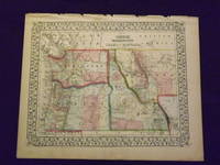
Map of Oregon Washington Idaho and Part of Montana.
<p>Unbound colored engraved map decorative boarder 14" x 11". Slight toning and aging margins show a little darkening some chips in upper margin; otherwise very bright and clear. Maps are wrapped with acid free board or in rigid sleeves. The Mitchell family started to produce atlases in 1846 and continued into the early 1890s. Around 1860 S. Augustus Mitchell Jr. took over and the atlas would be called Mitchell's New General Atlas. This is a very colorful and attractive map of a still relatively early view of Oregon Washington and Idaho from the 1870 installment of that atlas. The map also shows part of British America and Montana. Ristow 311-313. # 103161</p><p>$100</p>
Referenz des Buchhändlers : 103161
|
|
|
Mitchell, Samuel Augustus Jr
Map of Oregon Washington Idaho and Part of Montana
<p>Philadelphia 1865. Unbound colored engraved map decorative boarder 14 1/2"x 11". Slight toning and aging; otherwise very bright and clear. Maps are wrapped with acid free board or in rigid sleeves. The Mitchell family started to produce atlases in 1846 and continued into the early 1890s. Around 1860 S. Augustus Mitchell Jr. took over and the atlas would be called Mitchell's New General Atlas. This is a very colorful and attractive map of a still relatively early view of Oregon Washington and Idaho from the 1865 installment of that atlas. The map also shows part of British America and Montana. Ristow 311-313</p>
Referenz des Buchhändlers : 101200
|
|
|
MITCHELL, Samuel Augustus Jr
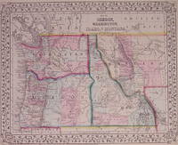
Map of Oregon Washington Idaho and part of Montana
Philadelphia: Mitchell Samuel Augustus Jr. 1871. unbound. very good. Map. Engraving with original hand coloring. Image measures 10.75" x 13.25".<br/> <br/> Classic map of the northwestern states showing Washington Oregon Idaho and part of Montana. At the time of publication Oregon was the only territory pictured that had official statehood status having been admitted into the union in 1859. As the gold rush drew increasing populations Montana was admitted in 1889 followed by Washington the same year and Idaho in 1890. The map includes towns rivers lakes mines forts missions and extensive topographical features. Emigrant roads are also shown. This map is in very good condition. <br> <br> Samuel Augustus Mitchell Sr. 1792-1868 was one of the leaders in American cartography of the 19th century and pioneered the conversion of engraved map plates to more affordable lithographic plates. His son Samuel Augustus Mitchell Jr. continued his father's successful mapmaking and publishing business and was one of the most prolific and renowned 19th century American publishers.<br/> <br/> Mitchell, Samuel Augustus Jr. unknown
Referenz des Buchhändlers : 203192
|
|
|
Mitchell, Samuel Augustus Jr
Map of Persia Turkey Afghanistan and Beloochistan.
<p>Unbound colored engraved map decorative border 14" x 11". Slight browning and aging a few chips in top margin not affecting image; overall bright and clean and in very good shape. Maps are wrapped with acid free board or in rigid sleeves. The Mitchell family started to produce atlases in 1846 and continued into the early 1890s. Around 1860 S. Augustus Mitchell Jr. took over and the atlas would be called Mitchell's New General Atlas. This is a very attractive single page colored map of Persia Turkey and Afganistan from the 1870 installment of that atlas. Includes an Inset of Palestine and the Holy Land.The coloring is very bright in this particular version of the map. Ristow 311-313.</p>
Referenz des Buchhändlers : 106779
|
|
|
Mitchell, Samuel Augustus Jr
Map of Persia Turkey Afghanistan and Beloochistan.
<p>Unbound colored engraved map decorative border 14" x 11". Slight browning and aging; overall bright and clean and in very good shape. Maps are wrapped with acid free board or in rigid sleeves. The Mitchell family started to produce atlases in 1846 and continued into the early 1890s. Around 1860 S. Augustus Mitchell Jr. took over and the atlas would be called Mitchell's New General Atlas. This is a very attractive single page colored map of Persia Turkey and Afghanistan from the 1869 installment of that atlas. Includes an Inset of Palestine and the Holy Land. The coloring is very bright in this particular version of the map. Ristow 311-313. </p>
Referenz des Buchhändlers : 106780
|
|
|
Mitchell, Samuel Augustus Jr
Map of Persia Turkey in Asia Afghanistan and Beloochistan.
<p>Unbound colored engraved map decorative boarder 14"x 11". Slight browning and aging; overall bright and clean and in very good shape. Maps are wrapped with acid free board or in rigid sleeves. The Mitchell family started to produce atlases in 1846 and continued into the early 1890s. Around 1860 S. Augustus Mitchell Jr. took over and the atlas would be called Mitchell's New General Atlas. This is a very colorful map of part of the Middle East from the 1864 installment of that atlas. The map includes an inset showing Palestine and the Holy Land. Extra postage may be required. Ristow 311-313. </p>
Referenz des Buchhändlers : 103231
|
|
|
Mitchell, Samuel Augustus Jr
Map of Persia Turkey in Asia Afghanistan and Beloochistan
<p>Philadelphia 1861. Unbound colored engraved map decorative boarder 14"x 11". Slight toning and aging and a little staining or soiling along bottom edge; overall bright and clear and in very good shape. Maps are wrapped with acid free board or in rigid sleeves. The Mitchell family started to produce atlases in 1846 and continued into the early 1890s. Around 1860 S. Augustus Mitchell Jr. took over and the atlas would be called Mitchell's New General Atlas. This is a colorful map of part of the Middle East from the 1861 installment of that atlas. The map includes an inset showing Palestine and the Holy Land. May require extra postage. Ristow 311-313</p>
Referenz des Buchhändlers : 101068
|
|
|
Mitchell, Samuel Augustus Jr
Map of Persia Turkey in Asia Afghanistan and Beloochistan
<p>Philadelphia 1882. Unbound colored engraved map decorative boarder 14"x 11". Slight toning and aging; overall bright and clear and in very good shape. Maps are wrapped with acid free board or in rigid sleeves. The Mitchell family started to produce atlases in 1846 and continued into the early 1890s. Around 1860 S. Augustus Mitchell Jr. took over and the atlas would be called Mitchell's New General Atlas. This is a colorful map of part of the Middle East from the 1882 installment of that atlas. Ristow 311-313</p>
Referenz des Buchhändlers : 101069
|
|
|
Mitchell, S Augustus
Map of Persia.
Philadelphia Pa.: S. Augustus Mitchell 1860. Engraved map in color. 11 x 13 inches. Includes Turkey and Afghanistan. Philadelphia, Pa.: S. Augustus Mitchell, 1860. unknown
Referenz des Buchhändlers : 50-0569
|
|
|
Mitchell, Samuel Augustus Jr
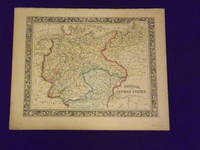
Map of Prussia and the German States.
Unbound colored engraved map decorative boarder 14"x 11". Slight toning and aging top margin a little rough at the edge but not significant; overall bright and clear and in very good shape. Maps are wrapped with acid free board or in rigid sleeves. The Mitchell family started to produce atlases in 1846 and continued into the early 1890s. Around 1860 S. Augustus Mitchell Jr. took over and the atlas would be called Mitchell's New General Atlas. This is an attractive fairly colorful map of Prussia from the 1861 Mitchell atlas. The map shows part of Poland and Switzerland and has a very sharp and attractive boarder. Ristow 311-313.
Referenz des Buchhändlers : 106135
|
|
|
Mitchell, Samuel Augustus Jr
Map of Quebec.
<p>Unbound colored engraved map decorative border 14"x 11". Slight toning and aging finger smudge in lower margin; otherwise bright and clear and in very good shape. Maps are wrapped with acid free board or in rigid sleeves. The Mitchell family started to produce atlases in 1846 and continued into the early 1890s. Around 1860 S. Augustus Mitchell Jr. took over and the atlas would be called Mitchell's New General Atlas. This is an fairly colorful map of Quebec from the 1870 installment of that atlas. The map includes an inset featuring Montreal. Ristow 311-313. Phillips 907. </p>
Referenz des Buchhändlers : 106798
|
|
|
Mitchell, Samuel Augustus Jr
Map of Quebec.
<p>Philadelphia 1882. Unbound colored engraved map decorative border 14"x 11". Slight toning and aging; overall bright and clear and in very good shape. Maps are wrapped with acid free board or in rigid sleeves. The Mitchell family started to produce atlases in 1846 and continued into the early 1890s. Around 1860 S. Augustus Mitchell Jr. took over and the atlas would be called Mitchell's New General Atlas. This is an fairly colorful map of Quebec from the 1882 installment of that atlas. The map includes an inset featuring Montreal. Ristow 311-313 Phillips 907</p>
Referenz des Buchhändlers : 101075
|
|
|
Mitchell, Samuel Augustus Jr
Map of Quebec
<p>Philadelphia 1869. Unbound colored engraved map decorative border 14"x 11". Slight toning and aging; overall bright and clear and in very good shape. Maps are wrapped with acid free board or in rigid sleeves. The Mitchell family started to produce atlases in 1846 and continued into the early 1890s. Around 1860 S. Augustus Mitchell Jr. took over and the atlas would be called Mitchell's New General Atlas. This is an fairly colorful map of Quebec from the 1869 installment of that atlas. The map includes an inset featuring Montreal. Ristow 311-313. Phillips 907</p>
Referenz des Buchhändlers : 101074
|
|
|
Mitchell, Samuel Augustus Jr
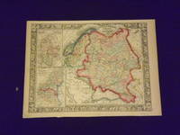
Map of Russia in Europe Sweden and Norway.
<p>Unbound colored engraved map decorative border 14"x 11". Slight toning and aging; overall bright and clear and in very good shape. Maps are wrapped with acid free board or in rigid sleeves. The Mitchell family started to produce atlases in 1846 and continued into the early 1890s. Around 1860 S. Augustus Mitchell Jr. took over and the atlas would be called Mitchell's New General Atlas. This is a colorful single page map of Russia and some Scandinavian countries from the 1864 installment of that atlas. The map includes insets featuring Denmark and Holland and Belgium. Ristow 311-313.</p>
Referenz des Buchhändlers : 106121
|
|
|
Mitchell, Samuel Augustus Jr
Map of Russia in Europe Sweden and Norway
<p>Philadelphia 1861. Unbound colored engraved map decorative border 14"x 11". Slight toning and aging; overall bright and clear and in very good shape. Maps are wrapped with acid free board or in rigid sleeves. The Mitchell family started to produce atlases in 1846 and continued into the early 1890s. Around 1860 S. Augustus Mitchell Jr. took over and the atlas would be called Mitchell's New General Atlas. This is a colorful single page map of Russia and some Scandinavian countries from the 1861 installment of that atlas. The map includes insets featuring Denmark and Holland and Belgium. Ristow 311-313</p>
Referenz des Buchhändlers : 101076
|
|
|
Mitchell, Samuel Augustus Jr
Map of South America.
<p>Unbound colored engraved map decorative border 14" x 11". Slight toning and aging some darkening in lower margin; otherwise bright and clear and in very good condition. Maps are wrapped with acid free board or in rigid sleeves. The Mitchell family started to produce atlases in 1846 and continued into the early 1890s. Around 1860 S. Augustus Mitchell Jr. took over and the atlas would be called Mitchell's New General Atlas. This is an attractive colored map of South America from the 1864 installment of that atlas. The map shows a "New Granada" in an inset. Extra postage may be required. Ristow 311-313. </p>
Referenz des Buchhändlers : 106805
|
|
|
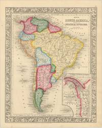
MITCHELL, S[amuel] Augustus
Map of South America Showing its Political Divisions.
Pennsylvania: S. Augustus Mitchell 1860. Engraved map of South America with inset map showing the Proposed Atrato-Inter-Oceanic Canal Routes on the Isthmus of Panama. 33.5 x 27 cm overall sheet size 39 x 31 cm. Framed by ornate foliate border. With original outline hand-colour. Very minor foxing to lower margin 2cm nick to left margin neither affecting map. Pennsylvania: S. Augustus Mitchell, 1860 unknown
Referenz des Buchhändlers : 61282
|
|

 Per e-mail erhalten
 Als pdf-Dokument herunterladen
 RSS feed
 Permanenter link


