|
Mitchell, S Augustus
Mitchell's Ancient Geography
hardcover. Good. Access codes and supplements are not guaranteed with used items. May be an ex-library book. hardcover
Referenz des Buchhändlers : 3382302195.G ISBN : 3382302195 9783382302191
|
|
|
Mitchell, S Augustus
Mitchell's Ancient Geography
paperback. Good. Access codes and supplements are not guaranteed with used items. May be an ex-library book. paperback
Referenz des Buchhändlers : 3382302187.G ISBN : 3382302187 9783382302184

|
|
|
MITCHELL, S[amuel] Augustus Jr
Mitchell's New General Atlas.
Philadelphia: S. Augustus Mitchell & New York: J.W.Willson 1867. Fifty of the maps 3 double-page 15 inset are devoted to Canada and the United States. Included are full-page plans of the cities of Boston New York City Philadelphia Baltimore Washington New Orleans Cincinnati & Chicago. cfPhillips Atlases 3558. folio. ff. 17. 91 hand-coloured lithographed maps & plans with decorative borders on 58 sheets 5 double-page. 1 hand-coloured time-table on verso of double-hemisphere map. original half calf over blind & gilt-stamped cloth binding worn & calf oxidized covers detached the maps themselves in very good condition. elala5456 Philadelphia: S. Augustus Mitchell & New York: J.W.Willson, 1867 hardcover
Referenz des Buchhändlers : elala5456
|
|
|
Mitchell, S Augustus
Mitchell's New General Atlas…
<p>Sold as a collection of maps. Folio original cloth with leather spine and corners about 48 colored maps. Joints cracked text block almost separated from coverts some spine and edge wear endpapers folded and creased some margin staining on maps of Ohio Cincinnati Illinois Chicago and Iowa. Pages 66 and 68 loose. Missing maps of Alaska Africa Central America Cuba Ireland Greece Connecticut Boston Norway New Jersey and Maltese Islands. However does contain attractive double page maps of the United States Texas California New York World and five other double page maps. Other maps appear to be present. Sold as collection of maps.</p> S. Augustus Mitchell,
Referenz des Buchhändlers : 106572
|
|
|
Mitchell, S Augustus
Mitchell's New School Atlas. Mitchell's MODERN ATLAS:
Philadelphia: E. H. Butler & Co. Good with no dust jacket. 1871. Hardcover. a series of Forty-Four Copperplate Maps compiled from the great atlases of Keith Johnston Kiepert The Geographical Institute of Weimar from the United States Coast Survey the surveys of the War Department and of the several states and from other reliable authorities drawn and engraved expressly to illustrate Mitchell's New School Geography. With Important Geographical Tables and an extensive Pronouncing Vocabulary of Nearly Ten Thousand Names. Gray paper boards green cloth spine front cover with illustration. Includes 45 colored maps some double page or full page some inset within the page. Numbered 1 to 44 there is a Map 13 Texas and a Map 13a Michigan Wisconsin present and listed in the Contents.; 9-3/4" x 11-3/4"; Well worn at now rounded corners worn at top of spine well worn at bottom of spine including 1/2" loss of spine cover boards rubbed with vertical line seen on front cover. Prior owner inscriptions inked on front free endpaper with a bit of blleding to text inside cover. Maps with faint foxing and soiling seen only at edges. Front hinge loose though holding well rear hinge functioning soundly. . E. H. Butler & Co. hardcover
Referenz des Buchhändlers : 6240
|
|
|
Mitchell, S Augustus, Jr
Mitchell's new general atlas containing maps of the various countries of the world plans of cities etc. : embraced in fifty-three quarto maps forming a series of eighty-four maps and plans together with valuable statistical tables
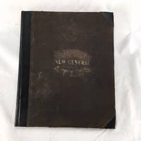
S. Augustus Mitchell 1863-01-01. Hardcover. Good. Folio. 83 leaves 28 pages: 84 color maps ; 40 cm. Black leather rebacked spine. Original black cloth. Good binding and cover. Wear to cloth edges occasional spotting dampstaining to bottom margin affecting last map and text pages in rear. Includes list of post offices in the United States population of the United States by the census of 1850 and 1860 table of population governments & C. table of distances mountains of the world and rivers of the world. Phillips 892. Mitchells New General Atlas was a classic geographical reference in the late 19th century. Taking over the Mitchell Company business after his father retired in 1860 S. Augustus Mitchell Jr. revised the existing Mitchell atlas and renamed it the New General Atlas. New editions were published yearly until 1887. The maps were so popular they were used by the public and sometimes other publishers until the beginning of the 1900s. See Ristow American Maps and Mapmakers. S. Augustus Mitchell hardcover
Referenz des Buchhändlers : 1606270137
|
|
|
Mitchell, S Augustus
Mitchell's new national map exhibiting the United States with the North American British Provinces Sandwich Islands Mexico and Central America. Together with Cuba and the West India Islands
Philadelphia: S. Augustus Mitchell 1859. Large hand-colored wall map on rods approx. 64" square with 4 engraved vignettes 3 inset maps 2 of the world and 1 of the Sandwich Islands all within an elaborate floral border; some infill along the margins slight loss in the population tables at the bottom and several cracks in the paper the whole neatly and professionally backed with linen; overall appearance is certainly very good or better with the usual small defects. America as it was on the eve of the Civil War. Unusual features of this map include the Shoshone Territory what is now mostly Idaho Colona now part of Colorado the unusually large Nebraska the horizontal Utah and New Mexico and the unusually small Dakotas. Phillips Maps of America lists only the 1856 edition. OCLC records examples from 1856 1857 both on conjoined sheets 1858 1860 and 1861 but not this. S. Augustus Mitchell unknown
Referenz des Buchhändlers : 49436

|
|
|
MITCHELL, S Augustus
Mitchell's School Atlas: Comprising the Maps and Tables Designed to Accompany Mitchell's School and Family Geography.
Philadelphia:: Published by E. H. Butler & Co. 1861. publisher's illustrated leather-backed boards. Corners and spine a bit worn; light soiling to boards; maps fine. Folio. Complete with 31 tinted maps 32 are listed on the title page but there is no No. 6. listed. Old student's ownership annotation in ink and pencil notes on endsheets. Published by E. H. Butler & Co., hardcover
Referenz des Buchhändlers : 67039
|
|
|
MITCHELL, SAMUEL AUGUSTUS
MITCHELL'S NATIONAL MAP OF THE AMERICAN REPUBLIC OR UNITED STATES OF NORTH AMERICA
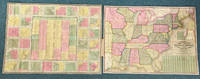
Philadelphia: Mitchell Publishing Company 1843 1843. First edition. 11 x 18.2 cm original roan folder with titles and decorations stamped in gold gilt on the front and rear covers. Contains a beautifully colored 61.8 x 85.7 cm of this brightly colored map and a 64 x 88 cm Sheet of Views with 32 regional inset maps. An exceptional example of this brightly colored map of what is today the Eastern portion of the United States. There is also a listing of states and population by classes white men white women male and female colored and the number that are slaves. A fine copy and a splendid production. Mitchell Publishing Company, 1843 unknown
Referenz des Buchhändlers : 43311
|
|
|
MITCHELL, S Augustus (1792-1868), and James H YOUNG (fl1817-50) l 1
Mitchell's Reference and Distance Map of the United States
Philadelphia: S. Augustus Mitchell 1845. Copper-engraved wall map with full original colour expertly repaired backed with modern linen trimmed in green cloth on contemporary rollers with bright colour overall in very good condition. An impressive wall map of the United States from a crucial year in American history.<br/> <br/> In 1834 Mitchell republished his A New Map of the United States under the title of Reference and Distance Map. New updated editions appeared almost yearly. When compared to the 1833 edition of the former this 1845 edition of the Reference and Distance Map shows many new developments in the upper Midwest. The outline of Lake Michigan has undergone extensive corrections. An oversized Wisconsin Territory 1836 now appears. Two of the small insets of American towns have been removed from the upper left-hand corner so that the new oversized Territory of Iowa 1838 could be added. The large inset General Map of the United States now shows Texas in its last year as an independent Republic. An important American map showing the country on the eve of its second great national expansion.<br/> <br/> Rumsey 4223; Phillips Maps p. 898. S. Augustus Mitchell unknown
Referenz des Buchhändlers : 4885

|
|
|
Mitchell, S Augustus
Mitchell's Traveller's Guide Through the United States
1833 Bound in black morocco with gilt titles and border with large 21 1/2 by 17 1/2" folding map and large index. Map has tears at the folds and old repairs on verso with archival tape minor staining index also torn at folds. Covers rubbed with wear at tips closed tear on spine. Gilt still quite bright in attractive covers. hardcover
Referenz des Buchhändlers : 001992
|
|
|
MITCHELL, Samuel Augustus Sr
Mitchell's National Map of the American Republic or United States of North America. Together with Maps of the Vicinities of 32 of the Principle Cities and Towns in the Union
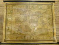
Philadelphia: S. Augustus Mitchell 1844. unbound. Map. Wall map on linen with wooden scrolls. 31.5" x 48.75"<br/> <br/> Large scale map of the eastern United States surrounded with insets of major harbors and towns. Elaborate border design with national coat of arms placed in the each corner contributes to its official quality. Population tables listed in three different insets plus an inset map of the Treaty of 1842 also called Webster-Ashburton Treaty settling a border dispute between Maine and New Brunswick. Large Iowa Territory and Minnesota is not yet named showing impending Westward expansion. From the "National Map Series" that Mitchell produced by subscription over a series of years. Original color but heavily varnished as issued. Samuel Augustus Mitchell Sr. 1792-1868 is one of the pioneers in American cartography of the 19th century and led the conversion of engraved map plates to more affordable lithographic plates. Drawn by James Henry Young 1817-1866 and engraved by J.H. Brightly both collaborated with Mitchell on this series of maps.<br/> <br/> S. Augustus Mitchell unknown
Referenz des Buchhändlers : 260312
|
|
|
Mitchell, Samuel Augustus
Mitchell's Travellers Guide Through the United States. A Map of Roads Distances Steamboat & Canal Routes…
<p>Engraved Hand colored folding map 43.5 x 54.5 cm 17" x 21 1/2" folding into original gilt lettered and decorated morocco covers covers are 5 1/2" x 3 1/4" includes folding index sheet. Map is boxed in a cloth and marble board box with paper label on spine. Spine is worn covers a little bit rubbed some light and unobtrusive dampstaining 4" split and one fold in the ocean some darkening but generally bright; otherwise very good. Samuel Augustus Mitchell 1792-1868 founded one of the most influential map publishing companies in America which would last for over 60 years. After trying his hand at teaching Mitchell turned to map publishing and produces his first atlas in 1831. The following year he produced the first edition of the present work in 1832. This map was engraved by J.H. Young and provides a detailed view of what is now the eastern United States. The map comes with a folding index that includes information on steamboat and canal routes. This guide would be published for about 20 years. Ristow 303-204.</p> S. Augustus Mitchell,
Referenz des Buchhändlers : 106021
|
|
|
Mitchell, S Augustus
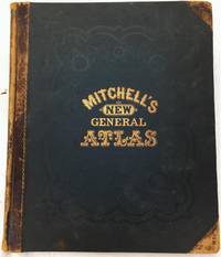
Mitchell's new general atlas : containing maps of the various countries of the world plans of cities etc. embraced in seventy-two quarto maps ; Forming a series of one hundred and three maps and plans together with valuable statistical tables ; Also a list of Post Offices of the United States and territories and census of 1860 and 1870
S. Augustus Mitchell 1874-01-01. Hardcover. Very Good. Handsome clean volume. Collated: 2 leaves 27 4 pages 106 color maps and plans on 72 leaves ; 39 x 32 cm. Original leather spine over publisher's navy blind tooled boards. Gold lettering on front. Internal gutter slightly attenuated at list of maps page. Some rubbing to leather spine/corners lightly bumped. Names on Clement Darlington West Chester PA 1874 Carrie D. Speakman 1880 on end page. <br><br> Maps are in near-fine condition and free of soiling or foxing. <br><br> Mitchell's New General Atlas was a classic geographical reference in the late 19th century. Taking over the Mitchell Company business after his father retired in 1860 S. Augustus Mitchell Jr. revised the existing Mitchell atlas and renamed it the New General Atlas. New editions were published yearly until 1887. The maps were so popular they were used by the public and sometimes other publishers until the 1900s. <br><br> See Ristow American Maps and Mapmakers. Phillips 892 S. Augustus Mitchell hardcover
Referenz des Buchhändlers : 1606150037
|
|
|
Mitchell, S Augustus
Mitchell's New General Atlas Containing Maps of the Various Countries of the World Plans of Cities etc
Philadelphia: S. Augustus Mitchell. Very good copy in the original leather-backed brown cloth. 1871. 1st. 1/2 leather. Folio unpag. Complete with all hand-colored maps; leather spine and corners rubbed hinges tight all plates clean & bright Full title reads as follows: "Mitchell's New General Atlas Containing Maps of the Various Countries of the World Plans of Cities etc. Embraced in Sixty-Three Quarto Maps Forming a Series of One Hundred Maps and PlansTogether with Valuable Statistical Tables" . S. Augustus Mitchell hardcover
Referenz des Buchhändlers : BOOKS040116I
|
|
|
Mitchell, Augustus, publisher
Mitchell's new general atlas containing maps of the various countries of the world plans of cities etc.
Philadelphia: S. Augustus Mitchell Jr. 1864. Square folio pp. 4 27 4; 84 hand-colored maps on 54 sheets; gilt on cover dull spine a little scuffed; internally very clean; aside from the dullness of the binding a very good sound copy in publisher's quarter brown morocco and brown cloth lettered in gilt on front. Includes full page city maps of Boston New York Baltimore Washington D.C. Cincinnati and New Orleans. S. Augustus Mitchell, Jr. unknown
Referenz des Buchhändlers : 29101

|
|
|
Mitchell, S Augustus, Jr
MITCHELL'S NEW GENERAL ATLAS CONTAINING MAPS OF THE VARIOUS COUNTRIES OF THE WORLD PLANS OF CITIES Etc.
Philadelphia 1862. 51 hand colored plates comprising 80 beautiful maps and charts many are double page and a few are insets. A truly extraordinary copy of one of the best Mitchell's atlases. All the maps are bright and vivid showing only some very light and scattered soiling to the edges and versos. Bound in recent black cloth with gold lettering on the spine. Recent Black Cloth. Excellent. Folio. Hardcover
Referenz des Buchhändlers : 884753
|
|
|
Mitchell, S Augustus
Mitchell's Modern Atlas: a Series of Forty-Four Copperplate Maps Compiled from the Great Atlases of Keith Johnston Kiepert the Geographical Institute of Wimar the U. S. Coast Survey Etc. to Illustrate Mitchell's New School Geography.
Philadelphia: J. H. Butler & Co. Fair. 1878. Second Edition. Hardcover. The spine is absent. The covers & front endpaper are loose. The contents are very good or better with all maps present 44 maps on 24 pages and undamaged. The front board is scuffed around the edges but still attractive and complete. ; 4to 11" - 13" tall; 24 pages . J. H. Butler & Co. hardcover
Referenz des Buchhändlers : 16938
|
|
|
Mitchell, Augustus S
Mitchell's New Intermediate Geography Tennessee Edition A System of Modern Geography
Philadelphia: E. H. Butler & Co. Good with no dust jacket. 1886. Hardcover. Good hardcover edition has a previous owner's name and date on the front endpaper. Spine ends and corner tips are worn there is a three inch split in the front hinge cloth. The tan cloth has darkened and there is some minor spotting and soiling. The book is illustrated with twenty three copper plate maps which are in excellent condition. ; 4to 11" - 13" tall; 138 pages . E. H. Butler & Co. hardcover
Referenz des Buchhändlers : 25482
|
|
|
Mitchell, S Augustus
Mitchell's Ancient Atlas Classical and Sacred Containing Maps Illustrating the Geography of the Ancient World .
Philadelphia PA: J. H. Butler and Co. 1881. Book. Good-VG. Hardcover. 4to - over 9¾" - 12" tall. Original binding with burgundy cloth library tape neatly mounted along all edges and binding providing durability. Ex-library typically marked and stamped perforation stamp to title page all maps unmarked and intact. Contents somewhat thumbed a bit toned by age. 12 pp. 6 hand-colored map pages containing a total of 11 maps lacking #5 Roman Empire. Rather surprising given incomplete state that this copy has not yet been sacrified to the plate-breakers. J. H. Butler and Co. Hardcover
Referenz des Buchhändlers : 020528
|
|
|
Mitchell, S Augustus
Mitchell's New General Atlas
Folio original cloth with leather spine and corners gilt title on front cover 65 colored maps. Joints and extremities rubbed but binding is sturdy and in very good condition the U.S. map is split at the middle fold someminor foxing and stains but maps are generally bright and clean. Five of the 65 maps in this atlas are double page and 33 realte to the U.S. The maps of the United States New York Pennsylvania and Texas are particularly attractive. S. Augustus Mitchell, hardcover
Referenz des Buchhändlers : 100381
|
|
|
Mitchell, S Augustus
Mitchell's New General Atlas
Folio original cloth with leather spine and corners gilt title on front cover 65 colored maps. Joints and extremities rubbed but binding is sturdy and in very good condition the U.S. map has a small split at lower end of center fold someminor foxing and stains but maps are generally bright and clean. Five of the 65 maps in this atlas are double page and 33 realte to the U.S. The maps of the United States New York Pennsylvania and Texas are particularly attractive. S. Augustus Mitchell, hardcover
Referenz des Buchhändlers : 100377
|
|
|
Mitchell, S Augustus
Mitchell's New General Atlas
Folio original cloth with leather spine and corners embossed gilt title on front cover 49 colored maps. Rubbing and fading to binding gilt dull removed label from front coverwear to extremities small stain aaffecting preliminaries occassional margin soiling and a few margin tears; U.S. map has split at the bottom of fold some minor toning but contents generally bright and clean. This atlas contains 49 colored maps twenty-six relate to the U.S. Only for maps are double page. Maps of Texas California and South America are particularly attractive. S. Augustus Mitchell, hardcover
Referenz des Buchhändlers : 100375
|
|
|
Mitchell, S Augustus
MITCHELL'S SCHOOL ATLAS: COMPRISING THE MAPS AND TABLES DESIGNED TO ACCOMPANY MITCHELL'S SCHOOL AND FAMILY GEOGRAPHY
Philadelphia: E. H Butler & Co. 1858. Hardcover. Fair worn covers except one double page map is loose with a tear in the Gulf of Mexico notes and names - most are in pencil - written on the blank pages and in some page margins moderate soiling and toning. The first four maps of 32 large and small maps originally present are missing. Texas map is present. Binding is intact. Oversize. ; Engraved color maps. . E. H Butler & Co. hardcover
Referenz des Buchhändlers : 18910
|
|
|
MITCHELL, Nahum
Mitchell's History of Bridgewater
MASSACHUSETTS. BRIDGEWATER. MITCHELL Nahum. Mitchell's History of Bridgewater Massachusetts. Re-Printed in Fac-simile. With an Introductory Note by Edward C. Mitchell. Bridgewater MA 1897. Portrait vi 424pp. Newly rebound in cloth. Very good. Reprint of the 1840 ed. unknown
Referenz des Buchhändlers : 39245
|
|
|
Mitchell, S Augustus
Mitchell's New General Atlas.
Philadelphia Pa.: S. Augustus Mitchell 1865. Containing maps of the various countries of the World plans of cities etc. Embraced in fifty-five quarto maps.forming a series of eighty-seven maps and plans together with valuable statistical tables. Philadelphia, Pa.: S. Augustus Mitchell, 1865. unknown
Referenz des Buchhändlers : 01-0221
|
|
|
MITCHELL, S Augustus
Mitchell's Traveller's Guide to the United States
MITCHELL S. Augustus. Mitchell's Traveller's Guide to the United States Containing the Principal Towns Cities &c . Together with Stage Steamboat Canal and Rail-Road Routes . Illustrated by an Accurate Map of the United States. Phila.: Mitchell and Hinman 1836. 1st ed. under this title. 78 pp. Folding map 18" x 23". Orig. full embossed morocco. One tiny hole in map in Alabama else a lovely copy. HOWES M-690. The work first appeared in 1834 but the map was issued separately. the 1836 edition was the first to contain both the text and the map. The folding map in this work is extrememly detailed with each state colored in outline. unknown
Referenz des Buchhändlers : 52445
|
|
|
Mitchell, Clarence Blair
Mitchell-Boulton Correspondence 1787-1792: Relative to Coinages for South Carolina and the United States Classic Reprint
hardcover. Good. Access codes and supplements are not guaranteed with used items. May be an ex-library book. hardcover
Referenz des Buchhändlers : 1397306882.G ISBN : 1397306882 9781397306883
|
|
|
Mitchell, Clarence Blair
Mitchell-Boulton Correspondence 1787-1792: Relative to Coinages for South Carolina and the United States Classic Reprint
paperback. Good. Access codes and supplements are not guaranteed with used items. May be an ex-library book. paperback
Referenz des Buchhändlers : 1397306238.G ISBN : 1397306238 9781397306234

|
|
|
Mitchell, Adrian
Mitchell: Plays with Songs: Tyger Two; Satie-Day/Night; Man Friday; In the Unlikely Event of an Emergency Oberon Modern Playwrights
paperback. Good. Access codes and supplements are not guaranteed with used items. May be an ex-library book. paperback
Referenz des Buchhändlers : 1870259408.G ISBN : 1870259408 9781870259408

|
|
|
Mitchell, S Augustus
Mitchells School Atlas to illustrate Mitchells School and Family Geography
Philadelphia: Thomas Cowperthwaite & Co. 1839. 2nd revised edition. Tan card boards w b/w illus to front & publishers book lists on rear with original black taped spine. Color maps Good with some dampstaining mostly evident on the blank back sides in Poor intact boards stained & faded outside & many scribbles to insides black cloth binding intact. Beat-up copy of pre-Civil-War book consisting of loose engraved color maps. Lacks maps 1 2 3 world maps & 28 Oceania but this copy includes all of maps 4 thru 27 North Anerica US Mexico Newfoundland & Nova Scotia New England Boston Vicinity Middle States Southern States State of Texas Western States Oregon & No. California Columbia River South America Europe Great Britain Germany & Switzerland France & Spain Asia Palestine Africa Egypt and Liberia. Despite stains & soiling the boards are still legible and the interior maps are in reasonably good condition although their blank versos have variable dampstains. Scarce collectible about 180 years old sold as is. <br/><br/>9-1/2 x 12 full-page color maps with blank versos. Thomas, Cowperthwaite & Co. hardcover
Referenz des Buchhändlers : 36695
|
|
|
MITCHELL, S Augustus, Jr
Mitchells New General Atlas Containing Maps of the Various Countries of the World Plans of Cities Etc. Embraced in Fifty-Five Quarto Maps forming a series of Eighty-Seven Maps and Plans together with Valuable Statistical Tables.
Philadelphia:: S. Augustus Mitchell Jr. 1865. original quarter morocco and gilt-lettered cloth. A few smudges to the List of Maps; map of Kansas Nebraska and Colorado was detached and has been re-inserted with wear to the marginal fore-edge but no damage to the map image; remaining maps generally nice. Leather rubbed; some small areas of non-structural damage to the cloth. . Folio. S. Augustus Mitchell, Jr., hardcover
Referenz des Buchhändlers : 29970
|
|
|
Mitchell, Samuel Augustus
Mitchells School Atlas
Square 4to 11 ½ x 9 ½ publishers original quarter green calf and pictorial peach-colored boards. With 17 hand-colored copper engraved maps 5 double pages plus insets. Spine ends and corners bumped shelf wear a few small dampstains soiling; binding a bit loose short splits to some of the centerfolds U.S. map and light toning and foxing to contents. Overall about very good. Interesting double page map of the United States that shows large portions of the map as territories including a good sized section labeled as Indian Territory. The Missouri Territory stretches well into the Northwest portion of the U.S. and a portion of the Northwest is designated as Upper California. An inset at the lower left hand side of the map illustrates the Gold Region of California. Thomas Cowperthwait & Co., hardcover
Referenz des Buchhändlers : 100382
|
|
|
Mitchell, Agustus
Mitchell’s School Atlas
<p>Revised Edition</p> Thomas, Cowperthwait, & Company hardcover
Referenz des Buchhändlers : 3021
|
|
|
MITCHELL, S Augustus
Mitchell’s School Atlas: comprising the maps etc. designed to accompany
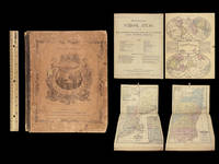
<p><strong>1865 Mitchell School ATLAS 31 MAPS America TEXAS Wild West Confederate South</strong></p><p>The name Mitchell has long been synonymous with 19th-century maps; in fact Mitchell maps are often considered the best of atlas maps from the 1800s. S Augustus Mitchell published an important geography book designed for schools and with it an impressive atlas. This 1865 atlas contains <strong>31 maps. </strong></p><p>Item number: #24864</p><p>Price: $599</p><p>MITCHELL S Augustus</p><p><strong><em>Mitchell's School Atlas: comprising the maps etc. designed to accompany…</em></strong></p><p>Philadelphia: published by Butler & Co. 1865.</p><p><u>Details</u>:</p><p><!-- if !supportLists-->· <!--endif-->Collation: Complete</p><p><!-- if !supportLists-->o <!--endif-->1 7</p><p><!-- if !supportLists-->o <!--endif--><strong>31 hand-colored maps</strong></p><p> <!--endif-->32 numbered; #6 does not exist as per table of contents on title page</p><p><!-- if !supportLists-->· <!--endif-->References: Flake 8087</p><p><!-- if !supportLists-->· <!--endif-->Language: English</p><p><!-- if !supportLists-->· <!--endif-->Binding: Leather; tight and secure</p><p><!-- if !supportLists-->· <!--endif-->Size: ~12in X 9.75in 30.5cm x 24.5cm</p><p>Our Guarantee:</p><p>Very Fast. Very Safe. Free Shipping Worldwide.</p><p>Customer satisfaction is our priority! Notify us with 7 days of receiving and we will offer a full refund without reservation!</p><p>24864</p><p>Photos available upon request.</p> Butler & Co hardcover
Referenz des Buchhändlers : 24864
|
|
|
Mitchell, S Augustus
Mitchell’s New Traveller’s Guide Through the United States… Showing the Rail Roads Canals Stage Roads…
<p>Engraved hand colored map 54.3x72.3cm 21 ½ x28 ½" with 128 pp of text folding into original gilt pictorial blindstamped leather covers 5 ¼ x3 ½ . Leather scuffed at joints and extremities a few short slits at folds bright very good or better. The United States from the Missouri River and the eastern Texas border. You can also see where the U.S. borders on the Indian Territory. There are five insets: Gold and Quicksilver District of California; North and South America showing the maritime and land routes to California; the copper mine regions around Lake Superior; region around Niagara Falls; and New England.</p> Thomas, Cowperthwait & Co., hardcover
Referenz des Buchhändlers : 100371
|
|
|
Mitchell, Derrick Lee
Miyah and Koala's First Day
hardcover. Good. Access codes and supplements are not guaranteed with used items. May be an ex-library book. hardcover
Referenz des Buchhändlers : 1934947695.G ISBN : 1934947695 9781934947692

|
|
|
Mitchell, T F/ Al-Hassan, S A
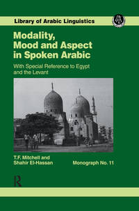
Modality Mood and Aspect in Spoken Arabic: With Special Reference to Egypt and the Levant
Kegan Paul Intl 1995. Hardcover. New. 1st edition. 280 pages. 9.75x6.50x0.75 inches. Kegan Paul Intl hardcover
Referenz des Buchhändlers : x-0710304056 ISBN : 0710304056 9780710304056
|
|
|
Mitchell, TF T F
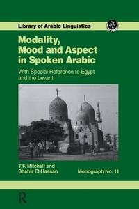
Modality Mood and Aspect in Spoken Arabic
New. Brand new and still unused unknown
Referenz des Buchhändlers : 1138976229 ISBN : 1138976229 9781138976221
|
|
|
Mitchell, Professor T F
Modality Mood and Aspect in Spoken Arabic Library of Arabic Linguistics
hardcover. Good. Access codes and supplements are not guaranteed with used items. May be an ex-library book. hardcover
Referenz des Buchhändlers : 0710304056.G ISBN : 0710304056 9780710304056
|
|
|
Mitchell, TF T F
Modality Mood and Aspect in Spoken Arabic
paperback. Good. Access codes and supplements are not guaranteed with used items. May be an ex-library book. paperback
Referenz des Buchhändlers : 1138976229.G ISBN : 1138976229 9781138976221
|
|
|
Mitchell, Professor T F
Modality Mood and Aspect in Spoken Arabic Library of Arabic Linguistics
Routledge 1995-05-25. 1. hardcover. New. 6.14x0.44x9.21. Buy with confidence. Excellent Customer Service & Return policy. Routledge hardcover
Referenz des Buchhändlers : DADAX0710304056 ISBN : 0710304056 9780710304056
|
|
|
Mitchell, Cathryn
Modelling the Main Ionospheric Trough Across the Northern Hemisphere
PN. New. 2004. Soft Cover. md . PN paperback
Referenz des Buchhändlers : 1342063
|
|
|
Mitchell, Pete
Modern Day Heroes: In Defense of America the Red Volume
paperback. Good. Access codes and supplements are not guaranteed with used items. May be an ex-library book. paperback
Referenz des Buchhändlers : 0975481983.G ISBN : 0975481983 9780975481981

|
|
|
Mitchell, Pete
Modern Day Heroes: In Defense Of America
hardcover. Good. Access codes and supplements are not guaranteed with used items. May be an ex-library book. hardcover
Referenz des Buchhändlers : 0975481991.G ISBN : 0975481991 9780975481998

|
|
|
Mitchell, Alva
Modern Graphics Communication 2nd Edition
Prentice Hall College Div. Used - Good. Ships from UK in 48 hours or less usually same day. Your purchase helps support Sri Lankan Children's Charity 'The Rainbow Centre'. Ex-library so some stamps and wear but in good overall condition. 100% money back guarantee. We are a world class secondhand bookstore based in Hertfordshire United Kingdom and specialize in high quality textbooks across an enormous variety of subjects. We aim to provide a vast range of textbooks rare and collectible books at a great price. Our donations to The Rainbow Centre have helped provide an education and a safe haven to hundreds of children who live in appalling conditions. We provide a 100% money back guarantee and are dedicated to providing our customers with the highest standards of service in the bookselling industry. Prentice Hall College Div unknown
Referenz des Buchhändlers : Z1-ZZ-006-00140 ISBN : 0130317241 9780130317247

|
|
|
Mitchell, Alva
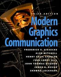
Modern Graphics Communication
paperback. Good. Access codes and supplements are not guaranteed with used items. May be an ex-library book. paperback
Referenz des Buchhändlers : 0131415166.G ISBN : 0131415166 9780131415164
|
|
|
Mitchell, Alva; Spencer, Henry Cecil; Hill, Ivan Leroy; Dygdon, John Thomas; Giesecke, Frederick E; Loving, Robert; Novak, James
Modern Graphics Communication 2nd Edition
Prentice Hall College Div 2000-08-31. Paperback. New. New. In shrink wrap. Looks like an interesting title! Prentice Hall College Div paperback
Referenz des Buchhändlers : Q-0130317241 ISBN : 0130317241 9780130317247
|
|
|
Mitchell, Clifford,
Modern Urinology
like new. unknown
Referenz des Buchhändlers : 45257591 ISBN : 1017613176 9781017613179

|
|
|
Mitchell, Clifford,
Modern Urinology
like new. unknown
Referenz des Buchhändlers : 45487230 ISBN : 1017608547 9781017608540

|
|

 Per e-mail erhalten
 Als pdf-Dokument herunterladen
 RSS feed
 Permanenter link


