|
DES BARRES, Pamela.
Confessions d'une groupie.
Coll. "Musique", Monaco, Le Serpent à Plumes - Editions du Rocher, 2006, Première Edition, in-8, br., couv. photo en coul. éd., 398 pp., nb. photos en noir, Sommaire, Une jeune californienne qui devient une "groupie" des plus grandes stars du Rock des années 60 et 70 : les Stones, Led Zeppelin, les Byrds, les Kinks, les Who, les Doors, Jimi Hendricks, Frank Zappa, Alice Cooper, et bien d'autres. Un tumultueux parcours rempli de sex, drogues mais aussi d'humour et d'autodérision ! RARE. Très bon état
Referenz des Buchhändlers : 65307
|
|
|
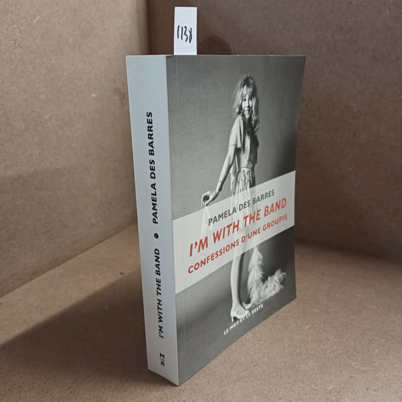
DES BARRES, Pamela
I'm with the band. Confessions d'une groupie.
2016 - broché - Editions Le mot et le reste - 2016 - In-8, broché, couverture illustrée - 428 pages - Traduction de Julia Dorner
Referenz des Buchhändlers : 1138
|
|
|
DES BARRES (Dr C.)
Le vin de Saint - Raphaël.
Paris, Baillière [Valence, Céas], vers 1880 ; in-8°, broché, couverture imprimée - 16 pages - Rare monographie du vin de Saint - Raphaël au quinquina. Orsi II, 507 - Chwartz I, 30
Referenz des Buchhändlers : 46400846
|
|
|
DES BARRES, J F W (1721-1824)
8 Navigational Profiles near Nova Scotia: Appearance of the Land from the White Islands to St. Marys River taken two Leagues off Shore; The Entrance of Milford Haven at the Head of Chedabucto Bay; The Entrance of Port Bickerton bearing N. W.; A View taken off the Entrance of Beaver Harbor Bald Isle bearing E 150 N; A View taken in the Offing of Beaver Harbour Bald Isle bearing W. by S. 3/4 S. distant 3/4 of a Mile; Appearance of the Shore to the Westward of Canso Cranberry Isle bearing N. by E. 1/2 E. distant 4 Miles; C. Bald Isle bearing N. 1/2 E. The Beaver Isles; Appearance of the S. E. Point of Nove Scotia taken from Canso Island Shewing the distant Land of Richmond Isles the Gut of Canso &c
London: J.F.W. Des Barres 1781. Hand-colored line engraving and aquatint. Two plates printed on two sheets joined with 8 views arranged in 5 rows. Sheet size: 32 x 43 3/4 inches. 8 navigational profile views from the greatest of all 18th century sea atlases.<br/> <br/> These eight views of sites in and around Nova Scotia were designed to give navigators additional information to the soundings on the charts of these same places. Several of the placenames have changed but Beaver Island Port Bickerton Chedabucto Bay and Canso remain. This is the 5th of 5 states with many ships and aquatinted features to the landscapes added to the original plates. Des Barres of Swiss-Huguenot extraction studied under the great mathematician Daniel Bernoulli at the University of Basel before continuing on to the Royal Military College at Woolwich. Upon the outbreak of hostilities with France in 1756 he joined the British Royal American Regiment as a military engineer. He came to the attention of General James Wolfe who appointed him to join his personal detail. During this period he also worked with the future legendary explorer James Cook on a monumental chart of the St. Lawrence River. From 1762 Des Barres was enlisted to survey the coastlines of Nova Scotia Newfoundland and the Gulf of St. Lawrence while his colleague Samuel Holland charted the New England coast. He also managed to gain access to some surveys of the American South Cuba and Jamaica. In 1774 Des Barres returned to England where he began work on The Neptune. His dedication to the project was so strong that often at his own expense he continually updated and added new charts and views up until 1784. That year he returned to Canada where he remained for a further forty years becoming a senior political figure and a wealthy land owner and living to the advanced age of 103.<br/> <br/> The American Revolution in drawings and prints; a checklist of 1765-1790 graphics in the Library of Congress / Compiled by Donald H. Cresswell with a foreword by Sinclair H. Hitchings. Washington : 1975 no. 397-404; #61e Henry Stevens Collection. J.F.W. Des Barres unknown
Referenz des Buchhändlers : 34403

|
|
|
DES BARRES, JFW (1721-1824) J F W
A Chart of the Harbour of Louisbourg in the Island of Cape Breton
London 1781. Engraved chart the town and border hand-coloured as issued. Minor repaired edge tears. Sheet Size: 22 5/8 x 32 1/2 inches. An important 18th century chart of Louisbourg harbour.<br/> <br/> Des Barres of Swiss-Huguenot extraction studied under the great mathematician Daniel Bernoulli at the University of Basel before continuing on to the Royal Military College at Woolwich. Upon the outbreak of hostilities with France in 1756 he joined the British Royal American Regiment as a military engineer. He came to the attention of General James Wolfe who appointed him to join his personal detail. During this period he also worked with the future legendary explorer James Cook on a monumental chart of the St. Lawrence River. From 1762 Des Barres was enlisted to survey the coastlines of Nova Scotia Newfoundland and the Gulf of St. Lawrence while his colleague Samuel Holland charted the New England coast. He also managed to gain access to some surveys of the American South Cuba and Jamaica. In 1774 Des Barres returned to England where he began work on The Neptune. His dedication to the project was so strong that often at his own expense he continually updated and added new charts and views up until 1784. That year he returned to Canada where he remained for a further forty years becoming a senior political figure and a wealthy land owner and living to the advanced age of 103. The Atlantic Neptune the most celebrated sea atlas contained the first systematic survey of the east coast of North America. Des Barres's synergy of great empirical accuracy with the peerless artistic virtue of his aquatint views created a work that "has been described as the most splendid collection of charts plates and views ever published" National Maritime Museum Catalogue. Upon the conclusion of the Seven Years War Britain's empire in North America was greatly expanded and this required the creation of a master atlas featuring new and accurate sea charts for use by the Royal Navy. Des Barres was charged with this Herculean task publishing the first volume in London in 1775 which was soon followed by three further volumes. Des Barres's monumental endeavor eventually featured over two-hundred charts and views many being found in several states. Des Barres's charts were immensely detailed featuring both hydrographical and topographical information and in many cases remained the most authoritative maps of the regions covered for several decades.<br/> <br/> Stevens 140. unknown
Referenz des Buchhändlers : 19326

|
|
|
DES BARRES, JFW (1721-1824) J F W
A chart of the bay and harbour of Pensacola in the province of West Florida surveyed by George Gauld A.M.
London: J.F.W. Des Barres in the 'Atlantic Neptune' 1780. Engraved with aquatint period oxidized color. Good condition apart from expert restoration to center fold upper and lower margins. A very rare and highly important sea chart of Pensacola Harbor from the 'Atlantic Neptune' the finest marine atlas of North America's east coast produced during the Revolutionary War.<br/> <br/> This superbly drafted map features the magnificent natural harbor of Pensacola on the Florida panhandle. The town with its fort and carefully laid out streets is featured in the left-centre of the map. Another settlement "Campbell Town" is located further up the harbour toward where the entrance of the "Scambia" Escambia River. The borders of various land grants are demarcated and the countryside is elegantly detailed with aquatint features and coloured in a light brown-green wash. The chart precisely captures the features of the coast showing how the harbor is protected by two sandy bars of land the outer being Santa Rosa Island. The chart features a great deal of quantitative hydrographic information and instructions to mariners are written in the lower right of the map ensuring that it was by far the most accurate and comprehensive pilot for the harbor produced in the eighteenth-century. The present example is the first of two variants of this chart. It is important to note that the year this map was printed the region was caught up in the dramatic action of the Revolutionary War. The Spaniards who had just joined the war on the American side seized the British garrison at Fort Barrancas and West Florida remained in their possession for the duration of the war. Joseph Frederick Wallet Des Barres was born in Switzerland where his Huguenot ancestors had fled following the repeal of the Edict of Nantes. He studied under the great mathematician Daniel Bernoulli at the University of Basel before immigrating to Britain where he trained at the Royal Military College Woolwich. Upon the outbreak of hostilities with France in 1756 he joined the British Royal American Regiment as a military engineer. He came to the attention of General James Wolfe who appointed him to join his personal detail. During this period he also worked with the legendary future explorer James Cook on a monumental chart of the St. Lawrence River. Upon the conclusion of the Seven Years War Britain's empire in North America was greatly expanded and this required the creation of a master atlas featuring new and accurate sea charts for use by the Royal Navy. Des Barres was enlisted to survey the coastlines of Nova Scotia Newfoundland and the Gulf of St. Lawrence. With these extremely accurate surveys in hand Des Barres returned to London in 1774 where the Royal Navy charged him with the Herculean task of producing the atlas. Gradually he was forwarded the manuscripts of numerous advanced surveys conducted by British cartographers in the American Colonies Jamaica and Cuba. The result was The Atlantic Neptune which became the most celebrated sea atlas of its era containing the first systematic survey of the east coast of North America. Des Barres's synergy of great empirical accuracy with the peerless artistic virtue of his aquatint views created a work that "has been described as the most splendid collection of charts plates and views ever published" National Maritime Museum Catalogue. The Neptune eventually consisted of four volumes and Des Barres's dedication to the project was so strong that often at his own expense he continually updated and added new charts and views to various editions up until 1784 producing over 250 charts and views many appearing in several variations. All of these charts were immensely detailed featuring both hydrographical and topographical information such that in many cases they remained the most authoritative maps of the regions covered for several decades. Following the completion of the Neptune Des Barres returned to Canada where he remained for forty years becoming a senior political figure and a wealthy land owner living to the advanced age of 103.<br/> <br/> National Maritime Museum Henry Newton Stevens Collection HNS 173A & Catalogue III 144 p.384; Sellers & Van Ee Maps and Charts of North America and the West Indies 1663. J.F.W. Des Barres in the 'Atlantic Neptune' unknown
Referenz des Buchhändlers : 19770

|
|
|
DES BARRES, Joseph F Wallet (1721-1824)
A group of six views printed on a single plate `A View of Cape Egmont and Winter Rock from the Eastward.'; `Entrance of Egmont Harbor.'; `The Entrance of Keppel Harbor 10 Leagues to the Eastward of Halifax.'; `Falls of Hinchinbroke River the North East Branch of Sandwich Bay.'; `The Entrance into Chisetcook Inlet 4 Leagues Eastward of Halifax.'; `Dartmouth Shore in the Harbor of Halifax'
London: Published by J.F.W. Des Barres in 'The Atlantic Neptune' 1777. Hand-colored etching on Bates paper. No imprint. Sheet size: 32 1/4 x 23 3/4 inches with center fold as with all early issues. Expert restoration to center fold and marginal tears. A set of six navigational views of Halifax Harbour and nearby coastal area from one of the most important North American marine atlases.<br/> <br/> This group includes four profile views intended as aids to navigation. The profiles were intended for use by captains of vessels to identify exactly where they were in relation to distant shorelines; added to these is a charming roundel giving a picturesque view of a waterfall on the Hinchinbroke River and finally a tranquil view in Halifax harbour which is enlivened by the small scene in the lower right of the image where amid clouds of steam men work frantically to re-tar the hull of a man-of-war. This finely coloured example of the print corresponds to Stevens 51 first state without stamped plate number. 'The Atlantic Neptune' was the first great marine atlas and one of the greatest achievements of eighteenth century cartography. Published in England in 1774 it contained over 250 charts and views of the North American and Canadian coasts. The charts were intensely detailed and contained both hydrographical and topographical details. The Neptune was compiled and published for the Royal Navy by Joseph F. W. Des Barres a Swiss cartographer who joined the Royal American Regiment as a surveyor. Des Barres fought in the French and Indian wars and was enlisted to survey the Canadian coastline. While his fellow surveyor Samuel Holland charted the New England coast Des Barres mapped the shoreline of Nova Scotia Newfoundland and the St. Lawrence River regions. In 1774 Des Barres returned to England where he compiled and published his monumental atlas; his dedication to the project was so strong that he published an updated version of the work every year until 1784. Des Barres' work was so superior to any other contemporary atlas that the maps were used as the standard charts of the East coast for over 50 years. The Neptune remains one of the most important atlases ever printed its views and maps chart the history of North America and allow us to glimpse forgotten shores long changed with the passage of time.<br/> <br/> Spendlove The Face of Early Canada Chapter 4: "J.F.W. Des Barres and The Atlantic Neptune"; pp. 18-22; Debard "The Family Origins of Joseph Fredericks Wallet DesBarres: A Riddle Finally Solved" Nova Scotia Historical Review Vol 14 No. 2 1994 p.15; Stevens 51A. Published by J.F.W. Des Barres in 'The Atlantic Neptune' unknown
Referenz des Buchhändlers : 34270

|
|
|
DES BARRES, J F W (1721-1824), publisher - Samuel HOLLAND (1728-1801) and John KNIGHT
A plan of Fort Montgomery and Fort Clinton taken by His Majesty's forces under the command of Maj. Gen.l Sir Henry Clinton K.B: Survey'd by Major Holland Surv.r Gen.l &c. . With large inset titled: Part of Hudsons River shewing the position of Fort Montgomery and Fort Clinton with the Chevaux de Frieze cables chains &c to obstruct the passage of his Majesty's forces up the river. By Lieut. John Knight of the Royal Navy in 1777
London 1779. Engraved and aquatint map period hand colouring. 14 lettered references large inset with title as above. Rare revolutionary chart of the Hudson River showing the American defenses on the eve of the Battle of Fort Montgomery.<br/> <br/> On October 6 1777 a British force led by Lieutenant General Sir Henry Clinton attacked Forts Montgomery and Clinton from the landward side where the American defenses were only partially completed. Support from cannon fire from British ships on the Hudson River that had passed through the chevaux de frise on the lower river. By the end of the day both forts had fallen to the British who burned the forts and tore down the stonework buildings. However the battle was a pyrrhic victory for the British. The campaign against the forts caused delays in reinforcing General John Burgoyne at Saratoga where Americans forced the British surrender ten days later at the Battle of Saratoga before Clinton's forces could arrive. The present map which depicts the Forts and the River defenses prior to the battle is from The Atlantic Neptune the finest large scale sea atlas of the United States and Canadian Atlantic coastline ever produced. The maps in the atlas were produced over a seven-year period 1775-82 and are well known for their accurate portrayal of various sounds bays bars harbors as well as navigational hazards. This atlas was used extensively by the Royal Navy during the American Revolution. Des Barres studied under the great mathematician Daniel Bernoulli at the University of Basel before continuing on to the Royal Military College at Woolwich. On the outbreak of the Seven Years war in 1756 he joined the British Royal American Regiment as a military engineer. He came to the attention of General James Wolfe who appointed him to be his aide-de-camp. From 1762 Des Barres was enlisted to survey the coastlines of Nova Scotia Newfoundland and the Gulf of St.Lawrence while his colleague Samuel Holland charted the New England coast and further south. In 1774 Des Barres returned to England where he began work on the Neptune. His dedication to the project was so strong that often at his own expense he continually updated and added new charts and views up until 1784. That year he returned to Canada where he remained for a further forty years becoming a senior political figure and a wealthy land owner and living to the advanced age of 103. The Atlantic Neptune was the first British sea atlas of her North American colonies and one of the most important achievements of eighteenth century cartography. With an official commission from the Royal Navy Des Barres published the first volume in London in 1775 which was soon followed by further volumes. Des Barres' monumental endeavor eventually featured over two-hundred charts and aquatint views many being found in several states. All of the charts were immensely detailed featuring both hydrographical and topographical information. The Neptune met with the highest acclaim from the beginning and is today widely regarded as superior to all other atlases produced during its time. Henry Stevens identified only a single state of this chart issued coloured or uncoloured which appeared in some examples volume four part two of the Atlantic Nepture; the map however is not listed in the engraved list of maps for that section and given the rarity was likely not issued in all copies.<br/> <br/> National Maritime Museum: Henry Stevens Collection: HNS156; Cf. Phillips Atlases 1198; Hornsby Surveyors of Empire: Samuel Holland J.F.W. Des Barres and the Making of the Atlantic Neptune 2011. unknown
Referenz des Buchhändlers : 33200

|
|
|
Des Barres, Joseph F W
A Statement Submitted by Lieutenant Colonel Desbarres for Consideration Respecting his Services From the Year 1755 The Utility of his Surveys and Publications Intituled The Atlantic Neptune
hardcover. Good. Access codes and supplements are not guaranteed with used items. May be an ex-library book. hardcover
Referenz des Buchhändlers : 1385766786.G ISBN : 1385766786 9781385766781
|
|
|
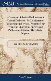
Des Barres
A View of the North Shore Sailing into the Bason of Mines in the Bay Fundy.
London 1775. Excellent. Notes: Aquatint and line engraving. This fine view is from "The Atlantic Neptune" by Capt. Joseph Fredrick Wallet Des Barres 1721-1824. "The Atlantic Neptune" is one of the most important sea atlases of USA and Canadian Atlantic coast that was ever produced. The atlas was first published in England in 1774 and was updated regularly till 1784. The maps are known for the accurate portrayal of various sounds bays bars and harbours in addition to navigational challenges. The maps are very detailed and contain both hydrographical and topographical information. Des Barres a Swiss cartographer and landscape artist who immigrated to England and trained at the royal military academy became a colonial administrator in Halifax Nova Scotia where he died. He was lieutenant royal American regiment c 1756; engineer under general wolf at Quebec c.1759; and governor of Prince Edward Island. He mapped the shore line of Nova Scotia New Found land and St. Lawrence River regions c.1764/1774 . This atlas was used by the Royal Navy during the American Revolution. <br>Reference Debard J. M. the family origins of J.f.W.Des Barres; Evens uncommon Obdurate: the several public careers of J.F.W. Des Barres Toronto 1989; De Vorsey map collector 1982 p.31 Image Size : 184x793 mm 7.25x31.25 Inches Platemark Size : Paper Size : 278x823 mm 11x32.375 Inches Coloring: Hand Colored Medium: Aquatint and line engraving Categories: Views Canada Nova Scotia unknown
Referenz des Buchhändlers : P739
|
|
|
DES BARRES, J F W (1721-1824); after William PIERIE
A View of Boston Taken on the Road to Dorchester
London: J. F. W. Des Barres 1776. Engraved view printed on laid paper engraved by James Newton after Pierie. Sheet size: 22 1/2 x 31 1/2 inches. First state. Rare view of Boston from the road to Dorchester published shortly after George Washington's first victory of the American Revolution.<br/> <br/> Following the Battles of Lexington and Concord American troops laid siege to Boston. Strategically Dorchester Heights offered commanding views of both Boston town and harbour. On March 4 1776 under the cover of darkness and with batteries firing from Roxbury and Cambridge to provide a diversion George Washington moved canon captured at Ticonderoga onto the Heights and fortified the position. Faced with little choice given the overwhelming strategic advantage General Howe retreated from Boston on March 17 giving George Washington and the Americans a decisive early victory in the war. The present view accomplished by British artillery officer William Pierie in 1773 depicts Boston Boston Harbor and Roxbury as it would have been seen by Washington and the American army. The Shirley-Eustis house the home of Governor William Shirley and later Governor William Eustis in Roxbury is visible in the middle ground and in the far distance the beacon is visible atop Beacon Hill. A rare view published in 1776 in the New England section of Des Barres monumental Atlantic Neptune. Joseph Frederick Wallet Des Barres was born in Switzerland where his Huguenot ancestors had fled following the repeal of the Edict of Nantes. He studied under the great mathematician Daniel Bernoulli at the University of Basel before immigrating to Britain where he trained at the Royal Military College Woolwich. Upon the outbreak of hostilities with France in 1756 he joined the British Royal American Regiment as a military engineer. He came to the attention of General James Wolfe who appointed him to join his personal detail. Des Barres returned to London in 1774 where the Royal Navy charged him with the Herculean task of producing an atlas of sea charts of the American coast. The result was The Atlantic Neptune which became the most celebrated sea atlas of its era containing the first systematic survey of the east coast of North America. Des Barres's synergy of great empirical accuracy with the peerless artistic virtue of his aquatint views created a work that "has been described as the most splendid collection of charts plates and views ever published" National Maritime Museum Catalogue. The Neptune eventually consisted of four volumes and Des Barres's dedication to the project was so strong that often at his own expense he continually updated and added new charts and views to various editions up until 1784 producing over 250 charts and views many appearing in several variations. Following the completion of The Neptune Des Barres returned to Canada where he remained for a further forty years becoming a senior political figure and a wealthy land owner living to the advanced age of 103.<br/> <br/> Henry Stevens Collection HNS97; Deak 132. J. F. W. Des Barres unknown
Referenz des Buchhändlers : 34921

|
|
|
DES BARRES, JFW (1721-1824) J F W
Annapolis Royal. St. Mary's Bay
London: Published by J.F.W. Des Barres in 'The Atlantic Neptune' 1781. Etching with added hand-colour. On laid paper with 'J Bates' watermark and 'JB' countermark. A fine print from "The Atlantic Neptune" which charts the Annapolis Royal with a coastal view of Gulliver's Hole and a descriptive text.<br/> <br/> 'The Atlantic Neptune' was the first great marine atlas and one of the greatest achievements of eighteenth century cartography. Published in England in 1774 it contained over 250 charts and views of the North American and Canadian coasts. The charts were intensely detailed and contained both hydrographical and topographical details. The Neptune was compiled and published for the Royal Navy by Joseph F. W. Des Barres a Swiss cartographer who joined the Royal American Regiment as a surveyor. Des Barres fought in the French and Indian wars and was enlisted to survey the Canadian coastline. While his fellow surveyor Samuel Holland charted the New England coast Des Barres mapped the shoreline of Nova Scotia Newfoundland and the St. Lawrence River regions. In 1774 Des Barres returned to England where he compiled and published his monumental atlas; his dedication to the project was so strong that he published an updated version of the work every year until 1784. Des Barres' work was so superior to any other contemporary atlas that the maps were used as the standard charts of the East coast for over 50 years. The Neptune remains one of the most important atlases ever printed its views and maps chart the history of North America and allow us to glimpse a forgotten land long changed by the passage of time. This chart is an excellent eighteenth century record of the first settlement in Canada. In 1605 two years before the first permanent English settlement at Jamestown three years before the founding of Quebec and fifteen years before the Pilgrims landed at Plymouth a small party of French explorers led by Sieur de Monts established Port Royal as the first settlement in Canada. The settlement was later renamed Annapolis Royal which is the name asigned to it in Des Barres chart.<br/> <br/> Spendlove The Face of Early Canada Chapter 4: "J.F.W. Des Barres and The Atlantic Neptune"; pp. 18-22; Debard "The Family Origins of Joseph Fredericks Wallet DesBarres: A Riddle Finally Solved" Nova Scotia Historical Review Vol 14 No. 2 1994 p.15. Published by J.F.W. Des Barres in 'The Atlantic Neptune' unknown
Referenz des Buchhändlers : 5598

|
|
|
DES BARRES, JOSEPH FREDERICK WALLET (1721-1824) and SAMUEL HOLLAND
Buzzards Bay and Vineyard Sound.
London: J. F. W. Des Barres for The Atlantic Neptune 1776. Large engraved chart from Des Barres' Atlantic Neptune on two sheets of laid paper joined each bearing "J Bates" watermark. 43x31 inches sheet size nice margins; contemporary hand-color in outline; slightest offsetting a superior copy. State 4 of 7. Fine chart depicting the waters between New Bedford and Martha's Vineyard.<br/> <br/> Buzzards Bay and the Vineyard Sound including the Elizabeth Islands and the western half of Martha's Vineyard. Showing much more on-shore information than is typical for a Des Barres chart there are details of property boundaries structures even a road from Menemshaw Pond to Tisbury. Native names throughout remain largely unchanged today. Joseph Des Barres was born in Switzerland in 1721 and educated in Basel before emigrating to England and entering the Royal Military College where he learned engineering and the art of surveying. In 1756 Des Barres was commissioned a Lieutenant in the Royal American Regiment and dispatched to North America. He served in America during the Seven Years War under Colonel Bouquet Lord Howe and General Amherst and participated in the Quebec campaign as General Wolfe's engineer. Though Des Barres was responsible for the surveys done of Nova Scotia and the Isle of Sable the surveying of the coastline of what became the United States was undertaken by Major Samuel Holland a Dutchman who joined the British army during the French and Indian War as an engineer and became ultimately Surveyor General for North America. Holland was in charge of a rather large staff that included Charles Blaskowitz and George Gauld. They ultimately provided greatly improved charts for the entire coastline and the Gulf of Mexico. All this work was done prior to the Revolution which necessarily brought the surveys to an end. The publishing supervised by Des Barres continued throughout the war years. Des Barres compiled and edited the atlas maintaining a high standard throughout. His primary motive seems to have been the navigational usefulness of the charts. He clearly envisioned a navigator's needs in approaching a shoreline. The Atlantic Neptune was the first new survey of American coastlines in a century and the need was very great. The charts were plagiarized for the next thirty or forty years. Des Barres also had a flare for making charts aesthetically appealing so that they are invariably handsome as well as unfailingly interesting.<br/> <br/> Stevens 88D; John Carter Brown Library Charting the East Coast of North America The Atlantic Neptune Providence: 1972; Robert Lingel 'The Atlantic Neptune' in the Bulletin of the New York Public Library July 1936 pp.571-603; Augustus P. Loring 'The Atlantic Neptune' in American Maritime Prints New Bedford: 1985. J. F. W. Des Barres for The Atlantic Neptune unknown
Referenz des Buchhändlers : 33412

|
|
|
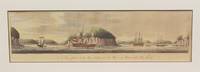
Des Barres
Cape Blonmedown / Cape Split
London 1779. Very Good a short tear from upper left margin enters in the image for half an inch. Image Size : 145x423 mm 5.71x16.65 Inches Platemark Size : Paper Size : 232x564 mm 9.13x22.20 Inches Coloring: Hand Colored Medium: Aquatint Categories: Views Canada Nova Scotia; unknown
Referenz des Buchhändlers : P2445
|
|
|
Des Barres
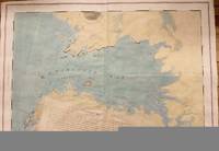
Charlotte Bay
London 1776. Very Good. Notes: A scarce and sought after map of Charlotte Bay in Greater Halifax. This area in present day contains numerous luxary cottages. Size : 680x975 mm 26.75x38.375 Inches Coloring: Hand Colored Category: Maps Canada East Nova Scotia; unknown
Referenz des Buchhändlers : M4657
|
|
|
DES BARRES, JFW (1721-1824) J F W
Chart of Port Shediack & Cocagne New Brunswick
London: J. F. W. Des Barres for 'The Atlantic Neptune' 1781. Etched with aquatint and stippling. Some outline color. Platemark: 29 1/4 x 21 3/8 inches; sheet: 32 3/4 x 24 3/4 inches. Laid paper watermarked "J. Bates" with counter mark "J.B." A meticulous survey of a portion of the eastern coast of New Brunswick on the Northumberland Straits with soundings and topographical detailing.<br/> <br/> This chart which appeared in Volume II of The Atlantic Neptune was part of the surveying work conducted by Des Barres himself in the late 1760s and early 1770s. The first state was issued in 1776; this enhanced second state appeared in 1779. Des Barres of Swiss-Huguenot extraction studied under the great mathematician Daniel Bernoulli at the University of Basel before continuing on to the Royal Military College at Woolwich. Upon the outbreak of hostilities with France in 1756 he joined the British Royal American Regiment as a military engineer. He came to the attention of General James Wolfe who appointed him to join his personal detail. During this period he also worked with the future legendary explorer James Cook on a monumental chart of the St. Lawrence River. From 1762 Des Barres was enlisted to survey the coastlines of Nova Scotia Newfoundland and the Gulf of St. Lawrence while his colleague Samuel Holland charted the New England coast. He also managed to gain access to some surveys of the American South Cuba and Jamaica. In 1774 Des Barres returned to England where he began work on The Neptune. His dedication to the project was so strong that often at his own expense he continually updated and added new charts and views up until 1784. That year he returned to Canada where he remained for a further forty years becoming a senior political figure and a wealthy land owner and living to the advanced age of 103. The Atlantic Neptune the most celebrated sea atlas contained the first systematic survey of the east coast of North America. Des Barres's synergy of great empirical accuracy with the peerless artistic virtue of his aquatint views created a work that "has been described as the most splendid collection of charts plates and views ever published" National Maritime Museum Catalogue. Upon the conclusion of the Seven Years War Britain's empire in North America was greatly expanded and this required the creation of a master atlas featuring new and accurate sea charts for use by the Royal Navy. Des Barres was charged with this Herculean task publishing the first volume in London in 1775 which was soon followed by three further volumes. Des Barres's monumental endeavor eventually featured over two-hundred charts and views many being found in several states. Des Barres's charts were immensely detailed featuring both hydrographical and topographical information and in many cases remained the most authoritative maps of the regions covered for several decades.<br/> <br/> Stevens 72h. J. F. W. Des Barres for 'The Atlantic Neptune' unknown
Referenz des Buchhändlers : 20210

|
|
|
DES BARRES, Joseph Frederick Wallet
Chart of the Harbour of Boston/ Nautical Remarks and Observations for the Chart of the Harbour of Boston.
London 5th August 1775. 705 by 1040mm 27.75 by 41 inches. Large aquatint and etched engraving on two sheets joined unfolded and uncut with the LVG watermark together with pamphlet quarto 280 by 230mm original blue wrappers typographic title pp. 5-12 there are no pages 3-4 which agrees with the John Carter Brown example. The first state of one of the most important Revolutionary War illustrations of Boston and its approaches accompanied by the very rare 12 page pamphlet by George Callender entitled 'Nautical remarks and observations for the chart of the harbour of Boston'. Callendar was the Master of HMS Romney. Commissioned in 1762 she served extensively in North America arriving in Boston in May 1768 to support the British during the enforcement of the Townshend Acts. Short of men it was the pressing of local men into service which increased tension in the town to a level which culminated in the Boston Massacre of 1770. This chart is part of a very large body of work known as the 'Atlantic Neptune' undertaken by Des Barres one of the greatest hydrographic achievements of the eighteenth century. The French and Indian War highlighted the lack of accurate mapping of the vast territories now under British control in North America. Samuel Holland was entrusted with the task of accurately mapping the northern portion of these territories. He proposed using the latest accurate methods which included astronomical readings and triangulation. In 1769 he was still working in Canadian waters but had instructed Callendar to undertake the survey of Boston. In England Des Barres was in charge of undertaking the detailed engraving. He set about providing the British government with more accurate mapping of the entire coastline of America and Canada. They proved to be of just as much use to the American rebel forces. This particular chart is notable for recording Boston as it was at the outbreak of hostilities. It illustrates the British defences before the siege. The second state in particular out of the four later ones would record the progress of the siege works constructed by the Americans around the city. As the title informs us it was surveyed in the year 1769 a troubled time in Boston. Extensive soundings are provided in the harbour. The road structure is accurately recorded as are the local towns. It even shows recorded field boundaries. An alphabetical key upper right identifies fourteen locations in the immediate area of Boston including batteries docks forts wharves and the all-important Charles-town Ferry. The accompanying pamphlet of sailing directions is rare. It was replaced soon after by a single sheet version entitled 'A Chart of the Harbour of Boston' which is sometimes found pasted to later states of the map. It is rarely found with the chart as here. Boston Engineering Department List of Maps of Boston pp. 70-71; Cumming British Maps of Colonial America pp.51-56; ESTC N12343 pamphlet; Guthorn 'British Maps of the American Revolution' 59/3 Holland's original manuscript; Krieger and Cobb Mapping Boston p. 106 plate 19; Nebenzahl Bibliography of printed battle plans 3; Sabin 10061 pamphlet; Sellers & Van Ee 945; Stevens Bibliography of the Atlantic Neptune unpublished pp. 211-216; Streeter II:706. unknown
Referenz des Buchhändlers : 10833
|
|
|
DES BARRES, JFW (1721-1824) J F W
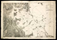
Chart of the Coast of Georgia
London 1780. Aquatint and line engraving period hand colouring. Very rare first state of Des Barres's chart of the coast of Georgia.<br/> <br/> This fine chart is from "The Atlantic Neptune" one of the finest large scale sea atlases of the United States and Canadian Atlantic coastline ever produced. The maps in the atlas were produce over a seven-year period 1775-82 and are well known for their accurate portrayal of various sounds bays bars harbors as well as navigational hazards. This atlas was used extensively by the Royal Navy during the American Revolution. This is a detailed chart of the Georgia and upper Florida coastlines covering an area between the mouth of the River May to John's Island. The towns of Savannah Beaufort Hardwick and Sunbury are shown and the coastal Parishes in Georgia are names. To the west is noted "Indian Boundary Line." This very rare first state is larger than the subsequent two states without any detail added to the South Carolina coast and without the inset in the lower right corner added in or after 1780.<br/> <br/> Stevens 168a. unknown
Referenz des Buchhändlers : 26675

|
|
|
Des Barres, Pamela
Confessions of a Groupie
New York: William Morrow. Very Good in Very Good dust jacket. 1987. First Edition. Hardcover. William Morrow hardcover
Referenz des Buchhändlers : 1984
|
|
|
Des Barres
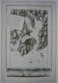
Egmont Harbor
London: The Atlantic Neptune 1775. Very Good laid on acid free canvas for long term preservation. A crease from the left extending in to the circle vignette in the map. Notes: Splendid chart of Egmont Harbor Nova Scotia - 30 miles east of Halifax. The beautifully engraved chart shows topography soundings anchorages and navigational notes. A circular vignette is superimposed on the chart with a view of what appears to be the only settlement there. At bottom is another engraved view of the coastline as seen from the sea. The title which includes detailed sailing instructions appears as a scrap of paper laid across the chart.<br>Aquatint and line engraving. This fine chart is from "The Atlantic Neptune" by Capt. Joseph Fredrick Wallet Des Barres 1721-1824. "The Atlantic Neptune" is one of the most important sea atlases of the USA and Canadian Atlantic coast that was ever been produced. The atlas was first published in England in 1774 and was updated regularly till 1784. The maps are known for the accurate portrayal of various sounds bays bars and harbours in addition to navigational challenges. The maps are very detailed and contain both hydrographical and topographical information. Des Barres a Swiss cartographer and landscape artist who immigrated to England and trained at the royal military academy became a colonial administrator in Halifax Nova Scotia where he died. He was a lieutenant in the royal American regiment c 1756; engineer under general wolf at Quebec c.1759; and governor of Prince Edward Island. He mapped the shore line of Nova Scotia Newfoundland and St. Lawrence River regions c.1764/1774 . This atlas was used by the Royal Navy during the American Revolution. <br>Reference Debard J. M. the family origins of J.f.W.Des Barres; Evens uncommon Obdurate: the several public careers of J.F.W. Des Barres Toronto 1989; De Vorsey map collector 1982 p.31 Size : 795x550 mm 31.25x21.625 Inches Coloring: Hand Colored Category: Maps Canada East Nova Scotia The Atlantic Neptune unknown
Referenz des Buchhändlers : M5011
|
|
|
DES BARRES, JFW (1721-1824) J F W
Egmont Harbour modern Jeddore Harbour Nova Scotia
London: Published by J.F.W. Des Barres in 'The Atlantic Neptune' 1779. Sea chart etched with roulette-work with original colour with aquatint view. Printed on laid paper with 'J Bates' watermark and 'JB' countermark. A very fine sea chart and view of Egmont now called Jeddore Harbour from 'The Atlantic Neptune' the first British sea atlas of her North American colonies<br/> <br/> This is a finely presented and highly detailed chart of what is now known as Jeddore Harbour near Halifax. The bay seven miles long and three miles wide is captured in a cartographic composition of great topographical and hydrographical detail and is further embellished by a roundel containing a mariner's view of the area. This chart is the fifth and final state produced and is identical to the Henry Stevens Collection variant 49G in the National Maritime Museum Greenwich. Des Barres studied under the great mathematician Daniel Bernoulli at the University of Basel before continuing on to the Royal Military College at Woolwich. On the outbreak of the Seven Years war in 1756 he joined the British Royal American Regiment as a military engineer. He came to the attention of General James Wolfe who appointed him to be his aide-de-camp. From 1762 Des Barres was enlisted to survey the coastlines of Nova Scotia Newfoundland and the Gulf of St.Lawrence while his colleague Samuel Holland charted the New England coast. In 1774 Des Barres returned to England where he began work on the Neptune. His dedication to the project was so strong that often at his own expense he continually updated and added new charts and views up until 1784. That year he returned to Canada where he remained for a further forty years becoming a senior political figure and a wealthy land owner and living to the advanced age of 103. The Atlantic Neptune was the first British sea atlas of her North American colonies and one of the most important achievements of eighteenth century cartography. With an official commission from the Royal Navy Des Barres published the first volume in London in 1775 which was soon followed by further volumes. Des Barres' monumental endeavor eventually featured over two-hundred charts and aquatint views many being found in several states. All of the charts were immensely detailed featuring both hydrographical and topographical information. Des Barres' plates were used to print further editions up into the first decade of the nineteenth-century. The Neptune met with the highest acclaim from the beginning and is today widely regarded as superior to all other atlases produced during its time.<br/> <br/> National Maritime Museum: Henry Stevens Collection: K0124 HNS 49G & Catalogue no.38 p.382; Cf. Spendlove The Face of Early Canada Chapter 4: "J.F.W. Des Barres and The Atlantic Neptune"; pp. 18-22; Debard "The Family Origins of Joseph Frederick Wallet Des Barres: A Riddle Finally Solved" Nova Scotia Historical Review Vol 14 No. 2 1994 p.15. Published by J.F.W. Des Barres in 'The Atlantic Neptune' unknown
Referenz des Buchhändlers : 5597

|
|
|
Des Barres, Pamela
I'm With the Band: Confessions of a Groupie
New York: Jove Editions 1988. First Jove Edition. Original Wraps. Very Good. First Jove Edition. Original Wraps. From the Collection of Jenny Lens. Inscribed by the author: "Love and kisses." Memoir from the most famous Hollywood groupie of all time! Shelfwear around edges creasing toning else tight bright and unmarred. 8vo 280pp. illus. b/w. Jove Editions unknown
Referenz des Buchhändlers : 12012
|
|
|
Des Barres, Pamela
I'm With The Band
<p>New York: Beech Tree Books 1987. First Edition. 300pp. Hard Cover: NEAR FINE. Dust Wrapper: VERY GOOD. Small pencil writing on half title page. Minor chips on top left corner and bottom of dust wrapper spine. SIGNED by the author.</p><p>"Sexually intimate memoir of a queen of the groupies and of the life she lived to the hilt turning on with the kings of rock 'n' roll.a classic account of rampant narcissism among guitar egomaniacs". Kirkus Review.</p> Beech Tree Books hardcover
Referenz des Buchhändlers : B01040

|
|
|
DES BARRES, Pamela
I'm With The Band
New York: Beech Tree Books/William Morrow 1987. First Edition. Octavo. 22cm. Publisher's original off white cloth spine titled in gilt over cream paper covered boards. Dustjacket. 304pp. Light scuffing to extremities a little bumping to the spine ends internally clean in a bright strong pictorial dustjacket with some minor marginal creasing and wear. A very good copy indeed. <br /> <br /> Pamela Des Barres' autobiographical account of her career as the pre-eminent rock and roll groupie and her adventures amongst music aristocracy from Frank Zappa to the Stones. Beech Tree Books/William Morrow unknown
Referenz des Buchhändlers : 82948

|
|
|
Des Barres, Pamela
I'm With the Band: Confessions of a Groupie
Beech Tree Books 1987-06-01. Hardcover. Good. 1.2000 8.1000 5.8000. Dust jacket has some wear and tear to the edges. General shelfwear to the cover and page edges. rn Beech Tree Books hardcover
Referenz des Buchhändlers : mon0003810680 ISBN : 068806602x 9780688066024

|
|
|
Des Barres, Pamela
I'm with the Band
New. Brand new and still unused unknown
Referenz des Buchhändlers : 0515097128 ISBN : 0515097128 9780515097122

|
|
|
Des Barres, Pamela
I'M with the Band. Confessions of a Groupie.
New York: Beech Tree Books/William MORROW. Fine in Fine dust jacket. 1987. First Edition; First Printing. Hardcover. 068806602X . First edition. Fine in fine dust jacket. The definitive 'tell all' groupie memoir. Hard to locate in top condition. ; 8vo 8" - 9" tall; 304 pages . Beech Tree Books/William MORROW hardcover
Referenz des Buchhändlers : 3115679 ISBN : 068806602X 9780688066024
|
|
|
Des Barres, Pamela
I'm With the Band: Confessions of a Groupie
hardcover. Good. Access codes and supplements are not guaranteed with used items. May be an ex-library book. hardcover
Referenz des Buchhändlers : 068806602X.G ISBN : 068806602X 9780688066024
|
|
|
Des Barres, Pamela
I'm With the Band: Confessions of a Groupie
<p>Very Good. Signed by Pamela Des Barnes on FEP: "Rock & Roll!" ; 1stED/1st hardcover dust jacket not clipped tan boards with gray spine slightly creased gold gilt tilte well bound clean text without creases tears or marksmany photos. Email for photos.</p> hardcover
Referenz des Buchhändlers : 0704IWP7FUK ISBN : 068806602X 9780688066024

|
|
|
Des Barres, Pamela (Signed)
I'm with the Band: Confessions of a Groupie
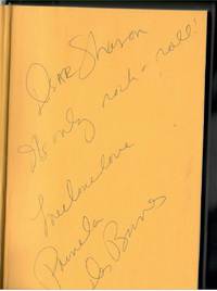
Beech Tree Books. As New in Fine dust jacket. 1987. First Edition; First Printing. Hardcover photos. 068806602X . Book As New. No notes. No other names or ANY markings. DJ with gentle reader wear but NO tears. DJ not price clipped $16.95 ; Inscribed by author at 1st page "it's only rock n' roll love" and signed in full. ; 302 pages; Signed by Author . Beech Tree Books hardcover
Referenz des Buchhändlers : 9175 ISBN : 068806602X 9780688066024
|
|
|
Des Barres
Isle Haut and Cape Chegnecto
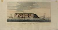
London 1779. Very Good. Image Size : 200x423 mm 7.87x16.65 Inches Platemark Size : Paper Size : 293x569 mm 11.54x22.40 Inches Coloring: Hand Colored Medium: Aquatint Categories: Views Canada Nova Scotia; unknown
Referenz des Buchhändlers : P2444
|
|
|
Des Barres, Joseph FW F W
Keppell Harbour; Knowles Harbour; Tangier Harbour; Saunder's Harbour; Deane Harbour
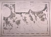
London: Des Barres Joseph F.W. 1779. Very Good lower margin extended. Laid down on acid free paper for long term preservation. . Notes: This map of the Keppell Knowles Tangier Saunder's and Deane harbours found on Cape Breton Island in Nova Scotia appears in The Atlantic Neptune an important cartographic work published by De Barres. <br><br>Colonel Joseph Frederick Wallet DesBarres 1721 – 1824 was a hydrographer cartographer military engineer and landscape artist who served in the Seven Years War in part as the aide-de-camp to General James Wolfe. He also created the monumental four volume Atlantic Neptune which was the most important collection of maps charts and views of North America published in the eighteenth century. Finally he was the Governor of Cape Breton Island and Prince Edward Island. Size : 620x930 mm 24.41x36.61 Inches Coloring: Original faint Hand Coloring Category: Maps Canada East Nova Scotia; Des Barres, Joseph F.W. unknown
Referenz des Buchhändlers : M8840
|
|
|
Des Barres, Pamela
Let's Spend the Night Together: Backstage Secrets of Rock Muses and Supergroupies
Chicago IL: Chicago Review Press 2007. First Edition. Hardcover. Very Good in Very Good Unprice-Clipped DJ. First Edition. Hardcover. From the Collection of Jenny Lens. With photographs by Jenny Lens and inscribed by the author: "You're the coolest! Keep the images coming. Love." Memoir from the most famous Hollywood groupie of all time! Light shelfwear around edges and dj else tight bright and unmarred. Matte color DJ gray/black paper over boards. 8vo 384pp. illus b/w index. Chicago Review Press hardcover
Referenz des Buchhändlers : 11994
|
|
|
Des Barres, Pamela
Let's Spend the Night Together: Backstage Secrets of Rock Muses and Supergroupies
Chicago Review Pr 2007. Hardcover. New. 400 pages. 9.00x6.25x1.25 inches. Chicago Review Pr hardcover
Referenz des Buchhändlers : 1-1556526687 ISBN : 1556526687 9781556526688

|
|
|
Des Barres, Pamela
Let's Spend the Night Together: Backstage Secrets of Rock Muses and Supergroupies
Brand: Chicago Review Press 2007-07-01. hardcover. New. 6.25x1.25x9.00. Buy with confidence. Excellent Customer Service & Return policy. Brand: Chicago Review Press hardcover
Referenz des Buchhändlers : DADAX1556526687 ISBN : 1556526687 9781556526688
|
|
|
DES BARRES, Joseph Frederick Wallet [1721-1824] [Army officer, military engineer, surveyor, First Lieutenant Governor of Cape Br
Manuscript document in secretarial hand unsigned dated Prince Edward Island Government House July 28 1812.
Charlottetown: 1812. A distinguished military engineer DesBarres served in the British Army in North America during the Seven Years' War and participated in the capture of Louisbourg in 1758 and of Quebec in 1759. General James Wolfe used a chart which he prepared of the St. Lawrence River and approaches to Quebec in his assault on the city. From 1763 to 1773 DesBarres surveyed and charted the Atlantic coast from Newfoundland to New York which resulted in the publication in 1777 of the Atlantic Neptune a four-volume atlas “which stands as a landmark in Canadian cartographic achievement†R.J.Morgan DCB VI pp. 196 and is considered to be the most important atlas of North America published in the eighteenth century. He went on to become the first Lieutenant Governor of Cape Breton 1784-87 the founder of Sydney and the Lieutenant Governor of Prince Edward Island 1804-12. He faced considerable opposition to his administration in both colonies and with the home government and in each instance was recalled to England. The present document is dated just one month before his recall from Prince Edward Island in August of 1812. In it DesBarres reprimands the Grand Jury for overstepping the bounds of their authority although he says he is willing to attribute their statements to “good intentions in an infant colony language which under other circumstances might be very differently received.â€. one-page folio. horizontal folds several tears with no loss of text. matted & framed size of frame: 21.75 x 16 inches; 55.2 x 40.6 cm. elala5919 [Charlottetown]: 1812 unknown
Referenz des Buchhändlers : elala5919
|
|
|
DES BARRES, Joseph F Wallet (1721-1824)
Miramichi Bay
London: J. F. W. Des Barres 1781. Engraved with aquatint on single double-page sheet watermarked "J. Bates." Excellent condition with minor repairs along centerfold. Detailed depiction of the mouth of the Miramachi River in New Brunswick and Miramachi Bay in the Gulf of St. Larwence.<br/> <br/> Des Barres of Swiss-Huguenot extraction studied under the great mathematician Daniel Bernoulli at the University of Basel before continuing on to the Royal Military College at Woolwich. Upon the outbreak of hostilities with France in 1756 he joined the British Royal American Regiment as a military engineer. He came to the attention of General James Wolfe who appointed him to join his personal detail. During this period he also worked with the future legendary explorer James Cook on a monumental chart of the St. Lawrence River. From 1762 Des Barres was enlisted to survey the coastlines of Nova Scotia Newfoundland and the Gulf of St. Lawrence while his colleague Samuel Holland charted the New England coast. He also managed to gain access to some surveys of the American South Cuba and Jamaica. In 1774 Des Barres returned to England where he began work on The Neptune. His dedication to the project was so strong that often at his own expense he continually updated and added new charts and views up until 1784. That year he returned to Canada where he remained for a further forty years becoming a senior political figure and a wealthy land owner and living to the advanced age of 103. The Atlantic Neptune the most celebrated sea atlas contained the first systematic survey of the east coast of North America. Des Barres's synergy of great empirical accuracy with the peerless artistic virtue of his aquatint views created a work that "has been described as the most splendid collection of charts plates and views ever published" National Maritime Museum Catalogue. Upon the conclusion of the Seven Years War Britain's empire in North America was greatly expanded and this required the creation of a master atlas featuring new and accurate sea charts for use by the Royal Navy. Des Barres was charged with this Herculean task publishing the first volume in London in 1775 which was soon followed by three further volumes. Des Barres's monumental endeavor eventually featured over two-hundred charts and views many being found in several states. Des Barres's charts were immensely detailed featuring both hydrographical and topographical information and in many cases remained the most authoritative maps of the regions covered for several decades. The survey of the St. Lawrence River and Gulf was conducted by Samuel Holland who provided many charts to the immense hydrographic enterprise realized in the Atlantic Neptune. This is the fourth state of the map with the imprint date changed to 1781.<br/> <br/> HNS 131D; Spendlove The Face of Early Canada Chapter 4: "J.F.W. Des Barres and The Atlantic Neptune"; pp. 18-22; Debard "The Family Origins of Joseph Fredericks Wallet Des Barres: A Riddle Finally Solved" Nova Scotia Historical Review Vol 14 No. 2 1994 p.15. J. F. W. Des Barres unknown
Referenz des Buchhändlers : 34986

|
|
|
DES BARRES, JFW (1721-1824) J F W
North East Coast of Nova Scotia / Northumberland Streights sic One sheet
London: British Admiralty for 'The Atlantic Neptune' 1779. Etching with roulette work original outline color on laid paper watermarked "JBates" and countermarked "JB" This excellent example of Des Barres' craftsmanship details a portion of the strait between New Brunswick and what is now Prince Edward Island then St. John's Island. It includes on the New Brunswick side: Shediac Cocagne and Boutouche. The chart includes soundings throughout the Straits and Baie Verte. This is one of the many regions Des Barres himself surveyed during the 1760s. Des Barres of Swiss-Huguenot extraction studied under the great mathematician Daniel Bernoulli at the University of Basel before continuing on to the Royal Military College at Woolwich. Upon the outbreak of hostilities with France in 1756 he joined the British Royal American Regiment as a military engineer. He came to the attention of General James Wolfe who appointed him to join his personal detail. During this period he also worked with the future legendary explorer James Cook on a monumental chart of the St. Lawrence River. From 1762 Des Barres was enlisted to survey the coastlines of Nova Scotia Newfoundland and the Gulf of St. Lawrence while his colleague Samuel Holland charted the New England coast. He also managed to gain access to some surveys of the American South Cuba and Jamaica. In 1774 Des Barres returned to England where he began work on The Neptune. His dedication to the project was so strong that often at his own expense he continually updated and added new charts and views up until 1784. That year he returned to Canada where he remained for a further forty years becoming a senior political figure and a wealthy land owner and living to the advanced age of 103. The Atlantic Neptune the most celebrated sea atlas contained the first systematic survey of the east coast of North America. Des Barres's synergy of great empirical accuracy with the peerless artistic virtue of his aquatint views created a work that "has been described as the most splendid collection of charts plates and views ever published" National Maritime Museum Catalogue. Upon the conclusion of the Seven Years War Britain's empire in North America was greatly expanded and this required the creation of a master atlas featuring new and accurate sea charts for use by the Royal Navy. Des Barres was charged with this Herculean task publishing the first volume in London in 1775 which was soon followed by three further volumes. Des Barres's monumental endeavor eventually featured over two-hundred charts and views many being found in several states. Des Barres's charts were immensely detailed featuring both hydrographical and topographical information and in many cases remained the most authoritative maps of the regions covered for several decades.<br/> <br/> Streeter copy: Vol. II # 58; Stevens 68e. British Admiralty for 'The Atlantic Neptune'] unknown
Referenz des Buchhändlers : 28787

|
|
|
Des Barres, J F W
Penobscot Bay to Blue Hill Bay Maine
London ca. 1780. Engraving on two joined sheets 30.25†x 43.25†sheet size hand-colored border. CONDITION: Good trimmed close at top and bottom with loss of a portion of neat line at top and all of neat line at bottom lower portions of longitudinal figures at bottom nicked original fold marks. <p>A fine chart depicting a portion of the Penobscot Bay region of Maine from the most celebrated maritime atlas of the eighteenth century.</p> <p>Published in London around 1780 in The Atlantic Neptune J. F. W. Des Barres’s landmark four-volume maritime atlas of North America this chart depicts the islands of Vinalhaven called Southern Fox Island until 1789 part of North Haven Isle au Haut Matinicus Isle spelled Metimicus and the area around Owl’s Head. It demonstrates a precise knowledge of the location of numerous smaller islands ledges and rocks the hazardous nature of the latter two being of particular significance to those navigating the waters of the region. Two rhumb line networks cover Penobscot Bay with a north arrow and a smaller one indicating magnetic north shown on the western side. Depth soundings appear around the most important islands and harbors. From a semantic viewpoint the highlight of this chart has to be “Ragged Arse Island.â€</p> <p>The lack of good charts during the Seven Years War generated complaints among British military engineers and naval officers leading to several large-scale surveying projects of the North American coast including newly-gained territory in Canada. Des Barres’ surveys represented just a portion of the massive charting initiative though he is given credit for assembling these various charts into atlas form. </p> <p>The Atlantic Neptune is considered the most comprehensive and important maritime atlas of the 18th century. It was published several times after 1774 and includes engraved plates from many distinct British surveying efforts most dating to the late 1770s and early 1780s. Des Barres was paid by the Admiralty for his work but allowed to keep the rights to plates. Due to the ongoing nature of the surveying effort Des Barres was constantly reconfiguring his atlas as new surveys emerged. Consequently there is considerable variation among the various copies of The Atlantic Neptune in terms of binding organization and contents.</p> <p>J. F. W. Des Barres 1721-1824 was a Swiss-born military engineer and cartographer. Trained in mathematics under Daniel and Jean Bernoulli he moved to England to study at the Royal Military College at Woolwich. In 1756 he received a lieutenant’s commission in the Royal American Regiment and recruited soldiers in the American colonies to join the fight against the French in the Seven Years War. He joined General James Wolfe’s Quebec campaign and worked on various engineering and surveying projects in Canada. In 1763 Des Barres accepted a commission to survey the coasts and harbors of North America. He first worked alongside the Surveyor General of North America Samuel Holland later undertaking his own surveys while Holland continued in parallel. Though there was substantial overlap Des Barres’ work in contrast to Holland’s land surveys focused on producing charts for maritime use. These regional charts were considered to be the most accurate for decades. Des Barres’s atlas owed much to Holland’s maps—which he obtained from the Board of Trade and Plantations—and the work of other contemporaries.</p> <p>REFERENCES: Brown Lloyd A. “The Atlantic Neptune.†The Pennsylvania Magazine of History and Biography Vol. 67 No. 4 1943 pp. 377–81.</p> [London, ca. 1780] unknown
Referenz des Buchhändlers : 3547
|
|
|
Des Barres
Port Amherst / Port Haldimand
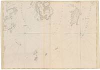
London 1775. Very Good. Notes: Aquatint and line engraving. This fine chart is from "The Atlantic Neptune" by Capt. Joseph Fredrick Wallet Des Barres 1721-1824. "The Atlantic Neptune" is one of the most important sea atlases of the USA and Canadian Atlantic coast that was ever been produced. The atlas was first published in England in 1774 and was updated regularly till 1784. The maps are known for the accurate portrayal of various sounds bays bars and harbours in addition to navigational challenges. The maps are very detailed and contain both hydrographical and topographical information. Des Barres a Swiss cartographer and landscape artist who immigrated to England and trained at the royal military academy became a colonial administrator in Halifax Nova Scotia where he died. He was a lieutenant in rhw royal American regiment c 1756; engineer under general wolf at Quebec c.1759; and governor of Prince Edward Island. He mapped the shore line of Nova Scotia Newfoundland and St. Lawrence River regions c.1764/1774 . This atlas was used by the Royal Navy during the American Revolution. <br>Reference Debard J. M. the family origins of J.f.W.Des Barres; Evens uncommon Obdurate: the several public careers of J.F.W. Des Barres Toronto 1989; De Vorsey map collector 1982 p.31 Size : 700x485 mm 27.5x19.125 Inches Coloring: Original Hand Coloring Category: ; Maps Canada East Nova Scotia unknown
Referenz des Buchhändlers : M6223
|
|
|
DES BARRES, Joseph Frederick Wallet
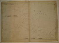
Port Campbell
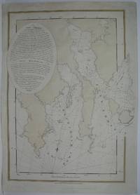
London 1776. First. unbound. very good. Sea chart. Engraving. Image measures 27.25" x 40.25".<br/> <br/> Beautiful rare nautical chart of Port Campbell SE Nova Scotia. This is the first state and shows settlements and shoals in outline only. Includes the yet named Shelburne Harbour and Roseneath Island now McNutt Island. Includes description of the shoreline and tides. Map is dated 1776 just before the Loyalists came and settled the area. Published in "The Atlantic Neptune" the first British sea atlas of the eastern coast of North America hailed for both its accuracy and its aesthetics. Small chips and tears to margin not affecting the image slight wear to original folds overall toning. J.F.W. Des Barres c. 1729-1827 was born in Basle Switzerland but went to military school in England. He became a colonial administrator in Nova Scotia and also served as governor of Quebec. Des Barres was commissioned for the surveying project in 1762 and dedicated ten years to the gathering of the charts and publication of the atlas.<br/> <br/> unknown
Referenz des Buchhändlers : 227653
|
|
|
Des Barres
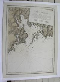
Port Jackson Medway Harbor Nova Scotia
London 1775. Very good. Notes: Aquatint and line engraving. This fine chart is from "The Atlantic Neptune" by Capt. Joseph Fredrick Wallet Des Barres 1721-1824. "The Atlantic Neptune" is one of the most important sea atlases of the USA and Canadian Atlantic coast that was ever been produced. The atlas was first published in England in 1774 and was updated regularly till 1784. The maps are known for the accurate portrayal of various sounds bays bars and harbours in addition to navigational challenges. The maps are very detailed and contain both hydrographical and topographical information. Des Barres a Swiss cartographer and landscape artist who immigrated to England and trained at the royal military academy became a colonial administrator in Halifax Nova Scotia where he died. He was a lieutenant in rhw royal American regiment c 1756; engineer under general wolf at Quebec c.1759; and governor of Prince Edward Island. He mapped the shore line of Nova Scotia Newfoundland and St. Lawrence River regions c.1764/1774 . This atlas was used by the Royal Navy during the American Revolution. <br>Reference Debard J. M. the family origins of J.f.W.Des Barres; Evens uncommon Obdurate: the several public careers of J.F.W. Des Barres Toronto 1989; De Vorsey map collector 1982 p.31 Size : 540x748 mm 21.25x29.375 Inches Coloring: Original Hand Coloring Category: Maps Canada East Nova Scotia unknown
Referenz des Buchhändlers : M3913 ISBN : 2125x29375 9782125x29371
|
|
|
Des Barres, Pamela
Rock Bottom
paperback. Good. Access codes and supplements are not guaranteed with used items. May be an ex-library book. paperback
Referenz des Buchhändlers : 0316882402.G ISBN : 0316882402 9780316882408
|
|
|
Des Barres, Pamela; Kemprecos, Paul
Rock Bottom: Dark Moments in Music Babylon
St Martins Pr 1996-10-01. Hardcover. New. In shrink wrap. Looks like an interesting title! St Martins Pr hardcover
Referenz des Buchhändlers : Q-0312148534 ISBN : 0312148534 9780312148539

|
|
|
DES BARRES, Joseph Frederick Wallet
South East Part of Bay of Fundy
London: J.F.W. Des Barres. unbound. very good. Map. Engraving. 32" x 82". Shows some wear to edges and toning of far left panel.<br/> <br/> The Bay of Fundy lies between Canada's Nova Scotia and New Brunswick provinces and touches the U.S. state of Maine. It's known for extremely high tides. J.F.W. Des Barres c. 1729-1827 was born in Basle Switzerland but went to military school in England. He became a colonial administrator in Nova Scotia and also served as governor of Quebec. Des Barres was commissioned for the surveying project in 1762 and dedicated ten years to the gathering of the charts and publication of the atlas.<br/> <br/> J.F.W. Des Barres unknown
Referenz des Buchhändlers : 288500
|
|
|
Des Barres, Joseph FW (Frederick Wallet) 1722-1824 F W
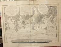
Spry Harbour; Port Pallisser; Port North; Port Parker; Beaver Harbour; Fleming River.
London 1779. Very Good wide margins. Notes: With oval shaped Inset View showing Cape Spry N. NE… Beaver Isles… Westermost Ledge of Pegasus Wing East.<br><br>The Atlantic Neptune published for the Royal Navy of Great Britain in London 1774-1781. It included a comprehensive survey of the coasts of Nova Scotia the coasts and harbors of the Gulf and River of St. Lawrence and the Atlantic coast of North America including New York to Mexico and New England. Size : 723x1035 mm 28.46x40.75 Inches Coloring: Original Outline Coloring Category: Maps Canada East Nova Scotia; unknown
Referenz des Buchhändlers : M10469
|
|
|
Des Barres, Pamela
Take Another Little Piece of My Heart: A Groupie Grows Up
William Morrow & Co 1992-11-01. Hardcover. New. New. In shrink wrap. Looks like an interesting title! William Morrow & Co hardcover
Referenz des Buchhändlers : Q-0688091490 ISBN : 0688091490 9780688091491

|
|
|
Des Barres, Pamela; Des Barres, Michael
Take Another Little Piece of My Heart: A Groupie Grows Up
Chicago Review Press 2008-09-01. Paperback. New. In shrink wrap. Looks like an interesting title! Chicago Review Press paperback
Referenz des Buchhändlers : Q-1556528000 ISBN : 1556528000 9781556528002

|
|
|
Des Barres, Pamela
Take Another Little Piece of My Heart
Berkley 1993-10-01. Mass Market Paperback. New. In shrink wrap. Looks like an interesting title! Berkley paperback
Referenz des Buchhändlers : Q-042513945X ISBN : 042513945X 9780425139455

|
|
|
Des Barres, Pamela
Take Another Little Piece of My Heart
Near Fine. !st Edition full number line signed by author on half title page; HCDJ not price clipped light wear no tears; straight spine edgesslight bottom corner bump; no marks; ships in boxVery Good unknown
Referenz des Buchhändlers : 0805QDCCOW2 ISBN : 0688091490 9780688091491
|
|

 Per e-mail erhalten
 Als pdf-Dokument herunterladen
 RSS feed
 Permanenter link


