|
Sanson Andre
Semaines scientifiques ou expos� annuel des progr�s de la science et de leurs applications � l'�conomie sociale agricole industrielle et domestique/ premiere ann�e
in12. Reliure demi-basane. 508 pages. Furne -jouvet unknown
Référence libraire : 43256
|
|
|
SANSON Andre
Traité de zootechnie EDITION ORIGINALE
Paris: Lib. agricole de la raison rustique 1888. Fine. Lib. agricole de la raison rustique Paris 1888-1893 115x185cm 5 volumes reliés. - 40808 - FRENCH VERSION FOLLOWS Troisième édition en partie originale car revue et corrigée. Le premier volume fait partie du troisième tirage de la troisième édition les volumes suivants font partie du deuxième tirage. Reliures en demi chagrin rouge dos à cinq nerfs sertis de filets dorés et comportant de petites traces de frottements pour certains volumes dos ornés de motifs floraux dorés trois mors affectés de légers manques en têtes encadrements de filets à froid sur les plats de cartonnage rouge plats du premier volume décolorés reliures de l'époque. Ouvrage illustré de figures dans le texte. Quelques rousseurs. Rare. Lib. agricole de la raison rustique unknown
Référence libraire : 34050

|
|
|
SANSON ANDRE
TRAITE DE ZOOTECHNIE - TOME 1 - BIBLIOTHEQUE AGRICOLE - Zoologie et zootechnie générales - organisations, fonctions physiologiques et hygiène des machines animales
LIBRAIRIE AGRICOLE DE LA MAISON RUSTIQUE. 1893. In-8. Relié. Etat d'usage, Coins frottés, Dos satisfaisant, Intérieur frais. XVII + 401 pages augmentées de nombreuses figures en noir et blanc dans le texte - auteur, titre, tomaison et filets dorés sur le dos - plats et contre plats jaspés. . . . Classification Dewey : 590-Zoologie
Référence libraire : RO30139274
|
|
|
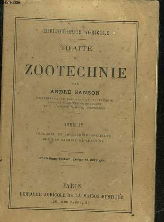
SANSON ANDRE
TRAITE DE ZOOTECHNIE - TOME 4 - ZOOLOGIE ET ZOOTECHNIE SPECIALES - BOVIDES TAURINS ET BUBALINS
LIBRAIRIE AGRICOLE DE LA MAISON RUSTIQUE - 3° EDITION. 1888. In-16. Broché. Etat d'usage, Couv. légèrement passée, Dos satisfaisant, Quelques rousseurs. 363 pages. Quelques gravures en noir et blanc dans le texte. Petites rousseurs sur la couverture.. . . . Classification Dewey : 590-Zoologie
Référence libraire : RO30064548
|
|
|
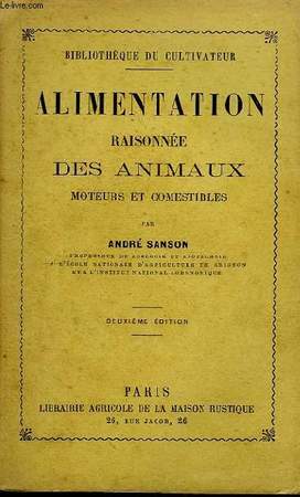
SANSON André
Alimentation raisonnée des Animaux moteurs et comestibles.
LA MAISON RUSTIQUE. 2ème édition. 1892. In-12. Broché. Bon état, Couv. légèrement passée, Dos satisfaisant, Intérieur frais. 170 pages.. . . . Classification Dewey : 590-Zoologie
Référence libraire : RO80034277
|
|
|
SANSON André
La maréchalerie ou ferrure des animaux domestiques
Lib. agricole de la Maison rustique, Paris 1897, 11,5x18,5cm, relié.
Référence libraire : 38358
|
|
|
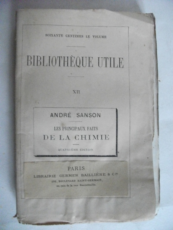
SANSON André
les principaux faits de la chimie
in 12 broché,mention de 4ème édition.Titre,192 pages,Germer-Baillière & Cie Bibliothèque utile XII.Rousseurs éparses. Sinon très bon état
Référence libraire : 5298
|
|
|
Sanson André
Semaines scientifiques ou exposé annuel des progrés de la science et de leurs applications à l'économie sociale agricole industrielle et domestique/ premiere année
Furne -jouvet 1866 in12. 1866. Reliure demi-basane. 508 pages. Bon Etat carte depliante h-t + gravures in texte
Référence libraire : 43256
|
|
|
SANSON André
TRAITE DE ZOOTECHNIE ou économie du betail
tome 1-zoologie et zootechnie génerale,organisation,fonctions physiologiques et hygiéne des animaux domestiques agricoles-
Référence libraire : 1619
|
|
|
SANSON André
Traité de zootechnie
Lib. agricole de la raison rustique, Paris 1888-1893, 11,5x18,5cm, 5 volumes reliés.
Référence libraire : 34050
|
|
|
SANSON André
Traité de zootechnie. TOME I
MAISON RUSTIQUE. 3ème édition. 1882. In-12. Broché. Bon état, Couv. convenable, Dos satisfaisant, Rousseurs. 448 pages. Quelques illustrations en noir et blanc dans le texte. Pages non coupées.. . . . Classification Dewey : 590-Zoologie
Référence libraire : RO80026312
|
|
|
SANSON André
Traité de Zootechnie. TOME III
LA MAISON RUSTIQUE. 3ème édition. 1888. In-12. Broché. Bon état, Couv. légèrement passée, Dos satisfaisant, Quelques rousseurs. 382 pages. Quelques illustrations en noir et blanc dans le texte.. . . . Classification Dewey : 590-Zoologie
Référence libraire : RO80029762
|
|
|
SANSON André (SECRÉTAIRE -ADJOINT DE LA SOCIÉTÉ IMPÉRIALE. ET CENTRALEDE MÉDECINE VÉTÉRINAIRE )
LE MEILLEUR PRESERVATIF CONTRE LA RAGE : étude de la physionomie des chiens et des chats enragés, lésions, causes, degré de contagion du virus; remèdes antirabiques par A. Sanson
Paris Bureaux de la Science Pittoresque et Bureaux de la Culture 1860 -in-12 demi-chagrin un volume, reliure demi-chagrin chocolat in-douze (binding half shagreen in-12)(20 x 13 cm), dos à nerfs (spine with raised bands) décoré "or" et à froid (gilt and blind stamping decoration), titre et auteur frappés "or" (gilt title), filet à froid de part et d'autre des nerfs et en tête et en pied, papier marbré marron et jaune aux plats (cover with marbled paper), toute tranches lisses, marque-page en tissu (bookmark in tissue), orné d'une gravure in-texte en noir + une figure de notation musicale in-texte en noir, 84 pages, 1860 Paris Bureaux de la Science Pittoresque et Bureaux de la Culture Editeurs,
Référence libraire : 23500
|
|
|
SANSON André .-
Les moutons.-
Histoire naturelle et zootechnie. 5°édition. 56 gravures. Paris. Maison Rustique. 1894. In-12 (120 x 186mm) broché, couverture jaune imprimée, ornée d'un mouton, VI, 167 pages et catalogue de la librairie, 48 pages. Gravures en noir dans le texte.
Référence libraire : ORD-9689
|
|
|
SANSON André.
TRAITE DE ZOOTECHNIE OU ECONOMIE DU BETAIL.
Paris, Librairie agricole de la maison rustique, 1877-82. 4 vol. in-12, demi-reliure.
Référence libraire : 5102
|
|
|
Sanson Angela
Anoressia. Storia letteratura e sitografia
Roma: Fondazione Mario Luzi 2018. Roma 2018; br. pp. 234. "L'idea di questo lavoro nasce dalla lettura dell'autobiografia di Michela Marzano 'Volevo essere una farfalla' e dalla partecipazione a un convegno 'Violenza sulla donna e femminicidio'. A partire da queste due esperienze ho cercato di rispondere a domande che dalla lettura di quel testo e dalla partecipazione a quel seminario erano sorte spontaneamente. Mi sono chiesta se sia plausibile interpretare l'anoressia nervosa come una violenza autoindotta e mi sono interrogata su quali potessero essere i motivi quali le ragioni profonde che hanno spinto la persona a diventare il suo stesso carnefice. Infine mi sono domandata se e in che modo la letteratura potesse fornire strumenti utili in tale percorso di comprensione." Angela Sanson Fondazione Mario Luzi unknown
Référence libraire : 3490460 ISBN : 8867481975 9788867481972
|
|
|
Sanson Armand.
Deux sculpteurs normands : les freres Anguier / par Armand Sanson. 1889 Hardcover
2020. Hardcover. New. Lang: - fre Pages 124. Reprinted in 2020 with the help of original edition published long back 1889. This book is Printed in black & white Hardcover sewing binding for longer life with Matt laminated multi-Colour Dust Cover Printed on high quality Paper re-sized as per Current standards professionally processed without changing its contents. As these are old books we processed each page manually and make them readable but in some cases some pages which are blur or missing or black spots. If it is multi volume set then it is only single volume if you wish to order a specific or all the volumes you may contact us. We expect that you will understand our compulsion in these books. We found this book important for the readers who want to know more about our old treasure so we brought it back to the shelves. Any type of Customisation is possible with extra charges. Hope you will like it and give your comments and suggestions. hardcover
Référence libraire : 1111015050816
|
|
|
Sanson Armand.
Deux sculpteurs normands : les freres Anguier / par Armand Sanson. 1889 Hardcover
2020. Hardcover. New. Lang: - fre Pages 128. Reprinted in 2020 with the help of original edition published long back 1889. This book is Printed in black & white Hardcover sewing binding for longer life with Matt laminated multi-Colour Dust Cover Printed on high quality Paper re-sized as per Current standards professionally processed without changing its contents. As these are old books we processed each page manually and make them readable but in some cases some pages which are blur or missing or black spots. If it is multi volume set then it is only single volume if you wish to order a specific or all the volumes you may contact us. We expect that you will understand our compulsion in these books. We found this book important for the readers who want to know more about our old treasure so we brought it back to the shelves. Any type of Customisation is possible with extra charges. Hope you will like it and give your comments and suggestions. hardcover
Référence libraire : 1111015050817
|
|
|
SANSON C.J.
UN HIVER A MADRID (ROMAN)
DE NOYELLES. 2008. In-8. Broché. Bon état, Couv. convenable, Dos satisfaisant, Intérieur frais. 505 pages.. . . . Classification Dewey : 820-Littératures anglaise et anglo-saxonne
Référence libraire : R200082302
|
|
|
Sanson Casimir d. .
Alphabet du jeu �checs comprenant le r�glement du jeu la marche des pi�ces le dictionnaire des mots techniques des maximes et conseils pour bien jouer la m�thode pour apprendre � lire et � �crire les coups et les noms des pi�ces en langues �trang�res; ou Livre pour apprendre seul la marche des pi�ces. 1871
2020. Paperback. New. Lang: - fre Pages 92. Reprinted in 2020 with the help of original edition published long back 1871. This book is Printed in black & white sewing binding for longer life with Matt laminated multi-Colour Soft Cover HARDCOVER EDITION IS ALSO AVAILABLE Printed on high quality Paper re-sized as per Current standards professionally processed without changing its contents. As these are old books we processed each page manually and make them readable but in some cases some pages which are blur or missing or black spots. If it is multi volume set then it is only single volume if you wish to order a specific or all the volumes you may contact us. We expect that you will understand our compulsion in these books. We found this book important for the readers who want to know more about our old treasure so we brought it back to the shelves. Any type of Customisation is possible with extra charges. Hope you will like it and give your comments and suggestions. paperback
Référence libraire : PB1111009697496
|
|
|
Sanson Casimir d. .
Alphabet du jeu �checs comprenant le r�glement du jeu la marche des pi�ces le dictionnaire des mots techniques des maximes et conseils pour bien jouer la m�thode pour apprendre � lire et � �crire les coups et les noms des pi�ces en langues �trang�res; ou Livre pour apprendre seul la marche des pi�ces. 1871 Hardcover
2020. Hardcover. New. Lang: - fre Pages 92. Reprinted in 2020 with the help of original edition published long back 1871. This book is Printed in black & white Hardcover sewing binding for longer life with Matt laminated multi-Colour Dust Cover Printed on high quality Paper re-sized as per Current standards professionally processed without changing its contents. As these are old books we processed each page manually and make them readable but in some cases some pages which are blur or missing or black spots. If it is multi volume set then it is only single volume if you wish to order a specific or all the volumes you may contact us. We expect that you will understand our compulsion in these books. We found this book important for the readers who want to know more about our old treasure so we brought it back to the shelves. Any type of Customisation is possible with extra charges. Hope you will like it and give your comments and suggestions. hardcover
Référence libraire : 1111009697496
|
|
|
Sanson Casimir.
Les premi�res le�ons du jeu des �checs etc. 1871
2020. Paperback. New. Lang: - fre Pages 260. Reprinted in 2020 with the help of original edition published long back 1871. This book is Printed in black & white sewing binding for longer life with Matt laminated multi-Colour Soft Cover HARDCOVER EDITION IS ALSO AVAILABLE Printed on high quality Paper re-sized as per Current standards professionally processed without changing its contents. As these are old books we processed each page manually and make them readable but in some cases some pages which are blur or missing or black spots. If it is multi volume set then it is only single volume if you wish to order a specific or all the volumes you may contact us. We expect that you will understand our compulsion in these books. We found this book important for the readers who want to know more about our old treasure so we brought it back to the shelves. Any type of Customisation is possible with extra charges. Hope you will like it and give your comments and suggestions. paperback
Référence libraire : PB1111010097888
|
|
|
Sanson Casimir.
Les premi�res le�ons du jeu des �checs etc. 1871 Hardcover
2020. Hardcover. New. Lang: - fre Pages 260. Reprinted in 2020 with the help of original edition published long back 1871. This book is Printed in black & white Hardcover sewing binding for longer life with Matt laminated multi-Colour Dust Cover Printed on high quality Paper re-sized as per Current standards professionally processed without changing its contents. As these are old books we processed each page manually and make them readable but in some cases some pages which are blur or missing or black spots. If it is multi volume set then it is only single volume if you wish to order a specific or all the volumes you may contact us. We expect that you will understand our compulsion in these books. We found this book important for the readers who want to know more about our old treasure so we brought it back to the shelves. Any type of Customisation is possible with extra charges. Hope you will like it and give your comments and suggestions. hardcover
Référence libraire : 1111010097888
|
|
|
Sanson Casimir.
Notice sur les ouvrages de M.de Jaenisch. Suivie d'un m�moire sur la r�futation de l'attaque L. Paulsen dans la partie fran�aise par M.de Jaenisch. 1869
2020. Paperback. New. Lang: - fre Pages 34. Reprinted in 2020 with the help of original edition published long back 1869. This book is Printed in black & white sewing binding for longer life with Matt laminated multi-Colour Soft Cover HARDCOVER EDITION IS ALSO AVAILABLE Printed on high quality Paper re-sized as per Current standards professionally processed without changing its contents. As these are old books we processed each page manually and make them readable but in some cases some pages which are blur or missing or black spots. If it is multi volume set then it is only single volume if you wish to order a specific or all the volumes you may contact us. We expect that you will understand our compulsion in these books. We found this book important for the readers who want to know more about our old treasure so we brought it back to the shelves. Any type of Customisation is possible with extra charges. Hope you will like it and give your comments and suggestions. paperback
Référence libraire : PB1111009176677
|
|
|
Sanson Casimir.
Notice sur les ouvrages de M.de Jaenisch. Suivie d'un m�moire sur la r�futation de l'attaque L. Paulsen dans la partie fran�aise par M.de Jaenisch. 1869 Hardcover
2020. Hardcover. New. Lang: - fre Pages 34. Reprinted in 2020 with the help of original edition published long back 1869. This book is Printed in black & white Hardcover sewing binding for longer life with Matt laminated multi-Colour Dust Cover Printed on high quality Paper re-sized as per Current standards professionally processed without changing its contents. As these are old books we processed each page manually and make them readable but in some cases some pages which are blur or missing or black spots. If it is multi volume set then it is only single volume if you wish to order a specific or all the volumes you may contact us. We expect that you will understand our compulsion in these books. We found this book important for the readers who want to know more about our old treasure so we brought it back to the shelves. Any type of Customisation is possible with extra charges. Hope you will like it and give your comments and suggestions. hardcover
Référence libraire : 1111009176677
|
|
|
Sanson Casimir
Alphabet du jeu des échecs ou éléments pour apprendre seul le jeu
Deux-Trois Broché In-12 (19*12), dos broché, couverture souple illustrée, 142pp., explications des termes techniques, notions de jeu, reproductions de parties, rousseurs, dos abîmé, état correct. Livraison a domicile (La Poste) ou en Mondial Relay sur simple demande.
Référence libraire : bf3466
|
|
|
SANSON Casimir.
Alphabet du Jeu des Echecs.
DEUX-TROIS / BERNARDIN-BECHET. Non daté. In-12. Broché. Etat d'usage, Couv. légèrement passée, Manque en coiffe de pied, Intérieur frais. 142 pages. Nombreuses figures en noir et blanc. Coiffe en tête abîmée, avec charnières fendues.. . . . Classification Dewey : 794.1-Echecs
Référence libraire : RO80019263
|
|
|
SANSON CHARLES HENRI
LA REVOLUTION FRANCAISE VUE PAR SON BOURREAU.
L'INSTANT. 1988. In-8. Broché. Etat d'usage, Coins frottés, Dos satisfaisant, Intérieur frais. 340 pages - illustration en noir et blanc sur le 1er plat - petite annotation au stylo bleu sur la page de faux titre.. . . . Classification Dewey : 944.04-Révolution de 1789
Référence libraire : R240084465
|
|
|
SANSON CHARLES-HENRI. (1739-1806).
MEMOIRES DE SANSON, EXECUTEUR DES JUGEMENTS CRIMINELS. AVEC UNE INTRODUCTION, DES NOTES ET DES COMMENTAIRES PAR LE BIBLIOPHILE POL ANDRE. NOMBREUSES GRAVURES DANS LE TEXTE ET HORS-TEXTE, D’APRES DES DOCUMENTS DE L’EPOQUE.
PARIS. ALBIN MICHEL, EDITEUR. SANS DATE (1911). IN-8 (14,5 X 21,5 X 3,5 CENTIMETRES ENVIRON) DE (4) + 390 PAGES, RELIURE D’EPOQUE 1/2 CHAGRIN VERT, DOS A QUATRE NERFS ORNE D’UN DECOR A FROID AVEC FILETS ET FLEURONS DORES, TITRE ET TETE DORES, COUVERTURE ILLUSTREE CONSERVEE. BEL EXEMPLAIRE.
Référence libraire : 2499
|
|
|
Sanson Christophe Jegouzo
Le Guide De L'environnement
Le moniteur 1990. in8. broch�. 296 pages. Le moniteur unknown
Référence libraire : 48916 ISBN : 2281130614 9782281130614

|
|
|
SANSON CHRISTIANE
MARIE DE LA TRINITE - DE L ANGOISSE A LA PAIX
CERF HISTOIRE. 2005. In-8. Broché. Etat du neuf, Couv. remarquable, Dos impeccable, Intérieur frais. 316 pages augmentées de planches de photos en noir et blanc.. . . . Classification Dewey : 230-Christianisme. Théologie chrétienne
Référence libraire : RO80165512
|
|
|
SANSON CHRISTIANE
MARIE DE LA TRINITE DE L'ANGOISSE A LA PAIX
CERF. 2003. In-8. Broché. Etat passable, Couv. convenable, Dos satisfaisant, Intérieur frais. 317 pages - quelques planches photos en noir et blanc.. . . . Classification Dewey : 922-Religieux
Référence libraire : RO20163673
|
|
|
SANSON Christiane
Une religion peuple - Mère Marie de Saint-Jean (1876-1969) et les origines des Dominicaines missionnaires des campagnes
Paris, Cerf 1989 xvi + 708gr., 24cm., br.orig., Thèse de doctorat, cachet au verso de la p.d.t., texte frais, poids: 1.1kg., R109655
Référence libraire : R109655
|
|
|
SANSON CORBO Tomas.
LA IGLESIA Y EL PROCESO DE SECULARIZACI�N EN EL URUGUAY MODERNO 1859-1919.
21 pp. Separata de la Revista Hispania Sacra. Instituto de Historia. CSIC. Madrid 2011. unknown
Référence libraire : 12903331
|
|
|
Sanson Creator
Le Bonheur Des Maisons Religieuses Ou Avis Propres À Diriger Les Religieuses Vocales . French Edition
Nabu Press 2012-02-05. Paperback. Good. Nabu Press paperback
Référence libraire : SONG1274518253 ISBN : 1274518253 9781274518255
|
|
|
SANSON D'ABBEVILLE Nicholas 1600 1667.
A FINE COMPOSITE ATLAS OF FRENCH AND DUTCH MAPS.
Paris and Amsterdam ca 1640-1655. Folio 17 2/8 x 12 4/8 inches. 19th-century French manuscript table of contents tipped-in at the beginning. 138 fine double-page engraved maps some browning and light spotting a few edges frayed. 19th-century plain linen a bit worn endpapers renewed. A fine composite atlas compiled before 1658 when Sanson's business partner Mariette issued the first French world atlas with the engraved title "Cartes Generales de Toutes les Parties du Monde". The majority of the maps are compiled by Nicolas Sanson who first published his atlas in 1654 with 100 maps and engraved and printed by Pierre Mariette; each held the copyright to half of the maps which bear their separate imprints and were issued progressively from 1630. These maps are supplemented by a large number of regional maps not available in Paris but published in Amsterdam by Hondius Jansson and Danckerts demonstrating the close links between the two mapping centers of Europe: Paris and Amsterdam each looking to the other to supply what they were unable to. The Dutch maps in this atlas include some important maps related to America: "Nova Virginiae Tabula" Virginiae partis australia et Floridae partis." and "Nova Anglia Novum Belgium et Virginia" by Hondius and Jansson. The map of the Magellan Straits "Freti Magellanici" is the very rare issue with the signature of Jodocus Hondius 1629 indicating that the map was bought on an early buying trip to Amsterdam. Other maps related to America are "Mappe-Mode." 1651 "L'Hydrographie ou Description de l'Eau" 1652 "Amerique Septentrionale" 1650 Burden 294 state 2 Boisseau's "Description de la Nouvelle France" Burden 261 state 1 Hondius and Jansson's "Nova Hispania" Duval's "Isles d'Amerique dites Caribes." Mariette's "Isle de Guadeloupe" and "Isle de Martinique" Sanson's "Amerique Meridionale" Jansson's "Venezuela" and "Peru" Duval's "La Guyane" Jansson's "Accuratissima Brasiliae Tabula" and "Chili". This the most comprehensive French folio atlas of this date contains an unprecedented number of maps of foreign countries including a number that are extremely rare: Boisseau"s "Description de la Nouvelle France" 1643 in the first state is the first printed map to illustrate and name all five Great lakes; and his map of Malta Gozo & Comino 1645; Duval's "Isles d'Amerique dites Caribes" and "la Guyane"; and Sanson and Mariett'e own "Estats de l'Empire dess Turqs en Europe" "Description de la Tartarie" "Carte des Trois Arabies" "L'Inde" "Les Iles Philippines" their maps of the African regions all early strikes showing fine plate-tone. Born in Abbeville a town in the Picardy region of France in 1600 Sanson was the most noted French cartographer in modern history. Mapmaker to Louis XIV King of France Sanson endowed his maps with the most recent geographical information as well as the finest and sharpest engraving of the period. His "Cartes Generales de Toutes les Parties du Monde" was the most important single product of French commercial cartography of the seventeenth century. Sanson sparked a renaissance in geographical endeavor in his native country which had not been a major player on the international cartographic stage since the great Oronce Fin� in the sixteenth century. With this atlas Sanson laid the foundations of French domination in map production initiating the so-called "French school of cartography" a school that was unprecedented in its attention to precision and scientific detail and discarded much of the decorative embellishments of previous maps as irrelevant. From Sanson's time in the second half of the seventeenth century until the latter part of the eighteenth century French geographical conceptions were more influential than those put forward by any other nation. With this landmark atlas Sanson all but single-handedly caused the center of cartographic innovation to shift from Holland to France. Catalogued by Kate Hunter. [Paris and Amsterdam, ca 1640-1655]. unknown
Référence libraire : 72lib262
|
|
|
SANSON D'ABBEVILLE Nicholas 1600 1667.
Amerique Septentrionale
Paris: Chez l'Auteur Et chez Pierre Mariette rue S. Iacques a l Esperance 1650 SANSON D'ABBEVILLE Nicholas 1600-1667. Amerique Septentrionale Par N. Sanson d'Abbeville Geog. du Roy A Paris Chez l'Auteur Et chez Pierre Mariette rue S. Iacques a l Esperance 1650. Avec privilege du Roy pour vingt Ans Single sheet 17 x 22 6/8 inches; 15 2/8 x 22 6/8 inches to the neat line; full margins showing the plate mark. Engraved map of North and Central America showing the northeastern and southern coasts and territories in close detail particularly New France and the Great Lakes all of which are shown here for the FIRST TIME the west coast extends as far north as as California which is shown as an island and New Mexico; the title appears within a fine rococo cartouche upper right with lines of latitude and longitude numbered every 5 degrees all with fine original colour in outline on paper watermarked with Grapes similar to Heawood 2428 with word Colonbier around grapes central vertical crease a bit browned corners chipped with loss Provenance: with Alta California Books 7/66; from the important cartographical library of Warren Heckrotte his sale Rare Cartography Exploration and Voyages Part I 29th October 2015 lot 176 First edition third issue. There are three states of the map: the first state of which only two examples are known which has no land to the north-west of California; the second state also quite uncommon adds coastline to the north and west and eliminates a few place-names north of California; the third state is the same as the second except that Lake Ontario has been shaded to match the other Great Lakes. Sanson's "Amerique Septentrionale" is the most influential map of North America of the 17th-century. On it for the first time on a printed map are depictions of all five of the Great Lakes. "LANDMARK MAP OF NORTH AMERICA" Burden "In 1650 Sanson published his LANDMARK MAP OF NORTH AMERICA. It was drawn with his usual care using the sinusoidal projection which is sometimes known by the name Sanson-Flamstead. It is perhaps most important for being the first printed map to delineate the five Great Lakes in a recognisable form. Sanson's map was the first to name Lakes Superior and Ontario and Lakes Erie and Huron unnamed appear in a more familiar form. Montreal recorded here at the important junction of the R des Prairies Ottawa River and the St. Lawrence River was chosen by Champlain in 1611 as the site for a trading post but it was not until 1642 that it became occupied year round. The waters of the north illustrate the continued hope of a North West Passage. The majority of the cartography of New France was new and would remain as the most accurate until seperseded by Coronelli in 1688. The east coast of North America does not bear much detail but one interesting feature is the location of "Novelle Amsterdam" on an island some distance off shore. The reference to N. Suede is the first on a printed map of the Swedish colony founded in 1638. The south and south-east are largely similar to those of the Hondius America Septentrionalis 1636. "To the west S. Fe Navajo Apache Taosij and others all appear for the first time. The first is incorrectly placed on the west bank of the Rio Grande here again flowing to the south-west. These were the first advances in the geography of this region for some time. California as an island is of the Briggs type with some important alterations; Sanson introduces four placenames from the de Laet map of 1630 C. de Fortune C. de Pinos C. de S. Martin and C. de Galera" Burden 294. Louis XIV The sun King King of France 1643�1715 had ruled his country and a large proportion of North America for a mere 7 years when Sanson created this magnificent map of his French Dominions there. His reign principally from his great palace at Versailles covered one of Frances most brilliant periods and Louis the Sun King remains the symbol of absolute monarchy of the classical age. However the beginning of his reign was fraught with conflict at home and abroad. "Louis was nine years old when the nobles and the Paris Parlement a powerful law court driven by hatred of the prime minister Cardinal Jules Mazarin rose against the crown in 1648. This marked the beginning of the long civil war known as the Fronde in the course of which Louis suffered poverty misfortune fear humiliation cold and hunger. These trials shaped the future character behaviour and mode of thought of the young king. He would never forgive either Paris the nobles or the common people. In 1653 Mazarin was victorious over the rebels and then proceeded to construct an extraordinary administrative apparatus with Louis as his pupil" Encyclopedia Britannica. On the world stage the war begun in 1635 between France and Spain was entering its last phase by the 1650s and the outcome would transfer European hegemony from the Habsburgs to the Bourbons; in a further series of conflicts between 1667 and 1697 he extended France�s eastern borders at the expense of the Habsburgs and then in the War of the Spanish Succession 1701�1714 engaged a hostile European coalition in order to secure the Spanish throne for his grandson. Sanson family members were revered among the foremost map makers in France for nearly a century. A leading exemplar of the French school of 17th century cartography Nicholas Sanson is widely regarded as the founder of modern geography and it is generally held that the so-called "Great Age" of French cartography originated with his publications. This exquisite hand-colored map of is a prime example of Nicholas Sanson's cartographic mastery. Sanson was born in Abeville a town in the Picardy region of France in the year 1600. As a young adult Sanson was a fervent historian focusing his studies particularly on the ancient world. Many have hypothesized that Sanson turned to cartography simply as a way of illustrating his work on ancient history. Whatever his motivations for pursuing a career in map-publication Sanson was undoubtedly the most prolific French cartographer during the reign of Louis XIV and as a result he was appointed G�ographe Ordinaire du Roi in 1630. Sanson also served as a private geography tutor for the King. In the span of his career Sanson published some 300 maps and two world atlases. He produced his first map when he was 16 and published his first atlas in 1645. Sanson also produced a series of four octavo volumes each one devoted to one of the four known continents. Sanson's productions were praised for their precision and renowned for their attention to detail without excessive decoration. Indeed some critics argued that his maps were too stark. Burden MNA 294 R this copy. W-TW 47. Wa-NWC 360. Leighly 20 Rep 3rd state . Pastoureau Les Atlas Fran�ais. Pastoureau Atlas du Monde Rep 2nd state . Heidenreich "Mapping the Great Lakes 1603-1700" in Cartographia Vo. 17 No. 3 1980 pp 32-64. This article is followed by sequel on the period 1700 -1760. . Paris: Chez l'Auteur Et chez Pierre Mariette rue S. Iacques a l Esperance, 1650 unknown
Référence libraire : 72map372

|
|
|
SANSON D'ABBEVILLE Nicholas 1600 1667.
Amerique Septentrionale
Paris: Chez l'Auteur Et chez Pierre Mariette rue S. Iacques a l Esperance 1650 Single sheet 16 7/8 x 22 6/8 inches; 15 2/8 x 22 6/8 inches to the neat line; full margins showing the plate mark. Exceptionally fine engraved map of North and Central America showing the northeastern and southern coasts and territories in close detail particularly New France and the Great Lakes all of which are shown her for the FIRST TIME the west coast extends as far north as California which is shown as an island and New Mexico; the title appears within a fine rococo cartouche upper right with lines of latitude and longitude all with fine original color in outline paper watermark Coat of Arms Heawood 673 but without c-k; one or two insignificant marginal stains. THE EXCEEDINGLY RARE FIRST STATE OF THIS SEMINAL MAP OF NORTH AMERICA ONE OF ONLY TWO EXAMPLES KNOWN - THIS EXAMPLE THE HECKROTTE COPY DESCRIBED BY BURDEN in his bibliography: "The Mapping of North America." Sanson's "Amerique Septentrionale" is the most influential map of North America of the 17th-century. For the first time on a printed map are depictions of all five of the Great Lakes: in this early state Lake Ontario is indicated by boundaries which do not have engraved shading in contrast to the other lakes portrayed; the latitudes at the right and left sides are numbered every 10 degrees; the longitudes along the lower edge are numbered every 10 degrees; the Azores are not yet depicted in the Atlantic; the short segment of the coastline running almost due west just to the north and west of the island of California in not present; in the northwest quarter there are to be found the place names of Anian Quivira and Nouvelle Albion; and Conibus is slightly to the east of where it appears in subsequent issues Heckrotte pp. 33-35. "LANDMARK MAP OF NORTH AMERICA" Burden. "In 1650 Sanson published his landmark map of North America. It was drawn with his usual care using the sinusoidal projection which is sometimes known by the name Sanson-Flamstead. It is perhaps most important for being the first printed map to delineate the five Great Lakes in a recognisable form . Sanson's map was the first to name Lakes Superior and Ontario and Lakes Erie and Huron unnamed appear in a more familiar form . Montreal recorded here at the important junction of the R des Prairies Ottawa River and the St. Lawrence River was chosen by Champlain in 1611 as the site for a trading post but it was not until 1642 that it became occupied year round. The waters of the north illustrate the continued hope of a North West Passage. The majority of the cartography of New France was new and would remain as the most accurate until superseded by Coronelli in 1688. The east coast of North America does not bear much detail but one interesting feature is the location of "Nouvelle Amsterdam" on an island some distance off shore. The reference to N. Suede is the first on a printed map of the Swedish colony founded in 1638. The south and south-east are largely similar to those of the Hondius America Septentrionalis 1636. "To the west S. Fe Navajo Apache Taosij and others all appear for the first time. The first is incorrectly placed on the west bank of the Rio Grande here again flowing to the south-west. These were the first advances in the geography of this region for some time. California as an island is of the Briggs type with some important alterations; Sanson introduces four placenames from the de Laet map of 1630: C. de Fortune C. de Pinos C. de S. Martin and C. de Galera. THE EXTREMELY RARE FIRST STATE OF THIS MAP KNOWN ONLY IN TWO EXAMPLES bears no coastlines to the west or north of California only the names Anian Quivera Nouvelle Albion and Conibas appear above" Burden. The Sanson family was revered among the foremost mapmakers in France for nearly a century. A leading exemplar of the French school of 17th century cartography Nicholas Sanson is widely regarded as the founder of modern geography and it is generally held that the so-called "Great Age" of French cartography originated with his publications. Sanson's productions were praised for their precision and renowned for their attention to detail without excessive decoration and this exquisite hand-colored map of is a prime example of his cartographic mastery. REFERENCES: Burden Mapping of North America 294 this copy; This map was the subject of a study by Warren Heckrotte in his article "Nicholas Sanson's Map of North American 1650: An apparently unrecorded first state" published in The Map Collector in 1980 No.12 pp. 33-36 at which time it was the only known copy. A copy of that article accompanies the map. Cf. W-TW 47; Wa-NWC 360.; Leighly 20 Rep 3rd state ; Pastoureau Les Atlas Fran�ais; Pastoureau Atlas du Monde Rep 2nd state ; Heidenreich "Mapping the Great Lakes 1603-1700" in Cartographia Vo. 17 No. 3 1980 pp 32-64. This article is followed by sequel on the period 1700 -1760. PROVENANCE: Galerie Grand Rue Gen�ve 1980; The Important Cartographical Library of Warren Heckrotte his sale Rare Cartography Exploration and Voyages Part I PBA Galleries 29 October 2015 lot 175. Paris: Chez l'Auteur Et chez Pierre Mariette rue S. Iacques a l Esperance, 1650 unknown
Référence libraire : 72map371

|
|
|
SANSON d'Abbevile Nicolas 1600 67
Amerique Septentrionale
Paris: N. Sanson & P. Mariette 1651. Copper-engraved map with original outline colour. The rare second state of this highly important map of North America by the founder of the French School of cartography. This very rare map is the most geographically progressive portrayal of the continent made at its time and was not superseded until Vincenzo Maria Coronelli's map of 1688. Importantly it is the first map to depict the Great Lakes in a recognizable form and the first to name Lake Ontario and Lake Superior. In his rendering of the region Sanson benefited from having received a copy of The Jesuit Relations published in Paris in 1649 a detailed account by French missionaries who had traveled in the region. Most notably this included Father Paul Ragueneau's account of his visit to Niagara Falls and Jean Nicollet's discovery of Lake Michigan "Lac des Puans" in 1634. Down the St. Lawrence River from the lakes Montréal is named the settlement having been founded by the Sieur de Maisonneuve in 1642. Elsewhere to the north a mysterious strait weaves over "New South Wales" on Hudson's Bay terminating in the interior of the continent a blank space labeled as "Mer Glaciale". This alludes to the existence of a much hoped-for Northwest Passage. On the eastern seaboard the map notes "Nouvelle Amsterdam" in the place of present day New York and is the first printed map to label "Nouvelle Suede" referring to the Swedish colony centered on Fort Christina founded on the site of present-day Wilmington Delaware in 1638. To the far southwest Sanson based his depiction on the Father Alonso Benavides Memorial a travel account of New Mexico published in Madrid in 1630. It is the first printed map to label "Santa Fe" which is incorrectly shown to be on the banks of the Rio Grande and the domains of various native tribes such as the "Apache" "Navajo" and the "Taosij" Taos. To the west California is shown as a large island and features some of the same nomenclature as found on Johannes de Laet's map of 1630. A striking aspect of the map is the sinusoidal projection employed by Sanson that essentially places the globe on an elliptical graticule creating a very pleasing aesthetic. The composition is finished by an extremely elegant Baroque title cartouche featuring swags of fruit and vegetation. Nicholas Sanson was born in the town of Abbeville in Picardy. Something of a child prodigy by the age of eighteen he could already be found in Paris drafting his own maps. There he quickly rose to become Royal Geographer to Louis XIII in 1630. He maintained the position upon the ascension of the "Sun King" Louis XIV in 1643 and later served as tutor to the ambitious young monarch. In 1644 he formed a lucrative partnership with Paris publisher Pierre Mariette with the objective of producing a great atlas that could rival those of the Amsterdam houses such as Blaeu and Jansson. The present map was devised as one of the most important maps in the atlas. The first state of the map was printed in 1650 and the present second state appeared a year later. The atlas itself entitled Les Cartes Générales de toutes les parties du Monde was not finally assembled until 1658. It was however a landmark moment in the history of French cartography being the first folio atlas produced in that country. The extremely high quality of Sanson's work motivated other French mapmakers to improve the standard of their production. Sanson also greatly influenced Louis XIV's chief minister Jean-Baptisite Colbert to heavily fund cartographic projects. This gave rise to a great French School of cartography that was to eventually wrest dominance of the mapmaking market from the Dutch by the 1680s. After Sanson's death in 1667 his work was continued by his sons Guillaume d.1703 and Adrian d.1708. The first state of this map is extremely rare with Burden citing but two copies in private American collections. This second state is also quite rare and can be recognized by addition of a coastline north west of California but with Lake Ontario unshaded and with the appearance of a river system. "With his 1650 Map of North America Sanson had introduced a great deal of information concerning the nomenclature of American Indians with words such as Apache and Navajo appearing on printed maps for the first time. He was also the first cartographer to show Santa Fe as the capital of New Mexico . an extraordinary document of the cultural and geographical resources known in the centers of learning in Europe" Martin & Martin. Burden The Mapping of North America I 294 state 3; Leighly California as an Island p.33 pl.7; McLaughlin The Mapping of California as an Island 12; Pastoreau Les Atlas Français XVIe-XVIIe Siècles p.387-9; Wagner The Cartography of the Northwest Coast of America to the Year 1800 360 pp.130-2; Wheat Mapping of the Transmississippi West I p.39; cf. Martin & Martin Maps of Texas and the Southwest p. 83 plate 10. N. Sanson & P. Mariette unknown
Référence libraire : 24777

|
|
|
SANSON d'Abbevile Nicolas 1600 67
Amerique Septentrionale
Paris: N. Sanson & P. Mariette 1659. Copper-engraved map with original outline colour. The third state of this highly important map of North America by the founder of the French School of cartography. This very rare map is the most geographically progressive portrayal of the continent made during its generation and was not superseded until Vincenzo Maria Coronelli's map of 1688. Importantly it is the first map to depict the Great Lakes in a recognizable form and the first to name Lake Ontario and Lake Superior. In his rendering of the region Sanson benefited from having received a copy of The Jesuit Relations published in Paris in 1649 a detailed account by French missionaries who had traveled in the region. Most notably this included Father Paul Ragueneau's account of his visit to Niagara Falls and Jean Nicollet's discovery of Lake Michigan "Lac des Puans" in 1634. Down the St. Lawrence River from the lakes Montréal is named the settlement having been founded by the Sieur de Maisonneuve in 1642. Elsewhere to the north a mysterious strait weaves over "New South Wales" on Hudson's Bay terminating in the interior of the continent a blank space labeled as "Mer Glaciale". This alludes to the existence of a much hoped-for Northwest Passage. On the eastern seaboard the map notes "Nouvelle Amsterdam" in the place of present day New York and is the first printed map to label "Nouvelle Suede" referring to the Swedish colony centered on Fort Christina founded on the site of present-day Wilmington Delaware in 1638. To the far southwest Sanson based his depiction on the Father Alonso Benavides Memorial a travel account of New Mexico published in Madrid in 1630. It is the first printed map to label "Santa Fe" which is incorrectly shown to be on the banks of the Rio Grande and the domains of various native tribes such as the "Apache" "Navajo" and the "Taosij" Taos. To the west California is shown as a large island and features some of the same nomenclature as found on Johannes de Laet's map of 1630. To the north an entirely unknown realm is named "Conibas" a mythical land that lay between North America and Asia. A striking aspect of the map is the sinusoidal projection employed by Sanson that essentially places the globe on an elliptical graticule creating a very pleasing aesthetic. The composition is finished by an extremely elegant Baroque title cartouche featuring swags of fruit and vegetation. Nicholas Sanson was born in the town of Abbeville in Picardy. Something of a child prodigy by the age of eighteen he could already be found in Paris drafting his own maps. There he quickly rose to become Royal Geographer to Louis XIII in 1630. He maintained the position upon the ascension of the "Sun King" Louis XIV in 1643 and later served as tutor to the ambitious young monarch. In 1644 he formed a lucrative partnership with Paris publisher Pierre Mariette with the objective of producing a great atlas that could rival those of the Amsterdam houses such as Blaeu and Jansson. The present map was devised as one of the most important maps in the atlas. The first state of the map was printed in 1650 a second state appeared a year later and the third state in 1659. The atlas itself entitled Les Cartes Générales de toutes les parties du Monde was not finally assembled until 1658. It was however a landmark moment in the history of French cartography being the first folio atlas produced in that country. The extremely high quality of Sanson's work motivated other French mapmakers to improve the standard of their production. Sanson also greatly influenced Louis XIV's chief minister Jean-Baptisite Colbert to heavily fund cartographic projects. This gave rise to a great 'French School' of cartography that was to eventually wrest dominance of the mapmaking market from the Dutch by the 1680s. After Sanson's death in 1667 his work was continued by his sons Guillaume d.1703 and Adrian d.1708. The first state of this map is extremely rare with Philip Burden citing only two copies in private American collections; this third state can be recognized by the addition of hachuring around Lake Ontario. Burden The Mapping of North America I 294; Leighly California as an Island p.33 pl.7; McLaughlin The Mapping of California as an Island 12; Pastoreau Les Atlas Français XVIe-XVIIe Siècles p.387-9; Wagner The Cartography of the Northwest Coast of America to the Year 1800 360 pp.130-2; Wheat Mapping of the Transmississippi West I p.39. N. Sanson & P. Mariette unknown
Référence libraire : 24778

|
|
|
SANSON d'ABBEVILLE Nicolas
Atlas du monde. 1665.
Paris Sand & Conti 1988 4to tutta tela editoriale con sovraccopertina illustrata a colori pp. 224 completamente illustrato da carte geografiche in nero e tavole a colori. In stato di nuovo. unknown
Référence libraire : 2-74407

|
|
|
Sanson d'Abbeville Nicholas
Brazil Brasil waar van de Kust door de Portugeezen bezeten .
Americas: Amsterdam Francois Halma 1705. Copper engraved map of Brazil by N. Sanson from Halma's Algemeene Werelde Beschryving Vol. 3 Black and white; title in Dutch; verso blank; Attractive small map of Brazil; title cartouche surrounded by garland of leaves in centre of country. This map appeared in Algemeene Weereld-Beschryving nae de Rechte Verdeeling der Landschappen Plaetsen Zeeën Rivieren &c. Geographisch Politisch Historisch Chronologisch en Genealogisch a Dutch edition of A. Phérotée de la Croix's Nouvelle Methode Pour Apprendre Facilement la Geographie Universelle which first appeared in 1690. Dark impression; minor dampstain at top of centre fold. Nicolas Sanson d'Abbeville.1600-67 ' father of the French cartography' and founder of the Sanson firm. Atlas ' Cartes générales de toutes les parties du Monde' 1658-70 and a pocket atlas in 4 parts 1652-1705. Sanson's small maps from A. Phérotée de la Croix's Nouvelle Methode Pour Apprendre Facilement la Geographie Universelle. first published in 1652 and engraved by A. Peyrounin were copied several times by various map publishers. Johann David Zunners made copies of Sanson's maps for his German translation of Die Gantze Erd-Kugel in 1679. Johannes Ribbius and Simon de Vries published copies in 1682 and 1683 with new maps engraved by Antoine d'Winter. The plates were later sold to Francois Halma who used them in 1699 and then again in 1705 with the titles re-engraved in Dutch. François Halma 1653 - 1722 Dutch publisher/printer; dealer/auction house. Cartographer and publisher of maps active in Utrecht Amsterdam Franeker and Leeuwarden. Published 'Description de l'Univers' 1700; 'Algemene Wereldtbescrijving' 1705; 'Corpus Inscriptionum' 1707 and 'Lexicon Philosophicum' 1713. Keoman: Hal 1; Phillips 528. Americas South America Brazil Amsterdam Francois Halma 1705 unknown
Référence libraire : 3249
|
|
|
Sanson d'Abbeville Nicholas
Canada of New France. Canada of Niew Vrankryk. Getrokken uit verschiede Franche Engelsche en en Hollandsche Beschrivingern enz. .
Americas: Amsterdam Francois Halma 1705. Copper engraved map of Canada by N. Sanson from Halma's Algemeene Werelde Beschryving Vol. 3 Black and white; title in Dutch; verso blank; strapwork title cartouche. Attractive small map of Canada and the Great Lakes a reduced version of one of the most influential seventeenth century maps of the French and English colonies in North America. It concentrates on the region of greatest French interest. The entire Great Lakes basin and the St. Lawrence River are shown in great detail. The most important aspect of the map is the first appearance of L. Erie ou du Chat as a recognizable lake on an atlas map. This delineation influenced the cartography of the region for more than 100 years and was not superceded until Delisle's "Carte du Canada" in 1703. The map is also an outstanding source for Indian tribal names and locations. Two names:Aouentsiouaeron and Attiouandarons appear here for the first time. Lake Superior and Michigan Lac du Puans are left open-end to the west. Embellished with a nice title cartouche and engraved by Anthoine d'Winter. This is the third state. Published in Francois Halma's Dutch edition of A. Pherotee de la Croix's Nouvelle Methode Pour Apprendre facilement la Geographie Universelle. Dark impression; dampstaining to lower margin just entering plate; centrefold and 2 further folds to fit in binding. Nicolas Sanson d'Abbeville.1600-67 ' father of the French cartography' and founder of the Sanson firm. Atlas ' Cartes générales de toutes les parties du Monde' 1658-70 and a pocket atlas in 4 parts 1652-1705. Sanson's small maps from A. Phérotée de la Croix's Nouvelle Methode Pour Apprendre Facilement la Geographie Universelle. first published in 1652 and engraved by A. Peyrounin were copied several times by various map publishers. Johann David Zunners made copies of Sanson's maps for his German translation of Die Gantze Erd-Kugel in 1679. Johannes Ribbius and Simon de Vries published copies in 1682 and 1683 with new maps engraved by Antoine d'Winter. The plates were later sold to Francois Halma who used them in 1699 and then again in 1705 with the titles re-engraved in Dutch. François Halma 1653 - 1722 Dutch publisher/printer; dealer/auction house. Cartographer and publisher of maps active in Utrecht Amsterdam Franeker and Leeuwarden. Published 'Description de l'Univers' 1700; 'Algemene Wereldtbescrijving' 1705; 'Corpus Inscriptionum' 1707 and 'Lexicon Philosophicum' 1713. Keoman: Hal 1; Phillips 528; Burden #575; Kershaw #138; McCorkle #683.5. Americas Canada Great Lakes New France Niew Vrankryk Amsterdam Francois Halma 1705 unknown
Référence libraire : 3239
|
|
|
SANSON D'ABBEVILLE Nicholas 1600 1667.
Cartes Generales de Toutes les Parties du Monde.
Paris: The Author and Pierre Mariette 1658 but 1659. Folio 17 x 12 4/8 inches. Title-page with woodcut arms letterpress table of contents. 113 fine double-page engraved maps with beautiful original colour in outline map of Germania Antiqua waterstained at outer edge just affecting image. 19th-century quarter French sheep marbled paper boards extremities scuffed. Provenance: contemporary consecutive numbering to the versos of most maps. Those maps relating particularly to the Americas are: three world maps "Mappe-Monde." 1651 one of the earliest obtainable maps to show the 5 Great Lakes "l'Hydrographie ou description de l'Eau" 1652 "Harmonie ou Correspondance du Globe." 1650 "Orbis vetus et orbis vetris." 1657 each map showing California as an island and the "Beach" peninsula "Amerique Septentrionale" 1650 "Le Canada ou Nouvelle France." 1656 Mexique ou Nouvelle Espagne" 1650 "Le Nouvelle Mexique et la Floride" 1656 "Les Ilse Antilles ." 1656 "Amerique Meridionale" 1650 "Terre Ferme" 1656 ".Guinane et Caribane." 1656 "Le Perou" 1656 "Le Chili" 1656 "Le Bresi" 1656 "Le Paraguayr Le Chili La Terre et les Isles Magellanicques" 1656 "Les deux Poles" 1657. The maps were compiled by Nicolas Sanson who first published his atlas in 1654 with 100 maps and engraved and printed by Pierre Mariette; each held the copyright to half of the maps which bear their separate imprints and were issued progressively from 1630. Born in Abbeville a town in the Picardy region of France in 1600 Sanson was the most noted French cartographer in modern history. Mapmaker to Louis XIV King of France Sanson endowed his maps with the most recent geographical information as well as the finest and sharpest engraving of the period. His "Cartes Generales de Toutes les Parties du Monde" was the most important single product of French commercial cartography of the seventeenth century. Sanson sparked a renaissance in geographical endeavor in his native country which had not been a major player on the international cartographic stage since the great Oronce Fin� in the sixteenth century. With this atlas Sanson laid the foundations of French domination in map production initiating the so-called "French school of cartography" a school that was unprecedented in its attention to precision and scientific detail and discarded much of the decorative embellishments of previous maps as irrelevant. From Sanson's time in the second half of the seventeenth century until the latter part of the eighteenth century French geographical conceptions were more influential than those put forward by any other nation. With this landmark atlas Sanson all but single-handedly caused the center of cartographic innovation to shift from Holland to France. Phillips 4260 NMM 3 271. Catalogued by Kate Hunter. Paris: The Author and Pierre Mariette, 1658 [but 1659]. hardcover
Référence libraire : 72lib76
|
|
|
SANSON D'ABBEVILLE Nicholas 1600 1667.
Cartes Generales de Toutes les Parties du Monde.
Paris: Sanson and Pierre Mariette 1658 but 1659. Folio. 17 x 12 6/8 inches. Title-page with woodcut arms letterpress table of contents very creased. 114 FINE engraved double-page maps including 2 folding hand-coloured in outline mounted on guards throughout one or two pale marginal. Contemporary mottled calf spine in seven compartments with six raised bands title gilt-lettered in one the others decorated with small gilt tools scuffed and worn with loss to extremities. A fine composite atlas including four double-hemisphere world maps: "Mappe-Monde ou Carte Generale du Monde" 1651 "L'Hydrographie ou Description de l'Eau" 1652 "Harmonie ou Correspondance du Globe." 1659 and "Orbis Vetus" 1657 each showing California as an island and a partial coastline of Australia with the "Beach" peninsula; and the fine map "Les Deux Poles Arctique." 1657 showing Canada and "Australe Incogneue". Maps relating to America include the world maps and "Amerique Septentrionale" 1650 the first to show all five Great Lakes "Le Canada ou Nouvelle France" 1656 "Le Nouveau Mexique et la Floride" 1656 "Mexique ou Nouvelle Espagne" 1650 "Les Isles Antilles" 1656 "Amerique Meridionale" 1650 "Terre Ferme" 1656 "Partie de Terre Ferme ou font Guine et Caribane" 1656 "Le Perou" 1656 "Le Chili" 1656 "Le Bresil" 1656 and "Le Paraguyr Le Chili La Terre et Les Isles Magellanicques" 1656. Maps related to Australia are: "Asie" 1650 "Asia Vetus" 1650 and "Les Isles Philippines Molucques et de la Sonde" 1654 each show the west coast of Carpentaria. The maps were compiled by Nicolas Sanson who first published his atlas in 1654 with 100 maps and engraved and printed by Pierre Mariette; each held the copyright to half of the maps which bear their separate imprints and were issued progressively from 1630. The maps in this Atlas date from 1632 "Carte Geographique des Postes qui traversent la France" by Melchior Tavernier but are evenly dated from the 1650s. Born in Abbeville a town in the Picardy region of France in 1600 Sanson was the most noted French cartographer in modern history. Mapmaker to Louis XIV King of France Sanson endowed his maps with the most recent geographical information as well as the finest and sharpest engraving of the period. His "Cartes Generales de Toutes les Parties du Monde" was the most important single product of French commercial cartography of the seventeenth century. Sanson sparked a renaissance in geographical endeavor in his native country which had not been a major player on the international cartographic stage since the great Oronce Fin� in the sixteenth century. With this atlas Sanson laid the foundations of French domination in map production initiating the so-called "French school of cartography" a school that was unprecedented in its attention to precision and scientific detail and discarded much of the decorative embellishments of previous maps as irrelevant. From Sanson's time in the second half of the seventeenth century until the latter part of the eighteenth century French geographical conceptions were more influential than those put forward by any other nation. With this landmark atlas Sanson all but single-handedly caused the center of cartographic innovation to shift from Holland to France. Lloyd Arnold Brown The World Encompassed exh. cat. Baltimore 1952 n. 157; Rodney W. Shirley The Mapping of the World London 1983 n. 390; Philip D. Burden The Mapping of North America: A List of Printed Maps 1511-1670 Rickmansworth 1996 375-6. Catalogued by Kate Hunter. Paris: Sanson and Pierre Mariette, 1658 [but 1659]. hardcover
Référence libraire : 72lib117
|
|
|
SANSON D'ABBEVILLE Nicholas 1600 1667.
Cartes Generales de Toutes les Parties du Monde.
Paris : Pierre Mariette 1666. Folio 17 4/8 x 12 4/8 inches. Letterpress title-page Tables des Cartes some light soiling. 94 FINE double-page engraved maps with original hand-colour in outline all mounted on guards. Contemporary speckled calf extremities scuffed. Provenance: partially obscured contemporary ownership inscription on the title-page and notes to the Tables des Cartes; 18th-century engraved armorial bookplate of C.G. Lieven on the front paste-down. AN ATTRACTIVE COPY of a fine composite atlas.Those maps relating particularly to the Americas are: three world maps "Mappemonde ou carte generale" 1651 one of the earliest obtainable maps to show the 5 Great Lakes "L'Hydrographie ou description de L'Eau" 1652 and "Harmonie ou Correspondance du Globe" 1651 each showing California as an island; "Amerique Septentrionale" 1650; "Le Canada ou Nouvelle France" 1656; "Mexicque ou Nouvelle Espagne" 1656; "Les Isles Antilles" 1656; "Sainct Christophle" no date; "Guadeloupe" no date; "Martinique" no date; "Amerique Meridionale" 1650; "Terre Ferme ou sont les Governations ou Gouvernemens de Terre Ferme Cartagene St. Marthe Rio De la Hache Venezuela Nouvelle Andaluise Popyan" 1656; "Partie de Terre Ferme ou sont Guiane et Caribane" 1656; "Le Perou et le course de la Rivre Amazone" 1656; "Le Chili" 1669; "Le Bresil" 1656; "Le Paraguayr le Chili la Terre et les Isles Magellanicques" 1656; "Les Deux Poles" 1657; and "Orbis Vetus.1657. The maps were compiled by Nicolas Sanson who first published his atlas in 1654 with 100 maps and engraved and printed by Pierre Mariette; each held the copyright to half of the maps which bear their separate imprints and were issued progressively from 1630. Born in Abbeville a town in the Picardy region of France in 1600 Sanson was the most noted French cartographer in modern history. Mapmaker to Louis XIV King of France Sanson endowed his maps with the most recent geographical information as well as the finest and sharpest engraving of the period. His "Cartes Generales de Toutes les Parties du Monde" was the most important single product of French commercial cartography of the seventeenth century. Sanson sparked a renaissance in geographical endeavor in his native country which had not been a major player on the international cartographic stage since the great Oronce Fin� in the sixteenth century. With this atlas Sanson laid the foundations of French domination in map production initiating the so-called "French school of cartography" a school that was unprecedented in its attention to precision and scientific detail and discarded much of the decorative embellishments of previous maps as irrelevant. From Sanson's time in the second half of the seventeenth century until the latter part of the eighteenth century French geographical conceptions were more influential than those put forward by any other nation. With this landmark atlas Sanson all but single-handedly caused the center of cartographic innovation to shift from Holland to France. Catalogued by Kate Hunter. Paris : Pierre Mariette, 1666. unknown
Référence libraire : 002574
|
|
|
SANSON D'ABBEVILLE Nicholas 1600 1667.
Cartes Generales de Toutes les Parties du Monde.
Paris: The Author and Pierre Mariette 1658 but 1659. Folio. 17 x 11 6/8 inches. Title-page with woodcut arms dampstained 3-page contemporary manuscript "Repertoir des Cartes de ce livre" without letterpress table of contents. 85 FINE engraved double-page maps including 10 folding hand-coloured in outline mounted on guards throughout one or two early repairs tears stains and edges frayed to folding map of Gascony last map of Ancient Greece stained and laid down on contemporary stock. Contemporary mottled calf spine in seven compartments with six raised bands morocco lettering piece in one the others decorated with small gilt tools scuffed and worn with loss to extremities. A fine composite atlas: the manuscript list of contents detailing the 75 maps of the modern world including two world maps with an additional ten maps of the old world including one world map. With two maps of America: "Amerique Septentrionale" 1650 the first to show all five Great Lakes; and "Amerique Meridionale" 1650. The maps were compiled by Nicolas Sanson who first published his atlas in 1654 with 100 maps and engraved and printed by Pierre Mariette; each held the copyright to half of the maps which bear their separate imprints and were issued progressively from 1630. The maps in this Atlas date from 1632 "Carte Geographique des Postes qui traversent la France" by Melchior Tavernier but are evenly dated from the late 1630s to 1659. Born in Abbeville a town in the Picardy region of France in 1600 Sanson was the most noted French cartographer in modern history. Mapmaker to Louis XIV King of France Sanson endowed his maps with the most recent geographical information as well as the finest and sharpest engraving of the period. His "Cartes Generales de Toutes les Parties du Monde" was the most important single product of French commercial cartography of the seventeenth century. Sanson sparked a renaissance in geographical endeavor in his native country which had not been a major player on the international cartographic stage since the great Oronce Fin� in the sixteenth century. With this atlas Sanson laid the foundations of French domination in map production initiating the so-called "French school of cartography" a school that was unprecedented in its attention to precision and scientific detail and discarded much of the decorative embellishments of previous maps as irrelevant. From Sanson's time in the second half of the seventeenth century until the latter part of the eighteenth century French geographical conceptions were more influential than those put forward by any other nation. With this landmark atlas Sanson all but single-handedly caused the center of cartographic innovation to shift from Holland to France. Lloyd Arnold Brown The World Encompassed exh. cat. Baltimore 1952 n. 157; Rodney W. Shirley The Mapping of the World London 1983 n. 390; Philip D. Burden The Mapping of North America: A List of Printed Maps 1511-1670 Rickmansworth 1996 375-6. Catalogued by Kate Hunter. Paris: The Author and Pierre Mariette, 1658 [but 1659]. hardcover
Référence libraire : 002553
|
|
|
SANSON D'ABBEVILLE Nicholas 1600 1667.
Cartes generales de la geographie ancienne et nouvelle ou les empires monarchies Royaumes
Paris: The author and Pierre Mariette 1675. 2 volumes in one. Folio 18 x 12 5/8 inches. Letterpress title-page to each volume and "Liste des Cartes" folding letterpress "Catalogues des Cartes Geographiques des Dieurs Jaillot Geographes Ordinaires du Roy" dated 1778 and with price-list in manuscript bound at the beginning. 83 FINE folding engraved maps of the new and ancient world with contemporary hand-colour in outline. Contemporary speckled calf rebacked to style. First edition. Containing maps dating from 1652-1669 and particularly related to the Americas: three world maps "Harmonie ou Correspondance du Globe" 1659 "Mappemonde ou carte generale" 1669 cf.Shirley 419 and " L'Hydrographie ou description de L'Eau" 1652 each showing California as an island the last also one of the earliest obtainable maps to show the 5 Great Lakes; "Amerique Septentrionale" 1669 Burden's first state 404; "Le Canada ou Nouvelle France" 1656; "Le Nouveau Mexique et la Floride" 1656 first state engraved by Somer and a cornerstone map of California and the Southwest based on the Blaeu world map of 1648; "Mexicque ou Nouvelle Espagne" 1656; "Les Isles Antilles" 1656; "Amerique Meridionale" 1669; "Terre Ferme ou sont les Governations ou Gouvernemens de Terre Ferme Cartagene St. Marthe Rio De la Hache Venezuela Nouvelle Andaluise Popyan" 1656; "Partie de Terre Ferme ou sont Guiane et Caribane" 1656; "Le Perou et le course de la Rivre Amazone" 1656; "Le Chili" 1669; "Le Bresil" 1656; "Le Paraguay" 1668; "Le Terre et les Isles Magellaniques" 1668. The maps were compiled by Nicolas Sanson who first published his atlas in 1654 with 100 maps and engraved and printed by Pierre Mariette; each held the copyright to half of the maps which bear their separate imprints and were issued progressively from 1630. Born in Abbeville a town in the Picardy region of France in 1600 Sanson was the most noted French cartographer in modern history. Mapmaker to Louis XIV King of France Sanson endowed his maps with the most recent geographical information as well as the finest and sharpest engraving of the period. His "Cartes Generales de Toutes les Parties du Monde" was the most important single product of French commercial cartography of the seventeenth century. Sanson sparked a renaissance in geographical endeavor in his native country which had not been a major player on the international cartographic stage since the great Oronce Fin� in the sixteenth century. With this atlas Sanson laid the foundations of French domination in map production initiating the so-called "French school of cartography" a school that was unprecedented in its attention to precision and scientific detail and discarded much of the decorative embellishments of previous maps as irrelevant. From Sanson's time in the second half of the seventeenth century until the latter part of the eighteenth century French geographical conceptions were more influential than those put forward by any other nation. With this landmark atlas Sanson all but single-handedly caused the center of cartographic innovation to shift from Holland to France. Philips 486. Catalogued by Kate Hunter. Paris: The author and Pierre Mariette, 1675. unknown
Référence libraire : 000470
|
|
|
SANSON D'ABBEVILLE Nicholas 1600 1667.
Cartes Generales de Toutes les Parties du Monde
Paris: The Author and Pierre Mariette 1658 but 1665. Folio 17 2/8 x 12 6/8 inches. Title-page with woodcut arms laid down on contemporary stock letterpress "Table des Cartes" extensively repaired on verso. Double-page engraved "Mappemonde ou carte generale" 1651 repaired on verso with missing text supplied in manuscript and 130 maps all hand-colored in outline and mounted on guards throughout occasional light spotting browning or marginal dampstaining last map of Ancient Greece repaired on verso. Late 17th-century calf gilt spine and corners with early restoration. Provenance: Maps numbered consecutively in a 17th-century hand. A comprehensive edition of Sanson's important work containing a number of important maps pertaining to the Americas: "Mappemonde ou carte generale" 1651 "L'Hydrographie ou description de L'Eau" 1652 "Harmonie ou Correspondance du Globe" 1659 all showing California as an island; "Amerique Septentrionale" 1650 the first to show all five Great Lakes; "Le Canada ou Nouvelle France" 1656; "Le Nouveau Mexique et la Floride" 1656; "Mexicque ou Nouvelle Espagne" 1656; "Les Isles Antilles." 1656; "Amerique Meridionale" 1650; "Terre Ferme ou sont les Governations ou Gouvernemens de Terre Ferme Cartagene St. Marthe Rio De la Hache Venezuela Nouvelle Andaluise Popyan" 1656; "Partie de Terre Ferme ou sont Guiane et Caribane" 1656; "Le Perou et le course de la Rivre Amazone" 1656; "Le Chili" 1656; "Le Bresil" 1656; "Le Paraguayr Le Chili et Les Isles Magellanicques" 1656; "Les Deux Poles." 1657; and "Orbis Vetus." 1657. The maps in this Atlas date from 1632 "Carte Geographique des Postes qui traversent la France" by Melchior Tavernier through to 1665. The maps were compiled by Nicolas Sanson who first published his atlas in 1654 with 100 maps and engraved and printed by Pierre Mariette; each held the copyright to half of the maps which bear their separate imprints and were issued progressively from 1630. Born in Abbeville a town in the Picardy region of France in 1600 Sanson was the most noted French cartographer in modern history. Mapmaker to Louis XIV King of France Sanson endowed his maps with the most recent geographical information as well as the finest and sharpest engraving of the period. His "Cartes Generales de Toutes les Parties du Monde" was the most important single product of French commercial cartography of the seventeenth century. Sanson sparked a renaissance in geographical endeavor in his native country which had not been a major player on the international cartographic stage since the great Oronce Fin� in the sixteenth century. With this atlas Sanson laid the foundations of French domination in map production initiating the so-called "French school of cartography" a school that was unprecedented in its attention to precision and scientific detail and discarded much of the decorative embellishments of previous maps as irrelevant. From Sanson's time in the second half of the seventeenth century until the latter part of the eighteenth century French geographical conceptions were more influential than those put forward by any other nation. With this landmark atlas Sanson all but single-handedly caused the center of cartographic innovation to shift from Holland to France. The index calls for 113 titles but as was often the case more maps have been added to this copy at the time of purchase. Cf. NMM 3 271. Catalogued by Kate Hunter. Paris: The Author and Pierre Mariette, 1658 [but 1665]. unknown
Référence libraire : 000139

|
|
|
SANSON D'ABBEVILLE Nicholas 1600 1667.
Cartes g�n�rales de toutes les parties du monde. - Geographia Sacra ex Veteri et Novo.
Paris: Pierre Mariette 1667 2 volumes. Folio 18 x 13 2/8 inches. 343 FINE double-paged engraved maps most with original hand-colour in outline by Sanson P. du Val and M. Tavernier a few maps a bit creased. Contemporary speckled calf rubbed extremities scuffed. Provenance: With the near contemporary ownership inscription of Guillelmi Detroyes dated 1686 on the front free endpaper and manuscript numbering to verso of most maps. The maps were compiled by Nicolas Sanson who first published his atlas in 1654 with 100 maps and engraved and printed by Pierre Mariette; each held the copyright to half of the maps which bear their separate imprints and were issued progressively from 1630. The maps in this Atlas date from the late 1630s but are evenly dated from the 1640s to 1667. They include the latest discoveries in the New World. 'Amerique sepentrionale' shows the Great Lakes for the first time; the map of New Mexico and Florida introduced California as an island. South America is mapped in great detail and a double hemisphere map is devoted to the two poles. Born in Abbeville a town in the Picardy region of France in 1600 Sanson was the most noted French cartographer in modern history. Mapmaker to Louis XIV King of France Sanson endowed his maps with the most recent geographical information as well as the finest and sharpest engraving of the period. His "Cartes Generales de Toutes les Parties du Monde" was the most important single product of French commercial cartography of the seventeenth century. Sanson sparked a renaissance in geographical endeavor in his native country which had not been a major player on the international cartographic stage since the great Oronce Fin� in the sixteenth century. With this atlas Sanson laid the foundations of French domination in map production initiating the so-called "French school of cartography" a school that was unprecedented in its attention to precision and scientific detail and discarded much of the decorative embellishments of previous maps as irrelevant. From Sanson's time in the second half of the seventeenth century until the latter part of the eighteenth century French geographical conceptions were more influential than those put forward by any other nation. With this landmark atlas Sanson all but single-handedly caused the center of cartographic innovation to shift from Holland to France. Pastoureau Sanson-VD; Shirley T.SAN-2b. Catalogued by Kate Hunter. Paris: Pierre Mariette, 1667 unknown
Référence libraire : 72lib386
|
|
 Recevoir par e-mail
 Télécharger en PDF
 Flux RSS


