|
Ortelius, Abraham
Epitome Theatri Orteliani 1601 Latin Edition
paperback. Good. Access codes and supplements are not guaranteed with used items. May be an ex-library book. paperback
Referenz des Buchhändlers : 1104741911.G ISBN : 1104741911 9781104741914
|
|
|
Ortelius, Abraham
Epitome Theatri Orteliani 1601 English and Latin Edition
hardcover. Good. Access codes and supplements are not guaranteed with used items. May be an ex-library book. hardcover
Referenz des Buchhändlers : 1162012676.G ISBN : 1162012676 9781162012674
|
|
|
Ortelius, Abraham:
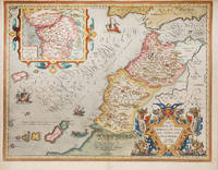
Fessae et Marocci Regna
Antwerp Plantin 1589. Copper engraving 7.8 x 10.6 cm modern hand colour small wormhole top right Latin text on verso. Miniature map of Morocco. Koeman Atlantes Neerlandici Ort 53 Map unknown
Referenz des Buchhändlers : 9903
|
|
|
ORTELIUS, Abraham
FESSAE ET MAROCCHI REGNA AFRICAE CELEBERR. Theatre de l'Univers - Fez & Morocco
Antwerp Christopher Plantin for the author 1598. . Double-page copper engraved map with later hand-colouring centre fold as issued cartouches for titles and publishing privilege French text on verso; sheet size: 41.8 x 53 cm.<br />Margins are trimmed.<br /> Well-preserved example of Ortelius' map of Fez & Morocco including a large inset cartouche of Western Africa. Taken from the fifth final and most complete French edition of Theatre de l'Univers. Enriched with decorative cartouches ships and sea monsters.<br /><br />Abraham Ortelius 1527-1598 was a cartographer and publisher he was born and died in Antwerp.<br /> Koeman III Ort 32. Antwerp, Christopher Plantin for the author, 1598. unknown
Referenz des Buchhändlers : 115611
|
|
|
Ortelius, Abraham
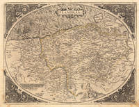
Flandria. Gerardus Mercator Rupelmundanus Describebat.
Antwerpen: Platin 1572. Other. In excellent condition. 385 by 503mm 15 by 19 inches. Original antique copper engraving uncolored as published. This very decorative antique map shows Flanders from Greuelinge in the west to Brussels in the east and Schouwen in the north and Lens in the south. The corners of the oval map are engraved with the cardinal points. In the North Sea are 2 sailing ships that fire with cannons a decorative compass rose and a sea monster. The title is engraved in the center of a very nice cartoushe. Ortelius was born on 14 April 1527 in the city of Antwerp which was then in the Habsburg Netherlands modern-day Belgium. The Orthellius family were originally from Augsburg a Free imperial city of the Holy Roman Empire. In 1535 the family had fallen under suspicion of Protestantism. Following the death of Ortelius's father his uncle Jacobus van Meteren returned from religious exile in England to take care of Ortelius. Abraham remained close to his cousin Emanuel van Meteren who would later moved to London. In 1575 he was appointed geographer to the king of Spain Philip II on the recommendation of Arias Montanus who vouched for his orthodoxy. He travelled extensively in Europe and is specifically known to have traveled throughout the Seventeen Provinces; in southern western northern and eastern Germany e.g. 1560 15751576; France 15591560; England and Ireland 1576; and Italy 1578 and perhaps twice or thrice between 1550 and 1558. Beginning as a map-engraver in 1547 he entered the Antwerp Guild of Saint Luke as an illuminator of maps. He supplemented his income trading in books prints and maps and his journeys included yearly visits to the Frankfurt book and print fair where he met Gerardus Mercator in 1554. In 1560 however when travelling with Mercator to Trier Lorraine and Poitiers he seems to have been attracted largely by Mercator's influence towards the career of a scientific geographer. Wikipedia Platin unknown
Referenz des Buchhändlers : 21509
|
|
|
ORTELIUS, Abraham
Fori Iulii Accurata Descriptio; An Accurate description of Friuli
Antwerp: Abraham Ortelius 1603. unbound. Map. Engraving with hand coloring. Image measures 14" x 18 3/4". Staining toning and chips to margins but otherwise is good condition.<br/> <br/> Friuli is the northeast Italian region bordering Austria Slovenia and the Adriatic Sea. It's home to the sharp-peaked Dolomite Mountains and vineyards producing white wines. Ortelius' 1603 edition extends from Venice north to the Italian Alps and east to Trieste and Istria. Lovely depiction of Venice floating on several islands. Abraham Ortelius 1527--1598 a Flemish cartographer and geographer is widely regarded as one of the important and influential cartographers in history. He is known for his "Theatrum Orbis Terrarum" which was the first modern atlas. Van Den Broecke 119<br/> <br/> Abraham Ortelius unknown
Referenz des Buchhändlers : 299083

|
|
|
Ortelius, Abraham
Forum Julii. "
Europe: Antwerp Joannem Bapt. Vrientium/ Vrients. 1601. Copper engraved minature map by Phillip Galle of the area of Friuli /giulaaround Trieste from" Epitome theatri Orteliani praecipuarum orbis regionum delinaetiones. . Editio ultima" Latin text to verso describing the succeeding map. . Dark impression overall toning. The first edition of the"Epitome" in 1577 a reduced format atlas with minature maps of Abraham Ortelius's "Theatrum" is believed to have been the initiative of the engraver Phillip Galle who asked Peter Heyns to write the text. Ortelius had fled to England in 1576 having taken refuge there from Spanish oppression and may have been unaware of the plan of his two friends. The pocket atlas was a a commmercial success and was reprinted several times with Galle adding many new maps and replacing some. Jan. Baptist Vrients bought the rights and plates of the Epitome from Phillip Galle in 1601 . he published 4 editions using the Galle plates of which this is the first with Latin text. Koeman Ort58; Phillips 413; Europe Italy Friulu Giula Antwerp Joannem Bapt. Vrientium/ Vrients. 1601 unknown
Referenz des Buchhändlers : 1339

|
|
|
Ortelius, Abraham
Frisia Occidentalis. Sibrandus Leonis Leovardiensis Describ. Cum privilegio Imp. et Reg. Mtm. ad. decenninium. 1579. Frisia Occidentalis. Sibrandus Leonis Leovardiensis Describ. Cum privilegio Imp. et Reg. Mtm. ad. decenninium. 1579. - Abraham Ortelius ∑ Hand-Colored Origin.
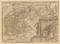
Antwerp: Juan Baptist Vrients 1612. A minor printers crease on the right side of the double page slightly visible. Overall in excellent condition. 36.8 x 498 cm 14.5 x 195 inches. Hand-Colored Original Copperplate Engraving by Abraham Ortelius depicting Frisia Occidentalis. Sibrandus Leonis Leovardiensis Describ. Cum privilegio Imp. et Reg. Mtm. ad. decenninium. 1579. Published Antwerp Juan Baptist Vrients 1612. Sheet: 36.8 x 498 cm 14.5 x 195 inches. A fine and original hand-colored example of Ortelius's celebrated cartographic work documenting this region of Germany with the precision and decorative artistry characteristic of the 16100s. Abraham Ortelius 1527-1598 was a Flemish cartographer and geographer from Antwerp widely regarded as the creator of the first modern atlas. His landmark publication Theatrum Orbis Terrarum 1570 set the standard for atlas-making for the next century presenting uniform copper-engraved maps with scholarly commentary. By Ortelius's death the Theatrum had appeared in 25 editions in seven languages. In 1575 King Philip II of Spain appointed him Royal Geographer. His maps engraved with extraordinary precision are among the most sought-after in antique cartography held in collections including the Plantin-Moretus Museum in Antwerp the Library of Congress and the British Library.This original copperplate engraving with original hand coloring depicts the region of Frisia Occidentalis. Sibrandus Leonis Leovardiensis Describ. Cum privilegio Imp. et Reg. Mtm. ad. decenninium. 1579. published in Antwerp Juan Baptist Vrients 1612. An inset map is included providing additional geographic context. The map records the political and geographic boundaries of the region as understood in 1612 offering a fascinating window into the history of German territorial organization. Sheet measures 36.8 x 498 cm 14.5 x 195 inches. In good condition overall with minor signs of age appropriate for a 17th-century engraving. Ready to frame. Broe. 81 Juan Baptist Vrients unknown
Referenz des Buchhändlers : 33372
|
|
|
Ortelius, Abraham
FRISIA OCCIDENTALIS/SIBRANDVS LEONIS LEOVARDIENSIS DESCRIB
c.1579. 15-3/4" x 19-3/4"- 40 x 50.1 cm. . Copper engraved map with original hand colouring. Laid down on board. An attractive map of Friesland and Groningen with inset of ancient Friesland. Abraham Ortelius 1527-1598 was a prominent Flemish cartographer who produced the first world atlas "Theatrum Orbis Terrarum" in 1570. This map was based on an earlier manuscript map by Sibrandus Leo whose name is featured in the title. unknown
Referenz des Buchhändlers : 1444
|
|
|
Ortelius, Abraham
Frisiae Orientalis Descriptio. Frisiae Orientalis Descriptio. - Abraham Ortelius ∑ Hand-Colored Original Copperplate Engraving ∑ Antwerpen 1588
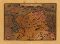
Antwerpen: Platin 1588. Other. In very good condition verso skilfully reinforced with thin Japan paper due to the old oxidation of the colors. Else a very good example. 308 by 442mm 12 by 17 inches. Hand-Colored Original Copperplate Engraving by Abraham Ortelius depicting Frisiae Orientalis Descriptio. Published Antwerpen Platin 1588. Sheet: 308 by 442mm 12 by 17 inches. A fine and original hand-colored example of Ortelius's celebrated cartographic work documenting this region of Germany with the precision and decorative artistry characteristic of the 15800s. Abraham Ortelius 1527-1598 was a Flemish cartographer and geographer from Antwerp widely regarded as the creator of the first modern atlas. His landmark publication Theatrum Orbis Terrarum 1570 set the standard for atlas-making for the next century presenting uniform copper-engraved maps with scholarly commentary. By Ortelius's death the Theatrum had appeared in 25 editions in seven languages. In 1575 King Philip II of Spain appointed him Royal Geographer. His maps engraved with extraordinary precision are among the most sought-after in antique cartography held in collections including the Plantin-Moretus Museum in Antwerp the Library of Congress and the British Library.This original copperplate engraving with original hand coloring depicts the region of Frisiae Orientalis Descriptio. published in Antwerpen Platin 1588. The map records the political and geographic boundaries of the region as understood in 1588 offering a fascinating window into the history of German territorial organization. Sheet measures 308 by 442mm 12 by 17 inches. In good condition overall with minor signs of age appropriate for a 16th-century engraving. Ready to frame. Broe. 82 Platin unknown
Referenz des Buchhändlers : 19751
|
|
|
Ortelius, Abraham
Gades; Guipuscoa; Carpetania. "Hunc Insulam Perlustrabat .":"Carpetaniæ Partis Descr." & " Guipus coae Regionis Typus
Europe: Antverpiæ"/Antwerp. "ex Officiana Plantiana" . Plantijn Christoffel. 1595. 3 copper engraved maps of: the bay & island of Cadiz the area of Toledo and Guipuzcoa in the Basque country Spain from Ortelius' "Theatrum Orbis Terrarum" 1595 edition; black & white. Latin text to verso. Map of Cadiz by Geo. Hoefnagel with decorative borders with birds & fruits and 2 medallions with illustrations of Hercules. The two smaller maps above show the areas of Toledo and San Sebastian. Good dark impression. Abraham Ortelius 1527-1598 Flemish Cartographer . produced the first modern Atlas "Theatrum Orbis Terrarum" in 1570. printed by Aegidus Coppen Diest. There were numerous editions thereafter with texts in various languages; the printing of such was taken over by Chrstoffel Plantijn in 1579 . Ortelius himself drew all the maps in manuscript before passing them to the printers. there is conjecture that he may have engraved some of the plates as well The 1595 Latin text edition is the most complete produced during his lifetime containing all the maps of the 1593 edition plus those of the the"Additamentum" and the"Pareragon" or Ancient geography. The " Additamenta" were supplements to the original Atlas; at the same time Ortelius replaced some maps with new ones showing the same place; some plates were also reworked . Ortelius was Geographer Royal To Phillip II of Spain from 1575. He also worked closely with Braun & Hogenburg on the "Civitas Orbis Terarum". After his death the plates were purchased by Jan Baptiste Vrients in 1601 who published further editions until 1612. Van de Krogt :3; .Koeman: Ort29 20 99; van.de. Broecke:31abc. Europe Spain & Portugal Cadiz Gades Guipuscoa Guipuzcoa San Sabastian Carpetania Toledo Antverpiæ"/Antwerp. "ex Officiana Plantiana" . Plantijn Christoffel. 1595 unknown
Referenz des Buchhändlers : 1775

|
|
|
Ortelius, Abraham
Gallia Strabonis Ceterorumq. "Galliæ Veteris Typus
Europe: Antverpiæ"/Antwerp. "ex Officiana Plantiana" . Plantijn Christoffel. 1595. Copper engraved map of Ancient France from "The Parergon "of Ortelius' "Theatrum Orbis Terrarum" 1595 edition; black & white. Latin text to verso. Ortelius paid particular reference to the description of Strabo. Good dark impression. Abraham Ortelius 1527-1598 Flemish Cartographer . produced the first modern Atlas "Theatrum Orbis Terrarum" in 1570. printed by Aegidus Coppen Diest. There were numerous editions thereafter with texts in various languages; the printing of such was taken over by Chrstoffel Plantijn in 1579 . Ortelius himself drew all the maps in manuscript before passing them to the printers. there is conjecture that he may have engraved some of the plates as well The 1595 Latin text edition is the most complete produced during his lifetime containing all the maps of the 1593 edition plus those of the the"Additamentum" and the"Pareragon" or Ancient geography. The " Additamenta" were supplements to the original Atlas; at the same time Ortelius replaced some maps with new ones showing the same place; some plates were also reworked . Ortelius was Geographer Royal To Phillip II of Spain from 1575. He also worked closely with Braun & Hogenburg on the "Civitas Orbis Terarum". After his death the plates were purchased by Jan Baptiste Vrients in 1601 who published further editions until 1612. Van de Krogt :3; .Koeman: Ort29: F 27p; van.de. Broecke: 196 Europe France Ancient France Gallia Veteris Antverpiæ"/Antwerp. "ex Officiana Plantiana" . Plantijn Christoffel. 1595 unknown
Referenz des Buchhändlers : 1806

|
|
|
Ortelius, Abraham
Gallia Vetus ad Iulii Caesaris commentaria.
Antwerp: Plantin-Moretus 1624. Copper engraving 36.5 x 46.5 cms modern hand colour a couple of unobtrusive printers creases Latin text on verso. Ancient Gaul engraved on the basis of Caesars commentaries on the Gallic Wars his first hand account of the campaign. The text on the verso explores ancient source material relating the the druids. Our example was published by Balthasar Moretus at the Plantin Press in the final edition of the Parergon. Ortelius's Theatrum Orbis Terrarum is generally considered the first modern atlas of the world originally published in 1570. Ortelius gathered and selected the best available cartographic knowledge and presented it in a single volume duly credited and finely engraved in a consistent style with explanatory text. The Theatrum was very decorative and hugely popular amongst the wealthy and educated running into over forty editions in Latin and the major European languages. For Ortelius himself however his accompanying atlas of ancient geography the Parergon was a "personal work" Koeman. He seems to have regarded himself first and foremost as an antiquary and rather than copying other people's maps he drew the originals himself; they were subsequently engraved for him by the master engraver Jan Wierix. The results have to be evaluated as the most outstanding engravings depicting the wide-spread interest in classical geography in the 16th century Koeman. Koeman Atlantes Neerlandici Ort 46. Van den Broecke 194.3 Map Plantin-Moretus unknown
Referenz des Buchhändlers : 7933
|
|
|
Ortelius, Abraham
Gallia"
Europe: Antwerp Joannem Bapt. Vrientium/ Vrients. 1601. Copper engraved minature map by Phillip Galle of France from" Epitome theatri Orteliani praecipuarum orbis regionum delinaetiones. . Editio ultima" Latin text to verso describing the succeeding map. . Dark impression overall toning light foxing to blank margins. The first edition of the"Epitome" in 1577 a reduced format atlas with minature maps of Abraham Ortelius's "Theatrum" is believed to have been the initiative of the engraver Phillip Galle who asked Peter Heyns to write the text. Ortelius had fled to England in 1576 having taken refuge there from Spanish oppression and may have been unaware of the plan of his two friends. The pocket atlas was a a commmercial success and was reprinted several times with Galle adding many new maps and replacing some. Jan. Baptist Vrients bought the rights and plates of the Epitome from Phillip Galle in 1601 . he published 4 editions using the Galle plates of which this is the first with Latin text. Koeman Ort58; Phillips 413; Europe France Antwerp Joannem Bapt. Vrientium/ Vrients. 1601 unknown
Referenz des Buchhändlers : 1511

|
|
|
Ortelius, Abraham
Gallia. "Galliae Regni Potentiss Nova Descriptio
Europe: Antverpiæ"/Antwerp. "ex Officiana Plantiana" . Plantijn Christoffel. 1595. Copper engraved map of France after Ioanne Ioliveto from Ortelius' "Theatrum Orbis Terrarum" 1595 edition; black & white. Latin text to verso. Good dark impression. Abraham Ortelius 1527-1598 Flemish Cartographer . produced the first modern Atlas "Theatrum Orbis Terrarum" in 1570. printed by Aegidus Coppen Diest. There were numerous editions thereafter with texts in various languages; the printing of such was taken over by Chrstoffel Plantijn in 1579 . Ortelius himself drew all the maps in manuscript before passing them to the printers. there is conjecture that he may have engraved some of the plates as well The 1595 Latin text edition is the most complete produced during his lifetime containing all the maps of the 1593 edition plus those of the the"Additamentum" and the"Pareragon" or Ancient geography. The " Additamenta" were supplements to the original Atlas; at the same time Ortelius replaced some maps with new ones showing the same place; some plates were also reworked . Ortelius was Geographer Royal To Phillip II of Spain from 1575. He also worked closely with Braun & Hogenburg on the "Civitas Orbis Terarum". After his death the plates were purchased by Jan Baptiste Vrients in 1601 who published further editions until 1612. Van de Krogt :3; .Koeman: Ort29: 21 9; van.de. Broecke:34. Europe France Gallia Regni Antverpiæ"/Antwerp. "ex Officiana Plantiana" . Plantijn Christoffel. 1595 unknown
Referenz des Buchhändlers : 1808

|
|
|
Ortelius, Abraham
Galliae Narbonensis ora Maritima; Sabaudia; Venuxiensis Comitatus. "Gallia Narbonens." "Sabudiae Ducat." & "Venuxini Comitatus Nova Descr
Europe: Antverpiæ"/Antwerp. "ex Officiana Plantiana" . Plantijn Christoffel. 1595. 3 copper engraved maps on 1 plate of :the southern coast of France from Narbonne to Marseille; the Savoy and Venaisssin the area of Avignon from Ortelius' "Theatrum Orbis Terrarum" 1595 edition; black & white. Latin text to verso. Good dark impression; some dampstaining to lower blank margin. Abraham Ortelius 1527-1598 Flemish Cartographer . produced the first modern Atlas "Theatrum Orbis Terrarum" in 1570. printed by Aegidus Coppen Diest. There were numerous editions thereafter with texts in various languages; the printing of such was taken over by Chrstoffel Plantijn in 1579 . Ortelius himself drew all the maps in manuscript before passing them to the printers. there is conjecture that he may have engraved some of the plates as well The 1595 Latin text edition is the most complete produced during his lifetime containing all the maps of the 1593 edition plus those of the the"Additamentum" and the"Pareragon" or Ancient geography. The " Additamenta" were supplements to the original Atlas; at the same time Ortelius replaced some maps with new ones showing the same place; some plates were also reworked . Ortelius was Geographer Royal To Phillip II of Spain from 1575. He also worked closely with Braun & Hogenburg on the "Civitas Orbis Terarum". After his death the plates were purchased by Jan Baptiste Vrients in 1601 who published further editions until 1612. Van de Krogt :3; .Koeman: Ort29: 29 108; van.de. Broecke:49abc. Europe France Narbonne Savoy Sabaudia Avignon Venaissin Venuxiensis Antverpiæ"/Antwerp. "ex Officiana Plantiana" . Plantijn Christoffel. 1595 unknown
Referenz des Buchhändlers : 1815

|
|
|
Ortelius, Abraham
Galliae veteris typus
Antwerp: Plantin-Moretus 1624. Copper engraving 39.5 x 49.5 cms modern hand colour Latin text on verso. Van den Broecke stresses the sigificance of this map of Gaul: in contrast to plate Ort 194 Gallia vetus based on Caesars commentaries this map is based on ancient geographical rather than on ancient military sources and is much more detailed. It contains the largest amount of text to be found on any map by Ortelius . testifying the importance he attached to it. It contains all elements of Ortelius as a true Renaissance scholar. Our example was published by Balthasar Moretus at the Plantin Press in the final edition of the Parergon. Ortelius's Theatrum Orbis Terrarum is generally considered the first modern atlas of the world originally published in 1570. Ortelius gathered and selected the best available cartographic knowledge and presented it in a single volume duly credited and finely engraved in a consistent style with explanatory text. The Theatrum was very decorative and hugely popular amongst the wealthy and educated running into over forty editions in Latin and the major European languages. For Ortelius himself however his accompanying atlas of ancient geography the Parergon was a "personal work" Koeman. He seems to have regarded himself first and foremost as an antiquary and rather than copying other people's maps he drew the originals himself; they were subsequently engraved for him by the master engraver Jan Wierix. The results have to be evaluated as the most outstanding engravings depicting the wide-spread interest in classical geography in the 16th century Koeman. Koeman Atlantes Neerlandici Ort 46; Van den Broecke 196.2. Map Plantin-Moretus unknown
Referenz des Buchhändlers : 8029
|
|
|
Ortelius, Abraham
Gelriae Cliviae Finitimorumque Locorum Verissima Descriptio Christiano Schrot. Auctore
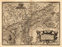
Antwerpen 1598. Other. A strong impression in excellent condition. 370 by 500mm 14 by 19 inches. Original antique copper engraving published 1598 in a French text edition of the " Theatrum Orbis Terrarum. Decorative map of Ortelius" first plate covering Gelderland. Based on Christiaan Sgrothen" s map of 1567 and is richly engraved with fine detail particularly along the rivers. The map is oriented with north to the left with ribbon cartouches marking the cardinal directions. Two ships sail in the Zuyder Zee and a decorative cartouche with flowers and birds. Ortelius was born on 14 April 1527 in the city of Antwerp which was then in the Habsburg Netherlands modern-day Belgium. The Orthellius family were originally from Augsburg a Free imperial city of the Holy Roman Empire. In 1535 the family had fallen under suspicion of Protestantism. Following the death of Ortelius's father his uncle Jacobus van Meteren returned from religious exile in England to take care of Ortelius. Abraham remained close to his cousin Emanuel van Meteren who would later moved to London. In 1575 he was appointed geographer to the king of Spain Philip II on the recommendation of Arias Montanus who vouched for his orthodoxy. He travelled extensively in Europe and is specifically known to have traveled throughout the Seventeen Provinces; in southern western northern and eastern Germany e.g. 1560 15751576; France 15591560; England and Ireland 1576; and Italy 1578 and perhaps twice or thrice between 1550 and 1558. Beginning as a map-engraver in 1547 he entered the Antwerp Guild of Saint Luke as an illuminator of maps. He supplemented his income trading in books prints and maps and his journeys included yearly visits to the Frankfurt book and print fair where he met Gerardus Mercator in 1554. In 1560 however when travelling with Mercator to Trier Lorraine and Poitiers he seems to have been attracted largely by Mercator's influence towards the career of a scientific geographer. Wikipedia unknown
Referenz des Buchhändlers : 21946
|
|
|
Ortelius, Abraham
Gelriae Cliviae Finitiorumque Locorum Verissima Descriptio Christiano Schrot. Auctore
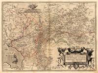
Antwerpen 1572 - 73. Other. In very good to excellent condition. 370 by 500mm 14 by 19 inches. Original antique copper engraving hand colored in outline when published. Decorative map of Ortelius" first plate covering Gelderland. Based on Christiaan Sgrothen" s map of 1567 and is richly engraved with fine detail particularly along the rivers. The map is oriented with north to the left with ribbon cartouches marking the cardinal directions. Two ships sail in the Zuyder Zee and a decorative cartouche with flowers and birds. Ortelius was born on 14 April 1527 in the city of Antwerp which was then in the Habsburg Netherlands modern-day Belgium. The Orthellius family were originally from Augsburg a Free imperial city of the Holy Roman Empire. In 1535 the family had fallen under suspicion of Protestantism. Following the death of Ortelius's father his uncle Jacobus van Meteren returned from religious exile in England to take care of Ortelius. Abraham remained close to his cousin Emanuel van Meteren who would later moved to London. In 1575 he was appointed geographer to the king of Spain Philip II on the recommendation of Arias Montanus who vouched for his orthodoxy. He travelled extensively in Europe and is specifically known to have traveled throughout the Seventeen Provinces; in southern western northern and eastern Germany e.g. 1560 15751576; France 15591560; England and Ireland 1576; and Italy 1578 and perhaps twice or thrice between 1550 and 1558. Beginning as a map-engraver in 1547 he entered the Antwerp Guild of Saint Luke as an illuminator of maps. He supplemented his income trading in books prints and maps and his journeys included yearly visits to the Frankfurt book and print fair where he met Gerardus Mercator in 1554. In 1560 however when travelling with Mercator to Trier Lorraine and Poitiers he seems to have been attracted largely by Mercator's influence towards the career of a scientific geographer. Wikipedia Koe. Ort 1C / 15. Broe. 61. 1 of 2. unknown
Referenz des Buchhändlers : 21923
|
|
|
Ortelius, Abraham
Gelriae Cliviae Finitimorumque Locorum verissima Descriptio. Christiano Schrot Auctore.
Antwerp: Vrients 1612. Other. In excellent condition. 372 by 503mm 14 by 19 inches. Original antique copper engraving published 1612 in a Italian text edition of the " Theatrum Orbis Terrarum. Uncolored example in a strong impression. The map is ornated with a title cartouche in the lower right corner naming the autor "Christian Schrot" on whom Abraham Ortelius based his cartographic source for this map in his atlas. Top left corner with a small mileage scale. For the decoration of the map we find a sailing ship in the "Zuyder Zee". Ortelius was born on 14 April 1527 in the city of Antwerp which was then in the Habsburg Netherlands modern-day Belgium. The Orthellius family were originally from Augsburg a Free imperial city of the Holy Roman Empire. In 1535 the family had fallen under suspicion of Protestantism. Following the death of Ortelius's father his uncle Jacobus van Meteren returned from religious exile in England to take care of Ortelius. Abraham remained close to his cousin Emanuel van Meteren who would later moved to London. In 1575 he was appointed geographer to the king of Spain Philip II on the recommendation of Arias Montanus who vouched for his orthodoxy. He travelled extensively in Europe and is specifically known to have traveled throughout the Seventeen Provinces; in southern western northern and eastern Germany e.g. 1560 15751576; France 15591560; England and Ireland 1576; and Italy 1578 and perhaps twice or thrice between 1550 and 1558. Beginning as a map-engraver in 1547 he entered the Antwerp Guild of Saint Luke as an illuminator of maps. He supplemented his income trading in books prints and maps and his journeys included yearly visits to the Frankfurt book and print fair where he met Gerardus Mercator in 1554. In 1560 however when travelling with Mercator to Trier Lorraine and Poitiers he seems to have been attracted largely by Mercator's influence towards the career of a scientific geographer. Wikipedia Broe. 61. State 3/4. Vrients unknown
Referenz des Buchhändlers : 13895
|
|
|
Ortelius, Abraham:
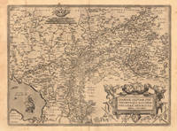
Germania
Antwerp Plantin-Moretus 1595. Copper engraving 36.5 x 51 cms black and white Latin text on verso. First published in the 1570 edition of the Theatrum Christiaan Sgrothen is cited as the principal source. Ortelius's Theatrum Orbis Terrarum is generally considered the first modern atlas of the world originally published in 1570. Ortelius gathered the best available cartographic knowledge and presented it in a consistent style in a single volume with text. The Theatrum was very decorative and hugely popular amongst the wealthy and educated running into over forty editions in Latin and the major European languages. Van den Broecke 56 Map unknown
Referenz des Buchhändlers : 7641

|
|
|
Ortelius, Abraham
Germania. "
Europe: Antwerp Joannem Bapt. Vrientium/ Vrients. 1601. Copper engraved minature map by Phillip Galle of Germany from" Epitome theatri Orteliani praecipuarum orbis regionum delinaetiones. . Editio ultima" Latin text to verso describing the succeeding map. . Dark impression overall toning. Printed slightly crooked on the page; upper margin with heading 7-9mm. The first edition of the"Epitome" in 1577 a reduced format atlas with minature maps of Abraham Ortelius's "Theatrum" is believed to have been the initiative of the engraver Phillip Galle who asked Peter Heyns to write the text. Ortelius had fled to England in 1576 having taken refuge there from Spanish oppression and may have been unaware of the plan of his two friends. The pocket atlas was a a commmercial success and was reprinted several times with Galle adding many new maps and replacing some. Jan. Baptist Vrients bought the rights and plates of the Epitome from Phillip Galle in 1601 . he published 4 editions using the Galle plates of which this is the first with Latin text. Koeman Ort58; Phillips 413; Europe Central Europe Germany Antwerp Joannem Bapt. Vrientium/ Vrients. 1601 unknown
Referenz des Buchhändlers : 1361

|
|
|
ORTELIUS, Abraham
GERMANICA. Theatre de l'Univers - Germany.
Antwerp Christopher Plantin for the author 1598. . Double-page copper engraved map with later hand-colouring centre fold as issued cartouches for titles and publishing privilege French text on verso; sheet size: 41.8 x 54 cm.<br />Some repairs to fold and minor spotting.<br /> Well-preserved example of Ortelius' map of Germanica. Taken from the fifth final and most complete French edition of Theatre de l'Univers. Enriched with decorative cartouches and ships.<br /><br />Abraham Ortelius 1527-1598 was a cartographer and publisher he was born and died in Antwerp.<br /> Koeman III Ort 32. Antwerp, Christopher Plantin for the author, 1598. unknown
Referenz des Buchhändlers : 114320
|
|
|
ORTELIUS, Abraham
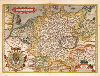
Goritiae Karstii Chaczeolae Carniolae Histriae Et Windorum Marchae Descrip.
Antwerpen ca. 1592. Altkolorierter Kupferkarte nach Wolfgang Lazius. 47 x 27 cm. Blattgr.; 34 x 23 5 cm. Kartengr. In sehr gutem Zustand. Am oberen Rand Textkartusche mit zweizeiligem Kartentitel. Aus Theatrum Orbis Terrarum. Antwerpen [ca. 1592]. unknown
Referenz des Buchhändlers : 1282-17

|
|
|
Ortelius, Abraham
Griechenlandt. "Graeciae Univerae Secundum hodierum situm Neoterica Descriptio
Greece: Antverpiæ"/Antwerp. " ghetruckht by Gieles van Diest." 1572. Copper engraved map of Greece after Jacob Gastaldi from Ortelius' "Theatrum Orbis Terrarum" 1571 edition; black & white; German text to verso. The map is from the first German text edition of the "Theatrum". Good dark impression; modern colour; ligtly toned and some light soiling. Abraham Ortelius 1527-1598 Flemish Cartographer . produced the first modern Atlas "Theatrum Orbis Terrarum" in 1570. printed by Aegidus Coppen Diest. There were numerous editions thereafter with texts in various languages; the printing of such was taken over by Chrstoffel Plantijn in 1579 . Ortelius himself drew all the maps in manuscript before passing them to the printers. there is conjecture that he may have engraved some of the plates as well Ortelius was Geographer Royal To Phillip II of Spain from 1575. He also worked closely with Braun & Hogenburg on the "Civitas Orbis Terarum". After his death the plates were purchased by Jan Baptiste Vrients in 1601 who published further editions until 1612. Van de Krogt :3; .Koeman: Ort 5 40; Zacherakis: 2485/1610; van den Broecke:146. Greece Continental Greece Gastaldi Antverpiæ"/Antwerp.. " ghetruckht by Gieles van Diest." 1572 unknown
Referenz des Buchhändlers : 2484

|
|
|
Ortelius, Abraham
Griecken. "Graeciae Univerae Secundum hodierum situm Neoterica Descriptio
Greece: Antverpiæ"/Antwerp. " ghedruckt by Gieles van Diest." 1571/3. Copper engraved map of Greece after Jacob Gastaldi from Ortelius' "Theatrum Orbis Terrarum" 1571 edition; coloured ;Dutch text to verso. The map is from the first Dutch text edition of the "Theatrum". Good dark impression; ligtly toned; old red crayon lines from Arta to Lamia and on the Isthmus of Corinth various other pencil underlinings; Short centrefo0ld split at lower margin repaired to verso. Abraham Ortelius 1527-1598 Flemish Cartographer . produced the first modern Atlas "Theatrum Orbis Terrarum" in 1570. printed by Aegidus Coppen Diest. There were numerous editions thereafter with texts in various languages; the printing of such was taken over by Chrstoffel Plantijn in 1579 . Ortelius himself drew all the maps in manuscript before passing them to the printers. there is conjecture that he may have engraved some of the plates as well Ortelius was Geographer Royal To Phillip II of Spain from 1575. He also worked closely with Braun & Hogenburg on the "Civitas Orbis Terarum". After his death the plates were purchased by Jan Baptiste Vrients in 1601 who published further editions until 1612. Van de Krogt :3; .Koeman: Ort 3 40; Zacherakis: 2485/1610; van den Broecke:146. Greece Continental Greece Gastaldi Antverpiæ"/Antwerp.. " ghedruckt by Gieles van Diest." 1571/3 unknown
Referenz des Buchhändlers : 2483

|
|
|
Ortelius, Abraham
Græcia sive Hellas. "Graecia Sophiani
Europe: Antverpiæ"/Antwerp. "ex Officiana Plantiana" . Plantijn Christoffel. 1595. Copper engraved map of Ancient Greece according to the description of Sophiani from "The Parergon " of Ortelius' "Theatrum Orbis Terrarum" 1595 edition; black & white. Latin text to verso. The map shows Ancient Greece and her colonies according to the description of Nikolaos Sophianos. Based upon Nikolaus Sophianos' map of Greece around 1540 which appears in Nicolai Gerbelji "In Descriptio Graciae Sophiani Prefatio " published by Johannes Oporinus in Basel in 1545 as an eight block woodcut map and in 1552 as a four sheet engraved map. Good dark impression; a few light spots to engraved area. Abraham Ortelius 1527-1598 Flemish Cartographer . produced the first modern Atlas "Theatrum Orbis Terrarum" in 1570. printed by Aegidus Coppen Diest. There were numerous editions thereafter with texts in various languages; the printing of such was taken over by Chrstoffel Plantijn in 1579 . Ortelius himself drew all the maps in manuscript before passing them to the printers. there is conjecture that he may have engraved some of the plates as well The 1595 Latin text edition is the most complete produced during his lifetime containing all the maps of the 1593 edition plus those of the the"Additamentum" and the"Pareragon" or Ancient geography. The " Additamenta" were supplements to the original Atlas; at the same time Ortelius replaced some maps with new ones showing the same place; some plates were also reworked . Ortelius was Geographer Royal To Phillip II of Spain from 1575. He also worked closely with Braun & Hogenburg on the "Civitas Orbis Terarum". After his death the plates were purchased by Jan Baptiste Vrients in 1601 who published further editions until 1612. Van de Krogt :3; .Koeman: Ort29 Q 3P; Zacherakis: 2495/1616; van den Broecke:215. Europe Greece Ancient Greece Sophiani Hellas Antverpiæ"/Antwerp.. "ex Officiana Plantiana" . Plantijn Christoffel.. 1595 unknown
Referenz des Buchhändlers : 1750

|
|
|
Ortelius, Abraham
Græcia. "Graeciae Univerae Secundum hodierum situm Neoterica Descriptio
Europe: Antverpiæ"/Antwerp. "ex Officiana Plantiana" . Plantijn Christoffel. 1595. Copper engraved map of Greece after Jacob Gastaldi from Ortelius' "Theatrum Orbis Terrarum" 1595 edition; black & white. Latin text to verso. Good dark impression. Abraham Ortelius 1527-1598 Flemish Cartographer . produced the first modern Atlas "Theatrum Orbis Terrarum" in 1570. printed by Aegidus Coppen Diest. There were numerous editions thereafter with texts in various languages; the printing of such was taken over by Chrstoffel Plantijn in 1579 . Ortelius himself drew all the maps in manuscript before passing them to the printers. there is conjecture that he may have engraved some of the plates as well The 1595 Latin text edition is the most complete produced during his lifetime containing all the maps of the 1593 edition plus those of the the"Additamentum" and the"Pareragon" or Ancient geography. The " Additamenta" were supplements to the original Atlas; at the same time Ortelius replaced some maps with new ones showing the same place; some plates were also reworked . Ortelius was Geographer Royal To Phillip II of Spain from 1575. He also worked closely with Braun & Hogenburg on the "Civitas Orbis Terarum". After his death the plates were purchased by Jan Baptiste Vrients in 1601 who published further editions until 1612. Van de Krogt :3; .Koeman: Ort29 91 40 Zacherakis: 2485/1610; van den Broecke:146. Europe Greece Gastaldi Antverpiæ"/Antwerp.. "ex Officiana Plantiana" . Plantijn Christoffel.. 1595 unknown
Referenz des Buchhändlers : 1751

|
|
|
Ortelius, Abraham
Gvastecan Reg.
Antwerp 1584. Excellent; upper margin extended. Notes: Note: This is one of the three maps of the large double-sheet Ortelius "La Florida Auctore Hieron. Chiaues. / Gvastecan Reg. / Pervviae Auriferae Regionis Typus. Didaco Mendezio Auctore." It has been seperated from the larger map. Note that the reference listed is for the double-sheet map.<br><br>"Published in editions of Theatrum Orbis Terrarum from 1854 onwards A. Ortelius here shows the three main areas of Spanish Colonial Interest in America in the 16th century: Florida Guasteca and the gold rich regions in Peru. The anonymous map of Guasteca continues the coastline of the gulf of Mexico to the south of the riode las Palmas." John Goss Size : 170x220 mm 6.75x8.625 Inches Coloring: Hand Colored Reference: Reference: Goss Map 13 Category: Maps Central America Mexico unknown
Referenz des Buchhändlers : M1477
|
|
|
Ortelius, Abraham
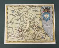
Hassia; Hennenbergensis Principatus. "Hassiae Descriptio." & "Hennenbergensis Ditionis vera delineatio
Europe: Antverpiæ"/Antwerp. "ex Officiana Plantiana" . Plantijn Christoffel. 1595. 2 copper engraved maps on 1 plate of Hessen & Henneberg Germany from Ortelius' "Theatrum Orbis Terrarum" 1595 edition; black & white. Latin text to verso. Good dark impression; some light spotting; dampstain to edges of lower blank margin. Abraham Ortelius 1527-1598 Flemish Cartographer . produced the first modern Atlas "Theatrum Orbis Terrarum" in 1570. printed by Aegidus Coppen Diest. There were numerous editions thereafter with texts in various languages; the printing of such was taken over by Chrstoffel Plantijn in 1579 . Ortelius himself drew all the maps in manuscript before passing them to the printers. there is conjecture that he may have engraved some of the plates as well The 1595 Latin text edition is the most complete produced during his lifetime containing all the maps of the 1593 edition plus those of the the"Additamentum" and the"Pareragon" or Ancient geography. The " Additamenta" were supplements to the original Atlas; at the same time Ortelius replaced some maps with new ones showing the same place; some plates were also reworked . Ortelius was Geographer Royal To Phillip II of Spain from 1575. He also worked closely with Braun & Hogenburg on the "Civitas Orbis Terarum". After his death the plates were purchased by Jan Baptiste Vrients in 1601 who published further editions until 1612. Van de Krogt :3; .Koeman: Ort29:54 86; van.de. Broecke: 95ab. Europe Central Europe Germany Hessen Hassia Henneberg Hennenbergensis Antverpiæ"/Antwerp. "ex Officiana Plantiana" . Plantijn Christoffel. 1595 unknown
Referenz des Buchhändlers : 1800

|
|
|
Ortelius, Abraham
Helvetia. "
Europe: Antwerp Joannem Bapt. Vrientium/ Vrients. 1601. Copper engraved minature map by Phillip Galle of Switzerland from" Epitome theatri Orteliani praecipuarum orbis regionum delinaetiones. . Editio ultima" Latin text to verso describing the succeeding map. . Dark impression overall toning light foxing to blank margins. The first edition of the"Epitome" in 1577 a reduced format atlas with minature maps of Abraham Ortelius's "Theatrum" is believed to have been the initiative of the engraver Phillip Galle who asked Peter Heyns to write the text. Ortelius had fled to England in 1576 having taken refuge there from Spanish oppression and may have been unaware of the plan of his two friends. The pocket atlas was a a commmercial success and was reprinted several times with Galle adding many new maps and replacing some. Jan. Baptist Vrients bought the rights and plates of the Epitome from Phillip Galle in 1601 . he published 4 editions using the Galle plates of which this is the first with Latin text. Koeman Ort58; Phillips 413; Europe Central Europe Switzerland Antwerp Joannem Bapt. Vrientium/ Vrients. 1601 unknown
Referenz des Buchhändlers : 1370

|
|
|
Ortelius, Abraham
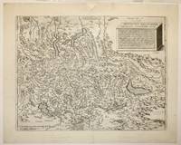
Helvetiae Descriptio Aegidio Tschudo Auct. Cum privilegio.
Antwerp: Diesth 1573. Other. With full margins as published printed on excellent thick paper. Verso German text with a decorative woodcut device. A strong impression in excellent condition. 344 by 455mm 13 by 18 inches. 344 by 455mm 13 by 18 inches. Copper engraving uncolored as published. Published 1573 in the second German text edition of the Theatrum Orbis Terrarum. This map was published in the Theatrum Orbis Terrarum from 1570 onwards. The first German text edition appeared 1572 Koeman Ort. 5 and was followed by 'Ein Zusatz bei dass Theatrum.' the 'Additamentum' in German language in 1573 and then by this German text edition in 1573. The map is based on the cartographic sources by Aegidius Tschudi 1505-72. An early interesting map of Switzerland orientated with the north to the south. Based on the cartographic source after A. Tschudi. With many engraved place names cities and small villages are shown as miniature city views. A mileage scale with Swiss miles in the lower left corner. Top right a simple square title cartouche with descriptive text of the history of Switzerland in Latin. Koeman Ort. 11; Broecke 115. Diesth unknown
Referenz des Buchhändlers : 21966
|
|
|
ORTELIUS, Abraham
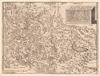
Helvetiae Descriptio. Aegidio Tschvdo Avct
1598. Map. Engraving. Image measures 13.5 x 18 inches. Sheet measures 16.5 x 20.5".<br/> <br/> This 1598 map of Switzerland is centered on Lake Lucerne and include much of Northern Italy. Oriented with south to the top the map extends from Lakes Como and Maggiore down north to Lake Constance. This map marked considerable progress in the mapping of Switzerland including as it does significant cities and locales. Furthermore a plinth rendered in three dimensions in the upper right corner of the map bears an inscription describing the geography of the region in Swiss miles. Given its wealth of information the map served as a productive model for Abraham Ortelius's map of Switzerland as published in his 1570 "Theatrum Orbis Terrarum" considered the first modern atlas of the world. The map is in good condition with repair to top center seam margin some foxing. French text on verso. Aegidius Tschudi 1505-1572 was a prominent member of Swiss society best known for his history of the early Swiss Confederacy Chronicon Helveticum. While his findings were greatly influenced by the prestige of his family his work did contribute to a considerable increase in knowledge of the Confederacy as it began in the 14th century and consequently developed.<br/> <br/> unknown
Referenz des Buchhändlers : 251164
|
|
|
Ortelius, Abraham
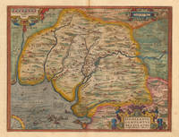
Hispalensis Conventus Delineatio Auctore Hieronymo Chiaues.
Antwerp: Platin 1598. Other. A very good example a small older mended clear split in the upper centerfold. 350 by 460mm 13 by 18 inches. Original antique copper engraving published 1598 in a French textedition of the Theatrum Orbis Terrarum. Finely hand-colored in wash and outline. The map is ornated with three cartouches in the lower right corner the title cartouche in the upper right corner we find a small cartouche with privilegium and in the upper left corner a small cartouche with a milage scale. Villages and towns are shown as miniature views moreover the map is ornated with ships sea monsters and animals as well a compass rose in the sea. Ortelius was born on 14 April 1527 in the city of Antwerp which was then in the Habsburg Netherlands modern-day Belgium. The Orthellius family were originally from Augsburg a Free imperial city of the Holy Roman Empire. In 1535 the family had fallen under suspicion of Protestantism. Following the death of Ortelius's father his uncle Jacobus van Meteren returned from religious exile in England to take care of Ortelius. Abraham remained close to his cousin Emanuel van Meteren who would later moved to London. In 1575 he was appointed geographer to the king of Spain Philip II on the recommendation of Arias Montanus who vouched for his orthodoxy. He travelled extensively in Europe and is specifically known to have traveled throughout the Seventeen Provinces; in southern western northern and eastern Germany e.g. 1560 15751576; France 15591560; England and Ireland 1576; and Italy 1578 and perhaps twice or thrice between 1550 and 1558. Beginning as a map-engraver in 1547 he entered the Antwerp Guild of Saint Luke as an illuminator of maps. He supplemented his income trading in books prints and maps and his journeys included yearly visits to the Frankfurt book and print fair where he met Gerardus Mercator in 1554. In 1560 however when travelling with Mercator to Trier Lorraine and Poitiers he seems to have been attracted largely by Mercator's influence towards the career of a scientific geographer. Wikipedia Broe. 28 Platin unknown
Referenz des Buchhändlers : 16774
|
|
|
Ortelius, Abraham
Hispalensis Conventus sive Andaluziae Pars. "Hispalensis Conventus delineatio
Europe: Antverpiæ"/Antwerp. "ex Officiana Plantiana" . Plantijn Christoffel. 1595. Copper engraved map of part of Andaluzia Spain from Ortelius' "Theatrum Orbis Terrarum" 1595 edition; black & white. Latin text to verso. The map focuses on the area surrounding Seville; sea battle off Cadiz; fish & monsters. Good dark impression. Abraham Ortelius 1527-1598 Flemish Cartographer . produced the first modern Atlas "Theatrum Orbis Terrarum" in 1570. printed by Aegidus Coppen Diest. There were numerous editions thereafter with texts in various languages; the printing of such was taken over by Chrstoffel Plantijn in 1579 . Ortelius himself drew all the maps in manuscript before passing them to the printers. there is conjecture that he may have engraved some of the plates as well The 1595 Latin text edition is the most complete produced during his lifetime containing all the maps of the 1593 edition plus those of the the"Additamentum" and the"Pareragon" or Ancient geography. The " Additamenta" were supplements to the original Atlas; at the same time Ortelius replaced some maps with new ones showing the same place; some plates were also reworked . Ortelius was Geographer Royal To Phillip II of Spain from 1575. He also worked closely with Braun & Hogenburg on the "Civitas Orbis Terarum". After his death the plates were purchased by Jan Baptiste Vrients in 1601 who published further editions until 1612. Van de Krogt :3; .Koeman: Ort29 18 74; van.de. Broecke:28. Europe Spain & Portugal Andalusia Hispalensis Conventus Antverpiæ"/Antwerp. "ex Officiana Plantiana" . Plantijn Christoffel. 1595 unknown
Referenz des Buchhändlers : 1776

|
|
|
Ortelius, Abraham
Hispania. " Regni Hispaniae Postomnium ditiones Locuplessima Descriptiio
Europe: Antverpiæ"/Antwerp. "ex Officiana Plantiana" . Plantijn Christoffel. 1595. Copper engraved map of the Iberian PeninsularSpain & Portugal from Ortelius' "Theatrum Orbis Terrarum" 1595 edition; black & white. Latin text to verso. Ships & monsters to sea. Good dark impression; smudge to lower left corner of blank margin; spot close to "Cartegena". Abraham Ortelius 1527-1598 Flemish Cartographer . produced the first modern Atlas "Theatrum Orbis Terrarum" in 1570. printed by Aegidus Coppen Diest. There were numerous editions thereafter with texts in various languages; the printing of such was taken over by Chrstoffel Plantijn in 1579 . Ortelius himself drew all the maps in manuscript before passing them to the printers. there is conjecture that he may have engraved some of the plates as well The 1595 Latin text edition is the most complete produced during his lifetime containing all the maps of the 1593 edition plus those of the the"Additamentum" and the"Pareragon" or Ancient geography. The " Additamenta" were supplements to the original Atlas; at the same time Ortelius replaced some maps with new ones showing the same place; some plates were also reworked . Ortelius was Geographer Royal To Phillip II of Spain from 1575. He also worked closely with Braun & Hogenburg on the "Civitas Orbis Terarum". After his death the plates were purchased by Jan Baptiste Vrients in 1601 who published further editions until 1612. Van de Krogt :3; .Koeman: Ort2916 7; van.de. Broecke:25. Europe Spain & Portugal Iberian Peninsular Antverpiæ"/Antwerp. "ex Officiana Plantiana" . Plantijn Christoffel. 1595 unknown
Referenz des Buchhändlers : 1773

|
|
|
Ortelius, Abraham
HISPANIAE VETERIS DESCRIPTIO Original Hand-colored Copper-engraved Map of Ancient Spain
Antwerp Belgium: Jan Baptiste Vrients 1603. 14 3/4 inches by 19 3/8 inches on a 16 5/8" by 21 3/4" sheet of laid paper. Latin text on the verso. van den Broecke 193. Abraham Ortelius was a Flemish scholar who moved to Antwerp to become a bookseller and cartographer. This map of ancient Spain is from his PARERGON published as an appendix to the THEATRUM ORBIS TERRARUM the world's first true atlas as well as the most authoritative and commercially successful atlas of the late 16th and early 17th centuries. Although it is dated 1586 in one cartouche this map actually is a second state printed between 1601 and 1612 as indicated by the stipple engraving in the ocean & seas and by the line through the word "Cinniana" in line 8 of the descriptive text within the cartouche in the lower right corner. The map is in very good condition: generally clean and bright with barely a hint of toning and minor soiling limited to the blank margins. Madrid bookseller's stamp and brief handwritten comment and signature in the margin on the verso. Original. Single Sheet. Very Good. Folio - over 12" - 15" tall. Map. Jan Baptiste Vrients
Referenz des Buchhändlers : W2303
|
|
|
Ortelius, Abraham
Hispaniae veteris typus
Antwerp: Plantin-Moretus 1624. Copper engraving 37.5 x 49.5 cms modern hand colour small burn hole in table of peoples and places Latin text on verso. Our example was published by Balthasar Moretus at the Plantin Press in the final edition of the Parergon. Ortelius's Theatrum Orbis Terrarum is generally considered the first modern atlas of the world originally published in 1570. Ortelius gathered and selected the best available cartographic knowledge and presented it in a single volume duly credited and finely engraved in a consistent style with explanatory text. The Theatrum was very decorative and hugely popular amongst the wealthy and educated running into over forty editions in Latin and the major European languages. For Ortelius himself however his accompanying atlas of ancient geography the Parergon was a "personal work" Koeman. He seems to have regarded himself first and foremost as an antiquary and rather than copying other people's maps he drew the originals himself; they were subsequently engraved for him by the master engraver Jan Wierix. The results have to be evaluated as the most outstanding engravings depicting the wide-spread interest in classical geography in the 16th century Koeman. Koeman Atlantes Neerlandici Ort 46; Van den Broecke 193.3. Map Plantin-Moretus unknown
Referenz des Buchhändlers : 8030
|
|
|
Ortelius, Abraham
Histria. "
Europe: Antwerp Joannem Bapt. Vrientium/ Vrients. 1601. Copper engraved minature map by Phillip Galle of Istria from" Epitome theatri Orteliani praecipuarum orbis regionum delinaetiones. . Editio ultima" Latin text to verso describing the succeeding map. . Dark impression overall toning. Printed slightly crooked on page upper margin with heading a little short 7-9mm. The first edition of the"Epitome" in 1577 a reduced format atlas with minature maps of Abraham Ortelius's "Theatrum" is believed to have been the initiative of the engraver Phillip Galle who asked Peter Heyns to write the text. Ortelius had fled to England in 1576 having taken refuge there from Spanish oppression and may have been unaware of the plan of his two friends. The pocket atlas was a a commmercial success and was reprinted several times with Galle adding many new maps and replacing some. Jan. Baptist Vrients bought the rights and plates of the Epitome from Phillip Galle in 1601 . he published 4 editions using the Galle plates of which this is the first with Latin text. Koeman Ort58; Phillips 413; Europe Italy Istria Antwerp Joannem Bapt. Vrientium/ Vrients. 1601 unknown
Referenz des Buchhändlers : 1341

|
|
|
ORTELIUS, Abraham
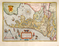
HOLLANDIAE ANTIQVORVM CAT THORVM SEDIS NOVA DESCRIPTIO AVCTORE IACO BO A DAVENTRIA. Theatre de l'Univers - Holland.
Antwerp Christopher Plantin for the author 1598. . Double-page copper engraved map with later hand-colouring centre fold as issued cartouches for titles and publishing privilege French text on verso; sheet size: 41.8 x 53 cm.<br /> Well-preserved example of Ortelius' map of Holland. Taken from the fifth final and most complete French edition of Theatre de l'Univers. Enriched with decorative cartouches and ships.<br /><br />Abraham Ortelius 1527-1598 was a cartographer and publisher he was born and died in Antwerp.<br /> Koeman III Ort 32. Antwerp, Christopher Plantin for the author, 1598. unknown
Referenz des Buchhändlers : 115602
|
|
|
ORTELIUS, Abraham
Hollandiae Antiquorum Catthorum Sedis Nova Descriptio
Antwerp: Abraham Ortelius 1592. unbound. Map. Uncolored engraving. Sheet measures 16" x 21".<br/> <br/> This beautiful 1588 map by Abraham Ortelius depicts Holland or the Netherlands in exceptional detail. The map covers the regions near the Wadden Sea roughly covering modern day provinces of North Holland South Holland and Utrecht. The map centered on Amsterdam is oriented with north to the left. Topographical and geographical features such as mountains and cities are beautifully rendered in profile.<br> <br> The waters surrounding the region are shown with waves and include several illustrations of ships throughout. This is the first state of the map with later states showing a stippled sea rather than waves. Includes a large strapwork title cartouche scale of miles with a divider in the lower left. The Royal coat of arms is presented in the top left. The map also includes a 16-point compass rose.<br> <br> Ortelius based this map on the work of Jacob van Daventer. Published in the 1588 edition of Ortelius' famous "Theatrum Orbis Terrarum" which is historically considered the first modern atlas. Based on the text on verso only 300 copies of this particular edition were ever printed van der Broecke 79.<br> <br> The map is in good condition with minor wear along the original centerfold. Minor foxing at places. Original plate mark is visible. Latin text on verso.<br> <br> Abraham Ortelius 1527--1598 a Flemish cartographer and geographer is widely regarded as one of the important and influential cartographers in history. He is known for his "Theatrum Orbis Terrarum" which was the first modern atlas. Hard to find in black and white.<br/> <br/> Abraham Ortelius unknown
Referenz des Buchhändlers : 273298

|
|
|
Ortelius, Abraham
Holsatia; Wandalicæ Insulæ. "Holsatiae Descriptio."& "Rugiae Usedomiaeet Iulianae Wandalicarum insula descriptio
Europe: Antverpiæ"/Antwerp. "ex Officiana Plantiana" . Plantijn Christoffel. 1595. 2 copper engraved maps on 1 plate of Holstein after Marco Iordano Holsatio and Rugen Island Germany from Ortelius' "Theatrum Orbis Terrarum" 1595 edition; black & white. Latin text to verso. Good dark impression. Abraham Ortelius 1527-1598 Flemish Cartographer . produced the first modern Atlas "Theatrum Orbis Terrarum" in 1570. printed by Aegidus Coppen Diest. There were numerous editions thereafter with texts in various languages; the printing of such was taken over by Chrstoffel Plantijn in 1579 . Ortelius himself drew all the maps in manuscript before passing them to the printers. there is conjecture that he may have engraved some of the plates as well The 1595 Latin text edition is the most complete produced during his lifetime containing all the maps of the 1593 edition plus those of the the"Additamentum" and the"Pareragon" or Ancient geography. The " Additamenta" were supplements to the original Atlas; at the same time Ortelius replaced some maps with new ones showing the same place; some plates were also reworked . Ortelius was Geographer Royal To Phillip II of Spain from 1575. He also worked closely with Braun & Hogenburg on the "Civitas Orbis Terarum". After his death the plates were purchased by Jan Baptiste Vrients in 1601 who published further editions until 1612. Van de Krogt :3; .Koeman: Ort29:49; van.de. Broecke:87ab. Europe Central Europe Germany Holstein Holsatiae Rugen Rugiae Antverpiæ"/Antwerp. "ex Officiana Plantiana" . Plantijn Christoffel. 1595 unknown
Referenz des Buchhändlers : 1795

|
|
|
Ortelius, Abraham
Holsatiae Descrip. Holsatiae Descrip. - Abraham Ortelius ∑ Hand-Colored Original Copperplate Engraving ∑ Antwerpen 1598
Antwerpen 1598. Other. In excellent condition. 340 by 248mm 13 by 9 inches. Hand-Colored Original Copperplate Engraving by Abraham Ortelius depicting Holsatiae Descrip. Published Antwerpen 1598. Sheet: 340 by 248mm 13 by 9 inches. A fine and original hand-colored example of Ortelius's celebrated cartographic work documenting this region of Germany with the precision and decorative artistry characteristic of the 15900s. Abraham Ortelius 1527-1598 was a Flemish cartographer and geographer from Antwerp widely regarded as the creator of the first modern atlas. His landmark publication Theatrum Orbis Terrarum 1570 set the standard for atlas-making for the next century presenting uniform copper-engraved maps with scholarly commentary. By Ortelius's death the Theatrum had appeared in 25 editions in seven languages. In 1575 King Philip II of Spain appointed him Royal Geographer. His maps engraved with extraordinary precision are among the most sought-after in antique cartography held in collections including the Plantin-Moretus Museum in Antwerp the Library of Congress and the British Library.This original copperplate engraving with original hand coloring depicts the region of Holsatiae Descrip. published in Antwerpen 1598. The map records the political and geographic boundaries of the region as understood in 1598 offering a fascinating window into the history of German territorial organization. Sheet measures 340 by 248mm 13 by 9 inches. In good condition overall with minor signs of age appropriate for a 16th-century engraving. Ready to frame. unknown
Referenz des Buchhändlers : 27467
|
|
|
Ortelius, Abraham
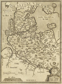
Insularum Aliquot Maris Mediterranei Descriptio. Ortelius Abraham – Mediterranean Islands · Copper Engraving · Theatrum Orbis Terrarum Antwerp · 1573
Antwerp: Platin 1573. Other. A very good example printed on excellent German paper. In excellent condition. 365 by 478mm 14 by 18 inches. Original antique copper engraving from the 'Theatrum Orbis Terrarum' by Abraham Ortelius the world's first modern atlas published in Antwerp 1573. Depicting Mediterranean Islands this map is a fine example of 1570s European cartography. Image: 365 by 478mm 14 by 18 inches. An attractive and historically significant 16th-century map for the discerning collector. Abraham Ortelius 15271598 was a Flemish cartographer and geographer born in Antwerp. He is widely regarded as the creator of the first modern atlas the 'Theatrum Orbis Terrarum' Theatre of the World first published in 1570 by Gilles Coppens de Diest in Antwerp. Considered the world's first true atlas it established the modern format of uniform standardized maps bound together in a single volume. Appointed Geographer to King Philip II of Spain in 1575 Ortelius was one of the most influential figures in the history of cartography. His maps are held in the collections of the British Library the Library of Congress and major European institutions. The 'Theatrum' went through more than 30 editions and was translated into multiple languages making Ortelius's maps among the most sought-after in the world of antique cartography.Decorative double page map showing six islands in the Mediterranean Islands Sicily Sardinia Corfu Malta Djerba Elba. Sicily is prominently displayed in the center of the map above the title cartouche.A fine example from Theatrum Orbis Terrarum Antwerp sought after by collectors of antique maps of Italy antique maps of Mediterranean Islands and antique copper engravings for sale. In good condition consistent with age. Light age-toning to the sheet as expected for a 16th-century engraving. Centerfold as published. Broe. 141 Platin unknown
Referenz des Buchhändlers : 24542
|
|
|
Ortelius, Abraham
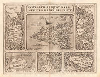
Insularum Aliquot Maris Mediterranei Descriptio.
Antwerp: Christopher Platin 1598. Other. A very good example in excellent condition. 360 by 475mm 14 by 18 inches. Original copper engraving published 1598 in a French edition of the Theatrum Orbis Terrarum. Finely hand-colored in wash and outline. Decorative doublepage map showing six islands in the Mediterranean Islands Sicily Sardinia Corfu Malta Djerba Elba. Sicily is prominently displayed in the center of the map above the title cartrouche. Ortelius was born on 14 April 1527 in the city of Antwerp which was then in the Habsburg Netherlands modern-day Belgium. The Orthellius family were originally from Augsburg a Free imperial city of the Holy Roman Empire. In 1535 the family had fallen under suspicion of Protestantism. Following the death of Ortelius's father his uncle Jacobus van Meteren returned from religious exile in England to take care of Ortelius. Abraham remained close to his cousin Emanuel van Meteren who would later moved to London. In 1575 he was appointed geographer to the king of Spain Philip II on the recommendation of Arias Montanus who vouched for his orthodoxy. He travelled extensively in Europe and is specifically known to have traveled throughout the Seventeen Provinces; in southern western northern and eastern Germany e.g. 1560 15751576; France 15591560; England and Ireland 1576; and Italy 1578 and perhaps twice or thrice between 1550 and 1558. Beginning as a map-engraver in 1547 he entered the Antwerp Guild of Saint Luke as an illuminator of maps. He supplemented his income trading in books prints and maps and his journeys included yearly visits to the Frankfurt book and print fair where he met Gerardus Mercator in 1554. In 1560 however when travelling with Mercator to Trier Lorraine and Poitiers he seems to have been attracted largely by Mercator's influence towards the career of a scientific geographer. Wikipedia Broe. 141 Christopher Platin unknown
Referenz des Buchhändlers : 16886
|
|
|
Ortelius, Abraham
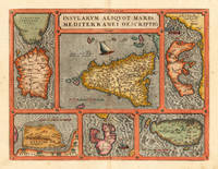
Insularum Aliquot Maris Mediterranei Descriptio. Ortelius Abraham – Mediterranean Islands · Copper Engraving · Theatrum Orbis Terrarum Antwerp · 1603
Antwerp 1603. Other. A very good example in vivid handcolor. Minor lightstaining outside the image. 365 by 478mm 14 by 18 inches. Original antique copper engraving from the 'Theatrum Orbis Terrarum' by Abraham Ortelius the world's first modern atlas published in Antwerp 1603. Depicting Mediterranean Islands this map is a fine example of 1600s European cartography. Image: 365 by 478mm 14 by 18 inches. An attractive and historically significant 17th-century map for the discerning collector. Abraham Ortelius 15271598 was a Flemish cartographer and geographer born in Antwerp. He is widely regarded as the creator of the first modern atlas the 'Theatrum Orbis Terrarum' Theatre of the World first published in 1570 by Gilles Coppens de Diest in Antwerp. Considered the world's first true atlas it established the modern format of uniform standardized maps bound together in a single volume. Appointed Geographer to King Philip II of Spain in 1575 Ortelius was one of the most influential figures in the history of cartography. His maps are held in the collections of the British Library the Library of Congress and major European institutions. The 'Theatrum' went through more than 30 editions and was translated into multiple languages making Ortelius's maps among the most sought-after in the world of antique cartography.Decorative doublepage map showing six islands in the Mediterranean Islands Sicily Sardinia Corfu Malta Djerba Elba. Sicily is prominently displayed in the center of the map above the title cartrouche.A fine example from Theatrum Orbis Terrarum Antwerp sought after by collectors of antique maps of Italy antique maps of Mediterranean Islands and antique copper engravings for sale. In excellent condition. Broe. 141 unknown
Referenz des Buchhändlers : 16331
|
|
|
ORTELIUS, Abraham
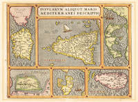
Insularum Aliquot Maris Mediterranei Descriptio; Sicily Malta Sardinia Corfu Elba and Zerbia
Antwerp: Abraham Ortelius 1603. unbound. Map. Engraving with beautiful original hand color. Image measures 14" x 18 3/4". Light staining and toning but otherwise is good condition.<br/> <br/> A representation of some islands in the Mediterranean Sea. Abraham Ortelius 1527-1598 a Flemish cartographer and geographer is widely regarded as one of the important and influential cartographers in history. He is known for his "Theatrum Orbis Terrarum" which was the first modern atlas. Van den Broecke #141<br/> <br/> Abraham Ortelius unknown
Referenz des Buchhändlers : 299306

|
|
|
ORTELIUS, Abraham
Insularum Aliquot Maris Mediterranei Descriptio; Sicily Malta Sardinia Corfu Elba and Zerbia
Antwerp: Abraham Ortelius 1584. unbound. Map. Engraving. Image measures 14" x 18 3/4". Light staining and toning on right margin but otherwise is good condition.<br/> <br/> A representation of some islands in the Mediterranean Sea. Abraham Ortelius 1527-1598 a Flemish cartographer and geographer is widely regarded as one of the important and influential cartographers in history. He is known for his "Theatrum Orbis Terrarum" which was the first modern atlas. Van den Broecke #141<br/> <br/> Abraham Ortelius unknown
Referenz des Buchhändlers : 299318

|
|
|
ORTELIUS, Abraham
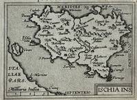
Ischia Ins
Antwerp: Philippe Galle 1595. unbound. Miniature map. Uncolored engraving. Image measures 3 1/8" x 4.25".<br/> <br/> Miniature map of Ischia off the coast of Naples detailing the volcanic landscape. From the 1595 pocket edition of Ortelius' "Theatrum Orbis Terrarum" or "Epitome" with text by Pieter Heyns. With Latin text on verso. Small repair to upper margin.<br> <br> Abraham Ortelius 1527--1598 a Flemish cartographer and geographer is widely regarded as one of the important and influential cartographers in history. He is known for his "Theatrum Orbis Terrarum" which was the first modern atlas.<br/> <br/> Philippe Galle unknown
Referenz des Buchhändlers : 327493
|
|
|
ORTELIUS, Abraham
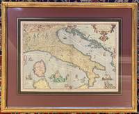
Italiae Novissima Descriptio Auctore Jacobo Cataldo Pedemontano
Antwerp: Ortelius Abraham 1573. framed. Map. Color engraving. Image measures 14 3/8" x 19.75". In gilt frame with empire French matting 23 x 28 1/2 inches.<br/> <br/> Gorgeous 16th century map of Italy. Elevations are beautifully colored and major towns are noted in red. Part of the Balkans Corsica and northern Sardinia are included along with part of Switzerland. Monaco is noted to the West. It was Ortelius's first map of Italy with a depiction of Neptune embracing and kissing a Neirid merwoman. A Sphinx perches atop the distance scale cartouche. Seven ships complete the composition. Some foxing and toning but otherwise a beautiful example of this uncommon edition. <br> <br> Abraham Ortelius 1527--1598 started his career as a Flemish map colorist eventually becoming a publisher cartographer and geographer. He widely regarded as one of the important and influential cartographers in history. He is known for his "Theatrum Orbis Terrarum" which was the first modern atlas. Van den Broecke 118.<br/> <br/> Ortelius, Abraham unknown
Referenz des Buchhändlers : 311532
|
|

 Per e-mail erhalten
 Als pdf-Dokument herunterladen
 RSS feed
 Permanenter link


