|
|
|
HONDIUS Jr. Jodocus (Amsterdam 1594 -1629)
Palatinatus Rheni
Carta geografica tratta dal Tabularum Geographicarum contractarum libri septem di Petrus Bertius, edizione latina del 1616. L'opera contiene 219 carte che illustrano questa nuova versione della geografia del Bertius, per la prima volta pubblicata nel 1612 con le carte di Barent Langenes. Le carte derivano dal grande atlante di Mercator/Hondius, delle quali molte rappresentano una semplice riduzione. "After the death of Cornelis Claesz in 1609, Jodocus Hondius II became the new publisher of the work, composed by 7 parts in 1, with engraved title-page and 220 full-page engraved maps in text. All the maps were newly engraved and slightly larger in size, because Hondius was not able to acquire the original plates. With the new plates the work was definitely improved and enjoyed a growing demand of the public, which at that time had the choice between the Atlas Minor by Mercator and Bertius' Tabularum Geographicarum. The 219 plates, with the oval world map appearing twice, were produced to illustrate a new version of the geography of Bertius, published in 1616. According to King, their correct attribution is by Hondius, after Mercator and Hondius, taken from Bertius, who was only responsible for revising his text again" [cfr. G. King, Miniature Antique Maps]. Incisione in rame, perfette condizioni. A superior rival to the pocket Ortelius atlas appeared about 1598, under the imprint of Barent Langenes and Cornelis Claesz. Claesz also published the Tabularum Geographicarum contractarum libri septem, edition with texy by Petrus Bertius, in 1600. After the death of Cornelis Claesz in 1609, Jodocus Hondius II became the new publisher of the work, composed by 7 parts in 1, with engraved title-page and 220 full-page engraved maps in text. All the maps were newly engraved and slightly larger in size, because Hondius was not able to acquire the original plates. With the new plates the work was definitely improved and enjoyed a growing demand of the public, which at that time had the choice between the Atlas Minor by Mercator and Bertius' Tabularum Geographicarum. The 219 plates, with the oval world map appearing twice, were produced to illustrate a new version of the geography of Bertius, published in 1616. According to King, their correct attribution is by Hondius, after Mercator and Hondius, taken from Bertius, who was only responsible for revising his text again. "After the death of Cornelis Claesz in 1609, Jodocus Hondius II became the new publisher of the work, composed by 7 parts in 1, with engraved title-page and 220 full-page engraved maps in text. All the maps were newly engraved and slightly larger in size, because Hondius was not able to acquire the original plates. With the new plates the work was definitely improved and enjoyed a growing demand of the public, which at that time had the choice between the Atlas Minor by Mercator and Bertius' Tabularum Geographicarum. The 219 plates, with the oval world map appearing twice, were produced to illustrate a new version of the geography of Bertius, published in 1616. According to King, their correct attribution is by Hondius, after Mercator and Hondius, taken from Bertius, who was only responsible for revising his text again" [cf. G. King, Miniature Antique Maps]. Copperplate, in very good conditions. Koeman p. 42; King p. 96/99.

|
|
|
HONDIUS Jr. Jodocus (Amsterdam 1594 -1629)
Poictou
Carta geografica tratta dal Tabularum Geographicarum contractarum libri septem di Petrus Bertius, edizione latina del 1616. L'opera contiene 219 carte che illustrano questa nuova versione della geografia del Bertius, per la prima volta pubblicata nel 1612 con le carte di Barent Langenes. Le carte derivano dal grande atlante di Mercator/Hondius, delle quali molte rappresentano una semplice riduzione. "After the death of Cornelis Claesz in 1609, Jodocus Hondius II became the new publisher of the work, composed by 7 parts in 1, with engraved title-page and 220 full-page engraved maps in text. All the maps were newly engraved and slightly larger in size, because Hondius was not able to acquire the original plates. With the new plates the work was definitely improved and enjoyed a growing demand of the public, which at that time had the choice between the Atlas Minor by Mercator and Bertius' Tabularum Geographicarum. The 219 plates, with the oval world map appearing twice, were produced to illustrate a new version of the geography of Bertius, published in 1616. According to King, their correct attribution is by Hondius, after Mercator and Hondius, taken from Bertius, who was only responsible for revising his text again" [cfr. G. King, Miniature Antique Maps]. Incisione in rame, perfette condizioni. A superior rival to the pocket Ortelius atlas appeared about 1598, under the imprint of Barent Langenes and Cornelis Claesz. Claesz also published the Tabularum Geographicarum contractarum libri septem, edition with texy by Petrus Bertius, in 1600. After the death of Cornelis Claesz in 1609, Jodocus Hondius II became the new publisher of the work, composed by 7 parts in 1, with engraved title-page and 220 full-page engraved maps in text. All the maps were newly engraved and slightly larger in size, because Hondius was not able to acquire the original plates. With the new plates the work was definitely improved and enjoyed a growing demand of the public, which at that time had the choice between the Atlas Minor by Mercator and Bertius' Tabularum Geographicarum. The 219 plates, with the oval world map appearing twice, were produced to illustrate a new version of the geography of Bertius, published in 1616. According to King, their correct attribution is by Hondius, after Mercator and Hondius, taken from Bertius, who was only responsible for revising his text again. "After the death of Cornelis Claesz in 1609, Jodocus Hondius II became the new publisher of the work, composed by 7 parts in 1, with engraved title-page and 220 full-page engraved maps in text. All the maps were newly engraved and slightly larger in size, because Hondius was not able to acquire the original plates. With the new plates the work was definitely improved and enjoyed a growing demand of the public, which at that time had the choice between the Atlas Minor by Mercator and Bertius' Tabularum Geographicarum. The 219 plates, with the oval world map appearing twice, were produced to illustrate a new version of the geography of Bertius, published in 1616. According to King, their correct attribution is by Hondius, after Mercator and Hondius, taken from Bertius, who was only responsible for revising his text again" [cf. G. King, Miniature Antique Maps]. Copperplate, in very good conditions. Koeman p. 42; King p. 96/99.

|
|
|
HONDIUS Jr. Jodocus (Amsterdam 1594 -1629)
Provincia Trevirensis
Carta geografica tratta dal Tabularum Geographicarum contractarum libri septem di Petrus Bertius, edizione latina del 1616. L'opera contiene 219 carte che illustrano questa nuova versione della geografia del Bertius, per la prima volta pubblicata nel 1612 con le carte di Barent Langenes. Le carte derivano dal grande atlante di Mercator/Hondius, delle quali molte rappresentano una semplice riduzione. "After the death of Cornelis Claesz in 1609, Jodocus Hondius II became the new publisher of the work, composed by 7 parts in 1, with engraved title-page and 220 full-page engraved maps in text. All the maps were newly engraved and slightly larger in size, because Hondius was not able to acquire the original plates. With the new plates the work was definitely improved and enjoyed a growing demand of the public, which at that time had the choice between the Atlas Minor by Mercator and Bertius' Tabularum Geographicarum. The 219 plates, with the oval world map appearing twice, were produced to illustrate a new version of the geography of Bertius, published in 1616. According to King, their correct attribution is by Hondius, after Mercator and Hondius, taken from Bertius, who was only responsible for revising his text again" [cfr. G. King, Miniature Antique Maps]. Incisione in rame, perfette condizioni. A superior rival to the pocket Ortelius atlas appeared about 1598, under the imprint of Barent Langenes and Cornelis Claesz. Claesz also published the Tabularum Geographicarum contractarum libri septem, edition with texy by Petrus Bertius, in 1600. After the death of Cornelis Claesz in 1609, Jodocus Hondius II became the new publisher of the work, composed by 7 parts in 1, with engraved title-page and 220 full-page engraved maps in text. All the maps were newly engraved and slightly larger in size, because Hondius was not able to acquire the original plates. With the new plates the work was definitely improved and enjoyed a growing demand of the public, which at that time had the choice between the Atlas Minor by Mercator and Bertius' Tabularum Geographicarum. The 219 plates, with the oval world map appearing twice, were produced to illustrate a new version of the geography of Bertius, published in 1616. According to King, their correct attribution is by Hondius, after Mercator and Hondius, taken from Bertius, who was only responsible for revising his text again. "After the death of Cornelis Claesz in 1609, Jodocus Hondius II became the new publisher of the work, composed by 7 parts in 1, with engraved title-page and 220 full-page engraved maps in text. All the maps were newly engraved and slightly larger in size, because Hondius was not able to acquire the original plates. With the new plates the work was definitely improved and enjoyed a growing demand of the public, which at that time had the choice between the Atlas Minor by Mercator and Bertius' Tabularum Geographicarum. The 219 plates, with the oval world map appearing twice, were produced to illustrate a new version of the geography of Bertius, published in 1616. According to King, their correct attribution is by Hondius, after Mercator and Hondius, taken from Bertius, who was only responsible for revising his text again" [cf. G. King, Miniature Antique Maps]. Copperplate, in very good conditions. Koeman p. 42; King p. 96/99.

|
|
|
HONDIUS Jr. Jodocus (Amsterdam 1594 -1629)
Saltzburg et Carinthia
Carta geografica tratta dal Tabularum Geographicarum contractarum libri septem di Petrus Bertius, edizione latina del 1616. L'opera contiene 219 carte che illustrano questa nuova versione della geografia del Bertius, per la prima volta pubblicata nel 1612 con le carte di Barent Langenes. Le carte derivano dal grande atlante di Mercator/Hondius, delle quali molte rappresentano una semplice riduzione. "After the death of Cornelis Claesz in 1609, Jodocus Hondius II became the new publisher of the work, composed by 7 parts in 1, with engraved title-page and 220 full-page engraved maps in text. All the maps were newly engraved and slightly larger in size, because Hondius was not able to acquire the original plates. With the new plates the work was definitely improved and enjoyed a growing demand of the public, which at that time had the choice between the Atlas Minor by Mercator and Bertius' Tabularum Geographicarum. The 219 plates, with the oval world map appearing twice, were produced to illustrate a new version of the geography of Bertius, published in 1616. According to King, their correct attribution is by Hondius, after Mercator and Hondius, taken from Bertius, who was only responsible for revising his text again" [cfr. G. King, Miniature Antique Maps]. Incisione in rame, perfette condizioni. A superior rival to the pocket Ortelius atlas appeared about 1598, under the imprint of Barent Langenes and Cornelis Claesz. Claesz also published the Tabularum Geographicarum contractarum libri septem, edition with texy by Petrus Bertius, in 1600. After the death of Cornelis Claesz in 1609, Jodocus Hondius II became the new publisher of the work, composed by 7 parts in 1, with engraved title-page and 220 full-page engraved maps in text. All the maps were newly engraved and slightly larger in size, because Hondius was not able to acquire the original plates. With the new plates the work was definitely improved and enjoyed a growing demand of the public, which at that time had the choice between the Atlas Minor by Mercator and Bertius' Tabularum Geographicarum. The 219 plates, with the oval world map appearing twice, were produced to illustrate a new version of the geography of Bertius, published in 1616. According to King, their correct attribution is by Hondius, after Mercator and Hondius, taken from Bertius, who was only responsible for revising his text again. "After the death of Cornelis Claesz in 1609, Jodocus Hondius II became the new publisher of the work, composed by 7 parts in 1, with engraved title-page and 220 full-page engraved maps in text. All the maps were newly engraved and slightly larger in size, because Hondius was not able to acquire the original plates. With the new plates the work was definitely improved and enjoyed a growing demand of the public, which at that time had the choice between the Atlas Minor by Mercator and Bertius' Tabularum Geographicarum. The 219 plates, with the oval world map appearing twice, were produced to illustrate a new version of the geography of Bertius, published in 1616. According to King, their correct attribution is by Hondius, after Mercator and Hondius, taken from Bertius, who was only responsible for revising his text again" [cf. G. King, Miniature Antique Maps]. Copperplate, in very good conditions. Koeman p. 42; King p. 96/99.

|
|
|
HONDIUS Jr. Jodocus (Amsterdam 1594 -1629)
Saxonia
Carta geografica tratta dal Tabularum Geographicarum contractarum libri septem di Petrus Bertius, edizione latina del 1616. L'opera contiene 219 carte che illustrano questa nuova versione della geografia del Bertius, per la prima volta pubblicata nel 1612 con le carte di Barent Langenes. Le carte derivano dal grande atlante di Mercator/Hondius, delle quali molte rappresentano una semplice riduzione. "After the death of Cornelis Claesz in 1609, Jodocus Hondius II became the new publisher of the work, composed by 7 parts in 1, with engraved title-page and 220 full-page engraved maps in text. All the maps were newly engraved and slightly larger in size, because Hondius was not able to acquire the original plates. With the new plates the work was definitely improved and enjoyed a growing demand of the public, which at that time had the choice between the Atlas Minor by Mercator and Bertius' Tabularum Geographicarum. The 219 plates, with the oval world map appearing twice, were produced to illustrate a new version of the geography of Bertius, published in 1616. According to King, their correct attribution is by Hondius, after Mercator and Hondius, taken from Bertius, who was only responsible for revising his text again" [cfr. G. King, Miniature Antique Maps]. Incisione in rame, perfette condizioni. A superior rival to the pocket Ortelius atlas appeared about 1598, under the imprint of Barent Langenes and Cornelis Claesz. Claesz also published the Tabularum Geographicarum contractarum libri septem, edition with texy by Petrus Bertius, in 1600. After the death of Cornelis Claesz in 1609, Jodocus Hondius II became the new publisher of the work, composed by 7 parts in 1, with engraved title-page and 220 full-page engraved maps in text. All the maps were newly engraved and slightly larger in size, because Hondius was not able to acquire the original plates. With the new plates the work was definitely improved and enjoyed a growing demand of the public, which at that time had the choice between the Atlas Minor by Mercator and Bertius' Tabularum Geographicarum. The 219 plates, with the oval world map appearing twice, were produced to illustrate a new version of the geography of Bertius, published in 1616. According to King, their correct attribution is by Hondius, after Mercator and Hondius, taken from Bertius, who was only responsible for revising his text again. "After the death of Cornelis Claesz in 1609, Jodocus Hondius II became the new publisher of the work, composed by 7 parts in 1, with engraved title-page and 220 full-page engraved maps in text. All the maps were newly engraved and slightly larger in size, because Hondius was not able to acquire the original plates. With the new plates the work was definitely improved and enjoyed a growing demand of the public, which at that time had the choice between the Atlas Minor by Mercator and Bertius' Tabularum Geographicarum. The 219 plates, with the oval world map appearing twice, were produced to illustrate a new version of the geography of Bertius, published in 1616. According to King, their correct attribution is by Hondius, after Mercator and Hondius, taken from Bertius, who was only responsible for revising his text again" [cf. G. King, Miniature Antique Maps]. Copperplate, in very good conditions. Koeman p. 42; King p. 96/99.

|
|
|
HONDIUS Jr. Jodocus (Amsterdam 1594 -1629)
Thietmarsia
Carta geografica tratta dal Tabularum Geographicarum contractarum libri septem di Petrus Bertius, edizione latina del 1616. L'opera contiene 219 carte che illustrano questa nuova versione della geografia del Bertius, per la prima volta pubblicata nel 1612 con le carte di Barent Langenes. Le carte derivano dal grande atlante di Mercator/Hondius, delle quali molte rappresentano una semplice riduzione. "After the death of Cornelis Claesz in 1609, Jodocus Hondius II became the new publisher of the work, composed by 7 parts in 1, with engraved title-page and 220 full-page engraved maps in text. All the maps were newly engraved and slightly larger in size, because Hondius was not able to acquire the original plates. With the new plates the work was definitely improved and enjoyed a growing demand of the public, which at that time had the choice between the Atlas Minor by Mercator and Bertius' Tabularum Geographicarum. The 219 plates, with the oval world map appearing twice, were produced to illustrate a new version of the geography of Bertius, published in 1616. According to King, their correct attribution is by Hondius, after Mercator and Hondius, taken from Bertius, who was only responsible for revising his text again" [cfr. G. King, Miniature Antique Maps]. Incisione in rame, perfette condizioni. A superior rival to the pocket Ortelius atlas appeared about 1598, under the imprint of Barent Langenes and Cornelis Claesz. Claesz also published the Tabularum Geographicarum contractarum libri septem, edition with texy by Petrus Bertius, in 1600. After the death of Cornelis Claesz in 1609, Jodocus Hondius II became the new publisher of the work, composed by 7 parts in 1, with engraved title-page and 220 full-page engraved maps in text. All the maps were newly engraved and slightly larger in size, because Hondius was not able to acquire the original plates. With the new plates the work was definitely improved and enjoyed a growing demand of the public, which at that time had the choice between the Atlas Minor by Mercator and Bertius' Tabularum Geographicarum. The 219 plates, with the oval world map appearing twice, were produced to illustrate a new version of the geography of Bertius, published in 1616. According to King, their correct attribution is by Hondius, after Mercator and Hondius, taken from Bertius, who was only responsible for revising his text again. "After the death of Cornelis Claesz in 1609, Jodocus Hondius II became the new publisher of the work, composed by 7 parts in 1, with engraved title-page and 220 full-page engraved maps in text. All the maps were newly engraved and slightly larger in size, because Hondius was not able to acquire the original plates. With the new plates the work was definitely improved and enjoyed a growing demand of the public, which at that time had the choice between the Atlas Minor by Mercator and Bertius' Tabularum Geographicarum. The 219 plates, with the oval world map appearing twice, were produced to illustrate a new version of the geography of Bertius, published in 1616. According to King, their correct attribution is by Hondius, after Mercator and Hondius, taken from Bertius, who was only responsible for revising his text again" [cf. G. King, Miniature Antique Maps]. Copperplate, in very good conditions. Koeman p. 42; King p. 96/99.

|
|
|
HONDIUS Jr. Jodocus (Amsterdam 1594 -1629)
Trassilvania
Carta geografica tratta dal Tabularum Geographicarum contractarum libri septem di Petrus Bertius, edizione latina del 1616. L'opera contiene 219 carte che illustrano questa nuova versione della geografia del Bertius, per la prima volta pubblicata nel 1612 con le carte di Barent Langenes. Le carte derivano dal grande atlante di Mercator/Hondius, delle quali molte rappresentano una semplice riduzione. "After the death of Cornelis Claesz in 1609, Jodocus Hondius II became the new publisher of the work, composed by 7 parts in 1, with engraved title-page and 220 full-page engraved maps in text. All the maps were newly engraved and slightly larger in size, because Hondius was not able to acquire the original plates. With the new plates the work was definitely improved and enjoyed a growing demand of the public, which at that time had the choice between the Atlas Minor by Mercator and Bertius' Tabularum Geographicarum. The 219 plates, with the oval world map appearing twice, were produced to illustrate a new version of the geography of Bertius, published in 1616. According to King, their correct attribution is by Hondius, after Mercator and Hondius, taken from Bertius, who was only responsible for revising his text again" [cfr. G. King, Miniature Antique Maps]. Incisione in rame, perfette condizioni. A superior rival to the pocket Ortelius atlas appeared about 1598, under the imprint of Barent Langenes and Cornelis Claesz. Claesz also published the Tabularum Geographicarum contractarum libri septem, edition with texy by Petrus Bertius, in 1600. After the death of Cornelis Claesz in 1609, Jodocus Hondius II became the new publisher of the work, composed by 7 parts in 1, with engraved title-page and 220 full-page engraved maps in text. All the maps were newly engraved and slightly larger in size, because Hondius was not able to acquire the original plates. With the new plates the work was definitely improved and enjoyed a growing demand of the public, which at that time had the choice between the Atlas Minor by Mercator and Bertius' Tabularum Geographicarum. The 219 plates, with the oval world map appearing twice, were produced to illustrate a new version of the geography of Bertius, published in 1616. According to King, their correct attribution is by Hondius, after Mercator and Hondius, taken from Bertius, who was only responsible for revising his text again. "After the death of Cornelis Claesz in 1609, Jodocus Hondius II became the new publisher of the work, composed by 7 parts in 1, with engraved title-page and 220 full-page engraved maps in text. All the maps were newly engraved and slightly larger in size, because Hondius was not able to acquire the original plates. With the new plates the work was definitely improved and enjoyed a growing demand of the public, which at that time had the choice between the Atlas Minor by Mercator and Bertius' Tabularum Geographicarum. The 219 plates, with the oval world map appearing twice, were produced to illustrate a new version of the geography of Bertius, published in 1616. According to King, their correct attribution is by Hondius, after Mercator and Hondius, taken from Bertius, who was only responsible for revising his text again" [cf. G. King, Miniature Antique Maps]. Copperplate, in very good conditions. Koeman p. 42; King p. 96/99.

|
|
|
HONDIUS Jr. Jodocus (Amsterdam 1594 -1629)
Warwicum, Northampton, Hunting.
Carta geografica tratta dal Tabularum Geographicarum contractarum libri septem di Petrus Bertius, edizione latina del 1616. L'opera contiene 219 carte che illustrano questa nuova versione della geografia del Bertius, per la prima volta pubblicata nel 1612 con le carte di Barent Langenes. Le carte derivano dal grande atlante di Mercator/Hondius, delle quali molte rappresentano una semplice riduzione. "After the death of Cornelis Claesz in 1609, Jodocus Hondius II became the new publisher of the work, composed by 7 parts in 1, with engraved title-page and 220 full-page engraved maps in text. All the maps were newly engraved and slightly larger in size, because Hondius was not able to acquire the original plates. With the new plates the work was definitely improved and enjoyed a growing demand of the public, which at that time had the choice between the Atlas Minor by Mercator and Bertius' Tabularum Geographicarum. The 219 plates, with the oval world map appearing twice, were produced to illustrate a new version of the geography of Bertius, published in 1616. According to King, their correct attribution is by Hondius, after Mercator and Hondius, taken from Bertius, who was only responsible for revising his text again" [cfr. G. King, Miniature Antique Maps]. Incisione in rame, perfette condizioni. A superior rival to the pocket Ortelius atlas appeared about 1598, under the imprint of Barent Langenes and Cornelis Claesz. Claesz also published the Tabularum Geographicarum contractarum libri septem, edition with texy by Petrus Bertius, in 1600. After the death of Cornelis Claesz in 1609, Jodocus Hondius II became the new publisher of the work, composed by 7 parts in 1, with engraved title-page and 220 full-page engraved maps in text. All the maps were newly engraved and slightly larger in size, because Hondius was not able to acquire the original plates. With the new plates the work was definitely improved and enjoyed a growing demand of the public, which at that time had the choice between the Atlas Minor by Mercator and Bertius' Tabularum Geographicarum. The 219 plates, with the oval world map appearing twice, were produced to illustrate a new version of the geography of Bertius, published in 1616. According to King, their correct attribution is by Hondius, after Mercator and Hondius, taken from Bertius, who was only responsible for revising his text again. "After the death of Cornelis Claesz in 1609, Jodocus Hondius II became the new publisher of the work, composed by 7 parts in 1, with engraved title-page and 220 full-page engraved maps in text. All the maps were newly engraved and slightly larger in size, because Hondius was not able to acquire the original plates. With the new plates the work was definitely improved and enjoyed a growing demand of the public, which at that time had the choice between the Atlas Minor by Mercator and Bertius' Tabularum Geographicarum. The 219 plates, with the oval world map appearing twice, were produced to illustrate a new version of the geography of Bertius, published in 1616. According to King, their correct attribution is by Hondius, after Mercator and Hondius, taken from Bertius, who was only responsible for revising his text again" [cf. G. King, Miniature Antique Maps]. Copperplate, in very good conditions. Koeman p. 42; King p. 96/99.

|
|
|
HONDIUS Jr. Jodocus (Amsterdam 1594 -1629)
Westmorland, Lancastria, Cestria..
Carta geografica tratta dal Tabularum Geographicarum contractarum libri septem di Petrus Bertius, edizione latina del 1616. L'opera contiene 219 carte che illustrano questa nuova versione della geografia del Bertius, per la prima volta pubblicata nel 1612 con le carte di Barent Langenes. Le carte derivano dal grande atlante di Mercator/Hondius, delle quali molte rappresentano una semplice riduzione. "After the death of Cornelis Claesz in 1609, Jodocus Hondius II became the new publisher of the work, composed by 7 parts in 1, with engraved title-page and 220 full-page engraved maps in text. All the maps were newly engraved and slightly larger in size, because Hondius was not able to acquire the original plates. With the new plates the work was definitely improved and enjoyed a growing demand of the public, which at that time had the choice between the Atlas Minor by Mercator and Bertius' Tabularum Geographicarum. The 219 plates, with the oval world map appearing twice, were produced to illustrate a new version of the geography of Bertius, published in 1616. According to King, their correct attribution is by Hondius, after Mercator and Hondius, taken from Bertius, who was only responsible for revising his text again" [cfr. G. King, Miniature Antique Maps]. Incisione in rame, perfette condizioni. A superior rival to the pocket Ortelius atlas appeared about 1598, under the imprint of Barent Langenes and Cornelis Claesz. Claesz also published the Tabularum Geographicarum contractarum libri septem, edition with texy by Petrus Bertius, in 1600. After the death of Cornelis Claesz in 1609, Jodocus Hondius II became the new publisher of the work, composed by 7 parts in 1, with engraved title-page and 220 full-page engraved maps in text. All the maps were newly engraved and slightly larger in size, because Hondius was not able to acquire the original plates. With the new plates the work was definitely improved and enjoyed a growing demand of the public, which at that time had the choice between the Atlas Minor by Mercator and Bertius' Tabularum Geographicarum. The 219 plates, with the oval world map appearing twice, were produced to illustrate a new version of the geography of Bertius, published in 1616. According to King, their correct attribution is by Hondius, after Mercator and Hondius, taken from Bertius, who was only responsible for revising his text again. "After the death of Cornelis Claesz in 1609, Jodocus Hondius II became the new publisher of the work, composed by 7 parts in 1, with engraved title-page and 220 full-page engraved maps in text. All the maps were newly engraved and slightly larger in size, because Hondius was not able to acquire the original plates. With the new plates the work was definitely improved and enjoyed a growing demand of the public, which at that time had the choice between the Atlas Minor by Mercator and Bertius' Tabularum Geographicarum. The 219 plates, with the oval world map appearing twice, were produced to illustrate a new version of the geography of Bertius, published in 1616. According to King, their correct attribution is by Hondius, after Mercator and Hondius, taken from Bertius, who was only responsible for revising his text again" [cf. G. King, Miniature Antique Maps]. Copperplate, in very good conditions. Koeman p. 42; King p. 96/99.

|
|
|
HONDIUS Jr. Jodocus (Amsterdam 1594 -1629)
Westphalia
Carta geografica tratta dal Tabularum Geographicarum contractarum libri septem di Petrus Bertius, edizione latina del 1616. L'opera contiene 219 carte che illustrano questa nuova versione della geografia del Bertius, per la prima volta pubblicata nel 1612 con le carte di Barent Langenes. Le carte derivano dal grande atlante di Mercator/Hondius, delle quali molte rappresentano una semplice riduzione. "After the death of Cornelis Claesz in 1609, Jodocus Hondius II became the new publisher of the work, composed by 7 parts in 1, with engraved title-page and 220 full-page engraved maps in text. All the maps were newly engraved and slightly larger in size, because Hondius was not able to acquire the original plates. With the new plates the work was definitely improved and enjoyed a growing demand of the public, which at that time had the choice between the Atlas Minor by Mercator and Bertius' Tabularum Geographicarum. The 219 plates, with the oval world map appearing twice, were produced to illustrate a new version of the geography of Bertius, published in 1616. According to King, their correct attribution is by Hondius, after Mercator and Hondius, taken from Bertius, who was only responsible for revising his text again" [cfr. G. King, Miniature Antique Maps]. Incisione in rame, perfette condizioni. A superior rival to the pocket Ortelius atlas appeared about 1598, under the imprint of Barent Langenes and Cornelis Claesz. Claesz also published the Tabularum Geographicarum contractarum libri septem, edition with texy by Petrus Bertius, in 1600. After the death of Cornelis Claesz in 1609, Jodocus Hondius II became the new publisher of the work, composed by 7 parts in 1, with engraved title-page and 220 full-page engraved maps in text. All the maps were newly engraved and slightly larger in size, because Hondius was not able to acquire the original plates. With the new plates the work was definitely improved and enjoyed a growing demand of the public, which at that time had the choice between the Atlas Minor by Mercator and Bertius' Tabularum Geographicarum. The 219 plates, with the oval world map appearing twice, were produced to illustrate a new version of the geography of Bertius, published in 1616. According to King, their correct attribution is by Hondius, after Mercator and Hondius, taken from Bertius, who was only responsible for revising his text again. "After the death of Cornelis Claesz in 1609, Jodocus Hondius II became the new publisher of the work, composed by 7 parts in 1, with engraved title-page and 220 full-page engraved maps in text. All the maps were newly engraved and slightly larger in size, because Hondius was not able to acquire the original plates. With the new plates the work was definitely improved and enjoyed a growing demand of the public, which at that time had the choice between the Atlas Minor by Mercator and Bertius' Tabularum Geographicarum. The 219 plates, with the oval world map appearing twice, were produced to illustrate a new version of the geography of Bertius, published in 1616. According to King, their correct attribution is by Hondius, after Mercator and Hondius, taken from Bertius, who was only responsible for revising his text again" [cf. G. King, Miniature Antique Maps]. Copperplate, in very good conditions. Koeman p. 42; King p. 96/99.

|
|
|
HONDIUS Jr. Jodocus (Amsterdam 1594 -1629)
Wilflispurgergow
Carta geografica tratta dal Tabularum Geographicarum contractarum libri septem di Petrus Bertius, edizione latina del 1616. L'opera contiene 219 carte che illustrano questa nuova versione della geografia del Bertius, per la prima volta pubblicata nel 1612 con le carte di Barent Langenes. Le carte derivano dal grande atlante di Mercator/Hondius, delle quali molte rappresentano una semplice riduzione. "After the death of Cornelis Claesz in 1609, Jodocus Hondius II became the new publisher of the work, composed by 7 parts in 1, with engraved title-page and 220 full-page engraved maps in text. All the maps were newly engraved and slightly larger in size, because Hondius was not able to acquire the original plates. With the new plates the work was definitely improved and enjoyed a growing demand of the public, which at that time had the choice between the Atlas Minor by Mercator and Bertius' Tabularum Geographicarum. The 219 plates, with the oval world map appearing twice, were produced to illustrate a new version of the geography of Bertius, published in 1616. According to King, their correct attribution is by Hondius, after Mercator and Hondius, taken from Bertius, who was only responsible for revising his text again" [cfr. G. King, Miniature Antique Maps]. Incisione in rame, perfette condizioni. A superior rival to the pocket Ortelius atlas appeared about 1598, under the imprint of Barent Langenes and Cornelis Claesz. Claesz also published the Tabularum Geographicarum contractarum libri septem, edition with texy by Petrus Bertius, in 1600. After the death of Cornelis Claesz in 1609, Jodocus Hondius II became the new publisher of the work, composed by 7 parts in 1, with engraved title-page and 220 full-page engraved maps in text. All the maps were newly engraved and slightly larger in size, because Hondius was not able to acquire the original plates. With the new plates the work was definitely improved and enjoyed a growing demand of the public, which at that time had the choice between the Atlas Minor by Mercator and Bertius' Tabularum Geographicarum. The 219 plates, with the oval world map appearing twice, were produced to illustrate a new version of the geography of Bertius, published in 1616. According to King, their correct attribution is by Hondius, after Mercator and Hondius, taken from Bertius, who was only responsible for revising his text again. "After the death of Cornelis Claesz in 1609, Jodocus Hondius II became the new publisher of the work, composed by 7 parts in 1, with engraved title-page and 220 full-page engraved maps in text. All the maps were newly engraved and slightly larger in size, because Hondius was not able to acquire the original plates. With the new plates the work was definitely improved and enjoyed a growing demand of the public, which at that time had the choice between the Atlas Minor by Mercator and Bertius' Tabularum Geographicarum. The 219 plates, with the oval world map appearing twice, were produced to illustrate a new version of the geography of Bertius, published in 1616. According to King, their correct attribution is by Hondius, after Mercator and Hondius, taken from Bertius, who was only responsible for revising his text again" [cf. G. King, Miniature Antique Maps]. Copperplate, in very good conditions. Koeman p. 42; King p. 96/99.

|
|
|
Honegger, R.E.
Amphibiens et reptiles menacés en Europe.
1978 Strasbourg, Conseil de l'Europe, 1978 : In-4 Carré, Broché. 127 pp., collection "sauvegarde de la nature" n° 15 Très bon état, Couv. convenable, Dos satisfaisant, Intérieur frais.
Referenz des Buchhändlers : VR32264

|
|
|
Honey, William B
European ceramic art from the end of the Middle Ages to about 1815.
London, Faber & Faber, 1949. 79 S., 192 Tafeln. S. minim. gebräunt, Buchrücken gering gebräunt, Buchumschl. randl. berieben, bestoßen u. etwas rissig.
Referenz des Buchhändlers : 22304BB
|
|
|
Honey, William B
German porcelain.
London, Faber & Faber, 1947. XV, 56, 96 S. zahlr. Ill. Or.-Leinen, m. illustr. Buchumschlag. S. leicht gebräunt, Buchumschl. randl. wenig bestoßen, Aufkl. a. hint. Buchumschl.
Referenz des Buchhändlers : 22174BB
|
|
|
Hongrie Europe
Europe n°411-412 07 08-1963 littérature hongroise [Unknown Binding]
Juillet - août 1963. Aspect jauni, pliures en dos de couverture, in térieur propre.
Referenz des Buchhändlers : LN6165 ISBN : 9
|
|
|
HONGRIE. . .
La v?rit? sur l'affaire Nagy. Les faits, les documents, les t?moignages internationnaux. Pr?face d'Albert Camus. Postface de Fran?ois Fejto.
Broch?. 256 pages. 19x24 cm.
|
|
|
HONGRIE...
A l'est, la trag?die continue. Reportage (10 pages) dans Paris-Match.
Num?ro complet.
|
|
|
Honneth Axel
Riconoscimento. Storia di un'idea europea
br. Axel Honneth è uno dei maggiori filosofi europei e dirige l'Istituto per la ricerca sociale fondato da Max Horkheimer e Theodor Adorno. Questo libro racconta una storia del pensiero europeo, che fin dall'inizio della modernità è attraversato dall'idea che i soggetti sociali siano legati da un rapporto di riconoscimento. Con lo sguardo rivolto alle tre principali tradizioni di pensiero del Vecchio continente, Honneth ci conduce lungo un viaggio tra la Francia, l'Inghilterra e la Germania e disegna i percorsi delle diverse declinazioni di questa idea e delle sue interpretazioni, raccontando ogni volta le sfide politiche e sociali che ne hanno dettato l'urgenza. Da Rousseau a Sartre, da Hume a Mill, da Kant a Hegel, la storia dell'idea di riconoscimento ci permette di pensare una società dinamica e conflittuale, capace di ospitare il dissenso e per questo democratica. Queste figure dell'idea di riconoscimento affondano le proprie radici nel diciassettesimo secolo e hanno formato la nostra tradizione culturale, interagendo e contaminandosi tra loro fino a oggi. In una società sempre più divisa, il riconoscimento è una risorsa preziosa e necessaria per difendere un'idea di democrazia che non possiamo più dare per scontata. Perché l'idea di riconoscimento, spiega Honneth, è la coscienza di una reciproca appartenenza.

|
|
|
Honneth, Axel
Anerkennung : eine europäische Ideengeschichte. Erste Auflage
Berlin : Suhrkamp. 2018. 237 Seiten. 20*12,5 cm. OPappband, OSchu.
Referenz des Buchhändlers : 152520

|
|
|
Honolka, Bert
Die Mädchen von Buda und Pest : Die Geschichte e. summar. Liebe.
Berlin [u.a.] : Dt. Buchgemeinschaft, 1969. 191 S. 8°. [Lizenzausg.]. Ill. OPpbd. (Leinenstruktur).
Referenz des Buchhändlers : 15996
|
|
|
Honore, Pierre
Ich fand den weißen Gott.
Frankfurt, Verlag Heinrich Scheffler, 1961. 359 S. Gr.-8° Groß-Oktav, Leinen
Referenz des Buchhändlers : 100665

|
|
|
Honoré de Balzac
Les Contes Drolatiques colligez ez abbayes de Touraine et mis en lumière par le sieur De Balzac pour l'esbattement des pantagruelistes et non aultres Édition illustrés de 425 dessins par Gustave Doré
mezza pelle non edit. con piatti marmorizzati, al dorso un disegno e titoli a due colori tracciati a mano, piccole rotture in cop., allentamento alla cerniera interna - volume in lingua francese - 425 illustrazioni di Gustave Doré in b.n. nel testo

|
|
|
Honoré de Balzac - a cura di Paola Brancassio e Anna Crisi
Eugénie Grandet
bross. edit. ill. - trad. di Giorgio Brunacci

|
|
|
Honoré de Balzac - nella traduzione di Salvatore De Carlo
Il peccato veniale
bross. edit. ill. con bandelle, un fascicolo distaccato, brunitura in cop. - in edizione di sole mille copie - una tavola di Anna Salvatore in b.n. fuori testo

|
|
|
Honoré, P
Ich fand d. weissen Gott.
Frankfurt/M. Scheffler, (1961). M. 72 Bildtaf., 65 Abb. u. 12 Tab. u. Ktn. 359 S. Lwd. in Schutzfolie. Bibliotheksex. m. Rsign. St. a. Tit. u. verso Tit.
Referenz des Buchhändlers : 633521
|
|
|
Honoré-Gabriel Riquetti conte di Mirabeau
L'arte di variare i piaceri dell'amore HIC et HEC
in cop.: Un piccolo capolavoro erotico del grande scrittore francese inedito in Italia - bross. edit. ill., minime fioriture ai tagli, lievi tracce d'uso in cop.

|
|
|
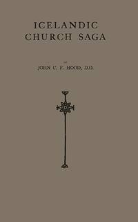
Hood, John Charles Fulton
ICELANDIC CHURCH SAGA
Greenwood Press Reprint. 1981. Hardcover. Very Good in No Dust Jacket dust jacket. Ex-library copy with usual stamps call numbers and pocket. Adhesive traces of former sticker.; Investigates the traces of early Christianity in the island and describes militant missionary efforts which led to the official adoption of Christianity in the year 1000. Further describes the development of the church under the Bishops of Skalholt and the stories of Iceland's two saints: St. Jon and Thorlak. Continues until the 19th Century. A; 9.5 x 1 x 6.5 Inches; 241 pages . 0313221944 . Greenwood Press Reprint hardcover
Referenz des Buchhändlers : 390 ISBN : 0313221944 9780313221941
|
|
|
Hood, Thomas
UP THE RHINE
Slight wear to extremities. Hinges weakening. Small stamp on first blank page; Fictionalized, epistolary account of a trip up the river into Germany. Two steel engravings as frontispieces and numerous other b&w illustrations; 8vo; 339 pages
|
|
|
HOOFT, F.W.'t:
Het Bevolkingsvraagstuk waar wij heengaan in west-europa.
Amsterdam, H.J. Paris, 1929, in-8°, VII + 111 S. met 30 grafieken tusschen, Stempel a.d. Titelbl., Hlwd. (Bibl.).
Referenz des Buchhändlers : 8728aaf
|
|
|
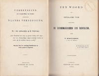
Hoogenboom, W
Een woord aan Neêrlands volk aangaande de verdedigbaarheid van Nederland. No. 1 der Antwoorden op de Prijsvraag: "Kan Nederland met hoop op goeden uitslag zelfs tegenover een overmachtigen vijand verdedigd worden en welke zijn de middelen daartoe noodig".
Utrecht Kemink 1872. 1st Edition . Hardcover. . ~ ~ NOTE: THE PRICE OF THIS BOOK IS CURRENTLY REDUCED! ~ ~ . Octavo. Pp. 152. HARDCOVER bound in contemporary cloth and marbled boards inner hinges cracked shelf ticket to spine old institutional stamps. In good condition fine interior. ~ FIRST EDITION. Written and submitted in reply to a competition held by the Vereeniging tot Verspreiding van Kennis aangaande 's Lands Verdediging. Any contributor had to address six painful questions eternal issues of worry and of concern for a small land surrounded by mighty neighbours. Even the position and capacity of the elderly and the women were to be considered: could they contribute to the Land's defense in any way beside active fighting Hoogenboom First Lieutenant Artillery was much concerned with the subject. His extended "Beschouwingen over Nederlands gewapende neutraliteit bij een oorlog tusschen andere Mogendheden" was published a few years later. Very rare. 005-9 <br/> <br/> Utrecht, Kemink hardcover
Referenz des Buchhändlers : 6678
|
|
|
HOOGHE, Romeyn de
Arlequin Deodat, et Pamirge Hypochondriaques
Ampia incisione (54 x 38 cm.) satirica, che presenta allegoricamente gli sviluppi della guerra per la successione Palatina e la guerra con la Turchia: i regnanti europei sono rappresentati come pazienti (ipocondriaci) curati da un dottore tedesco. Ogni personaggio, nell’illustrazione, è numerato, e il rimando numerico trova riferimento nel testo in basso: il dottore (1) tiene in mano un campione di urine e un libro e nella cintura ci sono biglietti di carta con scritti i nomi di località tedesche: gli altri sono Luigi XIV (2), Guglielmo III (3), Egon Von Fürstenberg (4), Maria di Modena (8). Testo in olandese, in due colonne. A wide satirical etching, showing an allegory about the consequences of Palatine succession. The European monarchs are represented as patients (hypocondriac) cared by a German doctor. Between the figures you can distinguish Louis XIV, Egon Von Fürstenberg, Whilem the III. Dutch text on two columns. British Museum 1855,0114.198
|
|
|
HOOGSTEDEN A.F.
Vodjes papier - de leuzen en frasen der Entente
116pp., geïll.omslag
|
|
|
HOOGSTEDEN A.F.
Vodjes papier - de leuzen en frasen der Entente
Amsterdam-Rotterdam, Van Langenhuysen 1918 116pp., geïll.omslag
Referenz des Buchhändlers : G39672
|
|
|
Hooiberg, A. J. (Bearb.)
Holland. Praktischer Reiseführer. Mit 9 Karten u. 2 Grundrissen.
Bln., Goldschmidt 1914 - 1915. 8°. IV,202,24 S. OLn. - Griebens Reiseführer 98 - gutes Expl.! OLn.
Referenz des Buchhändlers : 29658AB
|
|
|
Hopkins, Michael
European Communities Information, Its Use and Users
usual stickers and stamps on the inside of the cover, FEP and on the page block. Ex - Library
|
|
|
Hopkins, Tighe
The Dungeons of Old Paris
Hardcover. No jacket. Boards are lightly marked and worn. Spine sides and pastedown hinges are split, but binding remains intact. Spine foot is torn away. Abrasions on spine. Spine head is chipped. Leading corners are bumped and worn. Front upper leading corner is split. Embossed stamp and previous owner's name inked on second blank page. Upper edges of early pages are lightly bumped. Light marks and creases on some pages. Text is clear throughout. HJW Used

|
|
|
Hopp, E.O
Bundesstaat u. Bundeskrieg in Nordamerika. M. einem Abriß d. Colonialgeschichte als Einleitung.
Berlin, Grote, 1886. M. zahlr. Ktn. u. Abb. 2 Bl., 776 S. Hldr. Rücken fehlt. Einbd. bestoßen. Vord. Gelenk leicht gelockert. M. mehr. St. a. Tit. Papier leicht nachgedunkelt. (Oncken, Allg. Gesch. in Einzeldarst. 4/4).
Referenz des Buchhändlers : 616388
|
|
|
Horace (Quintus Horatius Flaccus)
The Works of Horace translated by Philip Francis D.D. to which is prefixed The Life of the Translator
London: J. Walker and Co. el al. Near Fine with No dust jacket as issued. 1815. First Edition Thus. First Printing. Leather. Bound in burgundy half leather spine in five compartments separated by gilt lines gilt lettering in one compartment a.e.g. blue endpapers. Engraved frontispiece and title page with vignette. . Covers only mildly rubbed with one small loss on front cover else fine; unmarked unread tight square and clean. NEAR FINE. . Engraved frontispiece and title page. 24mo 5" - 6" tall. viii 351 pp . J. Walker and Co., el al. hardcover
Referenz des Buchhändlers : 28654
|
|
|
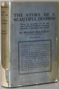
Horace Bleackley
THE BEAUTIFUL DUCHESS Being an Account of The Life And Times of Elizabeth Gunning Duchess of Hamilton and Argyll
London: John Lane The Bodley Head Ltd 1927. Hard Cover. near Very Good binding/Good dust jacket. 289pp. with 8 illustrations; Hardcover cloth binding with light edgewear to extremities. Heavier wear at bottom edge of rear board and bottom corners. Binding slightly cocked. Large chip at bottom dustjacket spine. Chips at top dustjacket spine. Small chips at bottom of front and rear dj covers. Dustjacket flaps are clipped; there is a previous owner name; no markings in text. near Very Good binding / Good dust jacket. John Lane The Bodley Head Ltd unknown books
Referenz des Buchhändlers : 240491
|
|
|
Horace C Beck; O M Dalton; J Graham Callander; E W Safford; W H Knowles; etc
Archaeologia or Miscellaneous Tracts relating to Antiquity Published by the Society of Antiquaries of London Vol. LXXVII 77 1927. Second Series volume 27
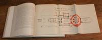
Society of Antiquaries of London London 1928. First Edition. Hardcover. Very Good Condition/No Dust Jacket. Clean firm brown covers with gilt lettering on the spine light wear to edges sound binding clean pages and end-papers. Volume contains many black and white plates photographs and illustrations. Fold out plan of Abbey of SS. Peter Paul and Augustine Canterbury in colour facing page 216. Contents include: I. Classification and Nomenclature of Beads and Pendants by Horace C. Beck; II. Early Chessmen of Whales Bone excavated in Dorset by O. M. Dalton; III. Recent Archaeological Research in Scotland by J. Graham Callander; IV. Expenses of Eleanor sister of Edward III on her marriage to Reynald Count of Guelders by E. W. Safford; V. Deerhurst Priory Church and excavations from 1926 by W. H. Knowles; VI. Post-Reformation Ecclesiastical Seals of Durham by C. H. Hunter Blair; VII. Pre-Roman Remains at Scarborough by Reginald A. Smith; VIII. St. Augustines Abbey Church Canterbury before the Norman Conquest by C. R. Peers; IX. Carved Stones at Breedon on the Hill Leicestershire by A. W. Clapham; X. Reculver: its Saxon Church and Cross by Peers; XI. Some Clocks and Jacks with Notes on the History of Horology by R. P. Howgrave-Graham; XII. Decoration and Sculptures of the Beauchamp Chapel Warwick by P. B. Chatwin. 346 pages. One volume of the 1-volume set. Contains colour and black and white plates. No dust jacket as published. Stamps for Halifax Antiquarian Society and "Withdrawn" stamp on front end-papers and prelims. Pages of main text and plates including reverse of plates are free from stamps. Hand-written reference numbers on end-papers. Quantity Available: 1. Shipped Weight: 2-3 kg. Pictures of this item not already displayed here available upon request. Inventory No: 40119061009. All our books music and maps are sent by a tracked mail service. This book is heavier than 1kg and may incur additional delivery charges on some delivery services to some locations. Society of Antiquaries of London hardcover
Referenz des Buchhändlers : 40119061009
|
|
|
Horak, Karl:
Burgenländische Volksschauspiele.
23 x 15 cm. 523 Seiten. Orig.-Leinenband (Einband mit Gebrauchspuren. Wenige Seiten mit kleinen Braunfleckchen. Insgesamt gut erhalten. Bücher de
|
|
|
Horak, Ulrike
Europa und der Stier. Ein Orbiculus mit der Darstellung der Europa. [Von Ulrike Horak]. With an English summary translated by Rosemary Moravec. (= Nilus, Band 2).
Wien: ÖVG 1998. 91 Seiten. Mit 24 Farbabbildungen auf Tafeln im Anhang. Gr. 8° (22,5-25 cm). Orig.-Broschur. [Softcover / Paperback].
Referenz des Buchhändlers : 160313

|
|
|
HORAN ,James - KIELY, Benedict -SOMERVILLE-LARGE, Peter
25 Views of Dublin
Town House and Country House, 1994 - In-4 oblong - Copuverture souple sous jaquette illustrée en couleurs -25 dessins en couleurs PP - 63 pages - Très propre.
|
|
|
HORAN ,James - KIELY, Benedict -SOMERVILLE-LARGE, Peter
25 Views of Dublin
Town House and Country House, 1994 - In-4 oblong - Copuverture souple sous jaquette illustrée en couleurs -25 dessins en couleurs PP - 63 pages - Très propre.
Referenz des Buchhändlers : 18696
|
|
|
Horan, Geraldine; Rash, Felicity; Wildmann, Daniel (eds.)
English and German Nationalist and Anti-Semitic Discourse, 1871-1945
Paperback in like new condition. German Linguistic and Cultural Studies, Volume 25. New shop stock with minor shelf-wear, no faults. TA Used
|
|
|
Horatio Walpole, Earl of Orford
The Works of Horatio Walpole Earl of Orford in Five Volumes 1798 WITH Memoires of the Last Ten Years of the Reign of George the Second in Two Volumes 1822 - Seven Volume Set Complete
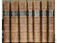
<p>The Works: London: Printed for G.G. and J. Robinson Paternoster-Row and J. Edwards Pall-Mall. MDCCXCVIII 1798 WITH Memoires of the Last Ten Years of the Reign of George the Second: London John Murray Albemarle-Street. MDCCCXXII 1822. Over 4000 pages and 177 full-page engravings. Seven volumes uniformly bound in Contemporary Calf over marbled boards. Gold Gilt on black leather title labels. Additional spine gilt stamping with decorative blindstamp. Some rubbing to bindings wear heavier towards extremities see image. Hand Marbled endpapers hinges unobtrusively reinforced with moire brown cloth. Internally clean Unmarked. Off-setting from plates with sporadic foxing particularly to plates and adjoining leaves as per usual. Full Collation of the papers used contents and plates on request. A Very Good Antiquarian Set Indeed. First Edition. Half-Leather Marbled Boards. Very Good. Illus. by 177 Full-page Engravings Fold-outs etc. 4to - over 11½" tall. Extremely Heavy Oversized Safely Securely Packed.</p> Printed for G.G. and J. Robinson and J. Edwards hardcover
Referenz des Buchhändlers : 930273
|
|
|
Horia Vintila
Dio è nato in esilio Diario di Ovidio a Tomi
trad. di Orsola Nemi tela rossa edit. con titoli e fregi, sovrac. ill. con piccole rotture e lieve brunitura
|
|
|
Horky-Hluchan, H & Lightfoot, S
Development Policies of Central and Eastern European States: From Aid Recipients to Aid Donors
Routledge 2012. This is an ex-library book and may have the usual library/used-book markings inside.This book has hardback covers. In fair condition suitable as a study copy. No dust jacket. Library sticker on front cover. Please note the Image in this listing is a stock photo and may not match the covers of the actual item500grams ISBN:9780415639125 Routledge hardcover
Referenz des Buchhändlers : 8627582 ISBN : 0415639123 9780415639125

|
|
|
Horky-Hluchan, O & Lightfoot, S
Development Policies of Central and Eastern European States: From Aid Recipients to Aid Donors
Routledge 2012. This is an ex-library book and may have the usual library/used-book markings inside.This book has hardback covers. In fair condition suitable as a study copy. No dust jacket. Library sticker on front cover. Please note the Image in this listing is a stock photo and may not match the covers of the actual item500grams ISBN:9780415639125 Routledge hardcover
Referenz des Buchhändlers : 8627581 ISBN : 0415639123 9780415639125
|
|
|
Hormann, K
Torrenten in Friaul u. d. Längsprofilentwicklung auf Schottern. (Diss.).
Kallmünz, Lassleben, 1964. M. 2 Ktn. u. 18 Abb. 81 S. (Münchner geogr. Hefte 26).
Referenz des Buchhändlers : 209192
|
|
|

 Per e-mail erhalten
 Als pdf-Dokument herunterladen
 RSS feed
 Permanenter link


