|
|
|
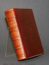
Jacob ben Asher; Sirkes, Joel; Bayit hadash. Falk, Joshua ben Alexander
TUR HOSHEN HA-MISHPAT. HELEK SHENI [only]
Period leather, reinforced with period burlap chamise. 89 + 142 leaves [ ie 462 pages total]. In Hebrew. Printed entirely on blue paper. Includes commentaries Bayit hadash by Yo'el Sirkes, and, Bet Yis´ra'el, Perishah u-derishah by Yoshu?a Falk. At head of title: Gadol yihyeh kavod (ha-Bayit) ha-aharon min ha-rishon. SUBJECT(S): Jewish law. OCLC: 944730470. OCLC lists only 1 institution with holdings worldwide (NYU). Period leather, protected by burlap chamise, appears to be in Very Good condition; chamise shows wear at corners and at one edge. Paper and binding remain very good. A beautiful copy Rare. (KH-9-4)
|
|
|
Jacob, Georg
Welche Handelsartikel bezogen die Araber des Mittelalters aus den nordisch-baltischen Ländern?. (Teildruck aus der) 2. gänzlich umgearbeit. u. vielfach verm. Aufl. FOTOKOPIE der Ausgabe Berlin 1891 nach dem Exemplar der Universitätsbibliothek Bonn.
(Essen, 1977). S. 1-17, [2] S. (Übersetzung der latein. Textstellen), u. S. 16-20 aus Supplement 2. Als Blockbuch geheftet.
Référence libraire : 43421

|
|
|
Jacob-Friesen, Holger (Herausgeber), Pia (Herausgeber) Müller-Tamm und Christoph (Mitwirkender) Frank
Die Meister-Sammlerin Karoline Luise von Baden.
Berlin, Deutscher Kunstverlag 2015. 544 Seiten. 4°, Hardcover/Pappeinband
Référence libraire : 107530

|
|
|
JACOBS Francis G.
Le restrizioni all'esercizio dei diritti e delle libertà garantiti dalla Convenzione Europea dei Diritti dell'Uomo: evoluzione dal 1950 al 1975
In-4°, pp. 15, copert. edit. Estratto.

|
|
|
Jacobs, Friedrich
Hellas. Geographie, Geschichte und Litteratur Griechenlands. Neu bearbeitet von Carl Curtius.
Stuttgart, Carl Krabbe 1897. * Mit Frontispiz. XII, 420 Seiten. 20,5 x 14 cm. Weinroter Original-Leinenband mit silbergeprägtem Rücken- und Deckeltitel.
Référence libraire : 121532

|
|
|
Jacobsen Hanns-D., Machowski Heinrich, Sager Dirk (Hrsg.)
Perspektiven für Sicherheit und Zusammenarbeit in Europa
Bonn (Bundeszentrale für politische Bildung) 1998 (= Schriftenreide der Bundeszentrale für politische Bildung Band 268, Erste Auflage). 8°, Originalbroschur (Paperback), 535 S.,
Référence libraire : V12151
|
|
|
Jacobsen Jens Peter
La signora Fonss A cura di Bruno Maffi
trad. di Bruno Maffi n. 2 in 16°, bross. edit. con sovrac. ill., piccole rotture e lievi tracce d'uso in sovrac.
|
|
|
Jacobsen, N. A. - Rohwer, J.
BATTAGLIE DECISIVE DELLA SECONDA GUERRA MONDIALE. VOL. I, II, e III
Mm 140x210 Opera completa. Tre volumi in copertina rigida con sovraccoperta, 326 + 344 + 293 pagine con tavole in nero non comprese nel testo. Tutti volumi sono in condizioni pari al nuovo evidentemente mai letti. Spedizione in 24 ore dalla conferma dell'ordine.
|
|
|
Jacobsen/Dollinger (Hrsg.)
Der Zweite Weltkrieg. In Bildern und Dokumenten.
München/Wien/Basel, Kurt Desch, 1963. 3 Bde. M. zahlr. Illustr. Or.-Ln., O.-Umschl.(diese leicht gebräunt), Deckelill. Guter Zust.
Référence libraire : 44033AB
|
|
|
Jacobsen/Dollinger (Hrsg.)
Der Zweite Weltkrieg. In Bildern und Dokumenten.
Wiesbaden, Löwit, 1963. 3 Bde. M. zahlr. Illustr. Or.-Ln., Or.-Umschl.(Rücken leicht gebräunt u. bei Bd. 3 kl. Einr.), Deckelillustr., innen guter Zust.
Référence libraire : 12324AB
|
|
|
Jacobsen/Dollinger (Hrsg.)
Der Zweite Weltkrieg. In Bildern und Dokumenten.
München/Wien/Basel, Kurt Desch, 1962. 3 Bde. gr.-8°. ca. 1500 S., m. zahlr. Illustr. Or.-Ln., Rücken leicht gebräunt, sauber u. gut erhalten.
Référence libraire : 59379AB
|
|
|
Jacobson Howard
Kalooki nights
trad. di Milena Zemira Ciccimarra bross. edit. ill. con bandelle

|
|
|
Jacobsson, Yvonne (fwd); Nina Lagergren, Jan Lundvik, Ricki Neuman, Tomas Bohm, Paul A Levine (essays)
Raoul Wallenberg: One Man Can Make a Difference
Stockholm Sweden: Judiska Museet i Stockholm 2004. Book. Near Fine. Soft cover. First Edition. 4to - over 9¾" - 12" tall. Stiff pictorial wraps. Catalogue to accompany 25 Jan.-30 Dec. 2004 exhibition. 58 pp. illus. w/ b&w photographs. Text in Swedish with English translation. Slight shelf/handling wear. Very scarce. Judiska Museet i Stockholm Paperback
Référence libraire : 035368 ISBN : 9197436313 9789197436311
|
|
|
Jacobus de Voragine / Richard Benz (signiert / inscribed copy)
Legenda aurea. Deutsch von Richard Benz. Volksausgabe. Erster und zweiter Band in einem.
Jena, Diederichs, 1925. XVIII S., 760, 720 Spalten. Orig.-Halbpergamentband. Mit eigenhändiger, persönlicher Widmung des Übersetzers Richard Benz vom 15. März 1945 in Bleistift. Beiligend die gedruckten Danksagungen anläßlich des 75. Geburtstages von Benz 1959 (mit drei eigenhändigen Zeilen) sowie zur Trauerfeier 1966. Die Legenda aurea in der Übersetzung von Benz erschien 1917-21 zunächst als bibliophiler Druck mit handkolorierten Initialen in limitierter Auflage. Die hier vorliegende Volksausgabe ist demgegenüber verkleinert. Ein gut erhaltenes Exemplar mit nur leichten Gebrauchsspuren.
Référence libraire : 000294
|
|
|
JACQUART, Jean.
FRANCOIS Ier.
in-8°, 440 pages, ill., index, cartonnage de l"editeur, jaquette illustree. Bel exemplaire. [LA-6]
|
|
|
Jacqueline Bel et Centre d'etudes et de recherche sur les civilisations et les litteratures europe
L'image de Napoléon dans les littératures européennes : Actes du colloque 12 13 et 14 novembre 1998 Les Cahiers du Littoral
Centre d'études et de recherche sur les civilisations et les littératures européennes CERCLE. Paperback. Good. Former library book. Different cover. Ammareal gives back up to 15% of this item's net price to charity organizations. Centre d'études et de recherche sur les civilisations et les littératures européennes, CERCLE paperback
Référence libraire : I-271-219 ISBN : 2951593805 9782951593800
|
|
|
Jacqueline Bel et Centre d'etudes et de recherche sur les civilisations et les litteratures europe
L'image de Napoléon dans les littératures européennes : Actes du colloque 12 13 et 14 novembre 1998 Les Cahiers du Littoral Jacqueline Bel et Centre d'études et de recherche sur les civilisations et les littératures europé
Centre d'études et de recherche sur les civilisations et les littératures européennes CERCLE. Softcover. L'image de Napoléon dans les littératures européennes : Actes du colloque 12 13 et 14 novembre 1998 Les Cahiers du Littoral <br/><br/>L'image de Napoléon dans les littératures européennes : Actes du colloque 12 13 et 14 novembre 1998 Les Cahiers du Littoral Jacqueline Bel et Centre d'études et de recherche sur les civilisations et les littératures europé Centre d'études et de recherche sur les civilisations et les littératures européennes, CERCLE paperback
Référence libraire : BN322955 ISBN : 2951593805 9782951593800
|
|
|
JACQUEMIN Alexis & PENCH Lucio R. (eds.)
Pour une compétitivité européenne (Rapports du Groupe Consultatif sur la compétitivité)
164pp., br.orig., 24cm.
|
|
|
Jacques Derrida
L'Europa in capo al mondo. Con due saggi di Maurizio Ferraris
Quale imminenza? Qualcosa di unico è in corso in Europa, in ciò che ancora si chiama Europa, anche se non si sa più bene che cosa si chiami in questo modo. Di fatto, a quale concetto, a quale individuo reale, a quale entità determinata si può, al giorno d’oggi, conferire questo nome? Chi ne traccerà le frontiere? Riottoso sia all'analogia sia all'anticipazione, quello che si annuncia sembra senza precedenti. Esperienza angosciata dell’imminenza, attraversata da due certezze contraddittorie: il vecchissimo soggetto della identità culturale in genere (prima della guerra si sarebbe forse parlato di identità «spirituale»), il vecchissimo soggetto della identità europea, ha certo la venerabile antichità di un tema esaurito. Ma forse questo «soggetto» conserva un corpo vergine. Il suo nome maschera forse qualcosa che non ha ancora un volto? E noi ci chiediamo nella speranza, con timore e tremore, a che somiglierà quel volto. Somiglierà ancora? E a quello di una qualche persona che crediamo di conoscere, Europa? E quand'anche la dissomiglianza avesse i connotati dell’avvenire, si sottrarrebbe alla mostruosità? Autori: Jacques Derrida. Curatori: Maurizio Ferraris.

|
|
|
Jacques Jean Schreiber Servan
La sfida americana
In 8° br. fig. col. pp. 290, ben tenuto
|
|
|
Jacques Le Goff
Con Hanka
bross. edit. ill. con bandelle, lievi segni di piega al dorso, firma d'appartenenza - prima edizione it. - trad. di Valentina Parlato

|
|
|
JACQUES LÉVY
EUROPA. UNA GEOGRAFIA. A CURA DI SERGIO VENTRIGLIA
DISPONIBILITÀ GARANTITA AL 99%; SPEDIZIONE ENTRO 12 ORE DALL'ORDINE. FONDO DI MAGAZZINO PARI AL NUOVO. LIEVI SEGNI DEL TEMPO. RARO. Quali sono i limiti, le radici, la sostanza, le articolazioni dell'Europa? Quali distanze, quali coerenze, quali metriche si riescono a individuare a fondamento di uno spazio che possa dirsi europeo? Il percorso di Jacques Lévy si snoda attraverso l'intreccio di territori e di reti che connotano questa parte del mondo, cerca di districarsi tra le logiche geopolitiche degli stati, preoccupati della perimetrazione e del consolidamento dei loro domini, e la dilatazione delle logiche reticolari, espressa dal mondo degli scambi e della cultura, condensata nei valori urbani, sorretta dall'avanzata di una possibile società europea. Questa geografia dell'Europa, pur evocando lo sfondo di rilievi, di fiumi, di climi, pur tenendo continuamente in conto i quadri amministrativi e il tessuto economico, è soprattutto un affresco che attinge a piene mani alla storia, alla costruzione e alla trasmigrazione dei valori, al divenire dei quadri sociali. Ne risulta una descrizione in cui molti tratti si sovrappongono o si negano a vicenda, molti sentieri s'intrecciano, molte scale di lettura operano in contemporaneità, ma che offre un'efficace chiave interpretativa dell'individualità e della consistenza geografica perché faticosamente e progressivamente sociale dell'Europa. Pasquale Coppola Indice Sommario: Prefazione all'edizione italiana Introduzione L'Europa come problema Parte prima. Trame. I L'impossibile quadro geografico dell'Europa. II L'invenzione dell'Europa: una geostoria. Parte seconda. Configurazioni. III Comunità europee. IV I territori della geopolitica. V. Una rete anseatica. VI. Una società europea Parte terza. Situazioni. VII. Quartieri d'Europa. VIII. Costruire, dicono, IX. Conclusione. Un messaggio europeo. Appendice. Un approccio. Glossario. Postfazione di Sergio Ventriglia. Bibliografia Jacques Levy (1952), insegna discipline geografiche presso l'Università di Reims e presso l'Institut d'études politiques di Parigi. E animatore della rivista Espace Temps sin dalla sua fondazione. Tra le sue opere più significative ricordiamo: Geographies du politique (Presses de Sciences Po, Paris 1991), Le monde espace et systémes, con M. F. Durand e D. Retaillé (Presses de Sciences Po/Dalloz, Paris. 1993. L'espace legitime Presses de Sciences Po, Paris 1995) e Le monde pour cite Hachette, Paris 1996). Comunità, campo di forze geopolitiche, rete di scambi, e infine società: sono questi i quattro piani, sovrapposti e interconnessi, su cui si struttura lo spazio europeo. Analizzando il legame tra questi piani, il volume traccia una dimensione spaziale dell'identità europea, avvalendosi delle più recenti innovazioni negli studi geografici e sociologici e di un apparato documentario e cartografico. L'Europe est un objet à construire, un problème à résoudre - un problème géographique. Elle n'est pas ce cadre imposé de l'Atlantique à l'Oural et formé d'états intangibles, mais peut-on trouver un principe qui rende compte d'une identité propre à cet espace ? Comment et pourquoi l'Europe, assez peu individualisée au Néolithique, connaît-elle au Moyen Age, une inflexion historique décisive? Communauté, champ de forces géopolitiques, réseau d'échanges, et enfin, société sont quatre plans, superposés et imbriqués, qui structurent l'espace européen. C'est l'agencement de ces trames qui distinguent l'Europe, avec, notamment, une très forte présence au monde, des découpages internes subtils, et la genèse, de par la volonté des Européens, d'un phénomène inédit, la construction européenne. Au terme du parcours, la dimension spatiale de l'identité européenne se dégage avec foce. Elle repose sur une extrême proximité de sociétés et de cultures a priori différentes, la nécessité d'un changement d'échelle pour rendre cette diversité créative ou simplement vivable. Cet ouvrage s'appuie sur les innovations récentes de la géographie et se nourrit de nombreux emprunts aux sciences sociales. Le propos, ambitieux, est, par le texte et la carte, accessible à un large public. Descrizione bibliografica Titolo: Europa. Una geografia Titolo originale: Europe: une géographie Autore: Jacques Lévy Curatore: Sergio Ventriglia Traduzione di: Sergio Ventriglia Editore: Torino: Edizioni di Comunità, 1999 Einaudi Lunghezza: 364 pagine; 22 cm; illustrato in b/n ISBN: 882450566X, 9788824505666 Collana: Volume 9 di Territori di Comunità Soggetti: Geografia umana, Geopolitica, Globalizzazione, Scienza, Tecnica, Topografia fisica, Ambiente, Animali, Terra, Spazio, Epistemologia, Teoria del sociale, Costruttivismo realistico, Conoscenza, Invenzione, Sistemismo dialogico, Società, Filosofia, Abitare, Martin Heidegger, Spazio, Relazioni di distanza, Leibniz, Metrica, Scala, The Legittime Space, Città, Urbanità, Densità, Diversità, Henri Lefebvre, Jane Jacobs, Sviluppo, Gentrificazione, Quartieri, Interazioni, Civiltà, Spazio pubblico, Öffentlicher Raum, Sfera pubblica, Öffentlichkeit, Norbert Elias, Individui, Erving Goffman, Lyn Lofland, Serendipità, Mobilità, Trasporti, Ambienti urbani, Amsterdam, Alterità, Modello di Johannesburg, Mondo, Forza, Rete gerarchica, Umanità, Homo sapiens, Cartografia, Mappe, Evoluzione, Attori spaziali, Cartogramma, ScapeToad, Mappa autoestensiva, Géographie du politique, Riferimento, Bibliografia, Benevolo, Durand, Barrot, Popper, Eco, Foucher, Bordieou, Jaspers, Perrin, Polanyi, Arendt, Anderson, Aristotele, Weber, Reynaud, Bruhl, Horkheimer, Adorno, Goddard, Pomian, Tonnies, Schulze, Todd, De Saussure, Bagnasco, Bairoch, Bloch, Braudel, Dematteis, Davie, Clouth, Cohen, Cattan, Elias, Hoggart, Haegel, Inglehart, Le Bras, Pelus, Kaplan, Stein, Pumain, Coppola, Clermont, Doblin, Dollfus, Kolossov, Lewin, Malia, Wolton, Cacciari, Husserl, Derrida, Gadamer, Faye, Morin, Patocka, Philonenko, Brunet, Moriconi, Drevet, Centro, Periferie, Dorsale, Confini, Distanza, Frontiere, Network, Reti, Rizoma, Urali, Documenti, Cittadinanza, Identità, Appartenenza, Comunità europee, Contraddizioni, Nazioni, Stati, Popoli, Competizione, Guerre, Industria, Risorse energetiche, Interessi, Relazioni internazionali, Idea di sé, Trattati, Diplomazia, Istituzioni, Ungheria, Jugoslavia, Disordini, Multiculturalismo, Lega anseatica, Reti, Urbanesimo, Dinamiche sociali, Mediterraneo, Mitteleuropa, Cultura, Danubio, Unione, Unità, Frammentazione, Geotipi, Russia, Indicatori, Allargamento, Sociologia, Critica, Produzione, Capitalismo, Strategia, Tableau, Sarajevo, Bosnia, Sistema, Human Geography, Geopolitics, Globalization, Science, Technique, Physical Topography, Environment, Animals, Earth, Space, Epistemology, Social Theory, Realistic Constructivism, Knowledge, Invention, Dialogic Systemism, Society, Philosophy, Dwelling, Space, Distance Relations, Metrics, Scale, Cities, Urbanity, Density, Diversity, Development, Gentrification, Neighborhoods, Interactions, Civilization, Public Space, Sphere, Individuals, Serendipity, Mobility, Transportation, Urban Environments, Otherness, Models, World, Strength, Hierarchical Network, Humanity, Cartography, Maps, Evolution, Space actors, Cartogram, Self-extensive map, Reference, Bibliography, Center, Peripheries, Dorsal, Borders, Distance, Frontiers, Networks, Rhizome, Urals, Documents, Citizenship, Identity, Membership, European communities, Contradictions, Nations, States, Peoples, Competition, Wars, Industry, Energy resources, Interests, International relations, Self idea, Treaties, Diplomacy, Institutions, Hungary, Unrest, Multiculturalism, Hanseatic League, Networks, Urbanism, Social dynamics, Mediterranean, Central Europe, Culture, Danube, Unity, Fragmentation, Geotypes, Indicators, Enlargement, Sociology, Criticism, Production, Capitalism, Strategy, System

|
|
|
Jacques MAUPAS - (1899-1956), Secrétaire général du Conseil d'État, Spécialiste des questions de droit international.
Le III à Reich et son Armée de Jacques MAUPAS - (1899-1956), Secrétaire général du Conseil d'État, Spécialiste des questions de droit international.
PARIS, les Editions internationales , 1940 - Edition Originale -In-8 - Broché - Couverture illustrée -230 pgages - L'ouvrage, portant la date de 1940, n'a été effectivement publié qu'en 1944 - Bel exemplaire
|
|
|
JACQUES Pierre
Les sources du Conflit Européen de 1914
Paris, Editions & Librairie, Librairie aéronautique, 1915. In-8 broché de 318 pages. Couverture jaunie avec petite tache. Peu courant.
|
|
|
JAEKEN, Godfried - WESTERLING, Hans.
L'Ecosse.
Bruxelles, éd. Artis - Historia, 1994, gd. in-4, cartonnage toilé éd., jaquette photo en coul. éd., 106 pp., 1 cartes en coul. et très nb. chromos contrecollés en coul., Table des matières, Très beau voyage en Ecosse. Bien complet des chromos. Très bon état
Référence libraire : 65909
|
|
|
Jaeckle, Erwin
Die Idee Europa.
Frankfurt/Berlin, Propyläen, 1988. 8°, 399 Seiten. Orig.Pappband mit OSU.
Référence libraire : 19116
|
|
|
Jaeger, Marc A
Die Zukunft des Abendlandes.
Bern, Francke Verlag, 1963. 270 S. Gr.-8° Groß-Oktav, Leinen
Référence libraire : 100676

|
|
|
Jaffé H. L. C.
Per un'arte nuova. De Stijl 1917-1931
8 tavole a colori e 47 illustrazioni in nero

|
|
|
Jahn, Bernhard (Herausgeber)
Zeremoniell in der Krise : Störung und Nostalgie. Zum 60. Geburtstag von Jörg Jochen Berns. ERSTAUSGABE.
Marburg : Jonas-Verlag, 1998. 160 Seiten. Mit zahlreichen Schwarz-Weiß- Abbildungen. 25 cm Originalpappband.
Référence libraire : 283850

|
|
|
Jahn, C. F
Illustrirtes Reisebuch 1850. Ein Führer durch Deutschland, die Schweiz, Tyrol, Italien und nach Paris, London, Brüssel, Amsterdam, Kopenhagen, Stockholm, Warschau. Mit einer Reisekarte von Deutschland und über 300 Ansichten. Unter Mitbenutzung amtlicher Quellen herausgegeben von C. F. Jahn. Neue bis April 1850 ergänzte und berichtigte Ausgabe, Reprint der Originalausgabe Berlin 1850 [mit entnehmbarer Faltkarte]
Leipzig: Zentralantiquariat der Deutschen Demokratischen Republik, 1985. 16 cm ; Leinen
Référence libraire : 105095

|
|
|
Jahn, Hajo [Hrsg.]
Zwischen Theben und Shangai: Jüdische Exilanten in China - Chinesische Exilanten in Europa Almanach zum V. Else-Lasker-Schüler-Forum 'Flucht in die Freiheit' 1. Aufl.
Chemnitz, Berlin, St. Petersburg: Oberbaum Verlag 1998. 258 S., mit schw/w Abb., 23cm x 14cm Leinen
Référence libraire : 6400549
|
|
|
Jahns, Max
Das französische Heer von der grossen Revolution bis zur Gegenwart: Eine kulturhistorische Studie.
Leipzig Grunow 1873. 1st Edition . Hardcover. . ~ ~ NOTE: THE PRICE OF THIS BOOK IS CURRENTLY REDUCED! ~ ~ . Octavo. Pp. xvi 800. Footnotes. Set in Gothic type. HARDCOVER bound in contemporary half calf spine with gilt raised bands between compartments blind tooling along boards marbled edges top of joint tender. In about fine condition. ~ FIRST EDITION. From the contemporary library of Master of Laws F. C. Koch with his handsome bookplate. TIMO-1 OUT <br/> <br/> Leipzig, Grunow hardcover
Référence libraire : 0611
|
|
|
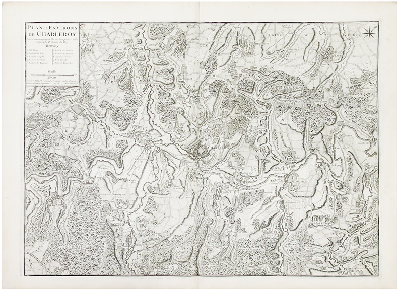
JAILLOT (Bernard).
[BELGIQUE] Plan et environs de Charleroy.
Paris, Sr. Jaillot, 1746. 480 x 666 mm.
Référence libraire : LBW03939
|
|
|
JAILLOT Alexis Hubert (1632 - 1712)
Estats De L'Empire du Grand Seigneur des Turcs en Europe, ou sont les Beglerbeglicz ou Gouverne de Romelie, de la Mer, de Bu
Dettagliata carta dell'Impero Turco e del Mediterraneo. Si estende dalla penisola arabica e l'impero di Persia a est fino alle baleari e a ovest fino all'Italia e alla Francia.Incisione su rame, in ottimo stato di coonservazione. Highly detailed engraved chart of the Turkish Empire, and Mediterranean, from Hubert Jaillot. Extends from the Arabian Peninsula and the Empire of Persia in the east to Algeria, the Balearic Islands, Italy and France in the west. Includes an elaborate cartouche, coast of arms.

|
|
|
JAILLOT Alexis Hubert (1632 - 1712)
L'Europe divisée suivant l'estendue de ses Principales Parties…
Titolo originale: "L'EUROPE / DIVISÉE SUIVANT L'ESTENDUE / DE SES PRINCIPALES PARTIES / SUBDIVISÉES EN LEURS PRINCIPALES PROVINCES / sur les Memoires les plus nouveaux / DEDIÉE / A MONSEIGNEUR LE DUC DE BOURGOGNE / Par son tres humble et tres obeissant Serviteur / HUMBERT IAILLOT Geographe du Roy / 1718." Grande carta murale in 6 fogli edita da Jaillot a Parigi nel 1718. Basata sulla cartografia di Nicolas Sanson, l'opera è un ingrandimento delle carte inserite negli atlanti di Sanson prima e Jaillot poi.Incisione in rame, coloritura coeva con ritocchi, sei fogli uniti e montati su tela, difetti minori ai margini, nel complesso in ottimo stato di conservazione.Scala di: 300.000 passi geometrici, 250 miglia d'Inghilterra, 60 leghe di Svezia, 125 leghe di Francia, 75 leghe di Germania, 100 leghe di Polonia, 90 leghe di Spagna, 300 miglia d'Italia, 50 leghe d'Ungheria, 400 leghe di Mosca, 100 leghe d'un'ora di cammino, 10 diete o giornate = cm. 11,4.Ottimo esempalrae di questa rarissima carta murale dell'Europa. "L'EUROPE / DIVISÉE SUIVANT L'ESTENDUE / DE SES PRINCIPALES PARTIES / SUBDIVISÉES EN LEURS PRINCIPALES PROVINCES / sur les Memoires les plus nouveaux / DEDIÉE / A MONSEIGNEUR LE DUC DE BOURGOGNE / Par son tres humble et tres obeissant Serviteur / HUMBERT IAILLOT Geographe du Roy / 1718." Large wall map in 6 sheets published by Jaillot in Paris in 1718. Based on the cartography of Nicolas Sanson, the work is an enlargement of the maps inserted in the atlas of Sanson and Jaillot before then. Copper engraving, contemporary colouring with touches, six sheets joined together and mounted on canvas, minor defects to margins, otherwise in excellent condition. Great esemple of this rare wall map of Europe.

|
|
|
JAILLOT Alexis Hubert (1632 - 1712)
La Mer Mediterranée divisée en mer de levant et de ponant, subdivisées en leurs principales parties ou mers…
Carta del Mediterraneo stampata a Parigi da Alexis Hubert Jaillot.Questo abile uomo d’affari nacque verso il 1632 ad Avignon-lès-Saint-Claude. Dall’infanzia Jaillot aveva mostrato un buon talento per l’arte e il disegno e da suo fratello Pierre-Simón aveva imparato la scultura. Durante il conflitto franco-spagnolo la loro città natale fu devastata, e così i due fratelli si trasferirono a Parigi nel 1657. Lì acquisirono presto una certa reputazione e il titolo di “Sculpteur du Roy”. Nel 1665, Jaillot si sposò con Jeanne Berey, figlia di Nicolas I Berey. La fortuna di Jaillot fu di entrare nel mercato cartografico in un momento particolarmente favorevole. All’inizio del 1668, sotto Luigi XIV, per la Francia iniziò un periodo particolarmente fecondo, come conseguenza della costante espansione territoriale c’era una grande richiesta di mappe che rappresentassero le conquiste francesi e le nuove frontiere. In seguito, Jaillot si associò con i figli di Nicolas Sanson, e fu in grado di commercializzare nuove carte con il prestigioso nome Sanson. Il suo atlante del 1681, l’Atlas Nouveau, divenne un tale successo commerciale che fu copiato illegalmente da altri editori. Jaillot non può essere annoverato tra i cartografi dell’epoca come i Sanson e Duval, fu però un abile incisore che seppe intelligentemente sfruttare le risorse che aveva ereditato, facendone opere mirabili. La sua fama crebbe al punto che il 20 luglio 1686 fu nominato “Géographe du Roy” e gli fu assegnata una cospicua pensione annuale; il titolo gli consentì di difendersi dai numerosi contraffattori. Una delle sue opere più belle fu Le Neptune François, o Atlas Nouveau des Cartes Marine. Dall’inizio del diciottesimo secolo la sua produzione di carte diminuì: erano richieste mappe sempre più aggiornate che non era in grado di offrire. D’altronde, i concorrenti più giovani erano geografi del calibro di Guillaume Delisle. Jaillot (m. 1712) cedette, quindi, l’azienda a suo figlio Bernard Jean-Hyacinthe.Incisione in rame coloritura coeva dei contorni, lievissime tracce di colla nelle pieghe centrali, per il resto in otitmo stato di conservazione. Map of the Mediterranean sea printed in Paris by Alexis Hubert Jaillot.Copperplate, with outline original colouring, good condition.Alexis Hubert Jaillot born around 1632 in Avignon-lès-Saint-Claude. Since childhood Jaillot had shown a good talent for art and drawing and had learned sculpture from his brother Pierre-Simón. During the Franco-Spanish conflict their hometown was devastated, and so the two brothers moved to Paris in 1657. There they soon acquired a certain reputation and the title of "Sculpteur du Roy". In 1665, Jaillot married with Jeanne Berey, daughter of Nicolas I Berey. Jaillot's fortune was to enter the cartographic market at a particularly favorable time. At the beginning of 1668, under Louis XIV, a particularly fruitful period began for France, as a consequence of the constant territorial expansion there was a great demand for maps that represented French conquests and new frontiers.Later, Jaillot joined forces with the sons of Nicolas Sanson, and was able to market new maps with the prestigious Sanson name. His Atlas of 1681, the "Atlas Nouveau", became such a commercial success that it was illegally copied by other publishers. Jaillot cannot be counted among the cartographers of the time such as the Sansons and Duval, but he was a skilled engraver who was able to intelligently exploit the resources he had inherited, making them wonderful works. His fame grew to the point that on 20 July 1686 he was named "Géographe du Roy" and was given a large annual pension; the title allowed him to defend himself against numerous counterfeiters.

|
|
|
JAILLOT Alexis Hubert (1632 - 1712)
Nouvelle Carte Marine de tous les Ports de l’Europe sur l’Océan et la Méditerranée
Nouvelle Carte Marine de tous les Ports de l’Europe sur l’Océan et la Méditerranée. Gravée et présentée à Monseigneur Phelypeaux, Conseiller du Roy en tous ses conseils, Secrétaire d’Estat, et des Commandemens de sa Maiesté, avant le Département de la Marine. Acquaforte, dimensioni 520x765 mm, firmata in lastra nel cartiglio per il titolo Par son tres humble et tres obeissant Serviteur Berey. In basso a sinistra, la firma dell’incisore, Gravée par Berey, e sotto l’imprint editoriale, A Paris Chés le S.r Jaillot Géographe ordinaire du Roy sur le Quay et a coté des grands Augustins.Bellissimo esemplare, con coloritura coeva dei contorni, nel primo stato di tre.Carta tratta da: Atlas François, contenant les cartes géographiques dans lesquelles sont très exactement remarquez les Empires, Monarchies, Royaumes et Estats de l’europe, de l’Asie, de l’Afrique et de l’Amerique […] à Hubert Jaillot, geographe ordinaire de sa Majesté.Carta nautica dell’Europa, incisa da Claude Auguste Berey, la cui firma appare sia nel cartiglio che nell’angolo in basso a sinistra. L’opera è dedicata a Jérôme Phélypeaux de Pontchartrain (1674 - 1747), segretario di Stato del Re e segretario di Stato della Marina dal 6 settembre 1699 al 1 di ottobre 1715. Alla morte di Nicolas II, a capo della tipografia Berey si insediò Alexis Hubert Jaillot. Questo abile uomo d’affari nacque verso il 1632 ad Avignon-lès-Saint-Claude. Dall’infanzia Jaillot aveva mostrato un buon talento per l’arte e il disegno e da suo fratello Pierre-Simón aveva imparato la scultura. Durante il conflitto franco-spagnolo la loro città natale fu devastata, e così i due fratelli si trasferirono a Parigi nel 1657. Lì acquisirono presto una certa reputazione e il titolo di “Sculpteur du Roy”. Nel 1665, Jaillot si sposò con Jeanne Berey, figlia di Nicolas I Berey. La fortuna di Jaillot fu di entrare nel mercato cartografico in un momento particolarmente favorevole. All’inizio del 1668, sotto Luigi XIV, per la Francia iniziò un periodo particolarmente fecondo, come conseguenza della costante espansione territoriale c’era una grande richiesta di mappe che rappresentassero le conquiste francesi e le nuove frontiere. In seguito, Jaillot si associò con i figli di Nicolas Sanson, e fu in grado di commercializzare nuove carte con il prestigioso nome Sanson. Il suo atlante del 1681, l’Atlas Nouveau, divenne un tale successo commerciale che fu copiato illegalmente da altri editori. Jaillot non può essere annoverato tra i cartografi dell’epoca come i Sanson e Duval, fu però un abile incisore che seppe intelligentemente sfruttare le risorse che aveva ereditato, facendone opere mirabili. La sua fama crebbe al punto che il 20 luglio 1686 fu nominato “Géographe du Roy” e gli fu assegnata una cospicua pensione annuale; il titolo gli consentì di difendersi dai numerosi contraffattori. Una delle sue opere più belle fu Le Neptune François, o Atlas Nouveau des Cartes Marine. Dall’inizio del diciottesimo secolo la sua produzione di carte diminuì: erano richieste mappe sempre più aggiornate che non era in grado di offrire. D’altronde, i concorrenti più giovani erano geografi del calibro di Guillaume Delisle. Jaillot (m. 1712) cedette, quindi, l’azienda a suo figlio Bernard Jean-Hyacinthe.Claude Auguste Berey (1651 - 1732) era un maestro scrittore calligrafo, incisore e commerciante di stampe francesi; secondo figlio di Nicolas I Berey e della sua seconda moglie Marie Trémison e fratellastro di Nicolas II Berey (1640 - 1667), lavorò in seguito per Alexis-Hubert Jaillot. Attivo tra il 1690 e il 1730, Claude Auguste stesso incise diverse tavole per le carte geografiche del Le Neptune François, o Atlas Nouveau des Cartes Marine. Intorno al 1697 aveva una bottega di stampe in rue Saint-Jacques, all’insegna della Principessa di Savoia. La carta è databile al 1699 - 1700, appena Phélypeaux venne incaricato; alcune p... Nouvelle Carte Marine de tous les Ports de l’Europe sur l’Océan et la Méditerranée. Gravée et présentée à Monseigneur Phelypeaux, Conseiller du Roy en tous ses conseils, Secrétaire d’Estat, et des Commandemens de sa Maiesté, avant le Département de la Marine. Etching, signed in the cartouche by the engraver Nicolas Berey II: Par son tres humble et tres obeissant Serviteur Berey. At lower left we find again the engraver's signature and the imprint A Paris Chés le S.r Jaillot Géographe ordinaire du Roy sur le Quay et a coté des grands Augustins.A fine impression, of the first state of three, with contemporary outline colour, very good condition.Taken from: Atlas François, contenant les cartes géographiques dans lesquelles sont très exactement remarquez les Empires, Monarchies, Royaumes et Estats de l’europe, de l’Asie, de l’Afrique et de l’Amerique […] à Hubert Jaillot, geographe ordinaire de sa Majesté.Nautical chart of Europe, engraved by Claude Auguste Berey, whose signature appears both in the cartouche and in the lower left corner. The work is dedicated to Jérôme Phélypeaux de Pontchartrain (1674 - 1747), Secretary of State of the King and Secretary of State of the Navy from 6 September 1699 to 1 October 1715.On the death of Nicolas II, Alexis Hubert Jaillot took over as head of the printing house Berey. This skilled businessman was born around 1632 in Avignon-lès-Saint-Claude. Since childhood Jaillot had shown a good talent for art and drawing and had learned sculpture from his brother Pierre-Simón. During the Franco-Spanish conflict their hometown was devastated, and so the two brothers moved to Paris in 1657. There they soon acquired a certain reputation and the title of "Sculpteur du Roy". In 1665, Jaillot married with Jeanne Berey, daughter of Nicolas I Berey. Jaillot's fortune was to enter the cartographic market at a particularly favorable time. At the beginning of 1668, under Louis XIV, a particularly fruitful period began for France, as a consequence of the constant territorial expansion there was a great demand for maps that represented French conquests and new frontiers.Later, Jaillot joined forces with the sons of Nicolas Sanson, and was able to market new maps with the prestigious Sanson name. His Atlas of 1681, the "Atlas Nouveau", became such a commercial success that it was illegally copied by other publishers. Jaillot cannot be counted among the cartographers of the time such as the Sansons and Duval, but he was a skilled engraver who was able to intelligently exploit the resources he had inherited, making them wonderful works. His fame grew to the point that on 20 July 1686 he was named "Géographe du Roy" and was given a large annual pension; the title allowed him to defend himself against numerous counterfeiters. One of his most beautiful works was "Le Neptune François, or Atlas Nouveau des Cartes Marine". From the beginning of the eighteenth century its map production decreased: more and more updated maps were required which it was not able to offer; Jaillot (d. 1712) ceded, therefore, the company to his son Bernard Jean-Hyacinthe.Claude Auguste Berey (1651 - 1732) was a master calligrapher writer, engraver and dealer of French prints; second son of Nicolas I Berey and his second wife Marie Trémison and half-brother of Nicolas II Berey (1640 - 1667), he later worked for Alexis-Hubert Jaillot. Active between 1690 and 1730, Claude Auguste himself engraved several plates for "Le Neptune François, or Atlas Nouveau des Cartes Marine".Around 1697 he had a print shop in the rue Saint-Jacques, under the banner of the Princess of Savoy.Themap can be dated to 1699 - 1700, as soon as Phélypeaux was commissioned; some examples of the work show, in the lower left corner, the imprint: Se Vend a Paris chez Iaillot le fils sur le Quay de l'Orloge du Palais; these are the runs of Bernard Jean-Hyacinthe Jaillot. The map had a further reprint from Louis Denis's typography.B... S. Bifolco, "Mare Nostrum, Cartografia nautica a stampa del Mar Mediterraneo" (2020), pp. 248-249, tav. 115.

|
|
|
JAILLOT Alexis Hubert (1632 - 1712)
Nouvelle carte Marine de tous les Ports de l’Europe sur l’Ocean et sur la Mediterranée...
Nouvelle Carte Marine de tous les Ports de l’Europe sur l’Océan et la Méditerranée. Gravée et présentée à Monseigneur Phelypeaux, Conseiller du Roy en tous ses conseils, Secrétaire d’Estat, et des Commandemens de sa Maiesté, avant le Département de la Marine. Acquaforte, dimensioni 520x765 mm, firmata in lastra nel cartiglio per il titolo Par son tres humble et tres obeissant Serviteur Berey. In basso a sinistra, la firma dell’incisore, Gravée par Berey, e sotto l’imprint editoriale, A Paris Chés le S.r Jaillot Géographe ordinaire du Roy sur le Quay et a coté des grands Augustins.Bellissimo esemplare, con coloritura coeva dei contorni, nel primo stato di tre.Carta tratta da: Atlas François, contenant les cartes géographiques dans lesquelles sont très exactement remarquez les Empires, Monarchies, Royaumes et Estats de l’europe, de l’Asie, de l’Afrique et de l’Amerique […] à Hubert Jaillot, geographe ordinaire de sa Majesté.Carta nautica dell’Europa, incisa da Claude Auguste Berey, la cui firma appare sia nel cartiglio che nell’angolo in basso a sinistra. L’opera è dedicata a Jérôme Phélypeaux de Pontchartrain (1674 - 1747), segretario di Stato del Re e segretario di Stato della Marina dal 6 settembre 1699 al 1 di ottobre 1715. Alla morte di Nicolas II, a capo della tipografia Berey si insediò Alexis Hubert Jaillot. Questo abile uomo d’affari nacque verso il 1632 ad Avignon-lès-Saint-Claude. Dall’infanzia Jaillot aveva mostrato un buon talento per l’arte e il disegno e da suo fratello Pierre-Simón aveva imparato la scultura. Durante il conflitto franco-spagnolo la loro città natale fu devastata, e così i due fratelli si trasferirono a Parigi nel 1657. Lì acquisirono presto una certa reputazione e il titolo di “Sculpteur du Roy”. Nel 1665, Jaillot si sposò con Jeanne Berey, figlia di Nicolas I Berey. La fortuna di Jaillot fu di entrare nel mercato cartografico in un momento particolarmente favorevole. All’inizio del 1668, sotto Luigi XIV, per la Francia iniziò un periodo particolarmente fecondo, come conseguenza della costante espansione territoriale c’era una grande richiesta di mappe che rappresentassero le conquiste francesi e le nuove frontiere. In seguito, Jaillot si associò con i figli di Nicolas Sanson, e fu in grado di commercializzare nuove carte con il prestigioso nome Sanson. Il suo atlante del 1681, l’Atlas Nouveau, divenne un tale successo commerciale che fu copiato illegalmente da altri editori. Jaillot non può essere annoverato tra i cartografi dell’epoca come i Sanson e Duval, fu però un abile incisore che seppe intelligentemente sfruttare le risorse che aveva ereditato, facendone opere mirabili. La sua fama crebbe al punto che il 20 luglio 1686 fu nominato “Géographe du Roy” e gli fu assegnata una cospicua pensione annuale; il titolo gli consentì di difendersi dai numerosi contraffattori. Una delle sue opere più belle fu Le Neptune François, o Atlas Nouveau des Cartes Marine. Dall’inizio del diciottesimo secolo la sua produzione di carte diminuì: erano richieste mappe sempre più aggiornate che non era in grado di offrire. D’altronde, i concorrenti più giovani erano geografi del calibro di Guillaume Delisle. Jaillot (m. 1712) cedette, quindi, l’azienda a suo figlio Bernard Jean-Hyacinthe.Claude Auguste Berey (1651 - 1732) era un maestro scrittore calligrafo, incisore e commerciante di stampe francesi; secondo figlio di Nicolas I Berey e della sua seconda moglie Marie Trémison e fratellastro di Nicolas II Berey (1640 - 1667), lavorò in seguito per Alexis-Hubert Jaillot. Attivo tra il 1690 e il 1730, Claude Auguste stesso incise diverse tavole per le carte geografiche del Le Neptune François, o Atlas Nouveau des Cartes Marine. Intorno al 1697 aveva una bottega di stampe in rue Saint-Jacques, all’insegna della Principessa di Savoia. La carta è databile al 1699 - 1700, appena Phélypeaux venne incaricato; alcune p... Sea chart of the Mediterranean sea, published by da Jaillot. Nicolas Berey (1606-1665), famous for his skills as painter of maps, became also engraver and, for a short period, he was also a publisher. He worked mainly in close contact with Nicolas Sanon’s workshop, his daughter married Alexis Hubert Jaillot. Copperplate, contemporary colour on the outlines, signs of humidity on upper part which partly damaged the engraving, in general in good condition.Very rare. S. Bifolco, "Mare Nostrum, Cartografia nautica a stampa del Mar Mediterraneo" (2020), pp. 248-249, tav. 115.

|
|
|
JAILLOT Alexis Hubert (1632 - 1712)
Nova Transilvaniae Principatus Tabula, ad Usum Serenissimi Burgundia Ducis
La mappa mostra la Transilvania, con rappresentazione dettagliata di tutte le città, foreste e montagne.La Transilvania è una regione storica situata in quella che oggi è la parte centrale della Romania.Acquaforte con bellissima colorazione originale, buone condizioni. Map shows Transylvania. With detailed representation of all cities, forests and mountains.Transilvania is a historical region located in what is today the central part of Romania.Copperplate, a fine impression with full original colouring, good condition.

|
|
|
Jake Arnott
L'irresistibile ascesa di Harry Starks
cartone edit. con titoli al dorso e sovrac. ill. - prima edizione it. - trad. di Delfina Vezzoli

|
|
|
Jakobeit, Cord (Hrsg.)
Gesamteuropa - Analysen, Probleme und Entwicklungsperspektiven. Schriftenreihe - Band 317 : Studien zur Geschichte und Politik
Bonn : Bundeszentrale für Politische Bildung, 1993. 740 S. kart., broschiert.
Référence libraire : 144360

|
|
|
Jakobs, Hermann
Kirchenreform und Hochmittelalter . 1046 - 1215. (= Grundriß der Geschichte, Band 7).
München, Wien. Oldenbourg, 1984. 288 S., Gr.-8°., Original-kartoniert,
Référence libraire : 481248
|
|
|
Jakobs, Hermann
Kirchenreform und Hochmittelalter : 1046 - 1215. Oldenbourg Grundriss der Geschichte ; Bd. 7.
München ; Wien : Oldenbourg, 1984. 288 S. : graph. Darst. ; 24 cm. Originalhardcover.
Référence libraire : 1077042

|
|
|
Jakobs, Hermann
Kirchenreform und Hochmittelalter. 1046 - 1215.
München/Wien, Oldenbourg, 1984. 24 cm. 288 S. : graph. Darst. kart. Sauber u. gut erhalten. 1 Biblioth.-Stemp. a. Tit.-Bl. Oldenbourg - Grundriß der Geschichte, Hrsg. Jochen Bleicken, Bd. 7
Référence libraire : 49524AB
|
|
|
Jakobs, Hermann
Kirchenreform und Hochmittelalter. 1046 - 1215. Oldenbourg Grundriss der Geschichte ; Bd. 7
München ; Wien : Oldenbourg, 1984. 288 S. : graph. Darst. Gr.-8°, kart.
Référence libraire : 164679

|
|
|
Jakobsweg - Dannhäuser, Wolfgang
Auf dem spanischen Jakobsweg. Illustrierter Reisebericht eines Pilgers.
Petersberg, Michael Imhof Verlag 2003. 244 Seiten. Mit sehr zahlreichen teils farbigen Abbildungen. Farbig illustrierter OKart.-Einband. Gutes Exemplar. 24x17 cm
Référence libraire : 142972

|
|
|
Jaksch, Wenzel
Europas Weg nach Potsdam. Schuld und Schicksal im Donauraum. Mit Bildtafeln, Karten und Dokumenten. (1. Auflage).
Deutsche Verlags-Anstalt; Stuttgart, 1958. 522 Seiten; graph. Darst.; Kt.; 24 cm; fadengeh., goldgepr. Orig.-Leinenband m. illustr. OUmschlag.
Référence libraire : 1221885

|
|
|
Jakubowicz, E
Lokalne zespoly osadnicze na przykladzie regionu opolskiego.
Warszawa, 1977. M. 1 Kte. u. 26 Abb. 72 S. (Acta Uniw. Wratislaviensis 359/Studia geogr.29).
Référence libraire : 237875
|
|
|
Jakubowski-Tiessen, Manfred (Hg.)
Krisen des 17. Jahrhunderts. Interdisziplinäre Perspektiven. Sammlung Vandenhoeck
Göttingen: Vandenhoeck & Ruprecht, 1999. 126 S. Broschiert.
Référence libraire : 902657

|
|
|
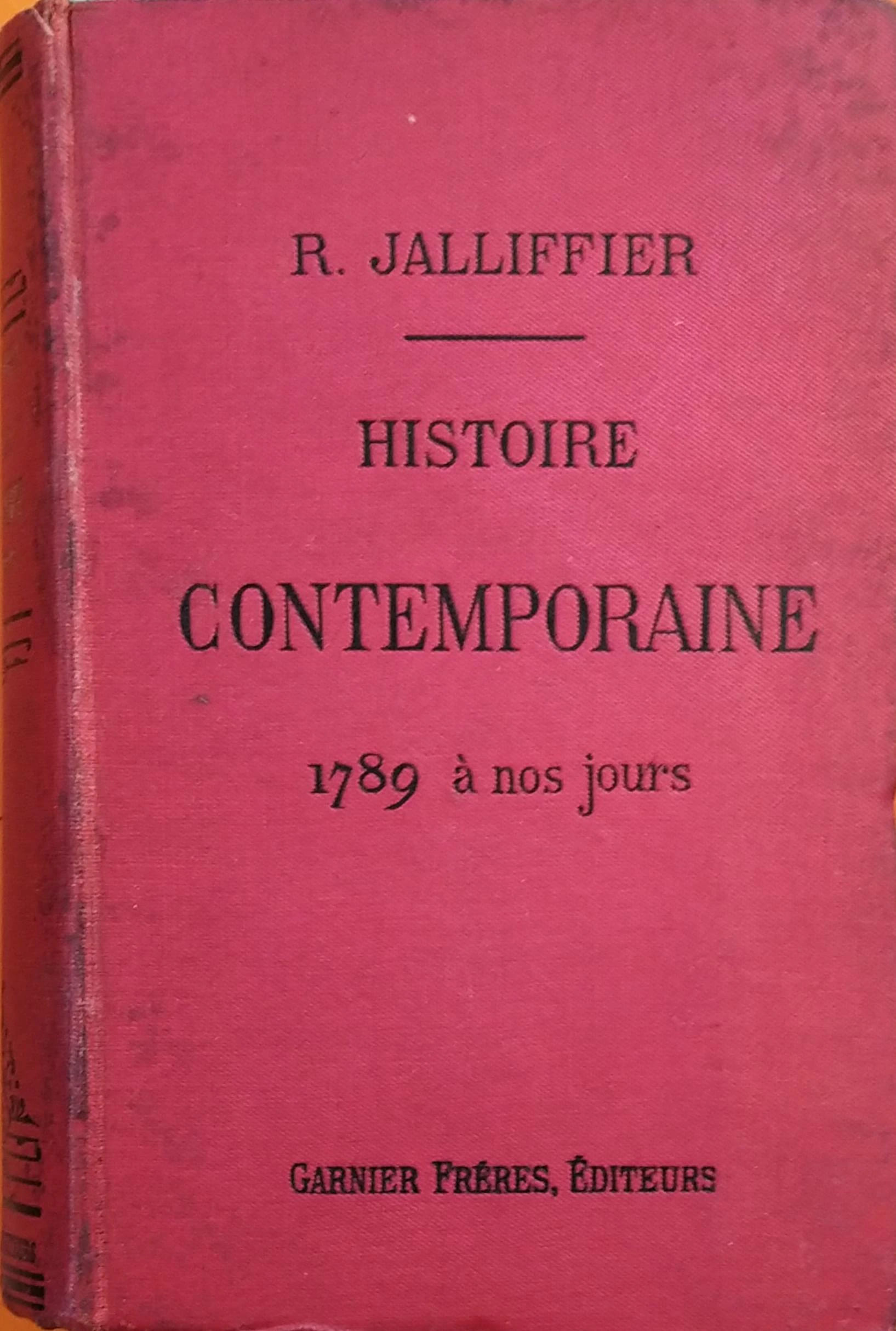
JALLIFFIER R.
Histoire contemporaine de 1789 à nos jours. Classes de Philosophie et de Première moderne
Couverture rigide. Reliure toile de l'éditeur. 1100 pages. 4 cartes dépliantes.
Référence libraire : 150206
|
|
|

 Recevoir par e-mail
 Télécharger en PDF
 Flux RSS
 Lien permanent


