|
Ordnance Survey Ireland
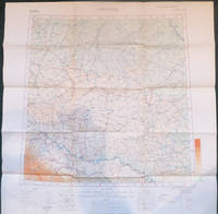
Kilkenny Tipperary Waterford
Sheet map. New. unknown
Référence libraire : ria9781908852014_new ISBN : 1908852011 9781908852014
|
|
|
Ordnance Survey Ireland
Kilkenny Tipperary
Sheet map. New. unknown
Référence libraire : ria9781907122958_new ISBN : 1907122958 9781907122958
|
|
|
Ordnance Survey Ireland
Kilkenny Tipperary Waterford
Sheet map. As New. unknown
Référence libraire : ria9781908852014_rkm ISBN : 1908852011 9781908852014

|
|
|
Ordnance Survey Ireland
Kilkenny Tipperary
Sheet map. As New. unknown
Référence libraire : ria9781907122958_rkm ISBN : 1907122958 9781907122958

|
|
|
Ordnance Survey Ireland
Laois Offaly Tipperary Irish Discovery Series
Ordnance Survey 1999. Paperback. Used; Good. Ex Library. <p><i><strong>Fast Dispatch. Expedited UK Delivery Available. Excellent Customer Service. </strong></i> <br/><br/>Bookbarn International Inventory #3292639</p> Ordnance Survey paperback
Référence libraire : 3292639 ISBN : 1901496600 9781901496604

|
|
|
Ordnance Survey Ireland
Laois Offlay Tipperary
Sheet map folded. New. unknown
Référence libraire : A9781907122576 ISBN : 1907122575 9781907122576

|
|
|
Ordnance Survey Ireland
Laois Offlay Tipperary Irish Discovery Series
Ordnance Survey. Map. New. Ordnance Survey unknown
Référence libraire : __1907122575 ISBN : 1907122575 9781907122576
|
|
|
Ordnance Survey of Northern Ireland
Larne Irish Discoverer Maps Irish Discoverer Series
Ordnance Survey of Northern Ireland. D. Map. Used; Good. Simply Brit Shipped with Premium postal service within 24 hours from the UK with impressive delivery time. We have dispatched from our book depository; items of good condition to over ten million satisfied customers worldwide. We are committed to providing you with reliable and efficient service at all times. 12/01/2005 Ordnance Survey of Northern Ireland unknown
Référence libraire : 2924376 ISBN : 1905306016 9781905306015
|
|
|
Ordnance Survey Ireland
Leitrim Longford Roscommon Sligo Irish Discovery Series
2012-12-17. New. Ships with Tracking Number! INTERNATIONAL WORLDWIDE Shipping available. May be re-issue. Buy with confidence excellent customer service! unknown
Référence libraire : 1907122834n ISBN : 1907122834 9781907122835

|
|
|
Ordnance Survey Ireland
Leitrim Longford Roscommon Sligo
Sheet map folded. New. unknown
Référence libraire : A9781907122835 ISBN : 1907122834 9781907122835

|
|
|
Ordnance Survey Ireland
Leitrim Longford Roscommon Sligo Irish Discovery Series
Ordnance Survey Ireland 2012. Map. New. 4th revised edition edition. 7.32x4.37x0.28 inches. Ordnance Survey Ireland unknown
Référence libraire : 2-1907122834 ISBN : 1907122834 9781907122835
|
|
|
Ordnance Survey Ireland
Leitrim Longford Roscommon Sligo Irish Discovery Series
Ordnance Survey Ireland 2012. Map. New. 4th revised edition edition. 7.32x4.37x0.28 inches. Ordnance Survey Ireland unknown
Référence libraire : __1907122834 ISBN : 1907122834 9781907122835
|
|
|
Ordnance Survey Ireland
Limerick Irish Street Maps
Ordnance Survey of Ireland. Map. GOOD. Spine creases wear to binding and pages from reading. May contain limited notes underlining or highlighting that does affect the text. Possible ex library copy will have the markings and stickers associated from the library. Accessories such as CD codes toys may not be included. Ordnance Survey of Ireland unknown
Référence libraire : 3236985522 ISBN : 1903974720 9781903974728
|
|
|
Ordnance Survey Ireland
Limerick Irish Street Map
2018-02-22. New. Ships with Tracking Number! INTERNATIONAL WORLDWIDE Shipping available. May be re-issue. Buy with confidence excellent customer service! unknown
Référence libraire : 1908852828n ISBN : 1908852828 9781908852823

|
|
|
Ordnance Survey Ireland
Longford Meath Westmeath
Sheet map folded. New. The Discovery Series are designed for tourist and leisure activities. Each one covers an area of 40km x 30km at the scale of 1:50000. There are 93 sheets in the series. 75 are produced by Ordnance Survey Ireland and 18 by Ordnance Survey Northern Ireland. The maps produced by Ordnance Survey Northern Ireland are called the Discoverer Series. unknown
Référence libraire : A9781908852632 ISBN : 1908852631 9781908852632

|
|
|
Ordnance Survey Ireland
Longford Meath Westmeath Discovery Series
Ordnance Survey Ireland 2016. Map. New. 4th revised edition edition. 7.40x4.37x0.59 inches. Ordnance Survey Ireland unknown
Référence libraire : __1908852631 ISBN : 1908852631 9781908852632
|
|
|
Ordnance Survey of Northern Ireland
Lough Erne
Sheet map folded. New. The Lough Erne Activity map has recently received the Gold award for best map at the International Map Trade Association awards. unknown
Référence libraire : A9781905306268 ISBN : 1905306261 9781905306268

|
|
|
Ordnance Survey of Northern Ireland
Lough Neagh: 1: 50000 Discover Series Volume 14
Ordnance Survey of Northern Ireland 1989. Volume 14. This is an ex-library book and may have the usual library/used-book markings inside.This book has soft covers. In fair condition suitable as a study copy. Please note the Image in this listing is a stock photo and may not match the covers of the actual item150grams ISBN: Ordnance Survey of Northern Ireland paperback
Référence libraire : 6606349
|
|
|
Ordnance Survey Ireland
MacGillycuddy's Reeks & Killarney National Park Irish Maps Atlases and Guides
Ordnance Survey Ireland. Map. New. Ordnance Survey Ireland unknown
Référence libraire : 2-1908852267 ISBN : 1908852267 9781908852267
|
|
|
Ordnance Survey Northern Ireland
Map catalogue 1968
Belfast: Her Majesty's Stationery Office 1968. First Edition. Near fine copy in the original stiff-card wrappers; edges very slightly dust-dulled and toned. Remains particularly and surprisingly well-preserved; tight bright clean and especially sharp-cornered. Physical description; v 39 p. ; 25 cm. bijl. Subjects; Ordance Survey of Nothern Ireland. Map Catalogue. 1968. Belfast: Her Majesty's Stationery Office unknown
Référence libraire : 233422

|
|
|
Ordnance Survey of Great Britain and Ireland
Maps of the Balkan Peninsula. Germany. Jitomir. Buda Pest. Bucuresti. Sofiya. Athenai.
Geographical Section General Staff 6 of 7 coloured maps loose within contemporary portfolio each with a small printed label to verso with number with the supplementary sheet: Table of treaties affecting Balkan Boundaries. Maps are:No 1 Jitomir Provisional Ed North M 35 1:1000000 1915 57.359.5 cm GSGS No 2758. No 2 Buda Pest 3rd Provisional Ed North L 34 1:1000000 1918 56.559.2 cm 2758 . No 3 Bucuresti 3rd Provisional Ed North L 35 1:1000000 1918 5760.3 cm GSGS No 2758. No 4 Sofiya 3rd Provisional ed North K 34 1:1000000 1918 5860 cm GSGS No 2758. No 5 Istambul Constantinople North 35 1:1000000 1918 64.563.6 cm 2 small crease tears GSGS No 2555. No 6 Athenai 2nd Provisional Ed North J 34 1:1000000 1917 61.559.6 cm GSGS No 2758. No 7 LACKING Skeleton Map of South East Europe.No 8 Table of Treaties affecting Balkan Boundaries to explain Historical Map 37.232 cm. Very difficult to list COPAC shows the Library of Congress as the only place held although there are a few maps listed individually. Handbooks prepared under the direction of the Historical Section of the Foreign Office No 15. Uncommon. Geographical Section, General Staff paperback
Référence libraire : 006033
|
|
|
Ordnance Survey Ireland
Mayo
Sheet map folded. New. unknown
Référence libraire : A9781908852755 ISBN : 1908852755 9781908852755

|
|
|
Ordnance Survey Ireland
Mayo
Sheet map folded. New. unknown
Référence libraire : A9781908852427 ISBN : 1908852429 9781908852427

|
|
|
Ordnance Survey Ireland
Mayo Discovery Series
Ordnance Survey Ireland 2016. Map. New. 6th revised edition edition. 7.52x4.45x0.55 inches. Ordnance Survey Ireland unknown
Référence libraire : 2-1908852755 ISBN : 1908852755 9781908852755
|
|
|
Ordnance Survey Ireland
Mayo Discovery Series
2016-08-22. New. Ships with Tracking Number! INTERNATIONAL WORLDWIDE Shipping available. May be re-issue. Buy with confidence excellent customer service! unknown
Référence libraire : 1908852755n ISBN : 1908852755 9781908852755
|
|
|
Ordnance Survey Ireland
Mayo Irish Discovery Series
Ordnance Survey Ireland 2015. Map. New. 5th revised edition edition. 9.45x2.36x0.39 inches. Ordnance Survey Ireland unknown
Référence libraire : 2-1908852437 ISBN : 1908852437 9781908852434
|
|
|
Ordnance Survey Ireland
Mayo Irish Discovery Series
Ordnance Survey Ireland. Map. New. Ordnance Survey Ireland unknown
Référence libraire : 2-1908852429 ISBN : 1908852429 9781908852427
|
|
|
Ordnance Survey Ireland
Mayo Irish Discovery Series
Ordnance Survey Ireland. Map. New. Ordnance Survey Ireland unknown
Référence libraire : __1908852429 ISBN : 1908852429 9781908852427
|
|
|
Ordnance Survey Ireland
Mayo Sligo Irish Discovery Series
Ordnance Survey Ireland. Map. New. Ordnance Survey Ireland unknown
Référence libraire : 2-1907122826 ISBN : 1907122826 9781907122828
|
|
|
Ordnance Survey Ireland
Mayo Sligo Irish Discovery Series
2012-12-17. New. Ships with Tracking Number! INTERNATIONAL WORLDWIDE Shipping available. May be re-issue. Buy with confidence excellent customer service! unknown
Référence libraire : 1907122826n ISBN : 1907122826 9781907122828

|
|
|
Ordnance Survey Ireland
Mayo Sligo Irish Discovery Series
2012-12-17. Good. Ships with Tracking Number! INTERNATIONAL WORLDWIDE Shipping available. May not contain Access Codes or Supplements. May be re-issue. May be ex-library. Shipping & Handling by region. Buy with confidence excellent customer service! unknown
Référence libraire : 1907122826 ISBN : 1907122826 9781907122828

|
|
|
Ordnance Survey Ireland
Mayo SW Galway
Sheet map folded. New. unknown
Référence libraire : A9781908852441 ISBN : 1908852445 9781908852441

|
|
|
Ordnance Survey Ireland
Mayo SW Galway Irish Discovery Series
2015-05-21. New. Ships with Tracking Number! INTERNATIONAL WORLDWIDE Shipping available. May be re-issue. Buy with confidence excellent customer service! unknown
Référence libraire : 1908852445n ISBN : 1908852445 9781908852441

|
|
|
Ordnance Survey Ireland
Mayo SW Galway Irish Discovery Series
2015-05-21. Good. Ships with Tracking Number! INTERNATIONAL WORLDWIDE Shipping available. May not contain Access Codes or Supplements. May be re-issue. May be ex-library. Shipping & Handling by region. Buy with confidence excellent customer service! unknown
Référence libraire : 1908852445 ISBN : 1908852445 9781908852441

|
|
|
Ordnance Survey Ireland
Mayo SW Galway Irish Discovery Map
Ordnance Survey 08/01/2000. Map. Used; Good. WE SHIP WITHIN 24 HRS FROM LONDON UK 98% OF OUR ORDERS ARE RECEIVED WITHIN 7-10 DAYS. We believe you will be completely satisfied with our quick and reliable service. All orders are dispatched as swiftly as possible! Buy with confidence! Ordnance Survey unknown
Référence libraire : mon0000852975 ISBN : 1901496384 9781901496383

|
|
|
Ordnance Survey Ireland
Mayo W Cent Irish Discovery Series
Ordnance Survey Ireland 2015. Map. New. 5th revised edition edition. 7.32x4.25x0.31 inches. Ordnance Survey Ireland unknown
Référence libraire : 2-1908852593 ISBN : 1908852593 9781908852595
|
|
|
Ordnance Survey Ireland
Mayo W Cent Irish Discovery Series
Ordnance Survey Ireland 2015. Map. New. 5th revised edition edition. 7.32x4.25x0.31 inches. Ordnance Survey Ireland unknown
Référence libraire : __1908852593 ISBN : 1908852593 9781908852595
|
|
|
Ordnance Survey Ireland
Meath Westmeath
Sheet map folded. New. The Discovery Series are designed for tourist and leisure activities. Each one covers an area of 40km x 30km at the scale of 1:50000. There are 93 sheets in the series. 75 are produced by Ordnance Survey Ireland and 18 by Ordnance Survey Northern Ireland. The maps produced by Ordnance Survey Northern Ireland are called the Discoverer Series. unknown
Référence libraire : A9781908852656 ISBN : 1908852658 9781908852656

|
|
|
Ordnance Survey Ireland
Meath Westmeath Discovery Series
Ordnance Survey Ireland 2016. Map. New. 5th revised edition edition. 7.48x4.37x0.39 inches. Ordnance Survey Ireland unknown
Référence libraire : __1908852658 ISBN : 1908852658 9781908852656
|
|
|
Ordnance Survey Ireland
Meath Westmeath Irish Discovery Series
Ordnance Survey 1998. Paperback. Used; Good. Ex Library. Paperback copy. <p><i><strong>Fast Dispatch. Expedited UK Delivery Available. Excellent Customer Service. </strong></i> <br/><br/>Bookbarn International Inventory #3337624</p> Ordnance Survey paperback
Référence libraire : 3337624 ISBN : 1901496066 9781901496062

|
|
|
ORDNANCE SURVEY OF NORTHERN IRELAND
MID-DOWN. Sheet 10. One-Inch popular series
Ordnance Survey of Northern Ireland 1938 000000000000000. Brown Card covers with original price 3/6. Back cover has some annotation the map itself is near fine. . Ordnance Survey of Northern Ireland , 1938 000000000000000 unknown
Référence libraire : 935 ISBN : 0000000000000 0000000000
|
|
|
Ordnance Survey of Northern Ireland
Mourne Country Outdoor Pursuits
Ordnance Survey 05/01/1994. Map. Used; Good. WE SHIP WITHIN 24 HRS FROM LONDON UK 98% OF OUR ORDERS ARE RECEIVED WITHIN 7-10 DAYS. We believe you will be completely satisfied with our quick and reliable service. All orders are dispatched as swiftly as possible! Buy with confidence! Ordnance Survey unknown
Référence libraire : 3690931 ISBN : 1873819072 9781873819074

|
|
|
Ordnance Survey of Northern Ireland
Mournes Sheet 29 Irish Discoverer Series
2004-12-31. Good. Ships with Tracking Number! INTERNATIONAL WORLDWIDE Shipping available. May not contain Access Codes or Supplements. May be re-issue. May be ex-library. Shipping & Handling by region. Buy with confidence excellent customer service! unknown
Référence libraire : 1873819978 ISBN : 1873819978 9781873819975

|
|
|
Ordnance Survey Ireland
North Leinster Town Maps Irish Maps Atlases and Guides
2007-02-05. New. Ships with Tracking Number! INTERNATIONAL WORLDWIDE Shipping available. May be re-issue. Buy with confidence excellent customer service! unknown
Référence libraire : 1905511000n ISBN : 1905511000 9781905511006

|
|
|
Ordnance Survey Ireland
Offaly Westmeath Irish Discovery Series
Ordnance Survey 1998. Paperback. Used; Good. Ex Library. <p><i><strong>Fast Dispatch. Expedited UK Delivery Available. Excellent Customer Service. </strong></i> <br/><br/>Bookbarn International Inventory #3292641</p> Ordnance Survey paperback
Référence libraire : 3292641 ISBN : 1901496457 9781901496451

|
|
|
Ordnance Survey Ireland
Official Dublin City and District Street Guide 2012/13 Irish - Maps Atlases and Guides
Ordnance Survey Ireland 06/13/2011. Revised edition. Spiral-bound. Used; Good. WE SHIP WITHIN 24 HRS FROM LONDON UK 98% OF OUR ORDERS ARE RECEIVED WITHIN 7-10 DAYS. We believe you will be completely satisfied with our quick and reliable service. All orders are dispatched as swiftly as possible! Buy with confidence! Ordnance Survey Ireland unknown
Référence libraire : 3578922 ISBN : 1907122664 9781907122668
|
|
|
Ordnance Survey Ireland
Official Road Atlas Ireland 2012-2013
2011-03-05. New. Ships with Tracking Number! INTERNATIONAL WORLDWIDE Shipping available. May be re-issue. Buy with confidence excellent customer service! unknown
Référence libraire : 1907122400n ISBN : 1907122400 9781907122408

|
|
|
Ordnance Survey Ireland
Official Road Atlas Ireland 2010-2011
2010-08-05. New. Ships with Tracking Number! INTERNATIONAL WORLDWIDE Shipping available. May be re-issue. Buy with confidence excellent customer service! unknown
Référence libraire : 1907122303n ISBN : 1907122303 9781907122309

|
|
|
Ordnance Survey Ireland
Official Road Atlas Ireland Irish Maps Atlases and Guides
2013-02-03. New. Ships with Tracking Number! INTERNATIONAL WORLDWIDE Shipping available. May be re-issue. Buy with confidence excellent customer service! unknown
Référence libraire : 1908852232n ISBN : 1908852232 9781908852236

|
|
|
Ordnance Survey Ireland
Official Road Atlas Ireland 2010-2011
Ordnance Survey Ireland 2010. Spiral-bound. Acceptable. Disclaimer:A readable copy. All pages are intact and the cover is intact. Pages can include considerable notes-in pen or highlighter-but the notes cannot obscure the text. At ThriftBooks our motto is: Read More Spend Less.Dust jacket quality is not guaranteed. Ordnance Survey Ireland unknown
Référence libraire : G1907122303I5N00 ISBN : 1907122303 9781907122309

|
|
 Recevoir par e-mail
 Télécharger en PDF
 Flux RSS


