|
|
|
MEYNADIER ROBER
LES ETAPES DE LA ROYAUTE D'ALPHONSE XIII
Librairie Académique Perrin et Cie. 1914. In-12. Broché. Bon état, Couv. légèrement passée, Dos satisfaisant, Non coupé. 301 pages. Etiquette de code sur le dos. Tampons et annotation de bibliothèque en page de titre. Quelques rousseurs.. . . . Classification Dewey : 946-Espagne, Portugal
Referencia librero : RO40205072
|
|
|
MEYRELLES Isabel
Anthologie de la poésie portugaise du 12ème au 20ème siècle.
Couverture souple. Broché. 382 pages. Fioritures dans le tableau synchronique et table des matières. Signature sur la couverture. Roussi. Défraîchi.
Referencia librero : 207865

|
|
|
MEYRELLES, Charles.
Anthologie de la Poesie portugaise du XII° au XX° siecle.
in-8 broche de 382 pages. Exemplaire du S.P. en bon etat (couv. et dos salis). [GA-2]
|
|
|
Mgr J. VENANCIO, J.-M. ALONSO, L. CIAPPI, A. RICHARD, J.-J. MOWATT, C. GALAMBRA de OLIVIERA et J. HAFFERT
MARIE SOUS le SYMBOLE du COEUR
Un ouvrage de 189 pages, format 135 x 210 mm, illustré, broché, publié en 1973, Editions Téqui, bon état
Referencia librero : LFA-126748000
|
|
|
MICARD Etienne.
L'héroïque inquiétude de Vasco de Gama.
P. P. Roger 1930. Grand in-8, 284 pages. Broché.
Referencia librero : 48852
|
|
|
MICHAEL HOWARD
Algarve - profile
CHEZ L'AUTEUR. 1984. In-4. Broché. Etat d'usage, Couv. légèrement passée, Dos satisfaisant, Intérieur frais. Environ 45 PAGES illustrées en couleur. . . . Classification Dewey : 946-Espagne, Portugal
Referencia librero : RO20256997

|
|
|
MICHAL Bernard
La guerre d'Espagne. Tome 1, 2, 3
Crémille. 1970. In-12. Relié. Bon état, Couv. convenable, Dos satisfaisant, Intérieur bon état. 3 vol. de 256 p. Reliure éditeur. plats et dos ornés. Nombreuses illustations noir et blanc.. . . . Classification Dewey : 946-Espagne, Portugal
Referencia librero : ROD0030532
|
|
|
MICHAL, Bernard.
La Guerre d'Espagne présentée par Bernard MICHAL.
Crémille. 1970. In-12. Relié. Bon état, Couv. convenable, Dos satisfaisant, Intérieur frais. Genève, Crémille, 1970, 3 volumes in 12, reliure éditeur moderne, photos et cartes.. . . . Classification Dewey : 946-Espagne, Portugal
Referencia librero : R300261997
|
|
|
MICHAËLIS DE VASCONCELLOS, Carolina.
A Infanta Dona Maria de Portugal (1521-1577) e as suas Damas. Ediçao fac-similada de la de Porto, 1902. Prefácio de Americo da Costa Ramalho.
Lisboa, Biblioteca Nacional, 1983. Folio; XXII pp., 122 pp., 2 hs. y cinco láminas con retratos. Alguna corrección en tinta del anterior propietario. Cubiertas originales.

|
|
|
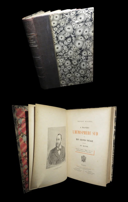
MICHEL (Ernest).
A travers l'hémisphère sud ou Mon second voyage autour du monde (Portugal - Sénégal - Brésil - Uruguay - Argentine - Chili - Pérou).
Paris, Bruxelles, Genève, Libraire Victor Palmé / Société belge de Librairie / Henri Trembley, s.d. [1887 / 1888]. Un vol. au format in-8 (248 x 165 mm) de 1 f. bl., 2 ff. n.fol., 1 frontispice n.fol., xi - 390 pp. et 1 f. bl. Reliure de l'époque de demi-chagrin maroquiné tabac, double filet doré porté sur les plats, dos à nerfs orné de filets gras et maigres en noir, filet maigre doré sur les nerfs, titre doré, tranches mouchetées.
Referencia librero : 32599
|
|
|
MICHEL (Ernest).
A travers l'Hémisphère Sud, ou mon second voyage autour du monde : Portugal, Sénégal, Brésil, Uruguay, République Argentine, Chili, Pérou.
P., Victor Palmé, 1887, fort in-8°, xi-388 pp, un portrait de l'auteur en frontispice et 42 gravures dans le texte et hors texte, reliure percaline rouge décorée noir et or de l'éditeur, coupes bisautées, tranches dorées, dos passé et lég. sali, qqs rares rousseurs (plus prononcées sur les premiers feuillets), bon état
Referencia librero : 120087
|
|
|
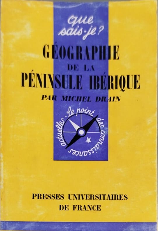
Michel Drain
Géographie de la péninsule ibérique
Presses Universitaires de France 1964 collection que sais je n° 1091. poche. 1964. broché. Ouvrage de géographie régionale analysant la péninsule ibérique structuré autour de l'opposition fondamentale entre l'intérieur des terres et ses façades maritimes. L'auteur Michel Drain allie une démarche précise et actualisée avec une prise en compte essentielle du passé pour la compréhension du présent
Referencia librero : 7398
|
|
|
Michel Pétuaud-Létang
Séville 2012 - une histoire, un futur
A EDITIONS. 1992. In-4. Broché. Bon état, Couv. convenable, Dos satisfaisant, Intérieur frais. 184 PAGES augmentées de nombreuses illustrations en noir/blanc et couleur, dans et hors texte. Couverture contrepliée. . . . Classification Dewey : 946-Espagne, Portugal
Referencia librero : RO20269523

|
|
|
MICHEL Raoul J, QUINCY Jacques
Espana, Bella Desconocida en 45 Mapas
Fernand Nathan. 1950 c.. In-8. Broché. Etat d'usage, Couv. légèrement passée, Dos satisfaisant, Intérieur bon état. 45 cartes n&b - Quelques rousseurs sur la page de titre.. . . . Classification Dewey : 946-Espagne, Portugal
Referencia librero : ROD0027757
|
|
|
MICHEL TORRES BALFAGON.
EL MUNDO DE LOS NEGOCIOS.
Langues et affaires.. 1988.. In-8. Cartonné. Bon état, Couv. convenable, Dos satisfaisant, Intérieur acceptable. 343 pages. 1ère de couverture illustrée en couleurs. Ecritures au stylo sur les 3 tranches de l'ouvrage. Etiquette sur le dos de l'ouvrage. Tampon sur la page de titre. Scotch sur la 2nde de couverture et sur la page de garde.. . . . Classification Dewey : 946-Espagne, Portugal
Referencia librero : RO20079198

|
|
|
MICHELE RODDLE / MICHELE AFFERGAN
VOIR L'ESPAGNE
HACHETTE. 1972. In-4. Relié toilé. Bon état, Couv. convenable, Dos satisfaisant, Intérieur frais. 152 pages. Nombreuses photos en couleurs et en noir et blanc, dans le texte et hors texte.. . Sous Emboitage. . Classification Dewey : 946-Espagne, Portugal
Referencia librero : RO20138331
|
|
|
MICHELE, Antonio.
Thesouro da Lingua Italiana, ou seja Méthodo para aprendella facilmente. [Seguido de:] Elementos de Conversação Italiana e Portugueza.
Lisboa, na Nova Officina de João Rodrigues Neves, 1807. 4to.; 1 h., 151 pp. + 140 pp. Enccuadernación en piel marbreada, de la época.

|
|
|
MICHELIN.
Guide rouge Michelin Espagne Portugal. 1974.
Clermont-Ferrand, Michelin, 1973, in-8 étroit, cartonnage toilé rouge éd., 381 pp., très nb. cartes en coul. et plans de villes, Le guide rouge des hôtels et des restaurants pour l'Espagne et le Portugal. Très bon état
Referencia librero : 63354
|
|
|
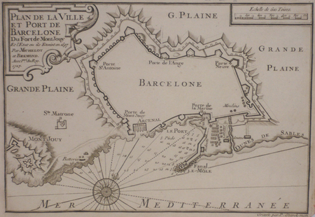
MICHELOT & BREMOND;
[BARCELONE] Plan de la ville et port de Barcelone du fort de Mont Jouy.
1727 174 x 254 mm.
Referencia librero : LBW024f1
|
|
|
MICHELOT & BREMOND;
[CATALOGNE/CADAQUES] Plan du port de Cadequié en Catalogne.
1727 173 x 251 mm.
Referencia librero : LBW024f3
|
|
|
MICHELOT & BREMOND;
[CATALOGNE/ROSES] Plan de la baye et citadelle de Rose et de Tourrille.
1727 172 x 251 mm.
Referencia librero : LBW024f2
|
|
|
MICHELOT & Laurent BREMOND Henry
Partie de l'Isle d'Ivice, et des Isles Fromentieres
Carta nautica tratta dal raro Recueil de Plusiereurs Plans des Ports et Rades de la Mer Mediterranée Dediée A Monseigneur le Grand Prieur de France, General des Galeres Levé et Dessigné sur les Lieux par les Srs. Michelot Hydrographe et Pilote Real des Galeres du Roy et Bremond Hydrographe du Roy et de la Ville, avec Pri.ge Du Roy (1727), atlante nautico di 37 tavole, stampato a Marsiglia. I piani nautici sono incisi da Pieter Starckman, uno dei più attivi intagliatori dell’epoca, collaboratore di molti cartografi ed editori. Secondo Shirley [cfr. Maps in the Atlases of the British Library, p. 1234] la prima edizione dell’opera contiene 21 tavole, mentre la ristampa, senza data, contiene 37 tavole delle quali alcune datate 1730. La terza, e ultima, contiene 38 tavole e reca la data 1732. Henry Michelot, dopo il successo riscosso con la pubblicazione della sua guida nautica Le Portulan de Partie de la Mer Méditerranée, ou Le vray Guide des Pilotes Costiers (1703), si unì a Laurent Bremond. All’inizio del XVIII secolo Henry Michelot e Laurens Bremond pubblicarono due importanti atlanti nautici del Mediterraneo e piani nautici ampiamente utilizzati dai naviganti costieri. Le carte sono interessanti e importanti per l’attendibilità derivata dall’esperienza di Michelot che, a differenza dei successivi “geografi del Dépôt des cartes et plans de la Marine” come Jacques-Nicolas Bellin, ha avuto una lunga esperienza in mare. Il primo atlante prodotto contiene 16 carte, su piccola scala, del Mediterraneo e della costa atlantica in prossimità dello stretto di Gibilterra, integrate da una o più profili costieri. Le date delle carte sono comprese tra il 1715 e il 1726; in questo periodo Michelot si firmava come Hydrographe et Pilote Real des Galères du Roy (idrografo e pilota della cambusa reale per il corpo della galea dei re). Poco si sa del co-creatore dell’opera Laurent Bremond. Nella raccolta nautica il suo nome succede sempre a quello di Michelot, e viene qualificato come Hydrographe du Roy et de la Ville (idrografo del re e della città). Bremond sembrerebbe essere stato l’editore e il venditore della raccolta nautica, la forza commerciale della società; titolare di una sorta di negozio vicino al porto. Tutte le carte sono chiaramente contrassegnate: Ce vendent a Marseille chez Laurens Bremond sur le Port au coin de Reboul (venduto a Marsiglia da Laurens Bremond nel porto all’angolo di Reboul). Incisione in rame, in ottimo stato di conservazione. Bibliografia S. Bifolco, Mare Nostrum (2019), pp. 270-271, tav. 122; Palau, 168325. Tooley, 438,80. Nautical chart taken from the rare Recueil de Plusiereurs Plans des Ports et Rades de la Mer Mediterranée Dediée A Monseigneur le Grand Prieur de France, General des Galeres Levé et Dessigné sur les Lieux par les Srs. Michelot Hydrographe et Pilote Real des Galeres du Roy et Bremond Hydrographe du Roy et de la Ville, avec Pri.ge Du Roy (1727), nautical atlas of 37 plates, printed in Marseilles. The nautical plans are engraved by Pieter Starckman, one of the most active engravers of the time, collaborator of many cartographers and publishers. According to Shirley [see Maps in the Atlases of the British Library, p. 1234] the first edition of the work contains 21 plates, while the reprint, undated, contains 37 plates, some of which are dated 1730. The third and last edition contains 38 plates and is dated 1732. Henry Michelot, after the success achieved with the publication of his nautical guide Le Portulan de Partie de la Mer Méditerranée, ou Le vray Guide des Pilotes Costiers (1703), joined Laurent Bremond. In the early 18th century Henry Michelot and Laurens Bremond published two important nautical atlases of the Mediterranean and nautical plans widely used by coastal mariners. The charts are interesting and important for the reliability derived from the experience of Michelot who, unlike later "geographers of the Dépôt des cartes et plans de la Marine" such as Jacques-Nicolas Bellin, had long experience at sea. The first atlas produced contains 16 maps, on a small scale, of the Mediterranean and the Atlantic coast near the Strait of Gibraltar, supplemented by one or more coastal profiles. The dates of the charts are between 1715 and 1726; at this time Michelot signed himself as Hydrographe et Pilote Real des Galères du Roy (hydrographer and pilot of the royal galley for the kings' galley corps). Little is known about the co-creator of the work Laurent Bremond. In the nautical collection his name always succeeds that of Michelot, and he is qualified as Hydrographe du Roy et de la Ville (hydrographer of the king and the city). Bremond would seem to have been the publisher and seller of the nautical collection, the commercial force of the company; owner of a sort of store near the port. All charts are clearly marked: Ce vendent a Marseille chez Laurens Bremond sur le Port au coin de Reboul (sold in Marseille by Laurens Bremond in the port at the corner of Reboul). Copper engraving, in excellent condition. Literature S. Bifolco, Mare Nostrum (2019), pp. 270-271, tav. 122; Palau, 168325. Tooley, 438.80.

|
|
|
MICHELOT & Laurent BREMOND Henry
Plan de la Baye de Gibraltar
Carta nautica tratta dal raro Recueil de Plusiereurs Plans des Ports et Rades de la Mer Mediterranée Dediée A Monseigneur le Grand Prieur de France, General des Galeres Levé et Dessigné sur les Lieux par les Srs. Michelot Hydrographe et Pilote Real des Galeres du Roy et Bremond Hydrographe du Roy et de la Ville, avec Pri.ge Du Roy (1727), atlante nautico di 37 tavole, stampato a Marsiglia. I piani nautici sono incisi da Pieter Starckman, uno dei più attivi intagliatori dell’epoca, collaboratore di molti cartografi ed editori. Secondo Shirley [cfr. Maps in the Atlases of the British Library, p. 1234] la prima edizione dell’opera contiene 21 tavole, mentre la ristampa, senza data, contiene 37 tavole delle quali alcune datate 1730. La terza, e ultima, contiene 38 tavole e reca la data 1732. Henry Michelot, dopo il successo riscosso con la pubblicazione della sua guida nautica Le Portulan de Partie de la Mer Méditerranée, ou Le vray Guide des Pilotes Costiers (1703), si unì a Laurent Bremond. All’inizio del XVIII secolo Henry Michelot e Laurens Bremond pubblicarono due importanti atlanti nautici del Mediterraneo e piani nautici ampiamente utilizzati dai naviganti costieri. Le carte sono interessanti e importanti per l’attendibilità derivata dall’esperienza di Michelot che, a differenza dei successivi “geografi del Dépôt des cartes et plans de la Marine” come Jacques-Nicolas Bellin, ha avuto una lunga esperienza in mare. Il primo atlante prodotto contiene 16 carte, su piccola scala, del Mediterraneo e della costa atlantica in prossimità dello stretto di Gibilterra, integrate da una o più profili costieri. Le date delle carte sono comprese tra il 1715 e il 1726; in questo periodo Michelot si firmava come Hydrographe et Pilote Real des Galères du Roy (idrografo e pilota della cambusa reale per il corpo della galea dei re). Poco si sa del co-creatore dell’opera Laurent Bremond. Nella raccolta nautica il suo nome succede sempre a quello di Michelot, e viene qualificato come Hydrographe du Roy et de la Ville (idrografo del re e della città). Bremond sembrerebbe essere stato l’editore e il venditore della raccolta nautica, la forza commerciale della società; titolare di una sorta di negozio vicino al porto. Tutte le carte sono chiaramente contrassegnate: Ce vendent a Marseille chez Laurens Bremond sur le Port au coin de Reboul (venduto a Marsiglia da Laurens Bremond nel porto all’angolo di Reboul). Incisione in rame, in ottimo stato di conservazione. Bibliografia S. Bifolco, Mare Nostrum (2019), pp. 270-271, tav. 122; Palau, 168325. Tooley, 438,80. Nautical chart taken from the rare Recueil de Plusiereurs Plans des Ports et Rades de la Mer Mediterranée Dediée A Monseigneur le Grand Prieur de France, General des Galeres Levé et Dessigné sur les Lieux par les Srs. Michelot Hydrographe et Pilote Real des Galeres du Roy et Bremond Hydrographe du Roy et de la Ville, avec Pri.ge Du Roy (1727), nautical atlas of 37 plates, printed in Marseilles. The nautical plans are engraved by Pieter Starckman, one of the most active engravers of the time, collaborator of many cartographers and publishers. According to Shirley [see Maps in the Atlases of the British Library, p. 1234] the first edition of the work contains 21 plates, while the reprint, undated, contains 37 plates, some of which are dated 1730. The third and last edition contains 38 plates and is dated 1732. Henry Michelot, after the success achieved with the publication of his nautical guide Le Portulan de Partie de la Mer Méditerranée, ou Le vray Guide des Pilotes Costiers (1703), joined Laurent Bremond. In the early 18th century Henry Michelot and Laurens Bremond published two important nautical atlases of the Mediterranean and nautical plans widely used by coastal mariners. The charts are interesting and important for the reliability derived from the experience of Michelot who, unlike later "geographers of the Dépôt des cartes et plans de la Marine" such as Jacques-Nicolas Bellin, had long experience at sea. The first atlas produced contains 16 maps, on a small scale, of the Mediterranean and the Atlantic coast near the Strait of Gibraltar, supplemented by one or more coastal profiles. The dates of the charts are between 1715 and 1726; at this time Michelot signed himself as Hydrographe et Pilote Real des Galères du Roy (hydrographer and pilot of the royal galley for the kings' galley corps). Little is known about the co-creator of the work Laurent Bremond. In the nautical collection his name always succeeds that of Michelot, and he is qualified as Hydrographe du Roy et de la Ville (hydrographer of the king and the city). Bremond would seem to have been the publisher and seller of the nautical collection, the commercial force of the company; owner of a sort of store near the port. All charts are clearly marked: Ce vendent a Marseille chez Laurens Bremond sur le Port au coin de Reboul (sold in Marseille by Laurens Bremond in the port at the corner of Reboul). Copper engraving, in excellent condition. Literature S. Bifolco, Mare Nostrum (2019), pp. 270-271, tav. 122; Palau, 168325. Tooley, 438.80.

|
|
|
MICHELOT & Laurent BREMOND Henry
Plan de la Baye et Citadelle de Rose et de Tourrille.
Carta nautica tratta dal raro Recueil de Plusiereurs Plans des Ports et Rades de la Mer Mediterranée Dediée A Monseigneur le Grand Prieur de France, General des Galeres Levé et Dessigné sur les Lieux par les Srs. Michelot Hydrographe et Pilote Real des Galeres du Roy et Bremond Hydrographe du Roy et de la Ville, avec Pri.ge Du Roy (1727), atlante nautico di 37 tavole, stampato a Marsiglia. I piani nautici sono incisi da Pieter Starckman, uno dei più attivi intagliatori dell’epoca, collaboratore di molti cartografi ed editori. Secondo Shirley [cfr. Maps in the Atlases of the British Library, p. 1234] la prima edizione dell’opera contiene 21 tavole, mentre la ristampa, senza data, contiene 37 tavole delle quali alcune datate 1730. La terza, e ultima, contiene 38 tavole e reca la data 1732. Henry Michelot, dopo il successo riscosso con la pubblicazione della sua guida nautica Le Portulan de Partie de la Mer Méditerranée, ou Le vray Guide des Pilotes Costiers (1703), si unì a Laurent Bremond. All’inizio del XVIII secolo Henry Michelot e Laurens Bremond pubblicarono due importanti atlanti nautici del Mediterraneo e piani nautici ampiamente utilizzati dai naviganti costieri. Le carte sono interessanti e importanti per l’attendibilità derivata dall’esperienza di Michelot che, a differenza dei successivi “geografi del Dépôt des cartes et plans de la Marine” come Jacques-Nicolas Bellin, ha avuto una lunga esperienza in mare. Il primo atlante prodotto contiene 16 carte, su piccola scala, del Mediterraneo e della costa atlantica in prossimità dello stretto di Gibilterra, integrate da una o più profili costieri. Le date delle carte sono comprese tra il 1715 e il 1726; in questo periodo Michelot si firmava come Hydrographe et Pilote Real des Galères du Roy (idrografo e pilota della cambusa reale per il corpo della galea dei re). Poco si sa del co-creatore dell’opera Laurent Bremond. Nella raccolta nautica il suo nome succede sempre a quello di Michelot, e viene qualificato come Hydrographe du Roy et de la Ville (idrografo del re e della città). Bremond sembrerebbe essere stato l’editore e il venditore della raccolta nautica, la forza commerciale della società; titolare di una sorta di negozio vicino al porto. Tutte le carte sono chiaramente contrassegnate: Ce vendent a Marseille chez Laurens Bremond sur le Port au coin de Reboul (venduto a Marsiglia da Laurens Bremond nel porto all’angolo di Reboul). Incisione in rame, in ottimo stato di conservazione. Bibliografia S. Bifolco, Mare Nostrum (2019), pp. 270-271, tav. 122; Palau, 168325. Tooley, 438,80. Nautical chart taken from the rare Recueil de Plusiereurs Plans des Ports et Rades de la Mer Mediterranée Dediée A Monseigneur le Grand Prieur de France, General des Galeres Levé et Dessigné sur les Lieux par les Srs. Michelot Hydrographe et Pilote Real des Galeres du Roy et Bremond Hydrographe du Roy et de la Ville, avec Pri.ge Du Roy (1727), nautical atlas of 37 plates, printed in Marseilles. The nautical plans are engraved by Pieter Starckman, one of the most active engravers of the time, collaborator of many cartographers and publishers. According to Shirley [see Maps in the Atlases of the British Library, p. 1234] the first edition of the work contains 21 plates, while the reprint, undated, contains 37 plates, some of which are dated 1730. The third and last edition contains 38 plates and is dated 1732. Henry Michelot, after the success achieved with the publication of his nautical guide Le Portulan de Partie de la Mer Méditerranée, ou Le vray Guide des Pilotes Costiers (1703), joined Laurent Bremond. In the early 18th century Henry Michelot and Laurens Bremond published two important nautical atlases of the Mediterranean and nautical plans widely used by coastal mariners. The charts are interesting and important for the reliability derived from the experience of Michelot who, unlike later "geographers of the Dépôt des cartes et plans de la Marine" such as Jacques-Nicolas Bellin, had long experience at sea. The first atlas produced contains 16 maps, on a small scale, of the Mediterranean and the Atlantic coast near the Strait of Gibraltar, supplemented by one or more coastal profiles. The dates of the charts are between 1715 and 1726; at this time Michelot signed himself as Hydrographe et Pilote Real des Galères du Roy (hydrographer and pilot of the royal galley for the kings' galley corps). Little is known about the co-creator of the work Laurent Bremond. In the nautical collection his name always succeeds that of Michelot, and he is qualified as Hydrographe du Roy et de la Ville (hydrographer of the king and the city). Bremond would seem to have been the publisher and seller of the nautical collection, the commercial force of the company; owner of a sort of store near the port. All charts are clearly marked: Ce vendent a Marseille chez Laurens Bremond sur le Port au coin de Reboul (sold in Marseille by Laurens Bremond in the port at the corner of Reboul). Copper engraving, in excellent condition. Literature S. Bifolco, Mare Nostrum (2019), pp. 270-271, tav. 122; Palau, 168325. Tooley, 438.80.

|
|
|
MICHELOT & Laurent BREMOND Henry
Plan de la Baye et Rade de Cadis et des environs
Carta nautica tratta dal raro Recueil de Plusiereurs Plans des Ports et Rades de la Mer Mediterranée Dediée A Monseigneur le Grand Prieur de France, General des Galeres Levé et Dessigné sur les Lieux par les Srs. Michelot Hydrographe et Pilote Real des Galeres du Roy et Bremond Hydrographe du Roy et de la Ville, avec Pri.ge Du Roy (1727), atlante nautico di 37 tavole, stampato a Marsiglia. I piani nautici sono incisi da Pieter Starckman, uno dei più attivi intagliatori dell’epoca, collaboratore di molti cartografi ed editori. Secondo Shirley [cfr. Maps in the Atlases of the British Library, p. 1234] la prima edizione dell’opera contiene 21 tavole, mentre la ristampa, senza data, contiene 37 tavole delle quali alcune datate 1730. La terza, e ultima, contiene 38 tavole e reca la data 1732. Henry Michelot, dopo il successo riscosso con la pubblicazione della sua guida nautica Le Portulan de Partie de la Mer Méditerranée, ou Le vray Guide des Pilotes Costiers (1703), si unì a Laurent Bremond. All’inizio del XVIII secolo Henry Michelot e Laurens Bremond pubblicarono due importanti atlanti nautici del Mediterraneo e piani nautici ampiamente utilizzati dai naviganti costieri. Le carte sono interessanti e importanti per l’attendibilità derivata dall’esperienza di Michelot che, a differenza dei successivi “geografi del Dépôt des cartes et plans de la Marine” come Jacques-Nicolas Bellin, ha avuto una lunga esperienza in mare. Il primo atlante prodotto contiene 16 carte, su piccola scala, del Mediterraneo e della costa atlantica in prossimità dello stretto di Gibilterra, integrate da una o più profili costieri. Le date delle carte sono comprese tra il 1715 e il 1726; in questo periodo Michelot si firmava come Hydrographe et Pilote Real des Galères du Roy (idrografo e pilota della cambusa reale per il corpo della galea dei re). Poco si sa del co-creatore dell’opera Laurent Bremond. Nella raccolta nautica il suo nome succede sempre a quello di Michelot, e viene qualificato come Hydrographe du Roy et de la Ville (idrografo del re e della città). Bremond sembrerebbe essere stato l’editore e il venditore della raccolta nautica, la forza commerciale della società; titolare di una sorta di negozio vicino al porto. Tutte le carte sono chiaramente contrassegnate: Ce vendent a Marseille chez Laurens Bremond sur le Port au coin de Reboul (venduto a Marsiglia da Laurens Bremond nel porto all’angolo di Reboul). Incisione in rame, in ottimo stato di conservazione. Bibliografia S. Bifolco, Mare Nostrum (2019), pp. 270-271, tav. 122; Palau, 168325. Tooley, 438,80. Nautical chart taken from the rare Recueil de Plusiereurs Plans des Ports et Rades de la Mer Mediterranée Dediée A Monseigneur le Grand Prieur de France, General des Galeres Levé et Dessigné sur les Lieux par les Srs. Michelot Hydrographe et Pilote Real des Galeres du Roy et Bremond Hydrographe du Roy et de la Ville, avec Pri.ge Du Roy (1727), nautical atlas of 37 plates, printed in Marseilles. The nautical plans are engraved by Pieter Starckman, one of the most active engravers of the time, collaborator of many cartographers and publishers. According to Shirley [see Maps in the Atlases of the British Library, p. 1234] the first edition of the work contains 21 plates, while the reprint, undated, contains 37 plates, some of which are dated 1730. The third and last edition contains 38 plates and is dated 1732. Henry Michelot, after the success achieved with the publication of his nautical guide Le Portulan de Partie de la Mer Méditerranée, ou Le vray Guide des Pilotes Costiers (1703), joined Laurent Bremond. In the early 18th century Henry Michelot and Laurens Bremond published two important nautical atlases of the Mediterranean and nautical plans widely used by coastal mariners. The charts are interesting and important for the reliability derived from the experience of Michelot who, unlike later "geographers of the Dépôt des cartes et plans de la Marine" such as Jacques-Nicolas Bellin, had long experience at sea. The first atlas produced contains 16 maps, on a small scale, of the Mediterranean and the Atlantic coast near the Strait of Gibraltar, supplemented by one or more coastal profiles. The dates of the charts are between 1715 and 1726; at this time Michelot signed himself as Hydrographe et Pilote Real des Galères du Roy (hydrographer and pilot of the royal galley for the kings' galley corps). Little is known about the co-creator of the work Laurent Bremond. In the nautical collection his name always succeeds that of Michelot, and he is qualified as Hydrographe du Roy et de la Ville (hydrographer of the king and the city). Bremond would seem to have been the publisher and seller of the nautical collection, the commercial force of the company; owner of a sort of store near the port. All charts are clearly marked: Ce vendent a Marseille chez Laurens Bremond sur le Port au coin de Reboul (sold in Marseille by Laurens Bremond in the port at the corner of Reboul). Copper engraving, in excellent condition. Literature S. Bifolco, Mare Nostrum (2019), pp. 270-271, tav. 122; Palau, 168325. Tooley, 438.80.

|
|
|
MICHELOT & Laurent BREMOND Henry
Plan de la Baye et Rades du Sofa.
Carta nautica tratta dal raro Recueil de Plusiereurs Plans des Ports et Rades de la Mer Mediterranée Dediée A Monseigneur le Grand Prieur de France, General des Galeres Levé et Dessigné sur les Lieux par les Srs. Michelot Hydrographe et Pilote Real des Galeres du Roy et Bremond Hydrographe du Roy et de la Ville, avec Pri.ge Du Roy (1727), atlante nautico di 37 tavole, stampato a Marsiglia. I piani nautici sono incisi da Pieter Starckman, uno dei più attivi intagliatori dell’epoca, collaboratore di molti cartografi ed editori. Secondo Shirley [cfr. Maps in the Atlases of the British Library, p. 1234] la prima edizione dell’opera contiene 21 tavole, mentre la ristampa, senza data, contiene 37 tavole delle quali alcune datate 1730. La terza, e ultima, contiene 38 tavole e reca la data 1732. Henry Michelot, dopo il successo riscosso con la pubblicazione della sua guida nautica Le Portulan de Partie de la Mer Méditerranée, ou Le vray Guide des Pilotes Costiers (1703), si unì a Laurent Bremond. All’inizio del XVIII secolo Henry Michelot e Laurens Bremond pubblicarono due importanti atlanti nautici del Mediterraneo e piani nautici ampiamente utilizzati dai naviganti costieri. Le carte sono interessanti e importanti per l’attendibilità derivata dall’esperienza di Michelot che, a differenza dei successivi “geografi del Dépôt des cartes et plans de la Marine” come Jacques-Nicolas Bellin, ha avuto una lunga esperienza in mare. Il primo atlante prodotto contiene 16 carte, su piccola scala, del Mediterraneo e della costa atlantica in prossimità dello stretto di Gibilterra, integrate da una o più profili costieri. Le date delle carte sono comprese tra il 1715 e il 1726; in questo periodo Michelot si firmava come Hydrographe et Pilote Real des Galères du Roy (idrografo e pilota della cambusa reale per il corpo della galea dei re). Poco si sa del co-creatore dell’opera Laurent Bremond. Nella raccolta nautica il suo nome succede sempre a quello di Michelot, e viene qualificato come Hydrographe du Roy et de la Ville (idrografo del re e della città). Bremond sembrerebbe essere stato l’editore e il venditore della raccolta nautica, la forza commerciale della società; titolare di una sorta di negozio vicino al porto. Tutte le carte sono chiaramente contrassegnate: Ce vendent a Marseille chez Laurens Bremond sur le Port au coin de Reboul (venduto a Marsiglia da Laurens Bremond nel porto all’angolo di Reboul). Incisione in rame, in ottimo stato di conservazione. Bibliografia S. Bifolco, Mare Nostrum (2019), pp. 270-271, tav. 122; Palau, 168325. Tooley, 438,80. Nautical chart taken from the rare Recueil de Plusiereurs Plans des Ports et Rades de la Mer Mediterranée Dediée A Monseigneur le Grand Prieur de France, General des Galeres Levé et Dessigné sur les Lieux par les Srs. Michelot Hydrographe et Pilote Real des Galeres du Roy et Bremond Hydrographe du Roy et de la Ville, avec Pri.ge Du Roy (1727), nautical atlas of 37 plates, printed in Marseilles. The nautical plans are engraved by Pieter Starckman, one of the most active engravers of the time, collaborator of many cartographers and publishers. According to Shirley [see Maps in the Atlases of the British Library, p. 1234] the first edition of the work contains 21 plates, while the reprint, undated, contains 37 plates, some of which are dated 1730. The third and last edition contains 38 plates and is dated 1732. Henry Michelot, after the success achieved with the publication of his nautical guide Le Portulan de Partie de la Mer Méditerranée, ou Le vray Guide des Pilotes Costiers (1703), joined Laurent Bremond. In the early 18th century Henry Michelot and Laurens Bremond published two important nautical atlases of the Mediterranean and nautical plans widely used by coastal mariners. The charts are interesting and important for the reliability derived from the experience of Michelot who, unlike later "geographers of the Dépôt des cartes et plans de la Marine" such as Jacques-Nicolas Bellin, had long experience at sea. The first atlas produced contains 16 maps, on a small scale, of the Mediterranean and the Atlantic coast near the Strait of Gibraltar, supplemented by one or more coastal profiles. The dates of the charts are between 1715 and 1726; at this time Michelot signed himself as Hydrographe et Pilote Real des Galères du Roy (hydrographer and pilot of the royal galley for the kings' galley corps). Little is known about the co-creator of the work Laurent Bremond. In the nautical collection his name always succeeds that of Michelot, and he is qualified as Hydrographe du Roy et de la Ville (hydrographer of the king and the city). Bremond would seem to have been the publisher and seller of the nautical collection, the commercial force of the company; owner of a sort of store near the port. All charts are clearly marked: Ce vendent a Marseille chez Laurens Bremond sur le Port au coin de Reboul (sold in Marseille by Laurens Bremond in the port at the corner of Reboul). Copper engraving, in excellent condition. Literature S. Bifolco, Mare Nostrum (2019), pp. 270-271, tav. 122; Palau, 168325. Tooley, 438.80.

|
|
|
MICHELOT & Laurent BREMOND Henry
Plan de la Rade d'Ascombrera
Carta nautica tratta dal raro Recueil de Plusiereurs Plans des Ports et Rades de la Mer Mediterranée Dediée A Monseigneur le Grand Prieur de France, General des Galeres Levé et Dessigné sur les Lieux par les Srs. Michelot Hydrographe et Pilote Real des Galeres du Roy et Bremond Hydrographe du Roy et de la Ville, avec Pri.ge Du Roy (1727), atlante nautico di 37 tavole, stampato a Marsiglia. I piani nautici sono incisi da Pieter Starckman, uno dei più attivi intagliatori dell’epoca, collaboratore di molti cartografi ed editori. Secondo Shirley [cfr. Maps in the Atlases of the British Library, p. 1234] la prima edizione dell’opera contiene 21 tavole, mentre la ristampa, senza data, contiene 37 tavole delle quali alcune datate 1730. La terza, e ultima, contiene 38 tavole e reca la data 1732. Henry Michelot, dopo il successo riscosso con la pubblicazione della sua guida nautica Le Portulan de Partie de la Mer Méditerranée, ou Le vray Guide des Pilotes Costiers (1703), si unì a Laurent Bremond. All’inizio del XVIII secolo Henry Michelot e Laurens Bremond pubblicarono due importanti atlanti nautici del Mediterraneo e piani nautici ampiamente utilizzati dai naviganti costieri. Le carte sono interessanti e importanti per l’attendibilità derivata dall’esperienza di Michelot che, a differenza dei successivi “geografi del Dépôt des cartes et plans de la Marine” come Jacques-Nicolas Bellin, ha avuto una lunga esperienza in mare. Il primo atlante prodotto contiene 16 carte, su piccola scala, del Mediterraneo e della costa atlantica in prossimità dello stretto di Gibilterra, integrate da una o più profili costieri. Le date delle carte sono comprese tra il 1715 e il 1726; in questo periodo Michelot si firmava come Hydrographe et Pilote Real des Galères du Roy (idrografo e pilota della cambusa reale per il corpo della galea dei re). Poco si sa del co-creatore dell’opera Laurent Bremond. Nella raccolta nautica il suo nome succede sempre a quello di Michelot, e viene qualificato come Hydrographe du Roy et de la Ville (idrografo del re e della città). Bremond sembrerebbe essere stato l’editore e il venditore della raccolta nautica, la forza commerciale della società; titolare di una sorta di negozio vicino al porto. Tutte le carte sono chiaramente contrassegnate: Ce vendent a Marseille chez Laurens Bremond sur le Port au coin de Reboul (venduto a Marsiglia da Laurens Bremond nel porto all’angolo di Reboul). Incisione in rame, in ottimo stato di conservazione. Bibliografia S. Bifolco, Mare Nostrum (2019), pp. 270-271, tav. 122; Palau, 168325. Tooley, 438,80. Nautical chart taken from the rare Recueil de Plusiereurs Plans des Ports et Rades de la Mer Mediterranée Dediée A Monseigneur le Grand Prieur de France, General des Galeres Levé et Dessigné sur les Lieux par les Srs. Michelot Hydrographe et Pilote Real des Galeres du Roy et Bremond Hydrographe du Roy et de la Ville, avec Pri.ge Du Roy (1727), nautical atlas of 37 plates, printed in Marseilles. The nautical plans are engraved by Pieter Starckman, one of the most active engravers of the time, collaborator of many cartographers and publishers. According to Shirley [see Maps in the Atlases of the British Library, p. 1234] the first edition of the work contains 21 plates, while the reprint, undated, contains 37 plates, some of which are dated 1730. The third and last edition contains 38 plates and is dated 1732. Henry Michelot, after the success achieved with the publication of his nautical guide Le Portulan de Partie de la Mer Méditerranée, ou Le vray Guide des Pilotes Costiers (1703), joined Laurent Bremond. In the early 18th century Henry Michelot and Laurens Bremond published two important nautical atlases of the Mediterranean and nautical plans widely used by coastal mariners. The charts are interesting and important for the reliability derived from the experience of Michelot who, unlike later "geographers of the Dépôt des cartes et plans de la Marine" such as Jacques-Nicolas Bellin, had long experience at sea. The first atlas produced contains 16 maps, on a small scale, of the Mediterranean and the Atlantic coast near the Strait of Gibraltar, supplemented by one or more coastal profiles. The dates of the charts are between 1715 and 1726; at this time Michelot signed himself as Hydrographe et Pilote Real des Galères du Roy (hydrographer and pilot of the royal galley for the kings' galley corps). Little is known about the co-creator of the work Laurent Bremond. In the nautical collection his name always succeeds that of Michelot, and he is qualified as Hydrographe du Roy et de la Ville (hydrographer of the king and the city). Bremond would seem to have been the publisher and seller of the nautical collection, the commercial force of the company; owner of a sort of store near the port. All charts are clearly marked: Ce vendent a Marseille chez Laurens Bremond sur le Port au coin de Reboul (sold in Marseille by Laurens Bremond in the port at the corner of Reboul). Copper engraving, in excellent condition. Literature S. Bifolco, Mare Nostrum (2019), pp. 270-271, tav. 122; Palau, 168325. Tooley, 438.80.

|
|
|
MICHELOT & Laurent BREMOND Henry
Plan de la Rade de Mayorque
Carta nautica tratta dal raro Recueil de Plusiereurs Plans des Ports et Rades de la Mer Mediterranée Dediée A Monseigneur le Grand Prieur de France, General des Galeres Levé et Dessigné sur les Lieux par les Srs. Michelot Hydrographe et Pilote Real des Galeres du Roy et Bremond Hydrographe du Roy et de la Ville, avec Pri.ge Du Roy (1727), atlante nautico di 37 tavole, stampato a Marsiglia. I piani nautici sono incisi da Pieter Starckman, uno dei più attivi intagliatori dell’epoca, collaboratore di molti cartografi ed editori. Secondo Shirley [cfr. Maps in the Atlases of the British Library, p. 1234] la prima edizione dell’opera contiene 21 tavole, mentre la ristampa, senza data, contiene 37 tavole delle quali alcune datate 1730. La terza, e ultima, contiene 38 tavole e reca la data 1732. Henry Michelot, dopo il successo riscosso con la pubblicazione della sua guida nautica Le Portulan de Partie de la Mer Méditerranée, ou Le vray Guide des Pilotes Costiers (1703), si unì a Laurent Bremond. All’inizio del XVIII secolo Henry Michelot e Laurens Bremond pubblicarono due importanti atlanti nautici del Mediterraneo e piani nautici ampiamente utilizzati dai naviganti costieri. Le carte sono interessanti e importanti per l’attendibilità derivata dall’esperienza di Michelot che, a differenza dei successivi “geografi del Dépôt des cartes et plans de la Marine” come Jacques-Nicolas Bellin, ha avuto una lunga esperienza in mare. Il primo atlante prodotto contiene 16 carte, su piccola scala, del Mediterraneo e della costa atlantica in prossimità dello stretto di Gibilterra, integrate da una o più profili costieri. Le date delle carte sono comprese tra il 1715 e il 1726; in questo periodo Michelot si firmava come Hydrographe et Pilote Real des Galères du Roy (idrografo e pilota della cambusa reale per il corpo della galea dei re). Poco si sa del co-creatore dell’opera Laurent Bremond. Nella raccolta nautica il suo nome succede sempre a quello di Michelot, e viene qualificato come Hydrographe du Roy et de la Ville (idrografo del re e della città). Bremond sembrerebbe essere stato l’editore e il venditore della raccolta nautica, la forza commerciale della società; titolare di una sorta di negozio vicino al porto. Tutte le carte sono chiaramente contrassegnate: Ce vendent a Marseille chez Laurens Bremond sur le Port au coin de Reboul (venduto a Marsiglia da Laurens Bremond nel porto all’angolo di Reboul). Incisione in rame, in ottimo stato di conservazione. Bibliografia S. Bifolco, Mare Nostrum (2019), pp. 270-271, tav. 122; Palau, 168325. Tooley, 438,80. Nautical chart taken from the rare Recueil de Plusiereurs Plans des Ports et Rades de la Mer Mediterranée Dediée A Monseigneur le Grand Prieur de France, General des Galeres Levé et Dessigné sur les Lieux par les Srs. Michelot Hydrographe et Pilote Real des Galeres du Roy et Bremond Hydrographe du Roy et de la Ville, avec Pri.ge Du Roy (1727), nautical atlas of 37 plates, printed in Marseilles. The nautical plans are engraved by Pieter Starckman, one of the most active engravers of the time, collaborator of many cartographers and publishers. According to Shirley [see Maps in the Atlases of the British Library, p. 1234] the first edition of the work contains 21 plates, while the reprint, undated, contains 37 plates, some of which are dated 1730. The third and last edition contains 38 plates and is dated 1732. Henry Michelot, after the success achieved with the publication of his nautical guide Le Portulan de Partie de la Mer Méditerranée, ou Le vray Guide des Pilotes Costiers (1703), joined Laurent Bremond. In the early 18th century Henry Michelot and Laurens Bremond published two important nautical atlases of the Mediterranean and nautical plans widely used by coastal mariners. The charts are interesting and important for the reliability derived from the experience of Michelot who, unlike later "geographers of the Dépôt des cartes et plans de la Marine" such as Jacques-Nicolas Bellin, had long experience at sea. The first atlas produced contains 16 maps, on a small scale, of the Mediterranean and the Atlantic coast near the Strait of Gibraltar, supplemented by one or more coastal profiles. The dates of the charts are between 1715 and 1726; at this time Michelot signed himself as Hydrographe et Pilote Real des Galères du Roy (hydrographer and pilot of the royal galley for the kings' galley corps). Little is known about the co-creator of the work Laurent Bremond. In the nautical collection his name always succeeds that of Michelot, and he is qualified as Hydrographe du Roy et de la Ville (hydrographer of the king and the city). Bremond would seem to have been the publisher and seller of the nautical collection, the commercial force of the company; owner of a sort of store near the port. All charts are clearly marked: Ce vendent a Marseille chez Laurens Bremond sur le Port au coin de Reboul (sold in Marseille by Laurens Bremond in the port at the corner of Reboul). Copper engraving, in excellent condition. Literature S. Bifolco, Mare Nostrum (2019), pp. 270-271, tav. 122; Palau, 168325. Tooley, 438.80.

|
|
|
MICHELOT & Laurent BREMOND Henry
Plan de la Ville et Port de Barcelone.
Carta nautica tratta dal raro Recueil de Plusiereurs Plans des Ports et Rades de la Mer Mediterranée Dediée A Monseigneur le Grand Prieur de France, General des Galeres Levé et Dessigné sur les Lieux par les Srs. Michelot Hydrographe et Pilote Real des Galeres du Roy et Bremond Hydrographe du Roy et de la Ville, avec Pri.ge Du Roy (1727), atlante nautico di 37 tavole, stampato a Marsiglia. I piani nautici sono incisi da Pieter Starckman, uno dei più attivi intagliatori dell’epoca, collaboratore di molti cartografi ed editori. Secondo Shirley [cfr. Maps in the Atlases of the British Library, p. 1234] la prima edizione dell’opera contiene 21 tavole, mentre la ristampa, senza data, contiene 37 tavole delle quali alcune datate 1730. La terza, e ultima, contiene 38 tavole e reca la data 1732. Henry Michelot, dopo il successo riscosso con la pubblicazione della sua guida nautica Le Portulan de Partie de la Mer Méditerranée, ou Le vray Guide des Pilotes Costiers (1703), si unì a Laurent Bremond. All’inizio del XVIII secolo Henry Michelot e Laurens Bremond pubblicarono due importanti atlanti nautici del Mediterraneo e piani nautici ampiamente utilizzati dai naviganti costieri. Le carte sono interessanti e importanti per l’attendibilità derivata dall’esperienza di Michelot che, a differenza dei successivi “geografi del Dépôt des cartes et plans de la Marine” come Jacques-Nicolas Bellin, ha avuto una lunga esperienza in mare. Il primo atlante prodotto contiene 16 carte, su piccola scala, del Mediterraneo e della costa atlantica in prossimità dello stretto di Gibilterra, integrate da una o più profili costieri. Le date delle carte sono comprese tra il 1715 e il 1726; in questo periodo Michelot si firmava come Hydrographe et Pilote Real des Galères du Roy (idrografo e pilota della cambusa reale per il corpo della galea dei re). Poco si sa del co-creatore dell’opera Laurent Bremond. Nella raccolta nautica il suo nome succede sempre a quello di Michelot, e viene qualificato come Hydrographe du Roy et de la Ville (idrografo del re e della città). Bremond sembrerebbe essere stato l’editore e il venditore della raccolta nautica, la forza commerciale della società; titolare di una sorta di negozio vicino al porto. Tutte le carte sono chiaramente contrassegnate: Ce vendent a Marseille chez Laurens Bremond sur le Port au coin de Reboul (venduto a Marsiglia da Laurens Bremond nel porto all’angolo di Reboul). Incisione in rame, in ottimo stato di conservazione. Bibliografia S. Bifolco, Mare Nostrum (2019), pp. 270-271, tav. 122; Palau, 168325. Tooley, 438,80. Nautical chart taken from the rare Recueil de Plusiereurs Plans des Ports et Rades de la Mer Mediterranée Dediée A Monseigneur le Grand Prieur de France, General des Galeres Levé et Dessigné sur les Lieux par les Srs. Michelot Hydrographe et Pilote Real des Galeres du Roy et Bremond Hydrographe du Roy et de la Ville, avec Pri.ge Du Roy (1727), nautical atlas of 37 plates, printed in Marseilles. The nautical plans are engraved by Pieter Starckman, one of the most active engravers of the time, collaborator of many cartographers and publishers. According to Shirley [see Maps in the Atlases of the British Library, p. 1234] the first edition of the work contains 21 plates, while the reprint, undated, contains 37 plates, some of which are dated 1730. The third and last edition contains 38 plates and is dated 1732. Henry Michelot, after the success achieved with the publication of his nautical guide Le Portulan de Partie de la Mer Méditerranée, ou Le vray Guide des Pilotes Costiers (1703), joined Laurent Bremond. In the early 18th century Henry Michelot and Laurens Bremond published two important nautical atlases of the Mediterranean and nautical plans widely used by coastal mariners. The charts are interesting and important for the reliability derived from the experience of Michelot who, unlike later "geographers of the Dépôt des cartes et plans de la Marine" such as Jacques-Nicolas Bellin, had long experience at sea. The first atlas produced contains 16 maps, on a small scale, of the Mediterranean and the Atlantic coast near the Strait of Gibraltar, supplemented by one or more coastal profiles. The dates of the charts are between 1715 and 1726; at this time Michelot signed himself as Hydrographe et Pilote Real des Galères du Roy (hydrographer and pilot of the royal galley for the kings' galley corps). Little is known about the co-creator of the work Laurent Bremond. In the nautical collection his name always succeeds that of Michelot, and he is qualified as Hydrographe du Roy et de la Ville (hydrographer of the king and the city). Bremond would seem to have been the publisher and seller of the nautical collection, the commercial force of the company; owner of a sort of store near the port. All charts are clearly marked: Ce vendent a Marseille chez Laurens Bremond sur le Port au coin de Reboul (sold in Marseille by Laurens Bremond in the port at the corner of Reboul). Copper engraving, in excellent condition. Literature S. Bifolco, Mare Nostrum (2019), pp. 270-271, tav. 122; Palau, 168325. Tooley, 438.80.

|
|
|
MICHELOT & Laurent BREMOND Henry
Plan du Port de Cadequie en Catalogne
Carta nautica tratta dal raro Recueil de Plusiereurs Plans des Ports et Rades de la Mer Mediterranée Dediée A Monseigneur le Grand Prieur de France, General des Galeres Levé et Dessigné sur les Lieux par les Srs. Michelot Hydrographe et Pilote Real des Galeres du Roy et Bremond Hydrographe du Roy et de la Ville, avec Pri.ge Du Roy (1727), atlante nautico di 37 tavole, stampato a Marsiglia. I piani nautici sono incisi da Pieter Starckman, uno dei più attivi intagliatori dell’epoca, collaboratore di molti cartografi ed editori. Secondo Shirley [cfr. Maps in the Atlases of the British Library, p. 1234] la prima edizione dell’opera contiene 21 tavole, mentre la ristampa, senza data, contiene 37 tavole delle quali alcune datate 1730. La terza, e ultima, contiene 38 tavole e reca la data 1732. Henry Michelot, dopo il successo riscosso con la pubblicazione della sua guida nautica Le Portulan de Partie de la Mer Méditerranée, ou Le vray Guide des Pilotes Costiers (1703), si unì a Laurent Bremond. All’inizio del XVIII secolo Henry Michelot e Laurens Bremond pubblicarono due importanti atlanti nautici del Mediterraneo e piani nautici ampiamente utilizzati dai naviganti costieri. Le carte sono interessanti e importanti per l’attendibilità derivata dall’esperienza di Michelot che, a differenza dei successivi “geografi del Dépôt des cartes et plans de la Marine” come Jacques-Nicolas Bellin, ha avuto una lunga esperienza in mare. Il primo atlante prodotto contiene 16 carte, su piccola scala, del Mediterraneo e della costa atlantica in prossimità dello stretto di Gibilterra, integrate da una o più profili costieri. Le date delle carte sono comprese tra il 1715 e il 1726; in questo periodo Michelot si firmava come Hydrographe et Pilote Real des Galères du Roy (idrografo e pilota della cambusa reale per il corpo della galea dei re). Poco si sa del co-creatore dell’opera Laurent Bremond. Nella raccolta nautica il suo nome succede sempre a quello di Michelot, e viene qualificato come Hydrographe du Roy et de la Ville (idrografo del re e della città). Bremond sembrerebbe essere stato l’editore e il venditore della raccolta nautica, la forza commerciale della società; titolare di una sorta di negozio vicino al porto. Tutte le carte sono chiaramente contrassegnate: Ce vendent a Marseille chez Laurens Bremond sur le Port au coin de Reboul (venduto a Marsiglia da Laurens Bremond nel porto all’angolo di Reboul). Incisione in rame, in ottimo stato di conservazione. Bibliografia S. Bifolco, Mare Nostrum (2019), pp. 270-271, tav. 122; Palau, 168325. Tooley, 438,80. Nautical chart taken from the rare Recueil de Plusiereurs Plans des Ports et Rades de la Mer Mediterranée Dediée A Monseigneur le Grand Prieur de France, General des Galeres Levé et Dessigné sur les Lieux par les Srs. Michelot Hydrographe et Pilote Real des Galeres du Roy et Bremond Hydrographe du Roy et de la Ville, avec Pri.ge Du Roy (1727), nautical atlas of 37 plates, printed in Marseilles. The nautical plans are engraved by Pieter Starckman, one of the most active engravers of the time, collaborator of many cartographers and publishers. According to Shirley [see Maps in the Atlases of the British Library, p. 1234] the first edition of the work contains 21 plates, while the reprint, undated, contains 37 plates, some of which are dated 1730. The third and last edition contains 38 plates and is dated 1732. Henry Michelot, after the success achieved with the publication of his nautical guide Le Portulan de Partie de la Mer Méditerranée, ou Le vray Guide des Pilotes Costiers (1703), joined Laurent Bremond. In the early 18th century Henry Michelot and Laurens Bremond published two important nautical atlases of the Mediterranean and nautical plans widely used by coastal mariners. The charts are interesting and important for the reliability derived from the experience of Michelot who, unlike later "geographers of the Dépôt des cartes et plans de la Marine" such as Jacques-Nicolas Bellin, had long experience at sea. The first atlas produced contains 16 maps, on a small scale, of the Mediterranean and the Atlantic coast near the Strait of Gibraltar, supplemented by one or more coastal profiles. The dates of the charts are between 1715 and 1726; at this time Michelot signed himself as Hydrographe et Pilote Real des Galères du Roy (hydrographer and pilot of the royal galley for the kings' galley corps). Little is known about the co-creator of the work Laurent Bremond. In the nautical collection his name always succeeds that of Michelot, and he is qualified as Hydrographe du Roy et de la Ville (hydrographer of the king and the city). Bremond would seem to have been the publisher and seller of the nautical collection, the commercial force of the company; owner of a sort of store near the port. All charts are clearly marked: Ce vendent a Marseille chez Laurens Bremond sur le Port au coin de Reboul (sold in Marseille by Laurens Bremond in the port at the corner of Reboul). Copper engraving, in excellent condition. Literature S. Bifolco, Mare Nostrum (2019), pp. 270-271, tav. 122; Palau, 168325. Tooley, 438.80.

|
|
|
MICHELOT & Laurent BREMOND Henry
Plan du Port de Cartagene
Carta nautica tratta dal raro Recueil de Plusiereurs Plans des Ports et Rades de la Mer Mediterranée Dediée A Monseigneur le Grand Prieur de France, General des Galeres Levé et Dessigné sur les Lieux par les Srs. Michelot Hydrographe et Pilote Real des Galeres du Roy et Bremond Hydrographe du Roy et de la Ville, avec Pri.ge Du Roy (1727), atlante nautico di 37 tavole, stampato a Marsiglia. I piani nautici sono incisi da Pieter Starckman, uno dei più attivi intagliatori dell’epoca, collaboratore di molti cartografi ed editori. Secondo Shirley [cfr. Maps in the Atlases of the British Library, p. 1234] la prima edizione dell’opera contiene 21 tavole, mentre la ristampa, senza data, contiene 37 tavole delle quali alcune datate 1730. La terza, e ultima, contiene 38 tavole e reca la data 1732. Henry Michelot, dopo il successo riscosso con la pubblicazione della sua guida nautica Le Portulan de Partie de la Mer Méditerranée, ou Le vray Guide des Pilotes Costiers (1703), si unì a Laurent Bremond. All’inizio del XVIII secolo Henry Michelot e Laurens Bremond pubblicarono due importanti atlanti nautici del Mediterraneo e piani nautici ampiamente utilizzati dai naviganti costieri. Le carte sono interessanti e importanti per l’attendibilità derivata dall’esperienza di Michelot che, a differenza dei successivi “geografi del Dépôt des cartes et plans de la Marine” come Jacques-Nicolas Bellin, ha avuto una lunga esperienza in mare. Il primo atlante prodotto contiene 16 carte, su piccola scala, del Mediterraneo e della costa atlantica in prossimità dello stretto di Gibilterra, integrate da una o più profili costieri. Le date delle carte sono comprese tra il 1715 e il 1726; in questo periodo Michelot si firmava come Hydrographe et Pilote Real des Galères du Roy (idrografo e pilota della cambusa reale per il corpo della galea dei re). Poco si sa del co-creatore dell’opera Laurent Bremond. Nella raccolta nautica il suo nome succede sempre a quello di Michelot, e viene qualificato come Hydrographe du Roy et de la Ville (idrografo del re e della città). Bremond sembrerebbe essere stato l’editore e il venditore della raccolta nautica, la forza commerciale della società; titolare di una sorta di negozio vicino al porto. Tutte le carte sono chiaramente contrassegnate: Ce vendent a Marseille chez Laurens Bremond sur le Port au coin de Reboul (venduto a Marsiglia da Laurens Bremond nel porto all’angolo di Reboul). Incisione in rame, in ottimo stato di conservazione. Bibliografia S. Bifolco, Mare Nostrum (2019), pp. 270-271, tav. 122; Palau, 168325. Tooley, 438,80. Nautical chart taken from the rare Recueil de Plusiereurs Plans des Ports et Rades de la Mer Mediterranée Dediée A Monseigneur le Grand Prieur de France, General des Galeres Levé et Dessigné sur les Lieux par les Srs. Michelot Hydrographe et Pilote Real des Galeres du Roy et Bremond Hydrographe du Roy et de la Ville, avec Pri.ge Du Roy (1727), nautical atlas of 37 plates, printed in Marseilles. The nautical plans are engraved by Pieter Starckman, one of the most active engravers of the time, collaborator of many cartographers and publishers. According to Shirley [see Maps in the Atlases of the British Library, p. 1234] the first edition of the work contains 21 plates, while the reprint, undated, contains 37 plates, some of which are dated 1730. The third and last edition contains 38 plates and is dated 1732. Henry Michelot, after the success achieved with the publication of his nautical guide Le Portulan de Partie de la Mer Méditerranée, ou Le vray Guide des Pilotes Costiers (1703), joined Laurent Bremond. In the early 18th century Henry Michelot and Laurens Bremond published two important nautical atlases of the Mediterranean and nautical plans widely used by coastal mariners. The charts are interesting and important for the reliability derived from the experience of Michelot who, unlike later "geographers of the Dépôt des cartes et plans de la Marine" such as Jacques-Nicolas Bellin, had long experience at sea. The first atlas produced contains 16 maps, on a small scale, of the Mediterranean and the Atlantic coast near the Strait of Gibraltar, supplemented by one or more coastal profiles. The dates of the charts are between 1715 and 1726; at this time Michelot signed himself as Hydrographe et Pilote Real des Galères du Roy (hydrographer and pilot of the royal galley for the kings' galley corps). Little is known about the co-creator of the work Laurent Bremond. In the nautical collection his name always succeeds that of Michelot, and he is qualified as Hydrographe du Roy et de la Ville (hydrographer of the king and the city). Bremond would seem to have been the publisher and seller of the nautical collection, the commercial force of the company; owner of a sort of store near the port. All charts are clearly marked: Ce vendent a Marseille chez Laurens Bremond sur le Port au coin de Reboul (sold in Marseille by Laurens Bremond in the port at the corner of Reboul). Copper engraving, in excellent condition. Literature S. Bifolco, Mare Nostrum (2019), pp. 270-271, tav. 122; Palau, 168325. Tooley, 438.80.

|
|
|
MIGNET M.
ANTONIO PEREZ ET PHILIPPE II
Charpentier, Libraire-Editeur, Paris. 1854. In-12 Carré. Broché. Etat d'usage. Couv. légèrement passée. Dos fané. Quelques rousseurs. 419 pages. Cahiers se détachant. 3e édition. Cour de Philippe II. Poursuites de Philippe II contre Perez. Troubles de Saragosse...

|
|
|
MIGNET M.
ANTONIO PEREZ ET PHILIPPE II
Charpentier, Libraire-Editeur, Paris. 1854. In-12 Carré. Broché. A relier. Couv. convenable. Dos abîmé. Quelques rousseurs. 419 pages. Etiquette de code sur la couverture. Quelques tampons de bibliothèque. Ex-Libris illustré en noir et blanc ('Lo Juste Viu de la Fe', J. Salvat) en page de garde. Dos très abîmé, avec d'importants manques. Derniers cahiers détachés. 3e édition. par M. Mignet, de l'Académie française.

|
|
|
Miguel Angel Garcia Guinea
Santillana y altamira - Coleccion Iberica.
Everest. 1994. In-8. Broché. Bon état, Couv. convenable, Dos satisfaisant, Intérieur frais. 64 pages - nombreuses photos en couleurs dans et hors texte - annotation sur la page de titre - livre en français.. . . . Classification Dewey : 946-Espagne, Portugal
Referencia librero : R100077472

|
|
|
MIGUEL ARTUR MURUPA.
Portuguese Africa in perspective. The making of a multi-racial nation.
Very Good English Paperback. Pbo. Roy. 8vo. (23 x 17 cm). In English. 96 p. B/w ills. Portuguese Africa in perspective. The making of a multi-racial nation.
|
|
|
Miguel Caballu Albiac
Espagne - Zaragoza - Saragosse
Turespana. 2000. In-8. Broché. Bon état, Couv. convenable, Dos satisfaisant, Intérieur frais. 36 pages. Nombreuses photographies et cartes en couleurs dans le texte. 2ème plat contre pliée.. . . . Classification Dewey : 946-Espagne, Portugal
Referencia librero : RO80206054

|
|
|
Miguel I König von Portugal (1802-1866)
Portrait. Brustfigur nach viertellinks in Uniform mit zahlr. Orden im Alter von 20 Jahren. Großer Punktierkupferstich von Jose Vicente Sales. Am Unterrand bezeichnet "S. A. R. o Serenissimo Senhor Infante D. Miguel".
Selbstverlag von J.V. Sales, 1823. Format: 520 x 425 mm (bis auf oder über die Plattenkante beschnitten). Reines Bildformat: 365 x 380 mm).
Referencia librero : 130677

|
|
|
Miguel I, King Of Portugal
Manifesto de Sua Magestade Fidelissima El-Rei Nosso Senhor o Senhor Dom Miguel Primeiro Classic Reprint Portuguese Edition
hardcover. Good. Access codes and supplements are not guaranteed with used items. May be an ex-library book. hardcover
Referencia librero : 0332657019.G ISBN : 0332657019 9780332657011

|
|
|
Miguel Portugal, Antonio
Gestão diferenciada e multicultural do currículo: Conceções e práticas em contexto multidiverso Portuguese Edition
paperback. Good. Access codes and supplements are not guaranteed with used items. May be an ex-library book. paperback
Referencia librero : 620217224X.G ISBN : 620217224X 9786202172240

|
|
|
Miguel Torga
VINDIMA
Non daté / 271 pages. Broché. Editions Coimbra
Referencia librero : LAN055C42GAR
|
|
|
MIGUELISME
Essai sur les événemens de Portugal
Paris G.-A. Dentu 1833 in-8 dérelié
Referencia librero : 38717

|
|
|
MILIAN MESTRE Manuel
Tout Morella
ESCUDO DE ORO, S.A. 1ère édition. Mars 1991. In-4. Broché. Bon état, Couv. fraîche, Dos satisfaisant, Intérieur frais. Environ 65 pages. Nombreuses photos en couleurs, dans le texte et hors-texte.. . . . Classification Dewey : 946-Espagne, Portugal
Referencia librero : RO80156603
|
|
|
Millar George Henry
A new and accurate map of Spain and Portugal

|
|
|
MILLER TOWNSEND
REINES DE CASTILLE
Arthaud. 1966. In-8 Carré. Broché, Jaquette. Bon état. Couv. convenable. Dos satisfaisant. Intérieur bon état. 295 pages. Illustré de photos en noir et blanc (héliogravées) hors texte. Tampon en page de garde. Isabelle et Ferdinand...

|
|
|
MILLER TOWNSEND
REINES DE CASTILLE
Arthaud. 1966. In-8. Broché. Bon état, Couv. convenable, Dos satisfaisant, Intérieur bon état. 295 pages. Illustré de photos en noir et blanc (héliogravées) hors texte. Tampon en page de garde.. Avec Jaquette. . . Classification Dewey : 946-Espagne, Portugal
Referencia librero : RO40086244

|
|
|
Miller, David
Die Olympische Revolution
Die Biographie von Juan Antonio Samaranch. Vorwort von Känig Juan Carlos. Aus dem Englischen von Stephanie Meyer zum Büschenfelde. München, Bertelsmann, 1992. Mit zahlreichen Tafelabbildungen. 415 S. Or.-Pp. mit Schutzumschlag.
Referencia librero : 164300

|
|
|
Miller, Henry/Miró, Joan
Das Lächeln am Fusse der Leiter.
Reinbek:, Rowohlt, 1981. 8°. 78 S., mehrfarbige Illustrationen, broschiert [49.-60. Tsd.]. (gut erhalten) (=rororo, 4163)
Referencia librero : 60729BB

|
|
|
MILLERON PATRICE
ODYSEE EN ESPAGNE - COTE CATALANE-BALEARES - LEVANT-ANDALOUSIE
HACHETTE - CLUB MEDITERRANEE. 1981. In-8. Broché. Bon état, Couv. convenable, Dos satisfaisant, Intérieur frais. 251 Pages. 1 Photo en couleur sur le 1er plat. Couverture contre pliée.. . . . Classification Dewey : 946-Espagne, Portugal
Referencia librero : RO80185220 ISBN : 2010079132
|
|
|
MILLERON PATRICE
ODYSSEE EN ESPAGNE - COTE CATALANE BALEARES - LEVANT ANDALOUSIE
HACHETTE / CLUB MEDITERRANEE. 1981. In-8. Broché. Bon état, Couv. convenable, Dos satisfaisant, Intérieur frais. 251 pages augmentées de nombreuses photos hors texte et plans en noir et banc - couverture contrepliée.. . . . Classification Dewey : 946-Espagne, Portugal
Referencia librero : R320055895 ISBN : 2010079132
|
|
|
MILLERON PATRICE
ODYSSEE EN ESPAGNE - COTE CATALANE-BALEARES - LEVANT-ANDALOUSIE.
ISBN : 2010079132. HACHETTE MEDITERRANEE. 1981. In-8 Carré. Broché. Bon état. Couv. convenable. Dos satisfaisant. Intérieur frais. 251 pages augmentées de nombreuses illustrations en couleur hors texte et quelqeus unes en noir et blanc - Couverture contrepliée -
|
|
|

 Recibir por correo electrónico
 Descargar en documento PDF
 Flujo RSS
 Link permanente


