|
|
|
Eraldo Susini
Azalee e rododendri
Volumetto tascabile n. 15 di collana, copertina rigida in cartonato illustrata lievemente abrasa ai bordi e al dorso, ombre da contatto e del tempo al piatto posteriore, molto ben conservate le pagine profuse di fotografie a colori e disegni realizzati da Gianni Rimondi. N. pag. 80. USATO

|
|
|
Eraldo Susini
Guida pratica di floricoltura e giardinaggio
III edizione, pagine tutte interessate da vecchia presenza di umidità che ha lasciato aloni più o meno intensi e margini ondulati, testi fruibili, con 149 fig.in nero nei testi, brossura editoriale flessibile, illustrata, ingiallita, con piccole abrasioni ed ampie tracce di vecchia umidità. Numero pagine 326 USATO

|
|
|
Eraldo Tonelli
Caratteristiche, allevamento, cura e addestramento del Pastore tedesco
I edizione, prefazione a cura dello stesso Eraldo Tonelli, pagine riccamente illustrate ed appena ingiallite ai bordi, piega agli angoli inf.delle prime carte, brossura editoriale flessibile, illustrata, con tracce di polvere, piega agli angoli ant.ed usura da scaffalatura. Numero pagine 111 USATO

|
|
|
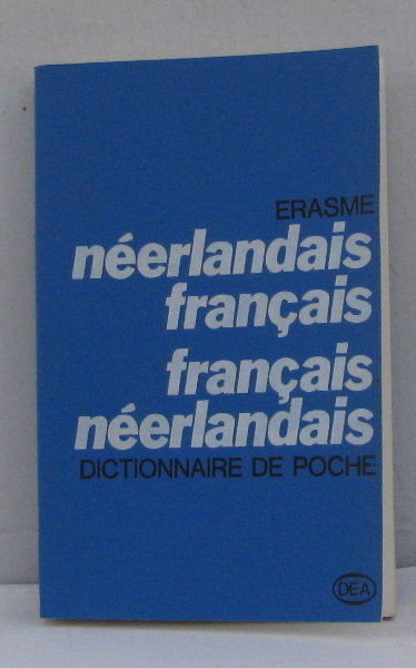
Erasme
Néerlandais français/français néerlandais
Dea/swb 1969 330 pages in12. 1969. Broché. 330 pages.
Référence libraire : 212603
|
|
|
Erasmus, Udo
Fats That Heal, Fats That Kill : The Complete Guide to Fats, Oils, Cholesterol and Human Health
456 Pages. The classic complete guide to fats, oils, cholesterol and human health. "A monumental piece of work... it will make a distinct contribution." - E. Cheraskin, M.D. author: Vitamin C: Who Needs It? Light wear. Unmarked. Excellent copy. Book
|
|
|
ERB, Emil:
Auf Wanderwegen rund um Zürich. Von Endstation zu Endstation der Städtischen Strassenbahn. 13 Haupt-, 13 Abkürzungs- und 9 Fernzielrouten. Mit einer Übersichtskarte, 22 Kartenskizzen und 22 Bildern. Herausgegeben von der Zürcherischen Arbeitsgemeinschaft für Wanderwege anlässlich des zehnjährigen Bestehens (Gründung Herbst 1933).
Zürich, Orell Füssli, 1943, in-8vo, 97 S., illustr. mit 1 Übersichtskarte, 22 Kartenskizzen und 22 Bildern in s./w., illustrierte Original-Broschüre.
Référence libraire : 89279aaf
|
|
|
Erberto Passoni
Panorama Scolastico Italiano
Brossura editoriale in cartoncino flessibile liscio con copertina che presenta patina di polvere e stemmi della casa editrice applicati in quarta. Prefazione di Mario Bandinelli. Buono lo stato di conservazione con pagine color seppia come i tagli. Numero pagine 233. USATO

|
|
|
ERBESATO GIAN MARIA.
Guida di Palazzo Te.
In 8°, br. edit. ill., pp. 63,(1), riccamente ill. a col. n.t.; ottimo es.. (x057) (la spedizione standard è SEMPRE tracciata con raccomandata-piego di libri, eventuale FATTURA da richiedere all'ordine)

|
|
|
Ercole Corti
Dizionario manuale di geografia antica e cenni preliminari ad intelligenza della storia
Opera impressa nel 1859. Coperta rigida in mezza tela con titoli oro al dorso ingiallita dal tempo mostrante segni di usura ai margini con abrasioni e strappi agli stessi ed al dorso e tracce di usura da sfregamento ai piatti con conseguenti macchioline di decolorazione; etichetta precedente alla cuffia inferiore. Pagine brunite dal tempo, in particolare ai tagli e sporadicamente fiorite. Bordi a barbe cotti e logorati non recanti impedimenti alla fruibilità. Il volume potrebbe contenere timbri ed etichette dell'Istituto Veneto, regolarmente acquisito dalla nostra libreria. Numero pagine complessive 914. USATO

|
|
|
Ercole Pozzoli Milena
Châteaux de la Loire
Gründ 1998 16 69x2 82x23 19cm. 1998. Relié.
Référence libraire : 500130983

|
|
|
Ercole Pozzoli Milena
Châteaux de la Loire
Gründ 1998 16 69x2 82x23 19cm. 1998. Relié.
Référence libraire : 500186450

|
|
|
ERCOLE POZZOLI Milena.
PARIS.
Profusion de fotografias en color.
|
|
|
Ercole Pozzoli,Milena.
Parigi. I luoghi e la storia.
<br/> STATO: USATO, COME NUOVO.<br/> TITOLO: Parigi. I luoghi e la storia. <br/> AUTORE: Ercole Pozzoli,Milena.<br/> EDITORE: Edizioni White Star <br/> DATA ED.: 1997,<br/> EAN: 9788880951285
|
|
|
ERDAL YAZICI.
Aphrodisias and surrounding areas.
New English Paperback. Pbo. Foolscap 8vo. (19 x 12 cm). In English. 180 p., color ills. The city of Aphrodisias, praised outside Anatolia - in the Mediterranean basin - with artefacts produced by sculptors in Antiquity, hasbeen brought to light by systematic excavations since 1961. The city has become more popular as the sculptures adorning the streets and buildings of thousands of years ago are unearthed.Today's world travellers are once again faced with the ancient residents of Aphrodisias, thanks to the dedicated efforts of scientists. True-life experiences of thousands of years have become more understandable as the inscriptions that they carried into the future are read and interpreted. The letters of the emperors, the verses engraved on stones which shed light on the city's social, cultural and economic life, and the graffitis drawn on the rows of the stadium and the theatre are such as to speak the past pages of history. Aphrodisias, which used to hold the ear of emperors at one ime, still astonishes and fascinates visitors today. The interest in and commitment to Aphrodisias of the Emperor Octavian is known through the letter he wrote to Stephanus, the governor of Laodicea:". "This one city I have taken for my own out of all Asia. I wish these people to be protectedas my own townsmen." This book prepared for travellers whose want to discover and face to history of Aphrodisias.
|
|
|
ERDAL YAZICI.
Troy and surrounding areas. The archaeological sites and monuments of the Troas Region. Parion, Assos, Alexandria Troas, Neandreia, Sanctuary of Apollo Smintheus, Tenedos / Bozcaada, Imbros / Gökçeada, Antardrus, The Museum of Troy, Çanakkale Archaeological Museum.
New English Paperback. Pbo. Cr. 8vo. (20 x 14 cm). In English. 284 p., color ills. Attandrus, which lies south of the Troas Region, has also taken its place among the unearthed cities after the latest excavations. Numerous ancient settlements and Ottoman structures (castles, religious buildings, etc.), which are less known in the Troas region and are waiting to beexplored, have been included in the pages of the book. Sightseeing these settlements and their structures in the pristine nature of the region also means embarking on a pleasant journey. The functionality and architecture of the structures of these settlements, established on high and sheltered locations, are amazing. The explorers of the region are mainly surprised by encountering structures of different periods at unexpected locations. The Early Bronze Age fortress, a Hellenistic temple, the Roman road and bridge, or the Ottoman castles and religious buildings are intertwined in the region. The locations and road descriptions of the settlements and structures to be visited along certain routes are provided in detail in the sections of the book.
|
|
|
ERDOGAN ASLAN.
Kekova Island.
New English Original bdg. HC. Large demy 8vo. (21 x 19 cm). In English. 160 p., ills. Kekova Island.
|
|
|
Eriberto Aievoli
Quesiti di patologia clinica e terapia chirurgica
Volume n. 2 della collana Quesiti di esame, ad uso di studenti e medici pratici. Legatura in tela marrone, con titoli in bianco al piatto ed al dorso, scolorita dal tempo, con lieve usura lungo i margini ed ai bordi. Taglio superiore colorato di rosso. Pagine ingiallite, con legatura allentata e con 468 risposte illustrate da 300 figure, in bianco e nero. Numero pagine 426. USATO

|
|
|
Eric A. Smith
ASP.NET at Work. Building 10 enterprise projects.
Pubblicazione in Inglese. Brossura ben conservata. Copertina in cartoncino patinato lucido che riporta lievi segni d'uso agli angoli. Qualche alone ai tagli. Pagine in ottimo stato. Contiene 1 CD posto alla fine del volume. Numero pagine 621. USATO

|
|
|
Eric Breton Eric Breton
Johnny Rock : Livre agenda 2020
CASA 2019 250 pages 18 2x25 2x3cm. 2019. Relié. 250 pages.
Référence libraire : 500037845

|
|
|
Eric De Mare
La fotografia
Legatura datata, n. 39 di collana, tradotto da R. Degli Uberti, illustrato da elaborati grafici e fotografie, copertina con minime tracce da conservazione, sovraccoperta con bordo stanco, ingiallita e sbiadita dalla luce, scurita da polvere e umido da scaffale, fogli con buon aspetto, velati da ossidazione avorio, intensa ai margini, denso pulviscolo ruggine e muffe ai tagli e unghia. N. pag. 398. USATO

|
|
|
Eric De Maré
La Fotografia
Legatura in piccolo formato, n. 39 di collana, tradotto da R. Degli Uberti, copertina in robusto cartonato, segnata da piccoli urti, sovraccoperta con danni da sfregamento e strappi, marcati alle estremità e canaletti, pigmento ombrato da polvere da scaffale, patinato usurato da attrito, inserto fotografico completa il testo, fogli velati da ossidazione bruna, intensa ai margini, denso pulviscolo da muffe con fioriture ai tagli. N. pag. 398. USATO

|
|
|
Eric Duffey
Parchi e riserve naturali d'Europa
Traduzione di Gina Bosisio, prefazione di Peter Scott, rilegatura editoriale rigida, ingiallita ai bordi, con usura alle punte, segno d'urto e strappetto al piede, lettera traforata al posteriore, sovraccoperta illustrata, ingiallita, con usura e qualche strappetto ai bordi, pagine riccamente illustrate ed in buonissimo stato di conservazione, fioritura ai tagli. Numero pagine 287 USATO

|
|
|
Eric Ecoutin
Oltre la corsualità Tecniche di insegnamento non istituzionale
Volume numero 5 appartenente alla collana Strumenti. Copertina leggermente stanca agli angoli, alle estremità del dorso e sulla lunghezza di esso. Presenti note a matita alle controguardie. Pagine ben salde alla cerniera, con ampio margine. Controguardia superiore distaccata per metà dal corpo. Numero pagine 124. USATO

|
|
|
Eric Hamovitch et Guides Ulysse
Chili
Guides de voyage Ulysse 2000. Paperback. Very Good. Former library book. Edition 2000. Ammareal gives back up to 15% of this item's net price to charity organizations. Guides de voyage Ulysse paperback
Référence libraire : H-017-326 ISBN : 2894640870 9782894640876
|
|
|
Eric Hamovitch et Guides Ulysse
Chili
Guides de voyage Ulysse 2000. Paperback. Very Good. Former library book. Ammareal gives back up to 15% of this item's net price to charity organizations. Guides de voyage Ulysse paperback
Référence libraire : H-489-745 ISBN : 2894640870 9782894640876
|
|
|
Eric Hamovitch et Guides Ulysse
Chili Eric Hamovitch et Guides Ulysse
Guides de voyage Ulysse. Softcover. Chili <br/><br/>Chili Guides de voyage Ulysse paperback
Référence libraire : BN104769 ISBN : 2894640870 9782894640876
|
|
|
Eric Meyer
Encyclopédie familiale d'homéopathie :de quoi souffrez-vous et comment vous guérir : 2609 remèdes de
LMV Editions 1997 1997 454 pages in8. 1997. Broché. 454 pages.
Référence libraire : 3447

|
|
|
Eric O'Keefe
Who rules america The people vs the political class
I edizione, inglese, brossura editoriale in cartoncino flessibile, illustrata, con leggere tracce di polvere e lievissimi segni di usura per scaffalatura, all'interno pagine in ottimo stato di conservazione, piccola macchia marrone ai tagli laterali. Numero pagine 94 USATO

|
|
|
Eric Prum - Josh Williams
Shake A new perspective on cocktails
Brossura in cartoncino semirigido, dalla copertina illustrata, con bandelle. Ritratto fotografico degli Autori alla bandella posteriore. Buonissimo lo stato di conservazione, pagine perfettamente tenute, ricche di fotografie a colori, nel testo. Numero pagine 167. USATO

|
|
|
Eric Prum, Josh Williams
Infuse Oil, spirit, water
Volume in lingua inglese. Brossura ad alette illustrata mostrante minimi segni di usura. Pagine in buono stato. Numero pagine 175. USATO

|
|
|
Eric Tabarly
Da un Pen Duick all'altro Dalla Transatlantica alla Transpacifica
Brossura filo refe datata, copertina con toni alterati dalla luce, patinato usurato da sfregamento e manipolazione, comuni tracce di attrito e compressione alle estremità, trad. dal francese di Francesco Di Franco, testo affiancato da percorso illustrato disegni e cartine di P. Gutelle e A. Massot, e arricchito da inserto fotografico, fogli allo stato del nuovo, puliti i tagli. N. pag. 208. USATO

|
|
|
Erica Tanov
Design by Nature Creating layered, lived-in spaces inspired by the natural world
I edizione, fotografie di Ngoc Minh Ngo, rilegatura in tutta tela editoriale, grigia, con titoli d'oro al dorso, titoli e fregi d'oro e d'argento al piatto anteriore, illustrazione applicata al posteriore, pagine riccamente illustrate, la n.211 sgualcita e con strappetto al bordo laterale, le altre in ottimo stato di conservazione. Numero pagine 229 USATO

|
|
|
Erich Bachman, Burkard von Roda and Werner Hemlbeger (editors)
The Wurzburg Residence and Court Gardens
Book in mint condition. 200pp. History and description of the German Palace in Wurzburg between Frankfurt and Nuremberg, considered to be the most beautiful Palace in the country. Very well illustrated.

|
|
|
Erich Demel
La pittura su porcellana
Volume rilegato in simil pelle, coperta muta ed in buono stato, sovraccoperta lievemente imbrunita ai margini e al dorso, pagine con naturale leggera imbrunitura ai bordi, libro completamente fruibile, traduzione di Marinella Favro, presenti numerose illustrazioni a colori e in nero nel testo, prima edizone, numero pagine 177 USATO

|
|
|
Erich Rahn
La tremenda forza del ju - jitsu 200 colpi di attacco e di difesa
Legatura editoriale in cartoncino rigido ruvido di colore rosso, protetto da sovraccoperta con bandelle illustrata e segnata da fitte fioriture. Buono lo stato conservativo generale, pagine salde e perfettamente tenute, ossidate da tonalità leggermente brunita, maggiore alle estremità e scurita ai tagli, illustrate da CCXCVIII ( 298 ) figure in bianco e nero, nel testo. Numero pagine 270. USATO

|
|
|
Erich Thiel
Verkehrsgeographie von Russisch-Asien
Erich Thiel Verkehrsgeographie von Russisch-Asien. , Ost-Europa-Verlag, Konigsberg Pr. 1934, Geografia del traffico dell'Asia-Russa. Copertina editoriale lievemente stanco ai bordi e sul dorso, interno ingiallito ma buonissimo. Buono (Good) . <br> <br> <br> 324<br>

|
|
|
Erik Blumenthal
Capire se stessi per capire gli altri Guida pratica per migliorare le proprie relazioni
Prima edizione nella collana Oscar Guide in ottimo stato di conservazione. Guida pratica per migliorare le proprie relazioni. Traduzione di Vanna Visentin. Brossura editoriale in cartoncino patinato illustrato. Interno integro, cerniera salda, pagine ottimamente conservate, pari al nuovo. Numero pagine 127 USATO

|
|
|
Erik Von Markovik alias Mystery, Chris Odom alias Lovedrop
Il metodo Mystery Un approccio infallibile per sedurre le donne più belle del mondo
Traduzione di Bruno Amato, IV ristampa della I edizione in Saggi Best Seller, introduzione di Neil Strauss, pagine in ottimo stato di conservazione, con alcune figure in nero nei testi, brossura editoriale illustrata, flessibile e con qualche lievissimo segno di usura ai bordi dovuto a scaffalatura. Numero pagine 255 USATO

|
|
|
Erika Grazia Lombardo
La casa leggera Ordinata, pulita e sostenibile in soli 31 giorni
Immersione nel decluttering e riordino, il mondo dei professional organizer. Pubblicazione recente, percorso illustrato da testimonianze fotografiche. Brossura con bandelle, segnata solo da manipolazione e con tracce di sfregamento, lievissima alterazione cromatica in cornice, interno allo stato del nuovo. N. pag. 411. USATO

|
|
|
Erina Gavotti
Erbe e bellezza Il sole, l'acqua, i fiori, le foglie, il vento, gli alberi, la pioggia: 280 consigli per essere più belli
Legatura datata, copertina in robusto cartonato illustrata, segnata da piccoli urti alle estremità e generale scoloritura, toni leggermente velati da polvere e umido, casto corredo illustrativo arricchisce 280 consigli per la bellezza, sporadiche fioriture ai fogli avvolti da ossidazione vintage, intensa ai margini e scura ai tagli. N. pag. 178. USATO

|
|
|
Erina Gavotti
Erbe e bellezza Il sole, l'acqua, i fiori, le foglie, il vento, gli alberi, la pioggia; 280 consigli per essere più belli
Illustrazioni presenti nel volume. Il volume si presenta in buono stato di conservazione. Il dorso e le copertine mostrano lievi segni di usura, piegature al dorso. Le pagine interne sono ingiallite dal tempo e fruibili. I tagli bruniti e regolari. La cerniera è ben salda. Numero pagine 259 USATO

|
|
|
ERKÂN-I HARBIYE UMUMIYE].
[MAP of Kharpout] Harput. Dersim, Palu, Malatya, Siverek.
Very Good Turkish, Ottoman (1500-1928) Original map. Oblong elephant folio. (50 x 60 cm). In Ottoman script. Scale: 1/200.000. [MAP of Kharpout]. Harput. Dersim, Palu, Malatya, Siverek. Rare Ottoman map shows Elaziz (Elazig), Dersim, ancient Harput et environment. This is one the serie of the Bonn projection maps which are the first map series in modern techniques in Turkey and the Ottoman Empire. This is one the serie of the Bonn projection maps which are the first map series in modern techniques in Turkey and the Ottoman Empire. In order to produce these maps covering Turkish territory, Reconnaissance Branch was incorporated into The Mapping Commission. The maps were produced in the datum based on the latitude and longitude of Ayasofya Mosque in equal area Bonn Projection. The field works for the 123 sheets covering the country were conducted by 76 staff. The production was completed in 18 years starting from east west. Field works continued without stopping except in years 1914 and 1920. This map series called also reconnaissance maps contributed a lot to producing 1:25.000 scale maps.
|
|
|
ERKÂN-I HARBIYE- UMUMIYE HARITA HEYETI [PREPARED BY THE MAP COMMITTEE].
[MAP of the BOSPHORUS and ENVIRONMENT] Istanbul Bogaz ve civar haritasi.
Very Good Turkish, Ottoman (1500-1928) Original cromolithograph mounted on cloth. Folded. Some foxing and slimming on creases. Oblong double elephant folio. (97 x 107 cm). In Ottoman script. Shows the Bosphorus, Istanbul city with detailed place names. Black Sea at North, Marmara Sea at South and the Princes' Islands seen at southwest area. Mapmaker not described usual like in Turkish military maps. An extremely rare the Bosphorus map with its unusual size. Not in TBBMM library (The Grand Assembly of Turkish Republic Liibrary). Not in Military Libraries in Turkey.
|
|
|
ERKÂN-I HARBIYE- UMUMIYE HARITA HEYETI [PREPARED BY THE MAP COMMITTEE].
[MAP of the BOSPHORUS] Bogaziçi; Kavaklar: Rumeli Kavagi, Belgrad, Hisarlar.
Very Good Turkish, Ottoman (1500-1928) Original cromolithograph color map. Repaired. A good copy. Oblong atlas folio. (50 x 60 cm). In Ottoman script. [MAP of the BOSPHORUS] Bogaziçi; Kavaklar: Rumeli Kavagi, Belgrad, Hisarlar. Shows Asian and European shores, topography with detailed place names in its Bosphorus part of Anadolu and Rumeli Kavagi of Istanbul. At east, Belgrad; at northeast, Black Sea. No information on mapmaker. Hegira:: 1327 = Gregorian: 1911. Scale: 1/25.000. Rare.
|
|
|
ERKÂN-I HARBIYE-I UMUMIYE.
[MAP of the BOSPHORUS / CONSTANTINOPLE] Kavaklar: Rumeli Kavagi, Hisarlar.
Very Good Turkish, Ottoman (1500-1928) Original color map. Folded. Chipped and slightly tears on extremities. Slightly stained and yellowing on paper. Oblong atlas folio. (50 x 60 cm). In Ottoman script. [MAP of the BOSPHORUS / CONSTANTINOPLE] Kavaklar: Rumeli Kavagi, Hisarlar. Shows the Bosphorus, and its Kavaklar and Hisarlar shores. Mapmaker is not described. Scale: 1/25.000. Mubde-i tul: Hagia Sophia. This is one the serie of the Bonn projection maps which are the first map series in modern techniques in Turkey and the Ottoman Empire. This is one the serie of the Bonn projection maps which are the first map series in modern techniques in Turkey and the Ottoman Empire. In order to produce these maps covering Turkish territory, Reconnaissance Branch was incorporated into The Mapping Commission. The maps were produced in the datum based on the latitude and longitude of Ayasofya Mosque in equal area Bonn Projection. The field works for the 123 sheets covering the country were conducted by 76 staff. The production was completed in 18 years starting from east west. Field works continued without stopping except in years 1914 and 1920. This map series called also reconnaissance maps contributed a lot to producing 1:25.000 scale maps. Hegira: 1328 = Gregorian: 1911. A good copy. Very scarce.
|
|
|
ERKÂN-I HARBIYE-I UMUMIYE.
[MAP of WEST ANATOLIA - SHORES of NORTH AEGEAN] Edremid Bay, The Dardanelles, Limni, Bozcaada (Tenedos), Balikesir, Ayvalik, Kal'a-yi Sultaniye.
Very Good Turkish, Ottoman (1500-1928) Original color map on cloth. Folded. A good copy. Oblong atlas folio. (50 x 60 cm). In Ottoman script. [MAP of WEST ANATOLIA] Edremid Bay, The Dardanelles, Limni, Bozcaada (Tenedos), Balikesir, Ayvalik, Kal'a-yi Sultaniye. Shows Northeast Anatolia; southwest entrance of the Dardanelles, Çanakkale, Balikesir cities, Ayvalik, Tenedos Island, shores of North Aegean, Bay of Edremit. Mapmaker is not described. Scale: 1/200.000. Mubde-i tul: Greenwich and Dersaadet. This is one the serie of the Bonn projection maps which are the first map series in modern techniques in Turkey and the Ottoman Empire. This is one the serie of the Bonn projection maps which are the first map series in modern techniques in Turkey and the Ottoman Empire. In order to produce these maps covering Turkish territory, Reconnaissance Branch was incorporated into The Mapping Commission. The maps were produced in the datum based on the latitude and longitude of Ayasofya Mosque in equal area Bonn Projection. The field works for the 123 sheets covering the country were conducted by 76 staff. The production was completed in 18 years starting from east west. Field works continued without stopping except in years 1914 and 1920. This map series called also reconnaissance maps contributed a lot to producing 1:25.000 scale maps. Hegira: 1327 = Gregorian: 1910. Slightly stained and yellowing on paper. Loose extremities. A good copy. Very scarce. One copy in TBMM Library Map Collection: 201102274.
|
|
|
ERKÂN-I HARBIYE-I UMUMIYE.
[OTTOMAN MAP of HASANKALE - ERZERON] Erzurum, Hasankale, Oltu, Hinis, Karakilise.
Very Good Turkish, Ottoman (1500-1928) Original color map. Oblong atlas folio. (51 x 61 cm). In Ottoman script. Folded. Topography and toponyms of East Anatolia: Shows Erzurum region, Hasankale (Pasinler), Oltu, Hinis, Karakilise and surroundings. Scale: 1: 200.000. This is one the serie of the Bonn projection maps which are the first map series in modern techniques in Turkey and the Ottoman Empire. In order to produce these maps covering Turkish territory, Reconnaissance Branch was incorporated into The Mapping Commission. The maps were produced in the datum based on the latitude and longitude of Ayasofya Mosque in equal area Bonn Projection. The field works for the 123 sheets covering the country were conducted by 76 staff. The production was completed in 18 years starting from east west. Field works continued without stopping except in years 1914 and 1920. This map series called also reconnaissance maps contributed a lot to producing 1:25.000 scale maps. Rare.
|
|
|
ERKÂN-I HARBIYE-I UMUMIYE].
[MAP of ALEXANDRETTA] Iskenderun - Tayakadin.
Very Good Turkish, Ottoman (1500-1928) Original color map on cloth. Folded. Wrinkled on paper. Stains on cloth. 12 sheets on paper. Oblong atlas folio. (50 x 60 cm). In Ottoman script.[MAP of ALEXANDRETTA] Iskenderun - Tayakadin. It shows villages and settlements in Tayakadin of Iskenderiye. Scale: 1/25.000. Hegira: 1329 = Gregorian: 1913. This is one the serie of the Bonn projection maps which are the first map series in modern techniques in Turkey and the Ottoman Empire. In order to produce these maps covering Turkish territory, Reconnaissance Branch was incorporated into The Mapping Commission. The maps were produced in the datum based on the latitude and longitude of Ayasofya Mosque in equal area Bonn Projection. The field works for the 123 sheets covering the country were conducted by 76 staff. The production was completed in 18 years starting from east west. Field works continued without stopping except in years 1914 and 1920. This map series called also reconnaissance maps contributed a lot to producing 1:25.000 scale maps. Not description on map-maker. A very detailed map. Extremely rare.
|
|
|
ERKÂN-I HARBIYE-I UMUMIYE].
[MAP of EAST & SOUTHEAST ANATOLIA] Maras - Elbistan - Birecik - Kilis.
Very Good Turkish, Ottoman (1500-1928) Original color map. Folded. Oblong atlas folio. (50 x 60 cm). In Ottoman script. Shows Eastern and Southeastern parts of Anatolia; Maras, Elbistan, Birecik and Kilis areas. Hegira: 1333 = Gregorian: 1917. Not description on map-maker.
|
|
|
ERKÂN-I HARBIYE-I UMUMIYE].
[MAP of EAST ANATOLIA and EAST BLACK SEA] Oltu, Artvin, Ispir, Hasankale.
Very Good Turkish, Ottoman (1500-1928) Original color map. Folded. Oblong atlas folio. (50 x 60 cm). In Ottoman script. [MAP of EAST ANATOLIA and ARTVIN] Oltu, Artvin, Ispir, Hasankale. Shows Artvin, Ispir, Hasankale and Kars city. Scale: 1/200.000. This is one the serie of the Bonn projection maps which are the first map series in modern techniques in Turkey and the Ottoman Empire. In order to produce these maps covering Turkish territory, Reconnaissance Branch was incorporated into The Mapping Commission. The maps were produced in the datum based on the latitude and longitude of Ayasofya Mosque in equal area Bonn Projection. The field works for the 123 sheets covering the country were conducted by 76 staff. The production was completed in 18 years starting from east west. Field works continued without stopping except in years 1914 and 1920. This map series called also reconnaissance maps contributed a lot to producing 1:25.000 scale maps. Hegira: 1332 = Gregorian: 1916. Not description on map-maker.
|
|
|

 Recevoir par e-mail
 Télécharger en PDF
 Flux RSS
 Lien permanent


