|
|
|
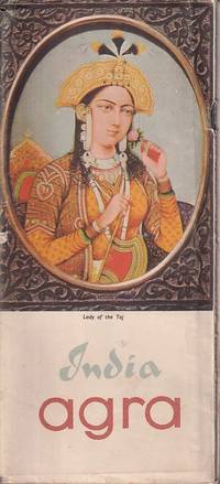
[AGRA, INDIA TRAVEL GUIDE].
India. Agra.
New Delhi.: Directorate of Advertising & Visual Publicity Government of India. 1966. Bifold booklet in stapled wrappers. Large folding map at rear colour photographic illustrations 20pp. 22.5 x 10.5cm. Two neat red ink annotations margin of last leaf "Tandoori chicken" and "Moti Mahal" some light foxing at margins of leaves original wrappers a little creased and soiled but overall still good. . Directorate of Advertising & Visual Publicity, Government of India. unknown
Referenz des Buchhändlers : 223257
|
|
|
[AHMET] MUHITTIN [ERGÜVEN], (1883-1969); MIRLIVA ALI SEREF PASHA, (Author and mapmaker of 'Umûmî Cografya Atlasi' published in 1894 - Active between 1885-1905).
[EARLY OTTOMAN MAP OF SUDAN] Sudan. Sâye-i Türkiye Hazret Gazi Sultan Abdülhamid Hân-i Sâni'de Maarif Umûmiye Nezâret-i Celîlesi ruhsatiyle meshur Haset tarafindan Fransa Cemiyet-i Cografya âzâlarindan mütesekkil komisyona mahsûs tanzîm edilmis oldugu son defaki atlasinin tercümesi olarak bu def'a Erkân-i Umûmiyye Dairesi Besinci Fen Subesi'ne me'mûr piyade mirlivâlarindan saâdetlü Ali Seref Pasa ve rifatlu binbasi fütûvvetlü Muhyiddin Efendi maarifetleriyle tertib ettirilmistir.
Very Good Turkish, Ottoman (1500-1928) Original color lithograph map. Folded. Oblong folio. (35 x 52 cm). In Ottoman script (Old Turkish with Arabic letters). It shows Sudan and West Africa, Atlas Ocean shores, Sahra Desert, and other parts of Africa. Scale: 1:15.000.000. A very detailed and attractive map. Slightly fading. Otherwise a very good copy. Dated Hegira: 1310 = [Gregorian 1894]. Taken from his attractive atlas titled "Yeni cografya atlasi. [i.e. New Geographical Atlas]". The cartographer, Ali Seref, or Hafiz Ali Seref (or Esref) Pasha (1840-1907) was an Ottoman soldier and mapmaker who was schooled in Paris as a cartographer around 1862. While in Paris he published his first atlas with 22 maps, called the Yeni atlas. Upon his return to Istanbul, he became the chief cartographer at the Matbaa-i Amire Printing Press in Beyazit. Chipping on extremities. Slight foxing. Overall a good copy. Not in OCLC.; Not in TBMM Map Collection.
|
|
|
[AHMET] MUHITTIN [ERGÜVEN], (1883-1969); MIRLIVA ALI SEREF PASHA, (Author and mapmaker of 'Umûmî Cografya Atlasi' published in 1894 - Active between 1885-1905).
[OTTOMAN MAP of BRITISH ISLES] Ingiltere. Sâye-i Türkiye Hazret Gazi Sultan Abdülhamid Hân-i Sâni'de Maarif Umûmiye Nezâret-i Celîlesi ruhsatiyle Haset tarafindan Fransa Cemiyet-i Cografya âzâlarindan mütesekkil komisyona mahsûs tanzîm edilmis oldugu son atlasinin tercümesi olarak bu def'a Erkân-i Umûmiyye Dairesi Besinci Fen Subesi'ne me'mûr piyade mirlivâlarindan saâdetlü Ali Seref Pasa ve topçu yüzbasilarindan fütûvvetlü Mehmed Nis'et Efendi maarifetleriyle tertib ettirilmistir.
Very Good Turkish, Ottoman (1500-1928) Original color map. Folded. Oblong folio. (35 x 52 cm). In Ottoman script. Color lithograph. It shows Sudan and West Africa, Atlas Ocean shores, Sahra Desert, and other parts of Africa. Scale: 1:15.000.000. A very detailed and attractive map. Slightly fading. Otherwise a very good copy. Dated Hegira: 1310 = [Gregorian 1894]. [EARLY OTTOMAN MAP of SUDAN] Sudan. Sâye-i Türkiye Hazret Gazi Sultan Abdülhamid Hân-i Sâni'de Maarif Umûmiye Nezâret-i Celîlesi ruhsatiyle meshur Haset tarafindan Fransa Cemiyet-i Cografya âzâlarindan mütesekkil komisyona mahsûs tanzîm edilmis oldugu son defaki atlasinin tercümesi olarak bu def'a Erkân-i Umûmiyye Dairesi Besinci Fen Subesi'ne me'mûr piyade mirlivâlarindan saâdetlü Ali Seref Pasa ve rifatlubinbasi fütûvvetlü Muhyiddin Efendi maarifetleriyle tertib ettirilmistir. Ali Seref Pasa or Hafix Ali Esref. He was a soldier, who was schooled in Paris as a cartographer around 1862. Already in Paris he published his first atlas with 22 maps, called 'Yeni atlas'. Upon his return to Istanbul he became a chief cartographer at the Maatbaa-i amire Printing Press in Beyazit, which was the successor of the Muteferrika press from 1727. Among others he translated the large Kiepert map of Anatolia to Ottoman. He died in 1907, leaving his large project of a gigantic map of Anatolia in 100 sheets unfinished. Ali's name is often misunderstood or even listed as two different people: Ali Seref Pasa and Hafiz Ali Esref. Until the surname law adopted on June 21, 1934, Turks did not have surnames. They were born with one first name and were until the adulthood described only as sons or daughters of their parent's names. Later they were given titles such as Effendi (Sir), Bey (Chief) or Hanim (Madam) for higher classes, or they were given names according to their work or class. The names were not inherited by children until 1934, when the surname law was enforced. The map maker Ali received names Seref, the honourable, and Pasa, the dignitary. He was also known as Hafiz, the memorizer of Qur'an and Esref, Proud. So Ali Seref Pasa would have a meaning 'Honourable Dignitary Ali, and Hafiz Ali Esref, Memorizer of Qur'an, Proud Ali. Daruttibaa - Matbaa-I Amire Printing Press: The first press in the Muslim world, called Daruttibaa, was founded in Istanbul by Ibrahim Muteferrika in 1727, with a permission of Sultan Ahmeet III. It was located in Muteferrika's house. The first book was published in 1729 and until 1742 sixteen other works followed. After Muteferrika's death, the press was supressed for printing, as printed books were considered dangerous. In 1796 the press was purchased by the government and moved to Uskudar in Istanbul, and in 1831 finally to Beyazit, where it was renamed to Matbaa-i Amire in 1866. The press was closed in 1901 and was reopened in 1908 under the name 'Âmire' In 1927 the name changed to State Printing House. The press still exists and is known for publishing school and educational books. Extremely rare. Not in OCLC.; Not in TBMM Map Collection.
|
|
|
[ALBUM DES GUIDES BLEUS] - FAVIERE (Jean) -
BOURBONNAIS NIVERNAIS.
Paris, Librairie Hachette les abums des gjuides bleus, 1965 ; in-8, 17 pp., cartonnage de l'éditeur. Très bon état avec sa jaquette (jaquette très bon état.
Referenz des Buchhändlers : 201508518
|
|
|
[ALGERIE].-
Tlemcen et sa région.-
Livret-Guide publié par le Syndicat d'Initiative de Tlemcen. 1921. In-12 br. couverture illustrée couleurs sur les 2 plats, 84pp. + 5 de publicités. Plan de Tlemcen et carte de la région dépliants h.-t. et illustrations photo in et h.-t. Bel exemplaire.
Referenz des Buchhändlers : ORD-167
|
|
|
[Algérie et Tunisie] – RICARD (P.).
Algérie, Tunisie.
Hachette, 1938, in-12, lxxxviii-518 pp, édition refondue et révisée par P. Ricard, 30 cartes et 37 plans (dont une carte dépliante in fine), index, reliure percaline bleue de l'éditeur, titres dorés au premier plat et au dos, encadrement à froid sur les plats, reliure défraîchie, intérieur propre, état correct (Coll. des Guides bleus)
Referenz des Buchhändlers : 105938
|
|
|
[ALLEMAGNE ; HOLLANDE]
Nouveau guide sur les bords du Rhin et en Hollande
XXXI, (1bl.), 303, (1bl.)pp., 16pp. de catalogue Chaix, 8 cartes cartonnage d'éditeur en percaline noire, dos lisse orné s.d;, s.d;, in-16, XXXI, (1bl.), 303, (1bl.)pp, 16pp. de catalogue Chaix, 8 cartes, cartonnage d'éditeur en percaline noire, dos lisse orné, 2 cartes des chemins de fer, 4 cartes représentant le cours du Rhin de Düsseldorff à Bâle, 1 carte des affluents du Rhin et 1 carte de la Hollande. Ce guide est divisé en deux parties : la première est consacrée aux bords du Rhin, la seconde à la Hollande. Tampon Ministère de la Police générale. Étiquette de librairie. Dos passé. Néanmoins bon exemplaire, bien complet de ses 8 cartes

|
|
|
[ALLEMAGNE].-
Guide de Fribourg en Brisgau et ses environs.-
Offert par l'Hôtel de l'Ange. s.d. (fin XIX°). In-12 (110 x 168mm) broché couverture illustrée sur les 2 plats, 71 pages, plan dépliant couleurs de Fribourg en frontispice, carte couleurs sur double page des environs, un dépliant présentant 2 itinéraires. et 13 gravures en noir dont 8 à pleine page. Couverture lgt passée mais bon exemplaire.
Referenz des Buchhändlers : ORD-188
|
|
|
[ALLEMAGNE].-
Guide du touriste Lettré. A la découverte de l'Allemagne. Ce qu'il faut voir, savoir et lire...
Bourg, Editions Touristiques et Littéraires, 1953, in 12 reliure de léditeur, jaquette illustrée, VIII-366 pages ; nombreuses illustrations.
Referenz des Buchhändlers : 43932
|
|
|
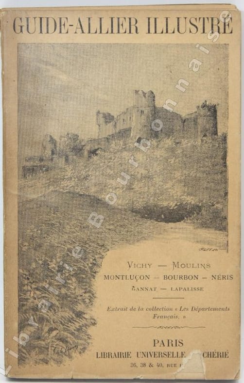
[ALLIER - CHERIE (Alfred)].
Guide-Allier illustré du commerce, de l'industrie et des voyageurs.
P., Librairie universelle, Alfred Chérié, s.d. [vers 1891] ; in-12, broché. 108 pp. - 3 ffeuillets roses de publicités. 1 plan de Vichy hors-texte. Quelques illustrations in-texte (Château de Moulins, Busset, Baleine, Lapalisse...). Déchirure avec petit manque en pied du premier plat, dos fragile.
Referenz des Buchhändlers : 14070
|
|
|
[ALLIER - GUIDE].
Guide Pratique. L'Allier.
Lyon, Editions P.P., R. L. Boireau, 1962 ; in-12, broché. 192 pp. dont 5 plans compris dans la pagination. Dos décoloré. Bon état.
Referenz des Buchhändlers : 15352

|
|
|
[ALLIER].-
Extrait du Panorama de la France.-
22°livraison. 1839. In-12 br. sans couverture, 22pp. 1 carte dépliante et 7 gravures h.-t. Qq. rousseurs. A relier.
Referenz des Buchhändlers : ORD-193

|
|
|
[ALSACE VELO GUIDE] - HOLDER (Louis) -
A la decouverte des specialités alsaciennes a velo tome 2.
Illfurth, Editions saint brice , 2022 ; in-8, 203 pp., br. Tome 2.
Referenz des Buchhändlers : 202202306
|
|
|
[ALSACE VELO GUIDE] - HOLDER (Louis) -
A la decouverte des specialités alsaciennes a velo tome 2.
Illfurth, Editions saint brice , 2022 ; in-8, 203 pp., br.
Referenz des Buchhändlers : 202202305
|
|
|
[ALSACE]-
Les Hautes-Vosges du Climont au Grand Ballon.-
Colmar. Imprimerie Strasbourgeoise. 1912. In-12 br. VII, 104pp. Tableau des hôtels et restaurants recommandés sur grande feuille repliée. Nb. illustrations in-t.
Referenz des Buchhändlers : ORD-259
|
|
|
[ALSACE].-
Almanach Alsacien 1854.-
Répertoire commercial, industriel, administratif et statistique du Haut et du Bas-Rhin. Strasbourg, au bureau du Marais-Vert. 1854. In-8 dos lisse veau noir orné, tranches marbrées, 694pp. et 60pp.( Guide du Voyageur sur les Chemins de Fer d'Alsace, Strasbourg-Bâle, Mulhouse-Thann). 2°plat de couverture presque détaché, quelques rousseurs mais assez bon exemplaire. Peu courant.
Referenz des Buchhändlers : ORD-246
|
|
|
[ALSACE].-
Guide à travers les Hautes-Vosges.-
Sté des Hôteliers et Restaurateurs des Htes-Vosges. s.l.n.d. In-8 br. couverture illustrée, 125pp.+ pub. Nb.illustration in-t.
Referenz des Buchhändlers : ORD-248
|
|
|
[American Guide Series] .
San Francisco. The Bay and Its Cities.
New York:: Hastings House Publishers 1940. First Printing of the First US Edition. A Near Fine copy in blue cloth binding with light offsetting to the preliminary pages in a Very Good unclipped dust jacket with wear to the head of the spine and the extremities. This city guide was compiled by writers in the Works Project Administration that emerged from the Great Depression and was published just one year before The U.S. entered the war against Japan. The book documents the history and growth of the city an dis profusely illustrated with black and white photographs. Hastings House Publishers, hardcover
Referenz des Buchhändlers : 27582
|
|
|
[AMSTERDAM - CITY GUIDE].
Le guide ou nouvelle description d'Amsterdam enseignant aux voyageurs et aux negoçians sa splendeur son commerce & la description de ses edifices ruës ports canaux ponts ecluses &c. Nouvelle edition augmentée considerablement.
Amsterdam: Paul de la Feuille 1720. Contemporary gold-tooled mottled calf with a red morocco title label lettered in gold on the spine gold-tooled board edges and red sprinkled edges. 8vo. Ad 1 with 28 engraved illustrations on 24 folding leaves including 20 illustrations of Amsterdam's most famous buildings and 4 leaves showing Dutch and European flags printed on both sides of the paper. Further with a small woodcut vignette on the title page one woodcut decorated initial and one woodcut headpiece. Ad 2 with a woodcut floral vignette on the title page and typographical tables in the text. 2 works in 1 volume. With: 2 Tarif general des Provinces Unies pour les droits d'entrée & de sortie que payent les marchandises tant en ce païs qu'à la Mer Baltique au passage du Sont.Amsterdam Paul de la Feuille 1718. Enlarged third and best edition - the first with running text instead of dialogues - of an interesting description of the city of Amsterdam together with a work containing the tariff rates for import and export of all kinds of goods and merchandise imposed by the Dutch Republic in alphabetical order. Also included are the tariff rates imposed in the Sont entrance of the Baltic sea and the last ordinances on the subject dated 1652 and 1655.The first edition of the Guide was published in Amsterdam by Daniel de la Feuille in 1701 and was mostly bound together with an edition of the Tarif of 1707 a second edition was printed in 1709.The plates show the most important buildings of the city such as the city hall now the Royal Palace of Amsterdam the stock exchange the main churches the 4 city gates the buildings of the Dutch East India Company VOC the Portuguese Synagogue etc.; the plates with the flags are from Fokkens' L'Art de Blason.Some minor dust soiling along the edges of the leaves the folding plates and quire K are slightly browned. Otherwise in very good condition.l Kress library S.2892; Ad 1: Nijhoff & V. Hattum 117; STCN 300355386 3 copies; WorldCat 65353974 838244431 46615043 313124792 46652734 1159002974 122306935 433419188 886395040 17 copies; cf. Cat. Goldsmith I10831 ed. 1772; not in Einaudi; ad 2: STCN 180657542 7 copies. Paul de la Feuille, unknown
Referenz des Buchhändlers : D84DQOR1MSG6

|
|
|
[ANJOU] - MORANT (Henry de).-
Le musée archéologique Saint-Jean. Notice par Henry de Mornant. 36 planches.
1945 Angers, Editions de l'Ouest, 1945, in 12 broché, 22 pages et 36 planches hors-texte.
Referenz des Buchhändlers : 39597
|
|
|
[ANJOU].-
Saumur et ses environs.-
Guide illustré. Edition nouvelle. Angers. Saumur. Syndicat d'Initiative de l'Anjou. s.d. (1914?). In-8 (125 x 212mm) broché, couverture jaune imprimée et illustrée en brun, 120 pages, nombreuses illustrations et publicités dans et hors texte et grand plan dépliant de Saumur. Couverture et 1ère page un peu salies sinon bon état.
Referenz des Buchhändlers : ORD-333
|
|
|
[ANONYME].
Suisse - Le Chemin de Fer Viège-Zermatt.
Evocation de la région et invitation au voyage, illustrées de photos; 1er plat de couverture joliment orné d'une lithographie couleurs (paysage au Cervin); reproduction d'une carte à reliefs sur le 2nd; annonces d'hôtels in fine. Ouvrage non daté, mais dernières dates citées dans le texte: 1904, et expression d'un futur: "en 1905-1906 au plus tard". Français
|
|
|
[ANONYME].
Suisse - Le Chemin de Fer Viège-Zermatt.
Berne, Hubacher, [s.d, 1905] 1 volume 11,6 x 17cm Agrafé sous couverture illustrée. 1 feuillet, 34p, 2 feuillets; illustrations en noir in texte, vignettes et pleines pages. Légèrement endommagé par l'humidité: très légèrement gondolé, très pâle mouillure en marges inférieures.
Referenz des Buchhändlers : 20151
|
|
|
[anonyme]:
Réseau du Nord. Stations balnéaires et thermales.
Paris, Guides Pratiques Conty, sans date. In-12 de [2]-372-28(publicités)-72 (publicités)-[6], pleine percaline bleue frappée noir et or. 2 taches au premier plat.
Referenz des Buchhändlers : 6472

|
|
|
[ANONYMOUS].
[EGYPT, HABESH [ETHIOPIA], SUDAN AND THE RED SEA] Manuscript map on a tissue paper of Egypt, Ethiopia, Sudan, Red Sea, circa 1890.
Very Good Arabic Original hand-colored map on tissue paper. 23x19 cm. In Ottoman script and Arabic. No scale. Manuscript notes of toponyms. The manuscript shows Egypt, Ethiopia, Sudan, the Red Sea along the line of Red Sea shores. Manuscript notes show that the map was used for military purposes in the last Ottoman Imperial period. Habesh Eyalet, Ethiopia in northeast Africa was conquered by Özdemir Pasha in 1557. His son, Osman Pasha, transformed the region into an eyalet, which remained under Ottoman suzerainty until the early 19th century when Egypt assumed its administration. (Source: Pashas, Begs, Effendis: A historical dictionary of titles and terms in the Ottoman Empire, Bayerle, Gustav.).
|
|
|
[ANONYMOUS].
[Manuscript map of Alexandria Port and its immediate hinterland].
Very Good Turkish Original manuscript map of Alexandria Port and its immediate hinterland. Folio. (33 x 41 cm). In Turkish (Modern). Folded. No scale. The manuscript shows Alexandria Port and the Palace of the King Farouk of Egypt, customs shores, ports and harbors, locations of the British ships, radio station, location of SS Ramlah, strait, Great Pass (?), waterfront for the lumber ships, sea current zones and probably entrance and exit routes etc. A very detailed map, decorated with ships. Some repairs with tape, tears, foxing and stains. Overall a good copy.
|
|
|
[ARIEGE].-
Extrait du Guide Pittoresque du voyageur en France.-
63°et 64°livraisons. Edité vers 1830. In-12 (143 x 227mm) broché sans couverture, 32pp. 1 carte dépliante et 12 gravures hors texte dont 2 en double. A relier.
Referenz des Buchhändlers : ORD-420
|
|
|
[ARIEGE].-
Extrait du Panorama de la France.-
63°et 64°livraisons. Edité vers 1830. In-12 br. sans couverture, 32pp. 1 carte dépliante et 12 gravures h.-t. Rousseurs. A relier.
Referenz des Buchhändlers : ORD-421
|
|
|
[ART] - PRINET (René-X.)
Initiation au dessin.
Paris, Librairie Ernest Flammarion, 1948; in-8, 4-124 pp. + 16 pl. hors-texte, broché. Collection « Manuels d'Initiation ». Nombreuses illustrations en noir et blanc, 24 in texte et 16 hors-texte.
|
|
|
[ART] - RICHER (Dr Paul)
Nouveau anatomie artistique – VI. Cours supérieur (suite). le nu dans l'art : l'art chrétien, depuis les origines jusqu'à la renaissance.
Paris, Plon, 1929; in-8 carré, 256 pp., broché (non coupé). Nombreuses illustrations photographiques en noir et blanc, et dessins. Bon état.
|
|
|
[ART] - TILLET (Jules)
De quelle époque est ce monument ? Guide pratique d'architecture.
Paris, Hachette, 1960; in-8 oblong, 104 pp., broché. Très bon état.
|
|
|
[ART] - VIOLLET-LE-DUC
Histoire d'un dessinateur, comment on apprend à dessiner.
Paris, J. Hetzel & Cie, vers 1880; in-4 (180 x 260 mm), 4-304 pp., reliure d'éditeur demi-cuir, coloris rouge sombre, dos orné à 4 nerfs. Bibliothèque d'Éducation et de Récréation. Quelques illustrations en noir et blanc et 3 en couleurs hors-texte.
|
|
|
[ART] - VIOLLET-LE-DUC
Histoire d'un dessinateur, comment on apprend à dessiner.
Paris, J. Hetzel & Cie, vers 1880 ; in-4 (180 x 260 mm), 4-304 pp., reliure d'éditeur demi-cuir, coloris rouge sombre, dos orné à 4 nerfs. Bibliothèque d'Éducation et de Récréation. Quelques illustrations en noir et blanc et 3 en couleurs hors-texte.
Referenz des Buchhändlers : _201600893
|
|
|
[ASIE] - KLEIN (Jacques).-
Hong-Kong - Formose (Taiwan) - Macao.
P., CITASE, 1977, in 8° étroit broché, 254 pages.
Referenz des Buchhändlers : 66317
|
|
|
[Auto Editors of Consumer Guide]
Corvette : America's Sports Car
New York: Beekman House 1989. 1st edition. Nice copy. large quarto. hardback with dust jacket 420pp. colour & b/w plates index Inc. many fine photos. Organised chronologically Beekman House hardcover
Referenz des Buchhändlers : 155240
|
|
|
[AUTOMOBILE TRAVEL GUIDE].
Motor trips through New England and Eastern New York. “The simplified motor guide.†100 road-maps in map section 100 street-plans in route section. . . .
Hartford CT: The Guyde Publishing Co. 1923. 8vo. Approx. 200 pp unpaginated. printed in red & black w/ 100s of maps 1 large folding at rear lozenge strip maps photo illustrations illustrated ads. Limp red cloth gilt lettering on front cover minor interior dustsoiling rubbing still VG- copy. Revised and expanded edition of this early Jazz Age automobile guide book through New England which was revised in order to accommodate the newly renumbered state routes highways and highway markers throughout New England and Eastern New York. The Guyde Publishing Co., hardcover
Referenz des Buchhändlers : 54022
|
|
|
[AUVERGNE] - [VELAY] - [GUIDES BLEUS].-
Guide Bleu Auvergne - Velay. Cantal, Haute-Loire, Puy-de-Dome, et en partie Allier, Ardèche, Aveyron, Lozère.
P., Hachette (Guides Blaus), 1979, in 12, cartonnage illustré de l'éditeur, 544 pages.
Referenz des Buchhändlers : 68469
|
|
|
[AUVERGNE]- JOANNE (P.).-
Le Mont-Dore et les eaux minérales d'Auvergne. La Bourboule - Royat - Chatelguyon - Chateauneuf - Saint-Nectaire - Saint-Alyre.
1903 Paris, Hachette (Collection des Guides Joanne, Guides Diamant), 1889, petit in 12 relié pleine percaline verte décorée de l'éditeur, IV-191-16 pages et 28-116 pages de publicités ; 2 cartes, un plan et 38 gravures.
Referenz des Buchhändlers : 85035
|
|
|
[AVEYRON].-
Extrait du Panorama de la France.-
68°livraison. Edité vers 1830. In-12 br. sans couverture, 16pp. 1 carte dépliante et 6 gravures h.-t. Rousseurs, 1°f.détachée.
Referenz des Buchhändlers : ORD-635
|
|
|
[AVIATION] - FAURE-FAVIER (Louise).-
Guide des voyages aériens. PARIS-TUNIS. Paris - Lyon - Marseille - Ajaccio - Tunis. Tunis-Bône et Lyon-Genève. Guide officiel avec une grande carte en couleurs. Préface de M. Laurent Eynac.
P., Guide des Voyages, 1930, petit in 8° broché, 131 et XXVIII pages ; couverture illustrée ; cartes et illustrations hors-texte et grande carte dépliante ; cachets de bibliothèque.
Referenz des Buchhändlers : 68919
|
|
|
[AVIGNON].-
Le Guide Avignonnais.-
Indispensable aux Touristes, aux Voyageurs et Hommes d'Affaires. Avignon. Rullière. s.d. (1923). In-12 (109 x 176mm) broché, couverture rouge imprimée, 120 pages, nombreuses photographies dans le texte et grand plan remplié hors texte. Bon exemplaire.
Referenz des Buchhändlers : ORD-647
|
|
|
[BAGDAD ARCHAEOLOGICAL CITY GUIDE and HUGE CITY MAP].
Baghdad [Archeological city guide with huge city map]. Foreword by Isa Salman (Director General of Antiquities).
Fine English Paperback. Roy. 8vo. (23 x 14 cm). In English. 29 p., color ills., a huge map (not opened). Baghdad [Archeological city guide with huge city map]. Foreword by Isa Salman (Director General of Antiquities). Very detailed modern guide including architectural works in Baghdad: Historical shrines, mausoleums and mosques, churches, monuments, etc.
|
|
|
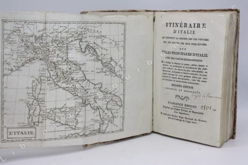
[BARONI (Lorenzo)].
Itinéraire d'Italie, qui contient la description des voyages par les routes les plus fréquentées aux villes principales d'Italie avec des cartes géographiques [...]. Deuxième édition augmentée et corrigée.
Florence, Joseph Tofani et Compagnie, Se vend chez Nicolas Pagni, 1801 ; in-8. 208 pp. - 26 cartes dépliantes. Couverture d'attente de l'époque en papier marbré. Frottements sur le dos et les plats. Inscriptions anciennes au crayon sur la première et la dernière garde. Ex-libris manuscrit sur le titre "Bigot de Préameneu" (il s'agit peut-être de Félixe Julien jean Bigot..., juriste et homme politique, un des quatre rédacteurs du Code civil de 1804).
Referenz des Buchhändlers : 14446
|
|
|
[BEAUVALLON SUR MER].-
La plus récente,la plus jolie station de la Côte d'Azur.
In-8 allongé, br. couverture illustrée couleurs de touristes en automobile, 14pp. Illustrations photos in-t. et plans.
Referenz des Buchhändlers : ORD-899
|
|
|
[BELGICANA]. GARNIR - DELMELLE - GLOTZ -BRIGODE -LOBET - EREVE, et Alii.
Lot de 7 revues Hainaut-Tourisme.
revues in-4, nombreuses illustrations photographiques. Bel ensemble. [PROF]
|
|
|
[BELGIQUE]
La Belgique. Guide pittoresque, monumental, artistique, historique, géographique, politique et commercial; précédé de l'Itinéraire de tous les chemins de fer belges et de la route de Paris à Cologne par Bruxelles
(3)ff. (faux-titre avec front. au verso, titre, titre de la 1ère partie), 159pp., 5pl., 327pp., 18ff. de publicités, 29pl cartonnage d'éditeur en percaline violine, armes royales de Belgique sur le premier plat, dos lisse orné 1856, 1856, in-18, (3)ff. (faux-titre avec front. au verso, titre, titre de la 1ère partie), 159pp, 5pl, 327pp, 18ff. de publicités, 29pl, cartonnage d'éditeur en percaline violine, armes royales de Belgique sur le premier plat, dos lisse orné, Frontispice et 34 planches. Nombreuses vignettes dans le texte. PREMIÈRE ÉDITION de ce rare guide. Manque la carte. Cartonnage passé. SCHELER (dir.), Bulletin du bibliophile belge, XIX, 1863, pp.173-174

|
|
|
[BELGIQUE] - VERKEST (Medard).-
Guide illustré du touriste à Bruges. 3e édition revue et augmentée.
bruges, Librairie Centrale, sans date, petit in 12 broché, 129 pages.
Referenz des Buchhändlers : 68924
|
|
|
[BELLE-ILE-EN-MER] BLONDEL LA ROUGERY E.
CARTE-GUIDE TOURISTIQUE DE BELLE-ILE-EN-MER - 1928
Quiberon Agence Générale Level et Robert 1928 -in-8 broché un guide, broché (agraphé) format in-octavo (paperback in-octavo) (20,5 de haut x 13,5 cm de large) éditeur, dos muet (spine - no title), dos et couverture grise imprimés (grey spine and cover printed), légères rousseurs sur la couverture (lightly redness marks on the cover), première de couverture d'une carte de belle-ile en noir, 5 pages de texte illustré de photos en noir + 12 pages de publicité de belle-ile sur papier blanc ou bleu avec illustration en noir (photo ou dessin) + une grande carte dépliante de Belle-Ile (dépliée : 70 cm x 60 cm), tirage en trois couleurs - échelle 1/25000ème, 1928 Quiberon Agence Générale Level et Robert Editeurs,
Referenz des Buchhändlers : 13230
|
|
|
[BELLE-ILE-EN-MER] VERRIER Anatole-Joseph
BELLE-ILE-EN-MER : GUIDE PRATIQUE DU VOYAGEUR, par A.-J. Verrier,... (25 avril 1891)
Le Palais (Belle-Ile-En-Mer) Anglade 1891 -in-12 broché un guide, broché crème in-douze Editeur (paperback in-12 Editor) (17,3 x 11,2 cm), dos muet (spine - no title), 1ère de couverture imprimée en bleu-marine et rouge et illustrée d'une vue de l'entrée du Port du Palais par A. LAMOUR, toutes tranches lisses, orné d'une carte dépliante de Belle-ile-en-Mer et Houat et Hoëdic en frontispice gravée en noir et marron (conforme aux Itinéraires tracés pour sept excursions et terminé par une table des matières trés détaillée), 120 pages, 1891 Le Palais (Belle-Ile-En-Mer) Anglade Editeur,
Referenz des Buchhändlers : 25623
|
|
|
[Bertolotti Davide].
Descrizione di Torino.
In-8° (cm. 22,7), legatura officinale in cartonato a stampa figurato, pp. XII 470 in barbe e in ottimo stato, con 1 grande pianta della Città di Torino ripiegata fuori testo in fine (Angelo Biasioli su disegno di Giovanni Battista Maggi); vignetta al frontespizio (Gran Madre di Dio realizzata da Carlo Gallina, la cui lastra originale è conservata al Museo Civico di Torino), testatine e finalini nel testo, tabelle statistiche; leggerissime fioriture. Prima edizione di questa stimatissima guida che in virtù della sua non agevole reperibilità ha conosciuto nel Novecento varie ristampe di carattere anastatico. Il nome dell'autore è contenuto in calce alla prefazione. Cfr. Fossati-Bellani II, 1782; Peyrot 430. Esemplare molto buono e genuino. (NE7)
|
|
|

 Per e-mail erhalten
 Als pdf-Dokument herunterladen
 RSS feed
 Permanenter link


