|
LA PEROUSE, Jean Francois de
Femme du Port des Francais.
Paris. 1797. Scene showing local woman from Alaska. From the Voyages of La Pérouse who set sail from France in 1785 to continue the discoveries of Captain Cook. He was shipwrecked in 1788 but his narrative maps and views survived and were published in 1797. Atlas Du Voyage De La Pérouse. Size: 400 x 255 mm. Copper engraving. Uncoloured. Very good condition. Slight browing around edges but not effecting image. unknown
Referenz des Buchhändlers : 55671

|
|
|
La Perouse; Buffon
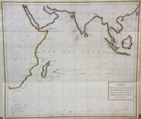
Indian Ocean map Carte des Declinaisons et inclinaisons de l'Aiguille Aimantee redigee d'apres la table des observations Magnetiques faites par les Voyageurs depuis l'Annee 1775.
Paris 1788. Very Good;. Notes: An 18th century mapping of the Indian Ocean. This handsome sea chart depicts magnetic needle readings along various routes in the ocean from the Cape of Good Hope le Cap des Aiguilles to the South East Asian archipelago. Size : 511x583 mm 20.12x22.95 Inches Coloring: Hand Colored in Outline Category: Maps Sea Chart; Maps Ocean Indian; unknown
Referenz des Buchhändlers : M7032
|
|
|
La PErouse, Jean FranAois de :
La Perousen's Entdeckungsreisen in den Jahren 1785 86 87 und 88. Aus dem Franzˆsischen mit Anmerkungen von Forster und Sprengel. 2 B‰nde.
Berlin und Hamburg 1800. Bibliothek der neuesten und interessantesten Reisebeschreibungen Band 23. 8vo. 410 S. mit 1 gest. Frontispiz 1 Portraitvignette auf dem Titel 2 Kupfertafeln 1 gef. Karte; 344 S. mit gest Frontispiz 1 Titelvignette 1 gefalt. Karte. Halblederb‰nde der Zeit mit RSchild etwas berieben Rotschnitt guter Zustand. unknown
Referenz des Buchhändlers : H492
|
|
|
LA PEROUSE, Jean-Francois de Galaup
La Perousens Entdeckungsreise in den Jahren 1785 1786 1787 und 1788 herausgegeben von M. C. A. Milet Mureau. Aus dem Französischen übersetzt und mit Anmerkungen begleitet von J. R. Forster und C. L. Sprengel. Mit 3 Kupfern und 1 Portrait 2 Theil: Mit 1 Kupfer 1 Vignette und 1 Karte. 1-2 Teil.
Berlin und Hamburg 1800. 2 Bde. 8°. Gest. Taf. gest. Titelbl. Titelbl. 1 nn. Bl. 410 S. mit 2 gest. Taf.; gest. Taf. gest. Titelbl. Titelbl. 344 S. mit e. gef. gest. Karte mit e. Porträtmedaillon des Perouse am Kupfertitel des ersten u. e. Illustrationsvignette am Kupfertitel des zweiten Teiles. Halblederbände d. Zeit mit je zwei Rückenschildchen u. Rückenzierlinien in Goldprägung Einbanddeckel mit Kiebitzpapier überzogen Vorsätze aus zweifärbig bedrucktem Buntpapier Ecken und Kanten bestoßen Ecken teilw. aufgespalten Einbanddeckel berieben fliegende Vorsatzblätter fehlen. Mit je e. Bibliotheksschildchen Joseph Bermann auf den vorderen Innendeckeln. Henze III146; vgl. Bibliotheca geographica 98; ADB 7166ff. Als zweiter und dritter Band der Reihe 'Bibliothek der neuesten und interessantesten Reisebeschreibungen' erschienene Ausgabe der 'Voyage de la Perouse autour du monde'. La Perouse 1741-1788 französischer Geograph und Weltumsegler unternahm diese umfassende Erforschung und Kartographierung des pazifischen Raums im Auftrag der französischen Krone. Am 1. August 1785 stachen die beiden Schiffe von Brest aus in See. Die erste Station war Teneriffa. Im Januar 1786 wurde Patagonien erreicht. Über Kap Hoorn und die Osterinsel ging es nach Hawaii und weiter nach Alaska. La Pérouse der sich zu den Aufklärern zählte verzichtete als erster Europäer bewusst auf die Inbesitznahme noch unerforschter Inseln. In Alaska knüpfte er wichtige Kontakte mit Indianern bevor er die Küste Kaliforniens bereiste. Beide Expeditionsschiffe 'Astrolabe' und 'Bousolle' mit ihrer Besatzung erlitten vermutlich im Bereich der Salomonen Schiffbruch und kehrten nicht nach Frankreich zurück. - Herausgegeben und redigiert wurde das Werk von Louis Marie Antoine Destouff de Milet-Mureau 1756-1825 die deutsche Übersetzung stammt von Johann Reinhold Forster 1729-1798 und C. L. Sprengel. Der vielseitige Naturwissenschaftler und Entdecker J. R. Forster hatte wenige Jahre zuvor James Cook auf dessen zweiter Südseereise begleitet. Erster Band mit nur zwei von drei Kupfertafeln. Berlin und Hamburg 1800. unknown
Referenz des Buchhändlers : REIS0790
|
|
|
La Perouse, J F G, Comte de:
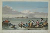
Manila Philippines Vue de Cavite dans la Baie de Manille.
Paris c. 1797. Copper engraving by Simonet after Duche de Vancy and J.M. Moreau le Jeune approx 29 x 42 cms trimmed to platemark left-hand margin extended hand-coloured blank verso. Map unknown
Referenz des Buchhändlers : 3921
|
|
|
La Perouse, Jean Francois de Galaup
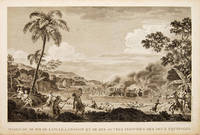
MASSACRE DE MM. DE LANGLE LAMANON ET DE DIX AUTRES DES DEUX ÉQUIPAGES
Atlas Du Voyage De La Pérouse. 1797. Scene showing the locals attacking voyagers as they disembark from their boats. From the Voyages of La Pérouse who set sail from France in 1785 to continue the discoveries of Captain Cook. He was shipwrecked in 1788 but his narrative maps and views survived and were published in 1797. Copper engraving. Very good condition. slight browing around edges but not effecting image Uncoloured. Size: 40 x 25.5 cm. 15½ x 10 inches unknown
Referenz des Buchhändlers : 55648
|
|
|
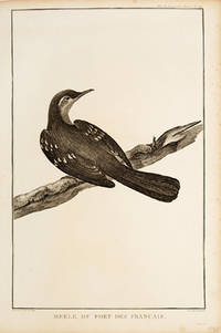
LA PEROUSE, Jean Francois de
Merle de Port des Francais.
Paris. 1797. Print of an Alaskan Merle Bird. From the Voyages of La Pérouse who set sail from France in 1785 to continue the discoveries of Captain Cook. He was shipwrecked in 1788 but his narrative maps and views survived and were published in 1797. Atlas Du Voyage De La Pérouse. Size: 255 x 400 mm. Copper engraving. Uncoloured. Very good condition. Slight browing around edges but not effecting image. unknown
Referenz des Buchhändlers : 55672
|
|
|
La Perouse; Buffon
North Pacific map Carte des Declinaisons et inclinaisons de l'Aiguille Aimantee redigee d'apres la table des observations Magnetiques faites par les Voyageurs depuis l'Annee 1775.
Paris 1788. Very Good; laid on acid-free canvas for long-term preservation. Notes: This handsome sea chart depicts magnetic needle readings along various routes in the North Pacific ocean.<br> Size : 590x1090 mm 23.23x42.91 Inches Coloring: Hand Colored in Outline Category: Maps Sea Chart; Maps Ocean Pacific; Maps United States West; unknown
Referenz des Buchhändlers : M6851
|
|
|
La Perouse
Nouvelle Bibliothèque des Voyages ou Choix des Voyages les Plus Intéressans Vol. 2
paperback. Good. Access codes and supplements are not guaranteed with used items. May be an ex-library book. paperback
Referenz des Buchhändlers : 0259332135.G ISBN : 0259332135 9780259332138

|
|
|
La Perouse
Part of the Great Pacific Ocean shewing the Route of the Spanish Frigate la Princesa commanded by D. Franc. Antonio Maurelle in 1781
London: G & T Robinson 1798. The English edition of a map published to accompany La Perouse' Voyage. G&T Robinson Nov. 1st 1798. Covers from the Gulf of Carpentaria to the Solitaire Islands to the Navigator Islands in the east and to above New Guinea. Charts Maurelle's tracks. G & T Robinson unknown
Referenz des Buchhändlers : 496
|
|
|
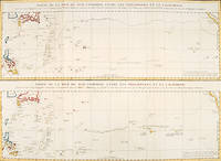
LA PEROUSE, Jean Francois de Galaup
PARTIE DE LA MER DU SUD COMPRISE ENTRE LES PHILIPPINES ET LA CALIFORNIE.
Paris: 1797. An interesting large sheet with two maps covering the same area. The top chart shows the routes of the Spanish galleons from Acapulco to the Philippines. The bottom chart shows La Perouse's route from Monterey through Hawaii and the Marianas to Macao. From the Voyages of La Pérouse who set sail from France in 1785 to continue the discoveries of Captain Cook. He was shipwrecked in 1788 but his narrative maps and views survived and were published in 1797. Thirty-eight years later the scattered remains of La Boussole and L'Astrolabe was discovered wrecked on a vicious reef on an atoll in the New Hebrides. Full title: "Partie de la Mer du Sud comprise entre les Philippines et la Californie d'apres de Carte Espagnole trouvee sur le Galion pris par l'Amiral Anson en 1743 qui represente l'etat des connaissances a cette epoque et les routes que suivaient ordinairement les Galions dans leur traversee de Manille a Acapulco. Partie de la Mer du Sud comprise entre les Philippines et la California d'apres une autre Carte Espagnole communiquee a La Perouse dans sa relache a Monterey sur laquelle il avait trace sa route ainsi que les Iles qu'il avait reconnues avec des notes sur celles qu'il n'avait pas retrouvee." Copper engraving. Very good condition; some light stains along the lower horizontal fold; a tear and some foxing to the upper margin; wide margins. Hand coloured. Size: 79 x 55.5 cm. unknown
Referenz des Buchhändlers : 56361
|
|
|
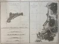
LA PEROUSE, J FG F G
Plan de L'ile de Paque; Plan de la Baie de Cook; April 1786 by the Boussole and Astrolabe
Paris: L'Imprimerie de la Republique 1797. Map. Engraving with hand coloring. Sheet measures 21 1/4" x 28"<br/> <br/> This chart depicts Easter Island with a close-up of Cook's Bay. Relief is depicted by hachure and elevation is shown from several vantage points. Points and peaks of the elevation views correspond to labels on the map. The Bay shows depths and various structures are labeled. The map appeared as Plate 10 in "Atlas du Voyage de La Perouse." It is in very good condition. Stain to upper margin minor foxing marks.<br> <br> Jean Francois de Galaup 1741-c.1788 was a French Navy officer and explorer known for his travels in Oceania. In 1787 he explored the northeast and mainland Asian coasts in the area of Korea. Other voyages included Alaska Japan Australia and the South Pacific. This map demonstrates some of the many observations and findings made on his journeys.<br/> <br/> L'Imprimerie de la Republique unknown
Referenz des Buchhändlers : 299774
|
|
|
La Perouse, Jean FG F G
PLAN DE L'ENTREE DU PORT DE BUCARELLI sur la Cote du Nord-Ouest de l'Amerique par 55 degrees 15' de Latitude Nord et 136 degrees 15' de Longitude a l'Ouest de Paris. map
Paris: La Perouse 1797. Map. Very good condition. Unbound. First Edition. Folio. A large map beautifully decorated with original outline color. The map is included in the Atlas volume of La Perouse's Voyages but was drawn from Spanish manuscripts as it was thought that it might be a part of the Northwest Passage. The map has an extra vertical crease from mis-folding but is quite clean and has large margins which are lightly soiled here and there. La Perouse Paperback
Referenz des Buchhändlers : 016788
|
|
|
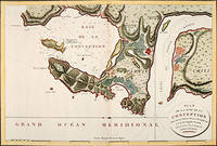
LA PEROUSE, Jean Francois de Galaup
PLAN DE LA BAIE DE LA CONCEPTION.
Paris: 1797. Fine sea chart of the bay and Bio Bio River region with great topographical and hydrological detail. Villages and Fort St. Pierre are depicted. From the Voyages of La Pérouse who set sail from France in 1785 to continue the discoveries of Captain Cook. He was shipwrecked in 1788 but his narrative maps and views survived and were published in 1797. Thirty-eight years later the scattered remains of La Boussole and L'Astrolabe was discovered wrecked on a vicious reef on an atoll in the New Hebrides. Copper engraving. Very good condition; slight browning to the centrefold. Hand coloured. Size: 57 x 42 cm. unknown
Referenz des Buchhändlers : 56362
|
|
|
LA PEROUSE, Jean Francois de GalaupEngraved by L AUBERT p E
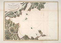
PLAN DE LA BAIE DE CASTURIES SITUEÉ SUR LA CÔTE ORIENTALE DE TARTARIE
Atlas Du Voyage De La Pérouse. Paris: L'Imprimerie de la Republique. 1797. From the Voyages of La Pérouse who set sail from France in 1785 to continue the discoveries of Captain Cook. He was shipwrecked in 1788 but his narrative maps and views survived and were published in 1797. An attractive sea chart showing a bay at the coast of Eastern Tartary. Relief shown by hachures; depths by soundings. This is how this part of La Pérouse's journey was described in a diary: 'On 11 August they reached the southwestern point of Sakhalin Island which La Pérouse named Cap Crillon Mys Kril'on. The ships anchored near Mys Kril'on and Vaujuas went ashore where he met more Ainu people some of whom also visited the ship. The ships began to sail through the strait the next day. La Pérouse called it Canal de Castries but it would later be called La Perouse Strait.' Copper engraving. Very good condition. Faint vertical waterstains. Some very slight browning to lower margin. Good margins. Hand coloured. Size: 68 x 49 cm. 27 x 19½ inches unknown
Referenz des Buchhändlers : 55877
|
|
|
LA PEROUSE, Jean Francois de Galaup PREVOST
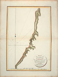
Plan de la Baie de Langle.
Paris: L'Imprimerie de la Republique.Atlas Du Voyage De La Pérouse. 1797. From the Voyages of La Pérouse who set sail from France in 1785 to continue the discoveries of Captain Cook. He was shipwrecked in 1788 but his narrative maps and views survived and were published in 1797. Tomari Region Russia ; Sakhalin Russia Full Title: Plan de la Baie de Langle. Situee a la partie ouest de l'Ile de Tchoka par 47048'36" de latitude nord et 139057'54" de longitude orientale. L. Aubert scripsit. Atlas du Voyage de la Perouse no. 49. Paris: L'Imprimerie de la Republique An V 1797. Engraved by AUBERTL. Size: 255 x 400 mm. Copper engraving. Hand coloured. Very good condition. unknown
Referenz des Buchhändlers : 55866
|
|
|
LA PEROUSE, Jean Francois de Galaup PREVOSTEngraved by AUBERT,L T E
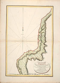
Plan de la Baie d'Estaing.
Atlas Du Voyage De La Pérouse. 1797. From the Voyages of La Pérouse who set sail from France in 1785 to continue the discoveries of Captain Cook. He was shipwrecked in 1788 but his narrative maps and views survived and were published in 1797. Uglegorsk Region Russia Full Title: Plan de la Baie d'Estaing. Situee a la cote de l'ouest de Tchoka par 48059'38" de latitude nord et par 14000'42" de longitude orientale prise du mouillage de l'Astrolabe. Cette Baie fut decouverte le 20 juillet 1787 par les Fregates Francaises la Boussole et l'Astrolabe commandees par MM. de La Perouse et de Langle. L. Aubert scripsit. Atlas du Voyage de la Perouse no. 51. Paris: L'Imprimerie de la Republique An V 1797. Engraved by AUBERTL. Size: 255 x 400 mm. Copper engraving. Uncoloured. Very good condition. unknown
Referenz des Buchhändlers : 55865
|
|
|
LA PEROUSE, Jean Francois de GalaupEngraved by AUBERT, L p E
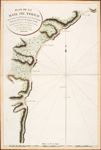
PLAN DE LA BAIE DE TERNAI Situeé sur la côte de Tartarie.
Atlas Du Voyage De La Pérouse. Paris: L'Imprimerie de la Republique. 1797. A crisp clear map of the Bay of Ternai in Tartary. Relief shown by hachures; depths by soundings. From the Voyages of La Pérouse who set sail from France in 1785 to continue the discoveries of Captain Cook. He was shipwrecked in 1788 but his narrative maps and views survived and were published in 1797. Thirty-eight years later the scattered remains of La Boussole and L'Astrolabe was discovered wrecked on a vicious reef on an atoll in the New Hebrides. Copper engraving. Fine condition; slight browning and foxing to wide margins not affecting the image. Hand coloured. Size: 42.5 x 56.5 cm. 16½ x 22 inches unknown
Referenz des Buchhändlers : 56364
|
|
|
La Perouse
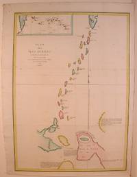
Plan des Iles Juriles et des Terres peu connues
Paris 1788. Very Good. Size : 685x495 mm 27x19.5 Inches Coloring: Hand Colored Category: Maps Russia; Maps Asia Far East Japan & Korea; unknown
Referenz des Buchhändlers : M4779
|
|
|
LA PEROUSE, Jean Francois de Galaup
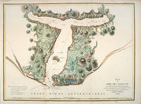
Plan du port des Francais.
Paris: 1797. From the Voyages of La Pérouse who set sail from France in 1785 to continue the discoveries of Captain Cook. He was shipwrecked in 1788 but his narrative maps and views survived and were published in 1797. Thirty-eight years later the scattered remains of La Boussole and L'Astrolabe was discovered wrecked on a vicious reef on an atoll in the New Hebrides. Attractive sea chart showing the entrance to Port des Français. Engraved by BOUCLET. Atlas Du Voyage De La Pérouse. Size: 680 x 495 mm. Copper engraving. Hand coloured. Fine condition. Good margins. unknown
Referenz des Buchhändlers : 55881
|
|
|
LA PEROUSE, Jean Francois de
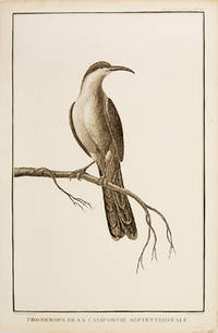
Pomerops de la Californie Septtentrionale.
Paris. 1797. Print of a Californian Cape bird. From the Voyages of La Pérouse who set sail from France in 1785 to continue the discoveries of Captain Cook. He was shipwrecked in 1788 but his narrative maps and views survived and were published in 1797. Atlas Du Voyage De La Pérouse Size: 255 x 400 mm. Copper engraving. Uncoloured. Very good condition. Slight browing around edges but not effecting image. unknown
Referenz des Buchhändlers : 55673
|
|
|
LA PEROUSE, (JEAN FRANCOIS GALAUP de). - WITH WORLD MAP
Relation abrégée du Voyage de La Perouse pendant les Années 1785 1786 1787 et 1788; pour faire suite à l'Abrégé de l'histoire générales des Voyages par Laharpe. Avec Portrait Figures et carte.
Leipsick No publisher 1799. Contemp. hcalf. Spine gilt and with gilt lettering. XXXVI562 pp. 5 engraved plates and 1 large folded engraved world map: "Mappemonde ou Carte réduite des Parties connues du Globe pour servir au Voyage de la Pérouse." 52 x 425 cm. A few margins of text at beginning and at end stained. The portrait lacks. <br/><br/><em>Sabin 38959. </em> unknown
Referenz des Buchhändlers : 53594
|
|
|
LA PEROUSE, Jean Francois Galaup de
Resa omkring Jorden af Herr de la Perouse åren 1785 och följande. Sammandrag
Stockholm: Johan Pfeiffer 1799. A few light spots but a very good copy. Small octavo; in attractive original Scandinavian half calf binding. <p><p>Rare Swedish edition of the voyage of La Pérouse whose fame was so widespread that there was a ready market for accounts of his voyage across Europe and beyond. Within four years of the publication of the official French edition in 1797 translations appeared in London Edinburgh Paris Stockholm Leipzig Berlin Copenhagen Haarlem St. Petersburg Boston and Amsterdam.</p> <p>This Swedish version was prepared by Samuel Ödmann from the octavo French edition. He also provides a preface. Not in the catalogue of the Hill collection; Ferguson knew the book only from copies in the Mitchell Library and the Kroepelien Collection Oslo.</p> </p> . Johan Pfeiffer unknown
Referenz des Buchhändlers : 3812959
|
|
|
LA PEROUSE, Jean-Francois de Galaup de
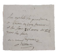
Short autograph note signed by La Pérouse.
At sea 1781. Short manuscript note in ink on a small sheet of laid paper 12 x 13.5 cm. An exceptionally rare autograph note signed by the great French explorer La Pérouse. The extraordinary story and achievements of La Pérouse are well known and recounted in the handsome official account of his expedition. However because he was lost without trace mid-voyage manuscript material relating to his life is very rare indeed. In the present note La Pérouse asks that his boat be given an impressive 286 "aunes" of canvas which is needed on board. An "aune" is an old-fashioned French measure usually translated as ell or cubit: its length could vary but the normal French/Parisian aune was about 118 cm meaning that La Pérouse is in fact asking for about 340 metres of canvas. The sheer quantity of the request speaks to La Pérouse having written the note while in charge of a large vessel.The document is counter-signed and noted as "delivered" by one "Deletombe": it seems very likely that this is Philippe-André-Joseph de Létombe who arrived in the United States in 1781 and was the French Consul in Boston and a correspondent of Thomas Jefferson. If this identification is correct the note would possibly date from La Pérouse's cruising in the West Indies and along the coast to Hudson Bay in 1781 and 1782.With old folds clearly and legibly written and docketed; in very good condition. unknown
Referenz des Buchhändlers : H1RDFKW35E6F
|
|
|
La Perouse, Jean-Francois de Galaup de ; John Dunmore [Editor]
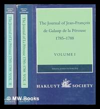
The journal of Jean-Francois de Galaud de la Pérouse 1785-1788. Vol.1 & 2 translated and edited by J. Dunmore
London : The Hakluyt Society 1994. First Edition. Hardcover. Fine cloth copies in a fine very slightly edge-dulled dust wrappers. Well-preserved overall. Not price-clipped. Volumes one and two. Series: Works issued by the Hakluyt Society. 2nd series ; 179. Physical description: 2 volumes ccxl 613 pages : illustrations maps ; 23 cm. Notes: Translated from the French. Subjects; Boussole Ship. Astrolabe Ship. Voyages and travels History 18th century. Explorers France Biography. London : The Hakluyt Society hardcover
Referenz des Buchhändlers : 448960 ISBN : 0904180387 9780904180381
|
|
|
LA PEROUSE, Jean Francois de Galaup DUCHE DE VANCY
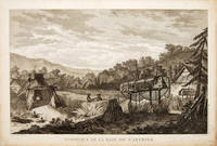
Tombeaux de la Baie de Castries.
Atlas Du Voyage De La Pérouse. 1797. From the Voyages of La Pérouse who set sail from France in 1785 to continue the discoveries of Captain Cook. He was shipwrecked in 1788 but his narrative maps and views survived and were published in 1797. Size: 400 x 255 mm. Copper engraving. Uncoloured. Very good condition. slight browing around edges not affecting image. unknown
Referenz des Buchhändlers : 55668
|
|
|
La Perouse, John Francis Galaup; Duche De Vancy, Jean Baptiste, Health, James
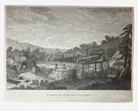
Tombs of Baie de Castries: an engraving from Charts and Plates to La Perouse's Voyage 1798
G. G & J. Robinson. LA PAROUSE John Francis Galaup; DUCHÉ DE VANCY Jean Baptiste; HEATH James: Tombs of Baie de Castries. An engraving from Charts and Plates to La Pérouse's Voyage London: G. G. & J. Robinson 1798. Copper engraving 310 × 230 mm plate on laid paper with good margins; plate mark visible; light overall toning and a few faint spots with a shallow horizontal fold as issued otherwise in very good condition. A view of the tombs at Baie de Castries showing a small settlement with two figures in the foreground and the distinctive raised wooden burial structures. Bais de Castries described in contemporary sources as lying on the eastern coast of Tartary corresponds to the North Pacific explored by La Perouse in 1787 in the region now identified with the northwest coast of America southeast Alaska. The drawing was made by Jean-Baptiste Louis Claude Théodore duc de Vancy one of the official artists attached to the expedition of Jean-François de Galaup comte de La Pérouse whose role was to record landscapes sites and customs encountered during the voyage. La Perouse and his crew wouldn't make it back to Paris with it latterly being discovered that his ship was wrecked at Vanikoro now the Solomon Islands. The plate was engraved in London by James Heath among the leading line engravers of the late eighteenth century and published by G. G. & J. Robinson for the atlas volume Charts and Plates to La Pérouse's Voyage Round the World issued in 1798 as part of the English edition of the expedition's results. . Very Good. Soft cover. 1st Edition. 1st Printing. 1798. G. G & J. Robinson paperback
Referenz des Buchhändlers : 003681
|
|
|
LA PEROUSE, Jean Francois de Galaup
Viaggi di La Pérouse Intorno al Mondo
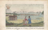
Livorno: Tipografia Vignozzi 1827. Three leaves a little short at the margins printer's error a little foxing but very good. Three volumes duodecimo three frontispieces and three plates all with good contemporary handcolouring; contemporary quarter roan binding lettered in gilt marbled boards with vellum tips. <p><p>Attractive early Italian edition of La Pérouse's voyage containing six charming coloured plates three of which are not recorded in the standard bibliographies. The first of these unrecorded plates is a costume study captioned "Uomo e Donna volgari della Concezione"; the second a view of Macao and the third depicts the death of botanist and savant Robert de Lamanon amidst a melée in Samoa during 1787. Neither Ferguson Forbes nor McLaren note the three plates additional to the frontispieces. Forbes did not in fact manage to inspect a copy of the book. Ferguson cites his own copy while McLaren consulted the Nan Kivell copy held by the National Library. </p> <p>This edition was part of a larger collection of voyages published in uniform duodecimo format with the series title Biblioteca Istruttiva e Piacevole ovvero raccolta dei più interessanti viaggi. Forbes confirms that each of the voyages was available separately. The spines in this set number the volumes within the series.</p> </p> . Tipografia Vignozzi unknown
Referenz des Buchhändlers : 4011312
|
|
|
LA PEROUSE, Jean Francois de Galaup de
Voyage autour du monde.
Paris: Imprimerie de la République 1797. Contemporary uniform gold-tooled marbled calf richly gold-tooled spines with a red title-label and a small green volume number label both lettered in gold gold-tooled board edges marbled endpapers. 4to 30 x ca. 23 cm. and large folio ca. 57 x 40 cm. Ad 1: with an engraved portrait of De la Pérouse by Tardieu and tables in the text. The atlas contains an engraved title page 1 large double-page folding map of De la Pérouse's journey 20 double-page maps and 48 full-page maps views and illustrations. Ad 2: with tables in the text. The atlas contains an engraved title page 1 double-page map and 43 full-page plates. Ad 3: with 33 folding engraved plates and with tables in the text. The atlas contains an engraved title page an engraved table of contents 37 large double-page folding maps 2 large double-page folding views and 10 full-page maps and illustrations. The three atlases for ads 1-3 are bound together in a large folio matching contemporary gold-tooled marbled calf binding. 9 volumes: ad 1 in 4 volumes; ad 2 in 2 volumes; ad 3 in 2 volumes with the atlases of the 3 works bound together in 1 volume. With:2 LABILLARDIÉRE Jacques Julien Houton de. Voyage à la recherche de Lapérouse.Paris H.J. Jansen An VIII = 1799-1800.3 ENTRECASTEAUX Antoine Raymond Joseph de Bruni chevalier d'. Voyage envoyé à la recherche de Lapérouse.Paris Imprimerie Impériale 1808. Three first editions of descriptions of the rarest and most interesting 18th-century expeditions bound as a set in beautiful contemporary uniform bindings. A milestone set in the history of exploration of the Pacific.Ad 1: Record of an important French scientific expedition in which participated a number of scientists and artists. De la Pérouse left France in 1785 with two frigates the Astrolabe and Boussole to explore the Pacific and the west coast of North America. He was sent there to explore the regions not explored by Captain Cook. Furthermore he was to seek for an interoceanic passage to scientifically observe the various countries peoples and products and to obtain reliable information about the fur trade and the extent of the Spanish settlements in California. This way De la Pérouse made a valuable contribution to the history of geographical discovery particularly concerning the American coast and its natives. The account describes expeditions to Easter Island Hawaii Macao Formosa the Aleutian Islands Samoa Tonga and Australia. The best results were obtained in exploring and mapping the unknown territories on the Asiatic side of the Pacific. This includes the discovery of the strait - still bearing De la Pérouse's name - between the island of Sakhalin and the northernmost island of Japan. De la Pérouse sent his accounts to France from Kamchatka and Botany Bay. But after the expedition left Botany Bay it was never heard from again. Two expeditions were sent out to look for him: the first was led by Dillon in 1827 the second by Dumont d'Urville in 1828. Only 39 years later the remnants of De la Pérouse's two frigates were discovered on the reef of Vanikoro one of the Santa Cruz Islands by Peter Dillon. The maps included in the present travel account is a large general map of the journey detailed maps of different isles several views and beautiful illustrations of plants birds ships people etc.Ad 2: Account of the naturalist De Labillardiére who accompanied one of the futile searches for De la Pérouse. The present expedition was sent out under d'Entrecasteaux and Huon de Kermadec in 1791-1794. Although the expedition was not successful it is of considerable importance because of the scientific observations and surveys of the coasts of Tasmania New Caledonia the north coast of New Guinea and the southwest coast of Australia it produced. De Labillardière's account of the Tongans is among the best contributions to their ethnology. The illustrations include views a portrait of a native illustrations of jewellery and 14 engraved botanical plates after Redouté.Ad 3: Scientific account of a search for De la Pérouse the same expedition as described in the work mentioned above ad 2. The expedition did not succeed but d'Entrecasteaux made important geographical discoveries and his account is extraordinarily rich in cartographical and astronomical material. The Recherche and the Espérance were under his command second captain was Huon de Kermadec after whom the islands north of New Zealand were named. The d'Entrecasteaux Islands near New Guinea were discovered and named for the admiral who later died of colic near the north coast of New Guinea. The beautiful large maps in the atlas depict wonderfully detailed illustrations of isles and coasts along the South Sea. The French Revolution divided the expedition: the royalists joined the Dutch on Java and the Republicans fell into the hands of the British Royal Navy. Also captured were the expedition's journal charts and natural history specimens. Sir Joseph Banks ordered that they be delivered to the coast of France under a flag of truce. With two small book plates on the front endpapers of Clemens Platen-Hallermund and IvR in every volume. Occasionally very slightly foxed in the margins and with a few minor tears in the bottom margin of some leaves otherwise in very good condition. Beautiful copies of an extremely rare and complete set of De la Pérouse's expedition and two descriptions of one of the two expeditions in search of De la Pérouse.l Ad 1: Chadenat 106; Cox I 67; Hill p. 173; Lada-Mocarski 52; Nissen ZBI 281; Sabin 38960; ad 2: Chadenat 99; Cox I 68; Nissen ZBI 2331; Sabin 38420; cf. Hill p. 168 English ed.; ad 3: Chadenat 5056; Hill p. 97 only 32 plates in text vols.; Poggendorf I 671; Sabin 22671. Imprimerie de la République, unknown
Referenz des Buchhändlers : 18688
|
|
|
LA PEROUSE, Jean Francois Galaup de
Voyage autour du Monde
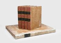
Paris: L'Imprimerie de la Republique 1797. One of the great documents of French exploration" in the original boards First edition an attractive set with strong impressions of the plates. La Pérouse's work is a "magnificent production and some authorities consider the engraving and craftsmanship to be superior even to that in the Cook-Webber atlas
It is one of the finest narratives of maritime exploration ever written and certainly deserves to hold a place of high honour among the great travel accounts of the 18th century" Howell. La Pérouse's 1741-c.1788 expedition left France in 1785 to seek an inter-oceanic passage examining the parts of the Pacific not yet explored by Cook conducting scientific observations on the various peoples and regions assessing the extent of Spanish settlement in California and determining the possibilities of French expansion in the Pacific. En route to Kamchatka La Pérouse was the first to navigate safely and chart the Japan Sea and the strait between the island of Sakhalin and the northernmost island of Japan which bears his name. At Kamchatka he received instructions to proceed to Australia arriving at Botany Bay in January 1788 just hours after Captain Phillip had arrived with the First Fleet. After leaving later the same year the expedition was never seen again. Evidence slowly came to light that both ships were wrecked on the reefs around the islands north-west of Australia. This account is based on dispatches sent from Australia and Kamchatka before this. The atlas volume contains maps of Russian Asia Japan San Francisco Monterey and the Sandwich Islands. The most significant results of La Pérouse's voyage are the charts of the Asiatic side of the Pacific and the details of "the peculiarities he observed in the Native Americans of the northwest coast of North America are especially valuable" Sabin. It also features the first representation of the crested quail. The engraved portrait of La Pérouse counted as the 70th plate is here bound as the frontispiece in Volume I as often. The atlas was published in two forms: on regular usually trimmed and large or thick paper. Forbes and Lada-Mocarski give the measurements for the large paper issue variously at 620 x 455 and 563 x 420 mm. Provenance: Amandine Doré 1911-2012 the French painter illustrator and writer her pencilled signature on the front free endpaper of Volume I dated 1955 her signature and initialled booklabel on the front endpapers of the atlas. Doré produced works for travel narratives such as Mexique pay a trois etages 1955. 5 vols comprising 4 quarto text vols 307 x 256 mm and folio atlas 585 x 440 mm. Engraved portrait of La Perouse after Tardieu. Atlas: engraved allegorical title page by Moreau le Jeune 69 engraved plates and maps some double-page or folding many with original tissue guards loosely inserted. Original pulled paste paper boards flat paper covered spines tinted pink twin dark green spine labels original sheep corners housed together in light brown slipcase; atlas original pulled paste paper boards flat vellum spine covered with white paper dark green morocco spine label recent sheep corners. Text with occasional marginal pencillings or notes. Text vols: bookplate removed from front pastedown of vol. I rubbed a few superficial chips to spines and early recolouring vol. I starting before title; atlas: spine and sides extensively rubbed superficial split to foot of front joint marginal tear to Plate 28 and two others. A very good copy. Anker 276; Ferguson 251 dated 1798; Forbes 272; Hill 972; Lada-Mocarski 52; Sabin 38960; Streeter VI: 3493. Richard Reed in Howell Anniversary Catalogue 72 1982. hardcover
Referenz des Buchhändlers : 181908
|
|
|
LA PEROUSE
VOYAGE AUTOUR DU MONDE.
Paris: chez Plassan An VI - 1798. In-8 p. mm. 216x136 4 volumi brossura muta coeva dorsi con mancanze pp. 4LXVIII368; 4414; 316148; 4328; con una grande carta geografica più e più volte ripieg. i.e. mappemonde ou carte reduite des parties connues du globe. In Appendice al III volume: Tables de la route de "La Boussole" pendant les années 1785-1786-1787-1788 depuis son départ d'Europe jusqu'à Botany-Bay Tables de la route de "L'Astrolabe" pendant les années 1785-1786-1787 depuis son départ d'Europe jusqu'au Kamtschatka. "Manca l'Atlante di tavole".Relazione del viaggio intorno al mondo in cui si tratta anche di astronomia fisica chimica mineralogia zoologia botanica e medicina. "Seconda edizione" la prima è del 1797 di questa importante opera che fu anche tradotta in varie lingue. Cfr. BrunetIII828 - GraesseIV103 - The Hill Collect. of Pacific Voyages972 per la prima edizione di one of the most important scientific explorations ever undertaken to the Pacific and the West coast of North America.Solo qualche lieve fioriture altrimenti esemplare con barbe ben conservato."Jean-François de Galaup Conte di La Pérouse navigatore francese 1741-1788 ebbe da Luigi XVI il comando di un grande viaggio di circumnavigazione allo scopo di esplorare le regioni ancora sconosciute del Pacifico. Partito con due navi su cui erano alcuni scienziati 1785 si portò all'isola di Pasqua alle Hawaii e quindi lungo le coste dell'Alasca. Nel 1787 toccate le Marianne Macao e Manila costeggiò la Manciuria ed esplorò i mari intorno al Giappone settentrionale spingendosi fino alla Camciatca. Mandò dalla Nuova Olanda le sue ultime notizie in patria e salpato dalla Baia del Botanico con le due navi scomparve per sempre 1788. Secondo le tracce scoperte da P. Dillon e da Dumont d'Urville sarebbe naufragato presso l'isola Vanikoro gruppo S. Croce". Così Diz. TreccaniVI p. 691. chez Plassan, unknown
Referenz des Buchhändlers : 117441

|
|
|
LA PEROUSE, Jean-Francois de Galaup (Comte de).
Voyage de la Pérouse autour du Monde publié conformément au décret du 22 Avril 1791 et rédigé par M. L.A. Milet-Mureau.
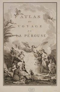
Paris Imprimerie de la République An V An V 1797. . First edition. 4 text vols 4to 30 x 23 cms and folio atlas 58 x 45 cms engraved portrait of La Pérouse after Tardieu atlas with engraved allegorical title-page by Moreau le Jeune titled Atlas du voyage de La Pérouse without imprint and 69 engraved plates comprising folding world map 35 views and natural history plates 33 maps or coastal profiles of which 20 double-page. Text volumes contemporary half-calf marbled boards chip to head of spine vol. I light marginal water-staining vol. II and title-page vol. III bound without half-titles joints vol. I cracked but sound lightly rubbed some scraping to boards; atlas 19th-century red morocco-backed boards neatly rebacked royal cypher of Prince Philippe of Belgium to cover and spine marginal repair to tear circa 7 cms to blank outer margin plate 15 not touching image occasional light foxing at beginning and end a very good set.<br /> The first edition of one of the most important scientific explorations ever undertaken to the Pacific and the northwest American coast and the first scientific voyage to California. 'The voyage round the world under the command of La Pérouse was intended as the French equivalent of Captain Cook's Third Voyage and was enthusiastically endorsed by the Academy of Sciences and particularly by Louis XVI. The most significant results of the voyage are the charts of the then imperfectly known Asiatic coast of the Pacific' Forbes. <br /><br />La Pérouse was the first explorer to navigate and chart the Japan sea and the strait between the island of Sakhalin and the northernmost island of Japan which bears his name. At Kamchatka he received instructions to proceed to Australia to assess the extent of British plans. He arrived at Botany Bay in January 1788 just hours after Governor Phillip had arrived with the First Fleet. La Pérouse's habit of forwarding copies of journals and drawings when opportunity offered ensured their survival for as is well known the accomplishments of the voyage have been overshadowed by the disappearance of the entire expedition. The folio atlas contains magnificent maps of Russian Asia Japan the Pacific North-West Coast Hawaii San Francisco and Monterey; the views include a fine series of botanical and ornithological plates including the California quail. Of particular interest to Hawaii is the plate that depicts French ships off Makena Maui. It is the first fully developed view of that island.<br /> Hill 972; Forbes 272; Lada-Mocarski 52; Ferguson 251; Brunet III 828-829; Sabin 4797. Paris, Imprimerie de la République, An V, An V [1797]. hardcover
Referenz des Buchhändlers : 98498
|
|
|
La Perouse, Jean-Francois de Galaup
Voyage de La Pérouse autour du monde publié conformément au décret du 22 avril 1791 et rédigé par M. L. A. Milet-Mureau . of 2; Volume 1 French Edition
hardcover. Good. Access codes and supplements are not guaranteed with used items. May be an ex-library book. hardcover
Referenz des Buchhändlers : 0274860783.G ISBN : 0274860783 9780274860784

|
|
|
La Perouse, Jean-Francois de Galaup
Voyage de La Pérouse autour du monde publié conformément au décret du 22 avril 1791 et rédigé par M. L. A. Milet-Mureau . of 2; Volume 2 French Edition
hardcover. Good. Access codes and supplements are not guaranteed with used items. May be an ex-library book. hardcover
Referenz des Buchhändlers : 0274860805.G ISBN : 0274860805 9780274860807

|
|
|
La Perouse, Jean-Francois de Galaup
Voyage de La Pérouse autour du monde publié conformément au décret du 22 avril 1791 et rédigé par M. L. A. Milet-Mureau . of 2; Volume 1 French Edition
paperback. Good. Access codes and supplements are not guaranteed with used items. May be an ex-library book. paperback
Referenz des Buchhändlers : 0274860775.G ISBN : 0274860775 9780274860777

|
|
|
La Perouse, Jean-Francois de Galaup
Voyage de La Pérouse autour du monde publié conformément au décret du 22 avril 1791 et rédigé par M. L. A. Milet-Mureau . of 2; Volume 2 French Edition
paperback. Good. Access codes and supplements are not guaranteed with used items. May be an ex-library book. paperback
Referenz des Buchhändlers : 0274860791.G ISBN : 0274860791 9780274860791

|
|
|
La Perouse, Jean-Francois de Galaup
Voyage de la Pérouse Autour Du Monde. T. 2 Éd.1797 Histoire French Edition
paperback. Good. Access codes and supplements are not guaranteed with used items. May be an ex-library book. paperback
Referenz des Buchhändlers : 2012632394.G ISBN : 2012632394 9782012632394

|
|
|
La Perouse, Jean-Francois de Galaup
Voyage de la Pérouse Autour Du Monde. T. 1 Éd.1797 Histoire French Edition
paperback. Good. Access codes and supplements are not guaranteed with used items. May be an ex-library book. paperback
Referenz des Buchhändlers : 2012632386.G ISBN : 2012632386 9782012632387
|
|
|
La Perouse, Jean-Francois de Galaup
Voyage de la Perouse Autour Du Monde. Tome 3 French Edition
paperback. Good. Access codes and supplements are not guaranteed with used items. May be an ex-library book. paperback
Referenz des Buchhändlers : 2019162024.G ISBN : 2019162024 9782019162023
|
|
|
La Perouse, Jean-Francois de Galaup
Voyage de la Pérouse Autour Du Monde. T. 3 Éd.1797 Histoire French Edition
paperback. Good. Access codes and supplements are not guaranteed with used items. May be an ex-library book. paperback
Referenz des Buchhändlers : 2012632408.G ISBN : 2012632408 9782012632400
|
|
|
La Perouse, Jean-Francois de Galaup
Voyage de la Perouse Autour Du Monde. Tome 1 French Edition
paperback. Good. Access codes and supplements are not guaranteed with used items. May be an ex-library book. paperback
Referenz des Buchhändlers : 2019162040.G ISBN : 2019162040 9782019162047
|
|
|
LA PEROUSE, (JEAN-FRANCOIS de GALAUP).
Voyage de La Pérouse autour du Monde publié conformément au Décrets du 22 Avril 1791 et rédigé par M.L.A. Milet-Mureau. 4 Vols. Atlas.
Paris Plassin 1798. 8vo. and folio 44 x 30 cm. Textvolumes bound in 4 contemporary half calf. Gilt spines with gilt lettering. Tome-label on volume one eroded. Stamp on title-pages. 4LXVIII368;4414;316120 = Tables;4328 pp. A few scattered brownspots. Atlasvolume bound in matching hcalf. Spine gilt and rubbed. Lower compartment of spine with wear and tear. Engraved portrai of Pérouse as frontispiece. Engraved pictorial titlepage with cupids and naviogational instruments dessinée par Moreau le Jeune and 69 engraved maps plans and plates of which 32 are large folded engraved maps. Mild foxing to some parts of some maps occasionally mild dampstains to some plates marginal browning and some spotting. One map with a repair to folding. <br/><br/><em>Second edition of the textvolumes the first appeared the year before 1797 and first edition of plates. 69 plates to the first 70 to the second."In 1785 Jean-Francois de Galaup Comte de la Perouse began preparations for an extensive sea voyage. His aim was to explore the Pacific regions of North and South America Asia and Australasia. The sponsor of the expedition was the French king Louis XVI who was inspired by Captain James Cook's Pacific voyages. Louis ordered the French expedition to show the world that France could also dominate in ocean exploration. The expedition consisted of two ships - La Boussole and L'Astrolabe. They carried a total of 225 crew officers and scientists. The ships left France in August 1785 and sailed south around Cape Horn. The voyage was expected to last four years. During the voyage La Perouse sent back regular reports to France. The expedition mapped coastlines and explored uncharted areas of ocean. The expedition's scientists also spent time onshore at various ports observing the habits and customs of local people and collecting natural history specimens. The expedition's progess until September 1787 was published by the French government as Voyage de La Perouse autour du monde La Perouse's voyage around the world. It was reprinted many times and translated into several languages. In 1791 when La Perouse had not returned to France or made any contact by dispatch the French government sent out a search party. It was commanded by Rear Admiral Joseph Antoine Bruni d'Entrecasteaux and consisted of two ships Recherche and Esperance. The complete disappearance of La Perouse caught the imagination of the European public. Songs stories and plays were written about the possible fate of the expedition including a popular play called Perouse or The desolate island. It was not until 1964 that the wreck of La Boussole was finally discovered on Vanikoro's reefs. At last the fate of La Perouse and his crew was known. The expedition is commemorated in the name of a Sydney suburb on the shores of Botany Bay - La Perouse." State Library of New South Wales Website.Sabin 38960. </em> unknown
Referenz des Buchhändlers : 53622
|
|
|
LA PEROUSE, Jean Francois
Voyage Round the World. Performed in the Years
1801. LA PEROUSE Jean Francois. A Voyage Round the World. Performed in the Years 1785 1786 1787 1788.TO which are added A Voyage from Manilla to California by Don Antonio Maurelle: and an Abstract of the Voyage and Discoveries of the Late Capt. G. Vancouver. Boston: Joseph Bumstead 1801 333pp. Contemporary full leather morocco spine label skillfully rebacked. Some toning throughout else very good. Hill 976. Sabin 38966. Howes L-93. Forbes 331. Shaw & Shoemaker 789. Ferguson 333. Reese Best of the West 20. Kroepelien 1331.The rare first American edition of one of the most important Pacific voyages. The La Perouse account was first published in Paris in French in 1797 and in English in 1798. This is one of the earliest Pacific voyages to appear in an American edition and published much less modestly than the French and British editions would have been the way the average American would have learned about La Perouse's important surveys of the Pacific coast and his descriptions of native Americans there. This is also the first American version although only a precis of Vancouver's voyage first published in London in 1798. The 1781 voyage of Spanish naval officer Francisco Antonio Mourelle incorrectly spelled in this edition's title went from the Philippines to the South Pacific where he explored in the vicinity of New Guinea and the Tonga Islands before sailing to Mexico. Howes is inaccurate in his pagination of this edition and the Hill copy contains a map that was added later. unknown
Referenz des Buchhändlers : 84360
|
|
|
La Perouse, Jean Francois de
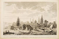
Vue d'un éstablissment des habitans du port des francais pour la saison de la peche.
Paris. 1797. Scene showing inhabitants of Lituya Bay Alaska in fishing season. From the Voyages of La Perouse who set sail from France in 1785 to continue the discoveries of Captain Cook. He was shipwrecked in 1788 but his narrative maps and views survived and were published in 1797. Atlas Du Voyage De La Pérouse. Size: 400 x 255 mm. Copper engraving. Uncoloured. Very good condition. slight browing around edges but not effecting image. unknown
Referenz des Buchhändlers : 55666
|
|
|
La Perouse, Jean Francois de Galaup
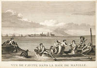
VUE DE CAVITE DANS LA BAIE DE MANILLE
Paris. 1797. This dramatic and attractive print is from the Voyages of La Perouse who set sail from France in 1785 to continue the discoveries of Captain Cook. He was shipwrecked in 1788 but his narrative maps and views survived and were published in 1797. Atlas du Voyage de la Perouse Copper engraving. Good margins crisp clear impression very good condition. slight browing around edges but not effecting image Uncoloured. Size: 40 x 25.5 cm. unknown
Referenz des Buchhändlers : 55645
|
|
|
LA PEROUSE, Jean Francois de Galaup
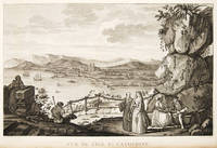
VUE DE L'ÎLE STE Catherine.
Paris. 1797. View of Brazil from the Voyages of La Perouse who set sail from France in 1785 to continue the discoveries of Captain Cook. He was shipwrecked in 1788 but his narrative maps and views survived and were published in 1797. Atlas Du Voyage De La Pérouse. Copper engraving. Very good condition. slight browing around edges but not effecting image. Uncoloured. Size: 40 x 25.5 cm. unknown
Referenz des Buchhändlers : 55649
|
|
|
LA PEROUSE, Jean Francois de Galaup
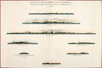
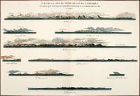
VUE DE LA CÔTE DU NORD-OUEST DE L'AMÉRIQUE reconnue par les Frégates Françaises la BOUSSOLE et L'ASTROLABE en 1786.
Paris: 1797. Eight profiles showing Mt. la Touche Baie de la Touche present Englefield Bay C. Hector present Cape St. James I. Kerouard Iles Sartine Scott Islands and Cap Blanc. The map is from the Voyages of La Pérouse who set sail from France in 1785 to continue the discoveries of Captain Cook. He was shipwrecked in 1788 but his narrative maps and views survived and were published in 1797. Thirty-eight years later the scattered remains of La Boussole and L'Astrolabe was discovered wrecked on a vicious reef on an atoll in the New Hebrides. Atlas Du Voyage De La Pérouse. Paris: Copper engraving. Very good condition; slight browning along the centrefold and foxing to wide margins a tear to the bottom margin along the centrefold not affecting the image. Hand coloured. Size: 58.5 x 43 cm. unknown
Referenz des Buchhändlers : 56369
|
|
|
LA PEROUSE, Jean Francois de Galaup
VUE DE LA CÔTE DU NORD-OUEST DE L'AMÉRIQUE reconnue par les Frégates Françaises la BOUSSOLE et L'ASTROLABE en 1786.
Paris: 1797. Nine profiles showing Mt. Beautems Mt. Crillon Mt.St. Hyacinthe Port Guibert Iles des Espagnols Iles Necker Necker Islands Ile Sn. Carlos Pointe des Brisants present Estevan Point and Baie Clonard Beresford Bay. The map is from the Voyages of La Pérouse who set sail from France in 1785 to continue the discoveries of Captain Cook. He was shipwrecked in 1788 but his narrative maps and views survived and were published in 1797. Thirty-eight years later the scattered remains of La Boussole and L'Astrolabe was discovered wrecked on a vicious reef on an atoll in the New Hebrides. Atlas Du Voyage De La Pérouse. Paris: Copper engraving. Very good condition; slight browning along the centrefold and foxing to wide margins a tear to the bottom margin along the centrefold not affecting the image. Hand coloured. Size: 58.5 x 43 cm. unknown
Referenz des Buchhändlers : 56368
|
|
|
LA PEROUSE, Jean Francois de Galaup BLONDELA
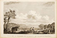
Vue de St. Pierre et St Paul au Kamtschatka.
Atlas Du Voyage De La Pérouse. 1797. View of St Pierre and St Paul in Kamtschatka. From the Voyages of La Pérouse who set sail from France in 1785 to continue the discoveries of Captain Cook. He was shipwrecked in 1788 but his narrative maps and views survived and were published in 1797. Size: 400 x 255 mm. Copper engraving. Uncoloured. Very good condition. slight browing around edges but not effecting image. unknown
Referenz des Buchhändlers : 55670
|
|
|
La Perouse, Jean-Francois de Galaup und Klaus Fischer
Zu den Klippen von Vanikoro : Weltreise im Auftr. Ludwigs XVI. 1785 - 1788. Jean-François de Lapérouse. Nach Lapérouses Tagebüchern aufgezeichn. von M. L.-A. Milet-Mureau. Übers. bearb. u. hrsg. von Klaus Fischer / Alte abenteuerliche Reiseberichte La Pérouse Jean-François de Galaup und Klaus Fischer
Stuttgart ; Wien : Ed. Erdmann 1987. 1987. Zu den Klippen von Vanikoro : Weltreise im Auftr. Ludwigs XVI. 1785 - 1788. Jean-François de Lapérouse. Nach Lapérouses Tagebüchern aufgezeichn. von M. L.-A. Milet-Mureau. Übers. bearb. u. hrsg. von Klaus Fischer / Alte abenteuerliche Reiseberichte <br/><br/>Zu den Klippen von Vanikoro : Weltreise im Auftr. Ludwigs XVI. 1785 - 1788. Jean-François de Lapérouse. Nach Lapérouses Tagebüchern aufgezeichn. von M. L.-A. Milet-Mureau. Übers. bearb. u. hrsg. von Klaus Fischer / Alte abenteuerliche Reiseberichte La Pérouse Jean-François de Galaup und Klaus Fischer Stuttgart ; Wien : Ed. Erdmann unknown
Referenz des Buchhändlers : BN257250 ISBN : 3522612108 9783522612104
|
|

 Per e-mail erhalten
 Als pdf-Dokument herunterladen
 RSS feed
 Permanenter link
