|
|
|
Service topographique fédéral:
Atlas topographique de la Suisse (Atlas Siegfried) - Feuille n° 342, Lucens.
Berne, Service topographique fédéral, 1931. Carte au 1 : 25,000, au format de 43 x 35 cm., sur papier parcheminé. Nom de possesseur au titre, pour le reste en très belle condition.
Référence libraire : 16908

|
|
|
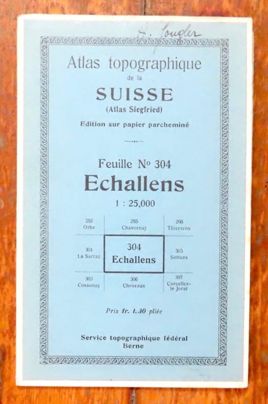
Service topographique fédéral:
Atlas topographique de la Suisse (Atlas Siegfried) - Feuille n° 304, Echallens.
Berne, Service topographique fédéral, 1935. Carte au 1 : 25,000, au format de 43 x 35 cm., sur papier parcheminé. Nom de possesseur au titre, pour le reste en très belle condition.
Référence libraire : 16909
|
|
|
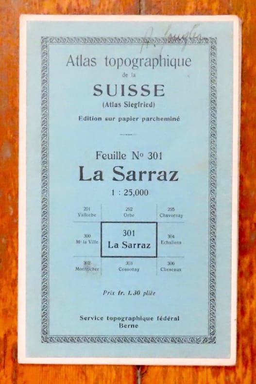
Service topographique fédéral:
Atlas topographique de la Suisse (Atlas Siegfried) - Feuille n° 301, La Sarraz.
Berne, Service topographique fédéral, 1935. Carte au 1 : 25,000, au format de 43 x 35 cm., sur papier parcheminé. Nom de possesseur au titre, pour le reste en très belle condition.
Référence libraire : 16910
|
|
|
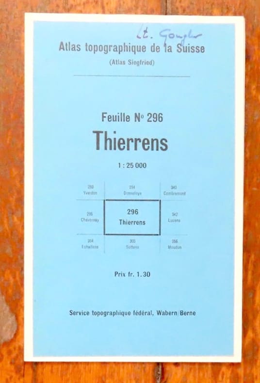
Service topographique fédéral:
Atlas topographique de la Suisse (Atlas Siegfried) - Feuille n° 296, Thierrens.
Berne, Service topographique fédéral, 1945. Carte au 1 : 25,000, au format de 43 x 35 cm., sur papier parcheminé. Nom de possesseur au titre, pour le reste en très belle condition.
Référence libraire : 16911
|
|
|
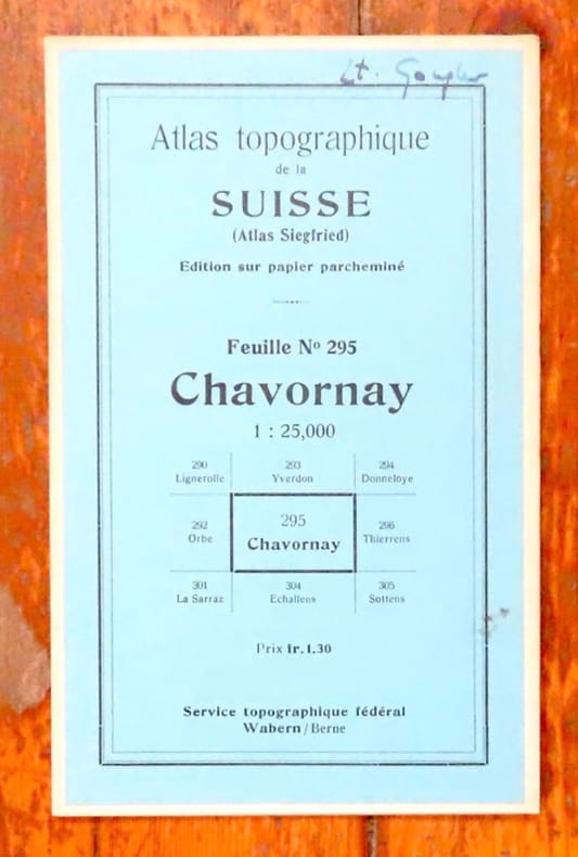
Service topographique fédéral:
Atlas topographique de la Suisse (Atlas Siegfried) - Feuille n° 295, Chavornay.
Berne, Service topographique fédéral, 1935. Carte au 1 : 25,000, au format de 43 x 35 cm., sur papier parcheminé. Nom de possesseur au titre, pour le reste en très belle condition.
Référence libraire : 16914
|
|
|
Service Géographique de l'Armée
CARTE n° 178 "GRENOBLE"
Type 1889, révisée en 1897, format 53 x 75 cm, assez bon état
Référence libraire : LFA00254
|
|
|
Service Géographique de l'Armée
CARTE n° 178 "GRENOBLE S.E."
Type 1889, révisée en 1897, état moyen
Référence libraire : LFA00252
|
|
|
Service de Tourisme Michelin
CARTE MICHELIN n° 90 "CORSE" Edition 1961
Une carte Michelin au 200 000éme, bon état
Référence libraire : LFA0024c
|
|
|
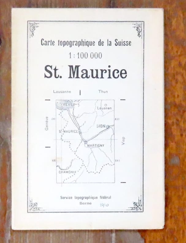
Service topographique fédéral:
Carte topogarphique de la Suisse 1:100 000. Saint-Maurice.
Berne, Service topographique fédéral, [1910]. Carte au 1 : 100,000, au format de 56 x 77 cm. Date manuscrite, petites déchirures, 2 renforcements au scotch.
Référence libraire : 16936
|
|
|
SERVICE HYDROGRAPHIQUE.
Catalogue des cartes, plans et ouvrages qui composent l'hydrographie française au Ier Janvier 1935.
1935 in-8, XVI, 326pp., br. Paris Imprimerie nationale 1935,
Référence libraire : 3303
|
|
|
Service géographique de l'armée
Les Ecritures sur les cartes topographiques
Paris : Service géographique de l'armée, 1934 In-8, 27 (17) p., fig. [92]Note(s) : La préface indique comme auteur M. Zabern, chef dessinateur
Référence libraire : 12493
|
|
|
SERVICE GEOGRAPHIQUE DE L'ARMEE.
Matériaux d'étude topologique pour l'Algérie et la Tunisie. 1, 3, 4, 5, 6emes séries.
1900 in-8, br. L'ensemble, sans la 2eme série: Paris Impr. du Service géographique de l'armée 1900-1906,
Référence libraire : 3327
|
|
|
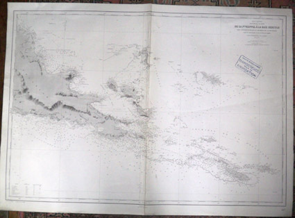
Service hydrographique de la Marine
Océan Pacifique. Nouvelle Guinée : De la Pointe Keppel à la Baie Hercule, Îles d'Entrecasteaux et archipel de la Louisiade. D'après les cartes les plus récentes de l'Amirauté anglaise. [carte marine]
1938 Service hydrographique de la Marine, 1899. Edition n° 2, juin 1938. N° 4977. Format : 106 x 75 cm.
Référence libraire : 583
|
|
|
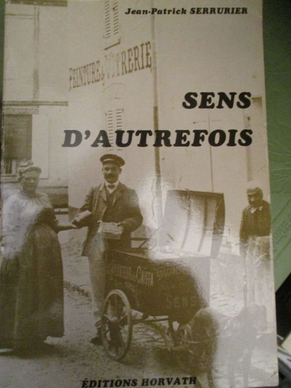
serrurier (jean patrick)
sens d'autrefois
édition horvath 1982 In8 broché 193 pages
Référence libraire : 4730
|
|
|
Service topographique fédéral:
Topographischer Atlas der Schweiz (Siegfriedatlas) - Blatt n° 353, Thun.
Bern, Eidg. Landestopographie, 1948. Carte au 1 : 25,000, au format de 43,5 x 35 cm., sur papier parcheminé. Nom de possesseur au titre, pour le reste en très belle condition.
Référence libraire : 16906

|
|
|
Service topographique fédéral:
Topographischer Atlas der Schweiz (Siegfriedatlas) - Blatt n° 373, Entlebuch.
Bern, Eidg. Landestopographie, 1929. Carte au 1 : 25,000, au format de 44 x 35 cm., sur papier parcheminé. Nom de possesseur au titre, pour le reste en très belle condition.
Référence libraire : 16907

|
|
|
Service topographique fédéral:
Topographischer Atlas der Schweiz (Siegfriedatlas) - Blatt n° 180, Ursenbach.
Bern, Eidg. Landestopographie, 1931. Carte au 1 : 25,000, au format de 44 x 35 cm., sur papier parcheminé. Nom de possesseur au titre, léger pli courant sur la carte.
Référence libraire : 16912

|
|
|
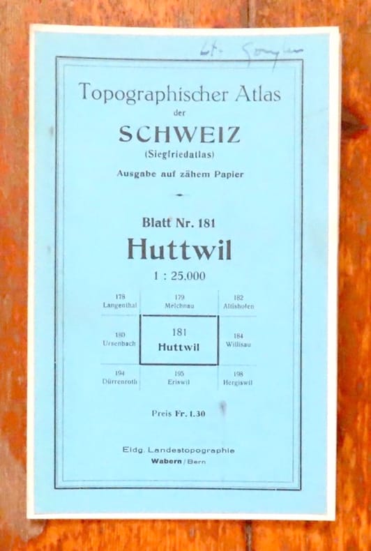
Service topographique fédéral:
Topographischer Atlas der Schweiz (Siegfriedatlas) - Blatt n° 181, Huttwil.
Bern, Eidg. Landestopographie, 1931. Carte au 1 : 25,000, au format de 43,5 x 35 cm., sur papier parcheminé. Nom de possesseur au titre, pour le reste en très belle condition.
Référence libraire : 16913
|
|
|
Service topographique fédéral:
Topographischer Atlas der Schweiz (Siegfriedatlas) - Blatt n° 179, Melchnau.
Bern, Eidg. Landestopographie, 1931. Carte au 1 : 25,000, au format de 43,5 x 35 cm., sur papier parcheminé. Nom de possesseur au titre, premier plat un peu taché.
Référence libraire : 16915

|
|
|
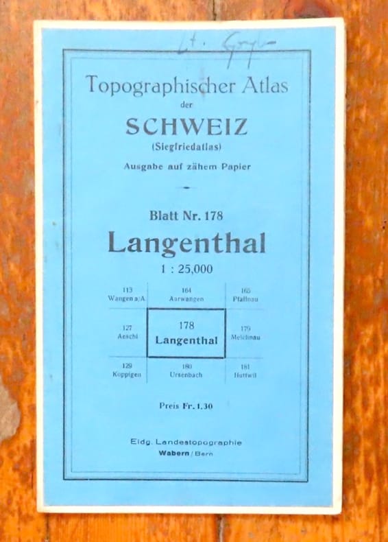
Service topographique fédéral:
Topographischer Atlas der Schweiz (Siegfriedatlas) - Blatt n° 178, Langenthal.
Bern, Eidg. Landestopographie, 1942. Carte au 1 : 25,000, au format de 43,5 x 35 cm., sur papier parcheminé. Nom de possesseur au titre, pour le reste en très belle condition.
Référence libraire : 16916
|
|
|
Service topographique fédéral:
Topographischer Atlas der Schweiz (Siegfriedatlas) - Blatt n° 151, Rupperswil.
Bern, Eidg. Landestopographie, 1931. Carte au 1 : 25,000, au format de 43,5 x 35 cm., sur papier parcheminé. Nom de possesseur au titre, pour le reste en très belle condition.
Référence libraire : 16917

|
|
|
Service topographique fédéral:
Topographischer Atlas der Schweiz (Siegfriedatlas) - Blatt n° 150, Aarau.
Bern, Eidg. Landestopographie, 1931. Carte au 1 : 25,000, au format de 43,5 x 35 cm., sur papier parcheminé. Nom de possesseur au titre, pour le reste en très belle condition.
Référence libraire : 16918

|
|
|
Service topographique fédéral:
Topographischer Atlas der Schweiz - Thun / Interlaken.
Bern, Eidg. Landestopographie, 1896. Carte au 1 : 50,000, au format de 77 x 55 cm., entoilée. Nom de possesseur au titre et auréole au titre.
Référence libraire : 18659

|
|
|
Service hydrographique de la Marine
Oc�an Pacifique. Nouvelle Guin�e : De la Pointe Keppel � la Baie Hercule �les d'Entrecasteaux et archipel de la Louisiade. D'apr�s les cartes les plus r�centes de l'Amiraut� anglaise. carte marine
Service hydrographique de la Marine 1938. Carte. Tr�s bon. Aucune reliure. Service hydrographique de la Marine 1899. Edition n� 2 juin 1938. N� 4977. Format : 106 x 75 cm. Tampon : carte condamn�e dangereuse pour la navigation. Pliure : une centrale petite trace de torsion longitudinale. Etat : petites torsions. Service hydrographique de la Marine unknown
Référence libraire : 0583

|
|
|
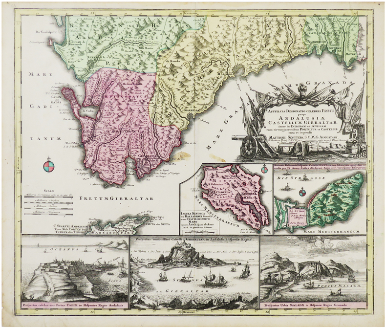
SEUTTER (Matthäus).
[ANDALOUSIE/GIBRALTAR] Accurata designatio celebris freti prope Andalusiæ Castellum Gibraltar inter in Europam et Africam, cum circumjacentibus Portubus, et Castellis, cura et impensis.
Augsbourg, [circa 1730]. 496 x 580 mm.
Référence libraire : LBW-6426
|
|
|
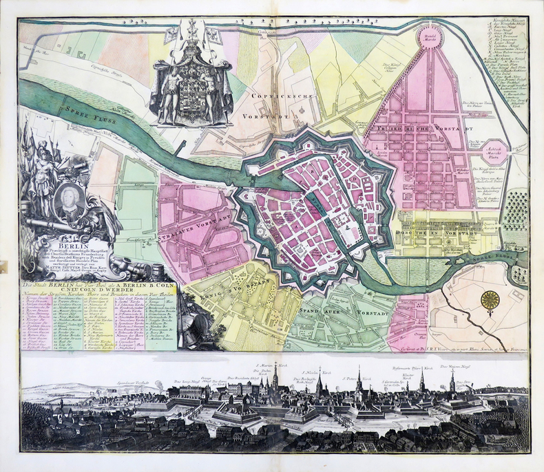
SEUTTER (Matthaeus).
[BERLIN] Berlin, die præchtigst. u. mæchtigste Hauptstatt des Churfürstenthums Brandenburg.
Augsbourg, [circa 1740]. 497 x 567 mm.
Référence libraire : LBW-4316
|
|
|
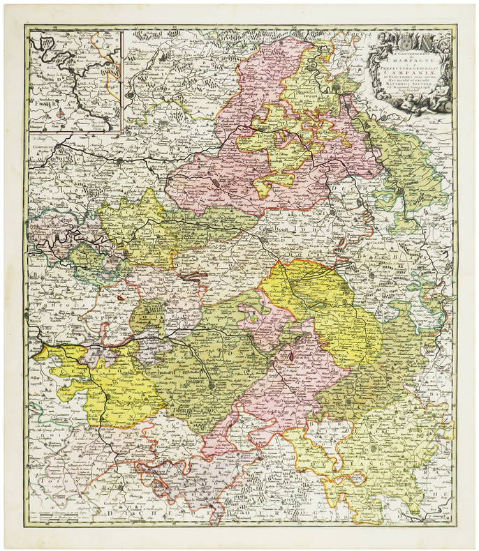
SEUTTER (Matthaeus).
[CHAMPAGNE] Le Gouvernement de Champagne i. e. Præfectura generalis Campaniæ in electiones suas divisa.
[circa 1740]. 575 x 490 mm.
Référence libraire : LBW-6172
|
|
|
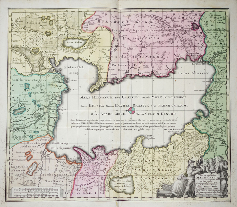
SEUTTER (Matthaeus).
[MER CASPIENNE] Nova et accuratissima Maris Caspii .
Augsbourg, [circa 1750]. 499 x 576 mm.
Référence libraire : LBW-2280
|
|
|
SEUTTER (Matthäus).
[POLOGNE/LITUANIE] Poloniæ regnum ut et Magni Ducatus Lithuaniæ.
Augsbourg, 1735. 501 x 583 mm + 1 index alphabétique de 479 x 585 mm.
Référence libraire : LBW-6404

|
|
|
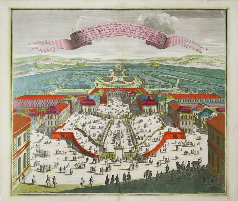
SEUTTER (Matthaeus).
[VERSAILLES] Versailles château de plaisance le plus délicieux et le plus magnifique dans l'Île de France, bâti par ordre de Louis XIV Roy de France, et nomé à cause de sa rare beauté la huitième merveille du monde.
Augsbourg, [circa 1740]. 497 x 578 mm.
Référence libraire : LBW-3685
|
|
|
SEUTTER (Matthäus).
Africa juxta navigationes et observationes recentissimas aucta correcta et in sua regna et status divisa, in lucem edita.
Augsbourg, [circa 1730]. 496 x 577 mm.
Référence libraire : LBW-6425

|
|
|
SEUTTER Georg Matthäus:
Atlas Novus Sive Tabula Geographica Totius Orbis Faciem. Partes Imperia Regna et Provincias Exhibentes Exactissima Cura Iuxta Recentissimas Observation. Aeri Incisae et Venum Expositae...
Augsburg, circa 1740. In-folio (53 x 33cm) relié en plein veau souple, dos rond lisse, premier plat titré à froid : "ATLAS NOVUS 50 MAPPAR: MATTH: SEUTTER S,C.M. GEOGR: AUG: VINDEL.".
Référence libraire : 20793

|
|
|
SEUTTER (Matthaeus);
Ducatus Luxemburg.
Augsbourg 1750 circa 496 x 577 mm.
Référence libraire : LBW-693

|
|
|
SEUTTER (Matthäus).
Le Royaume de France.
Augsbourg, [circa 1740]. 480 x 556 mm.
Référence libraire : LBW-6412

|
|
|
SEUTTER (Matthaus)
WIEN die Welt Berühmte Haupt und Residentz Stadt der Römischen Kayser, in Nider Oesterreich an der Donau, verfertigt ~u. verlegt von Matth. Seutter, Kays. Geogr. in Augspurg.
1740 570 x 650 mm. Carte sur cuivre, coloris ancien. Augsbourg Seutter ca. 1740.
Référence libraire : 16135
|
|
|
SEUTTER "il vecchio" Matthaus (1678 - 1757)
Le sette Chiese di Roma con le loro principali Relique, Stationi et indulgenze
Pianta delle sette chiese giubilari della capitale, tratta dal "Atlas Novus" del Seutter. La tavola delinea l’itinerario del pellegrinaggio cristiano alle Sette Chiese: le quattro basiliche maggiori, S. Giovanni in Laterano, S. Pietro, S. Maria Maggiore e S. Paolo, alle quali S. Filippo Neri aggiunse altre tre basiliche come meta del pellegrinaggio - S. Lorenzo fuori le Mura, S. Croce in Gerusalemme e S. Sebastiano. Orientata con l’oriente in alto, come la maggior parte delle piante di città prodotte nel XVI secolo, manca di una visione prospettica corretta, sia sotto il profilo delle proporzioni che delle distanze. Inoltre, lo spazio urbano è occupato, in maniera del tutto irreale, quasi esclusivamente da luoghi di culto. Le sette chiese principali sono rappresentate di dimensioni notevolmente maggiori rispetto agli altri edifici, e mostrano tutte le facciate rivolte verso l’osservatore. "Derivazione assai fedele della pianta Giubilare del Lauro aggiornata e ristampata dal De Rossi nel 1660 in cui sono state affiancate le didascalie in lingua tedesca a quelle in italiano. Il colonnato di San Pietro, all'epoca del prototipo ancora in corsa di realizzazione, appare più correttamente raffigurato senza il terzo braccio a chiusura della piazza. Assai vivace la coloritura d'epoca che rappresenta la maggiore caratteristica di questa, come di molte altre opere di editori nordici, che per il resto copiavano sempre le loro immagini da quelle di altri autori, essendo il fine commerciale il loro unico interesse" (cfr. Marigliani p. 618). Matthäus Seutter (1678 - 1757) fu uno dei più importanti e prolifici editori tedeschi di mappe del XVIII secolo. Attivo, come incisore sotto la tutela dell'importante J. B. Homann. All'inizio del 1700 Seutter lasciò Homann per tornare ad Augusta, dove lavorò per l'importante editore d'arte Jeremia Wolff (1663 - 1724), per il quale incise mappe e altre stampe. Intorno al 1717 fondò la propria casa editrice cartografica indipendente ad Augusta. La maggior parte delle mappe di Seutter sono pesantemente basate, se non addirittura copie, di lavori precedenti fatti dalle calcografie Homann e De L'Isle. Ciononostante, dal 1731/32 Seutter era uno degli editori più prolifici del suo tempo e fu onorato dall'imperatore tedesco Carlo VI che gli diede il titolo di Geografo Imperiale, dopo il quale la maggior parte delle mappe successive includeva la denominazione Avec Privilege. Seutter continuò a pubblicare fino alla sua morte, all'apice della sua carriera, nel 1757. Acquaforte, finemente colorata a mano, in ottimo stato di conservazione. Bibliografia Arrigoni Bertarelli (1930): n. 761; Marigliani (2007): p. 618, n. 579. Map of the seven jubilee churches of Rome, taken from Seutter's "Atlas Novus". The map outlines the itinerary of the Christian pilgrimage to the Seven Churches: the four major basilicas, St. John Lateran, St. Peter, St. Mary Major and St. Paul, to which St. Philip Neri added three more basilicas as pilgrimage destinations - St. Lawrence Outside the Walls, St. Croce in Jerusalem and St. Sebastian. Oriented with the east at the top, like most city maps produced in the 16th century, it lacks a correct perspective view, both in terms of proportions and distances. Moreover, the urban space is occupied, in a completely unreal way, almost exclusively by the churches. The seven main churches are represented considerably larger and show all the facades facing the observer. Very faithful derivation of the Jubilee map by Giacomo Lauro updated and reprinted by De Rossi in 1660 in which the captions in German have been placed side by side with those in Italian. The colonnade of St. Peter's, at the time of the prototype still under construction, appears more correctly depicted without the third arm closing the square. The coloring is very lively and represents the main characteristic of this work, as of many other works by Nordic publishers, who always copied their images from those of other authors, as the commercial purpose being their only interest (cf. Marigliani p. 618). Matthäus Seutter (1678 - 1757) was one of the most important and prolific German map publishers of the 18th century. Seutter was born the son of a goldsmith but apprenticed as a brewer. Apparently uninspired by the beer business, Seutter abandoned his apprenticeship and moved to Nuremberg where he apprenticed as an engraver under the tutelage of the prominent J. B. Homann. Sometime in the early 1700s Seutter left Homann to return to Augsburg, where he worked for the prominent art publisher jeremiad Wolff (1663 - 1724), for whom he engraved maps and other prints. Most of Seutter's maps are heavily based upon, if not copies of, earlier work done by the Homann and De L'Isle firms. Nonetheless, by 1731/32 Seutter was one of the most prolific publishers of his time and was honored by the German Emperor Karl VI who gave him the title of Imperial Geographer, after which most subsequent maps included the Avec Privilege designation. Etching, fine contemporary hand-colored, in excellent condition. Literature Arrigoni Bertarelli (1930): n. 761; Marigliani (2007): p. 618, n. 579.

|
|
|
SEUTTER "il vecchio" Matthaus (1678 - 1757)
Veteris et Modernae Urbis Romae Ichnographia et Accurata Designatio...
Pianta della città edita da Mattheus Seutter, inclusa nel suo Atlas Novus del 1730. La pianta deriva da quella di Giovan Battista Falda del 1676, della quale è una fedele ed accurata riduzione. Sebbene stampata intorno al 1725, probabilmente in occasione del Giubileo visto l'inserimento delle Sette Basiliche, raffigura la città intorno al 1676. L'opera infatti non contempla le innovazioni architettoniche alla città durante il pontificato di Innocenzo XII e nemmeno il Porto di Ripetta del 1704. E’ ancora riportato il terzo braccio di chiusura del colonnato di San Pietro, mai realizzzato. In alto a sinistra vedutine delle Sette Chiese principali e a destra stemma del papa Benedetto XIII (1724-1730). A sinistra in basso compare un elenco dei XIV rioni ed a destra una breve descrizione della città dal titolo Rom. In basso una scena allegorica con divinità fluviali. Matthäus Seutter (1678 - 1757) fu uno dei più importanti e prolifici editori tedeschi di mappe del XVIII secolo. Attivo, come incisore sotto la tutela dell'importante J. B. Homann. All'inizio del 1700 Seutter lasciò Homann per tornare ad Augusta, dove lavorò per l'importante editore d'arte Jeremia Wolff (1663 - 1724), per il quale incise mappe e altre stampe. Intorno al 1717 fondò la propria casa editrice cartografica indipendente ad Augusta. La maggior parte delle mappe di Seutter sono pesantemente basate, se non addirittura copie, di lavori precedenti fatti dalle calcografie Homann e De L'Isle. Ciononostante, dal 1731/32 Seutter era uno degli editori più prolifici del suo tempo e fu onorato dall'imperatore tedesco Carlo VI che gli diede il titolo di Geografo Imperiale, dopo il quale la maggior parte delle mappe successive includeva la denominazione Avec Privilege. Seutter continuò a pubblicare fino alla sua morte, all'apice della sua carriera, nel 1757. Acquaforte con coloritura editoriale, in ottimo stato di conservazione. Bibliografia Marigliani p. 234, n. 139; Scaccia Scarafoni n. 223. Map of the city edited by Mattheus Seutter, included in his "Atlas" of 1730. The map derives from that of Giovan Battista Falda of 1676, of which it is a faithful and accurate reduction. Although printed around 1725, probably on the occasion of the Jubilee given the inclusion of the Seven Basilicas, it depicts the city around 1676. The work in fact does not contemplate the architectural innovations to the city during the pontificate of Innocent XII, nor the Port of Ripetta of 1704. It still shows the third arm of the closing of the colonnade of St. Peter, never realized. In the upper left corner views of the Seven Main Churches and on the right the coat of arms of Pope Benedict XIII (1724-1730). On the lower left is a list of the XIV districts and on the right a brief description of the city entitled Rom. At the bottom an allegorical scene with river gods. Matthaeus Seutter (1678 - 1757) was one of the most important and prolific German map publishers of the 18th century. Seutter was born the son of a goldsmith but apprenticed as a brewer. Apparently uninspired by the beer business, Seutter abandoned his apprenticeship and moved to Nuremberg where he apprenticed as an engraver under the tutelage of the prominent J. B. Homann. Sometime in the early 1700s Seutter left Homann to return to Augsburg, where he worked for the prominent art publisher jeremiad Wolff (1663 - 1724), for whom he engraved maps and other prints. Most of Seutter's maps are heavily based upon, if not copies of, earlier work done by the Homann and De L'Isle firms. Nonetheless, by 1731/32 Seutter was one of the most prolific publishers of his time and was honored by the German Emperor Karl VI who gave him the title of Imperial Geographer, after which most subsequent maps included the Avec Privilege designation. Copper engraving, typical editorial hand coloring, in excellent condition. Bibliografia Marigliani p. 234, n. 139; Scaccia Scarafoni n. 223.

|
|
|
SEUTTER "il vecchio" Matthaus (1678 - 1757)
Veteris et Modernae urbis Romae Ichonographia et accurata Designatio…
Pianta della città edita da Mattheus Seutter, inclusa nel suo "Atlas" del 1730. La pianta deriva da quella di Giovan Battista Falda del 1676, della quale è una fedele ed accurata riduzione. In alto a sinistra compare il ritratto del papa Benedetto XIII (1724-30) e a destra il suo stemma. In basso a sinistra un elenco del XIV rioni ed a destra una breve descrizione della città dal titolo di Rom. Sebbene stampata intorno al 1725, probabilmente in occasione del Giubileo visto l'inserimento delle Sette Basiliche, raffigura la città intorno al 1676. L'opera infatti non contempla le innovazioni architettoniche alla città durante il pontificato di Innocenzo XII e nemmeno il Porto di Ripetta del 1704. Matthäus Seutter (1678 - 1757) fu uno dei più importanti e prolifici editori tedeschi di mappe del XVIII secolo. Attivo, come incisore sotto la tutela dell'importante J. B. Homann. All'inizio del 1700 Seutter lasciò Homann per tornare ad Augusta, dove lavorò per l'importante editore d'arte Jeremia Wolff (1663 - 1724), per il quale incise mappe e altre stampe. Intorno al 1717 fondò la propria casa editrice cartografica indipendente ad Augusta. La maggior parte delle mappe di Seutter sono pesantemente basate, se non addirittura copie, di lavori precedenti fatti dalle calcografie Homann e De L'Isle. Ciononostante, dal 1731/32 Seutter era uno degli editori più prolifici del suo tempo e fu onorato dall'imperatore tedesco Carlo VI che gli diede il titolo di Geografo Imperiale, dopo il quale la maggior parte delle mappe successive includeva la denominazione Avec Privilege. Seutter continuò a pubblicare fino alla sua morte, all'apice della sua carriera, nel 1757. Incisione in rame, tipica coloritura a mano editoriale, in ottimo stato di conservazione. Map of the city edited by Mattheus Seutter, included in his "Atlas" of 1730. The map derives from that of Giovan Battista Falda of 1676, of which it is a faithful and accurate reduction. On the upper left is the portrait of Pope Benedetto XIII (1724-30) and on the right his coat of arms. In the lower left a list of the XIV districts and on the right a brief description of the city entitled Rom. Although printed around 1725, probably on the occasion of the Jubilee given the inclusion of the Seven Basilicas, it depicts the city around 1676. The work in fact does not contemplate the architectural innovations to the city during the pontificate of Innocenzo XII, nor the Port of Ripetta of 1704. Matthäus Seutter (1678 - 1757) was one of the most important and prolific German map publishers of the 18th century. Seutter was born the son of a goldsmith but apprenticed as a brewer. Apparently uninspired by the beer business, Seutter abandoned his apprenticeship and moved to Nuremberg where he apprenticed as an engraver under the tutelage of the prominent J. B. Homann. Sometime in the early 1700s Seutter left Homann to return to Augsburg, where he worked for the prominent art publisher jeremiad Wolff (1663 - 1724), for whom he engraved maps and other prints. Most of Seutter's maps are heavily based upon, if not copies of, earlier work done by the Homann and De L'Isle firms. Nonetheless, by 1731/32 Seutter was one of the most prolific publishers of his time and was honored by the German Emperor Karl VI who gave him the title of Imperial Geographer, after which most subsequent maps included the Avec Privilege designation. Copper engraving, typical editorial hand coloring, in excellent condition. Huelsen (1915): n. 121; Marigliani, Le Piante di Roma nelle Collezioni private, pag. 235, 140.

|
|
|
Seutter, Matthias
Lüneburg, eine alte ehemals Herzoglich, nunmehro Churfürstl. Hanoversche wohlberühmte Statt in Nidersaechsischen Crays. Teilkolorierter Kupferstich.
Augsburg, [ca. 1760]. 50 x 56,5 cm. Unter Passpartout. Gerahmt.
Référence libraire : 86611

|
|
|
Seutter, Matthäus
Borussiae Regnum sub fortissimo Tutamine et justissimo Regimine Serenissimi ac Potentissimi Princips Friderici Wilhelmi. Altkolor. Kupferstich, mit Nebenkarte des Fürstentums Neuchatel, üppiger heraldischer Titelkartusche mit dem allegor. überhöhten Portr. Friedrich Wilhelms I., Meilenzeiger u. kleiner Windrose.
Augsburg, [ca. 1730]. 49,5 x 58 cm im Rahmen (57 x 66 cm). (Mit handschriftl. Pagina 22 (oben rechts) von alter Hand.
Référence libraire : 76480

|
|
|
SEVIM TEKELI.
Map of Japan by Mahmud of Kashgar; The oldest map of Japan drawn by a Turk, Mahmud Kashgar.
Fine English Paperback. Pbo. 12mo. (17 x 11 cm). In English. 16 p., 1 map. Map of Japan by Mahmud of Kashgar; The oldest map of Japan drawn by a Turk, Mahmud Kashgar.
|
|
|
SEVIM TEKELI.
The oldest map of Japan drawn by a Turk Mahmud of Kashgar. The map of America by Pirî Reis.
Fine English Paperback. Pbo. Roy. 8vo. (24 x 17 cm). In English. 20 p., 1 map. The oldest map of Japan drawn by a Turk Mahmud of Kashgar. The map of America by Pirî Reis.
|
|
|
SEVIM TEKELI.
The oldest map of Japan drawn by a Turk Mahmud of Kashgar. The map of America by Pirî Reis.
Fine English Paperback. Pbo. Roy. 8vo. (24 x 17 cm). In English. 20 p., 1 map. The oldest map of Japan drawn by a Turk Mahmud of Kashgar. The map of America by Pirî Reis.
|
|
|
SEVRES
Carte au 1/20 000?me. Fin XIXe.
Une feuille. 64x46 cm.
|
|
|
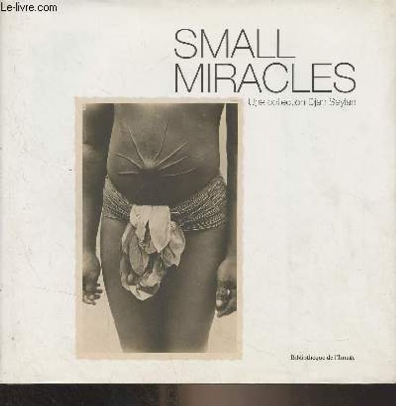
Seylan Djan
Small Miracles - Cartes postales exotiques 1895-1920
Bibliothèque de l'image. 2014. In-8. Relié. Bon état, Couv. convenable, Dos satisfaisant, Intérieur frais. 187 pages - nombreuses photos en noir et blanc et en couleurs hors texte. Jaquette légèrement passée et déchirée en coiffe de pied.. Avec Jaquette. . . Classification Dewey : 741.68-Illustrations des cartes postales
Référence libraire : R300323394
|
|
|
Seyer, Rev. Samuel.
MEMOIRS HISTORICAL AND TOPOGRAPHICAL OF BRISTOL AND IT'S NEIGHBOURHOOD, From the Earliest Period Down to the Present Time. Two Volumes.
Two Volumes. pp. 535; 602, (8) + Engraved title + 35 plates. With engraved illustrations in the text. Illustrated with numerous full page engravings and lithographs of views, buildings, maps, drawings, etc. One plate in hand color. Marbled endpapers. Text and plates have some foxing. Some offsetting from plates. Top edges gold. Deckle edges. 4to. 290 mm. Half leather over marbled boards. Raised bands. Spines decorated and lettered in gold. Inked ownership of Miss Ann Willcox on top of preface pages and elsewhere. Bookplate of Redmond Conyngham in both volumes. Redmond Conygham (1781-1846) was born in Philadelphia. He inherited from his paternal grandfather an estate in the county Donegal, Ireland, yielding L2,000 a year, and subsequently spent some time in Ireland. During his stay abroad he became intimate with Curran, Grattan, and other prominent Irishmen, including his cousin, William Conyngham Plunket, afterward lord-chancellor of Ireland. On his return to the U.S. he settled in Luzerne County, Pennsylvania, and was active in state and local politics. He then removed to Lancaster County, where he devoted much of his leisure to antiquarian research. Issued as a limited edition, less than 500 copies were printed. A very good copy of this handsome and informative book. Scarce. **PRICE JUST REDUCED! LivRm
|
|
|
SEYIR, HIDRIGRAFI VE OSINIOGRAFI DAIRESI BASKANLIGI.
Seyir, Hidrografi ve Osinografi Dairesi Baskanligi seyir haritalari ve notik yayinlar katalogu.
Fair English Paperback. Pbo. Roy. 8vo. (23 x 16 cm). In Turkish. With folding plans. Navigational maps, nautical charts and publications catalogue of department of course, hydrography and oceanography of Naval Forces. Seyir, Hidrografi ve Osinografi Dairesi Baskanligi seyir haritalari ve notik yayinlar katalogu.
|
|
|
Seymour William/Stirling David foreword/Watson WFN. maps W. F.
British Special Forces
London: Sidgwick & Jackson 1985. 1st printing. VG/VG dust jacket blind stamp on title page. xxvi 334 p. maps footnotes biblio index 8vo; Sidgwick & Jackson hardcover
Référence libraire : 46135 ISBN : 0283988738 9780283988738

|
|
|
Seymour William; maps and illustrations by W F N Watson
Great Sieges of History
Brassey's UK 1991 1991. First Edition. Hardcover. Very Good Condition/No Dust Jacket. Navy cloth gilt lettering numerous maps 338pp. Covers clean and firm with lightly bumped lower corners binding sound pages clean no inscriptions. First ed. No dust-jacket. Quantity Available: 1. Shipped Weight: 1-2kg. Pictures of this item not already displayed here available upon request. Inventory No: 65014080274. This book is heavier than 1kg and may incur additional delivery charges on some delivery services to some locations. Brassey's (UK), 1991 hardcover
Référence libraire : 65014080274

|
|
|
SEYMOUR WILLIAM & WATSON W. F. N. Maps
Yours to Reason Why: Decision in Battle
Book Club / Sidgwick &Jackson 1982. Super octavo hardcover VG in d/w VG; all our specials have minimal description to keep listing them viable. They are at least reading copies complete and in reasonable condition but usually secondhand; frequently they are superior examples. Ordering more than one book will reduce your overall postage costs. Book Club / Sidgwick &Jackson 1982 hardcover
Référence libraire : 218203
|
|
|
 Recevoir par e-mail
 Télécharger en PDF
 Flux RSS


