|
|
|
Scheurer, Christoph:
Das Nürenbergische Gebiet. Mit allen Nürnbergischen Hauptmannschafften, so theils in unterschiedlichen Benachbarter Chur Fürsten, Fürsten und Ständen, theils aber in Nürnbergischen Ämptern gelegen. Kupferstichkarte von Christoph Scheurer.
Format 48 x 55 cm. Blattgröße: 49 x 57 cm. *Originalausgabe der Karte von Scheurer, sie wurde später auch von Lotter nachgedruckt. Rechts eine große Kupferstichkartusche sowie rechts und links mit 17 Wappen. - Geglättete Falzspuren, insgesamt sauber und gut erhalten. Landkarten de
|
|
|
Schlacher, J
General-Karte von MITTEL-EUROPA in 12 Blättern. Maße 1:1,200,000.
Wien, k.k. militär-geografischen Institute (1875). 1 Skelett-Karte, 12 lith.Teilkarten, kol., in Segmente zerschnitten und auf Leinen aufgezog., zus. in modernen Leinenschuber unter Verwendung des Orig. Leder-Einbandrückens, dieser beschabt, eine Karte auf Leinenbezug schwarzfleck., Karte XI doppelt vorha
Référence libraire : KART0094

|
|
|
Schlesien:
Nova mappa geographica totius ducatus Silesiae tam superioris quam inferioris exhibens XVII minores principatus. Kolorierte Kuperstichkarte von Schlesien. Mit Prospect der Hauptstadt Breslau.
49 x 57,5 cm. Blattgröße: 52 x 65 cm. *Mit Planansicht / Prospectus der Stadt Breslau sowie einer großen Titelkartusche. Schön koloriertes Exemplar, sauber und sehr gut erhalten, breitrandig. Landkarten de
|
|
|
SCHMETTAU ( Friedrich, Wilhelm, Karl von)
Karte des Herzogthums Mecklenburg mit seinen verschiedenen Provinzen : als, des eigentlichen Herzogthums Mecklenburg, der Furstenthumer Wenden, Schwerin Razeburg, der Grafschaft Schwerin, und der Herrschaften Rostock und Stargard, wie auch der Herrschaft Wismar, des Schwedischen Pommern und der Insel Rugen, nebst einem Theile der angrenzenden Preussischen, Hannoverischen, Hollsteinischen und Lubeckischen Lander ... / durch F. W. C. von Schmettau
1794 21 sections montées sur toile et pliées formant une carte 680 x 980 mm, avec une extension de 195 x 490 mm correspondant à "Die Ost See". Berlin
Référence libraire : 16319
|
|
|
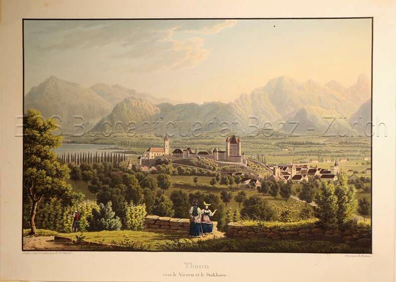
Schmid, David Alois (1791-1861)
Thoun vers Niesen et le Stockhorn.
(Zürich, Keller & Füssli), um 1830. Altkolorierte Aquatinta von Rudolf Bodmer (1805-1841). Bildgrösse: 16 x 24,1 cm. Blattgrösse: 19,4 x 27 cm. + Wichtig: Für unsere Kunden in der EU erfolgt der Versand alle 14 Tage verzollt ab Deutschland / Postbank-Konto in Deutschland vorhanden +, Abb.
Référence libraire : 627DG

|
|
|
Schmid, David Alois (1791-1861):
Thoun vers Niesen et le Stockhorn.
(Zürich, Keller & Füssli), um 1830. Altkolorierte Aquatinta von Rudolf Bodmer (1805-1841). Bildgrösse: 16 x 24,1 cm. Blattgrösse: 19,4 x 27 cm.
Référence libraire : 627DG
|
|
|
Schmid, Franz (1796-1851)
Aussicht von Zürich über den See nach den Gebirgen der kleinen Kantone. ? Vue depuis Zurich vers le lac et les montagnes de petits Cantons.
(Zürich, Keller, 1829). Aquatinta auf Papier. Bildgrösse: 10,5 x 38,7 cm. Blattgrösse: 13 x 40,5 cm. + Wichtig: Für unsere Kunden in der EU erfolgt der Versand alle 14 Tage verzollt ab Deutschland / Postbank-Konto in Deutschland vorhanden +, bild
Référence libraire : 597DG

|
|
|
Schmidt, Erich F.
TEPE HISSAR EXCAVATIONS 1931. The Museum Journal. Volume XXIII, Number 4, 1933.
pp. 323 - 487. Illustrated with numerous folding plates, maps and photographs. Quarto. Original printed wraps, chipped. Lacks spine. Front wrap detached. HOLY LAND BOX 1
|
|
|
Schmidt, L[udwig].
Topographische Karte der Gegenden von Wien. Astronomisch trigonometrisch aufgenommen von L. Schmidt. Wien, Johann Schönberg, [um 1850].
Gest. Karte in 16 Segmenten, auf Leinen aufgezogen und zeitgenössisch ankoloriert. 715:595 mm. Maßstab ca. 1:94 000. Nachstich der erstmals 1807 bei Cappi erschienenen Karte, die "ein Gebiet zwischen Altenmarkt a. d. Triesting (Westen) und Bruck a. d. Leitha (Osten) bzw. zwischen Schloß Schönborn (Norden) und Leobersdorf (Süden) dar[stellte]" (Dörflinger II, 502). "Die Brauchbarkeit der Karte wird dokumentiert durch Ausgaben noch Jahrzehnte später, auf denen dann auch bereits die ersten Eisenbahnlinien (Nordbahn, Südbahn) eingetragen sind" (ebd., 503). Die ÖNB hält einen anderen undatierten Nachstich, der den Titelzusatz "seiner Kays: Majestät Alexander I. [...] gewidmet" trägt und im Katalog "um 1813" angesetzt wird. - Leinen zwischen zwei Segmenten eingerissen, sonst sauber und wohlerhalten. Dörflinger II, 503, Fußn. 56. Vgl. Tooley II, 124.

|
|
|
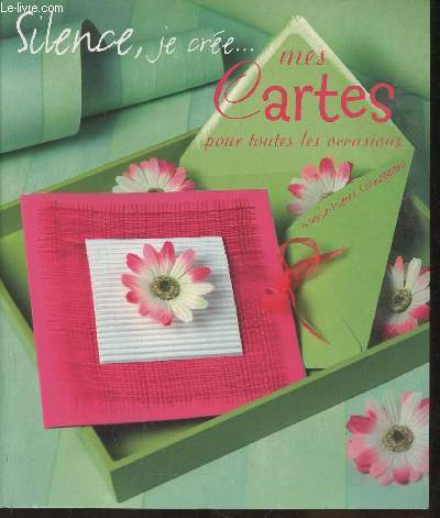
Schneegans Marie-Pierre
"Silence, je crée... mes cartes pour toutes les occasions (Collection ""Silence, je crée..."")"
France Loisirs/Tana. 2005. In-8. Broché. Bon état, Coins frottés, Dos satisfaisant, Intérieur acceptable. 91 pages. Couverture contrepliée. Quelques rousseurs. Nombreuses illustrations et photos en couleurs, in et hors texte.. . . . Classification Dewey : 741.68-Illustrations des cartes postales
Référence libraire : RO30354038
|
|
|
Schofield, Daniel (editor)
The Kingdom of Saudi Arabia (fully revised edition)
Inscription on ffep. No other marks. A lovely clean crisp very tight copy with bright boards and gilt lettering and with no bumping to corners. Dust jacket not price clipped or torn or creased. The delightful slip-case with gilt English and Arabic writing and design on a dark green vellum-type background is in excellent condition. 256pp.

|
|
|
School Maps KK Educational Maps Study Group Edited by Kiyoshi Nobutoki Gakuhiko Miyanaga/Sashie Nishihara Hiroshi
Our Song 1 Compliant with the Ministry of Education's Revised Course of Study
School Maps KK Educational Maps Study Group Edited by Kiyoshi Nobutoki Gakuhiko Miyanaga/Sashie Nishihara Hiroshi 1953. Soft Cover. Fine. The book is in fine condition. School Maps KK Educational Maps Study Group Edited by Kiyoshi Nobutoki Gakuhiko Miyanaga/Sashie Nishihara Hiroshi paperback
Référence libraire : 2083002116202803
|
|
|
SCHOTT Franciscus; PERION Joachim:
Itinerarii Italiae, Germaniaeque libri IIII. Ad hac iter Galliae et Hispaniae. [relié à la suite] Ioachimi Perionii benedictini Cormoeriaceni De rebus gestis, vitisque apostolorum liber.
Coloniae Agrippinae [et] Coloniae, sumptibus Bernardi Gualtheri [et] Theodoricum Baumium, 1620 - 1569. Trois tomes en un volume in-12 de [30]-456 (chiffrée 454)-[10] ; 161-[3] ; 216 pages, plein vélin à recouvrement, titres inscrit à la plume au dos.
Référence libraire : 16533

|
|
|
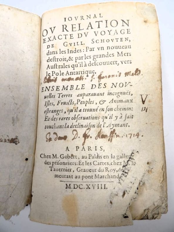
SCHOUTEN, Willem Corneliszoon.
Iournal (Journal) et Relation exacte du Voyage de Guill. Schouten, dans les Indes : Par un nouveau destroit et par les grandes Mers Australes qu’il a descouvert, vers le Pole Antartique. Ensemble des nouvelles Terres auparavant incognües, Isles, Fruicts, Peuples et Animaux étranges, qu’il a trouvé en son chemin : Et des rares observations qu’il y a fait touchant la déclinaison de l’Aymant.
Paris, Gobert (texte) & Tauernier (cartes), 1618. Petit in-8 – 11,5 x 17 cm. Reliure de l’époque en vélin, dos lisse muet. Dans une chemise-étui moderne. 7 ff., 232 pp., 4 pl. Première édition française du récit populaire de Schouten sur son voyage avec Jacob Le Maire à la recherche d’un passage alternatif au détroit de Magellan, qui a été traduit en français, allemand, latin et anglais moins d’un an après la première édition néerlandaise. Le voyage historique de Schouten n’était que le troisième tour du monde, « au cours duquel le Cap Horn fut découvert et contourné pour la première fois » (Hill). Exemplaire orné de 4 planches dépliantes (sur les 8 usuelles) : mappemonde ornée des portraits de Magellan et Schouten, carte du Cap Horn, gravure de l’Ile Horn, carte de la côte de Nouvelle Guinée. Lors d’un voyage, un ancien propriétaire a fait tamponner le dos de l’étui (XXe) au moment de son passage au Cap Horn.
Référence libraire : 2417
|
|
|
SCHRADER, Franz (1844-1924).
Atlas de Géographie Moderne.
Paris, Librairie Hachette et Cie., 1907. Gran folio; 64 mapas dobles impresos en color y 600 mapas y planos entre el texto, impreso al verso de los mapas dobles. Encuadernación de época, en media piel con puntas.

|
|
|
SCHREIBER Hermann Avec cent héliogravures et des cartes.
Tyrol. Avec cent héliogravures et des cartes.
Couverture souple. Broché. 154 pages.
Référence libraire : 208122

|
|
|
Schreiber, Georg
Chorographia Territorii Naumburgo-Citiensis. Episcopatus olim nomine celebris una cum magna Consiniorum parte exactissime designata a Ioh. Georg Schreibero. Edita curis et impensis Homannianorum Heredum. Norib: A MDCCXXXII. Cum Privilegio. [Altkolorierter Original-Kupferstich / original colored copper engraving].
o.J. Johann George Schreiber (auch Johann Georg Schreiber, geboren am 10. Dezember 1676 in Spremberg, Oberlausitz, gestorben am 31. Juli 1750 in Leipzig. Deutscher Kupferstecher, Kartograph und erster deutsche Kartenverleger im Kurfürstentum Sachsen. [4 Warenabbildungen]
Référence libraire : 12035DB

|
|
|
Schupp, Stefanie
Architekturstadtplan Hamburg. Mit Register nach Epochen, Gebäudetypen, Architekten, Strassen.
(Berlin), Verlagshaus Braun, (2004). 2 mehrfach gefalt. farb. Pläne, beidseitig bedruckt Gesamtplan im Maßstab 1:20000, verso Innenstadt im Maßstab 1:8000 sowie 103 S. Register (dt./engl.). Deckel 10,5 x 25 cm. Stärkerer OKart.
Référence libraire : 81261

|
|
|
Schweidnitz:
Schweidnitz. "Plan der Belagerung der Vestung Schweidnitz in Schlesien im Jahr 1762". Belagerungsplan von Schweidnitz. Kupferstich mit farbigen Truppenaufstellungen aus "Neues Kriegs-Theater ...", No. 49.
Format: 18 x 29,5 cm. *Leicht gebräunt, insgesamt gut erhalten. Landkarten de
|
|
|
Schütt, Ernst Christian (Hrsg.)
Hamburg in historischen Stadtplänen. Die Entwicklung der Stadt seit dem 16. Jahrhundert. Kommentiert von Joachim W. Frank.
(Berlin), Argon, (1995). 18 S. Textheft und 6 mehrf. gefalt. tls. farb. Plänen. 4to. 34,5 cm. Zusammen in OKart.-Mappe. in OPp.-Schuber.
Référence libraire : 39664

|
|
|
Sciuto Giovanni
ABC DE LA Cartomancie
Grancher Broché , format 14x20cm environ , bel ensemble , 221 pages .
Référence libraire : 6490

|
|
|
SCIUTO Giovanni
LE GUIDE DES REUSSITES 30 jeux inédits et leurs significations
1989 cartonné noir éditeur (hard-back percale editor) grand in-octavo, premier plat illustré en couleurs (front cover illustrated in colours), illustrations : bien documenté (well-documented), 277 pages, 1989 à Paris France Loisirs,
Référence libraire : 9358
|
|
|
Sciuto Giovanni
Votre Avenir par les Tarots - Méthode simplifiée en 10 Etapes
Jacques Grancher Broché au format 14x20cm env,couverture ill de cartes ,182 pages très bel ouvrage avec cependant en page 32 un passage surligné au fluo et le manque de la première page de garde.Epuisé
Référence libraire : 4076

|
|
|
SCOTO Francesco (1548 - 1622)
Roma
Pianta a proiezione obliqua della città tratta da "Itinerario, overo nova descrittione de' viaggi principali d'Italia […] di Francesco Scoto" edito a Venezia da Pietro Brigonci nel 1665. "Piazza Navona è posta in bella evidenza con l'obelisco trovata nel Circo di Massenzio e fatto innalzare durante il pontificato di Innocenzo X al centro della fontana dei Fiumi del Bernini, inaugurata nel 1651, ma evidentemente già in corso di realizzazione nel 1650. Manca invece la chiesa di Sant'Agnese in Agone (1652/57) e il colonnato di San Pietro (1656/57)" [cfr. Marigliani p. 209]. Le tavole pubblicate da Brigonci sono riconoscibili dal formato quadrato delle stampe.La sua prima edizione dell'Itinerario d'Italia fu nel 1665 ed aveva il testo ripreso dalla pubblicazione del Cadorin del 1659 la quale ampliava il racconto al Friuli, alla Sicilia, a Malta, al Lazio e alla Terrasanta, quindi nello stesso anno in una ristampa inseriva anche delle tavole su questi territori.Nel 1670, 1673, 1676 e 1679 si collocano le altre edizioni del Brigonci, tutte veneziane, tutte col titolo immutato "Itinerario, overo nova descrittione de' viaggi principali d'Italia […] di Francesco Scoto", tutte arricchite da poco meno di quaranta stampe antiche con vedute di città.Incisione in rame, in buono stato di conservazione. Bibliografia Marigliani (2007) p. 209, n. 115. An oblique projection map of the city taken from "Itinerario, overo nova descrittione de' viaggi principali d'Italia [...] di Francesco Scoto" published in Venice by Pietro Brigonci in 1665. "Piazza Navona is prominently displayed with the obelisk found in the Circus of Maxentius and erected during the pontificate of Innocent X at the centre of Bernini's Fountain of the Rivers, inaugurated in 1651, but evidently already under construction in 1650. The church of Sant'Agnese in Agone (1652/57) and the colonnade of St. Peter's (1656/57) are instead missing'. [cf. Marigliani p. 209]. The plates published by Brigonci can be recognised by the square format of the prints. His first edition of the Itinerary of Italy was in 1665 and had the text taken from Cadorin's publication of 1659, which extended the story to Friuli, Sicily, Malta, Latium and the Holy Land, and in the same year a reprint also included plates on these territories. In 1670, 1673, 1676 and 1679 there were other editions by Brigonci, all Venetian, all with the unchanged title "Itinerario, overo nova descrittione de' viaggi principali d'Italia [...] di Francesco Scoto", all enriched with just under forty antique prints with views of cities. Copper engraving, in good condition. Literature Marigliani (2007) p. 209, n. 115.

|
|
|
SCOTT Robert H.
CARTES DU TEMPS et AVERTISSEMENTS DE TEMPÉTES.
1879 Par Robert. H. Scott, M.A.F.R.S. traduit de l'anglais par MM. Zurcher et Margollé. Paris, Gauthier - Villars, 1879. Cartes et tableaux hors texte. In 8° de 155 pp. reliure demi-basane lit de vin, titre doré au dos. Quelques rousseurs, sinon très bon état.
Référence libraire : 41
|
|
|
Scott Stallard
Title: The Beauty of Bermuda (Signed By Author)
Signed 'Scott Stallard' to title page. No other marks or inscriptions. A lovely clean very tight copy with bright unmarked boards and no bumping to corners. Dust jacket not price clipped or marked or torn or creased with minor traces of storage. pp. Lavishly illustrated book with 117 mainly full-page coloured photographs of Bermuda and an introduction by Peter Benchley.

|
|
|
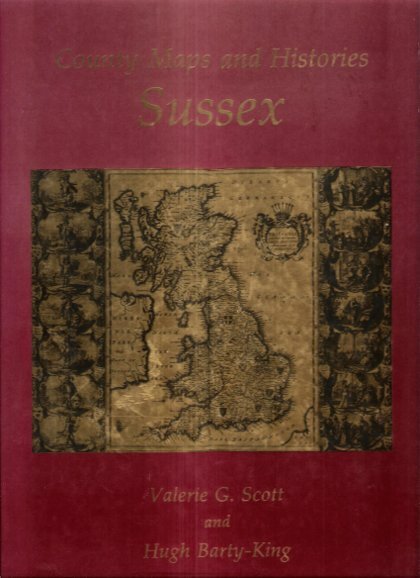
SCOTT Valerie G. , BARTY-KING Hugh
County Maps and Histories Series SUSSEX
Londres Quiller Press 1985 in-4° Nombreuses cartes couleurs et noir et blanc .- 34 p. , 550 gr.
Référence libraire : 023474
|
|
|
Scott, Cameron: Editor
Nanaimo Magazine, June 1993 - Gabriola Island Diving Photo on Cover
46 pages. Features: Nice photo of Harleys in front of the Queen's; Beachcombing - photo-illustrated article by Dave Drexhage; Hiking - photo-illustrated article by Jean Macleod le Cheminant - with maps of local hiking destinations; Sanctuary of the Sea - Gabriola Pass may harbour one of Canada's first Marine Reserves - photo-illustrated article by Iain Cuthbert; Nice photo ad for the ill-fated Pacliacchi's Restaurant in the old downtown firehall features photo outside the restaurant with dozens of supporters; Dozens of ads for local small businesses; and more. Moderate wear. Unmarked. A sound copy. Book

|
|
|
Scott, Munroe; McClure, Robert (Signed)
McClure : The China Years of Dr. Bob McClure *SIGNED BY SUBJECT*
409 pages. Dr. McClure's attractive signature upon half-title page. "This book started out to be a full biography of Dr. Bob McClure from his birth in 1900 up to the present time. It gradually transformed itself into something that may seem to fall halfway between an adventure story and a history of China through the first half of the twentieth century." - from Foreward. Prior owner's neatly written gift greetings upon half-title page which has a small piece cleanly clipped from top corner. Maps printed upon endpapers. Contents clean and unmarked. Light wear. Excellent copy. Book
|
|
|
Scott, Schomberg
Culzean : a History and Guidebook
No marks or inscriptions to contents. No creasing to covers. A very clean very tight copy with bright unmarked silightly rubbed boards, staples not rusted and no bumping to corners. 68pp. Culzean in the province of Carrick in South Ayrshire became the stronghold of the Kennedy clan whose roots go back to the 12th century. First edition, second printing. We do not use stock photos, the picture displayed is of the actual book for sale. Every one of our books is in stock in the UK ready for immediate delivery.

|
|
|
Scott-Elliot, W.
THE STORY OF ATLANTIS. A Geographical, Historical, and Ethnological Sketch. With a Preface by A. P. Sinnett.
pp. xiii, 87. Four colored folding maps of the World's Configuration. 8vo. Original full cloth binding. Joints detached. Old water spotting not affecting text. This edition was first issued in 1909. Scarce. **PRICE JUST REDUCED! OCC 6
|
|
|
SCULPTURE MONDIALE par André MALRAUX.
Le musée imaginaire de la sculpture mondiale volume 2 : des bas-reliefs aux grottes sacrées. Richement documenté (planches en couleurs, héliogravures, cartes).
Ed. Gallimard 1954 (coll. la Galerie de la Pléiade). Bel exemplaire relié, reliure pleine toile ornée et jaquette d'éd., gd et fort in-8, 512 pages + planches.
Référence libraire : AUB-6203
|
|
|
Scultetus, Bartholomäus
Misniae Et Lusatiae Tabula. Um 1600. Descripta à M. Bartholomaeo Sculteto Gorlit. Mark Meißen & Lausitz. [Altkolorierter Kupferstich, gerahmt].
o.J.
Référence libraire : 66483CB
|
|
|
SEACHART SCOTLAND - JOHN MARR, JOHN THORNTON.
A New Description of the East Coast of Scotland from Berwick to Bokannais: Wherein is fully shewed the Chief Forelands, Bays, Roads, Rivers, Havens, Creeks, Sands, Shoals, Depths of Water and Anchoridg, with the Course of the Tides, and what Moon make...
(London, ca. 1810). Folio. (45 x 28 cm.). Later hcloth. Gilt lettering on upper cover. 4 pp. in folio. + engraved map (44 x 52 cm.) Chart of the East Coast of Scotland Bu John Thornton. Left and right margins shaved (no loss of image). Light browning and a few brownspots.
|
|
|
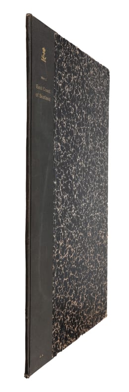
SEACHART SCOTLAND - JOHN MARR, JOHN THORNTON.
A New Description of the East Coast of Scotland from Berwick to Bokannais: Wherein is fully shewed the Chief Forelands, Bays, Roads, Rivers, Havens, Creeks, Sands, Shoals, Depths of Water and Anchoridg, with the Course of the Tides, and what Moon make...
(London, ca. 1810). Folio. (45 x 28 cm.). Later hcloth. Gilt lettering on upper cover. 4 pp. in folio. + engraved map (44 x 52 cm.) Chart of the East Coast of Scotland Bu John Thornton. Left and right margins shaved (no loss of image). Light browning and a few brownspots.
Référence libraire : 55309
|
|
|
SEBASTIAN MÜNSTER, (Map-maker), (1488-1552).
[HAND-COLOURED MAP of ASIA MINOR by MÜNSTER] Von den Landern Asie.
Very Good German Original hand-colored map. 4to. 27x19 cm, with cartoon frame: 40x30 cm. A decorative small map of Asia Minor, from east to the Euphrates, South to the Mediterranean, North to the Black Sea and including Thracia (Thrace). It shows Thracia, Bithynia, Pontus, Paphlagonia, Galatia, Phrygia Minor, Mysia, Phrygia Maior, Lydia, Ionia, Ephesos, Meandros, Lycus [Valley], Caria, Lycia, Pamphylia, Cilicia, Lycaoni, Pisidia, Argos Mt., Taurus Mt., Sebastia, Cappadocia, Armenia, Syria, Nicopolis. Seas decorated with sea monsters. The land filled with mountains. "Münster's Cosmography was one of the most influential geographical works of the 16th Century. It was published in a number of editions over a half century and was continuously revised and updated to include new illustrations and updated information. Sebastian Münster (1488-1552) was a cosmographer and professor of Hebrew who taught at Tübingen, Heidelberg, and Basel. He settled in the latter in 1529 and died there, of plague, in 1552. As a young man, Münster joined the Franciscan order and studied philosophy in Heidelberg. He also studied geography and mathematics in Loewen, as well as Hebrew at Freiburg. In 1512, he was ordained as a priest and taught philosophy and theology at Tübingen from 1514 to 1518. While in Tübingen, he also conducted further studies in geography. He moved to Basel in 1518 and published a Hebrew grammar, one of the first books in Hebrew published in Germany. In 1521 Münster moved again, back to Heidelberg, where he continued to publish Hebrew texts and the first German-produced books in Aramaic. After converting to Protestantism in 1529, he took over the chair of Hebrew at Basel, where he published his main Hebrew work, a two-volume Old Testament with a Latin translation. Münster made himself the center of a large network of scholars from whom he obtained geographic descriptions, maps, and directions. He published his first known map, a map of Germany, in 1525. Three years later, he released a treatise on sundials. In 1540, he published Geographia universalis vetus et nova, an updated edition of Ptolemy's Geographia. In addition to the Ptolemaic maps, Münster added 21 modern maps. One of Münster's innovations was to include one map for each continent, a concept that would influence Ortelius and other early atlas makers. The Geographia was reprinted in 1542, 1545, and 1552. Münster is best known today for his Cosmographia universalis, the first German-language description of the world. It was first published in 1554 and contained 471 woodcuts and 26 maps over 6 volumes. Many of the maps were taken from the Geographia and modified over time. It was released in at least 46 editions in 6 languages by 1650, with 21 German editions alone. The Cosmographia was widely used in the sixteenth and seventeenth centuries and the text, woodcuts, and maps all influenced geographical thought for generations.".
|
|
|
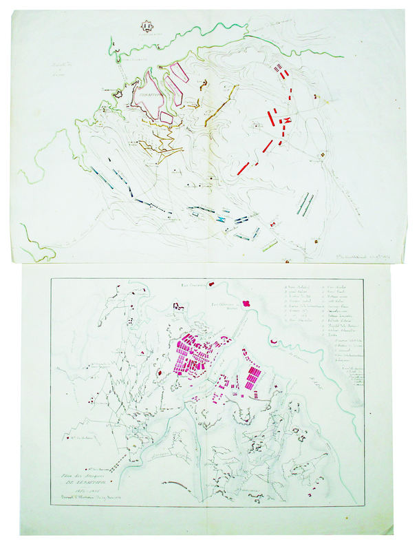
SEBASTOPOL. MANUSCRIT.
[Plan du siège de Sébastopol] [et] Plan des attaques de Sébastopol.
1854-1855. 272 x 422 mm et 288 x 386 mm, sur papier fin.
Référence libraire : LBW-4226
|
|
|
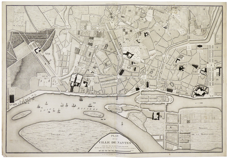
SEBIRE (J.) & COULON.
[NANTES] Plan de la ville de Nantes.
Nantes, Sebire, et Paris, Coulon, An 3. de la Rép. Fr. [1795]. 490 x 707 mm.
Référence libraire : LBW-5910
|
|
|
SEDAN
Carte au 1/200 000e. Sans date.
Une feuille 32x50 cm.
|
|
|
SEGUIN Jean-Pierre
Le jeu de carte.
Paris: Hermann, 1968 pet. in-4, 346 pages, riche illustration, bibliographie. Reliure toile, jaquette avec pet. marques.
Référence libraire : 13976538
|
|
|
SEGUIN Jean-Pierre - JANDIN Cécile de - GOURDON Marie-Thérèse
Cartes à jouer - Donation faite à la Bibliothèque Nationale par Monsieur Paul Marteau, maître-cartier, juin 1966
Bibliothèque Nationale, 1966, broch. gr. in-8 (19 x 26,5), 44 p., avant-propos de Etienne Dennery, avertissement de Jean Adhémar, gravures in-t., avec son carton d'invitation, tampon sur la couverture, bon état.
Référence libraire : QWA-19411

|
|
|
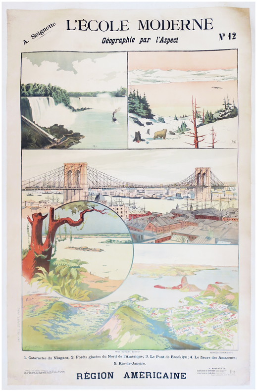
SEIGNETTE (Adrien) & LUNOIS (Alexandre).
L'École moderne. Géographie par l'aspect. N°12. Région américaine.
Paris, Paul Dupont, [1900]. 1,22 x 0,85 m ; montée sur toile.
Référence libraire : LBW-7872
|
|
|
SELF INSTRUCTOR.
The Self Instructor, or, Young Man's Best Companion; being an Introduction to all the various branches of useful Learning and Knowledge. Containing Writing, Grammar, Arithmetic, Astronomy, Geography, Chronology, and Miscellaneous Articles. To which is added, The Artist's Assistant; comprising the Arts of Drawing, Perspective, Etching, Engraving, Mezzotinto, Scraping, Painting, Drying, Colouring of Maps, etc. A brief account of Naval and Military Affairs. Also, various useful Medicinal Receipts.
8vo (218 x 135 mm), [4], 593, [3] pp., 3pp. of contents at end, folding engraved map of the world before the engraved and printed titles, 7 engraved plates, contemporary tree calf, spine gilt, morocco label, a nice copy. The map and the engraved frontispiece are "Published by Nuttall, Fisher, & Co., Liverpool, Sept. 1814, and Aug. 1815", respectively.
|
|
|
SELIGMAN, Adrian (text, illustrations and maps) Konstance Pares (linocut decorations)
No Stars to Guide
Hodder & Stoughton London 1947. 1st Edition. HARDCOVER. 1st printing. Thick 8vo in pale yellow cloth blue lettering to spine. 332pp 6 folding maps frontispiece and 20 other full page plates in blue wash all done by the author facsimile letters and linocut decorations all by Pares __CONDITION : A well preserved near FINE clean and tight copy pages slightly tanned neat inscription dated 1947 on front blank fly-leaf no other marks or inscriptions in a tanned slightly dusty and slightly edge-nicked but otherwise VERY GOOD complete Dust Jacket looks fine in its removable transparent protector. A very nice copy. . __We always ship in PROTECTIVE CARD PARCELS Hodder & Stoughton, London hardcover
Référence libraire : TK222592
|
|
|
Selwyn, Victor
Plan Your Route: The New Approach to Map Reading
Good+ Hardback with good+ dust jacket. Including the electronic technology and satellite navigation. Minor shelf wear. Corners of boards have been knocked very slightly. Clean text. Black & white/colour illustrations. 196p.
|
|
|
SELZ
Carte allemande au 1/80 000?. Fin XIXe.
1 feuille repli?e. 31,5x45 cm.
|
|
|
SEMIR, Ramon de
MAPA DE VALL FERRERA - 1951
Edit. Con. Sup. Geográfico, 1951. Mapa topográfico excursionista. 1:37.500. Mapa entelado y plegado. Firma antiguo proopietario. Muy buen ejemplar.
|
|
|
SEMIR, Ramon de
RIBAGORÇA. Llauset. Mulleres. Beciberri. Fenarroi - Granollers 1961 - Mapa
Granollers, Editorial Alpina, 1961. Mapa topográfico excursionista. Escala 1:25.000. Mapa entelado y plegado. Muy buen ejemplar.
|
|
|
SEMPÉ
Sempe : A question of balance
2006, Phaidon Press, coffret cartonné toilé contenant 23 cartes postales sur le thème du vélo (dessins et aquarelles) - manque 1 carte postale | Etat : bon, coffret défraîchi, cartes postales en très bon état, manque 1 carte postale (Ref.: ref98251)
Référence libraire : 9782845233112
|
|
|
SEMUR
Carte routi?re de l'arrondissement de Semur (C?te d'Or) au 1/50 000e. Sans date.
Une feuille 64x49 cm. Plis r?par?s.
|
|
|

 Recevoir par e-mail
 Télécharger en PDF
 Flux RSS
 Lien permanent


