|
[INDOCHINE] [VIETNAM [CARTES] [QUI NONN] [KANTUM] [DARLAC]
Carte de Qui Nonh
Paris, Avril 1945, Institut Géographique National. 1 grande carte, format 88*65 cm, à l'échelle 1/400.000e, en couleurs, dessinées par le S.G.M.A., publiées par l'Institut Géographique National en 1945., très bon état.
Referencia librero : 10423
|
|
|
[INDOCHINE] [VIETNAM [CARTES] [VINH]
Carte de Vinh Ouest
Paris, Avril 1945, Institut Géographique National. 1 grande carte, format 88*65 cm, à l'échelle 1/400.000e, en couleurs, dessinées par le S.G.M.A., publiées par l'Institut Géographique National en 1945., très bon état.
Referencia librero : 10422
|
|
|
[INDOCHINE] [VIETNAM [CARTES] [VINH]
Cartes de Vinh, Annam, Vinh Est et Vinh Ouest
Paris, Avril 1945, Institut Géographique National. 2 grandes cartes, format 88*65 cm, à l'échelle 1/400.000e, en couleurs, dessinées par le S.G.M.A., publiées par l'Institut Géographique National en 1945., très bon état.
Referencia librero : 8529

|
|
|
[INDOCHINE] [VIETNAM] [LAOS] [CAMBODGE] [CARTES] [[HUE OUEST]
Carte de Hué Ouest
Paris, Avril 1945, Institut Géographique National. 1 grande carte, format 92*72 cm, à l'échelle 1/400.000e, en couleurs, dessinées par le S.G.M.A., publiées par l'Institut Géographique National en 1945, très bon état.
Referencia librero : 10425
|
|
|
[INDOCHINE] [VIETNAM] [LAOS] [CAMBODGE] [CARTES] [KONG]{SIEM RAP] [ANGKOR]
Carte de Khong - Khong Ouest
Paris, Avril 1945, Institut Géographique National. 1 grande carte, format 92*72 cm, à l'échelle 1/400.000e, en couleurs, dessinées par le S.G.M.A., publiées par l'Institut Géographique National en 1945, très bon état.
Referencia librero : 10424
|
|
|
[INDOCHINE][VIETNAM][TONKIN] [CARTES] [HA DONG]
Cartes de Ha Dong, Delta du Tonkin, Ha Dong Est et Ha Dong Ouest
Hanoï, Mai 1917, Service Géographique de l'Indochine. 2 grandes cartes, format 45*65 cm, à l'échelle 1/25.000e, en couleurs, dressées, héliogravées et publiées par le Service Géographique de l'Indochine, sous la Direction du Capitaine Salel, très bon état.
Referencia librero : 8528

|
|
|
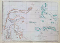
[INDONESIA - MAP OF SULAWESI & MALUKU ISLANDS] WELLER, EDWARD
Celebes and the Molucca Islands.
London.: Weekly Dispatch Atlas. circa1860. Map with outline handcolour 31.3 x 43.3; 33.3 x 48.7 cms sheet 12 x 17 inches small marginal bloom not affecting the map in very good condition. Detailed mapping of these two island groups by Edward Weller 1819–1884 from the ‘Weekly Dispatch Atlas’ an atlas published in monthly instalments from 1855 for subscribers to the long running newspaper. Weller was a pioneer in lithography and was sought after for his skill in producing detailed and accurate maps. . Weekly Dispatch Atlas. unknown
Referencia librero : 184035
|
|
|
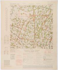
[INDONESIA - WWII MAP].
Java & Madura. 1:50000. Djombang. Sheet 53/XLIC. HIND 1090.
Washington D.C.: Army Map Service. First edition - revised AMS4. 1945. Army survey map printed in colour 36.7 x 36.7 cm; 58 x 48 cm sheet conversion graph glossary and administrative index to the inner margin; scale three column legend index to adjoining sheets and notes re grid references and mean declination to the foot; sheet toned a very few edge tears the map in very good condition. Wartime map produced by the US Army Map Service AMS who formed in 1942 and were at the forefront of military mapping campaigns during WWII and the post-war years. The very detailed map shows residency and administrative boundaries transportation ground and water features vegetation cultivation ruins religious sites "Graves; Chinese native" and "Cemetery; heathen Christian" walls hedges populated places built-up areas and buildings with those of iron stone wood and bamboo differentiated by colour; fishponds plantations and much more. . Army Map Service. unknown
Referencia librero : 200411
|
|
|
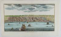
[INDONESIA - ANTIQUE PRINT] VAN DER SCHLEY, JAKOB
Samboupo.
circa1750. Hand-coloured engraving 19.5 x 35.6 cm 25.5 x 41.6 cm sheet original folds two old paper repairs not affecting the image a trifle toned but in very good condition Attractive bird's-eye view town plan of Makassar in Sulawesi prepared for Abbé Prevost's monumental 'Histoire Générale des Voyages.' . unknown
Referencia librero : 177186
|
|
|
[Institut Géographique National]
CARTE de FRANCE : AULUS les BAINS
Une carte dépliante au 1/50.000e (type 1922), format ouvert 750 x 565 mm, publiée en 1957, bon état
Referencia librero : LFA-126711119
|
|
|
[Institut Géographique National]
CARTE de FRANCE : FOIX n° 5-6
Une carte dépliante au 1/25.000e, format ouvert 725 x 555 mm, publiée en 1957, bon état
Referencia librero : LFA-126711118
|
|
|
[Institut Géographique National]
CARTE de FRANCE : VICDESSOS n° 1-2
Une carte dépliante au 1/25.000e, format ouvert 725 x 560 mm, publiée en 1962, bon état
Referencia librero : LFA-126711120
|
|
|
[Iran; Iraq; Maps] ['Published by Survey Directorate, GHQ Paiforce']: G H Q
Iran; Iraq; Paiforce WW2; Maps Fourteen 14 Index Maps mainly of areas/places in Iran
'Published by Survey Directorate G.H.Q. Paiforce 1944. All one page 20 x 33cms some stained but texts clear and complate. 1. Index map of Iraq and Iran for a 1:100000 scale survey series produced by the British military command PAIFORCE during World War II. All 20 x 32.5cm a couple sl. stained mainly good condition.1.Four Index maps of Iraq and Iran ¼ series I.D.R./X.D.R./G.S.G.S. 9002 3919 nos. 1-42.Index map of Iraq and Iran for a 1:100000 scale survey series produced by the British military command PAIFORCE during World War II. Index Map of 'Irq rn 1:100000 Series I.D.R. 9003'.3.Four Index Maps of places/areas of IRAN:a. Ahwaz 1:10000 series 1D MISC/563 to 573 stamped 11 June 1944b. Askaran and Sanandaj N.W. 1:25000 series …9005 stamped 25 June 1944c. Gach-I-Sar 1:50000 series stamped 11 June 1944d. Khurramshahr Abandan 1:12500 series4.Six Index Maps of places/areas of IRAQ all 1:25000 series ID 9005:a. Ba'qubab. Faidahc. Haffad. Hindiyae. Falluja f. MoselNo reference to other copies yet found. 'Published by Survey Directorate, G.H.Q. Paiforce [1944] unknown
Referencia librero : 26975
|
|
|
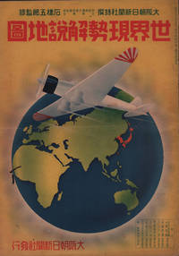
[ISHIBASHI GORO, GENERAL EDITOR]. 石橋五郎監修.
世界現勢解説地圖. Sekai Gensei Kaisetsu Chizu. Explanatory Maps of the Present State of the World.
大阪朝日新聞社. Osaka Asahi Shinbunsha. Showa 12 1937. 10 colour maps not including insets or sketch maps in text on 12 pages. Handsome world map features as the centre fold colour pictorial paper wrappers. A little light soiling and horizontal crease wrappers. An attractive atlas. 38 x 26.7cm. A large format atlas with six pages of coloured maps showing the nations of the world and five pages of Japanese text. The publication seems to have been produced to celebrate the 1937 world record flight from Tokyo to London by Iinuma Masaaki and Tsugayoshi Kenji in their plane 'Kamikaze' which was sponsored by the Asahi Newspaper. The front cover depicts the plane soaring over a map of the world while the back cover also had a colour image of the 'Kamikaze' with an advertisement for the Oji Paper Company which we are told donated a hundred million yen to support the flight. The name 'Kamikaze" had at that stage not yet taken on the connotations which it acquired during the Pacific War. <br> <br>The maps inside the volume show political boundaries major cities and transport routes. The opening pages show the Japanese Empire including Japan proper Korea Karufuto and Manchukuo with small insets covering Taiwan the Chishima Archipelago and Japan's South Sea mandate. The accompanying text focuses on Japan's newly acquired client state of Manchukuo detailing its area population principle products etc while the map includes graphs illustrating Japan's trade with the world and with Manchukuo. China receives an entry of its own with a map of the Chinese Republic and information on the political situation population trade and infrastructure. The central pages of the volume are taken up with a double-spread map of the world including depictions of the flags of a selection of the world's nations. Other sections of the work cover Asia Europe America Africa and Oceania grouped together. The discussion of Oceania includes a section on Hawaii and some small and improbable depictions of Maori and Indigenous Australians. . 大阪朝日新聞社. [Osaka Asahi Shinbunsha]. unknown
Referencia librero : 208633
|
|
|
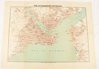
[ISTANBUL - POST-TREATY OF LAUSANNE].
Plan of Constantinople and Environs.
Constantinople.: The Anglo-American Book & Newsagency. 1925. Printed folding colour map 36 x 49.2 cm street grids for Stambul Pera Galata and Skutari railways and landing places marked small fold splits affecting the margins only now repaired with archival material two small holes at central folds pin-holes to the four corner some age-toning but in very good condition. A scarce map of the historic peninsula soon after the Republic of Turkey was founded and the capital moved to Ankara. Printed for the tourist market this map is a rare survival. . The Anglo-American Book & Newsagency. unknown
Referencia librero : 174961
|
|
|
[Isère, Drôme] lot de 6 cartes d'électeurs signées par 5 préfets différents pour Christophe-François de Beaumont de Verneuil d'Auty (1769-1851).
[Isère, Drôme] lot de 6 cartes d'électeurs signées par 5 préfets différents pour Christophe-François de Beaumont de Verneuil d'Auty (1769-1851).
[Isère, Drôme] lot de 6 cartes d'électeurs signées par 5 préfets différents pour Christophe-François de Beaumont de Verneuil d'Auty (1769-1851). Cartes des élections de 1824, 1826, 1829, 1830, 1834 et 1836. Seule la dernière (la seule pour la Drôme) porte une mention d'imprimeur (Borel à Valence). Cartes d'électeur de Christophe-François de Beaumont, propriétaire à Roybon (Isère) puis à Moras-en-Valloire (Drôme). Elles sont signées par les préfets successif de l'Isère et de la Drôme : Charles Lemercier de Longpré (1778-1854), Jules de Clavières (1762-1849), Antoine Finot (17801844) - 2 cartes -, Charles Pellenc (1790-1872) et Jean François Léon Saladin (1795-1873). Une carte avec déchirures. On joint un bulletin de vote royaliste portant les noms de cinq candidats : Chevenaz, Lavalette, Meffrey, Murinais et Pina. Il s'agit des candidats pour une élection avant 1827 (Chenevaz meurt en 1829 et se présente donc la dernière fois en 1827.). [88-2]
Referencia librero : 015690

|
|
|
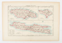
[JAMAICA AND JAVA AND BALI - MAP].
Jamaica and Java and Bali.
London and New York.: Encyclopedia Britannica. circa1900. Map in three insets after W & AK Johnston engravers with printed outline colour 18.9 x 28.9 cm central fold paper age-toned but in very good condition. Interesting map which first appeared in the ninth edition of Encyclopedia Britannica. . [Encyclopedia Britannica] unknown
Referencia librero : 174875
|
|
|
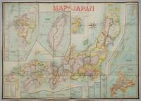
[JAPAN & TAIWAN - MAP] OKISHIO, TAKACHIKA
Map of Japan.
Kobe Japan.: Fuku-In-Kwan. 1906. Printed colour folding map on two conjoined sheets laid down 73.8 x 10⁵ cms foxing on verso not affecting map single pinhole in each corner scant spotting small fold splits no loss a few soft fold creases but in good condition. Very rare striking map of Japan published for the Western market. <br> <br>Created under the direction of Takachika Okishio featuring 10 inset maps: Chishima Kurile Islands Hokushu Hokkaido Ogasawara-Jima Bonin Islands Hachijo-Shima Ioshima Okinawa Saki-Shima Kyushu Saikaido Taiwan Formosa and Eastern Asia. The insets of Taiwan and Kyushu are the largest and centrally positioned. A Glossary and Explanation of Signs is printed at the foot of the map which list Towns Railway Stations Boundaries of Prefectures Notable Places Hot Springs Water-falls rapids Volcanoes Light-Houses Gold Silver and Coal-Oil fields. The Japanese Government Railway series of Travellers' Maps of Japan appear to have been modelled after this design. . Fuku-In-Kwan. unknown
Referencia librero : 197908
|
|
|
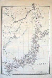
[JAPAN - 1850S MAP]
Japan.
London.: Cassell Petter & Galpin. circa1852. Map with outline handcolour 42.5 x 30.1 cms; 49.2 x 34.3 cms sheet margins a little toned small corner crase but in very good condition. Very detailed map of the Japanese islands with Sakhalin above and the coast of Manchuria and Korea. . Cassell, Petter & Galpin. unknown
Referencia librero : 185246
|
|
|
[JAPAN - MEIJI ERA MAP] BATHOLOMEW, JG J G
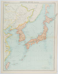
Japanese Empire - Political.
Edinburgh.: John Bartholomew & Son Ltd. 1922. Large double page map 54.2 x 43 cms map original fold some edge toning and to the fold but in very good condition. Large map prepared as plate 65 for “The Times Survey Atlas of the World” in 1922 and was prepared at the Edinburgh Geographical Institute under the direction of J G Bartholomew. The map shows Japan's territory inclusive of Korea southern Sakhalin and Taiwan. . John Bartholomew & Son Ltd. unknown
Referencia librero : 215880
|
|
|
[JAPAN - TOKYO - WORLD WAR II MAP] GFROERER, CURT (ARTIST).
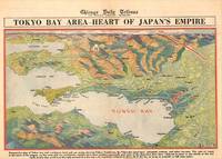
Tokyo Bay Area - Heart of Japan's Empire.
Chicago.: Chicago Daily Tribune. 28 July1945. Colour bird's eye view map 22.4 x 39.3 cms on a newspaper leaf trimmed to a half sheet 29.8 x 41.6 cms including caption slight toning at an old central fold the map in very good condition. <br>Unrelated black and white photographic illustrations on the verso "Pre-flight Trainers used in Chicago to give ground instruction to would-be pilots" and "New rekindled Montauk Light Long Island N.Y." Map published in the Chicago Daily Tribune days before the bombing of Hiroshima on August 61945. <br>"Perspective map of Tokyo bay and contiguous land and sea areas showing Tokyo Yokohama the Yokosuka naval base industrial sections and other features .In this map north is at the right instead of at the top - an expedient adopted to show all of the bay as large as possible in half page space." caption . Chicago Daily Tribune. unknown
Referencia librero : 209335
|
|
|
[JAPAN - WWII MAP] GFROERER, CURT (MAPMAKER).
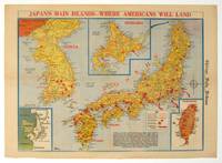
Japan's Main Islands - Where Americans Will Land.
Chicago.: Chicago Daily Tribune. August1945. Printed colour pictorial map on a single newspaper leaf 37 x 52 cms; 43 x 59.5 cms sheet three inset maps archivally laid down on linen very good condition. Full page map published in the "Chicago Daily Tribune" after the bombing of Hiroshima and Nagasaki prior to occupation by US and Allied forces in September 1945. "This is a new map of the main islands of Japan where American occupational troops will land and establish their military rule." map text The legend notes "Places bombed by U.S. Air Forces with a red circle" and "Cities bombed by Atomic Bomb" with a red star. The main map shows the Japanese islands of Honshu Shikoku and Kyushu with the Korean peninsula. Inset maps show Hokkaido Formosa and a general map of the area. . Chicago Daily Tribune. unknown
Referencia librero : 208877
|
|
|
[JAPAN - YAMANASHI - MAP]
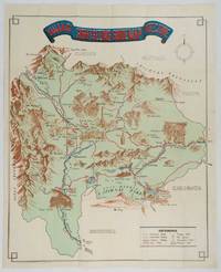
Yamanashi Prefecture Sight-Seeing Guide Map.
Kofu.: Onkodo Printing Co. circa1930s. Colour pictorial map 70.2 x 56 cms; 75.5 x 59.5 cms sheet light wear along the inner margin some soft creases from folding short split at center fold; in very good clean condition. An appealing and decorative map of Yamanashi Prefecture which while a process print has the attractive soft look of a lithograph adorned with vignettes of key attractions landmarks such as Mt. Fuji and industry such as silk and wine. The legend lists Railways 'Footing' Roads Hot Springs Hotels and National Parks. A scarce and attractive English language map for the tourist market. . Onkodo Printing Co., unknown
Referencia librero : 206841
|
|
|
[JAPAN AND KOREA - MAP]. MEYERS, JOSEPH
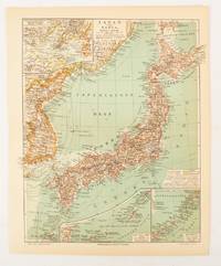
Japan und Korea.
Leipzig.: Bibliographisches Institut. 1902-1908. Map printed in colour 27.2 x 21.4 cm inset colour key to territorial administration by country inset "western continuation of the main chart" including the Gulf of Tschili and Tsientsin and two insets at the foot of the map to the Kuril and the Ryuku Islands text in Geman central fold slight edge toning but in very good condition. Attractive map text in German prepared for Meyers Großes Konversations-Lexikon. . Bibliographisches Institut unknown
Referencia librero : 174898
|
|
|
[Japanese Hand-Coloured Wood-Block Printing]; [Maps and Atlases]; [Tokyo Map] Hyoshiya Ichirobe
A WOODBLOCK HAND-COLOURED MAP OF TOKYO; JAPAN EIRI EDO OEZU Illustrated Edo
Edo Tokyo: Hyoshiya Ichirobe Hayashi-shi Yoshinaga First month 1684 But Third month 1680. A large woodcut map of Edo Tokyo with fine handcolouring on joined and folded paper. The map is breathtaking in its detail and features many paintings of important landmarks temples bridges and people who are often pictured working or fishing from boats on the waterways running through Tokyo. A stunning and very rare woodblock map beautifully and unusually handcoloured. Roads blocks buildings open areas canals and waterways are all vividly laid out on this huge and most impressive map. 123.5 by 149.5 cm. folded within paper covers folds to 28 by 18 cm now preserved in a fine clamshell box. A remarkably well preserved and very rare item with some light rubbing due to age and as to be expected. A bit of old worming or light soiling and occasional small repairs but in all quite astonishing in its quality and beautifully preserved with bright and vivid colour and detail. AN EXTRAORDINARY ITEM REMARKABLE FOR BOTH ITS CARTOGRAPHIC DETAIL AND ITS ARTISTIC BEAUTY. The wood block printing shows land tenures of Daimyo and Hatamoto. It also shows temples and shrines includes a distance chart and descriptive listing of Daimyo showing crests and halberds. There is also a inset of the eastern portion of Edo. Hyoshiya Ichirobe (Hayashi-shi Yoshinaga) unknown
Referencia librero : 24285

|
|
|
[JAPANESE WORLD WAR II MAP OF NEW ZEALAND].
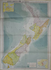
標準大東亜分図: 17 ニュージーランド編. Hyōjun Dai tōa bunzu: 17 Nyuujiirandohen. Standard Maps of Greater East Asia: 17 New Zealand.
Tokyo: 統制社Tosei-sha. 昭和18 Showa1943. Folding colour map of New Zealand with inset of Auckland and Wellington top and bottom corners1:2000000 scale little light browning. Original envelope worn with closed tears. 54 x 76.5cm. Good copy. Scale plan of New Zealand printed by Tosei in 1943. The map legend shows infrastructure deemed important to the Land Survey Bureau of the General Staff Headquaters of the Imperial Japanese army such as boundaries powerlines quarries and mines; railroads sea-routes etc. . 統制社(Tosei-sha) unknown
Referencia librero : 154080
|
|
|
[JEU DE CARTES GÉOGRAPHIQUES] PERROT, Aristide Michel (1793-1879)
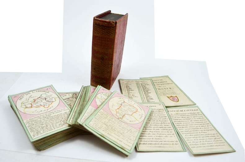
Analyse géographique sur les départements de la France.
Paris, Bourrut-Le Meri, Rue du Petit lion St Sauveur, [1819?]. Boite d’édition imitant un livre, recouvert de papier maroquiné rouge avec roulette florale dorée en encadrement sur les plats et un dos orné, titre doré au dos, glissière au niveau de la tranche supérieure.
Referencia librero : 12902
|
|
|
[JEU DE CARTES/ CARDS GAME]
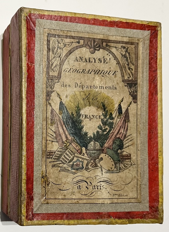
Analyse géographique des départements de la France.
Paris, Bourrut Lemerie, [circa 1836]. 1836 Jeu de 90 cartes (132 x 82 mm). (quelques rousseurs) 1 boite d'origine (160 x 120 mm) en carton recouverte de papier rouge, titre imprimé en couleur sur le couvercle. (défauts d'usage)
Referencia librero : 5579
|
|
|
[Jeu de cartes]
[Jeu de cartes] Jeu des poètes composé de 80 cartes avec portraits et extraits de leurs oeuvres.
Neuchâtel: Delachaux & Niestlé, [c. 1910] Jeu de carte formé de 20 familles de 4 cartes. Chaque famille est attribuée à un poète. Dans sa boîte d'origine (défr.), cartes en bon état. Dimensions: cartes, 7,5 x 11,5 cm; boîte, 16,5 x 12,5 cm.
Referencia librero : 13977179
|
|
|
[Jeu de cartes] Dreosbeke Erna
Le Tarot d’Isis. vers la confiance en soi
Amber Studio 1985 Complet de 36 cartes illustrées, joint une notice explicative du jeu 40 pages agrafées de 10 cm sur 6,3. sous étui. Très bon état d’occasion.
Referencia librero : 96384
|
|
|
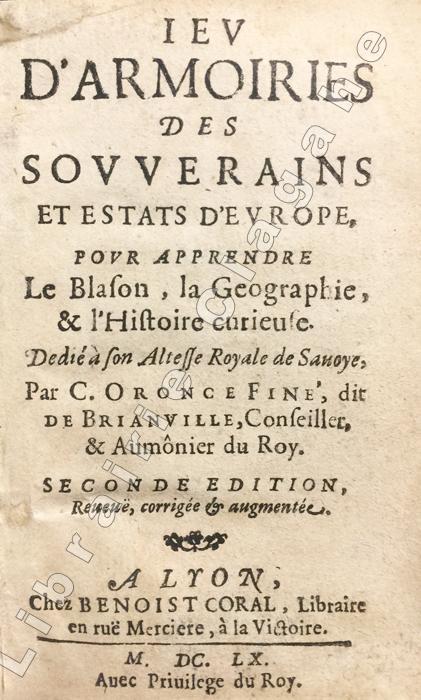
[Jeu de cartes] Fine de Brianville, Claude-Oronce :
Jeu d'Armoiries des Souverains et Estats d'Europe, pour apprendre le Blason, la Géographie et l'Histoire curieuse. dédié à son Altesse Royale de Savoye. Seconde édition, revue, corrigée et augmentée.
Lyon, Benoist Coral, 1660 ; in-24 ; pleine percaline bleue à décor floral, filets et titre dorés au dos (reliure du XIXe) ; (16) ff. dont titre et 2 planches gravées, 209 pp.
Referencia librero : 9246
|
|
|
[Jeu de l'hombre]
Le Jeu de l'hombre, comme on le joue présentement à la Cour, & à Paris. Avec les pertintailles. Enrichy de cartes figurées, qui representent les jeux qui se jouent. 7e édition, suivi de Décisions nouvelles sur les difficultez et incidens du jeu de l’hombre
Paris, chez Michel-étienne David, Chez Pierre Ribou 1709 In-16 16,5 x 9 cm. Reliure début XIXe siècle, demi-basane havane, dos lisse ornéde filets dorés, pèce de titre cuir fauve, [10]-166-[10]-33 pp. Reliure ternie, coins émoussés et frottés, intérieur jauni.
Referencia librero : 113602
|
|
|
[JEU]
Plateau de nain jaune
France, [vers 1880]. 27,5 x 22,5 cm (petits frottements, taches).
Referencia librero : 23223

|
|
|
[JEUX - CARTES A JOUER]
La Sibylle des Salons.
P., B.-P. Grimaud, (2ème moitié du XIXème siècle). Enseignes françaises, en pied, chromolithographies, coins très légèrement arrondis, 54 cartes (Etui cartonné incomplet) en bonne condition.
Referencia librero : 9519
|
|
|
[JEUX] - BERLOQUIN, Pierre.
100 Grandes Reussites.
Hardcover petit in-4 de 203 pages, nombreuses photos in-t, cartonnage illustre, jaquette rhodoide. Bel exemplaire. [P-28]
|
|
|
[JEUX] - LOHEAC-AMMOUN, Frank.
Tous les Jeux de Cartes. Règles - Techniques - Conseils.
in-8 de 294 pages imprimees en 2 couleurs, nombreuses figures in-t, lexique, index, cartonnage illustre plastifie. Bel exemplaire. [NV-8]
|
|
|
[JEUX] - RENAUDET, B.
Tous les Jeux de Cartes et leurs regles.
petit in-8 broche. Bel exemplaire. [CA31-8] Manille, Piquet, L'Ecarté, Poker, Rams, Besigue, Bouillotte, Mouche, Polignac, Baccara, Belote, Trente et Quarante, Lansquenet, Vingt-et-Un, Bridge, etc..
|
|
|
[JOHANN SAMUEL] HENRY [HEINRICH] KIEPERT, (1818-1899).
[WALL MAP OF THE IMPERIAL OTTOMAN INCLUDING ARABIAN PENINSULA / FRENCH EDITION] Nouvelle carte generale des Provinces Asiatiques de l'Empire Ottoman.
Very Good French Original map. Oblong Double Elephant Folio. (96x156 cm). In French. Scale: 1/1.500.000. With explanation of geographical terms in Greek, Turkish, Arabic and Persian; With overview sheet: Aperçu general de la division administrative des provinces asiatiques de l'Empire Ottoman. (Jaar: 2011 - Europeana Collections). French edition of Kiepert's huge map of the Imperial Ottoman territories. "Includes list of geographic terms in eastern languages and notes on administrative divisions. Includes notes on materials the cartographer used to put together the map". (See LC copy). Kiepert, (1818-1899), was born in Berlin. He traveled frequently as a youth with his family and documented his travels by drawing. His family was friends with Leopold von Ranke, who inspired Kiepert's creative endeavors. Kiepert was taught by August Meineke in school. Meineke influenced Kiepert's interest in classical antiquity. He attended Humboldt University of Berlin. He studied history, philology, and geography. He published his first geographical work, with Carl Ritter, in 1840, titled Atlas von Hellas und den hellenischen Kolonien. The atlas focused on ancient Greece. In 1848 his Historisch-geographischer Atlas der alten Welt was published. In 1854, his atlas, Atlas antiquus was released. It was translated into five languages. Neuer Handatlas über alle Teile der Erde was first published in 1855. In 1877 his Lehrbuch der alten Geographie was published, and in 1879 Leitfaden der alten Geographie, which was translated into English (A Manual of Ancient Geography, 1881) and into French. In 1894 he created the first part of a larger atlas of the ancient world titled Formae orbis antiqui. He traveled to Asia Minor four times between 1841 and 1848. He created two maps of the region, including Karte des osmanischen Reiches in Asien, in 1844. Kiepert taught geography at the University of Humboldt-Berlin starting in 1854. He taught at the university until his death. Akyol, article 536.; Dagtekin p. 22 (With detailed bibliography on Kiepert's maps). Rare. Preserved in a frame, will be sent without its frame. A wall map.
|
|
|
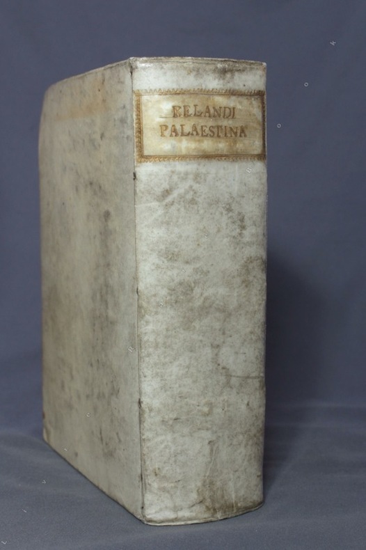
[JUDAICA; RELAND Hadrian] Hadriani Relandi:
Palaestina, ex Monumentis Veteribus Illustrata, in tres libros distributa, tabulis geographicis necessariis, iisque accuratis exornata, et a multis insuper, quae in primam editionem irrepserant, mendis purgata.
Norimbergae [Nuremberg], Petrum Conradum Monathum, 1716. Gros in-8 de [18]-787-[83]-[2bl.] pages, plein vélin ivoire du temps, dos lisse, titre doré au dos dans une cartouche de roulette dorée, tranches mouchetées. Hormis une pâle auréole d'humidité en marge supérieure de quelques feuillets, bel exemplaire.
Referencia librero : 8475
|
|
|
[Kartographie - Amerika]. - Wolff, Hans (Hg.)
America. Early Maps of the New World.
(München), Prestel, (1992). Qu.-4°. Mit zahlr. tlw. farb. Abbildungen. 192 S., OLwd. m. illustr. OUmschlag.
Referencia librero : 54494
|
|
|
[Kartographie - Britische Inseln]. - Shirley, Rodney W
Early Printed Maps of the British Isles. A Bibliography 1477-1650. Revised edition. (= Holland Press Cartographica 5).
(London), Holland Press, (1980). 4°. Mit 88 Tafeln. XXV, 188 S., OLwd. m. illustr. OUmschlag.
Referencia librero : 54487
|
|
|
[Kartographie - Heiliges Land]. - Wajntraub, Eva u. Gimpel
Hebrew Maps of the Holy Land.
Wien, Brüder Hollinek, 1992. 4°. Mit zahlr. tlw. ganzs. bzw. farb. Abbildungen. XXIV, 277 S., OLwd. m. illustr. OUmschlag.
Referencia librero : 54498
|
|
|
[Kartographie - Japan]. - Yamashita, Kazumasa
Japanese Maps of the Edo Period.
Honkomagome-Bunkyok-Tokyo, Kashiwashobo, 1998. 4°. Mit zahlr. Abbildungen. 270 S., 1 Bl., OLwd. m. illustr. OUmschlag.
Referencia librero : 54500
|
|
|
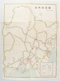
[KIKUCHI, KIYOSHI, EDITED BY]. 菊池清編輯.
満洲鉄道図. Manshu tetsudo zu. Railway Map of Manchuria.
奉天. Mukuden.: 満鉄鉄道総局. Mantetsu Tetsudo Sokyoku. 昭和 15 1940. Colour folded map seven small very holes not affecting the printed image otherwise good. 53 x 38.5cm Map showing the comprehensive railway network in Manchuria with names of all the stations. It includes the lines run by the South Manchurian Railway Company their temporary industrial lines light rail as well as the lines run by other Russian and Chinese companies. By 1940 the network had expanded so much that it included almost the whole of Manchuria. . 満鉄鉄道総局. [Mantetsu Tetsudo Sokyoku]. unknown
Referencia librero : 172590
|
|
|
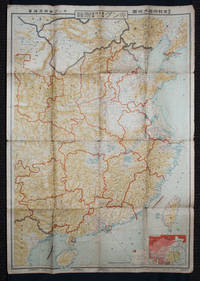
[KINGU HENSHū-KYOKU / KINGU EDITORIAL OFFICE] キング編輯局.
最新支那明細大地圖/滿・蒙・ソ聯國境大地圖. Saishin Shina meisai daichizu / Man Mō Soren kokkyō daichizu. Latest Large Detailed Map of China/Large Map of Manchuria Mongolia and the Soviet Union Borders.
Tokyo: 大日本雄辯會講談社 Dainihon Yūbenkai Kōdansha. Shōwa 13. 1938. Two large detailed maps of China and on the reverse of the Soviet Union in Asia Manchuria and Mongolia printed double sided on a single large sheet. Issued as a supplement to Volume 14 Number 1 of the magazine Kingu on New Year's Day in 1938. <br> <br>Holes at a number of holes causing a small amount of loss some occasional browning some chipping on margins. The map has clearly been used but is still largely complete. The colourful map of China on a scale of 1:2600000 includes part of Manchukuo and Inner and Outer Mongolia on the north and part of French Indochina to the south-west. It shows East Hebei Autonomous Anti- Communist Council Jidong Fanggong Zizhi Zhengfu 冀東防共自治政府 south of Manchukuo which existed from late 1935 until February the 1st1938. The legend includes national and provincial borders cities roads railways sea and air routes and undersea cables. There is an inset map of East Asia titled "Present Situation of Far East" on the lower right corner which shows the areas under influence of Communism and those under influence of/controlled or colonised by the United Kingdom France Japan and China. <br> <br>The map on the reverse printed in blue and black shows the Asian section of the Soviet Union Manchuria and Mongolia on a scale of 1:3000000. There is an inset map of Asia titled "Asian Continent" at the upper left corner the area enclosed by a rectangle which indicates the area covered in this map. The legend includes cities railways roads national borders district borders province borders and air routes. . 大日本雄辯會講談社 [Dainihon Yūbenkai Kōdansha]. unknown
Referencia librero : 159295
|
|
|
[KIZAKI, JUNICHI]. 木崎純一.
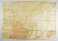
最新詳密蘇連極東地方大地図. Saishin shomitsu Soren Kyokuto chiho dai chizu Most Recent and Detailed Large Map of the Soviet Union and Far East Region.
東京. Tokyo.: 伊林書店. Ibayashi Shoten. 昭和14 1939. Colour printed folding map 78 X 109cm minor damage original envelope 27.5 x 20cm. Very good copy. This map offers comprehensive information on northern China Manchuria the Soviet Union and Hokkaido including Kuril Islands under the Japanese control. It also includes the Jewish Autonomous State which existed in the late 1930s. The inset map provides detailed information on the border area of Japan Manchuria and the Soviet Union. Legends include national borders railways major cities iron mines and oil wells. <br> <br>Published in 1939 this map is an expression of the tension Japan felt in its relationship with the Soviet Union. At the time the Soviet Union was seen as the mighty threat to the lying just north of Manchuria and Japan . . 伊林書店. [Ibayashi Shoten]. unknown
Referencia librero : 171112
|
|
|
[KOYAMA, KICHIZO]. 小山吉三.
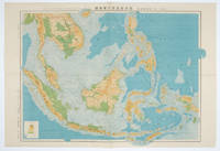
蘭領東印度諸島詳圖 附泰國・佛印・マレー半島. Ranryo Higashi-Indo Shotoo shozu : Fu Taikoku Futsu-In Mare Hanto. Malay Archipelago.
東京.Tokyo.: 日本名所圖繪社.Nihon Meisho Zuesha. 昭和16 1941. Folding colour Japanese map of the Malay Archipelago and Thailand scale 1: 8500000 with attractive original pictorial paper envelope. This map also shows the Dutch French and American colonies. Hainan Province and the South China Sea are shown in the north. Agricultural and mineral resources indicated across the map. Few small holes at holes and other light signs of wear. Slipcase lttle torn. Text in Japanese and English. 53.3 × 78.2cm. . 日本名所圖繪社.[Nihon Meisho Zuesha]. unknown
Referencia librero : 160538
|
|
|
[La RECHERCHE]
LA RECHERCHE
N° 176 - Avril 1986 Une revue d'environ 140 pages, format 295 x 220 mm, brochée, illustrée
Referencia librero : LFA00876
|
|
|
[LAFRERI - DUCHETTI - FLORINI - MAPS AND ENGRAVINGS - ITALY].
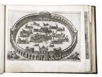
Large album with 16th-century maps and engravings of Italy.
Italy 1550. 17th-century gold-tooled brown calf sewn on 6 supports with the corresponding raised bands on the spine a red morocco title label on the spine with the title "Novissima urbis Romae descriptio" lettered in gold gold-tooled board edges. Large oblong folio ca. 59 x 42.3 cm. With 76 full-page engravings and 12 full-page etchings. Remarkable album with 77 beautiful examples of 16th-century Italian cartography all in very fine dark impressions. The collection includes plans of important Italian towns such as Rome Venice Genoa Naples Milan Florence Palermo Siena Bologna and Pisa as well as detailed views of individual buildings and monuments in Rome. They are engraved by several cartographers from the school of Antonio Lafreri 1512-1577 primarily Claudio Duchetti d. 1585 Matteo Florimi d. 1613 and Lafreri himself. Florimi's works are among the rarest of the Lafreri school map makers especially his Siena imprints of which several have here been included.In the middle of the 16th century Italy was the centre of map production and distribution in Europe. This industry primarily took place in Venice and Rome. The most notable of the publishers in Rome was Lafreri. His most important and most popular work is the Speculum Romanae magnificentiae a collection of plans an views of Rome's monuments; no two copies of the Speculum are the same. The present collection contains more than thirty plates from the Speculum. When Lafreri died his nephew Claudio Duchetti inherited the company. He continued to produce the Speculum plates but often made small adjustments and signed his own name at the bottom. Most of the Speculum plates in the present album are by Duchetti. After his death the copperplates were sold to other publishers such as Giovanni Orlandi before 1590-after 1640 who reissued them. The majority of the plates in the present album were printed by Orlandi in 1602.The album further contains 32 engraved city plans mostly of Italian towns although a few foreign cities are also included; one of the rarest is the view of Moscow which is also included here. The collection ends with a incomplete series of 11 etchings of landscapes and biblical scenes.A list of contents is available upon request.With the bookplate of Louis Routy de Charodon seigneur de Grésigny and Charodon 1710-1794 on the front pastedown and remnants of another bookplate above. The boards are somewhat scratched and stained the spine shows traces of use the edges of the boards have been professionally restored and the boards have been lengthened to fit the maps. The maps are slightly browned some are slightly foxed the first few maps have been mounted onto 17th-century leaves the longer maps are somewhat soiled on the fore edge three maps are restored at the fore edge and one at the bottom edge some maps have been cut slightly short. Otherwise in good condition.l Cf. Parshall P. "Antonio Lafreri's "Speculum Romanae magnificentiae"" in: Print Quarterly vol. 23 1 2006 pp. 3-28. hardcover
Referencia librero : ABC_49514
|
|
|
[LAND SURVEY DEPARTMENT, EMPIRE OF JAPAN]. 大日本帝国陸地測量部.
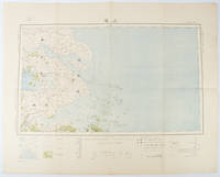
上海 支那江蘇省・浙江省. Japanese Map - Shanghai Jiangsu Province and Zhejiang Province.
Tokyo.: 大日本帝國陸地測量部. Dainihon Teikoku Rikuchi Sokuryōbu. Taisho 15. 1926. Folding colour Japanese map of Shanghai and coastal areas of Jiangsu and Zhejiang Provinces. Scale 1:100000 embossed stamp lower right corner. Legend lower edge showing different landforms on the left section forests deserts wildlands plateaus rivers and lakes middle section showing various facilities such as post offices telecommunication offices temples ancestral halls ancient battle ground mines military fortifications submarine communications cables city walls and gates etc. right section showing different sizes of cities towns and villages and administrative boundaries. <br> <br>Occasional foxing along edges and folds ink annotation in Kanji on reverse good copy. Text in Japanese. Sheet measures 45.2 x 57.7cm. This very detailed map was originally surveyed by the Land Survey Department Empire of Japan in Taisho 7 1918. This revised edition features the railway line connecting Hangzhou - Jiashan - Shanghai - Suzhou - Wuxi. . 大日本帝國陸地測量部. [Dainihon Teikoku Rikuchi Sokuryōbu]. unknown
Referencia librero : 173266
|
|

 Recibir por correo electrónico
 Descargar en documento PDF
 Flujo RSS
 Link permanente


