|
WESSEL, CASPAR.
Den syd østlige Fierdedeel af Siælland under det Kongl: Videnskabernes Societets Direction ved rigtig Landmaaling optaget og ved trigonometriske samt astronomiske Operationer prövet. Tegnet af C. Wessel. Aar 1770.
(København, 1771). (59 x 69 cm.). Kobberstukket kort over Sydøstsjælland fra Køge Bugt til den nordlige del af Møn. Opdelt i 24 sektioner og opsat på lærred således, at det ved foldning let kunne medbringes. Enkelte svage brunpletter.
|
|
|
WESSEL, CASPAR. - ET HISTORISK KORT.
Den Nord=Østlige Fierdedeel af Siælland under det kongl: Videnskabernes Societets Direction ved rigtig Landmaaling optaget og ved trigonometriske samt astronomiske Operationer prövet. Reduceret og tegnet Aar 1768 af Caspar Wessel.
(København), 1771. (59 x 69 cm.). Kobberstukket kort over Nordøstsjælland. Opdelt i 24 sektioner og opsat på lærred således, at det ved foldning let kunne medbringes.
|
|
|
West Virginia. Dept. of Transportation
West Virginia: 2007 Official State Travel Map
Charleston: Dept. of Transportation 2007. Map. Very Good/No Jacket. Clean and unmarked Dept. of Transportation unknown
Referenz des Buchhändlers : 840007
|
|
|
Westmoreland History Committee and Photographs and Maps
The History and Genealogy of Westmoreland Great Meadow New Hampshire.
Hardcover. Fine. sec.pr.20071976.One of the 500 copies printed.illus.Fine/Fine dust jacket. hardcover
Referenz des Buchhändlers : 2289
|
|
|
WESTMORLAND AND LAKE COUNTRY.
The 'Westmorland Gazette' Cycling and Touring Map of Westmorland and the Lake Country. Scale Half an Inch to a Mile. BRIGHT, CLEAN COPY AND A RARE SURVIVAL
8vo., folding coloured map on cloth measuring 22 x 26 inches (approx. 56 x 66 cms) folding in 36 panels to 6 x 3 inches (approx. 15 x 8 cms); original limp wrappers printed in black, a very good, bright, clean copy. EXTREMELY SCARCE IN THIS CONDITION.
|
|
|
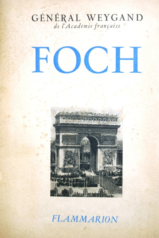
WEYGAND (Général) Cartes et photos hors texte.
Foch.
Couverture souple. Broché. 370 pages.
Referenz des Buchhändlers : 103197
|
|
|
WEY Francis:
La Haute-Savoie. Récits d'histoire et de voyage.
sans lieu, Les éditions du Bastion, 1991. In-8 broché de 502 pages, couverture illustrée. Quelques taches sur la couverture, pli au coin supérieur sur les 50 dernières pages.
Referenz des Buchhändlers : 17243
|
|
|
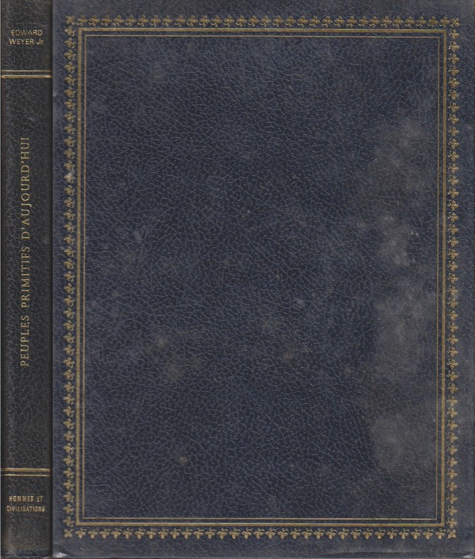
WEYER Edward (Jr.) 212 photographies. 14 cartes.
Peuples primitifs d'aujourd'hui.
Couverture rigide. Reliure skivertex, 286 pages, 23 x 29 cm. Jaquette rhodoïd.
Referenz des Buchhändlers : 115259
|
|
|
Weymouth, Anthony ; Trent, Christopher
Going to London
Previous owner's name well crossed out inside front board. Foxing to page edges. No other marks or inscriptions to contents. No creasing to covers or to spine. A clean tight copy with very slightly marked boards and minor bumping to lower corners. 160pp. A study of London for the visitor, mainly concentraing on its buildings. Illustrated with black & white photographs, some aerial.

|
|
|
WEZ. MANUSCRIT.
Plan géométrique des propriétés de Mr. le Comte Louis Duchatel situé à Wez.
1827. En 18 sections montées sur toile et pliées, formant une carte de 620 x 930 mm.
Referenz des Buchhändlers : LBW-4185

|
|
|
White TH.Terence Hanbury and Maps on End Papers T. H.
The Master an Adventure Story
Hardcover. Very Good. VG book & jacket. 1957.3.50 jacket price hardcover
Referenz des Buchhändlers : OU-36UB-0E9R
|
|
|
White Denim; Maps & Atlases
Daytrotter Vinyl Series No 5
Daytrotter 2012-12-11. Vinyl. Used:Good. Daytrotter unknown
Referenz des Buchhändlers : DADAXB00AEBB8AQ
|
|
|
White, Nelia; Chamberlain, W.; Laveridge, G.; Manchester, W.; MacKaye, Milton; Frank, Stanley; Linn, Edward; Barber, Noel; Mowat, Farley; Pagenstecher, Adelyn; Taylor, Frank; Baum, A.; Richter, Conrad; Le May, Alan
The Saturday Evening Post, April 13, 1957 - The Woes of Willie Mays / Governor Meyner of New Jersey
140 pages. Fiction: End of a Marriage; The Platoon of Pariahs; A Dream for Sale; Record Run; The Lady (part 3 of 4); Kiowa Moon (part 5 of 7). Articles: The Glamorous Governor of New Jersey - Bob Meyner abandoned bachelorhood mid-term; The Seven Dictators of Broadway - Reviewers John McClain, John Chapman, Richard Watts, Jr.; Robert Coleman, Tom Donnelly, Walter Kerr and Brooks Atkinson; ; The Woes of Willy Mays - why 1956 was almost a nightmare for him; The Oddest War Ever Fought - The Aden-Yemen war has been going on for 2,000 years, with daily time-outs for prayers and narcotic binges - article with maps and interesting photos; The Face of America - Prize Babies (photo); Pals of My Childhood - Farley Mowat writes of his two hilarious pets; My Daughter's Silent World - Adelyn Pagenstecher was told her daugher Mari was deaf; A Bloom for Mother-In-Law - beautiful color photos of tulips and daffodils ; Wonderful Wooden Sandwich - how plywood turns waste wood into a useful product - with photo of Sol Walter (Tony) of United States Plywood.. Ads: Liberty Mutual auto accident insurance; Savage brand lawn mowers; Bunnygrans - one-page photo ad featuring Lucille Ball and son; Nice Easter-themed two-page photo ad for Buick cars; National Cash Register (NCR) adding machines; Fantastic three-page color ad for International trucks; Vigoro plant foods; One-page black and white photo ad for movie "The Spirit of St. Louis" starring James Stewart; Great two-page color-photo ad for the 1957 Dodge Swept-wing convertible featuring Lawrence Welk; Pink Westinghouse clothes washer; 1957 Frigidaire pink (interior) fridge; 1957 Ford - two-page color-photo ad; Pall Mall cigarettes - cowboy scene; Page & Shaw chocolates; Chevrolet - two-page color photo of four 1957 models; Elgin Watches (graduation theme); American Airlines - nice color two-page ad shows glamorous lady boarding plane; L&M cigarettes - nautical theme; Eaton tandem axle ad features Joseph J. Hock of Baltimore; Longines-Wittnauer Watches; Nice two-page color ad for Kodak's broad line of cameras; Hit Parade cigarettes; Kings Men aftershave "I don't want to be a tycoon"; Douglas DC-7 airliner; Viewmaster; Johnson outboard motors; Harrison car air conditioning; Pullman cars; Evinrude outboards; Springfield mowers and tillers; Richard Harding Davis is honored in a U.S. Savings Bond ad; Vista auto wax; Nice color one-page Viceroy cigarette ad features tennis player Pancho Gonzales and his lovely wife Henrietta; Back cover Coke ad with sailing illustration. Average wear. Unmarked. A sound vintage copy. Magazine

|
|
|
White, Walter
A Month in Yorkshire (Signed By Publisher)
Appears unread. Signed to front end paper 'With the publisher's compliments M.T.D. Rigg, Dec 01'. No other marks or inscriptions. A lovely clean very tight copy with bright unmarked boards and no bumping to corners. Dust jacket not price clipped or marked or torn or creased. 386pp. The original travel/history account was published in 1858. This is the second edition facsimile.

|
|
|
Whitehead, Jack
Growth of Camden Town, The: AD 1800-2000
Book is in excellent condition with very light shelf wear to covers only. Binding is solid and square, covers have sharp corners, exterior shows no other blemishes, text/interior is clean and free of marking of any kind. 231 pages, heavily illustrated with color and b&w photos, drawings, maps, cross sections, architectural drawings. Contents include: Regents canal, Park Village east, Cumberland Basin, London, Girmingham, Railway, Robert B. Dockray, the Roundhouse, North London Railway, Great Wall of Camden, Ice wells, Gilbey's Wine and Spirits, Booth Poverty, survey, maps, Purfleet wharf, Harlow, Pirates club, Jubilee Waterside Centre, Stables Market, Suffolk wharf, Albert street, etc.

|
|
|
Whitehouse David and Ruth; maps drawn by John Woodcock and Shalom Schotten
ARCHAEOLOGICAL ATLAS OF THE WORLD
San Francisco CA: W. H. Freeman and Company. G/No Dustjacket. 1975. . Paperback. Sm 4to. 272 pp. rubbed bumped . W. H. Freeman and Company paperback
Referenz des Buchhändlers : BOOKS268939 ISBN : 0716702738 9780716702733
|
|
|
Whitney Josiah Dwight photographs by Carleton E. Watkins; maps by Charles Frederick Hoffmann; introduction by Jim Snyder
The Yosemite Book facsimile of 1868 edition on CD-ROM
<p>New York: Julius Bien Oakland: Octavo 1868; 2003. 1st edition. Other Binding. New/No Jacket as issued. New digital facsimile in electronic PDF format on CD-ROM disc of the 1868 first edition of this landmark of nature photography and conservation. California State Geologist Josiah Dwight Whitney created this lavish publication issued in an edition of only 250 copies as part of his campaign to claim and reserve the area that later became Yosemite National Park. Photographer Carleton Watkins who had earlier made his fame with breathtaking views of the Yosemite Valley contributed albumen-print photographs actual prints of which were mounted into each copy. The book also features two large- scale foldout maps by Charles Hoffmann and others. This Octavo Edition contains detailed digital images of every page of the original book as well as optimized viewing images of the plates and maps and supplementary materials including an introductory essay extra maps some never before published a provenance essay and detailed bibliographical information. "The most famous and rare book published about Yosemite. The volume was as much a work of photographic art as it was a guidebook."--Yosemite Association Newsletter</p> New York: Julius Bien (Oakland: Octavo)
Referenz des Buchhändlers : 8VWHYB01 ISBN : 1591100127 9781591100126

|
|
|
Wichmann, E. H. (Ernst Heinrich)
Begleitworte zu der Wandkarte des Hamburger Gebiets nebst Umgebung. Eine historisch topographische Beschreibung der Umgebung von Hamburg als Leitfaden für den Unterricht in der Heimatskunde.
Hamburg, Hermann Grüning, 1867. 144 S. Kl.-8vo. 16,5 cm. OBrosch.
Referenz des Buchhändlers : 91409

|
|
|
Wichmann, E. H. (Ernst Heinrich)
Begleitworte zu der Wandkarte des Hamburger Gebiets nebst Umgebung. Eine historisch topographische Beschreibung der Umgebung von Hamburg als Leitfaden für den Unterricht in der Heimatskunde.
Hamburg, Hermann Grüning, 1867. 144 S. Kl.-8vo. 17 cm. Spät. HLn. mit neuen Vorsatzbll.
Referenz des Buchhändlers : 56770

|
|
|
Wichmann, E. H. [Ernst Heinrich] (Hrsg.)
Heimatskunde. Topographische, historische und statistische Beschreibung von Hamburg und der Vorstadt St. Georg.
Hamburg, Wilhelm Jowien, 1863. VIII S., 1 Bl., 242 S. Mit 1 farb. lithograph. Faltkte. (Bildmaß 38,56 x 53,5 cm, darauf 4 historische Pläne). Blindgeprägt. OLn. (Rücken und Vorsätze fachmännisch ersetzt).
Referenz des Buchhändlers : 17571

|
|
|
Wide World of Maps
Greater Las Vegas Street Guide & Directory 2012 / 2013 NV Atlas
Wide World of Maps 2012-01-01. Spiral-bound. VeryGood. 9.5000 inches 8.5000 inches. Wide World of Maps unknown
Referenz des Buchhändlers : mon0002257278 ISBN : 1934839191 9781934839195
|
|
|
Wide World of Maps Inc.
Maricopa Florence & Coolidge Street Map
2010-01-01. Good. Ships with Tracking Number! INTERNATIONAL WORLDWIDE Shipping available. May not contain Access Codes or Supplements. May be re-issue. May be ex-library. Shipping & Handling by region. Buy with confidence excellent customer service! unknown
Referenz des Buchhändlers : 1934839132 ISBN : 1934839132 9781934839133

|
|
|
Wide World of Maps Inc.
Phoenix Metropolitan Street Atlas
Wide World of Maps Inc. 2013. Spiral-bound. Acceptable. Disclaimer:A readable copy. All pages are intact and the cover is intact. Pages can include considerable notes-in pen or highlighter-but the notes cannot obscure the text. At ThriftBooks our motto is: Read More Spend Less.Dust jacket quality is not guaranteed. Wide World of Maps, Inc. unknown
Referenz des Buchhändlers : G1934839221I5N00 ISBN : 1934839221 9781934839225

|
|
|
Wide World of Maps
Tucson Metropolitan Street Atlas : 2002 Edition
Wide World of Maps Incorporated 2002. Spiral-bound. Good. Disclaimer:A copy that has been read but remains in clean condition. All pages are intact and the cover is intact. The spine may show signs of wear. Pages can include limited notes and highlighting and the copy can include previous owner inscriptions. At ThriftBooks our motto is: Read More Spend Less.Dust jacket quality is not guaranteed. Wide World of Maps, Incorporated unknown
Referenz des Buchhändlers : G1887749330I3N00 ISBN : 1887749330 9781887749336

|
|
|
Wide World of Maps
Yavapai/Coconino Counties Street & Road Atlas
Phoenix Mapping Service. Used - Very Good. Ships from Reno NV. Great condition for a used book! Minimal wear. 100% Money Back Guarantee. Shipped to over one million happy customers. Your purchase benefits world literacy! Phoenix Mapping Service unknown
Referenz des Buchhändlers : GRP114747893 ISBN : 1887749373 9781887749374
|
|
|
Widhalm, Richard; Mück, Thomas
Topic Maps - Semantische Suche im Internet
Mak. Bibl.
|
|
|
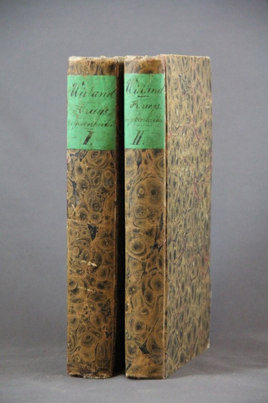
WIELAND Johannes:
Geschichte der Kriegsbegebenheiten in Helvetien und Rhätien als Handbuch zum Militairunterricht für Schweizeroffiziere aller Waffen.
Basel, In der Schweighauser’schen Buchhandlung, 1827. 2 volumes in-8 de 552 + 444 pages, cartonnages du temps recouverts de papier marbré, dos lisses, petite découpure en haut des 2 pages de garde (probablement afin d’ôter un nom ou un tampon).
Referenz des Buchhändlers : 1454
|
|
|
Wieland, Johann Wolfgang
Karte des historischen Herzogtums Oppeln, 1736. Principatus Silesiae Oppoliensis exactissima Tabula geographica: sistens Circulos Oppoliensem Ober-Glogau Gross Strelitz, Cosel, Tost. Rosenberg, Falckenberg & Lubleniz. Cum Spec. S. Caes. Rque. Mtis Privilegio. [Altkolorierter Original-Kupferstich / original coloured copper engraving].
o.J. [2 Warenabbildungen]
Referenz des Buchhändlers : 65322CB

|
|
|
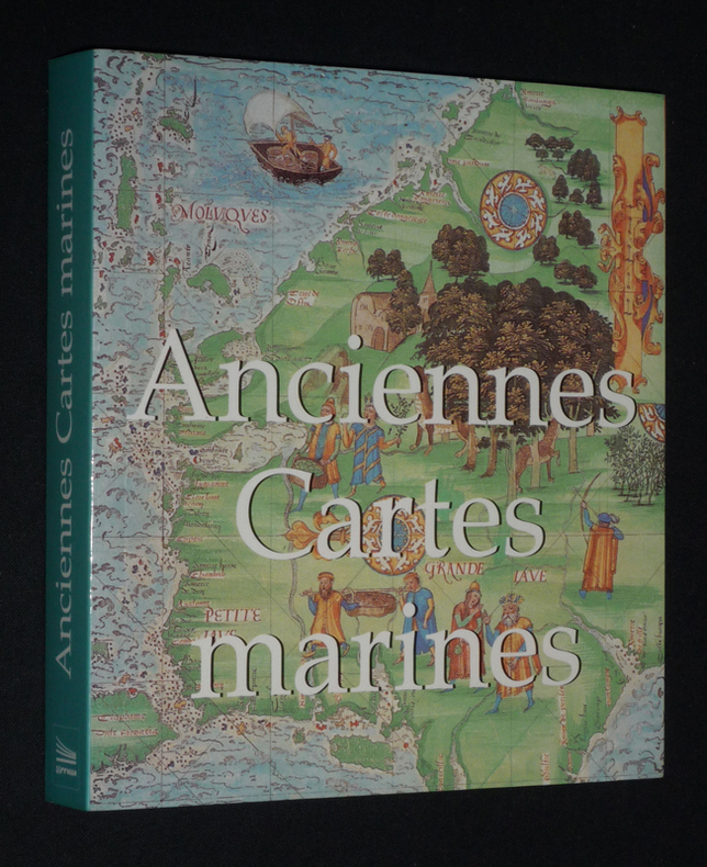
Wigal Donald
Anciennes cartes maritimes
Sirrocco Broché 2006 In-12 (14,8 x 16,2 cm), broché, 255 pages, illustrations en couleurs ; très bon état. Livraison a domicile (La Poste) ou en Mondial Relay sur simple demande.
Referenz des Buchhändlers : fj1065
|
|
|
WILLOUGBY Martin
"La carte postale; une histoire illustrée du tournant du siècle à nos jours."
Paris, Bookking International, 1993. 23 x 30, 153 pp., très nombreuses illustrations en couleurs, reliure d'édition carton imprimé + jaquette, très bon état.
Referenz des Buchhändlers : 73751 ISBN : 287714173
|
|
|
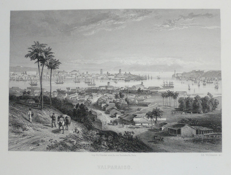
WILLMANN (Edward);
[CHILI] Valparaiso.
Paris circa 1860 126 x 168 mm.
Referenz des Buchhändlers : LBW-1203
|
|
|
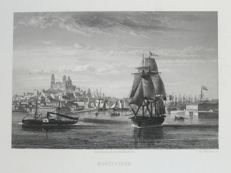
WILLMANN (Edward).
[URUGUAY] Montevideo.
Paris, [circa 1860]. 126 x 168 mm.
Referenz des Buchhändlers : LBW-1233
|
|
|
WILLIAMS & Co
Articles et Costumes pour Sports et Jeux.
Paris, Williams, Rue Caumartin, 1924. In 8 (115 x 195) de 72 p. Agrafé, couverture illustrée en brun. Excellent état.
Referenz des Buchhändlers : EYL-175
|
|
|
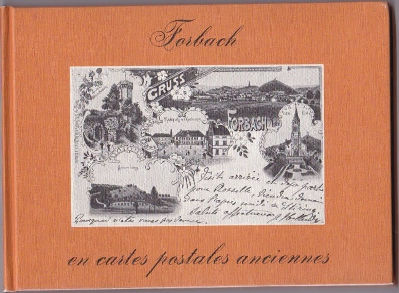
WILMIN H
Forbach En Cartes Postales Anciennes
Pays Bas Bibliotheque Europeenne 1980 In 12 Oblong Non paginé - env. 80 pages - cartonnage editeur illustré - trés nombreuses reproductions de CPA - bel etat
Referenz des Buchhändlers : RES10L74
|
|
|
WILMIN H
Forbach En Cartes Postales Anciennes
Pays Bas Bibliotheque Europeenne 1980 In 12 Oblong Non paginé - env. 80 pages - cartonnage editeur illustré - trés nombreuses reproductions de CPA - bel etat
Referenz des Buchhändlers : RES10L74
|
|
|
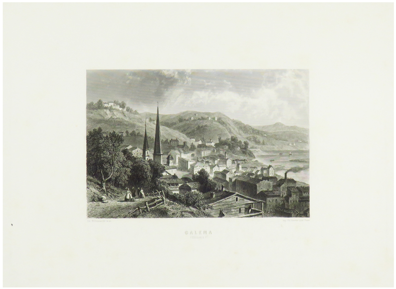
WILLMANN (Edward).
Galena (Illinois).
Paris, [circa 1860]. 131 x 172 mm.
Referenz des Buchhändlers : LBW-1248
|
|
|
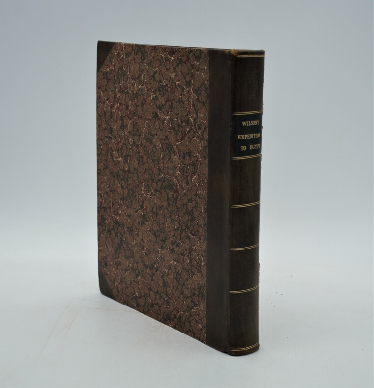
WILSON, Robert Thomas
History Of The British Expedition To Egypt; To Which Is Subjoined A Sketch Of The Present State Of That Country And Its Means Of Defence; Illustrated With Maps And Portraits of Sir Ralph Abercromby
London: T. Egerton, 1803. in-4° , (270x215) , relié demi basane et coins , dos lisse avec pièce de titre et auteur, xxi-387pp , frontispice , 2 tableaux dépliants et 3 cartes dépliantes légèrement coloriées ,quelques rousseurs , déchirure à une carte sans manque ,ex-libris charles Kettaneh, bon exemplaire .
Referenz des Buchhändlers : PHO-893
|
|
|
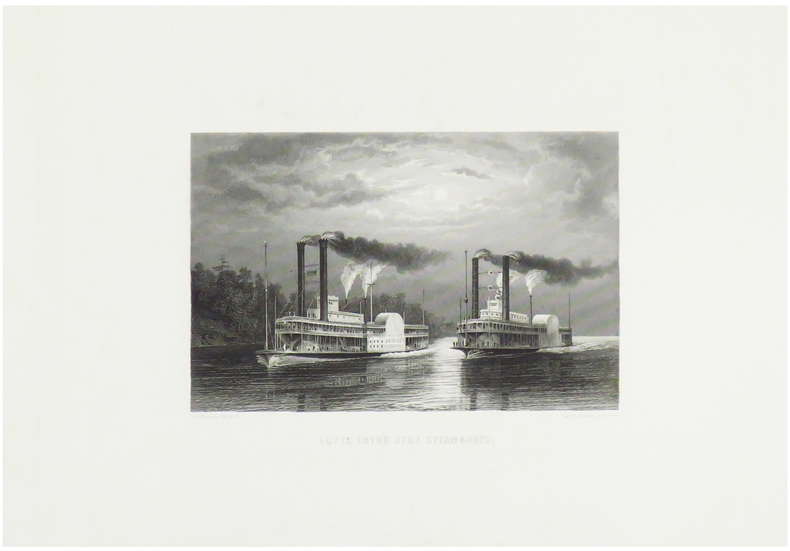
WILLMANN (Edward).
Lutte entre deux steamboats.
Paris, [circa 1860]. 125 x 170 mm.
Referenz des Buchhändlers : LBW-1249
|
|
|
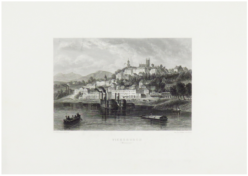
WILLMANN (Edward).
Vicksburgh (Missouri).
Paris, [circa 1860]. 130 x 170 mm.
Referenz des Buchhändlers : LBW-1247
|
|
|
wilbur cross Illustrated by paintings prints drawings maps
Naval Battles and Heroes
american heritage 1960. Used - Good. Ships from Reno NV. Shows some signs of wear and may have some markings on the inside. 100% Money Back Guarantee. Shipped to over one million happy customers. Your purchase benefits world literacy! american heritage, 1960 unknown
Referenz des Buchhändlers : GRP116949921
|
|
|
Wilbur E. Editor Garrett Maps photos Illustrator
National Geographic Index 1888-1988
National Geo. Society 1989. National Geo. Society 1989 Fine/Very Good DJ Unread. Bright red cloth with gold lettering and design. Bright mended jacket protected in clear archival Brodart dust jacket cover. Large Heavy Item. Hardcover. Fine/Very Good DJ. No Exp. National Geo. Society Hardcover
Referenz des Buchhändlers : 2000034744
|
|
|
Wiliam L Langer; Illustrator Maps
European Alliances and Alignments 1871-1890
Vintage 1964. Paperback. Good. good plus paperback light creasing/fading to cover former owner's stamp to bottom edge very slight water stain to bottom edge Vintage paperback
Referenz des Buchhändlers : 128484
|
|
|
Wilkes John Pugsley William H. William Howard donor WH. Pugsley Collection of Early Canadian Maps W. H.
British Colonies in North America 1797 Leather Bound
2019. Leather Bound. New. Leather Binding on Spine and Corners with Golden Leaf Printing on round Spine extra customization on request like complete leather Golden Screen printing in Front Color Leather Colored book etc. Reprinted in 2019 with the help of original edition published long back 1797. This book is printed in black & white sewing binding for longer life Printed on high quality Paper re-sized as per Current standards professionally processed without changing its contents. As these are old books we processed each page manually and make them readable but in some cases some pages which are blur or missing or black spots. If it is multi volume set then it is only single volume if you wish to order a specific or all the volumes you may contact us. We expect that you will understand our compulsion in these books. We found this book important for the readers who want to know more about our old treasure so we brought it back to the shelves. Hope you will like it and give your comments and suggestions. Lang: - English. EXTRA 10 DAYS APART FROM THE NORMAL SHIPPING PERIOD WILL BE REQUIRED FOR LEATHER BOUND BOOKS. COMPLETE LEATHER WILL COST YOU EXTRA US$ 25 APART FROM THE LEATHER BOUND BOOKS. hardcover
Referenz des Buchhändlers : LB1111007011100
|
|
|
Wilkes John Pugsley William H. William Howard donor WH. Pugsley Collection of Early Canadian Maps W. H.
British Colonies in North America 1797 FULL LEATHER BOUND
2019. SUPER DELUXE EDITION. New. Antique look with Golden Leaf Printing and embossing with round Spine completely handmade bindingextra customization on request like Color Leather Colored book special gold leaf printing etc. Reprinted in 2019 with the help of original edition published long back 1797. This book is printed in black & white sewing binding for longer life Printed on high quality Paper re-sized as per Current standards professionally processed without changing its contents. As these are old books we processed each page manually and make them readable but in some cases some pages which are blur or missing or black spots. If it is multi volume set then it is only single volume if you wish to order a specific or all the volumes you may contact us. We expect that you will understand our compulsion in these books. We found this book important for the readers who want to know more about our old treasure in old look so we brought it back to the shelves. Hope you will like it and give your comments and suggestions. Lang: - English. EXTRA 10 DAYS APART FROM THE NORMAL SHIPPING PERIOD WILL BE REQUIRED. Normal Hardbound Edition is also available on request. unknown
Referenz des Buchhändlers : SD1111007011100
|
|
|
Wilkes John Pugsley William H. William Howard donor WH. Pugsley Collection of Early Canadian Maps W. H.
British Colonies in North America 1797
2019. Paperback. New. Lang: - English. Reprinted in 2019 with the help of original edition published long back 1797. This book is Printed in black & white sewing binding for longer life with Matt laminated multi-Colour Soft Cover HARDCOVER EDITION IS ALSO AVAILABLE Printed on high quality Paper re-sized as per Current standards professionally processed without changing its contents. As these are old books we processed each page manually and make them readable but in some cases some pages which are blur or missing or black spots. If it is multi volume set then it is only single volume if you wish to order a specific or all the volumes you may contact us. We expect that you will understand our compulsion in these books. We found this book important for the readers who want to know more about our old treasure so we brought it back to the shelves. Any type of Customisation is possible with extra charges. Hope you will like it and give your comments and suggestions. paperback
Referenz des Buchhändlers : PB1111007011100
|
|
|
Wilkes John Pugsley William H. William Howard donor WH. Pugsley Collection of Early Canadian Maps W. H.
British Colonies in North America 1797 Hardcover
2019. Hardcover. New. Lang: - English. Reprinted in 2019 with the help of original edition published long back 1797. This book is Printed in black & white Hardcover sewing binding for longer life with Matt laminated multi-Colour Dust Cover Printed on high quality Paper re-sized as per Current standards professionally processed without changing its contents. As these are old books we processed each page manually and make them readable but in some cases some pages which are blur or missing or black spots. If it is multi volume set then it is only single volume if you wish to order a specific or all the volumes you may contact us. We expect that you will understand our compulsion in these books. We found this book important for the readers who want to know more about our old treasure so we brought it back to the shelves. Any type of Customisation is possible with extra charges. Hope you will like it and give your comments and suggestions. hardcover
Referenz des Buchhändlers : 1111007011100
|
|
|
Will Durant; Illustrator Glossy B&W illust. EP Maps
Life of Greece "the Story of Civilization" Series Part 2 II Two
simon & schuster Pub 1966-01-01. Unknown Binding. Very Good. Nice looking book has minor edge wear.dusk jacket is faded & has tears.Pages are tan and not crisp white. simon & schuster Pub unknown
Referenz des Buchhändlers : 641110222004
|
|
|
Willett, B. M. . [et al.] (eds.)
Philip's Modern School Atlas
85th edition. Fine hbk bound in glazed pictorial boards. Co-editors, D. Gaylard, L. Prince-Smith, J. Russell, R. Smith, A. Wells. ISBN 0540055549. 21219. eng
|
|
|
William C. Herow Maps Illustrator
National Park Service Camping Guide : Second Edition
Roundabout Publications 2004-01-01. Paperback. Used:Good. Roundabout Publications paperback
Referenz des Buchhändlers : DADAX1885464061 ISBN : 1885464061 9781885464064
|
|
|
William C. Herow; Illustrator Maps
National Park Service Camping Guide : Second Edition
Roundabout Publications 2004. Paperback. Good. Roundabout Publications paperback
Referenz des Buchhändlers : SONG1885464061 ISBN : 1885464061 9781885464064
|
|
 Per e-mail erhalten
 Als pdf-Dokument herunterladen
 RSS feed


