|
Map collectors' series
Map collectors' series ; Map Collectors' Circle [10 issues]
Ten issues in offwhite printed wraps; approx. 40-60p per issue, b&w illus., maps ; 25 cm Offerd as a lot only. Includes Number 5 Printed Maps of Tasmania ; No.16 Dictionary of Mapmakers Part I ; No. 32 French Explorer Maps of New Zealand; No. 39 Comparative Cartography ; No. 40 Dictionary of Mapmakers Part III; No. 44 Printed Maps of New South Wales, 1773-1873 ; No. 45 Smith's Virginai and its Derivatives ; No. 68 Printed Maps of America Part 1 by Tooley ; No. 69 Printed Maps of Amerca Part II by Tooley; No. 80 Printed Maps of America Part III by Tooley. || Cartography; Maps. Maps -- Bibliography. Cartes -- Collectionneurs et collections. Maps, Cartas; Bibliography.
|
|
|
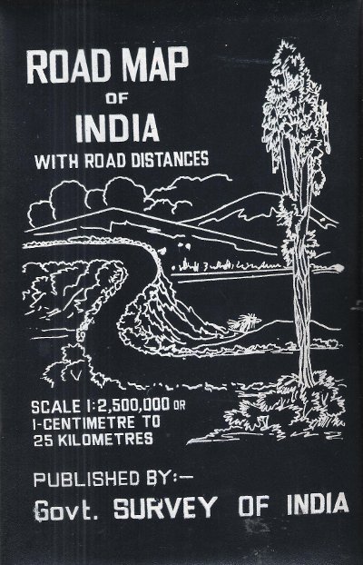
MAP OF INDIA
Road Map of India with Road Distances
Carte en couleurs , imprimée sur très bon papier collé sur tissu tramé , se repliant dans une pochette plastifiée . Echelle 1 cm pour 25 kilomètres . Tableau des distances entre les grandes villes . Pour voyager en Inde ou pour afficher au mur . Trés belle carte .- 1 p. , 600 gr.

|
|
|
MAP OF INDIA
Road Map of India with Road Distances
Gouvernement Survey of India 1977 150 Cm x 118 Cm Carte en couleurs , imprimée sur très bon papier collé sur tissu tramé , se repliant dans une pochette plastifiée . Echelle 1 cm pour 25 kilomètres . Tableau des distances entre les grandes villes . Pour voyager en Inde ou pour afficher au mur . Trés belle carte .- 1 p. , 600 gr.
Bookseller reference : 015281
|
|
|
Map. Florida. Cuba
Shell Map Of Florida And Cuba
Chicago: H. M. Gousha Company. Very Good. Measures approximately 18 x 29.5 inches 7 folds a few small breaks at folds. <br/><br/>With an inset map of Cuba. H. M. Gousha Company unknown
Bookseller reference : 4883
|
|
|
Map. Texas
Highway Map And Guide Of Texas
Aurora MO: Mid-West Map Co. 1925. Good. Measures approximately 17 x 28 inches 4 folds a few punctures at folds. Scarce. <br/><br/>On the verso are 324 listings of authorized garages for repairs and supplies. The panhandle appears to the left where New Mexico would be. " "Authorized guide & map service of Texas". Mid-West Map Co. unknown
Bookseller reference : 4882
|
|
|
Map. Washington State
Highways State Of Washington
Olympia WA: Department of Highways 1937. Very Good. Measures approximately 19 x 27.5 inches 4 folds lightly edgeworn toned <br/><br/>The Washington State highway maps series began in 1933. Department of Highways unknown
Bookseller reference : 4884
|
|
|
Mapas Naturismo
Costa Rica Road Map Naturismo 1:500K English & Spainish
2012-06-30. New. Ships with Tracking Number! INTERNATIONAL WORLDWIDE Shipping available. May be re-issue. Buy with confidence excellent customer service! unknown
Bookseller reference : 3981126947n ISBN : 3981126947 9783981126945

|
|
|
Mapas Naturismo
Costa Rica Road Map Naturismo 1:500K English & Spainish
2012-06-30. Good. Ships with Tracking Number! INTERNATIONAL WORLDWIDE Shipping available. May not contain Access Codes or Supplements. May be re-issue. May be ex-library. Shipping & Handling by region. Buy with confidence excellent customer service! unknown
Bookseller reference : 3981126947 ISBN : 3981126947 9783981126945

|
|
|
Mapas Naturismo
Nicaragua Karte mapa de Tourismo 1:500.000english & espanol / Tourismus- und Straßenkarte
unknown. gebraucht gut Originalbroschur Neu Verlagsfrisch. 90x68 cmbeidseitig . Mit Detailkarten von: -Rio San Juan 1:200.000 -Island Ometepe 1:200.000 -Delta RÃo San Juan 1:10.000 -Big and Little Corn Island 1:75.000 -und neu: zusätzlich: Isletas bei Granada 1:75.000 -zahlreiche Aktualisierungen an der Karibik Auf Anfrage per E-Mail können Sie die bei uns bestellten Artikel auch in unserer Buchscheune 01796 Struppen Mo.-Fr. 9-16 Uhr oder im Antiquariat Schloss Pillnitz 01326 Dresden Mo.-So. 10-18 Uhr abholen. unknown
Bookseller reference : B10625

|
|
|
MAPMEDIA.
Sokak sokak Ankara kent atlasi: 1/10.000.
Fine Turkish Paperback. Roy. 8vo. (24 x 17 cm). In Turkish. 224 p., plan, color ills. Sokak sokak Ankara kent atlasi: 1/10.000. Ankara city atlas (guide) street by street with a huge plan.
|
|
|
Maps
Asia Drawn by Electa Curtis. Pen & ink map of Asia drawn by NY state student
Very good overall. A large child's manuscript map of Asia ca. 1810 from the west coast of Africa to the Tasman Sea and from the Arctic Ocean to Tasmania. Australia is called "New Holland" and "New South Wales" covering the whole east coast. Off the WA coast are marked the "Tryal Rocks" and "Dampiers Rock". Other countries include India "Hindoostan"; China is called both "China" & "Chinese Tartary" & "Thibet" appears separately is marked as a large independent country north of India and east of China; Korea "Corea"; Japan is "Iles of Japan Isles of Zezo and Iles of Leeo Keeo"; "Phillippine Iles"; "Burmah" encompasses Burma Thailand Vietnam Cambodia & Laos; Russia is "Russia in Asia" & "Kamchatka"; "Arabia"; "Persia" "Turkey" "New Guinea" Indonesia is "Sumatra Java Borneo Moluccas Is. & Celebes". The Straights of Malacca are noted. Off the Australian coast both "Dampiers Rocks" and "Tryal Rocks" are marked. Tasmania appears as an island. The Arctic Ocean is named with "Novaya Zembla" marked. Off of Kamchatka islands marked include Beerings I. and Andrean Islands now Andrean of Islands in the Aleutian chain. The artist Electa Curtis was from western New York state and was born ca. 1793. Longitude and latitude readings in pen. 17 x 22" drawn in pen with original outline color and the border colored yellow. In an early frame and a little browned from the early wooden backing with a slight tidemark in the lower right corner. A wonderfully crude map of the Eastern Hemisphere. <br/><br/> unknown
Bookseller reference : 15636

|
|
|
MAPS
BIRD'S EYE VIEW OF NARA
1900. MAPS. BIRD'S EYE VIEW OF NARA. Osaka: K. Kawakami c. 1900. Folding panorama c. 22" x 25" colored green and view. Some notes by contemporary tourist added to key. Heavily worn at folds and edges partly separated at folds. unknown
Bookseller reference : 42458
|
|
|
MAPS
BIRD'S EYE VIEW OF NARA
1900. MAPS. BIRD'S EYE VIEW OF NARA. Osaka: K. Kawakami c. 1900. Folding panorama c. 22" x 25" colored green and view. Some notes by contemporary tourist added to key. Heavily worn at folds and edges partly separated at folds. unknown books
Bookseller reference : 42458
|
|
|
maps
Etablissement Militaire de St. Bernard. Atlas des batiments
c. early 19th century. Hardcover. Very Good. Half cloth and marbled paper over boards handwritten label on upper board; oblong folio 460 x 360 mm; entirely handwritten and drawn in black ink on the rectos only with "tableau des batiments militaires" and 7 maps. Boards heavily scuffed; binding shaken; some dusty finger-smudges here and there. <br/><br/> hardcover
Bookseller reference : LD7400
|
|
|
maps
Etablissement Militaire de St. Bernard. Atlas des batiments
c. early 19th century. Hardcover. Very Good. Half cloth and marbled paper over boards handwritten label on upper board; oblong folio 460 x 360 mm; entirely handwritten and drawn in black ink on the rectos only with "tableau des batiments militaires" and 7 maps. Boards heavily scuffed; binding shaken; some dusty finger-smudges here and there. <br/><br/> hardcover books
Bookseller reference : LD7400
|
|
|
MAPS
MAPS FOR THE JEWISH SCHOOL PORTFOLIO 1
1968. MAPS MAPS FOR THE JEWISH SCHOOL PORTFOLIO 1. New York: Jewish Education Committee Press January 1968. Ten color maps 9 1/2 x 14 inches plus bonus map of the Six Day War. Includes maps of ancient history and contemporary Israel as well as Eastern Europe. Maps fine original envelope has closed tears light soil. unknown
Bookseller reference : 79979
|
|
|
MAPS
MAPS FOR THE JEWISH SCHOOL PORTFOLIO 1
1968. MAPS MAPS FOR THE JEWISH SCHOOL PORTFOLIO 1. New York: Jewish Education Committee Press January 1968. Ten color maps 9 1/2 x 14 inches plus bonus map of the Six Day War. Includes maps of ancient history and contemporary Israel as well as Eastern Europe. Maps fine original envelope has closed tears light soil. unknown books
Bookseller reference : 79979
|
|
|
Maps
Maps to Accompany Annual Report 1906
Ottawa: Queen's Printer 1906. Wrappers 5pp. Very good. 5 maps in original card stock envelope. Maps are whole and complete though starting at folds some neatly repaired with tape. Printed envelope states "Maps 1906 - R.N.W. Mounted Police" and 3 map titles. Maps include: 1 Rt. Hon Sir Wilfred Laurier G.C.M.G.President of the Privy Council CANADA TERRITORIAL DIVISIONS. 2 TERRITORIAL DIVISION of CANADA. 3 MOUNTED POLICE STATIONS in NORTH-WESTERN CANADA - EASTERN SHEET 4 MOUNTED POLICE STATIONS in NORTH-WESTERN CANADA - WESTERN SHEET and 5 MOUNTED POLICE STATIONS in ALBERTA and SASKATCHEWAN. Queen's Printer Paperback
Bookseller reference : 115053
|
|
|
MAPS
MCMULLEN COUNTY MAP GENERAL LAND OFFICE
1877. reprint. VERY GOOD. Xerox 17 x 25 inches. Details include abstracts and names. Flat rolled. <br/><br/> unknown
Bookseller reference : 12957
|
|
|
Maps
Old Maps of America 1572 - 1848 Part 2
NY: Henry Stevens Son & Stiles 35 pages & Illustrated - Fair only. Soft Cover. Fair. Henry Stevens, Son & Stiles Paperback
Bookseller reference : FG 3131
|
|
|
Maps
Seedtime On The Cumberlands
NY: Macmillan & Co. 1960. 1st Edition 1st Printing. Hardcover. Very Good/Very Good. Clipped and slight sunned DJ. One sentence underlined on the Inside cover of DJ. An early map of Kentucky. Green cloth. 8 vo449 pages <br/> <br/> Macmillan & Co. hardcover
Bookseller reference : 25897
|
|
|
Maps
Southern Appalachian Region Maps - VA W VA MD TN
International Geological Congress 1900. no dates but guessing early to mid 1900's - 21 Maps: 1.Route Map Hyattstown to Frederick MD plate 3 2.Route Map Frederick MD to Charles Town W VA plate 4 3. Geologic Map and Sections Area NE of Harpers Ferry W VA plate 5 4. Route Map Hagerstown MD to Cacapon Mountain W VA plate 6 5. Section along Route Hancock to Cumberland MD plate 10 6. Route Map and Sections New Creek W VA to Virginia State Line plate11 7. Route Map and Section W VA state line to Winchester VA plate 12 8. Route Map Winchester to Luray VA and Section across Shenandoah Valley and Massanutten Mountain Plate 13 9. Route Map and Sections Mount Jackson to Staunton VA plate 14 10. Route Map and Sections Staunton to Healing Springs VA plate 15 11. Route Map and Sections Helaing Springs to Lexington VA plate 16 12.Route Map Natural Bridge to Roanoke VA and Section through Read Mountain Fenster plate 18 13. Route Map and Sections Elliston to Glenlyn VA plate 19 14. Route Map Glenlyn to Lebanon VA plate 20 15. Route Map and Section Lebanon to Bristol VA plate 21 16. Route Map Bristol to Pennington Gap VA plate 22 17.Map and Section of Cumberland Overthrust Block plate 23 18. Route Map Cumberland Gap to Morristown TN plate 24 19. Generalized Map and Section of the Cherokee Mountain Klippe TN plate 25 20. Route Map Bristol VA to Mountain City TN and Section from Delaney Mountain to Mountain City plate 26 21. Map of Fenster in Overthrust Block of Rome Formation 3 Miles 4.8 Kilometers East of Wytheville VA Plate 27. Maps. Good. International Geological Congress Paperback
Bookseller reference : FG 2016-26
|
|
|
MAPS
Special Edition Bulletin: Psychedelic Science Spring 2017
Santa Cruz: Multidisciplinary Association for Psychedelic Studies 2017. First Edition. Softcover Paperback. Near Fine Condition. 28cm x 21cm. 48 pages black and white photographs and illustrations. Illustrated saddle-stapled wrappers. Volume XXVII Number 1. An overview of MAPS activities plus articles on Psychedelic therapy MDMA research Psychedelics and Music and microdosing. Very minor general wear. Shipped Weight: .17 kilos. BZDB407 Ethnopharmacology & Psychedelia; Special Edition Bulletin Psychedelic Science Spring 2017 MAPS Multidisciplinary Association for Psychedelic Studies paperback
Bookseller reference : 0013479

|
|
|
MAPS
Special Edition Bulletin: Psychedelics and Policy Spring 2015
Santa Cruz: Multidisciplinary Association for Psychedelic Studies 2015. First Edition. Softcover Paperback. Near Fine Condition. 28cm x 21cm. 44 pages black and white photographs and illustrations. Illustrated saddle-stapled wrappers. Volume XXV Number 1. An overview of MAPS activities plus articles on psychedelics and politics decriminalization ayahuasca globalization Boom Festival and more. Very minor general wear. Shipped Weight: .16 kilos. BZDB407 Ethnopharmacology & Psychedelia; Special Edition Bulletin Psychedelics and Policy Spring 2015 MAPS Multidisciplinary Association for Psychedelic Studies paperback
Bookseller reference : 0013478

|
|
|
Maps
Stanford Map Of The Danubian Principalities Prepared From The Vienna Map 2 Maps North and South
Edward Stanford London unknown circa 1857 First Edition thus. Paperback. maps show slight toning a few stains & marks to back of linen otherwise in very good condition case bumped and rubbed with scuffed corners. approximately 54 x 54 inches. dissected linen backed colour map in two parts: North - from Konigr Ungar & Scharzes Meer to Serbia Bulgarien and Schwarzes Meer: South - Vusitrin & Griechenland to Scharzes Meer Meer von Marmara Kleinasien & Archiplagus Weiss. Both 71 X 137 cm legend in English on the North map boundaries carriage trails battlefields harbours in German scale of English miles 69 to one degree boxed set linen backed maps with marbled paper ends cloth covered slipcase Edward Stanford hardcover
Bookseller reference : 32586
|
|
|
MAPS
The Art of the Map-Maker in Essex 1566-1860.
Heron and Co. Ltd. 1947. First Edition 4to coloured frontis. 30 plates cloth. Heron and Co., Ltd., 1947 hardcover
Bookseller reference : 5728
|
|
|
Maps
The Literary Digest Atlas of the World and Gazetteer
Funk and Wagnalls Company. Collectible - Acceptable. Fair book. Blue cloth with gilt to the spine and front board. Hinges cracked and spine breaking. Light notation. Inquire if you need further information. Funk and Wagnalls Company hardcover
Bookseller reference : Y02C-00956
|
|
|
Maps
The Map Book
Harcourt 1988-01-01. Paperback. Very Good. Paperback. Pages are clean and unmarked. Covers show very minor shelving wear.; 100% Satisfaction Guaranteed! Ships same or next business day! Harcourt paperback
Bookseller reference : 132001210011 ISBN : 0153729198 9780153729195
|
|
|
Maps
THE MAP BOOK
Harcourt 1988. Paperback. Good. Harcourt paperback
Bookseller reference : SONG0153729198 ISBN : 0153729198 9780153729195
|
|
|
Maps
United States Strategic Bombing Survey Pacific Naval Analysis Division Interrogations of Japanese Officials Volume 1
United States Government Printin 1946-01-01. Hardcover. Good. . volume I United States Government Printin hardcover
Bookseller reference : mon0001456517
|
|
|
Maps
Vicissitude
Capitol 2013-07-16. Vinyl. Used:Good. Capitol unknown
Bookseller reference : DADAXB00D3HYKUI
|
|
|
MAPS
VINLAND MAP AND THE TARTAR RELATION
See notes. Used - Good. Good condition. Good dust jacket. See notes unknown
Bookseller reference : U12J-00371
|
|
|
MAPS
VINLAND MAP AND THE TARTAR RELATION
See notes 1965-01-01. Hardcover. Good. . See notes hardcover
Bookseller reference : mon0001481508
|
|
|
MAPS
VINLAND MAP AND THE TARTAR RELATION
1965. MAPS. THE VINLAND MAP AND THE TARTAR RELATION. By R.A Skelton et al. New Haven: Yale University Press 1966. Fourth printing. The historian John Muir Whitehill's copy with his notes on the preliminary leaves. 4to. red paper-covered boards; 291pp. A very good copy with a little scuffing to the boards. unknown
Bookseller reference : 54016
|
|
|
MAPS
VINLAND MAP AND THE TARTAR RELATION
1965. MAPS. THE VINLAND MAP AND THE TARTAR RELATION. By R.A Skelton et al. New Haven: Yale University Press 1966. Fourth printing. The historian John Muir Whitehill's copy with his notes on the preliminary leaves. 4to. red paper-covered boards; 291pp. A very good copy with a little scuffing to the boards. unknown books
Bookseller reference : 54016
|
|
|
MAPS GLOBES.
The global map.
Minneapolis MN: Global Map Co. ca. 1941. Oblong folio 22.5 x 11.25 in. Two rotating wheels each showing hemisphere projection maps which are attached to a thick brown base w/ printed labels on front cover original rivets still present printed paper label and instructions on verso some rubbing & edgewear minor foxing & scuffing still a G- exemplar. First edition of this fascinating and scarce global map which allows the user to view steamship or airline distance routes as well as the principal railroads. The global map was designed so that opposite halves of the earth’s surface could be rotated and synchronized enabling continuous and accurate spherical relationships across any point on the rotating maps. The label on the back lists the area in square miles and population totals of the world. The map is dated to around 1941 because of the inclusion of Vichy France the government allowed by the Nazi occupiers after the fall of France in 1940. Global Map Co., unknown
Bookseller reference : 48041
|
|
|
MAPS NEW YORK NEW JERSEY & PENNSYLVANIA. MacNAIR Henry.
A survey of the Empire Group with a complete distance table a compendious index of cities and post offices with populations and much statistical data. . . .
Boston: The Bullard Co. Inc. 1909. Large folding accordion-style folded map printed in red & black sized 41 x 38 in. which when entirely folded into covers measures 5.5 x 11.25 in. Original burgundy-coloured boards small lozenge map of New York & Pennsylvania on front cover some edgewear rubbing minor tidemark to upper fore-edge of 1 corner still VG- copy. Second edition revised of this scarce and well documented map showing good roads for automobile travel railroads canals new Erie Barge Canal Steamship lines ferries lighthouses electric railway lines and more. First published in 1908 and then again in 1910 MacNair drew from US government surveys State surveys and other original commercial sources. Worldcat locates 2 copies. The Bullard Co., Inc., hardcover
Bookseller reference : 52792
|
|
|
MAPS SOUTH AMERICA.
The new world school map of South America. . . .
Syracuse NY: Empire New England Company Inc. ca. 1920. Double Elephant folio. 51 x 59 in. Large colour-printed map dissected and mounted on linen backing brass grommets at upper fore-edge for hanging title stamped on verso minor edgewear at creases very minor lifting at seams minor dustsoiling to outer linen when folded still a VG exemplar. First edition thus of this scarce education map of post-World War I South American geography. The map details the principal railways water routes major cities steamship routes and geographical and political details. The Empire New England Company was active in upstate New York from about 1915 until the end of the 1920s selling educational supplies maps textbooks and more. The New World School Maps could be purchased individually or in cases which held between 6-10 individual maps for school uses according to company literature of the period. Worldcat locates 1 copy Buffalo & Erie County Public Library smaller size - 1931 ed. Empire New England Company, Inc., unknown
Bookseller reference : 52936
|
|
|
MAPS PORTLAND OREGON. BYINGTON Fred Fletcher & BROWN CA. Cartographer. C. A.
Nonpareil indexed map of Portland Oregon. . . .
Portland OR: Published by Byington Printing Co. March 1952. 1 large folding map sized 21 x 23 printed in red & black inset map on verso of map as well as street and city guide index street traction system transportation information and zones. Map folds down into small printed portfolio w/ fold-over flap printed in red & black illust. of mill on front light toning still VG. First edition thus of this updated city map with postal zones and all of the motorcoach lines and electric trolley lines delineated. The map is of particular interest as showing Portland OR neighborhoods before the clearing and construction of Interstate-5 and the outlines of the destroyed city of Vanport. Destroyed in the 1948 flood Oregon’s second largest city had been originally constructed by Henry Kaiser outside of the Portland city limits in order to house a large influx of African-American workers largely barred by Oregon discriminatory laws. Byington 1862-1956 was a California printer who moved to Oregon following World War I would own and operate Byington Printing Co. until his death. No copies located in Worldcat. Published by Byington Printing Co., unknown
Bookseller reference : 56432
|
|
|
Maps Benchmark
Arizona Benchmark Road & Recreation Atlas
Benchmark Maps. PAPERBACK. 0929591186 . New. Benchmark Maps paperback
Bookseller reference : Z0929591186ZN ISBN : 0929591186 9780929591186

|
|
|
Maps Benchmark
Arizona Benchmark Road & Recreation Atlas
Benchmark Maps. PAPERBACK. 0929591186 . New. Benchmark Maps paperback
Bookseller reference : Z0929591186ZN ISBN : 0929591186 9780929591186
|
|
|
Maps Benchmark
Benchmark Oregon Road & Recreation Atlas
Benchmark Maps. PAPERBACK. 092959150X Large Book; General wear . Very Good. Benchmark Maps paperback
Bookseller reference : 105802 ISBN : 092959150X 9780929591506

|
|
|
Maps Benchmark
Benchmark California Road Map
Benchmark Maps. MAP. 0783499043 BRAND NEW GIFT QUALITY! NOT OVERSTOCKS OR MARKED UP REMAINDERS! DIRECT FROM THE PUBLISHER!VCF . New. Benchmark Maps unknown
Bookseller reference : OTF-S-9780783499048 ISBN : 0783499043 9780783499048

|
|
|
Maps Benchmark
Washington Road and Recreation Atlas Benchmark Road & Recreation Atlas
Benchmark Maps. PAPERBACK. 0929591402 . New. Benchmark Maps paperback
Bookseller reference : Z0929591402ZN ISBN : 0929591402 9780929591407
|
|
|
Maps Benchmark
Washington Road and Recreation Atlas Benchmark Road & Recreation Atlas
Benchmark Maps. PAPERBACK. 0929591402 Brand New Direct from the Publisher! Not overstocks or marked up remainders! Ships in a sturdy cardboard container with tracking!VCF . New. Benchmark Maps paperback
Bookseller reference : OTF-S-9780929591407 ISBN : 0929591402 9780929591407
|
|
|
Maps Charles et al eds.
The Early History of West Long Branch New Jersey
West Long Branch Historical Society 1977. Softcover. Near Fine. Oversized in illustrated stiff wrappers. 86 pp. with map reproduction inside covers; illustrated with vintage photographs. Near fine covers a bit toned about the edges. <br/><br/> West Long Branch Historical Society paperback
Bookseller reference : WE16641
|
|
|
Maps Charles H.; Van Benthuysen Robert F. eds.
The Early History of West Long Branch New Jersey
Long Branch NJ: West Long Branch Historical Society 1977. Softcover. Very Good. Quarto in illustrated softcovers; vintage map endpapers; 86 pp. Illustarted with vintage photographs. Spine sticker from an historian's private library no interior markings. <br/><br/> West Long Branch Historical Society paperback
Bookseller reference : E11131B
|
|
|
Maps Collins
2016 Collins Handy Road Atlas Britain & Ireland
Collins Educational. SPIRAL-BOUND. 0008102317 UK BASED SELLER SHIPS DAILY. . Very Good. Collins Educational unknown
Bookseller reference : UU0062813 ISBN : 0008102317 9780008102319

|
|
|
Maps Collins
2019 Collins Handy Road Atlas Scotland
HarperCollins UK. PAPERBACK. 0008276390 . New. HarperCollins UK paperback
Bookseller reference : Z0008276390ZN ISBN : 0008276390 9780008276393

|
|
|
Maps Collins
2019 Collins Handy Road Atlas Scotland
HarperCollins UK. PAPERBACK. 0008276390 Remainder mark . Fine. HarperCollins UK paperback
Bookseller reference : Z0008276390Z1 ISBN : 0008276390 9780008276393
|
|
 Receive by email
 Download as PDF document
 RSS feed


