|
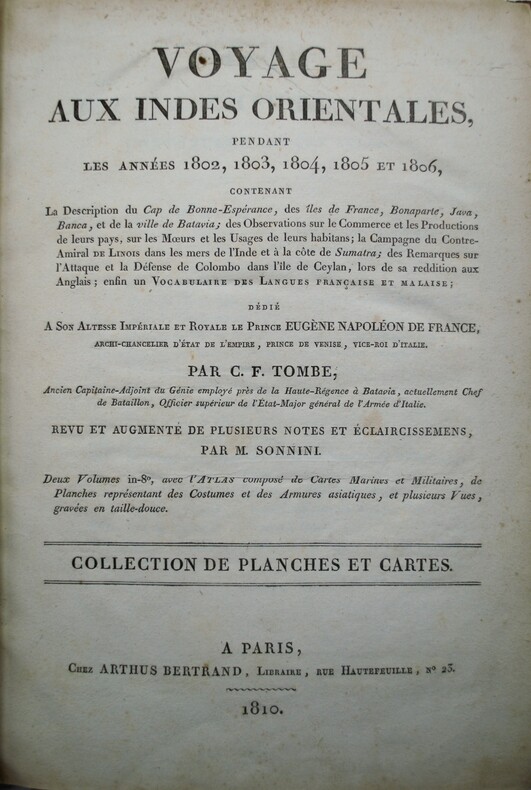
TOMBE (Charles François)
Voyage aux Indes orientales, pendant les annees 1802, 1803, 1804, 1805 et 1806.
Paris: Arthus Bertrand, 1810. — Atlas in-4, (295x200) (2 ff.), 18 cartes et planches , la plupart dépliantes ,relié demi veau ,dos lisse avec fers de navire , manque au dos .
Referenz des Buchhändlers : PHO-1157
|
|
|
Tom Harrison Maps (Firm)
Mono Divide High Country Tom Harrison Maps
map. Good. Access codes and supplements are not guaranteed with used items. May be an ex-library book. unknown
Referenz des Buchhändlers : 1877689467.G ISBN : 1877689467 9781877689468
|
|
|
Tom Harrison Maps
Mt Tam Trail Map Mount Tamalpais State Park
map. Good. Access codes and supplements are not guaranteed with used items. May be an ex-library book. unknown
Referenz des Buchhändlers : 1877689742.G ISBN : 1877689742 9781877689741
|
|
|
Tomlin, Maurice
Ham House
Some easily removable useful pencil notes added. No other marks or inscriptions. No creasing to covers or to spine. A very clean very tight copy with bright unmarked boards and no bumping to corners. 110pp. History, description and guide to Ham House in Surrey. Very well illustrated.

|
|
|
Tompkins, Stuart R.; Moorhead, Max L.
Russia's Approach to America
1950 offprint of article which first appeared in the British Columbia Historical Quarterly, April, July-October, 1949. Pages 53-66 and 231-255. Four pages of glossy black and white reproductions of historic maps. Part I - From Russian Sources, 1741-1761. Part II - From Spanish Sources, 1761-1775. Unmarked. Average wear. Binding intact. A sound copy of this informative work. Book

|
|
|
Tompkins, Stuart Ramsay
After Bering: Mapping the North Pacific
1958 offprint of article which first appeared in the British Columbia Historical Quarterly, January-April, 1955. 56 page booklet. "Will enable the reader to form a clearer idea, not only of the way in which the various voyages gradually introduce some measure of clarity into the prevailing views on the geography of these regions, but also of how the explorations of the nationals of various countries interlocked with one another and brought the several governments into conflict for possession of these regions." - from page 7. Unmarked with average wear. A sound copy of this informative work. Book

|
|
|
TONDEUR Freddy
Si Nyons m'était conté.
Autrefois, 2008, 82 p., broché, bon état.
Referenz des Buchhändlers : 87670
|
|
|
Tooley, R. V.
Tooley's Dictionary of mapmakers. Supplement
Quarto in pale yellow illus jacket; x, 116 pages : illustrations, maps, portraits ; 27 cm. Includes bibliographical references (pages ix-x). Cartographers -- Biography -- Dictionaries. Cartographes -- Biographies. Cartographers. Cartografen.
|
|
|
Tooley, Ronald V
Collector's guide to maps of the African continent and Southern Africa.
London, Carta Press, 1969. 25 cm. XVI, 132 S. mit über 100 Abb. im Text, 6 Farbtafeln im Einseit-Druck. Original Pappband (Hardcover), Fadenheftung. Tadelloses gepflegtes Exemplar.
Referenz des Buchhändlers : 16777AB

|
|
|
Torgau:
Torgau. "Plan der Bataille, welche d. 3. Nov. 1760 von der Kayserl Kön. Ungarischen und Königl. Preussischen Armee bey Torgau in Sachsen geliefert worden." Schlachtenplan von Torgau, links mit Legende. Kupferstich mit farbigen Truppenaufstellungen aus "Neues Kriegs-Theater ..." No. 35.
Format: 18 x 29,5 cm. *Leicht gebräunt, insgesamt gut erhalten. Landkarten de
|
|
|
Torgau:
Torgau. "Plan der Einnahme der Stadt Torgau im Monath August 1759. Des neuen Kriegs-Theaters 16. Sypplement. ". Stadtplan von Torgau, rechts mit Legende. Kupferstich mit farbigen Truppenaufstellungen aus "Neues Kriegs-Theater ...", 16. Supplement.
Format: 18 x 29,5 cm. *Leicht gebräunt, insgesamt gut erhalten. Landkarten de
|
|
|
TORRES VILLEGAS, Francisco Jorge.
Cartografía Hispano-Científica, ó sea, Los Mapas Españoles en que se representa a España bajo todas sus diferentes fases. Tomo Segundo (de dos).
Madrid, Imprenta de Don Ramón Ballone, 1857. Folio; portada, 379 pp., 4 hs. y 16 mapas coloreados, litografíados por Bachiller. Encuadernación de época en media piel.

|
|
|
Toshio Arisada / Meiji Maps, Meiji Maps
Image-based reading Selected books for Japanese language classes
Not Available 1977. Soft Cover. Fine. The book is in fine condition. Not Available paperback
Referenz des Buchhändlers : 2091202132900025
|
|
|
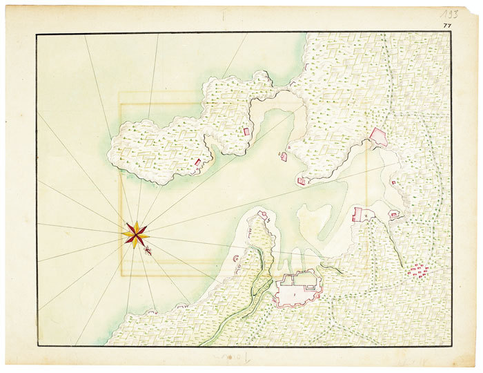
TOULON. MANUSCRIT.
[Plan manuscrit de la rade de Toulon].
[circa 1700]. 245 x 324 mm
Referenz des Buchhändlers : LBW-494
|
|
|
TOUSSOUN, Omar:
Mémoires de la société royale de géographie d’Egypte publiés sous les auspices de sa majesté Fouard 1er, Roi d Egypte. Tome VIII, Parties 1 à 3.
Société Royale de Géographie d’Egypte, 1926-1936, in-4to, XVI + 214 p. + VII planches/ p. 218-418 + III cartes géographiques/ p. 426-521+ I carte géographique, cartonnages originaux.
Referenz des Buchhändlers : 91376aaf
|
|
|
TOUSSOUN Omar (Prince):
Mémoire sur les anciennes branches du Nil.
Le Caire, Impr. de l’Institut français d’archéologie orientale, 1922. 2 vol. in-4 de VIII-60-[4] + IV-212-[5] pages demi-basane noire, dos à nerfs, étiquettes de titre et tomasion maroquin brun, couverture conservée. Légers accrocs sur les plats. Reliure moderne.
Referenz des Buchhändlers : 1592

|
|
|
TOULON. RUSSIE.-
Souvenir de la visite de l'escadre russe à Toulon le 13 Octobre 1893.-
Carte postale illustrée. 1893. Carte imprimée et illustrée en vert clair, dimensions 150 x 122 mm, Rare. Photo sur demande.
Referenz des Buchhändlers : ORD-20155
|
|
|
Touchette, Joseph I.
MCKAY'S GUIDE TO AFRICA. Maps by Alanson Hewes.
pp. vii, 311. Text maps. 8vo. Original full cloth binding. Original dust jacket, worn at extremities. AFRICA/4
|
|
|
TOURING-CLUB DE FRANCE
Nord. Carte toil?e au 1/400 000?. en couleurs.
Une feuille 90x63 cm.
|
|
|
Toynbee, Arnold J.
THE GERMAN TERROR IN FRANCE.
220p. + Plus six folding maps and numerous full page photographs. 8vo. Original full pictorial wraps, very slightly worn. First American edition. Nice copy. WWI 7
|
|
|
Tract
Appel.
S. l. [Paris] s.n. 1961 1 vol. broché 1 feuillet in-4 imprimé en noir sur papier rose. Tract-manifeste pour l'unique numéro de Sédition (octobre 1961), revue née de la rencontre de militants du trotskisme (Bernard Pêcheur, Marc Gauthier), de l’ultra-gauche (Louis Janover, Grandizo Munis) et du surréalisme (Gérard Legrand). Document provenant de la bibliothèque de Georges Bataille avec tampon à l'encre noire "Bibliothèque de Georges Bataille".
Referenz des Buchhändlers : 103929

|
|
|
Tract
Appel.
S. l. [Paris] s.n. 1961 1 vol. broché 1 feuillet in-4 imprimé en noir sur papier rose. Tract-manifeste pour l'unique numéro de Sédition (octobre 1961), revue née de la rencontre de militants du trotskisme (Bernard Pêcheur, Marc Gauthier), de l’ultra-gauche (Louis Janover, Grandizo Munis) et du surréalisme (Gérard Legrand). Document provenant de la bibliothèque de Georges Bataille avec tampon à l'encre noire "Bibliothèque de Georges Bataille".
Referenz des Buchhändlers : 103929
|
|
|
TRACT]
Hola !
Paris, le 15 février 1967, un feuillet in-4 (21 x 29,7 cm), imprimé en noir au recto sur papier pêche. Protestation contre Philippe Soupault, qui venait de faire paraître, au lendemain de la mort de Breton, une plaquette intitulée "Le Vrai André Breton" (Liège, Editions Brimborions). Signé par Gérard Legrand, José Pierre et Jean Schuster.
Referenz des Buchhändlers : 38473
|
|
|
TRACT]
Hola !
Paris, le 15 février 1967, un feuillet in-4 (21 x 29,7 cm), imprimé en noir au recto sur papier pêche. Protestation contre Philippe Soupault, qui venait de faire paraître, au lendemain de la mort de Breton, une plaquette intitulée "Le Vrai André Breton" (Liège, Editions Brimborions). Signé par Gérard Legrand, José Pierre et Jean Schuster.
Referenz des Buchhändlers : 38473
|
|
|
TRACT]
La Voie inique.
Paris, le 8 février 1963, un feuillet in-4 (22 x 28 cm), imprimé au recto en noir sur papier jaune. Protestation bilingue contre les tractations menées par les ministres de l'Intérieur français et espagnol à propos du sort des membres de l'O.A.S. et des républicains espagnols en exil. "Il y a un précédent à ce marchandage dans l'histoire de ce pays, ce précédent s'appelle Pétain". Signatures de : Robert Benayoun, André Breton, Edouard Jaguer, André Pieyre de Mandiargues, José Pierre, Jean Schuster, etc.
Referenz des Buchhändlers : 38471
|
|
|
TRACT]
La Voie inique.
Paris, le 8 février 1963, un feuillet in-4 (22 x 28 cm), imprimé au recto en noir sur papier jaune. Protestation bilingue contre les tractations menées par les ministres de l'Intérieur français et espagnol à propos du sort des membres de l'O.A.S. et des républicains espagnols en exil. "Il y a un précédent à ce marchandage dans l'histoire de ce pays, ce précédent s'appelle Pétain". Signatures de : Robert Benayoun, André Breton, Edouard Jaguer, André Pieyre de Mandiargues, José Pierre, Jean Schuster, etc.
Referenz des Buchhändlers : 38471
|
|
|
Tract
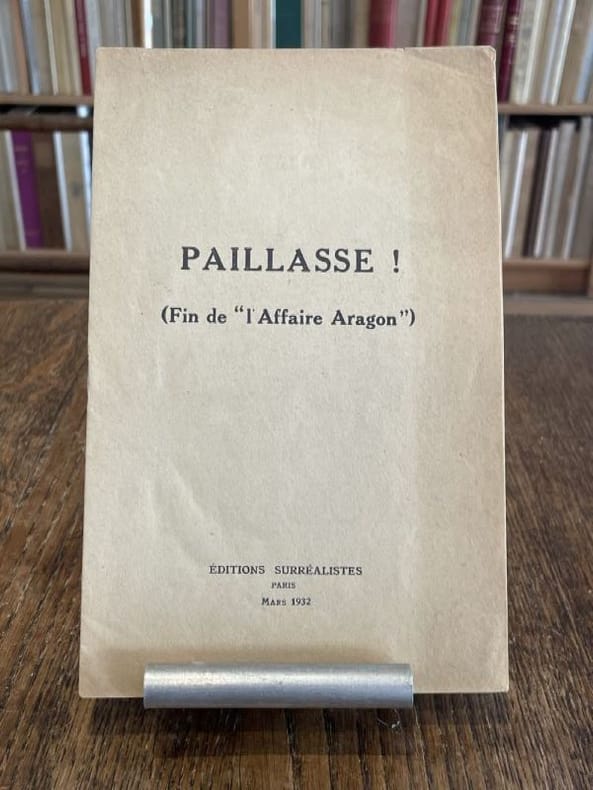
Paillasse ! (Fin de "l'Affaire Aragon").
Paris Editions surréalistes 1932 1 vol. broché plaquette in-8, agrafée, 11 pp. Édition originale. Contributions de René Char, René Crevel, Salvado Dali, Paul Eluard, Max Ernst, Benjamin Péret, Yves Tanguy, André Thirion et Tristan Tzara. Exemplaire provenant de la bibliothèque de Georges Bataille avec tampon à l'encre noire sur le premier feuillet "Bibliothèque de Georges Bataille". Légère marque d'insolation à la couverture.
Referenz des Buchhändlers : 104016
|
|
|
Tract
Paillasse ! (Fin de "l'Affaire Aragon").
Paris Editions surréalistes 1932 1 vol. broché plaquette in-8, agrafée, 11 pp. Édition originale. Contributions de René Char, René Crevel, Salvado Dali, Paul Eluard, Max Ernst, Benjamin Péret, Yves Tanguy, André Thirion et Tristan Tzara. Exemplaire provenant de la bibliothèque de Georges Bataille avec tampon à l'encre noire sur le premier feuillet "Bibliothèque de Georges Bataille". Légère marque d'insolation à la couverture.
Referenz des Buchhändlers : 104016
|
|
|
TRANCHANT Maurice
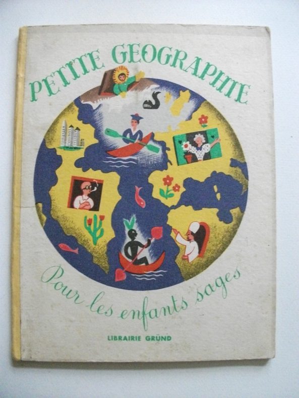
petite géographie pour tous les enfants sages
petit in 8 cartonné,dos pincé jaune,couverture illustrée en couleurs,titre illustré en couleurs 24 pages,20 charmantes illustrations en couleurs pleine page,ainsi qu’une double page de Maurice TRANCHANT Gründ éditeur 1947 Bon exemplaire,coloris frais
Referenz des Buchhändlers : 6237
|
|
|
Tract
Préallégation.
S.l.n.d. [1960] 1 vol. broché 1 feuillet in-4 imprimé en rose sur papier crème. Tract en marge de l'attribution du Prix des poètes, avec des textes par Désiré Nisard, Saint-John Perse, Rose P. Connolly. Document provenant de la bibliothèque de Georges Bataille avec tampon à l'encre noire sur le premier feuillet "Bibliothèque de Georges Bataille".
Referenz des Buchhändlers : 103932
|
|
|
Tract
Préallégation.
S.l.n.d. [1960] 1 vol. broché 1 feuillet in-4 imprimé en rose sur papier crème. Tract en marge de l'attribution du Prix des poètes, avec des textes par Désiré Nisard, Saint-John Perse, Rose P. Connolly. Document provenant de la bibliothèque de Georges Bataille avec tampon à l'encre noire sur le premier feuillet "Bibliothèque de Georges Bataille".
Referenz des Buchhändlers : 103932
|
|
|
TRACOL, Michel-André
Quand le Rhône... était un fleuve - Album de cartes postales, de photographies et de gravures composé et légendé par l'auteur
1980 Editions Michel-André Tracol - 1980 - In-4 à l'italienne, broché, sous jaquette illustrée - 142 pages - nombreuse iconographie
Referenz des Buchhändlers : 50107
|
|
|
Traduite en Francois, Avec des Notes Et des Cartes
Histoire Generale d'Espagne du P. Jean de Mariana de la Compagnie de Jesus Vol. 3
paperback. Good. Access codes and supplements are not guaranteed with used items. May be an ex-library book. paperback
Referenz des Buchhändlers : 0365078743.G ISBN : 0365078743 9780365078746
|
|
|
Traill, H. D.
ENGLAND, EGYPT, AND THE SUDAN.
242p + Plus three full page maps and a large folding map of the Nile Valley. Inked presentation to I. S. Beecher from Weston Fuller, Feb. 22nd, 1901. Foxed. Damp stained. 8vo. Original full red cloth binding, gold lettered. Top and bottom of spine chipped. Front cover slightly marred with white paint. First American Edition? AFRICA/6.
|
|
|
Trails Illustrated - National Geographic Maps
Mammoth Hots Springs - Yellowstone National Park NW Trails Illustrated Topographic Map #303
map. Good. Access codes and supplements are not guaranteed with used items. May be an ex-library book. unknown
Referenz des Buchhändlers : 1566953049.G ISBN : 1566953049 9781566953047
|
|
|
Trakker Maps Inc [Editor]
Union/Hudson/Essex Counties Atlas
Hagstrom Map Co 2000-01-28. paperback. New. In shrink wrap. Looks like an interesting title! Hagstrom Map Co paperback
Referenz des Buchhändlers : Q-0880976403 ISBN : 0880976403 9780880976404

|
|
|
TRAMEZINO o TRAMEZINI Francesco & Michele
Anteiquae Urbis Imago Accuratissime ex Vetusteis Monumenteis Formata
Pianta archeologica a proiezione verticale, con rappresentazione in alzato degli edifici antichi. Disegnata ed ideata da Pirro Ligorio, viene incisa da Jacob Bos per l’editore Tramezzino. Si tratta della grande pianta archeologica del Ligorio, frutto della sua valente esperienza di archeologo, che ebbe una grande influenza sulla produzione topografica della città per oltre due secoli. Per elaborare questa pianta, si avvalse della sua profonda conoscenza archeologica delle rovine di Roma, delle fonti classiche e di una vasta documentazione costituita da iscrizioni, bassorilievi e monete antiche. Per la parte topografica il Ligorio si basa sulla pianta del Bufalini del 1551.Roma entro le mura appare come un fantasioso insieme di edifici, alcuni noti e ancora presenti e altri che, sebbene localizzati con una certa esattezza, indubbiamente sono frutto di ricostruzioni abbastanza fantasiose. Non mancano gli errori di localizzazione, come ad esempio il Foro Romano, erroneamente collocato tra il Campidoglio ed il Palatino. Il primo stato della carta è noto solo attraverso gli esemplari conservati al British Museum e alla Philadelphia Library Company. La carta ebbe una ristampa inalterata, circa un secolo dopo per mano di Gian Battista de Rossi. Dopo un altro secolo circa (1773) anche Carlo Losi ne realizza una ristampa dalle lastre originali, che poi furono acquisite da Giovanni Scudellari e ristampate verso il 1820/30.In alto, lungo il bordo superiore, è impresso il titolo: ANTEIQUAE URBIS IMAGO ACCURATISSIME EX VETUSTEIS MONUMENTEIS FORMATA. Nel cartiglio all’angolo superiore sinistro si legge: EFFIGIES ANTIQUAE ROMAE EXVESTIGIIS AEDIFICIORUM RUINIS TESTIMONIO VETERUM AUCTORUM FIDE NUMISMATUM MONUMENTIS AENEIS PLUMBAEIS SAXEIS TIGLINISQUE COLLECTA ATQUE IN HANC TABELLAM REDACTA ATQUE DESCRIPTA A PYRRHO LIGORIO ROMANO PER XIIII REGIONES IN QUAS URBEM DIVISIT IMP CAESAR. AUG. PIOQUE IIII PONT MAX DICATA EXCUDERUNT ROMAE MICHAEL ET FRANCISCUS TRAMEZZINI M.D.LXI. Seguono l’indicazione del privilegio e la firma dell’incisore: Cum privilegio Sum[m]i Pont[ificis] et Senat[us] Venet[iani]. Iacobus Bossius belga incidebat. Orientazione fornita dal punto cardinale SEPTENTRIONE, indicazione collocata nell’angolo in alto a sinistra; il nord-est è in alto. Nella tavola alcuni monumenti e luoghi sono evidenziati attraverso il toponimo.Bulino, stampato su dodici fogli, applicati su tela e più volte ripiegati. Esemplare nel quarto stato finale, della tiratura Scudellari, finemente colorato a mano.Bibliografia:Bifolco - Ronca, Cartografia e Topografia italiana del XVI secolo (2018), pp. 2341-2342, tav. 1207, IV/IV; Destombes (1970): n. 94; Bevilacqua-Fagiolo (2012): p. 25; Caldana (2013): p. 22 e n. I.7; Frutaz (1962): n. XVIIa-b e tavv. 671-684; Hülsen (1915): VIII, pp. 52-53, nn. 31-35; Hülsen (1933): pp. 105-106, VIII; Karrow (1993): n. 51/11 e 51/11.4-51/11.7; Mandowsky-Mitchell (1963): tavv. 75-76; Scaccia Scarafoni (1939: nn. 11-13. Archaeological map with vertical projection, with representation in elevation of ancient buildings. Designed and conceived by Pirro Ligorio, it is engraved by Jacob Bos for the publisher Tramezzino. It is the great archaeological plant of Ligorio, the result of his valuable experience as an archaeologist, which had a great influence on the topographic production of the city for over two centuries. In order to elaborate this plan, he used his deep archaeological knowledge of the ruins of Rome, classical sources and a vast documentation consisting of inscriptions, bas-reliefs and ancient coins. For the topographic part Ligorio is based on the map by Bufalini of 1551.Rome within the walls appears as a fanciful set of buildings, some of them known and still present and others that, although located with a certain accuracy, are undoubtedly the result of quite fanciful reconstructions. There is no lack of localization errors, such as the Roman Forum, erroneously located between the Capitol and the Palatine Hill. The first state of the map is known only through the examples preserved at the British Museum and the Philadelphia Library Company. The ma was reprinted unchanged, about a century later by Gian Battista de Rossi. After another century or so (1773) Carlo Losi also made a reprint from the original plates, which were then acquired by Giovanni Scudellari and reprinted around 1820/30.At the top, along the upper edge, is engraved the title: ANTEIQUAE URBIS IMAGO ACCURATISSIME EX VETUSTEIS MONUMENTEIS FORMATA. In the cartouche in the upper left: EFFIGIES ANTIQUAE ROMAE EXVESTIGIIS AEDIFICIORUM RUINIS TESTIMONIO VETERUM AUCTORUM FIDE NUMISMATUM MONUMENTS AENEIS PLUMBAEIS SAXEIS TIGLINISQUE COLLECTA ATQUE IN HANC TABELLAM REDACTA ATQUE DESCRIPTA A PYRRHO LIGORIO ROMANO PER XIIII REGIONES IN QUAS URBEM DIVISIT IMP CAESAR. AUG. PIOQUE IIII PONT MAX DICATA EXCUDERUNT ROMAE MICHAEL ET FRANCISCUS TRAMEZZINI M.D.LXI. Follow the indication of the privilege and the signature of the engraver: Cum privilegio Sum[m]i Pont[ificis] et Senat[us] Venet[iani]. Iacobus Bossius Belgian incidebat. Orientation provided by the cardinal point SEPTENTRION, indication located in the upper left corner; the northeast is at the top. Engraving, printed on twelve sheets, applied on canvas and folded several times. Exemple in the fourth final state, of the edition by Scudellari. Literature:Bifolco - Ronca, Cartografia e Topografia italiana del XVI secolo (2018), pp. 2341-2342, tav. 1207, IV/IV; Destombes (1970): n. 94; Bevilacqua-Fagiolo (2012): p. 25; Caldana (2013): p. 22 e n. I.7; Frutaz (1962): n. XVIIa-b e tavv. 671-684; Hülsen (1915): VIII, pp. 52-53, nn. 31-35; Hülsen (1933): pp. 105-106, VIII; Karrow (1993): n. 51/11 e 51/11.4-51/11.7; Mandowsky-Mitchell (1963): tavv. 75-76; Scaccia Scarafoni (1939: nn. 11-13. Bifolco - Ronca, Cartografia e Topografia italiana del XVI secolo (2018), pp. 2341-2342, tav. 1207, IV/IV.

|
|
|
Travel & Maps
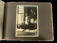
Japan Travel Photography Western Tourist Album Showing Temples Theater and Imperial Circuits Including Korea 1930s
1930. Japan travel photograph album. 1930s. This album documents Western travel through Japan during a period of expanding imperial influence and managed international tourism recording temple architecture theatrical performance and curated cultural sites alongside limited family portraiture. The photographs provide primary visual evidence of how foreign visitors encountered Japan through established travel circuits that emphasized religious monuments scenic landscapes and staged cultural forms while also including a labeled image from Korea that situates the journey within the geography of Japanese colonial rule.<br /> <br /> Album containing 22 silver gelatin photographs each mounted one per page with white ink captions identifying locations including "Nikko" "Kyoto" "Shochiku-za" "Koya San" "Akashi" "Takao" and "Korea." Three photographs depict members of a Western family posed in studio and outdoor settings including portraits in front of temple gates and residential entrances. The remaining images focus on architectural and cultural sites including temple facades with detailed ornamentation mountain and waterfall landscapes and a staged theatrical performance at the Shochiku-za theatre in Osaka showing performers in elaborate costume and makeup. One photograph labeled "Korea" depicts seated women wearing hanbok indicating travel beyond the Japanese home islands. The photographs are consistently sized at approximately 5 x 7 inches and mounted in an album measuring approximately 8.5 x 12 inches bound in cloth boards with decorative striping and cord binding.<br /> <br /> The album was produced during a decade when Japan promoted domestic and imperial sites as destinations for foreign travelers integrating religious landmarks urban infrastructure and colonial territories into a coherent tourist experience. Sites such as Nikko and Koya San were presented as emblematic of national heritage while theatrical venues and scenic locations formed part of structured itineraries. The inclusion of Korea reflects the extension of these travel routes into occupied regions where colonial subjects and landscapes were incorporated into representations of the empire. Photographs remain clear with strong contrast; minor wear to album consistent with handling; overall very good. A focused visual record of Western travel in 1930s Japan documenting how cultural sites and imperial geography were presented to foreign visitors. unknown
Referenz des Buchhändlers : 22302
|
|
|
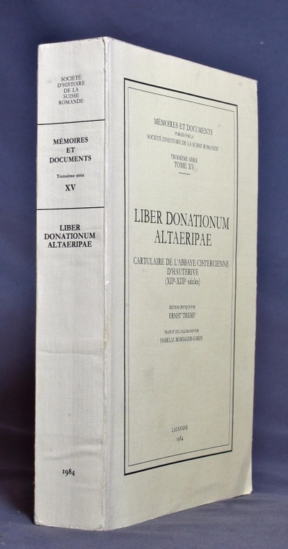
TREMP Ernst:
Liber donationum altaeripae. Cartulaire de l’abbaye cistercienne d’Hauterive (XIIe - XIIIe siècles).
Lausanne, Société d’histoire de la Suisse romande, 1984. In-8 broché de XII-433 pages, couverture imprimée.
Referenz des Buchhändlers : 1149
|
|
|
TREMAINE Jon
Tours de cartes. Collection : Image par image.
Paris, Solar, 1995. 24 x 27, 125 pp., très nombreuses illustrations en couleurs, cartonnage d'édition imprimé, bon état.
Referenz des Buchhändlers : 37107
|
|
|
Trench, Richard, with a foreword by Wilfred Thesiger, last of the great Arabia; Endpaper maps, color illustrations and black/whi
Arabian Travellers The European discovery of Arabia
MacMillan 1986-01-01. Hardcover. New. New. In shrink wrap. Looks like an interesting title! MacMillan hardcover
Referenz des Buchhändlers : Q-0333428897 ISBN : 0333428897 9780333428894
|
|
|
Trent, Christopher
Motoring on Regional Byways : Midland England : 50 Miles from Birmingham
Ex-library copy with usual (mininal) marks and stamps - to front end paper and reverse of title page only. Mainly clean tight pages with bright unmarked tape-free boards, dusty page edges and no bumping to corners. Dust jacket not price clipped or marked or torn or creased with minor traces of handling. 144pp. Many places deserving of exploration within fifty miles motoring of Birmingham.

|
|
|
Trevelyan, Raleigh & B/W Illus; Maps & Cartoons
Rome '44 the Battle for the Eternal City
Easton Press. Very Good with no dust jacket. 1990. Hardcover. Leather-bound hard cover published by Easton Press in 1990. No dust jacket. Black leather covers with gilt decorations and lettering. Corners are slightly bumped. Spine has three raised bands. Page edges are gilt-covered. Silk moire endpapers. Gray satin bookmark ribbon is attached to headband. Included are an unused and unattached bookplate from Easton Press and the Collector's Notes from Easton Press. Book is in very good plus condition. Large 8vo 366 pages 2.2 lb. ; Large 8vo 9" - 10" tall; 366 pages . Easton Press hardcover
Referenz des Buchhändlers : MST13651
|
|
|
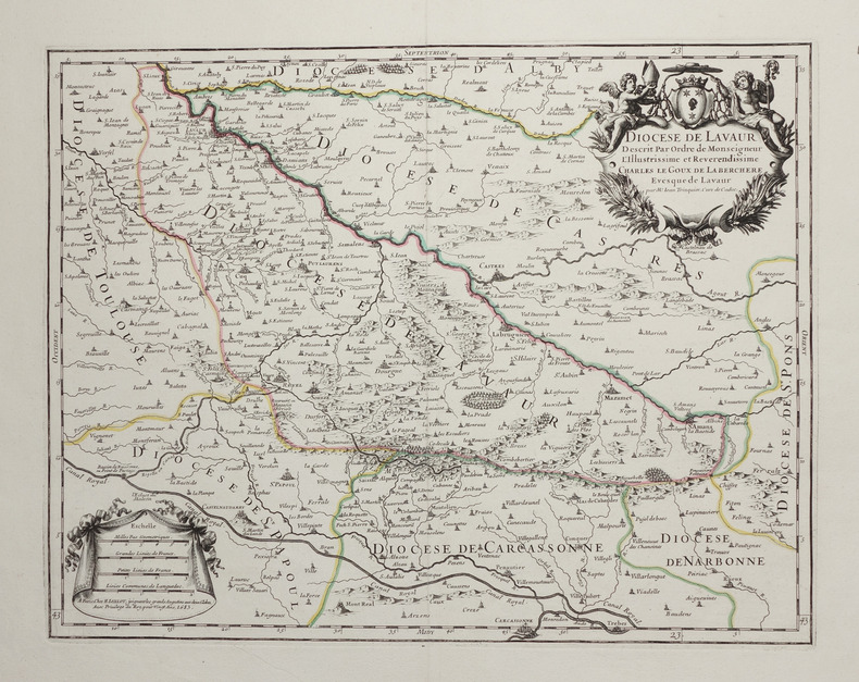
TRINQUIER (Jean).
[LAVAUR] Diocèse de Lavaur.
Paris, H. Jaillot, 1683. 351 x 451 mm.
Referenz des Buchhändlers : LBW-2754
|
|
|
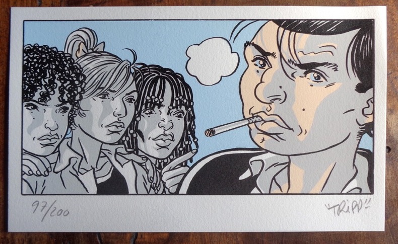
Tripp:
Petite sérigaphie couleurs.
2012 Sérigraphie au format 20 x 12.
Referenz des Buchhändlers : 984
|
|
|
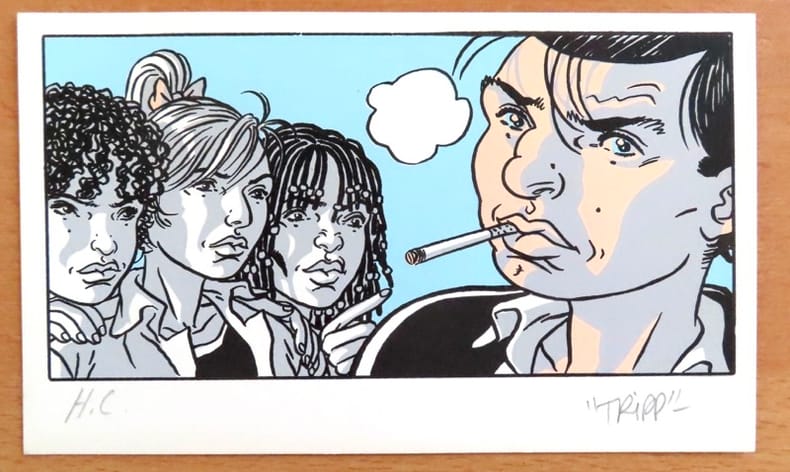
Tripp:
Petite sérigaphie couleurs.
Sérigraphie au format 20 x 12.
Referenz des Buchhändlers : 26117
|
|
|
Trigiani, Elaine
Top 10 Sicily (revised edition)
No marks or inscriptions. No creasing to covers or to spine. A lovely clean crisp very tight copy with bright covers and no bumping to corners. 160pp. The self-wraps open up to present a map of the island (front) and a map of Central Palermo (rear). This is the revised edition of the guide to the 10 best of everything in Sicily, eg, beaches, resorts, sights, restaurants, etc.

|
|
|
Tring Urban District Council
Tring Urban District : The Official Guide
No marks or inscriptions. Minor creasing to covers adjacent to spine. A very clean very tight booklet with bright unmarked boards and no bumping to corners. Large fold-out street plan and map on rear in excellent condition. 40pp. Official guide the the Hertfordshire town of Tring with history, Local Authority information and photographs of the town in the early 1970s. Extremely scarce.

|
|
|
TROUVE (Claude-Joseph, baron).
ESSAI HISTORIQUE SUR LES ETATS-GENERAUX DE LA PROVINCE DE LANGUEDOC, avec cartes et gravures. [&] DESCRIPTION GENERALE ET STATISTIQUE DU DEPARTEMENT DE L'AUDE. Avec cartes et gravures. 2 volumes
1818 A Paris, Firmin Didot, 1818. Deux volumes in-quarto (215 X 269) broché TOME I : XIX (dont faux-titre et titre), 584 pages, frontispice " Armoiries des Etats de Languedoc " (relié entre les pages 328 et 329), 2 cartes, 2 plans et un tableau dépliants ; TOME II : frontispice (Blasons), VIII (dont faux-titre et titre), carte dépliante gravée couleurs de l'Aude, 679 pages (" errata " au verso du dernier feuillet), 3 vues et 2 plans. EDITION ORIGINALE de ce remarquable ouvrage complet en deux volumes, qui comprend notamment une CARTE en couleurs gravée et TROIS GRANDES PLANCHES dépliantes représentant la grande vue de Carcassonne avec le plan de la Cité, la vue générale de Castelnaudary et celle de Narbonne. Le premier volume contient une étude historique depuis la conquête romaine, la description des différents diocèses du Languedoc et enfin l'histoire des ouvrages publics et des canaux. Le second volume donne une étude très détaillée de l'Aude comprenant la topographie, géologie, description des villes et villages, population, moeurs, agriculture, industrie, commerce, pêche, etc. Claude-Joseph, baron TROUVE (1768-1860), fut le deuxième préfet de l'Aude, succédant à Barante. Très soucieux de sa mission administrative, il organise en 1807 un recensement démographique et agricole détaillé, fait exécuter plusieurs enquêtes sur l'industrie et l'école, crée un réseau de correspondants qui alimentent peu à peu sa future " Description générale et statistique du département de l'Aude " (Les Audois, Dictionnaire biographique sous la direction de R. CAZALS & D. FABRE, 328).
Referenz des Buchhändlers : 1806
|
|
|
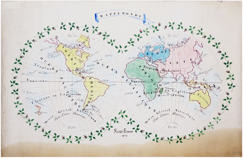
TRUSSON (Rachel).
Mappemonde.
1878. 61 x 90 cm.
Referenz des Buchhändlers : LBW-6628
|
|

 Per e-mail erhalten
 Als pdf-Dokument herunterladen
 RSS feed
 Permanenter link


