|
VIKINGS par Michel JANSEN.
Cap à l'Ouest. L'aventure des vikings. Richement documenté (photos, cartes, dessins).
Namur, les éd. du Soleil Levant 1963. Bel exemplaire relié, cartonnage orné d'éd., in-12, 266 pages.
Referência livreiro : AUB-3922
|
|
|
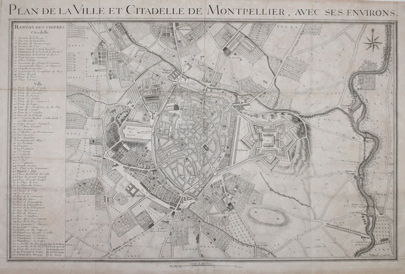
VILLARET (Jean).
[MONTPELLIER] Plan de la ville et citadelle de Montpellier, avec ses environs.
[circa 1740]. 485 x 733 mm.
Referência livreiro : LBW-2964
|
|
|
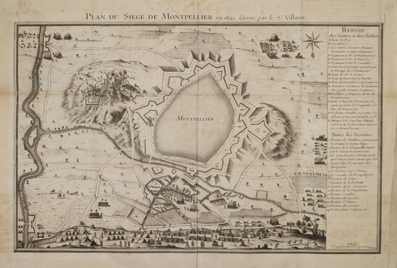
VILLARET (Jean).
[MONTPELLIER] Plan du siège de Montpellier en 1622, gravé par le Sr. Villaret.
[circa 1740]. 440 x 685 mm.
Referência livreiro : LBW-2965
|
|
|
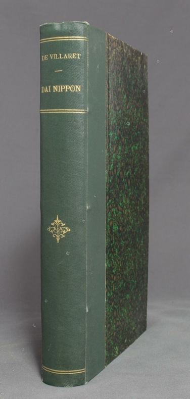
VILLARET [Etienne] de:
Dai Nippon (le Japon).
Paris, Ch. Delagrave, 1889. In-8 de [2]-X-389 pages, demi-percaline verte, dos orné de fleurons, filets et titre dorés. Tampon de possesseur sur ff. vierge, quelques repères au crayon dans le texte, 2 ff. restaurés.
Referência livreiro : 9596
|
|
|
VILATO (Javier).
Invitation illustrée d'une gravure originale signée.
Paris Société des peintres-graveurs français 1975 1 vol. Broché Carton d'invitation dépliant sur Arches illustré d'une eau-forte tirée en rouge (15 x 12 cm) signée et datée par Javier Vilato. En parfait état.
Referência livreiro : 109088
|
|
|
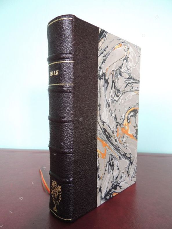
VILLENAUD Marie-Claude et Georges ( textes principaux ) NORMAND D. (dessins ) PAPIGNY G. ( plans et cartes )
IRAN
Paris Editions Vilo Les Guides modernes Fodor 1971 ( copyright by Editions Pallas ) 1 vol. ( 18,5 x 11,5 cm ) ( poids = 0,4 kg ) 298 pages , 22 photos , 9 plans de villes , 7 cartes archéologiques et historiques . Carte générale dépliante de l' Iran , en début de vol. . Demi-basane chagrinée brun foncé . Dos à 5 faux nerfs, titre et un fleuron dorés . Plats papier marbré . Ex-libris C. Delaby contrecollé au premier contreplat . ( Reliure récente ) . Excellent état .
Referência livreiro : 356
|
|
|
VILLENEUVE (Jules-Louis-Frédéric).
Vue générale du Mont-Blanc prise au-dessus de Sallenches.
1824. 455 x 554 mm.
Referência livreiro : LBW-776

|
|
|
VILA BLANCH, R. - SEMIR DE ARQUER, R. - LLADÓ, Ll.
MONTARTO - Granollers 1961 - Mapa
Granollers, Editorial Alpina, 1961. Coma Lo Forno - Colomers - Aigües Tortes - Boï. Mapa topográfico excursionista. Ascensiones y escaladas. Escala 1:25.000. Mapa entelado y plegado. Buen ejemplar.
|
|
|
VILAR, María José.
Ceuta en el Siglo XIX a través de su cartografía histórica y fuentes inéditas, 1800 - 1912. Prólogo de Carmen González Martínez.
Murcia, 2002. 4to. alargado; XIV pp., 380 pp. Ilustraciones y mapas. Cubiertas originales.

|
|
|
VILLAMARTIN, Francisco (1833-1872).
Obras selectas de... Comandante de la Infantería. Con la biografía del autor por Don Luis Vidart, y un Apéndice a las "Nociones del Arte Militar" por Don Arturo Cotarelo. Publícanse a expensas del Ministerio de la Guerra.
Madrid, Establecimiento Tipográfico de los Sucesores de Rivadeneyra, 1883. 4to.; LVIII pp., 655 pp. Con 12 mapas plegados y cuatro láminas, tres de ellas con retratos, grabadas por Bartolomé Maura. Encuadernación de época, en media piel.

|
|
|
Vilnay, Zev [Ze'ev]
The Holy Land in Old Prints and Maps
325x225 mm. 296 pages. Gilt hardcover with dust-jacket. Jacket yellowing and torn. Spine edges bumped. Few pages slightly stained - no damage to text. Pages yellowing. Else in good condition. PLEASE NOTE: This item is overweight. We may ask for extra shipping costs.
|
|
|
VINCENT (Michel).
Aubenas et Vals au début du siècle.
Salindres, Lou Raïol, 1976, 1 br. album in-8 oblong, titre, 69 reproductions de cartes postales anciennes + 9 pages de texte, intercalées ;
Referência livreiro : 5545
|
|
|
VINCENT (Michel).
L'album photos de Privas au début du siècle.
Alès, Lou Raiol, s.d. (vers 1977), 1 broché. album in-8 de 26 pages de reproductions de cartes postales anciennes avec en regard une photo récente de la même vue ;
Referência livreiro : 19397
|
|
|
VINCENT (Michel).
L'album photos de Ruoms-Vallon, St Marcel d'Ardèche en 1900.
Alès, Lou Raïol, 1977. Broché, couverture illustrée. in-8 oblong de 26 Planches photos + 2 pages de texte.
Referência livreiro : 20548
|
|
|
VINCELOT Mag
La gymnastique quotidienne de nos enfants (de 5 à 10 ans).
Paris, Bornemann, 1961. 13 x 18, 45 pp., broché, bon état.
Referência livreiro : 26590
|
|
|
VINS SUISSES par Georges DUTTWEILER.
Les vins suisses. Richement documenté (planches en couleurs, cartes régionales. Dessins de Paul-André PERRET.
Genève, éd. Générales S.A. 1968. Bel exemplaire relié, cartonnage orné d'éd., in-4, num., 312 pages.
Referência livreiro : AUB-5936
|
|
|
VINCENT Michel - BOUVARD Claude
MAISONS DE BRIE ET D'ÎLE-DE-FRANCE - Petite France, Goële, Multien, Valois (Extrême Sud), Orxois, Tardenois, Brie, Champagne occidentale, Pays d'Othe, Senonais, Gâtinais (Centre et Sud-Est), Puisaye (Nord).
Presses du Village, 1981, un volume in8, broché, 367 pages. Très nombreuses illustrations, photos, croquis, reproductions de cartes postales anciennes. En annexe : Synthèse d'une maison briarde et analyse des matériaux par Claude Bouvard. Index. Dos gauchi ( pas d'équerre), . Bon état.
Referência livreiro : 6556
|
|
|
VINCENT (Michel).
SAINT AGREVE EN 1900. L'Ardèche au début du siècle.
Alès, Lou Raïol, s.d. (vers 1977), 1 broché, couverture illustrée. in-8 oblong, album de 28 pages de reproductions de cartes postales anciennes ;
Referência livreiro : 19416
|
|
|
VINCENDON-DUMOULIN, C.A. (CLÉMENT ADRIEN).
Portulan Général contenant les Plans des Ports et Mouillages du Globe. Océan Atlantique. 2 Vols. (1. Iles Éparses. 2. Côtes D'Afrique).
Paris, Dépôt-Général de la Marine, 1852. Folio. (34,5 x 27 cm.). 2 uniform contemp. hcalf. Gilt spines with gilt lettering. Light wear to edges. Stamp on title-pages. Volume 1: Engraved title-page. (2) pp. and 24 engraved maps of islands of which 18 are double-page, numbered 1317-1340. - Volume II: Engraved title-page. 83 engraved maps, mostly double-page, numbered 1341-1423 and 1-83. Clean and fine.
|
|
|
Vincent J.
AN ATLAS OF ANCIENT GEOGRAPHY Dedicated with Permission to the Rev. Dr. Russell Head Master of Charter House School London. For the Use of Schools
Oxford and London: J. Vincent et al 1829. Engraved title page contents page followed by 21 double-page engraved maps hand coloured in outline and mounted on stubs; publisher's adverts pasted to front paste-down see bibliographic note at end. Original red morocco backed marbled boards with printed paper title label to the front board; gilt lines to the spine binding with a little general wear and rubbing to edges strong slightly chipped to the head/tail of the spine. Contents good and tight contemporary name to front end paper maps generally very good Britain with a short split to lower central fold a couple of othes nicked at head/tail of the fold line. A very good copy. Bibliographic note: The publisher's adverts to the front end paper reveal that this work was published in a number of formats - at quarto format with maps and plans illustrations plain or coloured; or the same without illustrations plain or coloured; and the same at a reduced scale for the use of schools plain or coloured. This copy is the last version but coloured. First Edition Thus. Hardcover. Very Good/No Dust Jacket. Royal 8vo. J. Vincent et al Hardcover
Referência livreiro : 027543

|
|
|
Vinogradov, A.P. (Editor-in-Chief).:
Atlas litologo-paleogeograficheskikh kart SSSR. [Atlas of Lithologic-Paleogeographical Maps of the USSR.] Vol. II. Devonian, Carboniferous, and Permian.
Large folio, 63x42cm. 65 double-page col. maps (sc. 1:7,500,000 or 1:400,000 or 1:5,00,000), with title sheets and double-page leaf of legenda (both in Russian and English), unbound in orig. cloth-backed printed portfolio, as issued. Portfolio with traces of handling but maps in fine condition.
|
|
|
VISSCHER (Nicolas);
[BELGIQUE/BRUXELLES] Bruxellensis tetrarchia.
Amsterdam circa 1700 574 x 464 mm.
Referência livreiro : LBW0417c
|
|
|
VISSCHER (Nicolas);
[BRABANT] Brabantiae Batavae pars occidentalis.
Amsterdam circa 1700 490 x 578 mm.
Referência livreiro : LBW0416d

|
|
|
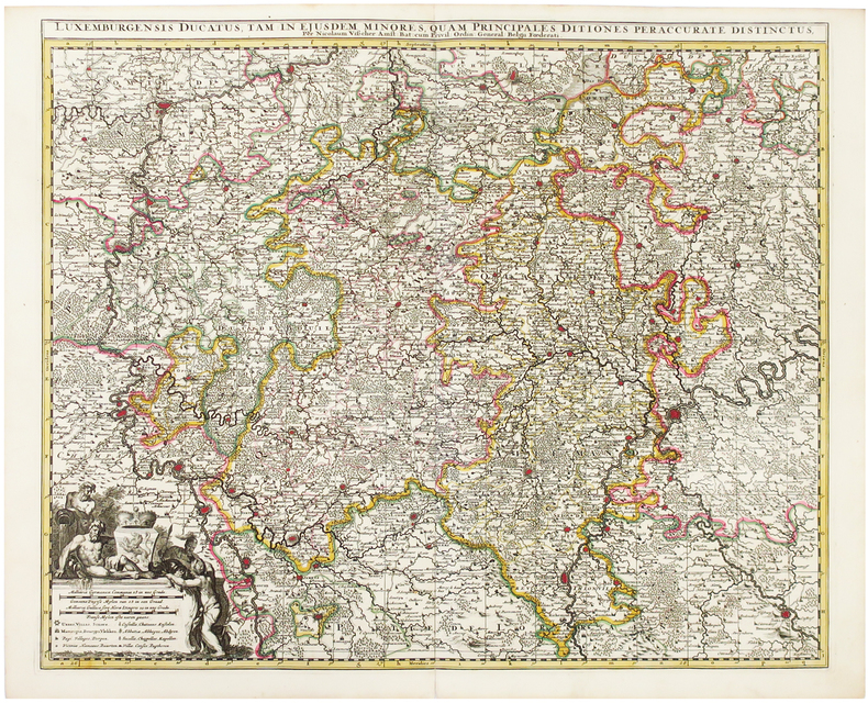
VISSCHER (Nicolas).
[LUXEMBOURG] Luxemburgensis ducatus.
Amsterdam, [circa 1700]. 489 x 585 mm.
Referência livreiro : LBW0417a
|
|
|
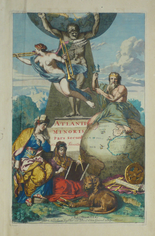
VISSCHER (Nicolas);
Frontispice pour l'Atlantis minoris - Pars secunda.
Amsterdam Nicolaum Visscher vers 1690 397 x 250 mm.
Referência livreiro : LBW-1718
|
|
|
VISSCHER (Nicolaus)
Regnum Siciliae cum circumjacentibus regnis et insulis.
1680 cadre bois naturel. 51 x 59 cm., 1 cartouche colorié, échelles des milles, Amsterdam N. Visscher 1680
Referência livreiro : 13545

|
|
|
Vischer, Georg Matthäus.
Aichbihel [Eichbückel, GB Wiener Neustadt] Achav uulgo hochau [Achau, GB Mödling]. [Wien], [1672].
2 Kupferstiche auf 1 Bl. 4to. Zwei Ansichten entnommen aus Vischers "Topographia Archiducatus Austriae Inf: Modernae, seu Controfee und Beschreibung aller Stätt Clöster und Schlösser wie sie anietzo in dem Erzhertzogtumb unter Osterreich". Vgl. Nebehay/W. 783.
|
|
|
Vischer, Georg Matthäus.
Archiducatus Austriae Superioris Geographica Descriptio facta Anno 1667. Augsburg, Melchior Küsell, 1669.
Kupferstichkarte von 12 Platten mit Legende und sechs Kartuschen (darunter auch Veduten mit figürl. Staffage, u. a. eine Ansicht des Traunsees mit Gmunden u. Schloß Orth sowie Attersee mit Schloß Kammer), zus. auf Leinwand aufgezogen und auf zwei zeitgenössische Holzstäbe mit gedrechselten Knäufen montiert. 1280:1265 mm. Erste Ausgabe der großen Vischer-Karte von Oberösterreich, spätere Ausgaben sind 1762 und 1808 erschienen. “Die erste der großen Landkarten des Georg Matthäus Vischer ist die Karte von Oberösterreich. Ende des Jahres 1666 hat Vischer das Projekt den oberösterreichischen Ständen vorgeschlagen, im Mai 1667 erhielt er schon den Auftrag, Sommer 1667 ist er mit den Vermessungsarbeiten im Gelände beschäftigt, und im Winter desselben Jahres wird die Karte bereits gezeichnet. Am 21. Februar 1668 konnte Vischer die vollendete Karte den Ständen vorlegen” (Dörflinger/Wagner). Die vorliegende Karte gilt als die erste autoptisch aufgenommene, großformatige und detaillierte Karte von Oberösterreich und “diente einem der universalsten Barockkartographen, dem Venezianer Vincenzo Coronelli (1650-1718) als Vorbild” (Kat. Austria Picta, 56f.), der die vorliegende Karte 1692 für seinen ‘Corso Geografico universale’ in verkleinertem Format nachgestochen hat. - Durch die alte Montage und Aufhängung mit den üblichen Gebrauchspuren und an den Plattenkanten etwas rissig, das Leinen jedoch fachmännisch erneuert, einige kl. Fehlstellen retuschiert. Wie alle großformatigen Wandkarten des Barock selten, die vorliegende noch dazu in der originalen Fassung des 17. Jahrhunderts auf zwei hölzerne Rundstäbe montiert. Dörflinger/Wagner/Wawrik, Descriptio Austriae (1977), 126 u. Tafel 28.

|
|
|
Vischer, Georg Matthäus.
Trvmmav [Trumau, GB Ebreichsdorf] Visscha [Schloss Fischau, Bad Fischau]. [Wien], [1672].
2 Kupferstiche auf 1 Bl. 4to. Zwei Ansichten aus entnommen aus Vischers "Topographia Archiducatus Austriae Inf: Modernae, seu Controfee und Beschreibung aller Stätt Clöster und Schlösser wie sie anietzo in dem Erzhertzogtumb unter Osterreich". Vgl. Nebehay/W. 783.
|
|
|
Visscher Nicolaes Pugsley William H. William Howard donor WH. Pugsley Collection of Early Canadian Maps W. H.
Carte nouvelle contenant la partie d'Amerique la plus septentrionale : ou sont exactement decrits les provinces suivants comme le Canada ou Nouvelle France la Nouvelle Ecosse la Nouvelle Angleterre les Nouveaux Pais Bas la Pensylvanie la Virginie la Caroline et l'Jle de Terre Neuve avec les profondeuis le long des cotes et sur les bancs 1745 Leather Bound
2019. Leather Bound. New. Leather Binding on Spine and Corners with Golden Leaf Printing on round Spine extra customization on request like complete leather Golden Screen printing in Front Color Leather Colored book etc. Reprinted in 2019 with the help of original edition published long back 1745. This book is printed in black & white sewing binding for longer life Printed on high quality Paper re-sized as per Current standards professionally processed without changing its contents. As these are old books we processed each page manually and make them readable but in some cases some pages which are blur or missing or black spots. If it is multi volume set then it is only single volume if you wish to order a specific or all the volumes you may contact us. We expect that you will understand our compulsion in these books. We found this book important for the readers who want to know more about our old treasure so we brought it back to the shelves. Hope you will like it and give your comments and suggestions. Lang: - French. EXTRA 10 DAYS APART FROM THE NORMAL SHIPPING PERIOD WILL BE REQUIRED FOR LEATHER BOUND BOOKS. COMPLETE LEATHER WILL COST YOU EXTRA US$ 25 APART FROM THE LEATHER BOUND BOOKS. hardcover
Referência livreiro : LB1111007010885
|
|
|
Visscher Nicolaes Pugsley William H. William Howard donor WH. Pugsley Collection of Early Canadian Maps W. H.
Carte nouvelle contenant la partie d'Amerique la plus septentrionale : ou sont exactement decrits les provinces suivants comme le Canada ou Nouvelle France la Nouvelle Ecosse la Nouvelle Angleterre les Nouveaux Pais Bas la Pensylvanie la Virginie la Caroline et l'Jle de Terre Neuve avec les profondeuis le long des cotes et sur les bancs 1745 FULL LEATHER BOUND
2019. SUPER DELUXE EDITION. New. Antique look with Golden Leaf Printing and embossing with round Spine completely handmade bindingextra customization on request like Color Leather Colored book special gold leaf printing etc. Reprinted in 2019 with the help of original edition published long back 1745. This book is printed in black & white sewing binding for longer life Printed on high quality Paper re-sized as per Current standards professionally processed without changing its contents. As these are old books we processed each page manually and make them readable but in some cases some pages which are blur or missing or black spots. If it is multi volume set then it is only single volume if you wish to order a specific or all the volumes you may contact us. We expect that you will understand our compulsion in these books. We found this book important for the readers who want to know more about our old treasure in old look so we brought it back to the shelves. Hope you will like it and give your comments and suggestions. Lang: - French. EXTRA 10 DAYS APART FROM THE NORMAL SHIPPING PERIOD WILL BE REQUIRED. Normal Hardbound Edition is also available on request. unknown
Referência livreiro : SD1111007010885
|
|
|
Visscher Nicolaes Pugsley William H. William Howard donor WH. Pugsley Collection of Early Canadian Maps W. H.
Carte nouvelle contenant la partie d'Amerique la plus septentrionale : ou sont exactement decrits les provinces suivants comme le Canada ou Nouvelle France la Nouvelle Ecosse la Nouvelle Angleterre les Nouveaux Pais Bas la Pensylvanie la Virginie la Caroline et l'Jle de Terre Neuve avec les profondeuis le long des cotes et sur les bancs 1745
2019. Paperback. New. Lang: - French. Reprinted in 2019 with the help of original edition published long back 1745. This book is Printed in black & white sewing binding for longer life with Matt laminated multi-Colour Soft Cover HARDCOVER EDITION IS ALSO AVAILABLE Printed on high quality Paper re-sized as per Current standards professionally processed without changing its contents. As these are old books we processed each page manually and make them readable but in some cases some pages which are blur or missing or black spots. If it is multi volume set then it is only single volume if you wish to order a specific or all the volumes you may contact us. We expect that you will understand our compulsion in these books. We found this book important for the readers who want to know more about our old treasure so we brought it back to the shelves. Any type of Customisation is possible with extra charges. Hope you will like it and give your comments and suggestions. paperback
Referência livreiro : PB1111007010885
|
|
|
Visscher Nicolaes Pugsley William H. William Howard donor WH. Pugsley Collection of Early Canadian Maps W. H.
Carte nouvelle contenant la partie d'Amerique la plus septentrionale : ou sont exactement decrits les provinces suivants comme le Canada ou Nouvelle France la Nouvelle Ecosse la Nouvelle Angleterre les Nouveaux Pais Bas la Pensylvanie la Virginie la Caroline et l'Jle de Terre Neuve avec les profondeuis le long des cotes et sur les bancs 1745 Hardcover
2019. Hardcover. New. Lang: - French. Reprinted in 2019 with the help of original edition published long back 1745. This book is Printed in black & white Hardcover sewing binding for longer life with Matt laminated multi-Colour Dust Cover Printed on high quality Paper re-sized as per Current standards professionally processed without changing its contents. As these are old books we processed each page manually and make them readable but in some cases some pages which are blur or missing or black spots. If it is multi volume set then it is only single volume if you wish to order a specific or all the volumes you may contact us. We expect that you will understand our compulsion in these books. We found this book important for the readers who want to know more about our old treasure so we brought it back to the shelves. Any type of Customisation is possible with extra charges. Hope you will like it and give your comments and suggestions. hardcover
Referência livreiro : 1111007010885
|
|
|
Visscher, Nicholas:
Champaigne et Brie. Map of the region Champagne in France.
Size: 39,5 x 49 cm. Sheet: 52 x 62 cm. Landkarten de
|
|
|
VITAL, Arthur:
Die Kartenentwurfslehre. [= Die Erdkunde; XXVI. Teil, Eine Darstellung ... hrsg. von Maximilian Klar).
Leipzig; Wien, Franz Deuticke., 1903, gr. in-8vo, (24x17), VIII + 96 S., mit 19 Text Holzschnitten und 4 gefalteten litho Tafeln, brauner Oln mit Jugendstil Prägung,
Referência livreiro : 135614aaf
|
|
|
Vitalis Raymond
Rhodes
Athens: Vassiliou Editions 1966 Locally produced pictorial guide for tourists. 112p.illus B & W fold out map at rear. Soft Cover. Very Good. Vassiliou Editions paperback
Referência livreiro : 26089
|
|
|
VITRY
Carte au 1/200 000e. Sans date.
Une feuille 32x50 cm.
|
|
|
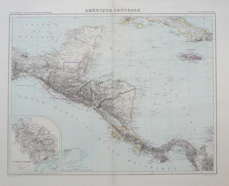
VIVIEN de SAINT-MARTIN (Louis).
Amérique centrale.
1885. 460 x 536 mm.
Referência livreiro : LBW-940
|
|
|
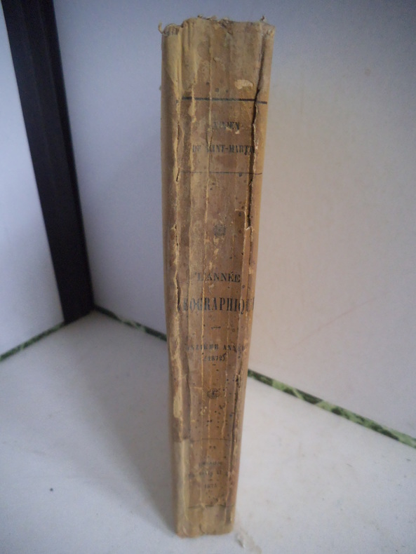
VIVIEN DE SAINT MARTIN
L’année géographique 1872.
revue annuelle des voyages de terre & de mer, des explorations, missions, relations aux sciences géographiques et ethnographiques. Onzième année 1872. In 12 broché, faux-titre, titre, XXXII- 467 pages, non coupé. 24 pages de catalogue, 3 cartes hors-texte dont 2 dépliantes. Librairie Hachette & Cie 1873. Dos insolé. Afrique-Océanie-Asie-Amérique du Sud- Amérique du Nord-région Arctique-Europe-géographie générale
Referência livreiro : 10472
|
|
|
Vlissingen
Vlissingen in oude ansichten.
Zaltbommel, Europese Bibliotheek, 1968 21 x 15, 160 pp., ca 150 figures, cartonnage éditeur illustré, très bon état
Referência livreiro : 5816
|
|
|
Vogelschauansicht der Stadt Zürich von 1576. Murer, Josef:
Der uralten wytbekannten Statt Zürich gestalt und gelägenheit, wie sy zu diser zyt in wäsen, ufgerissen und in grund gelegt, durch Josefen Murer und durch Christoffel Froschower, zu Eeren dem Vatterland getruckt, Im M.D.LXXVI Jar
Gattikon, Verlag Dorfpresse. 1966. Zehnfarben Lithografie auf festem Papier. Blattgrösse: 97 x 139 cm.
Referência livreiro : 1123DG
|
|
|
VOGEL E.
Le whist et le piquet. Tous les jeux et leurs règles.
Paris, Bornemann, 1968. 13 x 18, 47 pp., broché, très bon état.
Referência livreiro : 26583
|
|
|
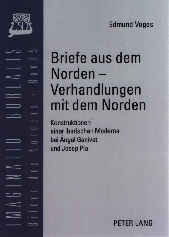
Voges, Edmund
Briefe aus dem Norden - Verhandlungen mit dem Norden: Konstruktionen einer iberischen Moderne bei Angel Ganivet und Josep Pla. Imaginatio Borealis (5).
Frankfurt am Main; Berlin; Bern; Bruxelles; New York; Oxford; Wien: Peter Lang, 2004. 306 S. Softcover.
Referência livreiro : 1190668
|
|
|
Voix ouvrière.
Voix ouvrière, supplément au n° 30 (7 juin 1968).
Paris Voix ouvrière 1968 1 vol. en feuilles Tract dactylographié daté du 7 juin. Protestation contre les violences policières de Flins, pointant du doigt la responsabilité de la CGT : "Qu'attendent les dirigeants de la CGT pour organiser la riposte ? Vont-ils continuer à prêcher le calme devant l'agression policière alors qu'ils déploient tout leur zèle à faire la chasse aux "gauchistes" ?".
Referência livreiro : 93143
|
|
|
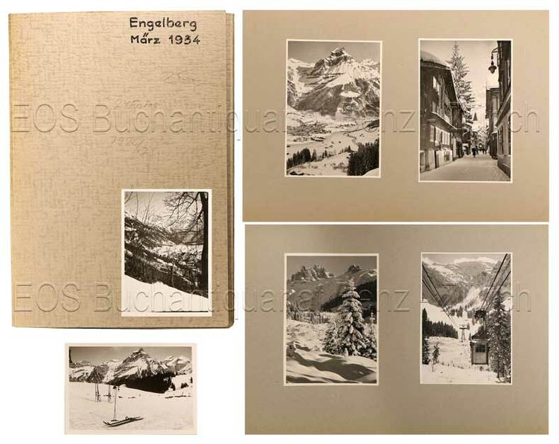
Volkart:
Engelberg
1934. 24 Fotografien, montiert auf Halbkarton. Format: ca. 8 x 6 u. 6 x 8 cm.
Referência livreiro : 792CG
|
|
|
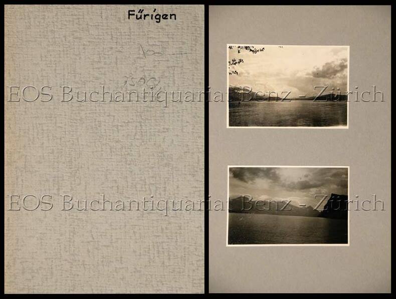
Volkart;
Fürigen.
(um 1935). 7 Fotografien, montiert auf Halbkarton. Format: ca. 8 x 6 u. 6 x 8 cm.
Referência livreiro : 750CG
|
|
|
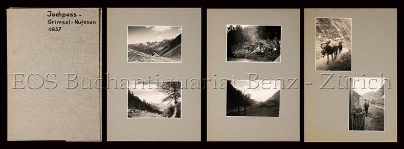
Volkart;
Jochpass - Grimsel - Nufenen (im Sommer).
1937. 19 Fotografien, montiert auf Halbkarton. Format: ca. 8 x 6 u. 6 x 8 cm.
Referência livreiro : 748CG
|
|
|
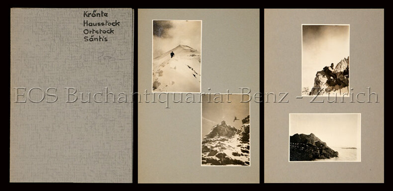
Volkart;
Krönte - Hausstock - Ortstock - Säntis (meist im Sommer).
1937. 19 Fotografien, montiert auf Halbkarton. Format: ca. 8 x 6 u. 6 x 8 cm.
Referência livreiro : 747CG
|
|
 Receber por correio electrónico
 Descarregar em documento PDF
 Fluxo RSS


