|
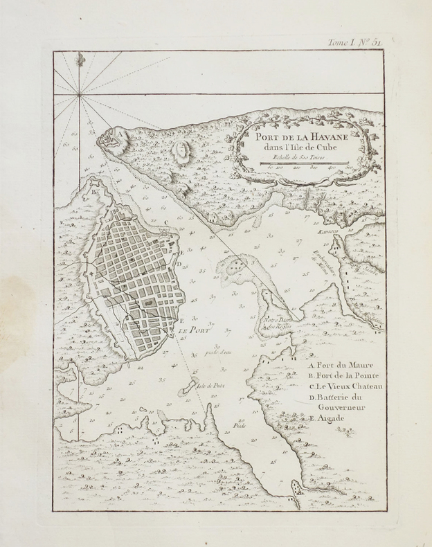
BELLIN (Jacques-Nicolas).
[CUBA] Port de La Havane dans l'isle de Cube.
1764. 219 x 159 mm.
Référence libraire : LBW-2375
|
|
|
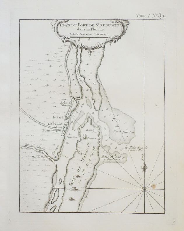
BELLIN (Jacques-Nicolas).
[FLORIDE/ST. AUGUSTINE] Plan du port de St. Augustin dans la Floride.
1764. 208 x 157 mm.
Référence libraire : LBW-2396
|
|
|
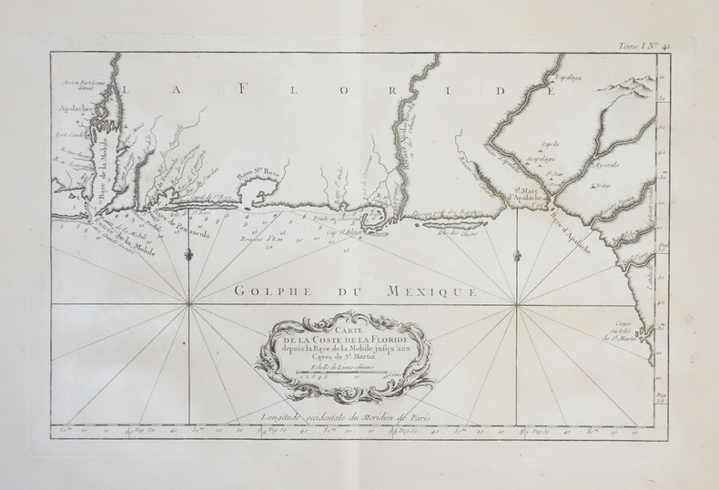
BELLIN (Jacques-Nicolas).
[FLORIDE] Carte de la coste de la Floride depuis la baye de la Mobile jusqu'aux cayes de St. Martin.
1764. 213 x 341 mm.
Référence libraire : LBW-2389
|
|
|
BELLIN (Jacques-Nicolas).
[GABON/CONGO/ANGOLA/NAMIBIE] Carte réduite des costes occidentales d'Afrique, depuis l'équateur jusqu'au vingtième degré de latitude méridionale comprenant les isles de St. Thomé et du Prince, les costes d'Angole, de Congo, de Loango &ca.
Paris, M. Bellin, 1754. 890 x 544 mm.
Référence libraire : LBW-6538

|
|
|
BELLIN (Jacques-Nicolas).
[GOLFE de GÊNES] Carte réduite du Golphe de Genes.
1768. 568 x 859 mm.
Référence libraire : LBW-4967

|
|
|
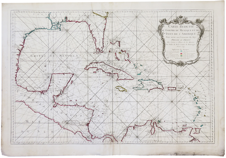
BELLIN (Jacques-Nicolas).
[GOLFE du MEXIQUE] Carte réduite du golphe du Mexique et des isles de l'Amérique.
1749. 539 x 825 mm.
Référence libraire : LBW-5876
|
|
|
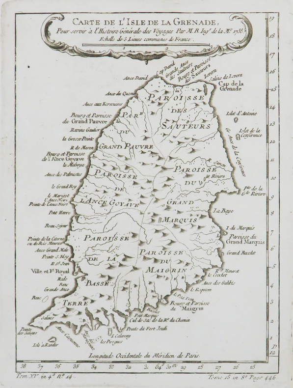
BELLIN (Jacques-Nicolas).
[GRENADE] Carte de l'isle de la Grenade.
1758. 207 x 153 mm.
Référence libraire : LBW02497
|
|
|
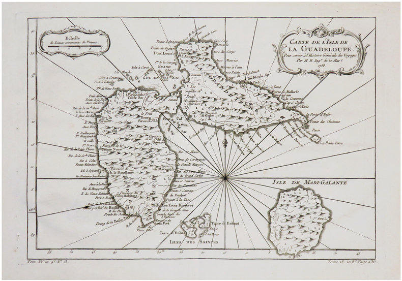
BELLIN (Jacques-Nicolas).
[GUADELOUPE] Carte de l'isle de la Guadeloupe.
1758. 213 x 306 mm.
Référence libraire : LBW-7256
|
|
|
BELLIN (Jacques-Nicolas).
[GUADELOUPE] Partie orientale de l'isle de la Guadeloupe appellée la Grande-Terre.
1764. 222 x 351 mm.
Référence libraire : LBW-2363

|
|
|
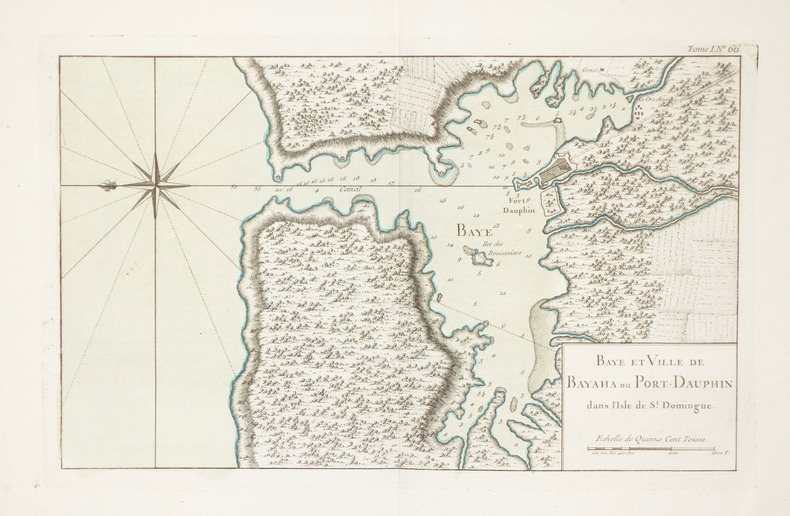
BELLIN (Jacques-Nicolas).
[HAITI] Baye et ville de Bayaha ou Port-Dauphin dans l'isle de St. Domingue.
1764. 212 x 348 mm.
Référence libraire : LBW-2361
|
|
|
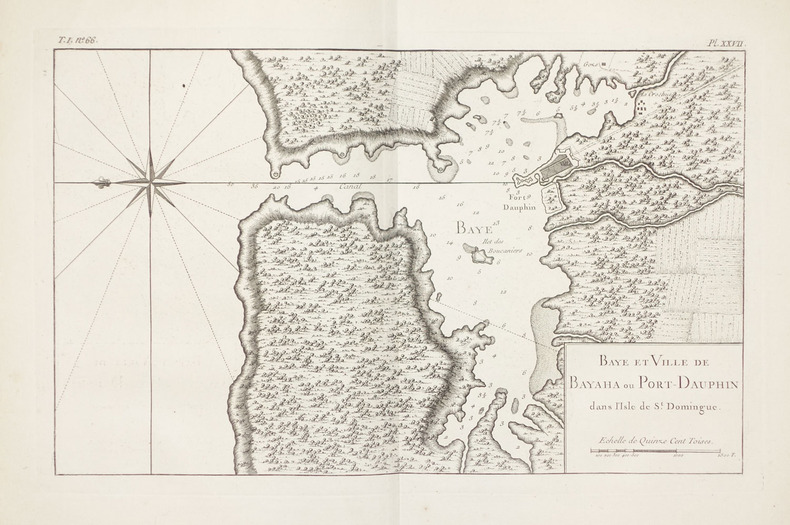
BELLIN (Jacques-Nicolas).
[HAITI] Baye et ville de Bayaha ou Port-Dauphin dans l'isle de St. Domingue.
1764. 212 x 348 mm.
Référence libraire : LBW-2350
|
|
|
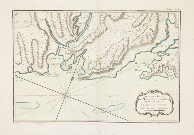
BELLIN (Jacques-Nicolas).
[HAITI] Carte des Bayes du Mesle des Flamands et de Cavaillon dans l'isle de St. Domingue.
1764. 221 x 331 mm.
Référence libraire : LBW-2359
|
|
|
BELLIN (Jacques-Nicolas).
[HAITI] Carte des Bayes du Mesle des Flamands et de Cavaillon dans l'isle de St. Domingue.
1764. 221 x 331 mm.
Référence libraire : LBW-2356

|
|
|
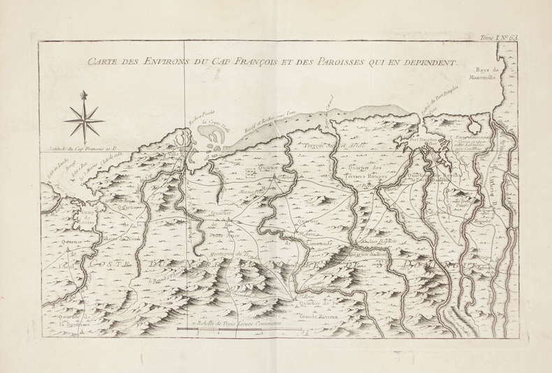
BELLIN (Jacques-Nicolas).
[HAITI] Carte des environs du Cap François et des paroisses qui en dépendent.
1764. 223 x 354 mm.
Référence libraire : LBW-2347
|
|
|
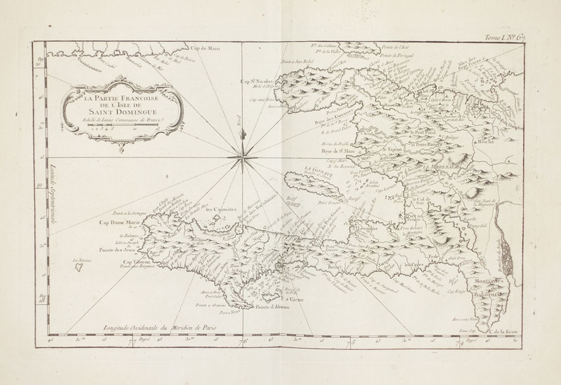
BELLIN (Jacques-Nicolas).
[HAITI] La partie françoise de l'isle de Saint Domingue.
1764. 216 x 345 mm.
Référence libraire : LBW-2351
|
|
|
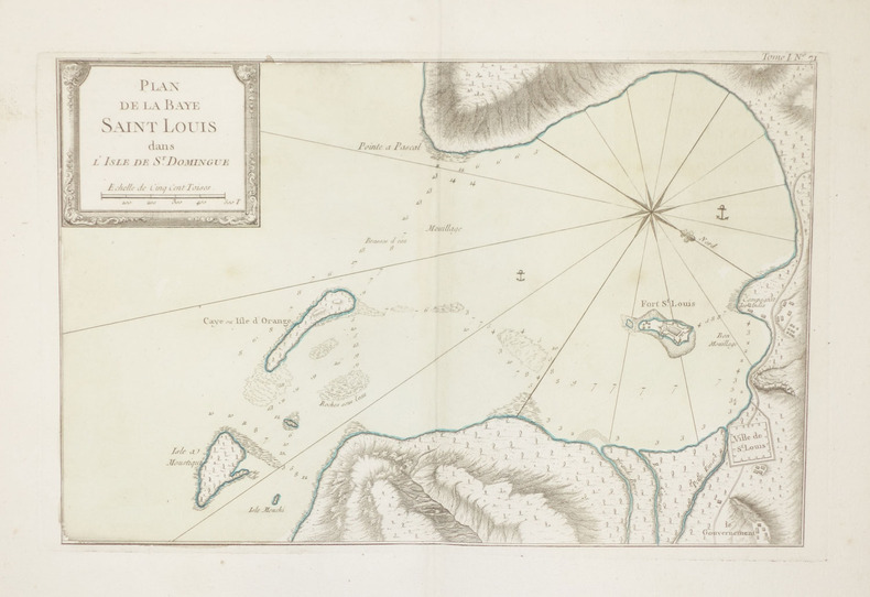
BELLIN (Jacques-Nicolas).
[HAITI] Plan de la Baye Saint Louis dans l'isle de St. Domingue.
1764. 224 x 348 mm.
Référence libraire : LBW-2358
|
|
|
BELLIN (Jacques-Nicolas).
[HAITI] Plan de la Baye Saint Louis dans l'isle de St. Domingue.
1764. 224 x 348 mm.
Référence libraire : LBW-2355

|
|
|
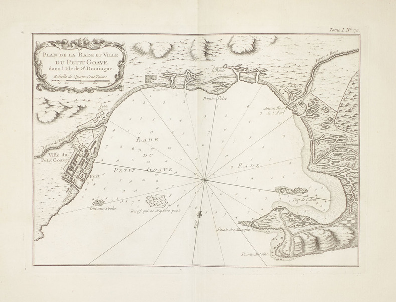
BELLIN (Jacques-Nicolas).
[HAITI] Plan de la rade et ville du Petit Goave dans l'isle de St. Domingue.
1764. 212 x 300 mm.
Référence libraire : LBW-2354
|
|
|
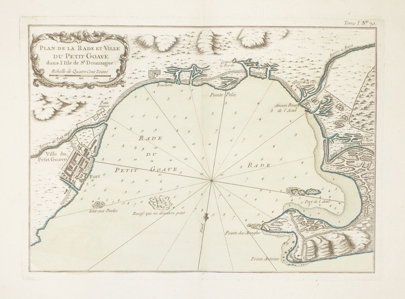
BELLIN (Jacques-Nicolas).
[HAITI] Plan de la rade et ville du Petit Goave dans l'isle de St. Domingue.
1764. 212 x 300 mm.
Référence libraire : LBW-2360
|
|
|
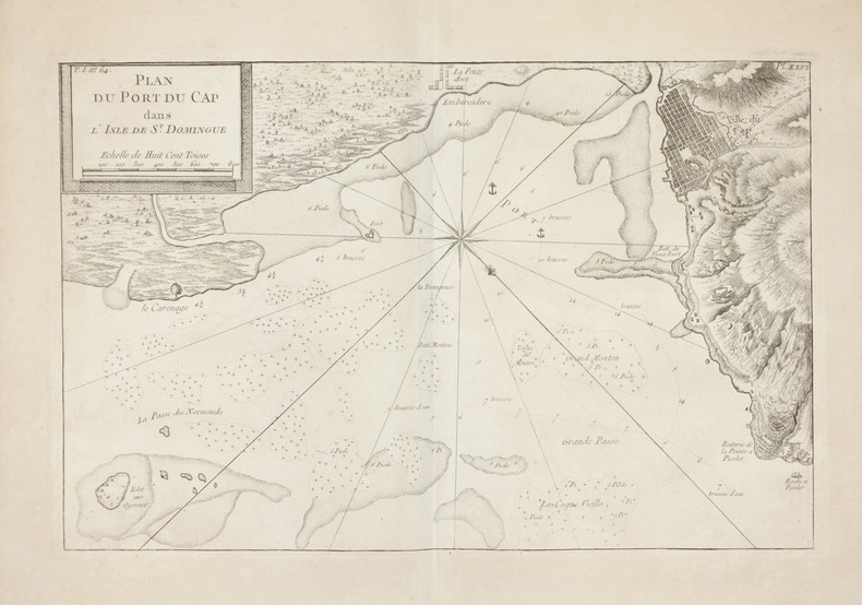
BELLIN (Jacques-Nicolas).
[HAITI] Plan du port du Cap dans l'isle de St. Domingue.
1764. 230 x 357 mm.
Référence libraire : LBW-2348
|
|
|
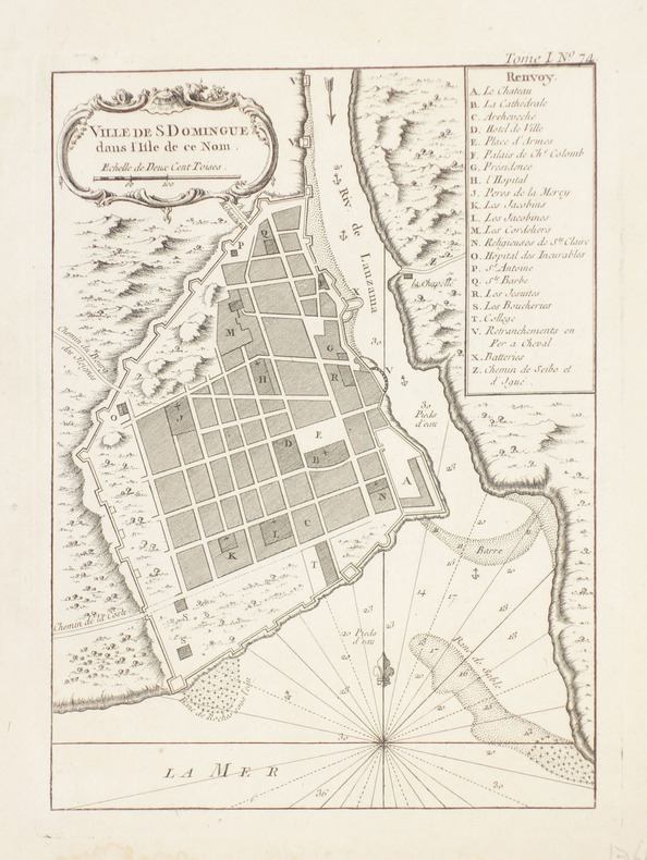
BELLIN (Jacques-Nicolas).
[HAITI] Ville de S. Domingue dans l'isle de ce nom.
1764. 219 x 162 mm.
Référence libraire : LBW-2357
|
|
|
BELLIN (Jacques-Nicolas).
[HAITI] Ville du Cap dans l'isle de St. Domingue.
1764. 221 x 352 mm.
Référence libraire : LBW-2349

|
|
|
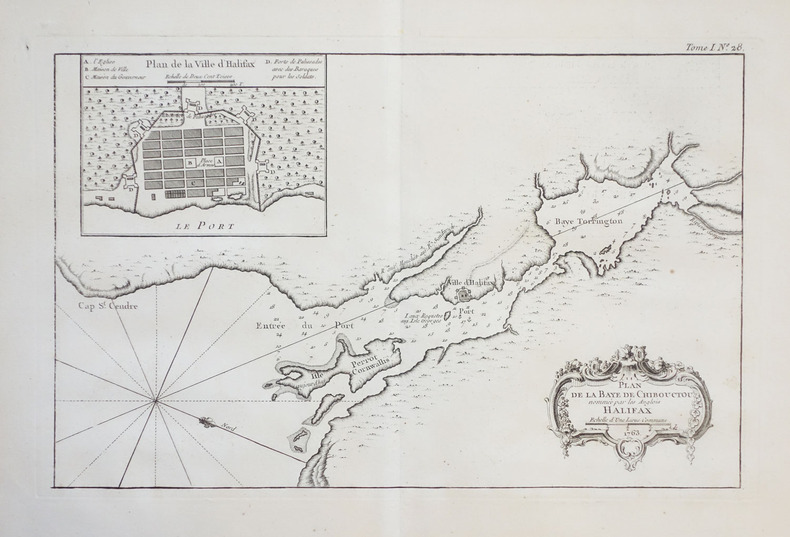
BELLIN (Jacques-Nicolas).
[HALIFAX] Plan de la baye de Chibouctou nommée par les Anglois Halifax.
1764. 221 x 349 mm.
Référence libraire : LBW-2381
|
|
|
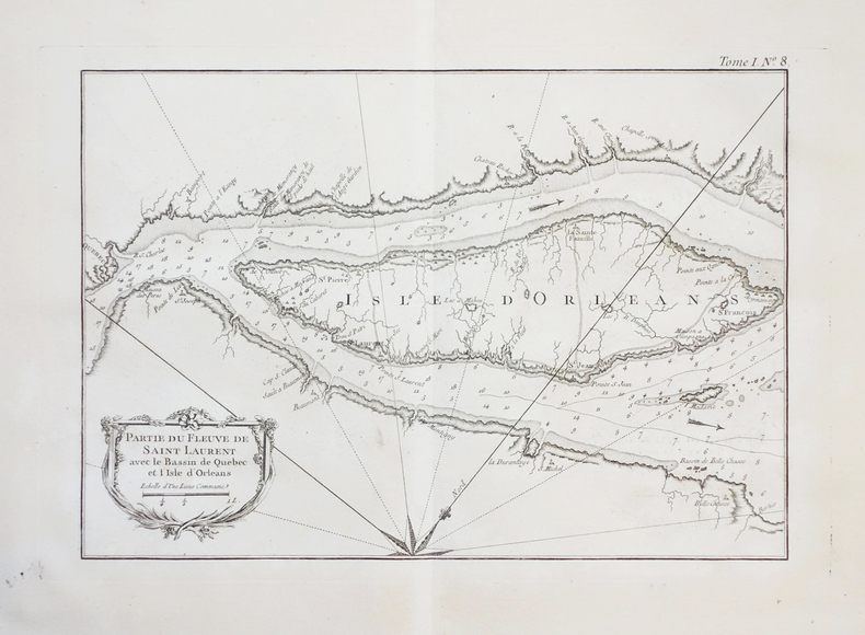
BELLIN (Jacques-Nicolas).
[ILE d'ORLEANS/QUEBEC] Partie du fleuve de Saint Laurent avec le bassin de Québec et l'isle d'Orléans.
[1764]. 208 x 297 mm.
Référence libraire : LBW-2382
|
|
|
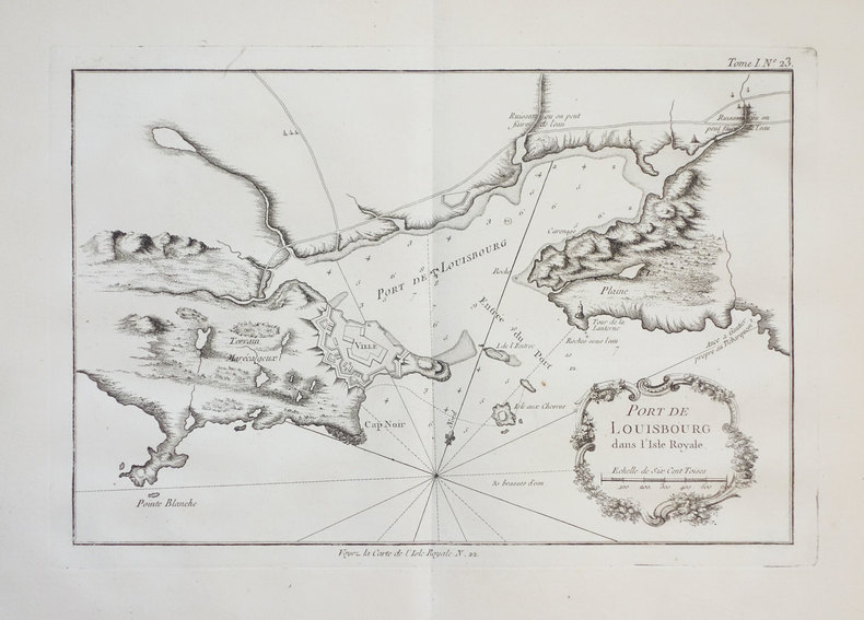
BELLIN (Jacques-Nicolas).
[ILE du CAP-BRETON] Port de Louisbourg dans l'Isle Royale.
1764. 204 x 312 mm.
Référence libraire : LBW-2379
|
|
|
BELLIN (Jacques-Nicolas).
[JAMAIQUE] Carte de l'isle de la Jamaique.
1758. 206 x 317 mm.
Référence libraire : LBW0249b

|
|
|
BELLIN (Jacques-Nicolas).
[JAMAIQUE] Carte des havres de Kingstown et de Port Royal.
1764. 195 x 297 mm.
Référence libraire : LBW-2262

|
|
|
BELLIN (Jacques-Nicolas).
[JAMAIQUE] Plan de la ville de Kingston.
1764. 199 x 294 mm.
Référence libraire : LBW-2346

|
|
|
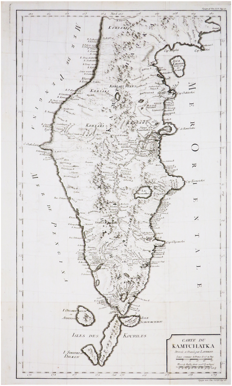
BELLIN (Jacques-Nicolas).
[KAMTCHATKA] Carte du Kamtchatka.
[circa 1750]. 521 x 294 mm.
Référence libraire : LBW-7018
|
|
|
BELLIN (Jacques-Nicolas).
[KYOTO] Plan de la ville de Meaco.
vers 1760. 193 x 277 mm.
Référence libraire : LBW-2269

|
|
|
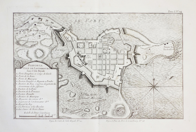
BELLIN (Jacques-Nicolas).
[LOUISBOURG/ILE du CAP-BRETON] Plan de la ville de Louisbourg dans l'Isle Royale.
1764. 208 x 340 mm.
Référence libraire : LBW-2385
|
|
|
BELLIN (Jacques-Nicolas).
[MALDIVES] Carte des isles Maldives.
1750. 218 x 155 mm.
Référence libraire : LBW02e58
|
|
|
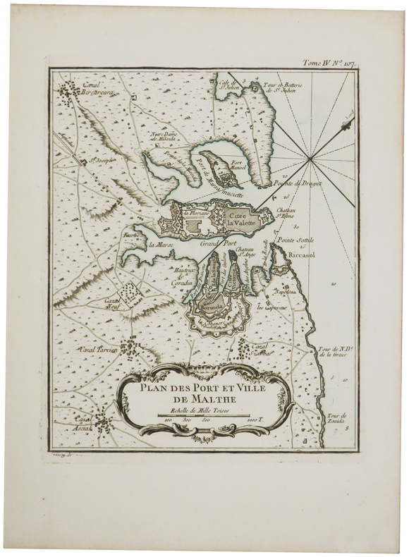
BELLIN (Jacques-Nicolas).
[MALTE] Plan des port et ville de Malthe.
[1764]. 220 x 179 mm.
Référence libraire : LBW-675
|
|
|
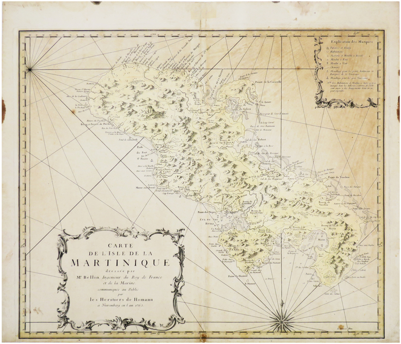
BELLIN (Jacques-Nicolas).
[MARTINIQUE] Carte de l'isle de la Martinique.
Nuremberg, Héritiers de Homann, 1762. 466 x 555 mm.
Référence libraire : LBW-4636
|
|
|
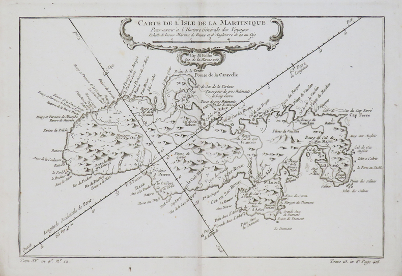
BELLIN (Jacques-Nicolas).
[MARTINIQUE] Carte de l'isle de la Martinique.
1758. 200 x 305 mm.
Référence libraire : LBW-4807
|
|
|
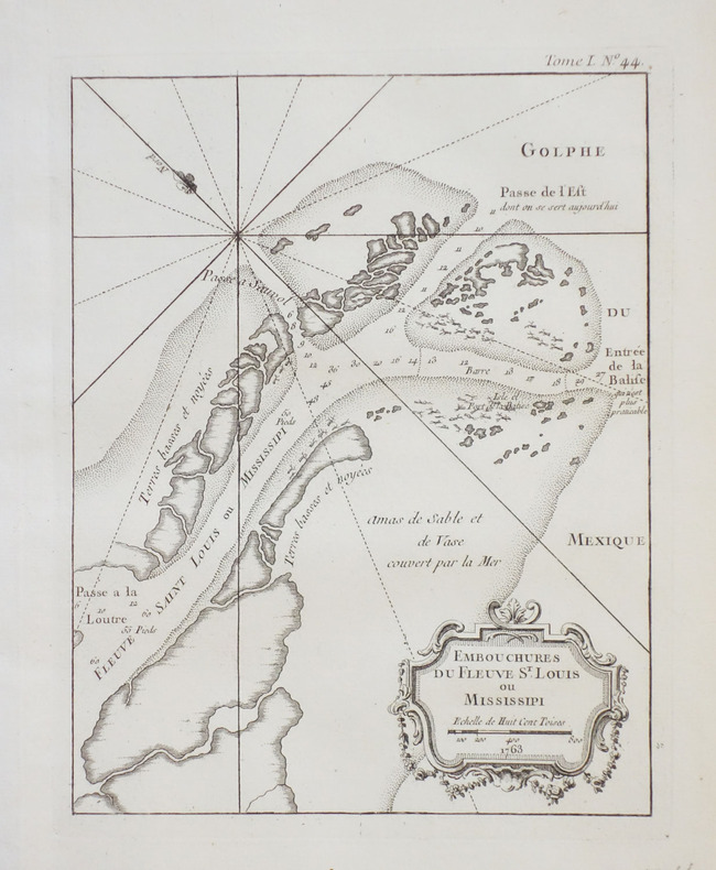
BELLIN (Jacques-Nicolas).
[MISSISSIPPI] Embouchures du fleuve St. Louis ou Mississipi.
1764. 215 x 167 mm.
Référence libraire : LBW-2391
|
|
|
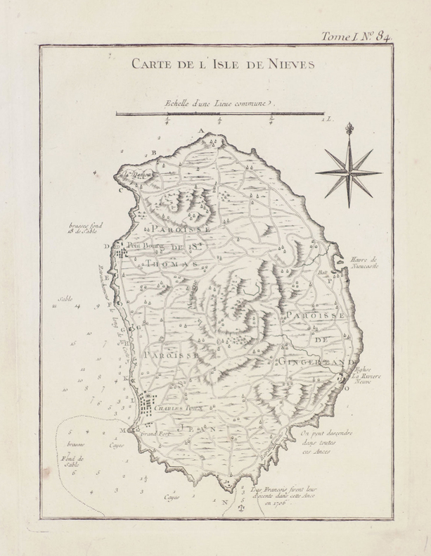
BELLIN (Jacques-Nicolas).
[NEVIS] Carte de l'isle de Nieves.
[1764]. 213 x 160 mm.
Référence libraire : LBW-2367
|
|
|
BELLIN (Jacques-Nicolas).
[OCÉAN INDIEN] Carte réduite de l'Océan Oriental ou mer des Indes.
1757. 557 x 865 mm.
Référence libraire : LBW-4877

|
|
|
BELLIN (Jacques-Nicolas).
[OUESSANT] 4me carte particulière des costes de Bretagne depuis l'anse de Goulven jusqu'à l'isle d'Ouessant.
1753. 582 x 812 mm.
Référence libraire : LBW-465
|
|
|
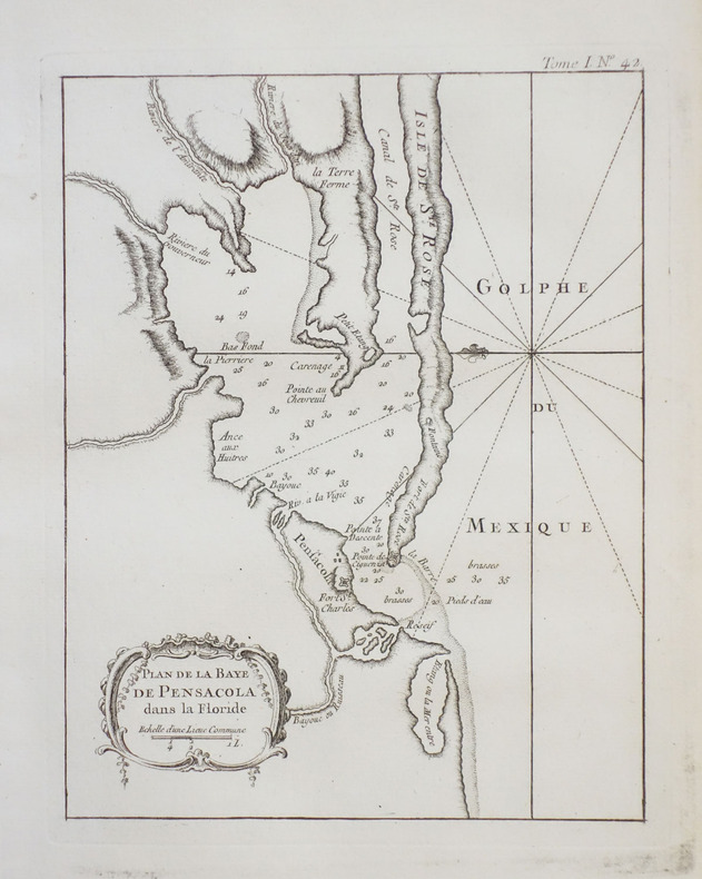
BELLIN (Jacques-Nicolas).
[PENSACOLA] Plan de la baye de Pensacola dans la Floride.
1764. 213 x 167 mm.
Référence libraire : LBW-2390
|
|
|
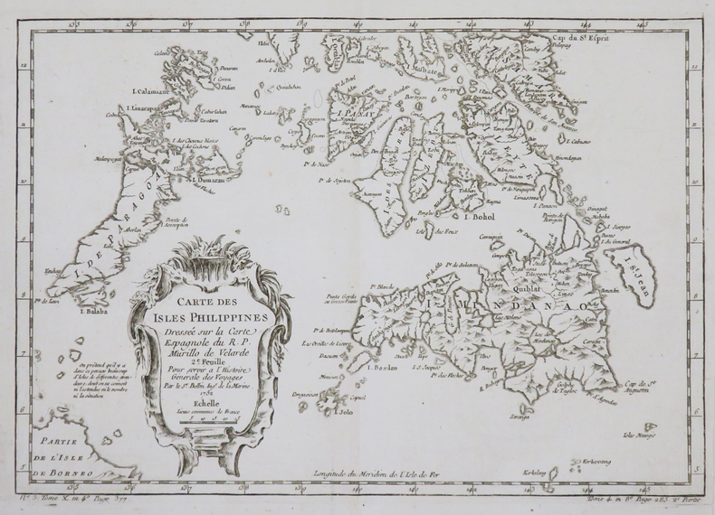
BELLIN (Jacques-Nicolas).
[PHILIPPINES] Carte des isles Philippines dressée sur la carte espagnole du R.P. Murillo de Velarde. 2e feuille.
1752. 209 x 302 mm.
Référence libraire : LBW02e55
|
|
|
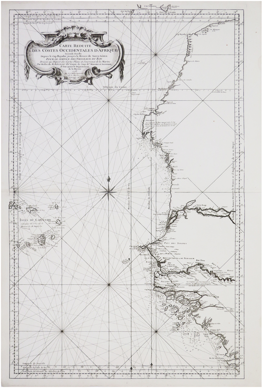
BELLIN (Jacques-Nicolas).
[SAHARA OCCIDENTAL/SIERRA LEONE] Carte réduite des costes occidentales d'Afrique. Seconde feuille depuis le cap Bojador jusqu'à la rivière de Sierra Leona.
Paris, Mr. Bellin, 1753. 885 x 552 mm.
Référence libraire : LBW-5948

|
|
|
BELLIN (Jacques-Nicolas).
[SAHARA OCCIDENTAL/SIERRA LEONE] Carte réduite des costes occidentales d'Afrique. Seconde feuille depuis le cap Bojador jusqu'à la rivière de Sierra Leona.
1753-1765. 882 x 550 mm.
Référence libraire : LBW-7692
|
|
|
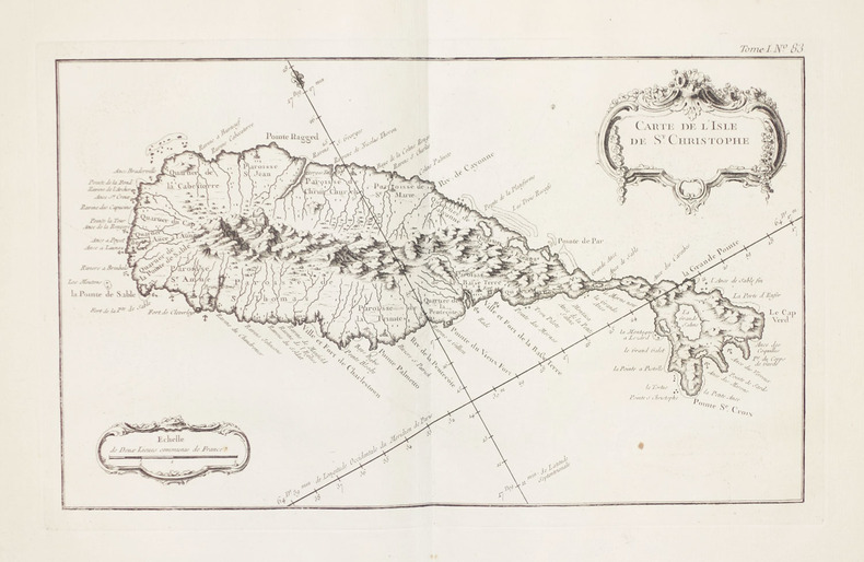
BELLIN (Jacques-Nicolas).
[SAINT KITTS] Carte de l'sle de St. Christophe.
1764. 203 x 337 mm.
Référence libraire : LBW-2366
|
|
|
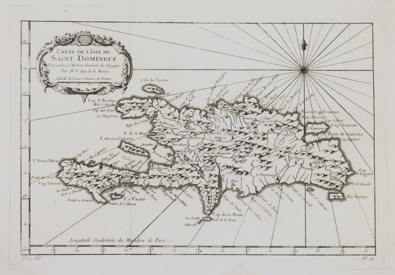
BELLIN (Jacques-Nicolas).
[SAINT-DOMINGUE] Carte de l'isle de Saint Domingue.
[circa 1760]. 189 x 287 mm.
Référence libraire : LBW0249f
|
|
|
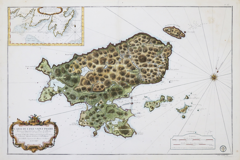
BELLIN (Jacques-Nicolas).
[SAINT-PIERRE-et-MIQUELON] Carte de l'isle Saint Pierre.
1763. 564 x 865 mm.
Référence libraire : LBW-4520
|
|
|
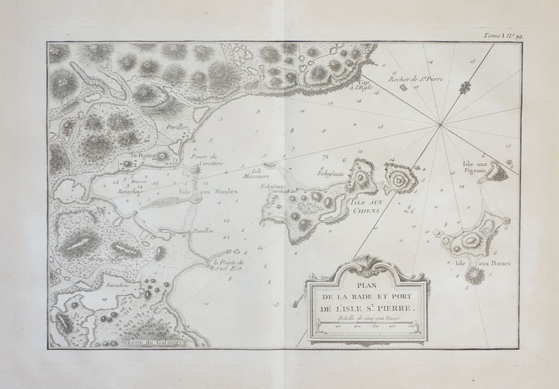
BELLIN (Jacques-Nicolas).
[SAINT-PIERRE-et-MIQUELON] Plan de la rade et port de l'isle St. Pierre.
1764. 214 x 328 mm.
Référence libraire : LBW-2378
|
|
|
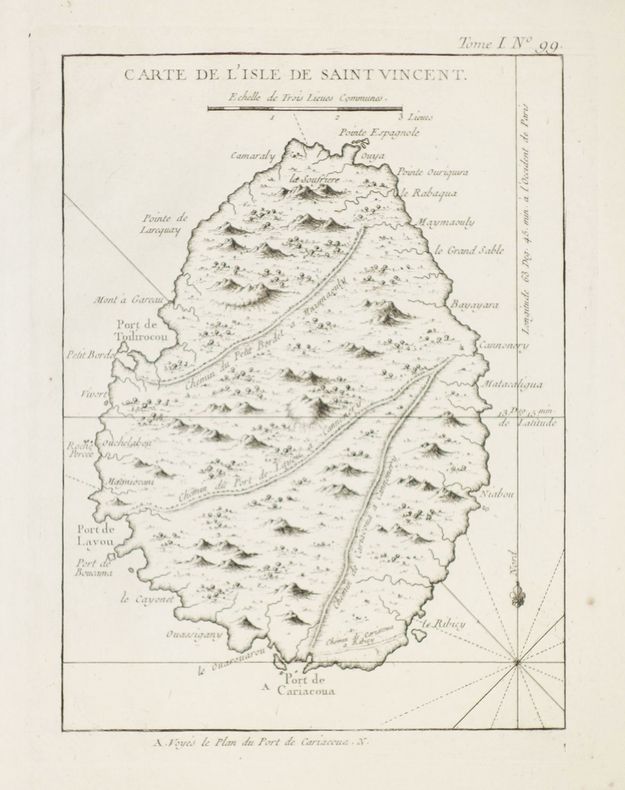
BELLIN (Jacques-Nicolas).
[SAINT-VINCENT] Carte de l'isle de Saint Vincent.
1764. 218 x 160 mm.
Référence libraire : LBW-2369
|
|
|
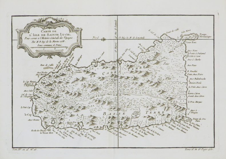
BELLIN (Jacques-Nicolas).
[SAINTE-LUCIE] Carte de l'isle de Sainte Lucie.
1758. 199 x 304 mm.
Référence libraire : LBW-4809
|
|
|
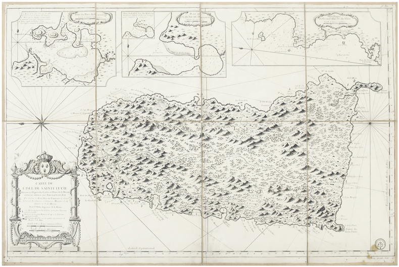
BELLIN (Jacques-Nicolas).
[SAINTE-LUCIE] Carte de l'isle de Sainte Lucie.
1763. En 8 sections montées sur toile et pliées, formant une carte de 592 x 902 mm ; titre manuscrit à l'encre au dos.
Référence libraire : LBW-6496
|
|
 Recevoir par e-mail
 Télécharger en PDF
 Flux RSS


