|
|
|
DAL PIAZ Giorgio -
La carta geologica delle Tre Venezie.
Roma, 1931, 8vo stralcio con copertina posticcia muta, pp. 309/314. - !! ATTENZIONE !!: Con il termine estratto (o stralcio) intendiamo riferirci ad un fascicolo contenente un articolo, completo in se, sia che esso sia stato stampato a parte utilizzando la stessa composizione sia che provenga direttamente da una rivista. Le pagine sono indicate come "da/a", ad esempio: 229/231 significa che il testo è composto da tre pagine. Quando la rivista di provenienza non viene indicata é perché ci è sconosciuta. - !! ATTENTION !!: : NOT A BOOK : “extract” or “excerpt” means simply a few pages, original nonetheless, printed in a magazine. Pages are indicated as in "from” “to", for example: 229/231 means the text comprises three pages (229, 230 and 231). If the magazine that contained the pages is not mentioned, it is because it is unknown to us.

|
|
|
dal Re Sebastiano (Chioggia 1525 - Roma 1575)
IL VERO DISEGNO DI VICOVARO OCCUPATO DA IMPERIALI ET RECUPERATO DALLA CHIESA A DI XIIII FEBRARO M.D.LVII.
Magnifico esemplare della rarissima pianta di Vicovaro pubblicata in occasione della battaglia del febbraio 1557.In alto a destra, in un riquadro, è inciso il titolo: IL VERO DISEGNO DI VICOVARO OCCUPATO DA IMPERIALI ET RECUPERATO DALLA CHIESA A DI XIIII FEBRARO M.D.LVII. Nell’angolo in basso a sinistra si trova la firma dell’incisore della lastra Sebastianus .f. che identifica Sebastiano dal Re. Opera priva di scala grafica e orientazione. Acquaforte e bulino, dimensioni mm 270x387.Veduta prospettica, di Vicovaro assediata (1557), vista da occidente firmata in lastra Sebastianus .f. Nel 1556 la cittadina fu presa dal Duca d’Alba, vicerè di Napoli, alleato dei Colonna contro papa Paolo IV; tornò alla Chiesa nell’anno successivo, il 14 febbraio, dopo una cruenta battaglia. L’attribuzione della lastra a Sebastiano dal Re è rigettata da Destombes, seguito dalla Borroni Salvadori e, più recentemente, daAlessia Alberti, che identificano il Sebastianus .f. della firma in Sebastiano de Valentinis. Tuttavia, lo stile è evidentemente diverso da quello dell’incisore udinese, mentre l’originaria attribuzione al De Re, che era attivo a Roma proprio in quegli anni, sembra molto più plausibile e congruente. Sebbene priva di indicazioni editoriali la lastra è sicuramente stata in possesso, e quindi anche stampata, da Antonio Lafreri.L’opera, infatti, è compresa tra le “Città & Fortezze” nel catalogo della tipografia Lafreri (1573 circa, n. 82), descritta come “Vicovaro”. La matrice venne ereditata da Claudio Duchetti e quindi da Giacomo Gherardi. Possiamo identificare questa lastra con quella inserita nel catalogo redatto per la vedova di Gherardi, Quintilia Lucidi, del 17-19 ottobre 1598 (n. 45 descritta come “Vicovaro”). La matrice venne acquisita, nel 1602, da Giovanni Orlandi. Nel 1614, con il trasferimento di Orlandi a Napoli, la matrice fu ceduta a Hendrick van Schoel.Come più volte osservato, le lastre vennero poi cedute a Francesco de Paoli, come documentato dall’inventario della vendita del 2 novembre 1633. Possibile quindi l’esistenza di un’ulteriore stesura della lastra, della quale tuttavia non abbiamo avuto riscontro.Bibliografiaa) Alberti (2010): n. 87; Brandhuber-Juffinger (2011); n. 96; Borroni Salvadori (1980): n. 218; Christie’s (1998): n. 1049; Destombes (1970): n. 113; De Vries (1981): n. 273; Edwards (1933): n. 70; Hatfield House (1992): n. 85; Lafreri (2014): n. 91; Phillips (1914): n. 71; Ruge (1904-16): IV, n. 85.84 & n. 89.93 & n. 90.95 ; Shirley (2004): II, n. 65; Wieder (1915): n. 142. Alberti (2005): p. 17, F.1; Alberti (2009): p. 128, n. A.79; Fauser (1978): vol. 2, p. 837, n. 14859; Pagani (2012): p. 83; Pognon (1968): p. 15; Tooley (1939): n. 594. Magnificent example of the very rare map of Vicovaro published during the battle of February 1557.Perspective view of a besieged Vicovaro (1557), seen from the west.At the top right, the title: IL VERO DISEGNO DI VICOVARO OCCUPATO DA IMPERIALI ET RECUPERATO DALLA CHIESA A DI XIIII FEBRARO M.D.LVII. In the lower left corner the signature "Sebastianus .f.", that identifies Sebastiano dal Re. Map without graphic scale and orientation. Etching and engraving.Bibliography:a) Alberti (2010): n. 87; Brandhuber-Juffinger (2011); n. 96; Borroni Salvadori (1980): n. 218; Christie’s (1998): n. 1049; Destombes (1970): n. 113; De Vries (1981): n. 273; Edwards (1933): n. 70; Hatfield House (1992): n. 85; Lafreri (2014): n. 91; Phillips (1914): n. 71; Ruge (1904-16): IV, n. 85.84 & n. 89.93 & n. 90.95 ; Shirley (2004): II, n. 65; Wieder (1915): n. 142. Alberti (2005): p. 17, F.1; Alberti (2009): p. 128, n. A.79; Fauser (1978): vol. 2, p. 837, n. 14859; Pagani (2012): p. 83; Pognon (1968): p. 15; Tooley (1939): n. 594. Bifolco-Ronca (2018): tav. 1202

|
|
|
Dall'Acqua Cristoforo
Nazioni diverse dell'Impero Russo
Incisione in rame di mm 100 x 179 alla battuta su carta spessa, in perfetta coloritura d'epoca di Lazaretti come indicato nella stampa. Esemplare privo di difetti. L'immagine era compresa nella edizione italiana dell'opera di Andrew Swinton :" Viaggio in Norvegia, in Danimarca ed in Russia negli anni 1788, 89, 90 e 91 / da Swinton ; tradotto dal conte Luigi Bossi ; con note del medesimo, e con tavole in rame colorate" stampata a Milano da Sonzogno nel 1816.
|
|
|
DALL'ACQUA Marzio e VECCHIARELLI Varo A. a cura.
Mostra storico-documentaria Il Territorio rappresentato, temi e problemi della cartografia nelle collezioni pubbliche parmensi sec. XIV-XIX. Catalogo dell mostra tenuta a Parma nel 1979.
In-8° carrè pp. 35 con 20 tav. f.t. Bross. edit. con timbri all'interno.
|
|
|
DALONGEVILLE, Rémi
Cahier Hors-Texte
1971 R. Dalongeville, I.G.P.M.O., Beyrouth - Octobre 1971 - In-4, cartonnage noir muet - Sans pagination - Cahier de planches et de cartes dépliantes + Très nombreuses photographies en N&B contrecollées in texte - Nombreuses reproductions manuscrites et textes dactylographiés
Referencia librero : 120362

|
|
|
DALRYMPLE (Alexander), FRÉVILLE (M. de Trad.)
Voyages dans la mer du Sud, par les Espagnols et les Hollandois.
Paris, Chez Saillant & Nyon, Pissot, 1774. In-8 (20,5x13cm) de 2ff.-XIV-1f. 502pp.- 1f., veau marbré époque, dos à nerfs orné avec pièce de titre grenat, tranches rouges, illustré de 3 cartes dépliantes in fine. Frottements, coins et coupes usés, coiffes arasées, débuts de fentes, quelques rousseurs
Referencia librero : PHO-2287

|
|
|
Danckaert L.
Abraham Ortelius (1527-1598), cartograaf en humanist.
, Brussel/Antwerpen/Turnhout, KBR/Museum Plantin-Moretus/Brepols,1998., softcover In-4, 208 pp.rijkelijk geill.in kleur en zw/w, ISBN 905622025x.
Referencia librero : 19106
|
|
|
Danckaert L.
Abraham Ortelius (1527-1598), cartograaf en humanist.
Brussel/Antwerpen/Turnhout,, KBR/Museum Plantin-Moretus/Brepols,1998., Hardcover In-4, 208 pp.rijkelijk geill.in kleur en zw/w, ISBN 905622025x.
Referencia librero : 67238
|
|
|
DANCKAERT, L. - MEURANT, R. - BALIS, J. et alii.
Credit Communal de Belgique et les plans de Bruxelles - Le Meiboom - Le premier Jardin botanique de Bruxelles, etc.
in-4°, 128 pp.,nombreuses illustrations. COMME NEUF ! [SUP]
|
|
|
DANCKAERT, L. - MEURANT, R. - BALIS, J. et alii.
Gemeentekrediet van België en de plannen van Brussel - De Meiboom - De eerste plantentuin van Brussel, etc.
in-4°, 143 pp., geillustreerd. NIEUW ! [SUP*]
|
|
|
DANCKAERT, Lisette et Alii.
CINQ ANNEES D'ACQUISITIONS 1974 - 1978 : Cartes et Plans.
Catalogue d'exposition in-4° broché. Quelques planches. Très bel exemplaire, très frais. [SO-7]*3]
|
|
|
DANCKAERT, Lisette et Alii.
Vijf jaar aanwinsten 1969-1973 : KAARTEN EN PLANS.
Catalogue d'exposition in-4° broché. 20 pp, quelques planches. NEW - NEUF. [MA-4]
|
|
|
DANCKAERT, Lisette et Alii.
Vijf jaar aanwinsten 1974-1978 : KAARTEN EN PLANS.
Catalogue d'exposition in-4° broché. 28 pp, quelques planches. NEW - NEUF. [MA-4*5]
|
|
|
DANCKAERT, Lisette.
L’Évolution territoriale de Bruxelles. La cartographie de 1550 à 1840.
Hardcover petit in-4°, 2 volumes brochés : 1 vol. de texte + 1 vol. contenant 6 grands plans dépliants, sous étui d'édition cartonné.- Peu courant. Etat proche du NEUF ! [P-51]
|
|
|
DANCKAERT, Lisette.
Negentien Belgische Steden in Kaart en Prent.
in-4° oblong, 95 pp. + 24 pages de planches en noir, broché. Très bel exemplaire. [P-51]
|
|
|
DANCKAERT, Lisette.
Plans et vues de dix-neuf villes belges.
in-4° oblong, 95 pp. + 24 pages de planches en noir, broché. Très bel exemplaire, très frais [P-51*]
|
|
|
Danckerts (1635-1701) Justus.
Ducatus Mediolanensis Parmensis et Montisferrati.
Incisione in rame (cm. 51x59) abilmente colorata da mano coeva. Non comune rara e dettagliata carta geografica tratta dall'atlante di Danckerts.. .

|
|
|
Daney,Charles.
Périgord. Noir, Blanc, Vert, Pourpre. . . et les autres.
<br/> TITOLO: Périgord. Noir, Blanc, Vert, Pourpre... et les autres. <br/> AUTORE: Daney,Charles.<br/> CURATORE: Photographies Régine Rosenthal. Testo in francese.<br/> EDITORE: La Renaissance du Livre<br/> DATA ED.: 2002,<br/> EAN: 9782804606855

|
|
|
DANGER René
"Traité pratique d'arpentage; notions générales, Lever des détails, Nivellement, Bornage, Cadastre, Remembrement, Cubage des bois, Formulaire."
Paris, Garnier Frères, 1928. "12 x 18, 306 pp., 172 figures et hors-texte, reliure d'édition pleine percaline, bon état (cachet d'ex-propriétaire; couverture légèrement insolée)."
Referencia librero : 90916
|
|
|
Danin, Avinoam
Distribution Atlas of Plants in the Flora Palaestina Area [SERIES]: Publications of the Israel Academy of Sciences and Humanities - Section of Sciences
28X19 cm. 519 pages. Hardcover in dust jacket. In good condition. PLEASE NOTE: This item is overweight. We may ask for extra shipping costs.
|
|
|
DANKERTS Cornelius / GAZZERA Costanzo
Sedes BELLI in Dauphinae et Provincae nec non DUCATUS SABAUDIAE, PRINCIPATUS PEDEMOINTII , DUCATUS MONTISFERRATI. Riproduzione ANASTATICA a COLORI della CARTA GEOGRAFICA del PIEMONTE edita a Amsterdam (tra il 1631 e il 1717). Nell'opuscolo di presentazione della ristampa anastatica della "Storia delòle Alpi Marittime di Pietro GIOFFREDO.
Opuscolo in-8° (cm. 20,9x14,9), pp. (20) inclusi i piatti + la grande riproduzione fuori testo della CARTA GEOGRAFICA di cm. 60x54 ripiegata fuori testo (impressa solo recto). Brossura editoriale. Contiene: 1) SOFFIETTI Isidoro, due pagine di storia dell'opera, con menzione dei manoscritti dell'Archivio di Stato di Torino. 2)riprod. del frontespizio dell'opera. 3) 13 pagine in fitti ma nitidi caratteri, riproducenti la lunga introduzione di Costanzo GAZZERA sulla storia, sull'mportanza, sui contenuti, l'attendibilità e i criteri dei 7 volumi dell'opera del GIOFFREDO, sua biografia e contesto storico.
|
|
|
DARDANO A.
Etiopia carta dimostrativa alla scala 1: 2.000.000 (edizione riservata), viste le segnature apportate supponiamo possa essere stata usata per scopi militari.
Formato cm. 85 X 96, a colori, più volte ripiegata con piccolo taglio riparato.
|
|
|
DARDANO A. a cura.
Carta della Somalia scala 1:2.000.000, bozza per uso di ufficio. Estratto dalla carta dell'Africa Orientale.
Formato cm. 64 X 96,5 a colori e più volte ripiega.a con taglietti e lievi bruniture ai margini bianchi.
|
|
|
Dardano Achille
Africa Orientale - Carta dimostrativa fisico-politica (Foglio 4)
Carta costruita, redatta e disegnata dall'A., a cura del Ministero delle Colonie - Ufficio studi e propaganda - Servizio cartografico; scala 1:2.000.000 (33f).
|
|
|
Dardano Achille, Hodnig (Odenigo) Armando
L'Europa etnico-linguistica. Atlante descrittivo in tre Carte speciali colorite con Testo dimostrativo.
(Cartografia - Etnologia - Storia delle nazionalità europee - Popoli d'Europa e regioni adiacenti) In 4° piccolo (cm 30 x 20), brossura editoriale verde con titoli in nero, pp. 39,(1) con il testo di Armando Hodnig (poi Odenigo) su due colonne e tre grandi carte a colori più volte ripiegate (cm 55 x 71), realizzate da Achille Dardano, conservate in una tasca sul piatto posteriore : Carta etnico-linguistica dell'Europa (cm 55 x 71) - Carta etnico-linguistica dell'Europa Centrale (cm 56,5 x 76,5) - Carta etnico-linguistica dell'Oriente Europeo (cm 56,5 x 76,5). Ottimo stato di conservazione.
|
|
|
DARDANO Achille.
Africa carta alla scala 1:10.000.000 stampata in colore verde.
Formato cm. 93 X 100 Più volte ripiegata conmlievi taglietti alle piegature, più evidente a quello centrale nella parte inferiore.

|
|
|
DARDANO,Achille(Ministero delle Colonie)
Africa Orientale Italiana.Carta dimostrativa fisico-politica.Costruita,redatta e disegnata dal Direttore del Servizio Cartografico
1 Vol. pag. Carta su scala 1:2.000.000, pieghevole,per uno sviluppo complessivo di 120x110. A colori. Proiezione policentrica. In custodia editoriale rifatta PROG 20583 CATT_ATT 31
|
|
|
Darwin Charles
Viaggio di un naturalista intorno al mondo

|
|
|
DAUTY / CHARLE / DUMORTIER / RORET
CARTE / NOUVEL ATLAS NATIONAL / ISERE 1833. dimensions 43 cm x 77 cm. Dauty Editeur propriétaire et RORET libraire à Paris. carte entoilée sous un fourreau et étui époques.
Referencia librero : 2673

|
|
|
Dauvillier,Alexandre.
Le volcanisme lunaire et terrestre. Origine des continents, des océans et des atmosphères - L'énergie géothermique.
<br/> NOTE: copia intonsa e in buono stato.<br/> TITOLO: Le volcanisme lunaire et terrestre. Origine des continents, des océans et des atmosphères - L'énergie géothermique. <br/> AUTORE: Dauvillier,Alexandre.<br/> EDITORE: Editions Albin Michel<br/> DATA ED.: 1958,<br/> COLLANA: Collection Sciences d'Aujourd'hui.<br/> Première édition, 3e mille.
|
|
|
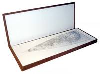
David Woodward; Hermon Dunlap Smith Center for the History of Cartography
The Holzheimer Venetian Globe Gores of the Sixteenth Century Signed by Author
Madison Wisc. : Juniper Press 1987. Hardcover. Like New. Signed. Maroon cloth portfolio clamshell case that contains 24 facsimiles sheets 24" x 9" unbound. Case is in near fine condition with very minor scuffing. Facsimiles in fine condition. Also includes descriptive booklet Cloth 8vo hardcover with marbled boards. Cover and binding are in fine condition text has clear/unmarked pages. Booklet is signed by David Woodward on its limitation leaf. - Published in a limited edition of 150 copies no. 64.This is an oversized or heavy book that requires additional postage for international delivery outside of Canada and the US. <br><br> Madison [Wisc.] : Juniper Press hardcover
Referencia librero : 1201030076
|
|
|
DAVOLI Zeno, SANFELICI Roberto
TERRE DI LANGOBARDIA. La "Lombardia" e il Ducato Estense nella Cartografia a stampa, 1796-1866.
In-8 oblungo (cm. 24.70), cartonato editoriale, sovracoperta editoriale illustrata, pp. 303, (1), con illustrazioni, nel testo, soprattutto a colori. Minimi segni d’uso alle cuffie e tracce di polvere, sempre alla sovracoperta; peraltro, volume in ottimo stato (nice copy).
|
|
|
DAVY, Marie-Madeleine
Encyclopédie des mystiques (4 tomes)
1977 - broché - Editions Seghers - 1977 et 1978 - 4 volumes in-12 (format poche) brochés - 607 + 655 + 429 + 472 pages - Ouvrages collectifs sous la direction de Marie-Madeleine DAVY - Marian BERLEWI (Conception et réalisation) - Tome 1 : "Chamanisme, Grecs, Juifs, gnose, christianisme primitif" - Tome 2 : "Christianisme occidental, ésotérisme, protestantisme, islam" - Tome 3 : "Egypte, Mésopotamie, Iran, hindouisme, bouddhisme indien" - Tome 4 : "Bouddhismes tibétain, Chinois, Japonais, Yi king, tch'an, zen"
Referencia librero : 640

|
|
|
Dawson, Joan, etc
Les Cahiers. La Société historique acadienne. Vol. 15, no. 4
La Société Historique Acadienne In-8 Couverture souple Moncton/Nouveau-Brunswick 1984
Referencia librero : 2987
|
|
|
Day, James M
Maps of Texas 1527-1900 The Map Collection of the Texas State Archives new in publisher's shrinkwrap
Mansfield Centre Connecticut: Martino Fine Books 1997. Brand New in perfect condition. STILL SEALED in the publisher's clear plastic SHRINKWRAP. NO rubbing. NO fading. Bright clean square and tight. Sharp corners. NO owner's name or bookplate. NO remainder mark. Fresh and crisp -- obviously never read. Limited to 100 copies. n. d. but 1997. Reprint of the expanded 1964 edition. The best edition of the best cartography of Texas maps. Describes and comments on some 1000 Texas maps from 1527 to 1900. Entries identify full title publisher map maker date content scale color dimensions etc. Illustrated. Bound in the original gilt-stamped bluish-green cloth. Moeb's U. S. REFERENCE-IANA 748: "A basic reference in the field. This 1964 issue contains 88 maps not in the prior printing." See Ristow 325. From the publisher: "This important work is the most extensive cartography devoted exclusively to Texas maps. It comprises the map collection of the Texas State Archives. In all approximately 1000 maps are meticulously described. There are excellent annotations describing coloring rivers mountains towns forts Indian tribes trails trading posts and a host of other subjects depicted in the maps. There is also interesting background information about the history of the territory or the map described. And of course dimensions and scales are given.". Reprint of the expanded 1964 edition. Hardcover. New/in publisher's shrinkwrap. iv 178pp. Great Packaging Fast Shipping. Martino Fine Books Hardcover
Referencia librero : 017659 ISBN : 1578980542 9781578980543
|
|
|
Day, James M
Maps of Texas 1527-1900 The Map Collection of the Texas State Archives
Mansfield Centre Connecticut: Martino Fine Books 1997. Brand New in perfect condition just removed from the publisher's shrinkwrap so we could write this description. NO rubbing. NO fading. Bright clean square and tight. Sharp corners. NO owner's name or bookplate. NO remainder mark. Fresh and crisp -- obviously never read. Limited to 100 copies. n. d. but 1997. Reprint of the expanded 1964 edition. The best edition of the best cartography of Texas maps. Describes and comments on some 1000 Texas maps from 1527 to 1900. Entries identify full title publisher map maker date content scale color dimensions etc. Illustrated. Bound in the original gilt-stamped bluish-green cloth. Moeb's U. S. REFERENCE-IANA 748: "A basic reference in the field. This 1964 issue contains 88 maps not in the prior printing." See Ristow 325. From the publisher: "This important work is the most extensive cartography devoted exclusively to Texas maps. It comprises the map collection of the Texas State Archives. In all approximately 1000 maps are meticulously described. There are excellent annotations describing coloring rivers mountains towns forts Indian tribes trails trading posts and a host of other subjects depicted in the maps. There is also interesting background information about the history of the territory or the map described. And of course dimensions and scales are given.". Reprint of the expanded 1964 edition. Hardcover. New/No jacket as issued. iv 178pp. Great Packaging Fast Shipping. Martino Fine Books Hardcover
Referencia librero : 018405 ISBN : 1578980542 9781578980543
|
|
|
DE AMBROSIS Delfino -
Appunti di topologia ad uso dei mappatori.
Firenze, 1922, 8vo stralcio con copertina posticcia muta, pp. 12 con 10 illustrazioni e 3 carte (una ripiegata) . - !! ATTENZIONE !!: Con il termine estratto (o stralcio) intendiamo riferirci ad un fascicolo contenente un articolo di rivista, sia che esso sia stato stampato a parte utilizzando la stessa composizione sia che provenga direttamente da una rivista. Le pagine sono indicate come "da/a", ad esempio: 229/231 significa che il testo è composto da tre pagine. Quando la rivista di provenienza non viene indicata é perchè ci è sconosciuta. - !! ATTENTION !!: : NOT A BOOK : “estratto” or “stralcio” means simply a few pages, original nonetheless, printed in a magazine. Pages are indicated as in "from” “to", for example: 229/231 means the text comprises three pages (229, 230 and 231). If the magazine that contained the pages is not mentioned, it is because it is unknown to us.

|
|
|
De Amicis Edmondo
Ricordi di Londra di Edmondo De Amicis seguiti da Una visita ai quartieri poveri di Londra di L. Simonin
illustrato da 21 incisioni

|
|
|
De BIE J., DEPAUW C., HUVENNE P., et autres
Gérard Mercator et la géographie dans les Pays-Bas Méridionaux (16e siècle)/Gerard Mercator en de geografie in de Zuidelijke Nederlanden (16de eeuw).
Anvers, Ville d'Anvers , Musée Plantin et Cabinet des Estampes, 1994. 21 x 30, 175 pp., nombreuses illustrations en couleurs et en N/B, broché, très bon état (1 cachet d'ex-propriétaire).
Referencia librero : 91025
|
|
|
DE BRABANDER, G.
NAKAARTEN OVER ANTWERPEN.
Brugge, Van de Wiele, 1988 Gebonden, linnen, originele geillustreerde uitgeversomslag in kleur, 32x25cm, 160pp, geillustreerd in kleur. ISBN 9069660393.
Referencia librero : 764
|
|
|
DE CHAURAND DE ST. EUSTACHE Enrico -
Circa la classificazione delle carte in riguardo ad una istituenda bibliografia di cartografia.
Firenze, 1923, 8vo stralcio con copertina posticcia muta, pp. 569/580. - !! ATTENZIONE !!: Con il termine estratto (o stralcio) intendiamo riferirci ad un fascicolo contenente un articolo di rivista, sia che esso sia stato stampato a parte utilizzando la stessa composizione sia che provenga direttamente da una rivista. Le pagine sono indicate come "da/a", ad esempio: 229/231 significa che il testo è composto da tre pagine. Quando la rivista di provenienza non viene indicata é perchè ci è sconosciuta. - !! ATTENTION !!: : NOT A BOOK : “estratto” or “stralcio” means simply a few pages, original nonetheless, printed in a magazine. Pages are indicated as in "from” “to", for example: 229/231 means the text comprises three pages (229, 230 and 231). If the magazine that contained the pages is not mentioned, it is because it is unknown to us.

|
|
|
De Coster Charles Theodore Henri
La Zelanda (Neerlandia) per Carlo De Coster. Con 50 disegni di Adolfo Dillens 1 carta geografica e 1 pianta
8°, mm 230x160, pp. 208, brossura editoriale illustrata, una carta ripiegata in antiporta e 1 pianta ripiegata a p. 81. Buon esemplare con dorso ben restaurato, qualcee segno del tempo e piccole macchioline sparse. Collana Biblioteca di viaggi XXVIII.

|
|
|
DE CROY [Collectif, ed.]
Albums de Croy. Tome VI (6): Comté de Hainaut III : Prévotés de Mons et Soignies
Bruxelles, Crédit Communal de Belgique 1990 280pp., avec 104 illustrations pleine-page en couleurs, reliure cart., jaq. ill., 34cm., bel état, poids: 2.5kg., B107049
Referencia librero : B107049
|
|
|
DE CROY [Collectif, ed.]
Albums de Croy. Tome VIII (8): Comté de Hainaut V : Chatellenie d'Ath
Bruxelles, Crédit Communal de Belgique 1989 336pp., avec 126 illustrations pleine-page en couleurs, reliure cart., jaq. ill., 34cm., bel état, poids: 2.8kg., B107050
Referencia librero : B107050
|
|
|
DE CROY [Collectif, ed.]
Albums de Croy. Tome XI (11): Tournai - Tournaisis
308pp., avec 98 illustrations pleine-page en couleurs, reliure cart., jaq. ill., 34cm., bel état, poids: 2.7kg., B107051
|
|
|
DE CROY [Collectif, ed.]
Albums de Croy. Tome XI (11): Tournai - Tournaisis : Institutions religieuses, villes et villages
Bruxelles, Crédit Communal de Belgique 1991 308pp., avec 98 illustrations pleine-page en couleurs, reliure cart., jaq. ill., 34cm., bel état, poids: 2.7kg., B107051
Referencia librero : B107051
|
|
|
DE CROY [Collectif, ed.]
Albums de Croy. Tomes XXIV-XXV (24-25): Fleuves et rivières. XXIV: Sambre et Lys, XXV: Escaut et Scarpe
Bruxelles, Crédit Communal de Belgique 1988-1990 Tomes 24-25 ("Fleuves et rivières" complètes), 332 + 336pp., avec 154 planches en couleurs pleine-page, reliures cart. d'éditeur, jaquettes, 34cm., très bon état, poids: 5.8kg., B119083
Referencia librero : B119083
|
|
|
DE CROY [Collectif, ed.]
Albums de Croÿ. Tome X (10): Comté de Hainaut VII : Prévôté de Binche, bailliages du Roeulx, de Braine-le-Comte, Flobecq et Lessines, Enghien, Hal
Bruxelles, Crédit Communal de Belgique 1991 349pp., avec 112 illustrations pleine-page en couleurs, reliure cart. d'éditeur, jaquette illustrée, 34cm., bel état, poids: 3kg., B119084
Referencia librero : B119084
|
|
|
DE DOMINICIS V. - CASINI S. -
Memoria illustrativa per la carta della vegetazione della Val di Farma (Colline Metallifere) .
Pisa, Società Toscana di Scienze Naturali, 1979, 8vo punto metallico, pp. 36 con una cartina e 2 illustrazioni fotografiche nel testo, 11 tabelle (nove ripiegate, allegate in fine) ed una carta a colori (di grande formato) più volte ripiegata, allegata in fine.

|
|
|
DE FER, NICOLAS.
Routes des Postes d'Italie. Dressées suivant les derniers Reglemens Par N. De Fer Geograp. de Mons.gr Le Dauphin.
Paris, Avec Privilege du Roy, 1705. Incisione in rame all'acquaforte, confini in colore d'epoca (in giallo sono mostrate le strade postali) cm 46,5 x 51 circa (alla lastra) più margini. In basso al centro una legenda in cui sono riportate le principali strade di percorrenza (le strade da Parigi a Roma, da Roma a Parigi, da Roma a Venezia, Firenze, Napoli ecc.), con le principali città e località di fermo posa. Esemplare interessato da una leggera e uniformemente diffusa patina di sporco, stampato su carta pesante, nell'insieme in buono stato di conservazione (Rif. Borri, 160).

|
|
|

 Recibir por correo electrónico
 Descargar en documento PDF
 Flujo RSS
 Link permanente


