|
|
|
Dutton, Capt. Clarence E
Atlas to accompany the Monograph on the Tertiary History of the Grand Cañon District [Large format Portfolio with 23 enclosed Maps including an accompanying Text Sheet]
Peregrine Smith, Inc., Santa Barbara, 1977. 50,5 x 42,5 cm ; Leinen
Referenz des Buchhändlers : 101504

|
|
|
DUVAL Pierre (Abbeville 1619 - Paris 1683).-
Les costes des royaumes de Fez, Alger, Tunis et Tripoli en Barbarie Suivant les Routiers et Portolans de divers Pilotes par P. Du Val Géographe du Roy. 1664.-
Snsl. 1664. Grande carte couleurs (ca 437 x 268 mm) marges comprises. Traces de scotch à chaque coin, pli vertical, voir photo.
Referenz des Buchhändlers : ORD-19745

|
|
|
Duverney Jacques
Un tour en Suisse. Histoire, science, monuments, paysages
2 volumi legati assieme, 16°, pp. 281, 273, complessivamente 24 tavole incise da Karl Girardet fuori testo, rilegatura coeva in mezza tela e pelle, titolo e decorazioni in oro al dorso, cornici a secco ai piatti, tagli dorati, Esemplare molto buono e fresco

|
|
|
DUVOSQUEL Jean-Marie & LEMOINE-ISABEAU Claire
La région de Comines-Warneton. Sept siècles de documents cartographiques et iconographiques
Bruxelles, Crédit Communal de Belgique 1980 152pp,. richement illustré de cartes et plans et photos, 35cm., reliure cart. d'éditeur, bon état, B93410
Referenz des Buchhändlers : B93410
|
|
|
DUVOSQUEL Jean-Marie & LEMOINE-ISABEAU Claire
La région de Comines-Warneton. Sept siècles de documents cartographiques et iconographiques
152pp,. richement illustré de cartes et plans et photos, 35cm., reliure cart. d'éditeur, bon état, B93410
|
|
|
Duvosquel, Jean-Marie / Lemoine-Isabeau, Claire.
region de Comines-Warneton. Sept siecles de documents cartographiques et iconographiques.
151 p., [20] p. of plates (some folded) : ill. (some col.) ; 35 cm. Series Collection Histoire Pro Civitate 8 Bibliography Includes bibliographical references.

|
|
|
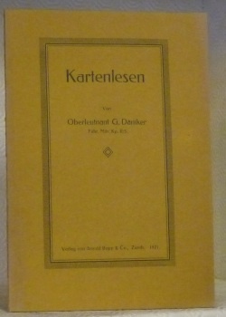
DÄNIKER, G.
Kartenlesen.Von Oberleutnant G. Däniker Fahr. Mitr. Kp. II/5.
Zürich, Arnold Bopp 1921, 235x165mm, 55Seiten, broschiert. Schönes Exemplar.
Referenz des Buchhändlers : 43262
|
|
|
Dépot de la Guerre - Officiers du Corps d'Etat Major
Carte entoilée des environs de Paris, en deux pans, est et ouest
Dépot de la Guerre Dépot de la Guerre, 1884. Carte entoilée des environs de Paris en deux pans chacun de 106 x 75 cms et de 18 feuilles toutes présentes, soit un panneau en deux parties de 212 x 150 cms et 36 feuilles. Frise d'encadrement. Echelle 1/40 000. Imprimée par l'Imprimerie linéographique du Dépôt de la Guerre. Mention de provenance dans un cartouche "A. Bouyssou, Lieutenant 78e Infanterie - Ecole de Guerre 1885-87" . Devenu Général il intégra un temps le 122 e RI de Rodez (Aveyron). On note le mur d'enceinte entourant Paris. Très bon exemplaire.
Referenz des Buchhändlers : 169207

|
|
|
Dépot de la Guerre - Officiers du Corps d'Etat Major
Carte entoilée des environs de Paris, en deux pans, est et ouest
Dépot de la Guerre, 1884. Carte entoilée des environs de Paris en deux pans chacun de 106 x 75 cms et de 18 feuilles toutes présentes, soit un panneau en deux parties de 212 x 150 cms et 36 feuilles. Frise d'encadrement. Echelle 1/40 000. Imprimée par l'Imprimerie linéographique du Dépôt de la Guerre. Mention de provenance dans un cartouche "A. Bouyssou, Lieutenant 78e Infanterie - Ecole de Guerre 1885-87" . Devenu Général il intégra un temps le 122 e RI de Rodez (Aveyron). On note le mur d'enceinte entourant Paris. Très bon exemplaire.

|
|
|
E. Nardin
Carte de Maroc Algérie Tunisie
Paris Garnier Frères Libraires Editeurs s.d. (circa 1905) - 1 carte au 1/2.700.000 64 5 cm x 90 cm - Nouvelle carte dressée d'après les documents les plus récents par E. Nardin - Très bon état - On joint une carte des confins algéro-marocains dressée par la Compagnie Générale Française du Maroc présentant les propriétés acquises par la Cie 26 cm x 33 5 cm bon état
Referenz des Buchhändlers : 16849

|
|
|
E. NARDIN, (French cartographer), (18.-19. century).
[MAP / THE IMPERIAL OTTOMAN IN 1909 / BALKANS / NORTH AFRICA] Peninsule des Balkans - Empire Ottoman. [Carte géographique].
Very Good French This attractive color lithographed map shows the Imperial Ottoman territories in the Balkan Peninsula, Anatolia, also North African shores and Maghreb countries, Egypt and Vilayet de Tripoli (Libya) and Liva de Benghasi. It has small views with a small scale of Tripoli, Europe, Egypt, and Nubia with the Arabian Peninsula. This map reflects the territories and situation of the last period of the Ottoman Empire soon after the Second Constitutional Era in 1908. Inside the red lines in this map shows the Ottoman territories in 1909 with its maximum extent, just before the Balkan Wars, (1912-1913). In Europe, Western Thrace territories up to Montenegro including Adrianople are within the borders of the Empire. E. Nardin was a French cartographer who prepared more than sixty maps in the early 19th century, especially mapping Middle Eastern, North African, Sub-Saharan African areas. Original color lithograph folded map in its original wrappers. Oblong double elephant folio. (77x95 cm). Wrappers dimensions: (21,5x14 cm). In French. Echelle 1/4.165.000 (Scale). Only two copies in OCLC. Extremely rare. No date.
|
|
|
Eachard, Lawrence
THE GAZETTEER The gazetteer's: or newsman's interpreter.
London: printed for John Nicholson and Samuel Ballard 1704. The Seventh Edition . Hardback. Fine. 12mo. Being a geographical index. Of all the considerable cities patriachships. in Europe. The seventh edition corrected and very much enlarged with the addition of a table of births marriages &c. of.Unpaginated.256pp. Both parts present. The second part being The Births marriages etc of all the Kings Princes and Potentates of Europe. Original full calf binding with panelled polished calf boards and attractive decoration to the corners of the outer panel. Robbed to the extremities but a nice copy. PLEASE EMAIL FOR PHOTOS. <br/> <br/> printed for John Nicholson, and Samuel Ballard hardcover
Referenz des Buchhändlers : TH254
|
|
|
Eachard, Lawrence
THE GAZETTEER'S OR NEWMAN'S INTERPRETER Being a Geographical Index
London: John Nicholson and Samuel Ballad 1716. eleventh edition . Hardback. Vg. 12mo. ii pubs. ad. including maps and atlases by Herman Moll. i pp ad Preface incl. The Clavis i pp vi Gazetteer a5-Ll5; iii pub. book lists.; bound with the Second Part THE GAZETTEER'S OR NEWMAN'S INTERPRETER Being a Geographical Index .in Asia Africa and America pub. by George Sawbridgeand Maurice Atkins London the third edition Corrected and Enlarged 1710 Preface iv Or Divers Measures iii The Clavis i pp The Gazeteer A6- M5 pub. ads iii pp. Original full calf with raised bands. Single gilt ruled borders to the boards. <br/> <br/> John Nicholson and Samuel Ballad hardcover
Referenz des Buchhändlers : Pa888
|
|
|
Ebel Johann Gottfried
Manuel du voyageur en Suisse, par M. J. G. Ebel. Nouvelle édition.
16°, mm 170x100, pp. LXXXVIII, 620, legatura in piena pelle epoca titolo su tassello al dorso, mancanze al dorso, abrasion e parziale staccatura della parte inferiore, buono stato nel complesso, pagine ancora fresche, con la famosa e grande carta della Svizzera ripiegata all'interno, pubblicata da Audin e incisa da Heinrich Keller. ID 6464

|
|
|
Ebel Johann Gottfried
Nouvel Ebel. Manuel du voyageur en Suisse et en Tyrol. Dixième édition.
16°, mm 180x120, pp. (6), LI, (3), 650, legatura in mezza tela con titolo manoscritto al dorso, una sgualcitura della carta all'angolo del piatto anteriore carte lievemente sbiadite, ma buon esemplare. Antiporta litografica con titoli calligrafici e ritratti ovali allegorici dei cantoni svizzeri in cornice decorata; indice dell'introduzione, delle strade e degli itinerari, e indice alfabetico dei luoghi al fondo. Carte ripiegate di Chamounix, Thun e Tyrol all'interno e al fondo di grande dimensione la Suisse par Keller; qualche strappo alle tavole. Decima edizione che contiene la carta della Svizzera incisa e disegnata da Keller. ID 6463

|
|
|
Echard, Laurence
Dizionario geografico portatile ovvero descrizione di tutti i regni, provincie, città, patriarcati, vescovadi, forti, fortezze, cittadelle, ed altri luoghi considerabili delle quattro parti del mondo
2 volumi, pp. XXVIII, 287; 336; rilegatura ottocentesca in mezza tela, piatti marmorizzati, titolo su etichetta al dorso, tagli spruzzati, testo su due colonne. una tavola più volte ripiegata con il mappamondo diviso in due facce all'antiporta del primo volume. Esemplare molto buono

|
|
|
Echard, Laurence; Ladvocat, Jean Baptiste
Dictionnaire geographiue-portatif ou description des royaumes provinces villes patriarchats, eveches, duches, comtes, maquisats, villes imperiales et anseatiques ports, forteresses, citadelles, et autres lieux considerables des quatre parties du monde
180x110 mm, pp. (14), 783; 2 tavole ripiegate fuori testo, l'Europa e un bel mappamondo; testo su due colonne, rilegatura coeva in piena pelle, titolo su tassello e fregi in oro al dorso, tagli e risguardi marmorizzati. Nuova edizione corretta e aumentata. Esemplare buono.

|
|
|
ECKERT-GREIFENDORFF, M
Kartographie. Ihre Aufgaben und Bedeutung für die Kultur der Gegenwart.
Berlin, de Gruyter, 1939. Gr.-8vo. 7, 437, (1) S., 1 Bl., 1 Portrait. OLwd (stark verschmutzt, Buchblock etwas gelockert).
Referenz des Buchhändlers : 1029413
|
|
|
EDIP ÖZKALE, MUSTAFA RIZA SENLER.
Haritaci Mehmet Sevki Pasa ve Türk haritacilik tarihi (1919 yilina kadar).
Fine Turkish Paperback. 4to (28 x 20 cm). In Turkish. 85 p. Haritaci Mehmed Sevki Pasa ve Türk haritacilik tarihi (1919 yilina kadar). First and Only Edition.
|
|
|
Edited by IRFAN DAGDELEN.
Cadastre de la ville de Constantinople. VI. Cercle municipale. Livre figure.
Fine English Original bdg. HC. Folio. (48 x 33 cm). [vi], 4 p., 103 color cadastral maps. In French and Turkish. Cadastral maps of Constantinople, Pera. Cadastre de la ville de Constantinople. VI. Cercle Municipale. A very heavy volume.
|
|
|
Edited by JEAN-FRANÇOIS PEROUSE, FEZA GÜNERGÜN.
Entre trois mers: Cartographie Ottomane et Française des Dardanelles et du Bosphore.= Üç denizin arasinda: Osmanli ve Fransiz Bogaz haritalari. [Exhibition catalogue]. Curated by Pascal Lebouteiller. Articles by Jean-Louis Bacque-Grammont, Faruk Bilici, A. M. Celâl Sengör, George Tolias, Catherine Hofmann, Emmanuelle Vagnon et alli.
New English Paperback. Small 4to. (25 x 21 cm). In French and Turkish. 267, [3] p., color and b/w ills. Entre trois mers: Cartographie Ottomane et Française des Dardanelles et du Bosphore.= Üç denizin arasinda: Osmanli ve Fransiz Bogaz haritalari. [Exhibition catalogue]. Curated by Pascal Lebouteiller. Articles by Jean-Louis Bacque-Grammont, Faruk Bilici, A. M. Celâl Sengör, George Tolias, Catherine Hofmann, Emmanuelle Vagnon et alli. Between three seas: Ottoman and French Cartography from the Dardanelles to the Bosphorus (17th - 19th centuries). The exhibition, "Between Three Seas: Ottoman and French Cartography from then Dardanelles to the Bosphorus (17th ¿ 19th Centuries)" is a collaboration between Arkas Art Center and French Institute for Anatolian Studies. Included in the exhibition are maps of the Dardanelles and the Bosphorus that are lent by the French National Library and French National Archives for the first time and important maps borrowed from archives and collections in Turkey. The exhibition sheds light on the close relationship between the Ottoman and French states over centuries through showing transportation routes by sea, military and armed force settlements, surrounding rural and agricultural areas, geographic and cultural boundaries. The maps of Turkish and French origin offer a comparative perspective on the Bosphorus and the Dardanelles as well as on Ottoman and French cartography. The exhibition also includes pilot charts, military maps, sketches, calculations, drafts and scribbles that reveal the production process of the maps.
|
|
|
Edited by JEAN-FRANÇOIS PEROUSE, FEZA GÜNERGÜN.
Entre trois mers: Cartographie Ottomane et Française des Dardanelles et du Bosphore.= Üç denizin arasinda: Osmanli ve Fransiz Bogaz haritalari. [Exhibition catalogue]. Curated by Pascal Lebouteiller. Articles by Jean-Louis Bacque-Grammont, Faruk Bilici, A. M. Celâl Sengör, George Tolias, Catherine Hofmann, Emmanuelle Vagnon et alli.
Fine English Paperback. Small 4to. (25 x 21 cm). In French and Turkish. 267, [3] p., color and b/w ills. Entre trois mers: Cartographie Ottomane et Française des Dardanelles et du Bosphore.= Üç denizin arasinda: Osmanli ve Fransiz Bogaz haritalari. [Exhibition catalogue]. Curated by Pascal Lebouteiller. Articles by Jean-Louis Bacque-Grammont, Faruk Bilici, A. M. Celâl Sengör, George Tolias, Catherine Hofmann, Emmanuelle Vagnon et alli. Between three seas: Ottoman and French Cartography from the Dardanelles to the Bosphorus (17th - 19th centuries). The exhibition, "Between Three Seas: Ottoman and French Cartography from then Dardanelles to the Bosphorus (17th ¿ 19th Centuries)" is a collaboration between Arkas Art Center and French Institute for Anatolian Studies. Included in the exhibition are maps of the Dardanelles and the Bosphorus that are lent by the French National Library and French National Archives for the first time and important maps borrowed from archives and collections in Turkey. The exhibition sheds light on the close relationship between the Ottoman and French states over centuries through showing transportation routes by sea, military and armed force settlements, surrounding rural and agricultural areas, geographic and cultural boundaries. The maps of Turkish and French origin offer a comparative perspective on the Bosphorus and the Dardanelles as well as on Ottoman and French cartography. The exhibition also includes pilot charts, military maps, sketches, calculations, drafts and scribbles that reveal the production process of the maps.
|
|
|
Edited by M. MEHRYAR, SH. S. FATULLAYEV, F. F .TEHRANI, B. QADIRI.
Pictorial documents of Iranian cities in the Qajar period.= Asnâd-i tasvîrî-i shahr'hâ-yi Îrânî-i dawrah-i Qâjâr.
New New English Original bdg. Dust wrapper. Folio. (43 x 30 cm). In Persian and English. [i-xxxvii] pp. text in English, [8], 264 p. text in Persian, richly illustrated. After a large historical background, the presented book has old views, city plans and maps of Iranian cities including Russian, Iranian, Arabian and Western cartographers in the Qajar dynasty (1794-1925). A very comprehensive large and heavy book on Iran in the 19th century cartographic material.
|
|
|
Edited by NKVD [I. E. THE CENTRAL EXECUTIVE COMMITTEE].
[ASIA / EARLY USSR ATLAS] Atlas Soyuza Sovetskih Sotsyalisticheskih Respublik.= Sûrâ-yi Sosyalist Cumhuriyetleri'nin Ittifakinin atlasi.= Atlas Khorhrdayin Sots'ialistakan ??Hanrapetut'yunneri Miut'yan.= At'lasi Sabch'ota Sotsialist'uri Resp'ublik'ebis K'avshiris.= Atlas der Union der Sozialistischen Sowjetrepubliken.= Atlas of the Union of Soviet Socialist Republics.= Atlas de l'Union des Républiques socialistes soviéts. Contributions by Avel Safranovich Enukidze (1877-1937).
Very Good Russian Original dark green cloth bdg. Oblong folio. (28 x 36 cm). Eight languages of the title on the colophon, the text is completely Russian. [6], [ii], 108 p., [36] maps in various sizes, some of folded: (62x47 cm, 52,5x45,5 cm, 49,5x27 cm [x3], 61x47 cm; other maps are 36x28 cm). Four unnumbered leaves with half-title and contents for each section. Two small millimetric cuttings on two text pages. Ex-owner's name is on the title page. Markings on the index. Otherwise a very good and clean copy. Rare complete and the first atlas including a fine collection of 36 attractive chromo-lithograph maps mostly with tissue papers of the Soviet Union, edited by the Central Executive Committee and Enukidze (1877-1937), who was a prominent Georgian "Old Bolshevik". One of 11000 copies. Being published only 10 years after the USSR was established, this is the earliest atlas of the country. It seems to have been published with a wider audience in mind, with a title page in various European languages. The borders of many areas -including not just administrative regions throughout the USSR, but also entire autonomous republics (especially in Central Asia)- were in a state of flux; as such, the borders in this Atlas (including the wax-paper overlays meant to update various maps with changes made between when they were drawn and when the Atlas was published) often don't look anything like the borders they were set at the end of the Soviet Union and have continued on to modern times. Since the boundaries were often ideologically- (sometimes ethnically-, less so economically-) motivated, this offers an interesting insight into the mindset of the administration that was making these changes. Map list: World map, General USSR, USSR in Europe, Asia and USSR, Karelian Autonomous Soviet Socialist Republic, Komi-Zyryan Autonomous Oblast, Avt, Votskaya Oblast, Maryinskaya, Cherepovetsky District, Vologda Oblast, Avt. Chuvashskaya SSR (Chuvashia), Avt. Tatarskaya SSR (Tatarstan), Avt. Bashkirskaya SSR (Bashkiria), ASSR Nemchev Povoljiya, Kalmykia (Kalmykia), Krimskaya SSR (Crimea), Adigeiskaya (Tscherkeskaya) Obl. (Cherkesia), Kabardino-Balkarskaya Avt. Obl. (Kabardino-Balkarian Rep.), Karachayskaya Avt. Obl. & Tscherkesskiy Nation. Okrug (Karachay-Cherkessia), Chechenskaya Avt. Obl. (Chechnya), Ingushetiya, Severo-Osetiya, Avt. Daghestanskaya SSR, Avt. Kazakskaya SSR, Kyrgyzkaya ASSR, Avt. Oiuratskaya Oblast, Burito - Mongolskaya SSR (Kazakhstan), Avt. Yakustkaya SSR (Yakutia), Beloruskaya SSR (Belarus), Ukrainskaya, SSR (Ukraine), Moldavskaya SSR (Moldovia), Zakavkazkaya SSR (Abkhazia), Azerbaijanskaya SSR (Azerbaijan), Arminskaya SSR (Armenia), SSR Gruzii (Georgia), Central Asian SSR (Karakalpakstan, Kyrgyzstan, Turkmenistan, Uzbekistan), Uzbekistan, Turkmenistan. OCLC shows copies in twenty-three libraries worldwide: 7852120, 968755133, and 822577467.
|
|
|
Edmond Gabriel
Éléments de Topographie
MARCH S. et Cie 1914 in8. 1914. Cartonné. « Éléments de topographie et tracé des voies de communication » d'Edmond Gabriel est un manuel technique complet publié en 1914 (réédité en 1926) dédié à la science de la topographie c'est-à-dire l'étude de la mesure et de la représentation de la surface terrestre. L'ouvrage d'environ 650 pages aborde en détail les instruments d'arpentage l'évaluation des surfaces et des angles et comprend de nombreuses illustrations figures et planches dépliantes
Referenz des Buchhändlers : 100148587

|
|
|
Eduard Van Ermen, Luc Vanhove, Stefan van Lani
kaartboek van de Abdij van Park 1665
, Algemeen Rijksarchief 2000, 2000 Hardcover, 266 pagina's, Nederlands, 345 x 245 mm, Nieuw, met illustraties in kleur en z/w, .
Referenz des Buchhändlers : 57314
|
|
|
Eduard Van Ermen, Luc Vanhove, Stefan van Lani
kaartboek van de Abdij van Park 1665
Hardcover, 266 pagina's, Nederlands, 345 x 245 mm, Nieuw, met illustraties in kleur en z/w, . Facsimile van Typographie boeck oft delineatie en affteeckeninch der abdije en convent van heeren Parch: en alle haer goederen, appendentien en dependentien der selfver; soo van erfeven, erfpachten, leenen als cheynsen; by ghesworene landtmeters afghemeten, door lasten en sorge vande eerwerd: heer Flibert de Pape, abt van Parch ; en door den selfve bij een vergadert en in order ghestelt, en volbracht. Anno 1665

|
|
|
Edward Wells
A New Map of Latium, Etruria, and as much of Antient Italy, as lay Between Gallia Cisalpina and Grecia Magna Sheving their Principal Divisions, Cities, Towns, Rivers, Mountains &c. Dedicated to his highness William Duke of Glocester.
In folio (46x25 cm); esemplare in buone-ottime condizioni di conservazione. Prima edizione di questa bella carta del centro Italia con fine coloritura coeva che descrive i territori della Toscana, dell'Umbria, delle Marche, del Lazio, della Campania ed una parte della capitanata. Edward Wells, il cartografo che realizzò la stampa, era un sacerdote della Chiesa d'Inghilterra e sostenitore dell'istruzione. Durante la sua vita pubblicò numerose carte, tra cui diversi atlanti del mondo antico e contemporaneo. Wells era figlio di un vicario ed entrò alla Christ Church di Oxford alla fine del 1686. Si laureò nel 1690 e lavorò come tutore nel suo college dal 1691 al 1702. Quindi, si spostò a Cotesbach, nel Leicestershire, da dove continuò a pubblicare i suoi lavori. Dal 1698 in poi, Wells compilò molti sermoni, diversi libri ed alcunbi atlanti. Tradusse anche testi classici e cristiani, aggiungendo talvolta annotazioni geografiche. Le sue “geografie descrittive” non erano opere eccessivamente originali, ma furono molto popolari al suo tempo per la bellezza ed eleganza del tratto. Nel 1701 pubblicò un Trattato di geografia antica e moderna che riscosse un notevole successo e che vide quattro edizioni successive. A quest'opera, seguì una Geografia storica del Nuovo Testamento pubblicata nel 1708, accompagnata da una Geografia storica dell'Antico Testamento edita tra il 1711 ed il 1712. Opera in buone-ottime condizioni di conservazione.

|
|
|
Efrat, Zvi [Ed.]
Borderline Disorder: The Israel Pavilion, The 8th International Architecture Exhibition, La Biennale di Venezia, 2002 [IN HEBREW, ENGLISH AND ITALIAN]
IN HEBREW, ENGLISH AND ITALIAN. 22X15 cm. 153+61 pages. Softcover. Cover slightly stained. Else in good condition.
|
|
|
EGIDI Giov.
Problemi di gnomonica pratica
In 4 (cm 23,5 x 32), pp. 7 + (1b) con 2 figure nel testo. Brossura editoriale. Estratto dagli Atti dell'Accademia Pontificia de' Nuovi Lincei.
|
|
|
Ehrle, Franceso
Roma prima di Sisto V du Perac-Lafrey del 1577 riprodotta dall'esemplare esistente nel museo britannico
4°, 32 cm, pp. 70, brossura editoriale, titolo al piatto, esemplare ottimo. Contributo alla storia del Commercio delle stampe a Roma nel Secolo 16 e 17°

|
|
|
EIZYKMAN, Boris
Inconscience fiction
1979 - broché - Editions Kesselring - Collection Matin d'un Blues, animée par Bob Nadoulek, N° 4 - 1979 - In-8 (21,5 x 14,5 cm) broché - 318 pages - Illustrations en noir et blanc - A PROPOS : Cet ouvrage explore comment une forme de capitalisme « cool » et ses excès façonnent des réalités politiques inédites, où conflits et désirs se jouent hors des scènes traditionnelles. Entre analyses critiques de la pop culture, lectures de Dick et Spinrad, et essais sur violence, mort et pulsions, le livre cartographie une « zone » fictionnelle où surgissent modèles sociaux et tensions imprévues. Écriture à la fois théorique et passionnée, l’ouvrage propose une nouvelle grille pour lire la science-fiction comme laboratoire des futurs possibles.
Referenz des Buchhändlers : 550

|
|
|
Elford,G.R.
Kappadokien und Umland. Ein verzaubertes und bezauberndes Land.
<br/> STATO: NUOVO.<br/> TITOLO: Kappadokien und Umland. Ein verzaubertes und bezauberndes Land. <br/> AUTORE: Elford,G.R.<br/> EDITORE: Convivio Nardini Ed.<br/> DATA ED.: 1992,<br/> EAN: 9788840440873

|
|
|
Elfriede Regina Knauer
Die Carta Marina des Olaus Magnus von 1539
Ein kartographisches Meisterwerk und seine Wirkung. Volume in ottime condizioni. Brossura
|
|
|
ELKHADEM Hossam, HEERBRANT Jean-Paul, WELLENS-DE DONNER Liliane, CALCOEN Roger
"Cartes des Amériques, dans les collections de la Bibliothèque Royale Albert 1er; exposition organisée à la Bibliothèque Royale Albert 1er du 13 novembre au 31 décembre 1992."
Bruxelles, Bibliothèque Royale Albert 1er, 1992. 18 x 25, 169 pp., nombreuses cartes en couleurs et en N/B, broché, très bon état (cachet d'ex-propriétaire).
Referenz des Buchhändlers : 91892
|
|
|
ELKHADEM Hossam, HEERBRANT Jean-Paul, WELLENS-De DONDER Liliane, CALCOEN Roger
Cartes des Amériques dans les collections de la Bibliothèque Royale Albert 1er. Exposition organisée à la Bibliothèque Royale Albert 1er du 13 novembre au 31 décembre 1992.
Bruxelles, Bibliothèque Royale Albert Ier, 1992. 18 x 25, 169 pp., quelques cartes en couleurs, broché, très bon état.
Referenz des Buchhändlers : 98266
|
|
|
ELKHADEM Hossam, HEERBRANT Jean-Paul, WELLENS-DE DONNER Liliane, CALCOEN Roger
Cartes des Amériques, dans les collections de la Bibliothèque Royale Albert Ier.
Bruxelles, Bibliothèque Royale Albert 1er, 1992. 18 x 25, 169 pp., nombreuses cartes en couleurs et en N/B, broché, très bon état.
Referenz des Buchhändlers : 104.000
|
|
|
Ellefsen, E. u. K.B. Sollesnes (Red.)
Cappelens atlas større utgabe for hjem og skole.
Oslo, Cappellens Forlag, 1962. 4°. M. 64 farb. Taf. 22 S. Text. OHlwd. M. Rsign. Kanten leicht beschabt. St. a. Tit.
Referenz des Buchhändlers : 136857
|
|
|
Emiliani Andrea - Zanasi Stefano
Edizioni d'arte e cartografia tra '500 e '600 nella corte estense. Il Tasso a Castelvetro A.D. 1564.
Bross., cm 25x19,5, pp 169, ill. a col. e b/n.. " quando su Ferrara sarà disceso il silenzio, destinato a scivolare oscuro verso i secoli a venire, rimarrà tuttavia a lungo acceso sull'orizzonte un sentimento del passato che in altri luoghi è destinato a disperdersi precocemebte. Forse la storia del collezionismo intessuta di sensualità del possesso artistico, come anche del desiderio squisito della rarità "dell'unicum" possiede in se stessa anche questa capacità di sostare sul profilo del tempo d'una città, addirittura nella polvere di stanze e sacrestie" (Andrea Emiliani). - ISBN: 9788867261277

|
|
|
EMILIANI M. e PAPOCCHIA R. L.
Nozioni di cartografia e avviamento alla lettura delle carte geografiche.
In-8° gr. pp. 129 con 81 fig. n.t. Bross. edit. con tracce d'uso.
|
|
|
Emma Maglio
Catastici dei traslati di propriet dei beni stabili. The land registers of Venetian Candia (1588-1605, 1621-1645)
, Brepols, 2025 Paperback, Pages: 776, Size:170 x 240 mm, Languages: English, Italian. ISBN 9789603710943.
Referenz des Buchhändlers : 70860
|
|
|
Emmanuelle Vagnon
Cartographie et representations de l'Orient mediterraneen en Occident (du milieu du XIIIe a la fin du XVe siecle)
, Brepols - Harvey Miller, 2013 Hardcover. 453 p., 2 b/w ill. 15 colour ill., 210 x 270 mm, Languages: French, Including an index. Fine copy. ISBN 9782503548968.
Referenz des Buchhändlers : 45719
|
|
|
Emmius, Ubbo
Typus Frisiae orientalis. Auctore Ubbone Emmio. [um 1640]. [Altkolorierter Kupferstich, gerahmt / handcolored copper engraving, framed].
o.J. Emmius Ubbo Geschichtsschreiber, * 5.12.1547 Greetsiel (Ostfriesland), ? 9.12.1625 Groningen. (lutherisch, dann reformiert)Emmo Ubbone b. Amsterdam, um 1640, 38,5 x 49 cm. Detaillierte Ansicht der ostfriesischen Gegend. Links und rechts oben zwei Wappen, links unten Titelkartusche mit bäuerlicher Szenerie. Rechts unten Landkarte des Gebietes südlich von Emden ca. 1277, 14 x 11 cm. Umrandet von Szenario mit Neptun. Im Falz oben restauriert. Ansonsten gut erhalten. Sehr dekoratives Blatt in breitem Rand.- Auch unkoloriert, mit Gebrauchsspuren erhältlich; 270 . JPEG-Bilder auf Anfrage möglich. East Frisia. "Typus Frisiae Orientalis" Period coloured copperplate engraved map by Emmo Ubbone and Guil. Blaeu, Amsterdam ca. 1640 [3 Warenabbildungen] (Ubbo Emmius, geboren am 5. Dezember 1547 in Greetsiel, gestorben am 9. Dezember 1625 in Groningen. Deutscher evangelisc
Referenz des Buchhändlers : 60953BB

|
|
|
EMORY, William Hemsley.
Notes of a Military Reconnoissance, from Fort Leavenworth, in Missouri, to San Diego, in California ; including parts of the Arkansas, Del Norte, and Gila Rivers.
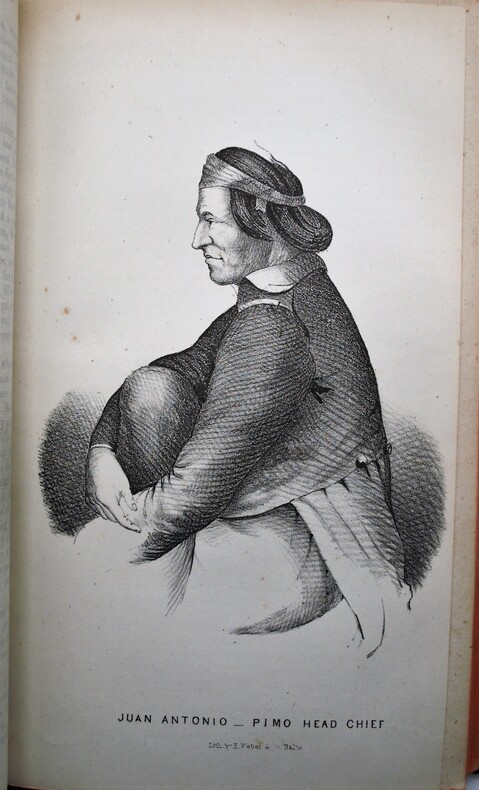
Washington, Wendell and Van Benthuysen, Printers, 1848. Octavo. xvi, 416 pages. Contemporary half calf, smooth spine gilt with author and title, red edges, stamp on title. Hinge cracked, small loose and label on spine. Large folding map detached and showing browning along the folds. First edition, Senate issue. 30th Congress, 1st Session, Senate, Executive No. 7. Illustrated with 43 plates, including three battle plans of the Mexican–American War (among them the Battle of Pueblo de Los Angeles), early views of California settlements (including San Diego), ethnographic portraits, and botanical plates, and accompanied by the large folding engraved map (33 × 75 inches, environ 84x190cm) The report documenting the military reconnaissance conducted in 1846–1847 during the Mexican–American War by Lieutenant-Colonel William H. Emory of the Corps of Topographical Engineers. The text is divided into two distinct parts : a narrative of the journey itself, combining geographical, logistical, and military observations, followed by extensive appendices presenting the scientific results of the expedition, including meteorological and astronomical observations, geological notes, and natural history data. A primary source for the history of the American Southwest. The plates provide early visual documentation of California, Native American populations, scientific observations, and contemporary military operations. The large folding engraved map, entitled Military Reconnoissance of Arkansas, Rio del Norte, and Rio Gila (dated 1847), is the cartographic centerpiece of the work. Compiled from original field observations, it provides the first comprehensive official mapping of the regions traversed by the expedition, integrating military routes, topography, settlements, barometric profiles, and tables of distances and elevations. The present example corresponds to the second and finalized state. Demi veau époque, dos lisse avec auteur et titre, tranches rouges, cachet au titre, charnière fendues, carte détachée et présentant des brunissures aux plis. Rapport officiel du Sénat sur la reconnaissance de 1846–1847, associant le récit de l’expédition et des annexes scientifiques. Illustré de planches et accompagné de la grande carte dépliante gravée, second état, document cartographique majeur de la guerre américano-mexicaine. Ch.3E
Referenz des Buchhändlers : PHO-2174
|
|
|
Engraved by J & C. WALKER.
[PORTOLAN MAP of the BOSPHORUS] Bosphorus to Kerempeh. (Black Sea sheet IX).
Very Good English Original b/w portolan chart. Folded. A little foxing and some pencil markings and notes in Ottoman script in its period. Oblong double elephant folio. (70 x 102 cm). In English. Bosphorus to Kerempeh from the Russian survey of 1834 with additions and corrections by Commander W. J. L. Wharton., R. N. 1872-80. It's written 'London published according to Act of Parliament at the Hydrographic Office of the Admiralty Jare. 16th 1854. Also shows Killa Bay (Shile Bay) from a survey by Lieut. Comm. W. R. Pristen and the midshipmen of H. M. S. Royal Sovereign, 1920. Topography partly from a Turkish map. Up side of map, engraved a view from sea of entrance of the Bosphorus, Rumili (sic. Rumeli) Lighthouse and environment with several hills. And also shows Amastra (Ancient Amastris) from Russian surveys, 1834-41; Kosku Bay from a surbey by Capt. Spratt R. N. 1854; and Sungul Bay (Zonguldak) from the Heraclee Companys plans to 1915. A rare navigation chart.
|
|
|
Engraver: M. DE RIENZI.
[MAP of FRENCH POLYNESIA AND MICRONESIA] Polynesie et Micronesie; d'apres la classification et les divisions etablies par. M. de Rienzi.
Very Good French Original b/w map. Folded. Oblong 4to. (23 x 29 cm). In French. It shows New Zealand, Australia, and islands in Polynesia and Micronesia. [MAP of FRENCH POLYNESIA AND MICRONESIA] Polynesie et Micronesie; d'apres la classification et les divisions etablies par. M. de Rienzi.
|
|
|
ENNIO POLEGGI
ICONOGRAFIA DI GENOVA E DELLE RIVIERE.
IN 4°, pp.207. LEGATURA EDITORIALE IN PIENA TELA RIGIDA BLU CON TITOLO + SOVRACOPERTINA ILLUSTRATA A COLORI CON TITOLO. SGUARDIE FIGURATE. 132 ILLUSTRAZIONI in b/n/col. RIPRODUCENTI VEDUTE PIANTE E CARTE DI GENOVA E DELLE RIVIERE. L'AUTORE, CHE INSEGNA STORIA DELL'URBANISTICA ALLA FACOLTA' DI ARCHITETTURA DI GENOVA, HA AVUTO IL MERITO DI RITROVARE UN GRANDE NUMERO DI INEDITI ARRICCHENDOLI CON UNA COPIOSA DOCUMENTAZIONE. OTTIMA CONSERVAZIONE.<BR> ID 5714

|
|
|
Enrico Iachello, a cura di
L'isola a tre punte La cartografia storica della Sicilia nella collezione La Gumina (XVI-XIX secolo)
Dedica con firma appartenenza all'occhiello ed al frontespizio, introduzione di Giuseppe Giarrizzo, brossura editoriale flessibile, illustrata, con alette, danneggiata da traccia di vecchia umidità che ha lasciato macchiati ed ondulati i margini inferiori, pagine riccamente illustrate e con tracce di umidità lungo tutti i bordi, testi perfettamente fruibili, abrasione all'ultima carta per adesivo rimosso. Numero pagine 231 USATO

|
|
|
ENTERLINE James Robert -
Erikson, Eskimos & Columbus. Medieval European Knowledge of America.
Baltimore, The Johns Opkins University Press, 2002, 8vo (cm. 26 x 16,5) legatura tutta tela con fregi e titoli dorati al dorso e sovraccopertina illustrata a colori, pp. XX-342 con 72 illustrazioni e carte nel testo.

|
|
|
EREDI HOMANN (HOMANNIANORUM HEREDUM).
Carte generale d’Empire de Russie et de Tartarie grande et petite en Europe et Asie. Tartariae Maioris sive Asiaticae tabula.
Norimberga, 1730. Incisione in rame all’acquaforte, colore d’epoca, cm 50 x 57 (alla lastra), titolo in alto, piccolo cartiglio in basso a sn. animato da personaggi e animali, reticolato e margine graduato su tutto il perimetro. Esemplare non freschissimo, aloni di umido ai margini bianchi, tenue coloritura.

|
|
|

 Per e-mail erhalten
 Als pdf-Dokument herunterladen
 RSS feed
 Permanenter link


