|
|
|
Weigel Christoph
Vindelicia Rheti et Noricum
30,5 x 38,5 cm. Incisione in rame a pieni margini, con acquarellatura d'epoca. Piccolo cartiglio sulla sinistra, rappresentante un ritrovamento archeologico di una lapide con inciso il titolo della carta ed la firma dell'autore sorro. A fianco quattro monete romane. Qualche fioritura, piccole abrasioni alla piega naturale della carta.

|
|
|
WEIGEL Johann Christoph (1661 - 1726)
AUSTRIA inferior Secundum IIII. Quadrantes & regiones contiguas excudente Christophoro Weigelio
CARTA GEOGRAFICA di cm. 34,8x28,2 al filo della lastra, incisa in rame su forte carta pregiata di cm. 45,3x36,7 e colorata a amano all'epoca, proveniente da Atlante (probabilm. "Atlas Portatilis, Oder Compendieuse Vorstellung Der gantzen Welt: in einer kleinen Cosmographie, 1723) in cui era rilegata mediante brachetta alla piega. Uno dei primi atlanti scolastici, utile anche ai viaggiatori. WEIGEL, incisore su rame, mercante d'arte ed editore (cfr de.wikipedia).Perfettamente conservata.
|
|
|
WEIGEL Johann Christoph (1661 - 1726)
BELGIUM Regium accuratissime descriptum cum permutationibus cursus publici curante Christophoro Weigelio Noribergae
CARTA GEOGRAFICA di cm. 39x34,4 al filo della lastra, incisa in rame su forte carta pregiata di cm. 44x36,7 e COLORATA a mano all'epoca, proveniente da Atlante (probabilm. "Atlas Portatilis, Oder Compendieuse Vorstellung Der gantzen Welt: in einer kleinen Cosmographie, 1723) in cui era rilegata mediante brachetta alla piega. Uno dei primi atlanti scolastici, utile anche ai viaggiatori. WEIGEL, incisore su rame, mercante d'arte ed editore (cfr de.wikipedia). Salvo una fessura di 5 cm.al bordo inferiore della piega, è perfettamente conservata.
|
|
|
WEIGEL Johann Christoph (1661 - 1726)
HOLSATIAE, DITHMARSIAE, STORMARIAE et VAGRIAE Ducatus. Autore Christ: Weigel Norimbergae. [Schleswig-Holstein, Dithmarschen, Stormarn, foce dell'Elba...].
CARTA GEOGRAFICA di cm. 39,4X33,2 al filo della lastra, incisa in rame su forte carta pregiata di cm. 45x37 e COLORATA a mano all'epoca, proveniente da Atlante (probabilm. "Atlas Portatilis, Oder Compendieuse Vorstellung Der gantzen Welt: in einer kleinen Cosmographie, 1723) in cui era rilegata mediante brachetta alla piega. Uno dei primi atlanti scolastici, utile anche ai viaggiatori. Kiel Lubeck Hamburg, Bad Segeberg, la regione Eckernförde-Travemünde-Lüneburg-Elbemündung. WEIGEL, incisore su rame, mercante d'arte ed editore (cfr de.wikipedia). Salvo una fessura di 5 cm.al bordo inferiore della piega, è perfettamente conservata.

|
|
|
Weiland, C. F
Koenigl. Preuss. Prov. Schlesien. Entworfen und gezeichnet von C. F. Weiland.
Weimar, Geograph. Inst. 1846. Grenzkolor. Stahlst., 41 x 56 cm, mit Maßstäben u. statist. Übersicht sowie einer Nebenkarte. Breitrandig. Mittelfaltung. W. Rand mit Knick- u. Knitterspuren. Randläs. tlw. hinterlegt. Mittelfalz mit kl. hinterlegten Rissen. Zwei kl. Ecken fehlen. Papierbed. schwach gebr. Schönes Kartenbild. Nebekarte: Die nächste Umgebung von Breslau. Die Statistik zeigt die Einteilung der Provinz in Regierungs-Bezirke.
Referenz des Buchhändlers : KART0046

|
|
|
WEISS (Helmut) DUNCKER (Dieter R.)
duche de Brabant en cartes et gravures anciennes.
Couverture reliee sous jaquette, 160 pages, 39 x31 cm, ** tres bon etat ( neuf !!! ). ISBN 9782801104767. reproductions de cartes et gravures en couleurs et en noir et blanc, legendes en francais, anglais et allemand, captions in French, English and German, Beschriftung im Franzosisch, Englisch und Deutsch

|
|
|
WEISS (Helmut) DUNCKER (Dieter R.)
duche de Brabant en cartes et gravures anciennes.
Hardcover, 160 pages, Texte en Francais, 385 x 305 mm, Tres belle exemplaire !!. ISBN 9782801104767. reproductions de cartes et gravures en couleurs et en noir et blanc, legendes en francais, anglais et allemand, captions in French, English and German, Beschriftung im Franzosisch, Englisch und Deutsch

|
|
|
Weisz, Leo
Die Schweiz auf alten Karten. Mit Geleitwort und einem kartographisch-technischen Anhang von Prof. Ed. Imhof.
Zürich, NZZ, 1969. 4°. 247 S. Mit zahlr. (dv. viele gef.) Karten u. Textillustr. nach alten Vorlagen. Orig.-Halblederband. + Wichtig: Für unsere Kunden in der EU erfolgt der Versand alle 14 Tage verzollt ab Deutschland / Postbank-Konto in Deutschland vorhanden +, A 2. Auflage.
Referenz des Buchhändlers : 4008CB

|
|
|
WH Smith & Sons W H
PLAN OF LONDON With INDEX
Edinburgh: John Bartholomew & Co. 1880. 1st Edition . Hardback. Fine. Folio. ND 1880 The Royal Horticultural Society Gardens in Kensington are still mapped but closed in 1882 being the Royal Albert Hall and Royal College of Music so this scarce map is published prior to that date. 23.5 x 33 x 23.5 inches 80x60 cms Folded and enclosed with a green cloth booklet 31pp with index of the streets etc. A nice copy with a few pin-holes where the folds intersect. A single un-dissected sheet pasted on linen with 36 panels when folded. From Hampstead to south of Battersea and Shepherd's Bush to Greenwich with printed and hand-colouring. The map has grid-lines each covering half mile suares with grid letters and numbers in the margins. Tower Bridge is not present. <br/> <br/> John Bartholomew & Co. hardcover
Referenz des Buchhändlers : GT058
|
|
|
WHEAT J. C. - BRUN C.F.
Maps and Charts published in America before 1800. A bibliography. Second revised edition.
In 8°, t.t. edit. con sovracc. ill., pp. XXIV,215,(3), con numerose riprod. di carte in tavv. f.t.,copia molto buona. (L026/d) (la spedizione standard è SEMPRE tracciata con raccomandata-piego di libri, eventuale fattura da richiedere all'ordine)
|
|
|
Wheat, Carl I; Institute Of Historical Cartography, San Francisco
Mapping The Transmississippi West 1540-1861: Volumes One - Five Parts 1 & 2 Complete 350-Copy Limited Edition
Parsippany NJ.: Maurizio Martino. VG In Green Cloth With Gilt Lettering. 5 Books In 6 Volumes Complete. Oversize. All Pages Clean Bindings Tight. Pub. 1995 Reprint Of 1957 I.H.C. Edition. Pages: 1378. Undated. Reprint. Hardcover. Maurizio Martino hardcover
Referenz des Buchhändlers : MASTER361054I
|
|
|
Wheat, Carl I
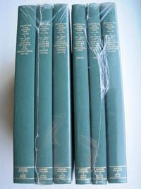
Mapping the Transmississippi West 1995 6 separate vols complete; with large FOLD-OUT maps; new in publisher's shrinkwrap & PUBLISHER'S CARDBOARD SHIPPING BOX
Storrs-Mansfield CT / Parsippany New Jersey: Martino Fine Books / About Books 1995. 6 separate volumes complete 5 volumes bound in 6 books WITH LARGE FOLD-OUT MAPS -- just like the first edition. SEE PHOTOS. Each of the 6 books in this 1995 large format edition measures 9.25" wide by 12.25" tall. This is NOT the later smaller format 3-volume reprint in which the maps are reduced in size. Unlike later reduced-size editions the maps in this 1995 six-volume edition measure as large as 21" by 33" when unfolded. SEE PHOTOS. As original co-publisher we are pleased to offer the few remaining sets of the 1995 large-format 6-volume edition recently rediscovered in our warehouse. They are BRAND NEW in perfect condition. STILL SEALED in the publisher's clear plastic SHRINKWRAP and the PUBLISHER'S CARDBOARD SHIPPING BOX. NO rubbing. NO fading. Bright clean square and tight. NO owner's name or bookplate. NOT a remainder. Fresh and crisp -- obviously never read. No date but 1995 First Martino/About Books printing "strictly limited to 350". Reprint of the original 1957-1963 six separate volumes: xiv 264; xiii 281; xiii 349; xiii 260; xix 222; iv 223-487pp. MAPPING THE TRANSMISSISSIPPI WEST is a monumental and exceptionally thorough work that is unlikely to be surpassed. The set is illustrated with a total of 376 maps including several that fold out. In this standard carto-bibliography are full descriptions of some 1300 maps from the year 1540 to about 1880. Wheat discusses each map showing the origins of its date and weighing its significance and accuracy. He also identifies the atlases and books in which the maps can be found. Norman Thrower: "Scholars and others who are interested in the American west have found Wheat's work indispensable." Ristow 382: "A comprehensive cartobibliography with many fine reproductions." The 6 volumes are uniformly bound in the original gilt-stamped green cloth. SEE PHOTOS. Oversize Hardcover. All 6 volumes measure 9.25" wide by 12.25" tall. This heavy set will require extra postage for Priority and International shipments. But for media mail you pay only our standard charge for 1 volume and we ship the other 5 volumes at no extra cost. First Martino/About Books printing. Oversize Hardcover. New/in publisher's shrinkwrap. Illus. by We ship all 6 volumes for cost of 1. 6 volumes: 9.25" wide by 12.25" tall. Great Packaging Fast Shipping. Martino Fine Books / About Books Hardcover
Referenz des Buchhändlers : 018762
|
|
|
Wheat, Carl I
Mapping the Transmississippi West Volume Five Part 1 From the Civil War to the Geological Survey Part One of Vol. V; Vol. 5; 1995 new
Storrs-Mansfield CT / Parsippany New Jersey: Martino Fine Books / About Books 1995. Vol. 5 Part I only of 6 separate books. As original co-publisher we are pleased to offer the few remaining individual volumes from our 1995 large-format 6-volume edition that were recently rediscovered in our warehouse. Oversize Hardcover. 9.25" wide by 12.25" tall. This volume is NOT from the later smaller format 3-volume reprint in which the maps are reduced in size. Offered here is Vol. 5 Part I only Vol. 5 was issued in 2 separate books. It is BRAND NEW in perfect condition. NO rubbing. NO fading. Bright clean square and tight. NO owner's name or bookplate. NOT a remainder. Fresh and crisp -- obviously never read. No date but 1995 First Martino/About Books printing "strictly limited to 350". Vol. 5 Part I only. Reprint of the 1963 Institute of Historical Cartography original. MAPPING THE TRANSMISSISSIPPI WEST is a monumental and exceptionally thorough work that is unlikely to be surpassed. In this standard carto-bibliography are full descriptions for hundreds of important maps 1861-1867. Many are illustrated on full page plates 9.25" wide by 12.25" tall. Wheat discusses each map showing the origins of its date and weighing its significance and accuracy. He also identifies the atlases and books in which the maps can be found. Norman Thrower: "Scholars and others who are interested in the American west have found Wheat's work indispensable." Ristow 382: "A comprehensive cartobibliography with many fine reproductions." Bound in the original gilt-stamped green cloth. This large heavy book will require extra postage for Priority and International shipments but only the standard charge for media mail. First Martino/About Books printing. Oversize Hardcover. New/No jacket as issued. xix 222pp. Great Packaging Fast Shipping. Martino Fine Books / About Books Hardcover
Referenz des Buchhändlers : 018771
|
|
|
Wheat, Carl I
Mapping the Transmississippi West Volume Five Part Two From the Civil War to the Geological Survey Part 2 of Vol. V; Vol. 5; 1995 new
Storrs-Mansfield CT / Parsippany New Jersey: Martino Fine Books / About Books 1995. Vol. 5 Part 2 only of 6 separate books. As original co-publisher we are pleased to offer the few remaining individual volumes from our 1995 large-format 6-volume edition that were recently rediscovered in our warehouse. Oversize Hardcover. 9.25" wide by 12.25" tall. This volume is NOT from the later smaller format 3-volume reprint in which the maps are reduced in size. Offered here is Vol. 5 Part 2 only Vol. 5 was issued in 2 separate books. It is BRAND NEW in perfect condition. NO rubbing. NO fading. Bright clean square and tight. NO owner's name or bookplate. NOT a remainder. Fresh and crisp -- obviously never read. No date but 1995 First Martino/About Books printing "strictly limited to 350". Vol. 5 Part 2 only. Reprint of the 1963 Institute of Historical Cartography original. MAPPING THE TRANSMISSISSIPPI WEST is a monumental and exceptionally thorough work that is unlikely to be surpassed. In this standard carto-bibliography are full descriptions for hundreds of important maps from 1868 to the 1870s. Many are illustrated on full page plates 9.25" wide by 12.25" tall. Wheat discusses each map showing the origins of its date and weighing its significance and accuracy. He also identifies the atlases and books in which the maps can be found. As this is the final volume it contains a comprehensive index for all 6 books in the set. Norman Thrower: "Scholars and others who are interested in the American west have found Wheat's work indispensable." Ristow 382: "A comprehensive cartobibliography with many fine reproductions." Bound in the original gilt-stamped green cloth. This large heavy book will require extra postage for Priority and International shipments but only the standard charge for media mail. . First Martino/About Books printing. Oversize Hardcover. New/No jacket as issued. iv pp. 223-487. Great Packaging Fast Shipping. Martino Fine Books / About Books Hardcover
Referenz des Buchhändlers : 018772
|
|
|
Wheat, Carl I; & Gary Kurutz; Warren Heckrotte
The Maps of the California Gold Region 1848-1857 A Biblio-Cartography of an Important Decade : Enlarged
Storrs-Mansfield Connecticut: Maurizio Martino Publisher 1995. 1995 Enlarged edition. BRAND NEW in perfect condition. NO rubbing. NO fading. Bright clean square and tight. Sharp corners. NO owner's name or bookplate. NOT a remainder. Fresh and crisp -- obviously never read. No date but 1995 First Martino printing "strictly limited to 350". This 1995 edition has all the content of the 1942 original plus is updated and enlarged. There is a new introduction by Gary Kurutz that places Wheat's work in historical context and offers information on the book's production and initial reception. Also new are descriptions by Warren Heckrotte of 27 Gold Rush maps or variants that Wheat missed. Another plus is the frontispiece Map of the Southern Mines 1852 which did not appear in the 1942 trade edition but only in 22 deluxe presentation copies. Including the frontispiece there are a total of 27 full-page and double-page map facsimiles. This is an attractively produced book handsomely bound in the original tan cloth stamped in bright red and black over a cream color spine label. Oversize Hardcover. 9.25" wide by 12.25" tall. This large heavy book will require SUBSTANTIAL extra postage for international shipments but only the standard charge for priority or media mail. Updated and Expanded Edition. Oversize Hardcover. New/No jacket as issued. xlii 153pp. plates 262 total pages. Great Packaging Fast Shipping. Maurizio Martino Publisher Hardcover
Referenz des Buchhändlers : 018317
|
|
|
Wheat, James Clement; & Christian F Brun (signed)
Maps and Charts Published in America before 1800 A Bibliography
New Haven Connecticut & London: Yale University Press 1969. SIGNED by co-author Christian Brun on the title page his signature only NOT personalized to anyone. Very Good condition. Mild crease to one corner of a few early leaves. NOT a library discard. NO owner's name or bookplate. NO underlining. NO highlighting. NO margin notes. 1969. First Edition. Expertly described here are all separately published maps and charts in America until 1800 as well as those in books pamphlets almanacs magazines atlases and gazetteers. Illustrated with 18 map reproductions frontispiece in color; 1 folding. Bibliography. Index. Bound in the original gilt-stamped blue cloth. 7.75" wide by 10.25" tall. Signed by Christian F. Brun. First Edition. Hardcover. Very Good condition/No jacket. xxii 215pp. 18 plates . Great Packaging Fast Shipping. Yale University Press Hardcover
Referenz des Buchhändlers : 018432
|
|
|
Whitfield (Peter)
Mapping the World. A History of exploration.
Folio Society, Londres, 2000. Un volume in-4 reliure de l'éditeur sous étui cartonné illustré, 263 pages, texte en anglais, riche iconographie en couleurs. Parfait état.
Referenz des Buchhändlers : 4856
|
|
|
WHITAKER (Harold)
The Harold Whitaker Collection of County Atlases, Road-Books & Maps Presented to the University of Leeds.
First Edition, 4to, frontis., facsimiles, orig. cloth.
|
|
|
WHITAKER Harold
The Harold Whitaker Collection of County Atlases, Road-Books & Maps presented to the University of Leeds. A Catalogue.
4to., SOLE EDITION, with a frontispiece and 9 plates of facsimiles; cloth, covers a little sunned and age-marked, backstrip faded else a very good, clean copy of a scarce work. This outstanding catalogue (compiled by Whitaker of his own collection) was published by the Brotherton Library as 'Library Publications' No. 2. It was never reprinted and is now increasingly hard to find. Sold from an institution with its small, neat stamp on front free endpaper, half-title and title only

|
|
|
WHITFIELD Peter
The Charting of the Oceans. Ten Centuries of Maritime Maps. FINE COPY IN UNCLIPPED DUSTWRAPPER
Roy 4to., First Edition, with numerous fine coloured reproductions and pictorial endpapers; blue cloth, gilt back, a fine copy in unclipped dustwrapper.

|
|
|
WHITFIELD PETER -
The Charting of the oceans. Ten centuries of maritime maps.
London, The British Library, 1996, 4to quadrato (cm. 27 x 29) tutta tela editoriale con sovraccopertina illustrata a colori, pp. 136 con numerosissime illustrazioni in nero e a colori nel testo. Stato di nuovo.

|
|
|
WHITFIELD PETER -
The Charting of the oceans. Ten centuries of maritime maps.
London, The British Library, 1996, 4to quadrato (cm. 27 x 29) tutta tela editoriale con sovraccopertina illustrata a colori, pp. 136 con numerosissime illustrazioni in nero e a colori nel testo. Stato di nuovo.

|
|
|
WHITFIELD Peter -
The Charting of the oceans. Ten centuries of maritime maps.
London, The British Library, 1996, 4to quadrato (cm. 27 x 29) tutta tela editoriale con sovraccopertina illustrata a colori, pp. 136 con numerosissime illustrazioni in nero e a colori nel testo. Stato di nuovo.

|
|
|
WICHURA, A.:
Das militärische Planzeichnen und die Militär-Kartographie. Ein Handbuch für Officiere. (ERSTAUSGABE).
Berlin, Ernst Siegfried Mittler, 1872, in-8vo, 2 Bl. + 86 S. + 2 lith. Figurentafeln, Bibl.-Stempel und hs. Bibl.-Nr. auf Titelbl., Leinenband, vergold. Titel und Bibl.-Nr. auf dem Rücken.
Referenz des Buchhändlers : 59489aaf
|
|
|
Wiebeking Carl Friedrich von; Eckard, Johann Christian
Hydrographisch und militairische Karte von dem Nieder Rhein von Lintz bis unter Arnheim in X Blatt ; Sr: Hocfurstl :Durchlaucht dem Landgrafen von Hessen Darmstadt
Serie di 9 (su 10) incisioni all'acquaforte di mm 670 x 340 alla battuta su carta di gran corpo. Tutti i foglio a grandi margini in perfetto stato di conserazione. Carta in scala 1:30 000. Magnifica e molto rara opera cartografica sul Corso del Reno, purtroppo mancante dell'ottavo (8) foglio.
|
|
|
Wiggers, Hinke & Glerum, Huub
Speelkaarten Holland Casino
, Holland Casino, Ringband; COMPLEET; Inclusief kaartspel en losse bijlage met vertaling in Engels en Duits.
Referenz des Buchhändlers : 62446
|
|
|
Willem Jan Neutelings
Around the world in 200 globes, stories of the twentieth century
Antwerpen , Uitgeverij Luster, 2024 Hardcover, 264 pages, 30.5 x 25 cm, richly illustrated, English text. *new ISBN 9789460583674.
Referenz des Buchhändlers : 66524
|
|
|
Williams Brian Lye Keith (cartographie) Lye Keith (cartographie)
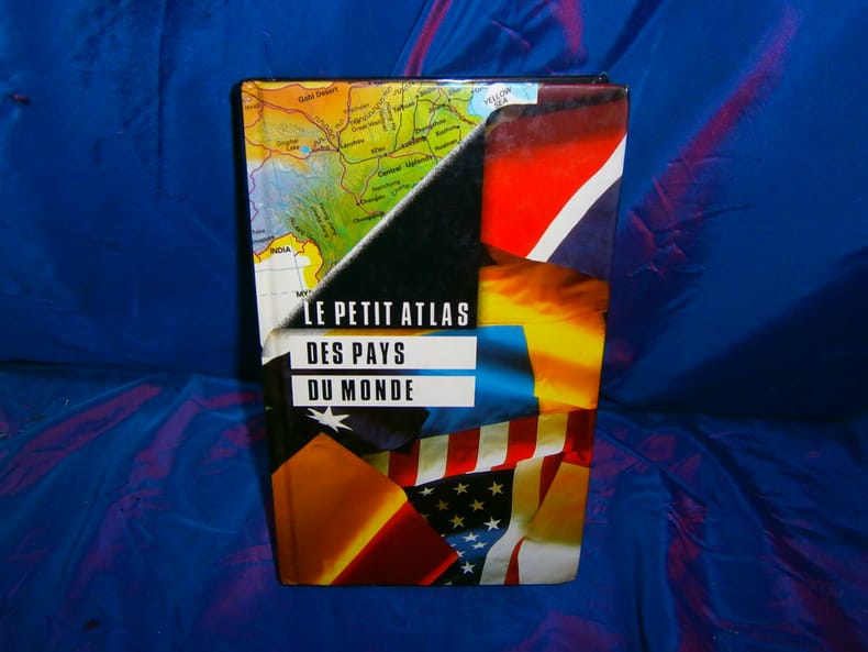
Le petit Atlas des pays du monde
France loisirs 1995 415 pages in8. 1995. Cartonné. 415 pages.
Referenz des Buchhändlers : 75321
|
|
|
Williams Brian Lye Keith (cartographie) Lye Keith (cartographie)
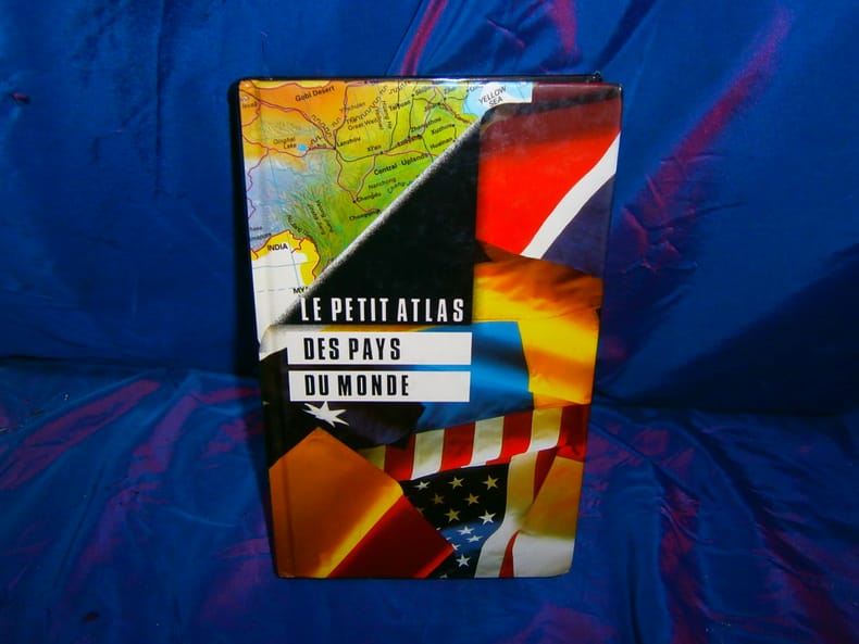
Le petit Atlas des pays du monde
France loisirs 1995 415 pages in8. 1995. Cartonné. 415 pages.
Referenz des Buchhändlers : 87879
|
|
|
Williams Brian Lye Keith (cartographie) Lye Keith (cartographie)
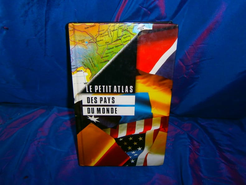
Le petit Atlas des pays du monde
France loisirs 1995 415 pages in8. 1995. Cartonné. 415 pages.
Referenz des Buchhändlers : 98687
|
|
|
Wild, Johannes
Karte des Kantons Zürich im Masstab von 1:25000 nach den in den Jahren 1843 bis 1851 gemachten Aufnahmen von 1825 bis 1865 auf Stein gravirt im topographischen Bureau in Zürich.
Zürich, Meliorations- und Vermessungsamt, 1990. 4°-quer. Titelblatt, Ueberischt und 30 faksimilierte, farbige Kartenblätter. 16 Seiten Dokumentation zur Faksimilierung. Orig. Pappschachtel mit Deckelschild. + Wichtig: Für unsere Kunden in der EU erfolgt der Versand alle 14 Tage verzollt ab Deutschland / Postbank-Konto in Deutschland vorhanden +, A|B [2 Warenabbildungen]
Referenz des Buchhändlers : 1904CB

|
|
|
Wilford, John Noble.
MAPMAKERS.
414p. Numerous illustrations. 8vo. Original printed wraps. **PRICE JUST REDUCED! REF4
|
|
|
WILHELM GREVE, (Map maker).; OSCAR FÜRSTENAU, (1826-1863), (Lithographer).
[LARGE COLLECTION OF MILITARY MAPS AND PLANS OF PRUSSIA] 53 Preussische Karten. [i.e. 53 Prussian maps].
Very Good German Original color lithograph maps in 7 special cloth cases. Cases large 8vo., only seventh one is smaller which is covered by European marbling. Bookseller and bibliothek stamps on some maps, plans and sketches; and cases interior. A fine map collection. Contents: V.1: Includes 1 map, 2 plans and 5 skecthes, 1 uebersichtskarte. Uebersichtskarte für die Geschichte des Iten und IIten schlesisschen Krieges von 1740-1745. Kriege Friedrichs des Grossen. 1/740000. 73x81 cm.; Plan zur Erstürmung von Glogam am 9 Marz 1741 (Entworfen nach alten Planen). 1/6250 / 1/100000. 48x52 cm; Plan der Schlach bei Mollwitz am 10 April 1741. 1/25000. 43x59 cm.; (Skizze) Stellung der preussischen und oesterreichischen Truppenam, 3 Januar 1741. 1/740000. 30x30 cm.; Skizze zum Scharmützel bei Ellguth und zum Gefecht bei Ottomachall am 9. Januar 1741. 1/67500. 34x26 cm.; Skizze zu den Winterquartieren des preussen mit Stellung der Truppen am 20 Februar 1741. 1/740000. 46x52 cm.; Skizze zum Ueberfall bei Baumgarten am 27 Feb. 1741. 1/50000. 29x34 cm.; Marsch der oesterreichischen Armee unter F. M. Neipperg und der preussischen Truppen unter dem Könige von der Schlacht bei Mollwitz. 1/1480000. 36x42 cm.; [.] Standorte des preussischen Heeres bei Ausbruch des Krieges 1740. 1/2400000. 34x55 cm.; V.2: 12 pieces: 3 uebersichtskarten, 2 planen, 7 skizzen. ... von Europa im Jahre 1756. 1/18000000. 33x46 cm.; ... des südöstlichen Kriegsschauplatzes. 1/740000. 65x95 cm.; Standorte des preussischen uns sachsischen Heeres und Stellung des oestreichischen Truppen in Böhmen, Mahren, oestrç Schlesen und Erzth. oesterreich var Beginn des siebenjahrigen Krieges. 1/2200000. 56x72 cm.; Plan der Schlacht bei Lobositz am 1. Oktober 1756. Verlauf des Schlact bis etwa 12 Uhr Mittags. 1/25000. 47x60cm (Also includes Plan der 2ten Attacke des preussischen Kavallerie and Skizze des beiderseitigen Vormarsches am 30ten September 1756).; ... Weiterer Verlaufdes Schlact bis etwa 3 Uhr Nachtmittags. 1/25000. 47x60 cm.; Skizzen: 1. Vormarssch 28. 8 bis 10.9.56. 2.-3. Pirna 1.10.56. 4. Bewegungen Schwerins 56. 5. Pirna 10.10.56. 6. Pirna 12.10.56. 7. Pirna 13.10.56. V.3: 5 skizzen (No: 8-12) und 3 plannen (No: 3, 4-A, 4-B). Plan 4-A-4-B: Prag, 6.5.1757.; Plan 3: Reichenberg, 21.4.57. Skizze 8: Postrungen und Winterquartiere Dezember 56 (Huge size).; Versammlung der Heere, Marz und April 57.; Einmarsch bis 30.4.57.; Stellungen am 1.5.57.; Stellungen am 5.5.57. V.4: Karten 1,2,3,5 (4 is missing); skies 31,32; uebersichtskarte 5; Plan 12-B. ... des nordöstlischen Kriegsschauplatzes (Huge size).; Skizze 31: Heeresbewegungen vom 11.11.57 bs zum Einrücken in die Winterquartiere, Winter 1757-58.; (World War 1): Karte 1: Belgien und nordost-frankreich. Ostpreussen, polen, kurland, Weissrussland.; Galizien und Wolkynien.; Kleinasien , Schweizes Meer, Kaukasien, Kurdistan, Armenien, Aserbeidschan, Arabier, Mittellandisches Meer: Vordasien map. V.5: Sizzen 20-24 - Planen 6-A, 6-B - 9. Planen: Gr. Jagersdorf, 30.8.57.; Jager b. Goerlitz, 31.8.-9.9.57. Moys, 7.9.57.; Breslau, 22.11.57.; Schweidnitz, 24.10-12.11.57.; Skizze 20: Feldzung in ostpreussen Vormarsch des russischen Heeres bis 6.7.57.; 21: Heeresbewegungen vom 6.7.57 bis zur Schlact bei Gr. Jagersdorf. 22: ... nach der Schlact bei Gr.-Jagersdorf bis zum Schluss.; 23: Bewegungen i. d. Lausitz u. i. Schleisen, 20.8.-30.11.57.; 24: Lager bei Liegnitz, 19.-27.9.57. V.6: Plan 5-A, 5-B - Skizzen no: 13-19. Plans: Kolin, 18.6.57.; Kolin, 18.6.57.; Skizzen 13: Beiderseitige Stellungen 8.5.57.; 14: Operationen Beverns u. d. Königs gegen Daun 10.5.-17.6.57.; Bewegungen vom 20.6.-1.7.57. Stellungen vom 1.7.57.; Rechten Elbufer in der ersten Halfte des Juli 1757.; ... vor Zittau, 12.-20.8.57. V.7: 4 plans in cloth covered with European marbling. These last 4 plans from "Suworow und Polens untergang. Nach archivalischen Quellen dargestellt" von Friedrich von Smitt, 1858 First Edition. Pl. 1: Der Schlact am Rymnik den 11/22 Septeember 1789. Pl. 2: ... der
|
|
|
WILKES (J.).
Cumberland.
London, 1802, mapa grabado en cobre, suavemente coloreado a mano, de 23'5 x 19 cm.
|
|
|
Wilkie, Richard W. ; Tager, Jack [Ed.]
Historical Atlas of Massachusetts
31.5x41 cm. 152 pages. Hardcover with dust jacket. Cover corners slightly rubbed. Else in good condition. PLEASE NOTE: This item is overweight. We may ask for extra shipping costs.
|
|
|
Wilkingson, Robert
WILKINSON'S ATLAS CLASSICA : being a collection of maps of the countries mentioned by the ancient authors both sacred and profane with their various subdivisions at different periods
London: Robt. Wilkinson 1823. 1st Edition . Hardback. Vg. Folio. 52 coloured plates - 45 maps 7 chrono-geological charts 7 maps double-page. Orignal boards and spine. Fine contents with hand-coloured maps thoughout. Rubbed and worn boards but a sound binding needing new paper covering pasted to the boards.The fine map plates are dated between 1800 and 1823 <br/> <br/> Robt. Wilkinson hardcover
Referenz des Buchhändlers : Map926
|
|
|
WILLIAM FRANKLIN [FRANCKLIN], (18th-19th century).
[RARE TROJAN MAP] Bemerkungen über die Ebene von Troja.; Uebersicht der neuesten geographischen Veranderungen in den Jahren 1799 und 1800 (Allgemeine Geographische Ephemeriden VII. Bds. erstes Stick. Januar 1801).
Very Good German Modern soft cover. Cr. 8vo. (20 x 12 cm). In German. 114 p., 1 folded map of Troia (Ebene von Troja) and one folded table (Statistische Tabelle auf das Jahr 1800). (Books is probably missing, because text is not completed on 114th page). Franklin's article pp. 25-64. Map of Troia (Charte von der Ebene von Troja) oblong 19x24 cm. Bemerkungen über die Ebene von Troja.; Uebersicht der neuesten geographischen Veranderungen in den Jahren 1799 und 1800 (Allgemeine Geographische Ephemeriden VII. Bds. erstes Stick. Januar 1801). It's just for sale for its map and Franklin's 'Troy'. Franklin was captain in the East India Company's service. His article of 'Bemerkungen über die Ebene von Troja" [Remarks and observations on the plain of Troy] reflects the romantic spirit of Europe in its period, especially on Hellenism. This volume (seventh) of the serie (Allgemeine Geographische Ephemeriden) is rare and map which it includes rare as well. Could not be found any copy of this volume in OCLC.
|
|
|
Wilmot, Sydney (editor); with J K Finch; Walter L Huber; F H Peters; William L Hartley; George R Schneider; et al
Transactions of the American Society of Civil Engineers : Centennial Transactions Volume CT 1953
New York: American Society of Civil Engineers 1953. Fine condition. Bright clean square and tight. Sharp corners. Gilt on cover is still bright and shiny. No owner's name or bookplate. Pages are fresh and crisp. No underlining. No highlighting. No margin notes. Illustrations throughout. Author Index. Subject Index. Includes: A HUNDRED YEARS OF AMERICAN CIVIL ENGINEERING 1852-1952 by J. K. Finch pp. 28-96; AN ENGINEERING CENTURY IN CALIFORNIA by Walter L. Huber pp. 97-111; SURVEYING AND MAPPING IN CANADA 1852-1952 by F. H. Peters pp. 857- 871; WATERWAY GROWTH IN THE UNITED STATES by William L. Hartley pp. 976-1041; HISTORY AND FUTURE OF FLOOD CONTROL by George R. Schneider pp. 1042- 1099; etc. There are also papers on Civil Engineering - History and Practice; Engineering Education; City Planning; Construction; Irrigation; Power Sanitary Engineering; Soil Mechanics; Structural; Surveying; Transportation; Waterways; Allied Interests Metals in the Economy; Synergism between Engineering and Petroleum; Iron and Steel Production 1851-1951. Bound in the original black cloth. . First Edition. Hardcover. Fine condition/No dust jacket. 8vo. xii 1330pp. American Society of Civil Engineers Hardcover
Referenz des Buchhändlers : 003010
|
|
|
Winslow, A
The Mapping of Missouri.
St. Louis, 1892. M. 1 farb. Faltkte. u. zahlr. Ktn.-Skizzen. S. 57-99. OU. m. St. u. Sign. (Trans. of The Acad. of Science of St. Louis 6,3).
Referenz des Buchhändlers : 245892
|
|
|
Witting, Rolf; Cajander, A. K.; Ramsay, W.; Grano, J. G.; Various
Atlas of Finland Suomen Kartasto Atlas ver Finland, 1925
Otava,, Kustannusosakeyhtio; Geographical Society of Finland,, 1926 Original publisher's paper-covered boards, Elephant folio 46x35cm. 8 pages + 38 double-page color maps. Text in Finnish and English, In fine condition.
Referenz des Buchhändlers : 69800
|
|
|
Wit, Frederik de
Carta Noua accurata del Paßagio et strada dalli Paesi Baßi per via de Allemgne per Italia et per via di Paesi suizeri a Geneua, Lione et Roma.[altkolorierter Kupferstich / handcolored copper engraving].
o.J.
Referenz des Buchhändlers : 46786BB

|
|
|
WITH COMPLIMENTS OF THE MINISTRY OF INFORMATION, KINGDOM OF SAUDI ARABIA.
Saudi Arabian map: The Kingdom of the Saudi Arabia.= Harita al-Mamlakat al-Arabiyya al-Saudiyya.
Very Good English Original folded color map. Oblong atlas folio. (60x91 cm). Bilingual in English and Arabic. Arabic map and texts with b/w photographs of some views from Saudi Arabia and English map and texts with b/w photos of Jeddah, Riyadh and Dhahran airports with legends and "distances in kilometers". It shows a very detailed landscape of entire Arabian Peninsula including Saudi Arabia, Aden, Oman, Muscat Qatar, Trucial Coast, Nafud, Dahna, Rub' Al-Khali, Najran, Asir, Yemen, Ramlat As Sab'atayn, Dhofar, Al Mahrah, Hadhramaut, Kuwait, Neutral Zone, and others.
|
|
|
WITT DE, (1630-1703).
Occidentalior Tractus Maris Mediterranei / Wester Gedeelte van de Middelandse Zee
Carta geografica incisa in rame (cm. 48,5x57,5 e margini) con bellissima colorazione coeva. Classica carta eseguita sul modello dei portalani. In De Wit si combinano magistralmente la precisione geografica e il dettaglio artistico. Gli Olandesi apprezzavano molto anche il fattore estetico e l'incantevole gusto decorativo di Wit fu un ulteriore elemento per il suo successo. Dopo la morte di De Wit e di suo figlio, le lastre vennero acquistate da Louis Renard, che le diede di nuovo alle stampe con un suo testo. Reiner e Josua Ottens ristamparono l'atlante di Renard nel 1739 con testo in francese e di nuovo nel 1745 con testo in olandese e i loro nomi incise sulle lastre per la prima volta.. .

|
|
|
WITT DE, Federico.
Novissima et accuratissima Septentrionalis ac Meridionalis Americae descriptio...
Carta geografica incisa in rame (cm. 48,6x57 e margini) con bellissima colorazione coeva. Bella carta geografica raffigurante l'America Settentrionale e quella Meridionale, interessante è l'introduzione di alcuni elementi quali: la California raffigurata come isola, i Grandi Laghi lo Stretto di Anian e nella parte meridionale i territori del Quiri Regio, le isole Salmon, la Nuova Guinea. In De Witt si combinano magistralmente la precisione geografica e il dettaglio artistico. Gli Olandesi apprezzavano molto anche il fattore estetico e l'incantevole gusto decorativo fu un ulteriore elemento di successo. Dopo la morte di De Wit e di suo figlio, le lastre vennero acquistate da Louis Renard, che le diede di nuovo alle stampe con un suo testo. Reiner e Josua Ottens ristamparono l'atlante di Renard nel 1739 con testo in francese e di nuovo nel 1745 con testo in olandese e i loro nomi incise sulle lastre per la prima volta. Bella e rara carta geografica, con mancanza in parte dell'America settentrionale (restaurata) e precisamente nella sezione pigmentata in verde, dove l'acidità del colore naturale ha creato dei sollevamenti e delle crepe.. .
|
|
|
WITT DE, Federico.
Poli Arctici et Circumiacentium Terrarum descriptio novissima Per Fredericum de Wit, Amstelodami.
Carta geografica incisa in rame (cm. 48,8x58 e margini) con bellissima colorazione coeva. Bella carta geografica raffigurante il Polo Nord, che inclde l'Europa Settentrionale, parte della Siberia, della Groenlandia e del Canada Orientale (Baie di Baffins, di Button e di Hudson). L'altra metà del circolo è denominata "Americae Septentrionalia incognita" e "Tartaria Maritima incognita". Gli angoli del quadrato entro cui è inscritto il cerchio sono decorati da scene con navi, cetacei ed animali artici. In De Wit si combinano magistralmente la precisione geografica e il dettaglio artistico. Dopo la morte di De Wit e di suo figlio, le lastre vennero acquistate da Louis Renard, che le diede di nuovo alle stampe con un suo testo. Carta molto inusuale e decorativa.. .
|
|
|
WITT DE, Federico.
Poli Arctici et Circumiacentium Terrarum descriptio novissima Per Fredericum de Wit, Amstelodami.
Carta geografica incisa in rame (cm. 48,8x58 e margini) con bellissima colorazione coeva. Bella carta geografica raffigurante il Polo Nord, che inclde l'Europa Settentrionale, parte della Siberia, della Groenlandia e del Canada Orientale (Baie di Baffins, di Button e di Hudson). L'altra metà del circolo è denominata "Americae Septentrionalia incognita" e "Tartaria Maritima incognita". Gli angoli del quadrato entro cui è inscritto il cerchio sono decorati da scene con navi, cetacei ed animali artici. In De Wit si combinano magistralmente la precisione geografica e il dettaglio artistico. Dopo la morte di De Wit e di suo figlio, le lastre vennero acquistate da Louis Renard, che le diede di nuovo alle stampe con un suo testo. Carta molto inusuale e decorativa.. .
|
|
|
Wolff Christian.
ELEMENTA GEOGRAPHIAE ET HYDROGRAPHIAE.
(Codice OS/0268) Volume monografico completo, capitolo autonomo tratto dall'opera "ELEMENTA MATHESEOS UNIVERSAE, Tomus II". In 4° antico (223x175 mm) da p. 607 a p. 702 + 4 tavole ripiegate con numerose incisioni in rame. Senza frontespizio, ma con proprio titolo. Capolettera.Testo su 2 colonne, in latino. Carta normalmente ossidata, in buone condizioni. Legatura moderna tutta tela, titolo tipografico al dorso. Ottimo stato. ~~~ SPEDIZIONE IN ITALIA SEMPRE TRACCIATA

|
|
|
Wood H. J.
La scoperta del mondo
illustrazioni

|
|
|
Wood,H.J.
La scoperta del mondo.
<br/> TITOLO: La scoperta del mondo. <br/> AUTORE: Wood,H.J.<br/> CURATORE: Trad.dall'ingl.di R.degli Uberti.<br/> EDITORE: Sansoni<br/> DATA ED.: 1960,<br/> COLLANA: Coll.Le Piccole Storie Illustrate.<br/>
|
|
|
Woodward, David
Catalogue of Watermarks in Italian Printed Maps. (ca 1540-1600).
cm. 17,5 x 24,5, 206 pp. con 335 ill. n.t. e 335 grafici. Rilegato. Biblioteca di bibliografia italiana Questo catalogo rappresenta la prima raccolta importante di radiografie di filigrane, indispensabile per quelle istituzioni che posseggono collezioni di carte geografiche, stampe, disegni, musiche o manoscritti italiani del sedicesimo secolo. Sono fornite 335 riproduzioni di filigrane con la descrizione generale della filigrana, data, titolo, bibliografia, localit? Testo inglese. This catalogue represents the first important collection of watermarks indispensable for those institutions possessing sixteenth century Italian geographical maps, prints, drawings, music or manuscripts. 335 watermark reproductions are supplied with a general description of the actual mark, the date, its title, bibliography and location. Inglese 720 gr. 206 p.
|
|
|

 Per e-mail erhalten
 Als pdf-Dokument herunterladen
 RSS feed
 Permanenter link


