|
MAURETTE F.
GEOGRAPHI DE LA FRANCE - CLASSE DE PREMIERE - BACCALAUREAT - 1° PARTIE
LIBRAIRIE HACHETTE ET CIE - 4° EDITION. 1910. In-18. Cartonné. Bon état, Couv. convenable, Dos satisfaisant, Intérieur frais. 127 pages. Quelques palnches illustrées de cartes en noir et blanc, dépliantes.. . . . Classification Dewey : 912-Atlas, cartes et plans
Referencia librero : RO30073851

|
|
|
Maurette, F
Atlas Pratique.
Paris., Librairie Hachette., 1929. 250 cartes et cartons en couleurs. Graphiques de statistique en noir. Index alphabétique de 16000 noms. 84 farbige Kartenseiten, VIII Seiten Graphiken (Statistiken), 23 Seiten Index. Zustand: Aus einer Institutsbibliothek ausgeschieden, Einbandkanten berieben und bestossen, Rücken mit Klebestreifen unten und oben, mittig am Rücken angeplatzt, Vorsatz mit Bibliotheksstempel. 4°. OHalbleinen.
Referencia librero : 043013
|
|
|
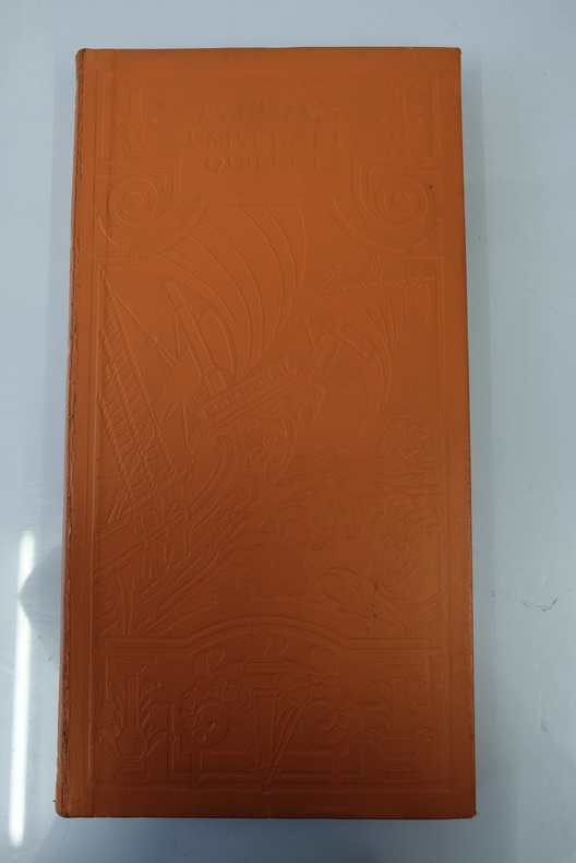
Maurice Allain
Atlas universel Quillet. Le monde français (France et colonies). Deuxième partie : L'Europe - L'Asie - L'Afrique - L'Amérique - L'Océanie
Librairie Aristide Quillet, Paris, Strasbourg, Bruxelles, 1929. 2 volumes in-folio oblongs (45 / 23 cm) demi-basane orange. Plats estampés à froid. Le monde français : 42 cartes en couleur suivies d'un index alphabétique de 200 pages. Deuxième volume : 57 cartes en couleurs à double pages, certaines dépliantes.Table des cartes. Index alphabétique (59 pages).
Referencia librero : ATLAS06M
|
|
|
MAURICE FALLEX
NOUVEL ATLAS CLASSIQUE. 3e EDITION.
DELAGRAVE. 1923. In-4. Cartonné. Etat d'usage, Couv. légèrement passée, Dos satisfaisant, Intérieur frais. 79 pages de cartes en couleurs. Dos restauré, bande de papier bleue collée. Premier plat détaché.. . . . Classification Dewey : 912-Atlas, cartes et plans
Referencia librero : R260145569
|
|
|
MAURICE FALLEX
NOUVEL ATLAS CLASSIQUE. 9e EDITION.
DELAGRAVE. 1937. In-4. Cartonné. Etat d'usage, Couv. partiel. décollorée, Dos satisfaisant, Intérieur frais. 79 pages de cartes en couleurs. Dos restauré, bande de toile bleue collée.. . . . Classification Dewey : 912-Atlas, cartes et plans
Referencia librero : R260145570
|
|
|
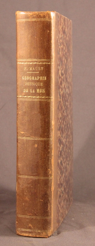
MAURY F.; TERQUEM P.-A. (trad.):
Géographie physique de la mer.
Paris, Lib. militaire, maritime et polytechnique de J. Corréard, 1858. In-8 de 571 pages suivies des planches, demi-basane brune, dos lisse orné. Coiffes épidermées, mors et charnière du 1er plat fendus, quelques rousseurs.
Referencia librero : 2087
|
|
|
Mayer, Tobias
Mathematischer Atlas, in welchem auf 60 Tabellen alle Theile der Mathematic vorgestellet. (Grundwerk und Supplement in 1 Bd.).
Augsburg, Pfeffel, (1745). 1 Kupfertitel, 1 Bl. (Vorbericht), 68 teils kolorierte Kupfertafeln. Quer-Gr.-Fol. Mod. Ldr. [5 Warenabbildungen]
Referencia librero : 20271

|
|
|
MAYGRIER J.-P.
NOUVELLES DEMONSTRATIONS D'ACCOUCHEMENTS avec des planches en taille-douce accompagnées d'un texte raisonné propre à en faciliter l'explication. Fac-similé
P., Louis Pariente pour les laboratoires Cilag, 1988. In-folio, reliure skivertex bordeaux, vignette sur le plat supérieur, toutes tranches dorées, 262 pages dont frontispice et 80 planches. Accident à la coiffe supérieure (frottements suite à un choc), très bon état par ailleurs. Tirage numéroté (388/500) Fac-similé de l'édition publiée chez Béchet 1822-1827.
|
|
|
MAZELLIER Philippe
TAHITI.
reliure éditeur - 17,5x27 - 191 pp - sans date - éditions RENCONTRE, Lausanne.Collection " ATLAS DES VOYAGES, RENCONTRE" dirigée par Charles-Henri FAVROD.Nombreuses illustrations dans et hors texte.
Referencia librero : 4951
|
|
|
Mc NALLY Rand
Wolrd Atlas. Imperial Edition
CHEZ L'AUTEUR. 1968. In-4. Cartonnage d'éditeurs. Bon état, Couv. convenable, Dos satisfaisant, Intérieur frais. 294 pages. Nombreuses illustrations et photos en noir et blanc et bicolores dans le texte et en planches hors-texte. Nombreuses planches d'Atlas en couleurs, hors-texte. Dos cuir bordeaux. Ouvrage en anglais.. . . . Classification Dewey : 912-Atlas, cartes et plans
Referencia librero : RO80003910
|
|
|
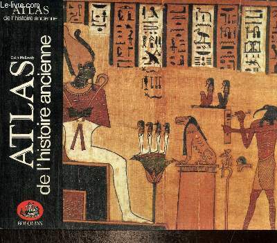
McEvedy Colin
Atlas de l'histoire ancienne
Robert Laffont. 1985. In-8. Broché. Etat d'usage, Couv. légèrement pliée, Dos satisfaisant, Intérieur acceptable. 95 pages. Nombreuses cartes en noir et bleu hors texte.. . . A l'italienne. Classification Dewey : 912-Atlas, cartes et plans
Referencia librero : RO80256466
|
|
|
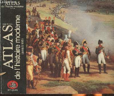
McEvedy Colin
Atlas de l'histoire moderne (jusqu'à 1815)
Robert Laffont. 1985. In-8. Broché. Etat passable, Coins frottés, Dos frotté, Papier jauni. 95 pages. Quelques rousseurs. Texte sur 3 colonnes. Nombreuses cartes bicolores.. . . A l'italienne. Classification Dewey : 912-Atlas, cartes et plans
Referencia librero : RO30357074
|
|
|
McIntyre, Douglas A & Hull, Karen S (editors) ; James Atlas (Foreword)
The Harvard Advocate Anniversary Anthology
Cambridge MA: Schenkman Books. New. 1987. Hardcover. 0870470299 . FREE UPGRADE to Courier/Priority Shipping Upon Request IN STOCK AND IMMEDIATELY AVAILABLE FOR SHIPMENT - Flawless copy brand new pristine never opened -- 413 pages. -- with a bonus offer-- . Schenkman Books hardcover
Referencia librero : 54176 ISBN : 0870470299 9780870470295
|
|
|
McLeod, Judyth A
Atlas der legendären Länder.
Hamburg : National Geographic, 2010. Von Atlantis bis zum Garten Eden 319 S. (28x23 cm) illustrierter Pappband / gebundene Ausgabe
Referencia librero : 52641
|
|
|
McLintock, A. H. (Ed.)
A Descriptive Atlas of New Zealand.
Wellington, Owen, 1960. XXI, 109 SS. Text, 48 mehrfarbige Karten, XXIV s.w. Tafeln, zahlreiche Tabellen und Diagramme im Text. 4° (ca. 31 x 25 cm), original Pappband, Rückentitel goldgeprägt. Im illustrierten original Schutzumschlag (dieser etwas angeschmutzt und mit hinterlegten kl. Randläsuren).
Referencia librero : 24252
|
|
|
McMillan, Beverly
Atlas des menschlichen Körpers : Aufbau, Funktion und Krankheiten. Argosy Publishing. [Veröff. von National Geographic Deutschland.Übers. Isabelle Fuchs]
Hamburg : Gruner + Jahr/RBA 2011. Autoris. dt. Ausg. 288 S. : überw. Ill. ; 35 cm Pappe [2 Warenabbildungen] 0
Referencia librero : 71526

|
|
|
MEA P.
Carte itinéraire d'un voyage de Hakodaté à Yocohama (Japon) par M. Marin.
IMP. MEA. Non daté. In-Folio. En feuillets. Etat passable, Couv. convenable, Dos satisfaisant, Intérieur frais. Carte dépliante en noir et blanc, de 44/30 cm quelques manques en coins et en marge de la carte n'altérant pas la lecture de la carte. Pas de plats de couverture.. . . A l'italienne. Classification Dewey : 912-Atlas, cartes et plans
Referencia librero : RO80006281
|
|
|
Mecator, Gerardus
Atlas von 1595 - Atlas sive Cosmographiecae meditationes de fabrica mundi et fabricati fugura. Atlantis Pars Altera. Geographia Nova Totius Mundi. Nachdruck der Ausgabe Duisburg 1595. Angehängt: Einführung und Erläuterungen.
Zü., Coron Vlg 1985. Folio. 10 nn Bll. 57 doppelblattgroße Karten (farbig) 32 S. 2-spaltig mit Erläuterungen mit z. Tl. farbigen Abb., OLeder. Einband mit reicher Goldpräg., 6 Bünde, 3seitiger Farbschnitt. Sehr schön und sauber erhalten.
Referencia librero : 33264BB
|
|
|
MEDECINS DU MONDE
ATLAS DU MONDE - CARNETS DE ROUTE.
MEDECINS DU MONDE. 1986. In-12. Broché. Bon état, Couv. convenable, Dos satisfaisant, Intérieur frais. 31 pagesd illustrées de nombreuses cartes en couleur - Couverture illustrée d'une carte en cuoleur.. . . . Classification Dewey : 912-Atlas, cartes et plans
Referencia librero : R320008125
|
|
|
MEDECINS DU MONDE
Atlas du Monde. Carnets de route.
CHEZ L'AUTEUR. 1986. In-12. Broché. Bon état, Couv. convenable, Dos satisfaisant, Intérieur frais. 31 pages.Nombreuses planches de cartes en couleur.. . . . Classification Dewey : 912-Atlas, cartes et plans
Referencia librero : RO20038988
|
|
|
Medori Henri
GAP Nº 28 - Atlas Mondial
Aedis 2013 16 pages 28 6x38 79x0 5cm. 2013. Broché. 16 pages.
Referencia librero : 500123368

|
|
|
MEER FREDERIC VAN DER
ATLAS DE LA CIVILISATION OCCIDENTALE
Elsevier. 1952. In-Folio Carré. Relié. Bon état. Couv. légèrement passée. Dos satisfaisant. Intérieur frais. 228 pages. Illustré de nombreuses photos en noir et blanc (héliogravées) et de cartes en couleur. Plats légèrement tachés. 2e édition. Préface de René Grousset.

|
|
|
MEGGLE ARMAND
ATLAS ECONOMIQUE ET TOURISTIQUE DES REGIONS DE FRANCE ET D'ALGERIE
MINISTERE DU COMMERCE ET DE L'INDUSTRIE. 1923. In-4. Broché. Etat d'usage, Tâchée, Dos abîmé, Intérieur frais. 88 pages augmentées de nombreuses photos et illustrations en noir et blanc in et hors texte - renfort adhésif sur le dos retenant le 1er plat - plats légèrement abîmés et tâchés -. . . A l'italienne. Classification Dewey : 912-Atlas, cartes et plans
Referencia librero : R160203360
|
|
|
MEHMED B. EMIR HASAN EL-SU'UDI.
History of the West Indies known as the New Hadith. A history of the discovery of America.= Tarih-i Hind-i Garbi veya Hadis-i Nev.
Very Good Very Good English Original bdg. Dust wrapper. Color ills. 4to. 56, [ix] p., color ills., 116 leaves of color reprint in Ottoman script from Müteferrika. In Ottoman script (color reprint of Müteferrika print), Turkish transcription, and English translation. The text has been rendered into English by Suheyla Artemel. Contents: A Brief History of the Discovery of the New World, Geographical Description of the New World, Vegetation of the New World, The Fauna of the New World, The People of the New World, The Habits and Traditions of the People. "Tarih-i Hind-i Garbi el-Musemma bi Hadis-i Nev" (History of the West Indies Known) as the New Hadith) which contains an account of the discovery of America, was translated from European sources by Mehmet b. Emir Hasan el-Su'udi approximately ninety years after the event and dedicated to Murad III. The writer's aim to inform monarch about the new world.
|
|
|
MEHMED ESREF (Binbasi [i.e. Major]), (1846-1912).
[PLATE / DEMOGRAPHY / ORIGINS OF THE PEOPLES IN EUROPE & USA] Hükûmât-i muhtelîfede mevcûd akvâmin kavmiyetini gösterir levha. [i.e. showing the origins of existing communities in various countries [in Europe & USA]].
Very Good Turkish, Ottoman (1500-1928) Original color litographed plate. 18x41 cm. In Ottoman script (Turkish with Arabic letters). Two-paged plate. A rare color lithographed plate from Mehmed Esref's 'Muhtasar Umûmî Atlas'. A very detailed plate showing Europe's and the US' demographic structure in 1922 with very attractive detailed statistical schemes. Besides the usual demographic scheme, there are 28 European states on the plate: Germany, France, Spain, Russia (Soviets), England, Italy, Poland, Romania, Holland, Norway, Estonia, Czechoslovakia, Austria, Switzerland, Lithuania, Yugoslavia, Portugal, The United States of America, Hungary, Sweden, Denmark, Latvia, Belgium, Greece, Finland, Avrupa-yi Türkî [i.e. Turkey in Europe], Albania. Mehmed Esref (1846-1912) was a Turkish / Ottoman military cartographer and educator in the Ottoman military school [Mekteb-i Harbiye] active in the first part of the 20th century, and he prepared and published many separate maps and atlases more besides this one.
|
|
|
MEHMED NES'ET [DEMIRTAS] BEY (Müdafaa-i Milliye Vekâleti Harita Dairesi Kartografi Subesi Müdüriyetinde Mütekâid Miralay - Albay-), (1866-1928).
[MAP of AMERICA] Yeni Simalî ve Cenubî Amerika [New North and South America]. Published by Owner of Kanaat Kitabhanesi: Ilyas Efendi.
Very Good Turkish, Ottoman (1500-1928) Original color map. Very good and clean. Atlas folio. (73 x 59 cm). In Ottoman script. Map of New United States, Canada, Alaska; and South America. Scale: 1/35000000. Hegira: 1341 = Gregorian: 1925. Mehmed Neset Bey was born in Scutari, Istanbul. He served as colonel in World War 1 and Turkish National Struggle. He was a military origin map-maker. (Source: Savaslarda haritacilar, Harita Genel Komutanligi, Ank., 2017). Extremely rare.
|
|
|
MEHMED NES'ET [DEMIRTAS] BEY (Müdafaa-i Milliye Vekâleti Harita Dairesi Kartografi Subesi Müdüriyetinde Mütekâid Miralay - Albay-), (1866-1928).
[MAP of NEW OCEANIA] Yeni Okyanusya. Published by Owner of Kanaat Kitabhanesi: Ilyas Efendi.
Very Good Turkish, Ottoman (1500-1928) Original color map. Very good and clean. Atlas folio. (73 x 59 cm). In Ottoman script. Map of Oceania. It shows Australia, New Zealand, Micronesia etc. Scale: 1/20.000.000. Hegira: 1341 = Gregorian: 1925. Mehmed Neset Bey was born in Scutari, Istanbul. He served as colonel in World War 1 and Turkish National Struggle. He was a military origin map-maker. (Source: Savaslarda haritacilar, Harita Genel Komutanligi, Ank., 2017). Extremely rare.
|
|
|
Meier Helmut. Hrsg
Mit anderen Augen. Der Bildführer von Braunschweig und Umgegend aus der Vogelschau.
Braunschweig., Kommissionsverlag der Buchhandlung Benno Goeritz., 1930. Zur Förderung des heimatkundlichen Unterrichts entworfen, gezeichnet und hrsg. von Helmut Meier. 10 einseitig bedruckte Seiten und ein Doppelblatt. Zustand: Bibliotheksexemplar, Titelblatt, Titelblattrückseite und letzte Seite gestempelt - entwertet, Einbandrücken unten mit Bibliotheksschild, Einband gebräunt und fingerfleckig, zwei kleine Zahleneinträge auf dem Einband und Innendeckel. 4°. S OKarton.
Referencia librero : 008859
|
|
|
Meier, Paul Jonas
Niedersächsischer Städteatlas. 1. Abteilung: Die braunschweigischen Städte. 2. Aufl.
Braunschweig, Westermann , 1926. gr.Folio(49x38cm), 17 Tafeln, 13 Stadtansichten, 2 Karten im Text, 50 S., Pappmappe
Referencia librero : 7-3-650

|
|
|
Meier, Paul Jonas
Niedersächsischer Städteatlas. 2. Abteilung: einzelne Städte. 4. Osnabrück, 5./6. Einbeck und Northeim
Braunschweig und Hamburg, Westermann , 1935. gr.Folio(49x38cm), 10 S., 10 S., 3 Tafeln, 3 Tafeln, Pappmappe
Referencia librero : 7-3-653

|
|
|
Meier, Paul Jonas
Niedersächsischer Städteatlas. 2. Abteilung: einzelne Städte. 1. Hildesheim, 2. Hannover, 3. Hameln
Braunschweig, Westermann , 1933. gr.Folio(49x38cm), 8 S., 3 Tafeln, 7 S., 4 Tafeln, 11 S., 2 Tafeln, Pappmappe
Referencia librero : 7-3-651
|
|
|
Meinhardt Dieter, Schäfer Eberhard
Grand Atlas Mondial. Un outil exceptionnel pour mieux comprendre le monde
Marshall Cavendish. 1998. In-4. Relié. Bon état, Couv. convenable, Dos satisfaisant, Papier jauni. 351 pages. Nombreuses illustrations en couleur dans et hors texte.. . . . Classification Dewey : 912-Atlas, cartes et plans
Referencia librero : RO30344081

|
|
|
Meissas Michelot
Petit Atlas élémentaire par MM Achille Meissas et Auguste Michelot dressé pour la petite géographie méthodique et le manuel de géographie des mèmes auteurs - Atlas A
Hachette 0 In4 - l'atlas comporte 8 carte gravées sur acier rehaussées en couleurs - manque de tissus au dos . Sans date ( vers 1860)
Referencia librero : Dk146
|
|
|
Meissas Michelot
Petit Atlas élémentaire par MM Achille Meissas et Auguste Michelot dressé pour la petite géographie méthodique et le manuel de géographie des mèmes auteurs - Atlas A
Hachette 0 In4 - l'atlas comporte 8 carte gravées sur acier rehaussées en couleurs - manque de tissus au dos . Sans date ( vers 1860)
Referencia librero : Dk146
|
|
|
MEISSAS Achille
PETIT ATLAS ELEMENTAIRE
1900 bradel in-octavo, 8 planches en couleurs sur double page, fin 19ème Paris chez Hachette et Cie,
Referencia librero : 4241
|
|
|
MEISSAS Achille
Petit atlas universel de Géographie ancienne.
Hachette Et Cie Paris Sans date In-8 cartonné ( 270x165 mm ), titre en noir sur papier vert.Dos absent, remplacé par une bande de tissu bleu.14 cartes en couleurs à double pages.
Referencia librero : 78043
|
|
|
MEISSAS Achille - MICHELOT
Petit atlas élémentaire de géographie moderne dressé pour la petite géographie méthodique.
Couverture rigide. Cartonnage de l'éditeur. 8 cartes. 16 x 24 cm. Légèrement défraîchi.
Referencia librero : 138811

|
|
|
MEISSAS ACHILLE / MICHELOT AUGUSTE
PETIT ATLAS UNIVERSEL DE GEOGRAPHIE MODERNE.
HACHETTE ET CIE. vers 1900. In-8. Cartonné. Etat d'usage, Coins frottés, Dos abîmé, Intérieur acceptable. 17 planches de cartes en ouleurs a déplier - Dos manquant.. . . . Classification Dewey : 912-Atlas, cartes et plans
Referencia librero : R320023282
|
|
|
Meissas Achille, Michelot
Petit atlas élémentaire dressé pour la petite géographie méthodique
Chez les auteurs. Non daté. In-8. Cartonné. Etat d'usage, Tâchée, Dos satisfaisant, Papier jauni. 8 cartes dépliantes, en couleurs. Quelques rousseurs. Quelques annotations à l'encre sur les contreplats et en page de faux-titre.. . . . Classification Dewey : 912-Atlas, cartes et plans
Referencia librero : R200105887
|
|
|
MEISSAS ACHILLE, MICHELOT AUGUSTE
PETIT ATLAS ELEMENTAIRE
Chez L. Hachette et Cie, Paris. 1855. In-8 Carré. Relié. Etat passable. Plats abîmés. Dos abîmé. Rousseurs. 16 planches (sur doubles-pages) de cartes en noir et blanc, parfois colorées. Couverture très abîmée avec manques importants. Plats détachés. Nombreuses annotations d'époque au dos des plats, et en pages de garde et de titre. Quelques annotations et taches sur les planches. Dressé pour la Petite Géographie méthodique et le Manuel de Géographie des mêmes auteurs.

|
|
|
MEISSAS ACHILLE, MICHELOT AUGUSTE
PETIT ATLAS ELEMENTAIRE, DRESSE POUR LA PETITE GEOGRAPHIE METHODIQUE
Chez l'auteur - Librairie L. Hachette et Cie. Non daté. In-8 Carré. Relié. Etat d'usage. Plats abîmés. Dos abîmé. Intérieur acceptable. 8 doubles-planches de cartes en couleur. Plats très abîmés avec manques. Couverture se détachant. Annotations au dos du 1er plat. Quelques annotations sur les cartes. 2e moitié du XIXe siècle. Mappe-monde. Europe. Asie...

|
|
|
MEISSAS ACHILLE, MICHELOT AUGUSTE
PETIT ATLAS ELEMENTAIRE, DRESSE POUR LA PETITE GEOGRAPHIE METHODIQUE ET LE MANUEL DE GEOGRAPHIE DES MEMES AUTEURS
Chez L. Hachette et Cie. Non daté. In-8 Carré. Relié. Etat d'usage. Tâchée. Dos satisfaisant. Intérieur bon état. 8 cartes en noir et blanc, colorées, sur planches double page. Dos muet. Bords des plats frottés. Annotations d'époque au dos des plats et des planches. Une planche détachée. Vers 1850. Ouvrages autorisés par le Conseil impérial de l'Instruction publique. Mappemonde. Europe. Asie...

|
|
|
MEISSAS ACHILLE, MICHELOT AUGUSTE
PETIT ATLAS ELEMENTAIRE, DRESSE POUR LA PETITE GEOGRAPHIE METHODIQUE ET LE MANUEL DE GEOGRAPHIE DES MEMES AUTEURS
Chez L. Hachette et Cie. Non daté. In-8. Relié. Etat d'usage, Tâchée, Dos satisfaisant, Intérieur bon état. 8 cartes en noir et blanc, colorées, sur planches double page. Dos muet. Bords des plats frottés. Annotations d'époque au dos des plats et des planches. Une planche détachée.. . . . Classification Dewey : 912-Atlas, cartes et plans
Referencia librero : RO40104176

|
|
|
MELIN
Atlas Melin - Historique et Géographique
PARIS André.. Non daté. In-Folio. Relié toilé. Bon état, Couv. défraîchie, Coiffe en tête abîmée, Intérieur bon état. 70 pages. Nombreuses planches de cartes en couleurs, et quelque-unes en planches hors-texte. Dos et coins en toile rose/rouge. Coiffe en pied légèrement abîmée. Quelques rares rousseurs dans le texte.. . . . Classification Dewey : 912-Atlas, cartes et plans
Referencia librero : RO20049734
|
|
|
Mellinger, Axel & Hoffmann, Susanne
Der grosse Reader's Digest Himmelsatlas.
Stuttgart, Franckh-Kosmos Verlags-GmbH & Co., 2002. 34 cm, 96 Seiten, mit zahlreichen Himmelskarten, Pappband mit Spiralbindung. Genehmigte Sonderausgabe für Reader's Digest leichte Gebrauchsspuren, Kopfecken bestoßen, gut bis sehr gut erhalten.
Referencia librero : 11669AB ISBN : 389915066
|
|
|
Mellinger, Axel und Susanne Hoffmann
Der große Reader's Digest Himmelsatlas. Sonderausg.
Stuttgart: Reader's Digest Deutschland, Schweiz, Österreich, 2002. 96 S., überw. Ill., 34 cm + 2 drehbare Sternkarten für Einsteiger. Opp., Spiralheftung.
Referencia librero : 187436

|
|
|
MENDRAS HENRI ET REILLIER FREDERIC
ATLAS 340 MILLIONS D'EUROPEENS
RAMSAY. 1990. In-8. Broché. Bon état, Couv. convenable, Dos satisfaisant, Intérieur frais. 192 pages. 1re de couverture illustrée en couleur. Nombreux graphisme et schémas en couleur et en noir blanc, dans le texte et hors texte.. . . . Classification Dewey : 912-Atlas, cartes et plans
Referencia librero : RO20149562
|
|
|
Menke, Th. (Theodor)
Orbis antiqui descriptio. In usum scholarum edidit Th. Menke. Editio tertia.
Gotha, Justus Perthes, 1860. Quer-4to. Mit 18 gest. Taf. m. grenzkolorierte Karten. Hldr. d. Zt.
Referencia librero : 26566

|
|
|
MERAY Tibor
AUSTRALIE.
reliure éditeur - 17,5x27 - 251 pp - 1962 - éditions RENCONTRE, Lausanne.Collection " ATLAS DES VOYAGES, RENCONTRE" dirigée par Charles-Henri FAVROD.Nombreuses illustrations dans et hors texte.
Referencia librero : 4978
|
|
|
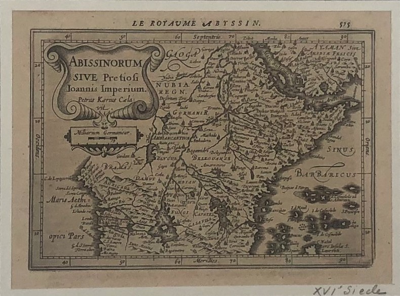
Mercator Gerard / Janssonius/ Petrus Kaerius
Le royaume Abyssin , ABISSINORUM SIVE Pretiosi Ioannis Imperium
Le Royaume abyssin et le royaume du Prêtre Jean par Mercator (XVIIe),19 x 13 cm,texte français au verso
Referencia librero : PHO-422
|
|

 Recibir por correo electrónico
 Descargar en documento PDF
 Flujo RSS
 Link permanente


