|
HUGHES (William).
Philips' School Atlas of Classical Geography. New and enlarged edition with a copious consulting index.
London, s.d. (v. 1900), pt in-4° (18 x 28), 19 cartes en couleurs sur double page gravées sur acier, montées sur onglets, reliure toile havane de l'éditeur. The World as known to the Ancients. The Roman Empire. Britannia. Gallia. Hispania. Italia (North and Central). Italia (South). Grecia (Northern part) with Thessalia and Epirus. Peloponnesus. Agean Sea and islands. Macedonia, Thracia, Mesia, etc. Germania, with Vindelicia, Rhetia, Noricum, and part of Pannonia. Asia Minor. Syria. Palestina. Assyria, Media, Armenia, etc. Aegyptus. Mauretania, Numidia, and Africa. Bel atlas.
Referenz des Buchhändlers : 19651
|
|
|
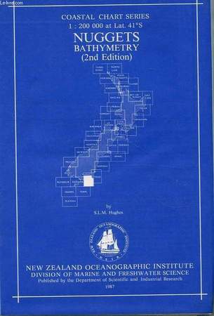
HUGHES S. L. M.
NUGGETS BATHYMETRY, COASTAL CHART SERIES, 1:200 000 at Lat. 41°S
New Zealand Oceanographic Institute - DSIR. 1987. In-8. En feuillets. Etat du neuf, Couv. fraîche, Dos impeccable, Intérieur frais. 1 carte dépliable très grand format en couleur dans sa pochette plastique d'origine.. . . . Classification Dewey : 912-Atlas, cartes et plans
Referenz des Buchhändlers : RO40107295
|
|
|
HUGHES S. L. M.
NUGGETS BATHYMETRY, COASTAL CHART SERIES, 1:200 000 at Lat. 41°S
New Zealand Oceanographic Institute - DSIR. 1987. In-8 Carré. En feuillets. Etat du neuf. Couv. fraîche. Dos impeccable. Intérieur frais. 1 carte dépliable très grand format en couleur dans sa pochette plastique d'origine. 2nd edition. N.Z. Ocean. Inst., Division of Marine and Freshwater Science.

|
|
|
Hulot Nicolas
Planète nature : La Beauté à l'infini
Michel Lafon 2002 In-4 relié 30,4 cm sur 25,2. 191 pages. Très bon état d’occasion.
Referenz des Buchhändlers : 72175
|
|
|
Humbert, Henri [Jean]
Végétation du Grand Atlas marocain oriental. Exploration botanique de l'Ari Ayachi.
Alger, Impr. La Typo-Litho [Druck], 1924. 23 cm. 89 S. mit 13 Plänen. Private Halbleinwand (Hardcover) m. ggpr. R. Gutes Exemplar. Plan 13 am Rand geknittert und mit 3 Einrissen. Mit einer Widmung des Verfassers, diese aber am Rand beschnitten. Vorbesitzer-Namenszüge a. Titel. Aus der Bibliothek von Prof.em. Wilhelm Barthlott, Bonn (Stempel). Extrait du Bulletin de la Sociéte d'Histoire Naturelle de l'Afrique du Nord, Tome 15, pp. 147-234.
Referenz des Buchhändlers : 10932AB

|
|
|
Humboldt, Alexander von
Die Entdeckung der Neuen Welt. Band 1: Kritische Untersuchung zur historischen Entwicklung der geographischen Kenntnisse von der Neuen Welt und den Fortschritten der nautischen Astronomie im 15. und 16. Jahrhundert. Band 2: Geographischer und physischer Atlas der Äquinoktial-Gegenden des neuen Kontinents. Unsichtbarer Atlas aller von Alexander von Humboldt in der Kritischen Untersuchung aufgeführten und analysierten Karten. Textband und Atlasband [vollständig - 2 Bände mit Schuber]
Frankfurt am Main und Leipzig: Insel-Verlag, 2009. 31 cm ; Pp.
Referenz des Buchhändlers : 103475

|
|
|
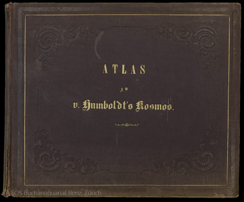
Humboldt, Alexander von
Kosmos. Entwurf einer physischen Weltbeschreibung. ? Dabei: Bromme Traugott: Atlas zu Alex. v. Humboldt's Kosmos.
Stuttgart und Augsburg, Cotta und Krais & Hoffmann, 1845?1858. Quer-4°. XVI, 507 S.; (1) Bl., 535 S.,; (1) Bl., 645 S.; (1) Bl., 690 S., Atlas: (2) Bl., 136 S. Mit 42 Tafeln (davon 39 Karten mit Grenzkolorit). Blind- und goldgeprägte Orig.-Leinenbände. + Wichtig: Für unsere Kunden in der EU erfolgt der Versand alle 14 Tage verzollt ab Deutschland / Postbank-Konto in Deutschland vorhanden +, 2225BB|2225BB_2|2225BB_3 4 Bände + Atlasband. [3 Warenabbildungen]
Referenz des Buchhändlers : 2225BB

|
|
|
Humboldt, Alexander von:
Kosmos. Entwurf einer physischen Weltbeschreibung. – Dabei: Bromme Traugott: Atlas zu Alex. v. Humboldt's Kosmos.
4 Bände + Atlasband. Stuttgart und Augsburg, Cotta und Krais & Hoffmann, 1845–1858. Quer-4°. XVI, 507 S.; (1) Bl., 535 S.,; (1) Bl., 645 S.; (1) Bl., 690 S., Atlas: (2) Bl., 136 S. Mit 42 Tafeln (davon 39 Karten mit Grenzkolorit). Blind- und goldgeprägte Orig.-Leinenbände.
Referenz des Buchhändlers : 2225BB
|
|
|
Humlum, Johannes
Kultur Geografisk Atlas. / Wirtschaftsgeographischer Atlas . / Atlas de la Geographie Economique. / Atlas of Economic Geography.
Copenhagen., Gyldendalske Boghandel, Nordisk Forlag., 1955. Zwei Bände. I.- Atlas. 127 Hovedkort og 336 Bikort over Befolkningsforhold, Rästofproduktion, Rästofhandel samt Industri og Vandkraft. 3. Udgave. XX, 126(1) Seiten. II. - Tekstbind. 3. Udgave. 320 Seiten mit Abbildungen und Zeichnungen im Text.; Der Atlas ist viersprachig: Dänisch, Deutsch, Französisch und Englisch, der Textband ist nur in dänischer Sprache verfaßt.; Zustand beider Bände: Aus einer Institutsbibliothek ausgeschieden, Einbandkanten berieben, Einbände und Titelblätter mit Bibliotheksstempel (Titelblatt mit zwei Bibliotheksstempeln) und Inventarnummer) Gr.-8°. OLeinen.
Referenz des Buchhändlers : 049601
|
|
|
HUOT Victor / DUMAS-VORZET
Carte de l'Amérique du Sud Physique. N°76
HACHETTE & Cie. 1898. In-Plano. En feuillets. Bon état, Couv. convenable, Dos satisfaisant, Intérieur frais. Carte couleurs en double-planches hors-texte, avec serpente, de 68/55cm.. . . . Classification Dewey : 912-Atlas, cartes et plans
Referenz des Buchhändlers : RO20045379
|
|
|
HUOT Victor / DUMAS-VORZET / DELAUNE
Carte de l'Amérique du Sud (Est). N°80
HACHETTE & Cie. 1897. In-Plano. En feuillets. Très bon état, Couv. convenable, Dos satisfaisant, Intérieur frais. Carte couleurs, en double-planches hors-texte, de 68/55 cm. Avec Serpente.. . . . Classification Dewey : 912-Atlas, cartes et plans
Referenz des Buchhändlers : RO20045384
|
|
|
HUOT Victor / DUMAS-VORZET / DELAUNE
Carte de l'Amérique du Sud (Nord-Est) N°78
HACHETTE & Cie. 1891. In-Plano. En feuillets. Très bon état, Couv. convenable, Dos satisfaisant, Intérieur frais. Carte couleurs en double-planches hors-texte, de 68/55 cm, avec serpente.. . . . Classification Dewey : 912-Atlas, cartes et plans
Referenz des Buchhändlers : RO20045382
|
|
|
HUOT Victor / DUMAS-VORZET / DELAUNE
Carte de l'Amérique du Sud (Sud). N°81
HACHETTE & Cie. 1897. In-Plano. En feuillets. Très bon état, Couv. convenable, Dos satisfaisant, Intérieur frais. Carte couleurs, en double-planches hors-texte de 68/55 cm.. . . . Classification Dewey : 912-Atlas, cartes et plans
Referenz des Buchhändlers : RO20045385
|
|
|
HUOT Victor / DUMAS-VORZET / DELAUNE
Carte de l'Amérique du Sud Politique. N°76 bis
HACHETTE & Cie. 1898. In-Plano. En feuillets. Bon état, Couv. convenable, Dos satisfaisant, Intérieur frais. Carte couleurs en double-planches hors-texte, de 68/55 cm.. . . . Classification Dewey : 912-Atlas, cartes et plans
Referenz des Buchhändlers : RO20045380
|
|
|
HUOT Victor / DUMAS-VORZET / DELAUNE
Carte de l'Amérique du Sud. Nord-Ouest. N°77
HACHETTE. 1894. In-Plano. En feuillets. Très bon état, Couv. convenable, Dos satisfaisant, Intérieur frais. Carte couleurs, en double-planches hors-texte de 68/55 cm, avec serpente.. . . . Classification Dewey : 912-Atlas, cartes et plans
Referenz des Buchhändlers : RO20045381
|
|
|
Hurault Louis
Cartes et plans de Terre Sainte
SIP Laronde. non daté. In-4. En feuillets. Bon état, Couv. convenable, Dos satisfaisant, Intérieur frais. Dossier comprenant 36 cartes et plans géographiques en couleurs et un dépliant de 54 pages de notes explicatives des cartes et plans.. . . . Classification Dewey : 912-Atlas, cartes et plans
Referenz des Buchhändlers : R260233009
|
|
|
Hurter, Joh. Christoph
Geographica provinciarum Sveviae descriptio. Schwaben in XXVIII übereintreffenden Tabellen vorgestellet. - Und: Allgemeines Register.
Augsburg, Hanß (Johann) Georg Bodenehr, 1679. Gr.-8vo. Mit gest. dopplblattgr. illustr. Titel v. Melchior Küsel, gest. Inhaltsbl. m. Übersichtskarte u. 28 ebenfalls doppelblattgr. gest. Karten 18 Bl. (1 w.). Schlichte Brosch. d. Zt.
Referenz des Buchhändlers : 29981

|
|
|
HUSA, Vaclav;
DER MENSCH UND SEINE ARBEIT. DIE ARBEIDSWELT IN DER BILDENDEN KUNST DES 11. BIS 17. JAHRHUNDERTS,
, Wiesbaden, R. Lowit GmbH, 1971., original Leinenband, frontispice, 230 x 270mm., 227 Seiten mit 187 Tafeln und zahlreichen Abbildungen im Text.
Referenz des Buchhändlers : 14513
|
|
|
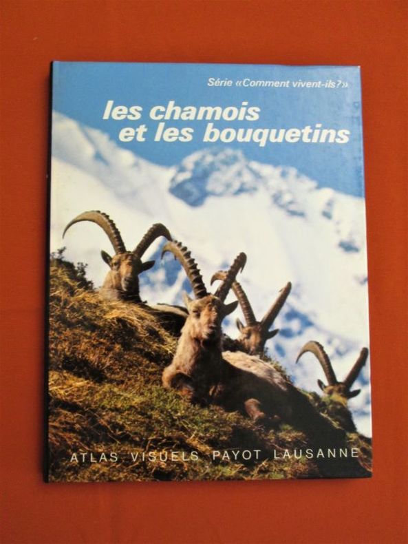
HUTTER Pierre - GLAUSER Michel
Les chamois et les bouquetins
Atlas Visuels Payot Lausanne, 1981. In-8 broché (20,5 x 16 cm), 70 pages - 78 photographies en couleurs et en noir et blanc dans le texte et hors-texte.- 250g.L. - Très bon état
Referenz des Buchhändlers : 28807
|
|
|
Hänsgen, Dirk
Deutschlandatlas : unser Land in 200 thematischen Karten. Dirk Hänsgen Sebastian Lentz, Sabine Tzschaschel (Hrsg.). [Kart.: Leibniz-Institut für Länderkunde, Leipzig] 9783896786821
Darmstadt : WBG, (Wiss. Buchges.), [Abt. Verl.] 2010. 240 S. mit 201 farb. Kt., 30 farb. Abb. und Grafiken; 30 cm Top Zustand, gebundene Ausgabe, Hardcover/Pappeinband
Referenz des Buchhändlers : 47292

|
|
|
Hänsgen, Dirk (Hrsg.)
Deutschlandatlas. Unser Land in 200 thematischen Karten. Karte: Leibniz-Institut für Länderkunde, Leipzig.
Darmstadt : WBG (Wissenschaftliche Buchgesellschaft), 2010. 240 S. mit zahlreichen Abbildungen und Karten ; 30 cm; gebunden, illustrierter Orig.-Pappband;
Referenz des Buchhändlers : 123627

|
|
|
Hänsgen, Dirk (Hrsg.)
Deutschlandatlas: unser Land in 200 thematischen Karten. Dirk Hänsgen ... (Hrsg.). [Kart.: Leibniz-Institut für Länderkunde, Leipzig]
Darmstadt: WBG, (Wiss. Buchges.), [Abt. Verl.] 2010. 240 S.: Ill., graph. Darst., Kt.; 30 cm Pappe 0
Referenz des Buchhändlers : 57236

|
|
|
Hänsgen, Dirk, Sebastian Lentz und Sabine Tzschaschel (Hg.)
Deutschlandatlas. Unser Land in 200 thematischen Karten.
Darmstadt : WBG Wissenschaftliche Buchgesellschaft, 2010. 240 S. mit zahlreichen Abbildungen; 30 cm; gebunden, Orig.-Pappband mit Original-Schutzumschlag;
Referenz des Buchhändlers : 146020

|
|
|
Häntzschel, Walther
Die Praxis des modernen Maschinenbaues. Modell=Atlas.
Berlin, Weller. 12 zerlegbare Maschinenmodelle auf 8Tafeln. Halbln., etwas berieb. + bestoss. insges. guter Zustand.
Referenz des Buchhändlers : 51360AB
|
|
|
I. [PAEZ, Gaspar / MENDEZ, le Père Alphonse] II. [KIRWITZER, Wencelas Pantaléon] III. [ANDRADE, Antonio de]
I. Histoire de ce qui s’est passé au royaume d’Ethiopie Es années 1624, 1625 & 1626. Tirées des lettres écrites & adressées au R.P. Mutio Viteleschi, General de la Compagnie de Jésus. Traduite de l’Italien en François par un Père de la mesme Compagnie. II. Histoire de ce qui s’est passé au Royaume de la Chine en l’Année 1624. III. Histoire de ce qui s’est passé au Royaume du Tibet. Tirée des Lettres écrites en l’année 1626. Relations écrites par les Jésuites en Ethiopie, Chine et Tibet
Rare réunion de trois lettres jésuites écrites d’Ethiopie, de Chine et du Tibet. Exemplaire d’une grande pureté conservé dans son vélin de l’époque. Paris, Sébastien Cramoisy, 1629.Soit 3 ouvrages reliés en 1 volume in-8 de : I/ (4) ff., 262 pp. mal chiffrées 252, (1) f.bl. ; II/ (2) ff., 102 pp., (1) f.bl. ; III/ (4) ff., 104 pp. Plein vélin souple de l’époque, dos lisse avec le titre manuscrit. Reliure de l’époque. 168 x 108 mm.
Referenz des Buchhändlers : LCS-8124
|
|
|
I. A. (IBRAHIM ALAETTIN GÖVSA), (1889-1949).
[PROPAGANDA MAP SPREADING THE WORD THAT TURKEY IS WINNING THE WAR] Map of West Anatolia and the Archipelago showing the fronts of Turkish War of Independence in 1921-22. Tercümân-i Hakîkât'in kârilerine hediyesi. [i.e. Extra suppl. to 'Tercümân-i Hakîkat' Newspaper].
Very Good Turkish, Ottoman (1500-1928) An extremely rare litho propaganda map published as an extra supplement to the Tercümân-i Hakîkat [i.e. The Translator of Truth] newspaper just before the proclamation of Republic in Turkey in 1923 by Mustafa Kemal Atatürk (1881-1938), showing the front in West Anatolia during the War of Independence (or National Struggle) between 1919-1922 against Greek forces. The upside of the map between the note as title 'Gift to the readers of 'Tercümân-i Hakîkat', Mustafa Kemal Atatürk's portrait among decorated heroic lithographed drawings. In the lower right corner, can be seen legends of the map, scale, and mapmaker's signature. Tercümân-i Hakîkat was a daily newspaper published in Istanbul between 1878-1921 during the Ottoman Empire. Tercüman-i Hakîkat, the most important newspaper published during the reign of Sultan Abdülhamid II, was founded by novelist Ahmed Midhat Efendi, (1844-1912). In the beginning, most of the articles were written by Ahmed Midhat Efendi. It was an encyclopedic newspaper with the aim of inculcating and educating reading habits among the Turks and it played an important role in the training of many famous Ottoman journalists. Its first issue was published on June 26, 1878. After Ahmed Midhat's death in 1913, the newspaper changed owners, and the last issue was published on February 11, 1921. Ibrahim Alaettin Gövsa, (1889-1949), was an Ottoman / Turkish journalist, educator, and intellectual who supported the War of Independence the most. This propaganda map published in Tercümân-i Hakîkat, during the war in 1920 or 1921, is a propaganda tool that calls on the literate people belonging to a certain class, especially those living in Istanbul, to support the war, and aims to spread the word that Turkey is winning the war. Original lithograph map. 50x35,5 cm. In Ottoman script (Turkish with Arabic letters). Scale: 1: 250.000. Occasionally foxing and slight stains on paper, folded traces. Otherwise a very good copy.
|
|
|
IBNU'N-NEDÎM (EBU'L-FEREC MUHAMMED BIN EBÎ YA'KÛB ISHÂK BIN MUHAMMED BIN ISHÂK EN-NEDÎM), (935-990).
El-Fihrist [Islâm tarihinin ilk dört asrindaki ilmî, edebî ve fikrî faaliyetlerin sistematik bir biçimde sunuldugu bibliyografik bir eserdir].Prep. by Abdülkadir Coskun. Translated by Ramazan Sesen.
New Turkish Original bdg. HC. Roy. 8vo. (24 x 17 cm). In Turkish. El-Fihrist. [Islâm tarihinin ilk dört asrindaki ilmî, edebî ve fikrî faaliyetlerin sistematik bir biçimde sunuldugu bibliyografik bir eserdir].Prep. by Abdülkadir Coskun. Translated by Ramazan Sesen. Translation of manuscript copy of Süleymaniye Yazma Eser Library, Sehid Ali Pasha Nr. 1934.
|
|
|
IBRAHIM OF MURSIYE.
The chart of Ibrahim of Mursiye 1461.= Mürsiyeli Ibrahim haritasi 1461.
Fine English Paperback. Pbo. Cr. 8vo. (20 x 14 cm). In English and Turkish. 31 p., b/w ills. The chart of Ibrahim of Mursiye 1461.= Mürsiyeli Ibrahim haritasi.
|
|
|
Ieee *atlas* Te & The Institute Of Electrical And Electronics Engineers ieee
IEEE Atlas Test Language - Standard 41
John Wiley & Sons Inc 1984. Subsequent. Hardcover. Used; Acceptable. Ex Library. Dust jacket torn. <p><i><strong>Fast Dispatch. Expedited UK Delivery Available. Excellent Customer Service. </strong></i> <br/><br/>Bookbarn International Inventory #2793000</p> John Wiley & Sons Inc hardcover
Referenz des Buchhändlers : 2793000 ISBN : 0471827452 9780471827450
|
|
|
IGN France
Carte topographique 1636 Est - 1;25000 / Castillon la bataille Saint Emilion -
IGN France. 1982. In-Plano. Broché. Bon état, Couv. convenable, Dos satisfaisant, Intérieur frais. Carte topographique 1636 Est - 1;25000 / Castillon la bataille Saint Emilion - Partie Est de la feuille au 1:50 000 de libourne.. . . . Classification Dewey : 912-Atlas, cartes et plans
Referenz des Buchhändlers : RO80208027

|
|
|
IGN.
CARTE TOURISTIQUE. NEW YORK MANHATTAN. 1 / 15000.
CHEZ L AUTEUR.. Non daté. In-Plano. Broché. Bon état, Couv. convenable, Dos satisfaisant, Intérieur frais. Carte dépliante en couleurs de 96 cm / 130.5 cm.. . . . Classification Dewey : 912-Atlas, cartes et plans
Referenz des Buchhändlers : R150181385
|
|
|
IGN.
CARTE TOURISTIQUE. NEW YORK MANHATTAN. 1 / 15000.
CHEZ L AUTEUR.. Non daté. In-Plano Carré. Broché. Bon état. Couv. convenable. Dos satisfaisant. Intérieur frais. Carte dépliante en couleurs de 96 cm / 130.5 cm.

|
|
|
IGOL.
ROUTES DE FRANCE.
CHEZ L AUTEUR.. Non daté. In-8. Broché. Etat d'usage, Couv. légèrement passée, Agraffes rouillées, Intérieur acceptable. 54 pages de texte + 1 carte dépliante en couleurs en fin d'ouvrage.. . . . Classification Dewey : 912-Atlas, cartes et plans
Referenz des Buchhändlers : R150169921

|
|
|
IGOL.
ROUTES DE FRANCE.
CHEZ L AUTEUR.. Non daté. In-8 Carré. Broché. Etat d'usage. Couv. légèrement passée. Agraffes rouillées. Intérieur acceptable. 54 pages de texte + 1 carte dépliante en couleurs en fin d'ouvrage.

|
|
|
ILLINOIS ATLAS WARNER Charles & Augustus & BEERS Frederick Silas James & Daniel.
Atlas of the State of Illinois to which is added an atlas of the United States maps of the hemispheres. . . combined town county state national and general atlas.
Chicago IL: Warner & Beers 62 & 64 Lake Street 1873. Atlas folio. 16 x 18.7 in. 3 3 5-91 1 pp. Woodcut-engraved title page 42 hand-coloured steel-engraved maps all w/ nicely executed engraved borders couple double-page additional steel-engraved “Family Records†page filled-out in manuscript inserted. Original front panel stamped in decorative gilt lettering mounted on recent black cloth binding occasional edgewear minor soiling to fore-edges of textblock couple very minor closed tears still VG copy from the library of John Inkster 1828-1908 Scottish-American farmer who immigrated in 1860 to Pilot Township Kankakee IL to farm with his brother James and then continued West to farm in Coast Fork Lane Co. Oregon and finally the Washington Territory in 1881 where he homesteaded near Davenport WT assisted in building Fort Spokane and served as County Commissioner from 1886-1892. First edition of this exceedingly scarce Illinois Atlas published just after the great Chicago Fire of 1871 featuring an unrecorded platt map of Pilot Township in Kankakee County Illinois showing all the properties and property owners in 1872. This atlas also features the Railway map of Illinois City Map of Chicago maps of all the Illinois Counties and large map of the United States. Of special interest are the excellent early western maps of Texas; Minnesota Nebraska and the Dakota Territory; Wyoming Montana and Idaho Territories; Nevada and California along with map of Oregon and Washington and Alaska Territories. The Beers and Warners were successful map publishers in Chicago IL from about 1850 to 1886 and often publishing as Warner & Beers the cartographers produced a series of early state and county atlases and regional maps which were considered the most detailed maps produced at the time of the respective regions. As their Township and County maps often detailed individual homes and landowners they provide invaluable reference tools to researchers historians and genealogists. No copies located of this specific Warner & Beers Atlas in Worldcat; No individual copies located of the Pilot Township Map; See: Portrait & Biographical Record of Kankakee County Illinois 1893 pp. 390-391; An Illustrated History of the Big Bend Country embracing Lincoln Douglas Adams & Franklin Counties 1904 pp. 421-425. Warner & Beers, 62 & 64 Lake Street, hardcover
Referenz des Buchhändlers : 54200
|
|
|
Illustrated Atlas of Hawaii with a History 1970 1970
Illustrated Atlas of Hawaii with a History
Very Good. VG unknown
Referenz des Buchhändlers : 41-70FD-TFTQ
|
|
|
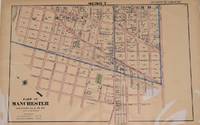
Illustrated Atlas of the City of Richmond
MAP PART OF MANCHESTER. CHESTERFIELD
F. W. Beers C. E. 1876. Plan showing Part of the 3rd and 4th Wards in Manchester. Interesting to see how much of Manchester was not developed at this time. Taken from The Illustrated Atlas of the City of Richmond published in 1876. F. W. Beers, C. E. unknown
Referenz des Buchhändlers : 271208
|
|
|
Illustrated Atlas of the City of Richmond
MAP PART OF MANCHESTER. CHESTERFIELD
F. W. Beers C. E. 1876. Plan showing Part of the 3rd and 4th Wards in Manchester. Interesting to see how much of Manchester was not developed at this time. Taken from The Illustrated Atlas of the City of Richmond published in 1876. F. W. Beers, C. E. unknown books
Referenz des Buchhändlers : 271208
|
|
|
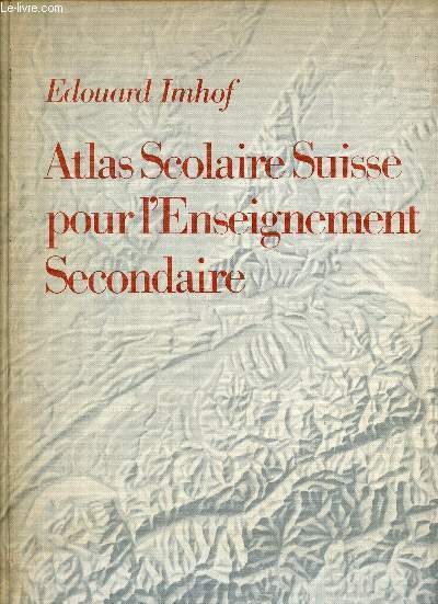
Imhof Edouard
Atlas scolaire suisse pour l'enseignement secondaire - 12éme édition- conférence des chefs des départements cantonaux de l'instruction publique
Payot lausanne. 1962. In-4. Relié. Bon état, Couv. convenable, Dos satisfaisant, Intérieur frais. 144 pages. Nombreuses cartes en couleur, hors texte. Inclus une carte du monde, pliée et ndépendante, de médecins sans frontière de 80 x 60cm environ, datant de 2016.. . . . Classification Dewey : 912-Atlas, cartes et plans
Referenz des Buchhändlers : R200118000
|
|
|
IMHOF, Ed.:
Atlas scolaire Suisse pour l'enseignement secondaire. Publié par la Conférence des Chefs des Départments cantonaux de l'Instruction publique, subventionné par la Confédération et les Cantons. 5me édition. complètement refondue.
Lausanne, Payot (Lithographie de l'Institut artistique Orell Füssli, Zurich), 1932, in-4to, XII + 136 cartes en couleurs, reliure en demi-toile originale, bon exemplaire propre..
Referenz des Buchhändlers : 19931aaf
|
|
|
IMHOF, Ed.:
Atlas scolaire Suisse pour l'enseignement secondaire. Publié par la Conférence des Chefs des Départments cantonaux de l'Instruction publique, subventionné par la Confédération et les Cantons. 14e édition.
Lausanne, Payot (Lithographie de l'Institut artistique Orell Füssli, Zurich), 1972, in-folio, VIII + 147 cartes en couleurs, + 1 cahier Supplément p. 148 à 188, reliure en toile originale.
Referenz des Buchhändlers : 42166aaf
|
|
|
IMHOF, Ed.:
Atlas scolaire Suisse pour l'enseignement secondaire. Publié par la Conférence des Chefs des Départments cantonaux de l'Instruction publique, subventionné par la Confédération et les Cantons. 12e édition.
Lausanne, Payot (Lithographie de l'Institut artistique Orell Füssli, Zurich), 1962, in-folio, VIII + 144 cartes en couleurs, reliure en toile originale. Bel état.
Referenz des Buchhändlers : 42167aaf
|
|
|
IMHOF, Ed.:
Atlas scolaire Suisse pour l'enseignement secondaire. Publié par la Conférence des Chefs des Départments cantonaux de l'Instruction publique, subventionné par la Confédération et les Cantons. 2e édition.
Lausanne, Payot (Exécuté par l'institut Kartographia Winterthur S.A.), 1921, in-4to, X + 136 cartes en couleurs, reliure en demi-toile originale, bon exemplaire.
Referenz des Buchhändlers : 58766aaf
|
|
|
IMHOF, Ed.:
Atlas scolaire Suisse pour l'enseignement secondaire. Publié par la Conférence des Chefs des Départments cantonaux de l'Instruction publique, subventionné par la Confédération et les Cantons. 3e édition.
Lausanne, Payot (Exécuté par l'institut Kartographia Winterthur S.A.) , 1925, in-4to, X + 136 cartes en couleurs, reliure en demi-toile originale, bon exemplaire.
Referenz des Buchhändlers : 58767aaf
|
|
|
IMHOF, Ed.:
Atlas scolaire Suisse pour l'enseignement secondaire. Neuvième (9me) édition.
Lausanne, Payot (Lithographie et impr. Orell Füssli, Zurich), 1951, in-4to, VIII + 144 cartes en couleurs, reliure en demi-toile originale, bon exemplaire.
Referenz des Buchhändlers : 87598aaf
|
|
|
IMHOF, Ed.:
Atlas. - Schweizerischer Mittelschulatlas. 10. Auflage, bearbeitet ... von Ed. Imhof.
Zürich, Orell Füssli, 1951, gr. in-4°, VIII + 144 farb. Karten, Original-Halbleinenband.
Referenz des Buchhändlers : 59017aaf
|
|
|
IMPRIMERIE INDUSTRIELLE
Carte de l'Europe - Afrique - Moyen Orient eu du Bassin Méditerranéen.
EDE. Non daté. In-Plano. En feuillets. Bon état, Livré sans Couverture, Dos satisfaisant, Intérieur acceptable. Carte dépliante (à la verticale) en couleurs, de 98 / 49 cm.. . . . Classification Dewey : 912-Atlas, cartes et plans
Referenz des Buchhändlers : RO80070154
|
|
|
Inc. Atlas Model Railroad Co.
The Complete Atlas Wiring Book All Scales From Z to No. 1 All Scales from Z to no. 1
Atlas Model Railroad Co. January 1992. Trade Trade. Used - Good. Sticker residue on front cover Satisfaction Guaranteed!! Atlas Model Railroad Co. unknown
Referenz des Buchhändlers : 190392
|
|
|
INCONNU
LONDON HALLWAG - PLAN DE LONDRE
INCONNU. 1969. In-Plano. Broché. Etat d'usage, Couv. convenable, Dos satisfaisant, Intérieur frais. 1 carte de dimension 90X21 et 1 petit livret de 32 pages collé à l'intérieur.. . . . Classification Dewey : 912-Atlas, cartes et plans
Referenz des Buchhändlers : RO20155188
|
|
|
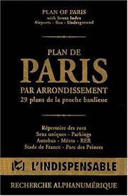
Indispensable Atlas
Atlas routiers : Plan de Paris par arrondissements - 29 plans de la proche banlieue
Indispensable. MAP. 270720241X Edges show some rubbing and scuffing and pages are well leafed through. Used but in good shape. . Good. Indispensable unknown
Referenz des Buchhändlers : MAPRJ01202006 ISBN : 270720241X 9782707202413
|
|
 Per e-mail erhalten
 Als pdf-Dokument herunterladen
 RSS feed


