|
International Association Of Agricultural Economists Committee For The World Atlas Of Agricultural
World Atlas Of Agriculture Volume 1 Europe U. S. S. R. Asia Minor
Novora: Instituto Geofrafico De Agostini 1969. 527 pages. Hard Cover. Very Good. 10 X 14. Instituto Geofrafico De Agostini Hardcover
Referencia librero : 037110
|
|
|
IOANNIS IANSSONIUS EXC
"Carte originale ""DESCRIPTION DU GUIENNE"""
"IOANNIS IANSSONIUS EXC. 17ème-18ème s.. In-Plano. Broché. Bon état, Couv. convenable, Dos satisfaisant, Intérieur frais. Carte originale, sur papier à la forme, 56/42 cm, délimitation des provinces en couleurs, deux échelles ""Milliaria Germanica"" et Milliaria Gallica"".XVIII ème siècle environ.. . . . Classification Dewey : 912-Atlas, cartes et plans"
Referencia librero : RO20020300
|
|
|
IRISH HISTORY: ATLAS. Haughton J. P.
ATLAS OF IRELAND. Prepared under the direction of the Irish National Committee for Geography.
IRISH HISTORY: ATLAS. Haughton J. P. ATLAS OF IRELAND. Prepared under the direction of the Irish National Committee for Geography. Chairman: Josph P. Haughton/ . Dublin:: Royal Irish Academy 1979. First edition. . Binding is slightly bumped at tips of corners else a near fine copy with all plates fresh and clean issued without dust jacket. . Folio dark green cloth stamped in gilt on spine and front cover pp. 7 104 illustrated with maps and charts of Ireland most in color. Contains a one-page foreword by G. F. Mitchell and a two-page introduction by Joseph F. Haughton a two-page detailed list of contents followed by 97 full-page maps and charts of Ireland with following topics: Geology and geophysics; Geomorphology and hydrology; Soils; Climate; Flora and fauna; Settlement; Population; Primary production; Manufacturing; Tertiary activities; Society and culture; The Irish landscape; and Ordnance Survey concluding with a detailed index of the contents. Royal Irish Academy, hardcover
Referencia librero : 79915
|
|
|
Irlinger, Bernhard
Radtouren in Irland : 60 Radtouren durch alle Landesteile der Republik Irland mit Schwerpunkt im Westen
München : Bruckmann, 1993. 192 S. Mit 97 Farbfotos, 54 Kt.-Skizzen u. 1 Übersichtskt. Gr. 8°. Ill. orig. engl. Broschur.
Referencia librero : 32035
|
|
|
IRO Autoführer
Italien - Französische Riviera - Westösterreich. Hier: Band Norditalien. Mit 21 6farbigen Kartenseiten im Massstab 1:250 000 / zwei 6farbigen Kartenseiten im Massstab 1:400000 / einer zehnfarbigen strassenkarte im Masstab 1:1 000 000. In Hinterdeckeltasche eine 10farbige, gefaltete IRO-Strassen- und Reisekarte im Massstab 1:1 000 000 (124 : 86,5 cm), bearbeitet von Ernst Kremling. Mit reich illustrierter Werbung im Textteil.
München, IRO., (um 1955). Gr.8°. [14,5 : 24,5 cm]. XVI/48/192 Seiten für Karten und Textteil. Roter Originalleinenband mit goldgeprägtem Deckeltitel und Lesebändchen. (1 Eck und oberes Rückenende gering bestossen). - Ansonsten ein sehr gut erhaltenes, sauberes Exemplar in fester Bindung, ohne Eintragungen und seltener Vollständigkeit.
Referencia librero : 48746AB

|
|
|
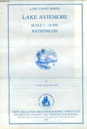
IRWIN J., MAIN W. DE L.
LAKE AVIEMORE BATHYMETRY, LAKE CHART SERIES, SCALE 1:10 000
New Zealand Oceanographic Institute - DSIR. 1987. In-8. En feuillets. Très bon état, Couv. fraîche, Dos impeccable, Intérieur frais. 1 carte dépliable très grand format en couleur.. . . . Classification Dewey : 912-Atlas, cartes et plans
Referencia librero : RO40107297
|
|
|
IRWIN J., MAIN W. DE L.
LAKE WAITAKI BATHYMETRY, LAKE CHART SERIES, SCALE 1:6 000
New Zealand Oceanographic Institute - DSIR. 1987. In-8. En feuillets. Etat du neuf, Couv. fraîche, Dos impeccable, Intérieur frais. 1 carte dépliable très grand format en couleur dans sa pochette plastique d'origine.. . . . Classification Dewey : 912-Atlas, cartes et plans
Referencia librero : RO40107298

|
|
|
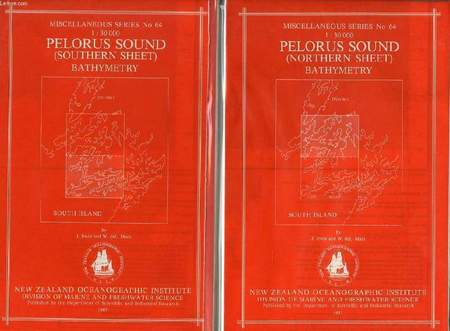
IRWIN J., MAIN W. DE L.
PELORUS SOUND, NORTHERN & SOUTHERN SHEETS, BATHYMETRY, MISCELLANEOUS SERIES N° 64, 1:30 000
New Zealand Oceanographic Institute - DSIR. 1987. In-8. En feuillets. Etat du neuf, Couv. fraîche, Dos impeccable, Intérieur frais. 2 cartes dépliables très grand format en couleur dans leur pochette plastique d'origine.. . . . Classification Dewey : 912-Atlas, cartes et plans
Referencia librero : RO40107292
|
|
|
IRWIN J., MAIN W. DE L.
LAKE AVIEMORE BATHYMETRY, LAKE CHART SERIES, SCALE 1:10 000
New Zealand Oceanographic Institute - DSIR. 1987. In-8 Carré. En feuillets. Très bon état. Couv. fraîche. Dos impeccable. Intérieur frais. 1 carte dépliable très grand format en couleur. N.Z. Ocean. Inst., Division of Marine and Freshwater Science.

|
|
|
IRWIN J., MAIN W. DE L.
LAKE WAITAKI BATHYMETRY, LAKE CHART SERIES, SCALE 1:6 000
New Zealand Oceanographic Institute - DSIR. 1987. In-8 Carré. En feuillets. Etat du neuf. Couv. fraîche. Dos impeccable. Intérieur frais. 1 carte dépliable très grand format en couleur dans sa pochette plastique d'origine. N.Z. Ocean. Inst., Division of Marine and Freshwater Science.

|
|
|
IRWIN J., MAIN W. DE L.
PELORUS SOUND, NORTHERN & SOUTHERN SHEETS, BATHYMETRY, MISCELLANEOUS SERIES N° 64, 1:30 000
New Zealand Oceanographic Institute - DSIR. 1987. In-8 Carré. En feuillets. Etat du neuf. Couv. fraîche. Dos impeccable. Intérieur frais. 2 cartes dépliables très grand format en couleur dans leur pochette plastique d'origine. N.Z. Ocean. Inst., Division of Marine and Freshwater Science.

|
|
|
ISELIN, Marc:
Chirurgie der Hand. Atlas der Operationstechnik. Mit 693 Abbildungen.
Stuttgart, Georg Thieme Verlag, 1959, Q-4to, XII + 324 S., illustr. mit 693 Abbildungen, Original-Leinenband mit vergoldeter Schrift.
Referencia librero : 79122aaf
|
|
|
ISFAHAN MAP.
[CITY MAP OF ISFAHAN]. Map of Isfahan with a large index.
Very Good English Original color city map of Isfahan. 70x50 cm. In English. Folded. No scale. This detailed Isfahan city map includes a very detailed alphabetical index as well. There are some b/w photos indicated several important places and buildings on the map. Remarks says, "Please note that most Government Departments, Point 4, Fao, Banks etc. are situated around the Shah Sqaure. Ask for Ostandari i.e. the Governor's Office at F6 or find the Information Dept. at D6. All streets, avenues, kuchehs are listed under the name of khiaban eg. Khiaban Abbasssad is under K. not A. Historic places are listed both under their own names e.g. Ali-Qapu, Chehel-Sotoon etc.; and under Mosques, Minarets, etc.".
|
|
|
ISHAK HAKKI SUBASI, (1890-1932?].
[MAP of EAST ANATOLIA] Urfa: Siverek, Harput, Diyarbakir, Adiyaman.
Very Good Turkish, Ottoman (1500-1928) Original color map. Folded. Oblong atlas folio. (50 x 60 cm). In Ottoman script. Shows Eastern parts of Anatolia; Siverek, Urfa city and border of Diyarbakir and Adiyaman cities; Siverek; Harput (Kharpout); et alli. Scale: 1/200.000. Hegira: 1333 = Gregorian: 1917. Not description on map-maker. This is one the serie of the Bonn projection maps which are the first map series in modern techniques in Turkey and the Ottoman Empire. This is one the serie of the Bonn projection maps which are the first map series in modern techniques in Turkey and the Ottoman Empire. In order to produce these maps covering Turkish territory, Reconnaissance Branch was incorporated into The Mapping Commission. The maps were produced in the datum based on the latitude and longitude of Ayasofya Mosque in equal area Bonn Projection. The field works for the 123 sheets covering the country were conducted by 76 staff. The production was completed in 18 years starting from east west. Field works continued without stopping except in years 1914 and 1920. This map series called also reconnaissance maps contributed a lot to producing 1:25.000 scale maps. Subasi is cartographer of this map according to Türkezer - Cobanoglu: History of Mapping in Turkey-1:200.000 Scale Maps.
|
|
|
ISIDORE
Carte de France. Côte-d'Or. N°20
IMP. MIGEON. XIXe siècle. In-4. En feuillets. Bon état, Livré sans Couverture, Dos satisfaisant, Intérieur frais. Une planche de 35 x 26.5 cm, illustrée d'une carte gravée en couleurs.. . . . Classification Dewey : 912-Atlas, cartes et plans
Referencia librero : RO80087894
|
|
|
ISMAIL KUMAN, NEBAHAT SÜTUNÇ, (Bursa School Teachers of Geeography).
Türkiye cografyasi sorulu uygulama atlasi.
Very Good Turkish Paperback. 4to. (29 x 21 cm). In Turkish. [16] p., 18 numerous b/w maps of Turkey. Türkiye cografyasi sorulu uygulama atlasi.
|
|
|
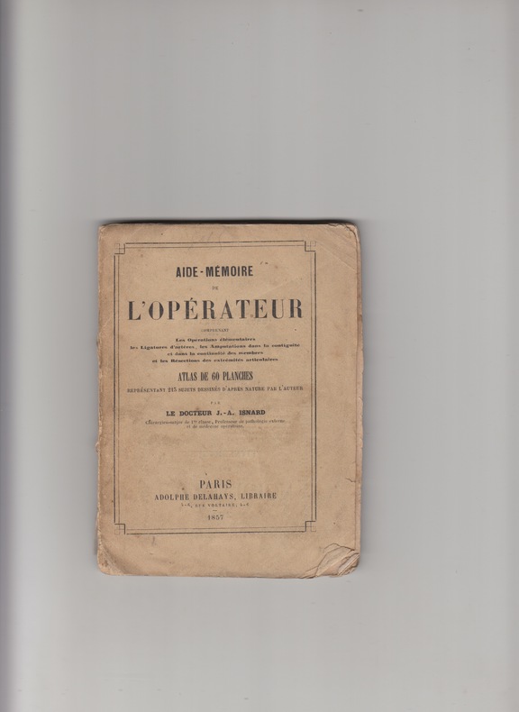
ISNARD J.A.-
AIDE MEMOIRE DE L'OPERATEUR -ATLAS DE 60 Planches -lithographies en noir -
A.DELAHAYS 1857 - IN12 br.-couv.imp.-
Referencia librero : 831
|
|
|
ITALY ATLAS.
Viaggi d'Italia i piu frequentati e particolarmente da chi viaggi per le Poste
ca 1790. Small 4to. 5 x 4 inches. Manuscript title-page index leaves and pages of notes of useful information to travellers concerning costs/tolls. 15 exceptionally fine manuscript folding route maps in ink and watercolor each with separate title-leaf one or two maps with discreet repairs to folds on verso. Modern red morocco signed S.E 1968. Provenance: with the small ink library stamp of The Admiralty Library on the title-page and verso of last map; from the library of Christopher Henry Beaumont Pease Lord Wardington 1924-2005 his sale Sotheby's May 9th 2006 lot 113 A beautiful atlas of road maps showing the main post roads of Italy. These detailed and colourful maps are described in the notes at the beginning as depicting the most commonly traveled routes in particular those that go through areas that act as postal stages. In addition to the roads the maps show distance in miles and postal stages castles towns rivers regional borders and coastlines. The individual routes are: from Florence to Rome Rome to Naples Rome to Ancona Florence to Bologna Bologna to Ancona Bologna to Padua Venice to Rimini Milan to Venice Mantua to Bologna Mantua to Trento Milan to Bologne Turin to Milan Milan to Genoa Genoa to Pisa and Livorno to Florence. From the distinguished library of Lord Wardington whose collection of Atlases was unique: "a panoply of the history of cartography and of great mapmakers" Andrew Phillips "An Appreciation" Sotheby's sale catalogue. [ca 1790]. unknown
Referencia librero : 72lib1089
|
|
|
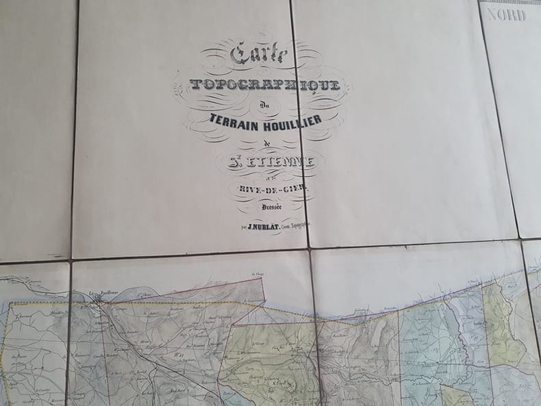
J Nublat
Carte Topographique du terrain houillier de Saint Etienne et de Rive de Gier - Dressée par J. Nublat Géomètre Topographe
Nublat 0 Grande Carte ( 150 X 104 cm ) toilée en 18 panneaux - Sans date ( vers 1840/1850) - Trés bon état
Referencia librero : Tir306
|
|
|
J Nublat
Carte Topographique du terrain houillier de Saint Etienne et de Rive de Gier - Dressée par J. Nublat Géomètre Topographe
Nublat 0 Grande Carte ( 150 X 104 cm ) toilée en 18 panneaux - Sans date ( vers 1840/1850) - Trés bon état
Referencia librero : Tir306
|
|
|
J Belot . F Lepennetier
Anatomie radiographique du squelette normal . Atlas
Amédée Legrand Paris 1927
Referencia librero : 9725
|
|
|
J. J. HELLERT.
[MAP of BATTLE of MOHACZ] Bataille de Mohacz entre Louis Roi de Hongrie et Souleman I. le 28 Aôut 1526 (20 Silkide 932). Grave par U. Muschani. Atlas des batailles et sieges pour servir a l'histoire de l'Empire Ottoman, Pl. VIII.
Very Good French Original b/w map. Oblong folio. (30 x 34 cm). In French. [MAP of BATTLE of MOHACZ] Bataille de Mohacz entre Louis Roi de Hongrie et Souleman I. le 28 Aôut 1526 (20 Silkide 932). Grave par U. Muschani. Atlas des batailles et sieges pour servir a l'histoire de l'Empire Ottoman, Pl. VIII. From "Nouvel atlas physique, politique et historique de l'Empire ottoman et des États limitrophes. / dressé. par J.-J. Hellert ; revu, corrigé et accompagné d'un commentaire historique, géographique et statistique. par Ge Heck, et L[é]on Plée..." printed in 1843. Engraved. Rare.
|
|
|
J. J. HELLERT.
[MAP of OTTOMAN CRIMEA] Crimee. Gravee par U. Muschani.
Very Good French Original b/w map. Oblong folio. (30 x 34 cm). In French. [MAP of OTTOMAN CRIMEA] Crimee. Gravee par U. Muschani. Shows Crimean peninsula, shores of Black Sea, Azov Sea, Kerkinit Golf, with its old places names. From "Nouvel atlas physique, politique et historique de l'Empire ottoman et des États limitrophes. / dressé. par J.-J. Hellert ; revu, corrigé et accompagné d'un commentaire historique, géographique et statistique. par Ge Heck, et L[é]on Plée..." printed in 1843. Engraved. Rare.
|
|
|
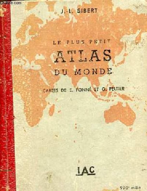
J.-L. SIBERT
LE PLUS PETIT ATLAS DU MONDE - CARTES DE E.FONNE ET G.PELTIER.
IAC. 1940. In-32. Broché. Bon état, Coins frottés, Dos satisfaisant, Intérieur frais. 48 pages + 19 pages d'index alphabétique - nombreuses cartes en couleurs hors texte - ouvrage d'environ 8,5 x 11 cm.. . . . Classification Dewey : 912-Atlas, cartes et plans
Referencia librero : R240102617
|
|
|
J.-L. Sibert
Le plus petit atlas du monde -990e édition.
Iac. 1940. In-32. Broché. Etat d'usage, Couv. légèrement passée, Dos fané, Intérieur acceptable. 48 pages + environ 18 pages d'index alphabétique - nombreuses cartes en couleurs hors texte - coins frottés - plats légèrement frottés.. . . . Classification Dewey : 912-Atlas, cartes et plans
Referencia librero : R160225691
|
|
|
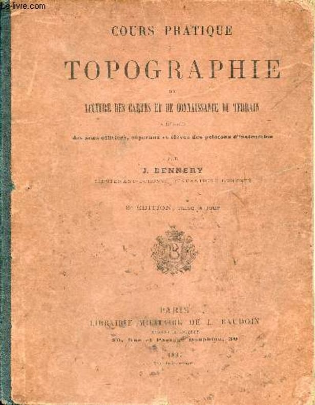
J.Dennery
Cours pratique de topographie de lecture des cartes et de connaissance du terrain à l'usage des sous-officiers,caporaux et élèves des pelotons d'instruction - 3e édition mise à jour.
Librairie militaire de L.Baudoin. 1897. In-8. Cartonné. Etat passable, Couv. défraîchie, Dos abîmé, Quelques rousseurs. 77 pages - nombreuses figures en noir et blanc dans et hors texte - corps de l'ouvrage désolidarisé des plats - papier jauni - accroc sur le dos - coins frottés - plats tâchés.. . . . Classification Dewey : 912-Atlas, cartes et plans
Referencia librero : RO80267294
|
|
|
J.PETIT & M.ROUABLE
CROQUIS CLASSE DE 4EME - ENSEIGNEMENT DE LA GEOGRAPHIE - INCOMPLET - manque croquis n°4 + 6 + 7 + 8 + 10 + 11 + 13 + 14 + 15 + 19 + 31.
FERNAND NATHAN. NON DATE. In-8. En feuillets. Etat d'usage, Couv. légèrement passée, Dos satisfaisant, Intérieur acceptable. 21 croquis / 32 croquis - manque croquis n°4 + 6 + 7 + 8 + 10 + 11 + 13 + 14 + 15 + 19 + 31 - croquis en feuillets en violet et blanc sous pochette souple en état d'usage - annotations sur quelques croquis - 2 photos disponibles.. . . . Classification Dewey : 912-Atlas, cartes et plans
Referencia librero : R240084402
|
|
|
JACQUES MERCIER (DESSINATEUR)
"CARTE DE L'AUSTRALIE. (EXTRAIT DE LA REVUE ""7 JOURS"")."
AU BUREAU DE LA REVUE. NON DATE. In-Folio. Broché. Etat d'usage, Couv. légèrement passée, Dos satisfaisant, Intérieur frais. Carte en couleurs de 40 x 55 cm. Fentes en bordures.. . . . Classification Dewey : 912-Atlas, cartes et plans
Referencia librero : R260167568
|
|
|
JACQUES MERCIER (DESSINATEUR)
"CARTE DU FRONT ORIENTAL. (EXTRAIT DE LA REVUE ""7 JOURS"")."
AU BUREAU DE LA REVUE. NON DATE. In-Folio. Broché. Etat d'usage, Couv. légèrement passée, Dos satisfaisant, Intérieur frais. Carte en couleurs de 40 x 55 cm. Fentes en bordures.. . . . Classification Dewey : 912-Atlas, cartes et plans
Referencia librero : R260167569
|
|
|
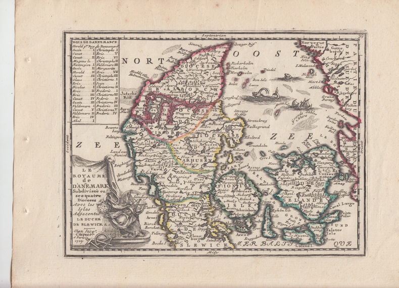
Jacques Chiquet Le Nouveau et Curieux Atlas Geographique et Historique.
"Le Royaume de Danemark" subdivisé en ses quatre dioceses avec les isles adjacentes ,le duché de Slewick -Carte gravée d'époque coloris époque avec feuillet de texte imprimé joint ,extrait du Nouveau et Curieux Atlas Geographique et Historique.
1719 Paris,Nouveau et Curieux Atlas Geographique et historique., c.1719.DENMARK DANEMARK scandinavia bon état; map cuivre carte Chiquet -"Le Royaume de Danemark"schöne original altkolorierte Kupferstich-Karte von Chiquetaus seinem Atlas von 1719Blatt-Format: ca. 27,5 x 21 cm
Referencia librero : 22877
|
|
|
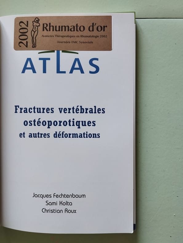
Jacques Fechtenbaum Sami Kolta Christian Roux
Atlas des fractures vertébrales ostéoporotiques et autres déformations
Sans date.
Referencia librero : 500237106
|
|
|
Jacques Boussard
Atlas historique et culturel de la France
Elsevier Publishing Company 1957 In-4 relié sous jaquette noire, titres jaunes, jaquette un peu passée, sinon intérieur frais, bon état d’occasion.
Referencia librero : 72253
|
|
|
Jacques Chiquet Le Nouveau et Curieux Atlas Geographique et Historique.
Candia - Crete Carte gravée d'époque coloris époque avec feuillet de texte imprimé joint . KRETA (Crete) / Griechenland (Greece),extrait du Nouveau et Curieux Atlas Geographique et Historique.
1719 Paris,Nouveau et Curieux Atlas Geographique et historique., c.1719.17 x 22,5cm, This old map of Candia or Crete comes from Jacques Chiquet's Le Nouveau et Curieux Atlas Geographique. This vintage map of Candia or Crete was printed with hand coloring on handmade paper using copper engraved plates. Originally created by Antoine Menard and published by Chiquet in 1711, Chiquet deleted Menard's name throughout when he republished the atlas eight years later. Chiquet only published two works, Le Nouveau et Curieux Atlas and Nouveau Atlas Francais also published in 1719, and his works are therefore uncommon
Referencia librero : 22885

|
|
|
JACQUES MERCIER (DESSINATEUR)
CARTE DETAILLEE DE LA TUNISIE. (EXTRAITE D'UNE REVUE)
AU BUREAU DE LA REVUE. NON DATE. In-Folio. Broché. Etat d'usage, Couv. légèrement passée, Dos satisfaisant, Intérieur frais. Carte en couleurs de 40 x 55 cm.. . . . Classification Dewey : 912-Atlas, cartes et plans
Referencia librero : R260167564
|
|
|
JACQUES MERCIER (DESSINATEUR)
CARTE DES BALKANS
AU BUREAU DE LA REVUE. NON DATE. In-Folio. Broché. Etat d'usage, Couv. légèrement passée, Dos satisfaisant, Intérieur frais. Carte en couleurs de 40 x 55 cm.. . . . Classification Dewey : 912-Atlas, cartes et plans
Referencia librero : R260167566
|
|
|
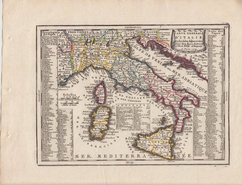
Jacques Chiquet Le Nouveau et Curieux Atlas Geographique et Historique.
Carte Generale d'Italie et des Isles Adjacentes Tire des Bons Auteurs - Carte gravée d'époque coloris époque avec feuillet de texte imprimé joint ,extrait du Nouveau et Curieux Atlas Geographique et Historique.
1719 Paris,Nouveau et Curieux Atlas Geographique et historique., c.1719.17 x 22,5cm, Coloring: Hand ColoredSize: 8.5 x 6.5 inchesCondition: VG+,Fine example of Chiquet's map of Italy from his Le Nouveau et Curieux…Includes a finely engraved cartouche.
Referencia librero : 22882
|
|
|
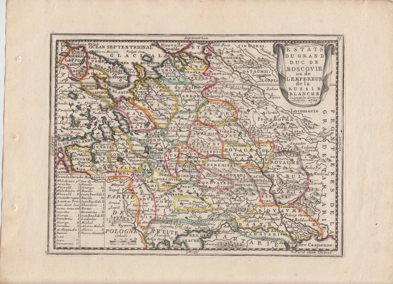
Jacques Chiquet Le Nouveau et Curieux Atlas Geographique et Historique.
ESTATS DU GRAND DUC DE MOSCOVIE ou de L'EMPEREUR de la RUSSIE BLANCHE.suivant les dernieres relations White Russia.Carte gravée d'époque coloris époque avec feuillet de texte imprimé joint ,extrait du Nouveau et Curieux Atlas Geographique et Historique.
1719 Paris,Nouveau et Curieux Atlas Geographique et historique., c.1719.Published by La Nouveau et Curieux Atlas Geographique et historique. c.1719., 1719 Copper engraving. Original colour with later additions. Size: 22 x 16.5 cm. (8? x 6? inches). Fine condition, good margins. Map of European Russia, with a list of Dukes of Muscovy at lower left and a title cartouche at top right. In the early eighteenth century, French cartography overtook the Dutch in terms of accuracy and design. Chiquet's delightful Nouveau et Curieux Atlas was typical product of the time. Moreland and Bannister, p.132.
Referencia librero : 22875
|
|
|
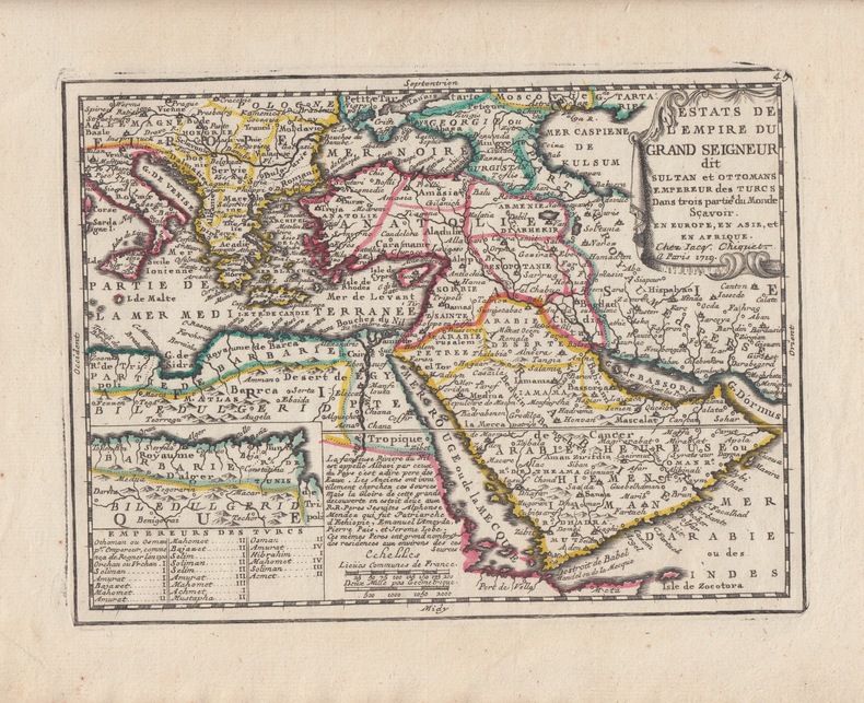
Jacques Chiquet Le Nouveau et Curieux Atlas Geographique et Historique.
Estats De L'Empire Du Grand Seigneur dit Sultan et Ottomans Empereur des Turcs Dans trois partie du Monde Scavoir. En Europe, En Asie, et En Afrique. Carte gravée d'époque coloris époque avec feuillet de texte imprimé joint .TÜRKISCHES REICH (Turkish Empire / Ottoman Empire) ,extrait du Nouveau et Curieux Atlas Geographique et Historique.
1719 Paris,Nouveau et Curieux Atlas Geographique et historique., c.1719.17 x 22,5cm, Khaled Al Ankary, The Arabian Peninsula in Old European Maps, page 285; Tooley's Dic. of Mapm. Rev. Ed. A - D, S. 264 (Jacques Chiquet, c. 1673-1721; french cartographer, engraver and 'marchand d' estampes, rue St Jacques' in Paris). - Zeigt das Türkische Reich mit Arabien. - Oben rechts Titelkartusche. - Unten links Insetkarte der Nordküste von Afrika; rechts daneben Erklärungen. - Zusätzlich liegt der Karte ein beschreibendes Blatt bei. - Seltene Karte! The map shows the Ottoman Empire which shows the Arabian Peninsula with much information on the towns and the watercourses. It includes a list of names of Ottoman sultans in the bottom left hand corner, and a small additional map of Tunisia and Algeria. - Rare map! This vintage map of the Middle East is printed with hand coloring on handmade paper using copper engraved plates. Originally created by Antoine Menard and published by Chiquet in 1711, Chiquet deleted Menard's name throughout when he republished the atlas eight years later. Chiquet only published two works, Le Nouveau et Curieux Atlas and Nouveau Atlas Francais also published in 1719, and his works are therefore uncommon. This historic old map of the Middle East would make a fine addition to any collection or a beautiful Middle East antique map gift.
Referencia librero : 22880
|
|
|
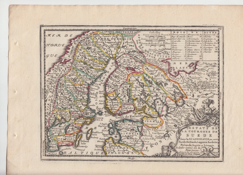
Jacques Chiquet Le Nouveau et Curieux Atlas Geographique et Historique.
ETATS DE LA COURONNE DE SUEDE dans la Scandinavie ou sont Suéde ,Gotlande,Lapponie suédoise,Finlande,Ingrie et Livonie subdivisées dans leurs provinces - Carte gravée d'époque coloris époque avec feuillet de texte imprimé joint ,extrait du Nouveau et Curieux Atlas Geographique et Historique.
1719 Paris,Nouveau et Curieux Atlas Geographique et historique., c.1719.Published by Le Nouveau et Curieux Atlas Geographique et historique. c.1719., 1719- Copper engraving. Original colour with later additions. Size: 22 x 16.5 cm. (8? x 6? inches). Fine condition, good margins.rare
Referencia librero : 22879
|
|
|
Jacques Chiquet Le Nouveau et Curieux Atlas Geographique et Historique.
L' Asie Dressée selon les Observations de Mrs. de l'Academie Royale des Sciences. Carte gravée d'époque coloris époque avec feuillet de texte imprimé joint,extrait du Nouveau et Curieux Atlas Geographique et Historique.
1719 A Paris chez I. Chiquet A Paris 1719. - 25':.- Altkolorierter Kupferstich aus Le nouveau et curieux Atlas Geographique . b. Jacques Chiquet in Paris, dat. 1719, 17 x 22,5cm Tooley's Dic. of Mapm. Rev. Ed. A - D, S. 264 (Jacques Chiquet, c. 1673-1721; french cartographer, engraver and 'marchand d' estampes, rue St Jacques' in Paris). - Zeigt Asien zwischen Arabien und Japan. - Fine condition, good margins.bonnes marges
Referencia librero : 22865

|
|
|
Jacques Chiquet Le Nouveau et Curieux Atlas Geographique et Historique.
L' AFRIQUE Dressée suivant les Auteurs les plus nouveaux et sur les Observations de Mrs. de l'Academie Royale des Sciences- Carte gravée d'époque coloris époque avec feuillet de texte imprimé joint .AFRICA CONTINENT ABYSSINIA CONGO NUBIA MADAGASCAR ENGR. MAP,extrait du Nouveau et Curieux Atlas Geographique et Historique.
1719 Le nouveau et curieux Atlas Geographique . b. Jacques Chiquet Paris, dat. 1719,Leaf 21,0 x 27,4 cmengraving app.: 16,5 x 22,5 cmDressee suivant les Auteurs les plus nouveaux . . . 1719Map Maker: JacquesChiquetPlace / Date: Paris / 1719Coloring: Hand ColoredSize: 8.5 x 6.5 inchesFine example of Chiquet's map of Africa from his Le Nouveau et Curieux…Includes a finely engraved cartouche.References: McLaughlin 191.
Referencia librero : 22868

|
|
|
Jacques Chiquet Le Nouveau et Curieux Atlas Geographique et Historique.
L'Europe Dressee sur les Observations de Mrs. de l'Academie Royale des Sciences- Carte gravée d'époque coloris époque avec feuillet de texte imprimé joint,extrait du Nouveau et Curieux Atlas Geographique et Historique.
1719 Le nouveau et curieux Atlas Geographique . b. Jacques Chiquet Paris, dat. 1719, This charming small map of Europe is based on the geography of Guillaume Delisle. The Prime Meridian is shown as the Ferro meridian that was established in the year 1634 by the French king Louis XIII and Cardinal Richelieu. This meridian was chosen because Ferro island is the most western position of the Old World. Color: hand color Size: 8.8 x 6.6 inches - 22.4 x 16.8 cm,bonnes marges
Referencia librero : 22867

|
|
|
Jacques Chiquet Le Nouveau et Curieux Atlas Geographique et Historique.
L'Espagne nomme Par les Anicens Grecs Iberia ou Hesperia . . .Dressée suivant les Auteurs les plus nouveaux et sur les Observations de Mrs. de l'Academie Royale des Sciences- Carte gravée d'époque coloris époque avec feuillet de texte imprimé joint ,extrait du Nouveau et Curieux Atlas Geographique et Historique.
1719 Nouveau et Curieux Atlas Geographique et historique., c.1719. L'Espagne nomme Prs les Anicens Grecs Iberia ou Hesperia . . . 1719Map Maker: JacquesChiquetPlace / Date: Paris / 1719Coloring: Hand ColoredSize: 8.5 x 6.5 inchesCondition: VG+Fine example of Chiquet's map of Spain & Portugal from his Le Nouveau et Curieux…Includes a finely engraved cartouche.
Referencia librero : 22870

|
|
|
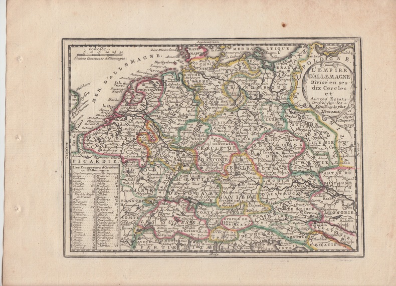
Jacques Chiquet Le Nouveau et Curieux Atlas Geographique et Historique.
L'EMPIRE D'ALLEMAGNE divisé en ses dix cercles et autres Etats, Dressée d'aprés les memoires les plus nouveaux.Carte gravée d'époque coloris époque avec feuillet de texte imprimé joint ,extrait du Nouveau et Curieux Atlas Geographique et Historique.
1719 Paris,Nouveau et Curieux Atlas Geographique et historique., c.1719.Copper engraving. Original colour with later additions. Fine condition, good margins. 16.5 x 21.5 cm. (6? x 8? inches),bon état
Referencia librero : 22873
|
|
|
JACQUES COPEAU
LE PLUS PETIT ATLAS DU MONDE
EDITIONS IAC. 1940. In-24. Cartonné. Etat d'usage, Couv. légèrement passée, Dos satisfaisant, Intérieur acceptable. 115 pages. Dos rouge. Manque 1er plat de couverture. Quelques pages détachées de l'ouvrage.. . . . Classification Dewey : 912-Atlas, cartes et plans
Referencia librero : R240001482
|
|
|
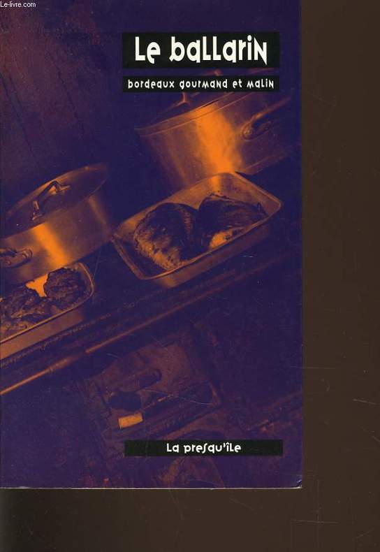
JACQUES BALLARIN
LE BALLARIN bordeaux gourmand et malin
EDITIONS LA PRESQU'ILE. 1998. In-8. Broché. Bon état, Couv. convenable, Dos satisfaisant, Intérieur frais. 206 pages. Nombreuses photographies en noir et blanc et en couleur, dans le texte par Philippe Taris.. . . . Classification Dewey : 912-Atlas, cartes et plans
Referencia librero : R240008765
|
|
|
Jacques Chiquiet Le Nouveau et Curieux Atlas Geographique et Historique.
LE ROYAUME DE FRANCE suivant Observations de Mrs. de l'Academie Royale des Sciences- Carte gravée d'époque coloris époque avec feuillet de texte imprimé joint ,extrait du Nouveau et Curieux Atlas Geographique et Historique.
1719 Nouveau et Curieux Atlas Geographique et historique., c.1719. Copper engraving. Original colour with later additions. Good margins.bon etat,22.4 x 16.8 cm,bonnes marges .
Referencia librero : 22871

|
|
|
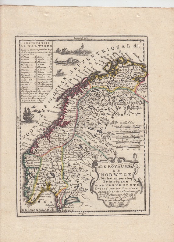
Jacques Chiquet Le Nouveau et Curieux Atlas Geographique et Historique.
Le Royaume de Norwege Divise en ses cinq Principaux Gouvernements dréssé sur les derniers memoires-Carte gravée d'époque coloris époque avec feuillet de texte imprimé joint,extrait du Nouveau et Curieux Atlas Geographique et Historique.
1719 Paris,Nouveau et Curieux Atlas Geographique et historique., c.1719.Published by Le Nouveau et Curieux Atlas Geographique et historique. c.1719., 1719- Copper engraving. Original colour with later additions. Size: 22 x 16.5 cm. (8? x 6? inches). Fine condition, good margins.rare
Referencia librero : 22878
|
|
|
Jacques Chiquet Le Nouveau et Curieux Atlas Geographique et Historique.
LE ROYAUME DE HONGRIE ou se trouvent la Transilvanie, la Moldavie, la Valaquie, la Bosnie la Servie et la Bulgarie, & - Carte gravée d'époque coloris époque avec feuillet de texte imprimé joint ,extrait du Nouveau et Curieux Atlas Geographique et Historique.
1719 Paris,Nouveau et Curieux Atlas Geographique et historique., c.1719.17 x 22,5cm,bon etat. Hungary. Copper engraving. Original colour with later additions. Fine condition, good margins. Size: 22 x 16 cm. (8? x 6? inches). Map of Hungary, including modern day Yugoslavia, Rumania and Bulgaria. List of Hungarian kings at lower centre, title cartouche at top right. In the early eighteenth century, French cartography overtook the Dutch in terms of accuracy and design. Chiquet's delightful Nouveau et Curieux Atlas was typical product of the time.Map shows total Hungary with Moldavia, Bulgaria, Rumania Serbia, Bosnia, Dalmatia and Slovenia.
Referencia librero : 22881

|
|
|
JACOBI / ZIELER:
Lehrbuch und Atlas der Haut und Geschlechtskrankheiten für praktische Ärzte und Studierende. Auf der Grundlage von Prof. Jacobis Atlas der Hautkrankheiten textlich vollständig neu bearbeitet, bildlich wesentlich vermehrt und verbessert von Dr. Karl Zieler.
Berlin / Wien, Urban & Schwartzenberg, 1924, in-4to, XIV + 556 S., + 322 farbige und 2 schwarze Abbildungen auf 169 Tafeln und 99 Textbildern, Hlwd.
Referencia librero : 92543aaf
|
|
 Recibir por correo electrónico
 Descargar en documento PDF
 Flujo RSS


