|
[Ungarn]
?Szerem Varmegye (Comitatus Sirmiensis)?.
[Wien, um 1810]. Grenzkolor. Kupferstich-Karte aus D. v. Görög, Magyar Atlas (Blattgröße 27,1 x 37,5 cm, Darstellung 22,3 x 28,9 cm).
Referencia librero : 55227

|
|
|
[VIETNAM] [ATLAS]
Atlas Historique des six provinces du sud du Vietnam - Du milieu du XIXe au début du Xxe siècle
Paris, Les Indes Savantes, 2003. 1 volume in-4, reliure moderne cartonnée et illustrée, 287 pp., enrichi de 53 cartes en couleurs à pleine page, exemplaire neuf.
Referencia librero : 13681
|
|
|
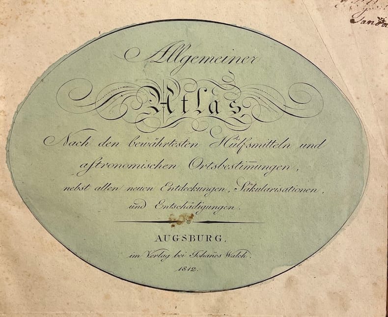
[WALSCH (Johannes)]
Allgemeiner Atlas, Nach den bewährtesten Hülfsmitteln und astronomischen Ortsbestimmungen.
Augsburg, im Verlag bei Johannes Walch, 1812. Pt. in-4° oblong (25,5 x 21 cm), 36ff. Reliure d'époque demi-basane à coins, pièce de titre rouge au dos.
Referencia librero : 39755
|
|
|
[Walser, Gabriel; J. J. Mezger]
Schweizerischer Atlas bestehend in 19 Carten.
Ohne Ort, ohne Verlag bzw. Drucker, o. J. (um 1770). Qu.-4° (32,5 x 28 cm). Mit gest. Titel von J. J. Mezger u. 19 grenz- u. flächenkolor. Kupferkarten. Einfacher grüner Kart.-Umschlag d. Zt. m. handschriftl. Deckeltitel.
Referencia librero : 64868

|
|
|
[WISCONSIN, MARATHON COUNTY -- MAP ATLAS]. BUSSELL, [Charles Edward] & HOLWAY
Map of the County of Marathon Wisconsin compiled and published by . . . .
Neillsville & Wasau WI: Bussell & Holway Civil Engineers 1881. 8vo. 180 pp unpaginated. with double-page engraved title plat maps throughout primarily on facing recto & verso of leaves while some are overlapping and on next blank continuing w/ laid-in Township Range Plat Map MS on form 4-590 demarcating Government Land and dated March 6 1895 inserted into rear pocket annotations demarcating plat changes red ink markings of “Government Land†w/ V’s and other annotations on several of the maps in Marathon County by former real estate land surveyor. Contemporary black calf rebacked hinges restored w/ thumbing some edgewear still a VG- copy. First edition of this detailed and compact pocket plat map atlas issued by Bussell b. 1854 was a surveyor/civil engineer based out of nearby Neillsville Clark WI and his partner Holway for lands platted through Marathon County Wisconsin in the 19th-Century as the centrally located County opened for logging and settlement on lands driven by the Wisconsin Central Railroad and the Wisconsin Valley Railroad later the Wisconsin Valley Land Company. This exceptional reference provides names of all the original homesteaders and plat-holders as of the time of publication as well as demarcating houses churches schools mills U.S. Government lands state lands as well as the lines for the Lake Shore Traffic Co. Dundee Land Co. and development lands of the C.P. Haseltine Co. Worldcat locates only 1 physical copy at Library of Congress Wisconsin Historical Society does have a scanned searchable copy available online; See: Louise Marchetti History of Marathon County Wisconsin and Representative Citizens 1913. Bussell & Holway, Civil Engineers, unknown
Referencia librero : 62541
|
|
|
[WORLD ATLAS] Guthrie, William
A New Geographical Historical and Commercial Grammar; and present State of the several Kingdoms of the World.illustrated with a correct set of maps. Twelfth Edition with great additions and considerable improvements.
London 1790. Twelfth Edition. Hardcover. Very Good. Thick quarto. 22 engraved maps after Thomas Kitchin georgrapher to the King. A colorful hodgepodge of a binding with parts contemporary and other bits newer. Contents typically toned. <br/><br/> hardcover
Referencia librero : D19541
|
|
|
[YILDIZ PALACE MAP ON SILK HANDKERCHIEF FOR THE SOCIAL AIDS IN THE PERIOD OF SULTAN ABDULHAMID 2].
[THE GRECO-TURKISH WAR MAP ON A SILK HANDKERCHIEF MADE IN YILDIZ PALACE] Devlet-i Aliyye ve Yunan Muhaberebesi. Engraved map of the Greco-Turkish War in 1897 on a silk handkerchief made in Yildiz Palace in the period of Sultan Abdulhamid II.
Very Good Turkish, Ottoman (1500-1928) Original engraved map on the silk handkerchief made in Yildiz Palace for the 'Iane Sergisi' [i.e. Exhibition of the Social Assistance] in the period of Sultan Abdülhamid II. In its decorative frame. Frame size: 53,5x53,5 cm; map size: 38x38 cm. In Ottoman script. Scale: 1/600.000. Several minimal splits, minor foxing, and slight stains on cloth. Otherwise in good condition. A rare and decorative 1897 silk handkerchief map of the Greco-Turkish War in 1897, which was the only war in which the Ottoman army was victorious during the reign of Abdulhamid 2, is a fine example of Ottoman / Turkish cartographic textiles made in Ottoman court (Yildiz Palace textile workshops). This beautiful map depicts an attractive war scene from the 1313 Greek War on the upper half, and it's engraved a map of Balkan & Greek lands on its lower half. War painting has 'Melona' signature in Ottoman script. The map shows Thessaloniki [i.e. Salonica] Bay on the west; Yanya [i.e. Ioanna] Vilayat on the east; lands of Greece, Galos Bay, Uzi Strait on the south and Dimetoka and Avalonia areas in the Serefiye, Ergiri sanjaks on the north in its period. Written on the map, "Baht-i himâye-yi feyzvâne-i cenâb-i hilâfetpenâhide evlad-i süheda ve mecrûhin-i asakir-i sâhâne", [i.e. It was printed for the "Iane Sergisi" (i.e. The Social Help Exhibition) in the high memory of our soldiers who were martyred and veterans in the Greek War under the patronage of the Sultan.]. The Greco-Turkish War of 1897, also called the Thirty Days' War and known in Greece as the Black '97 (Mauro '97), or the Unfortunate War (Atychis polemos), was a war fought between the Kingdom of Greece and the Ottoman Empire. Its immediate cause was the question over the status of the Ottoman province of Crete, whose Greek majority long-desired union with Greece. Despite the Ottoman victory on the field, an autonomous Cretan State under Ottoman suzerainty was established the following year (as a result of the intervention of the Great Powers after the war), with Prince George of Greece and Denmark as its first High Commissioner. This was the first war effort in which the military and political personnel of Greece were put to test since the Greek War of Independence in 1821. For the Ottoman Empire, this was also the first war effort in which the reorganized military personnel were put to test. The Ottoman army was under the guidance of a German military mission led by Colmar Freiherr von der Goltz, who had reorganized it after the defeat in the Russo-Turkish War (1877-1878). The conflict proved Greece was wholly unprepared for war. Plans, fortifications and weapons were non-existent, the mass of the officer corps was unsuited to its tasks, and training was inadequate. As a result, the numerically superior, better organized, equipped and led Ottoman forces pushed the Greek forces south out of Thessaly. Almost all of the aids made to the families or disabled people of those who were martyred in the 1897 Ottoman-Greek War (such as printing this map) were made within the framework of the donations of "Evlâd-i Süheda and Malûlîn-i Guzât-i Asâkir-i Sahane". People and citizens of all classes and beliefs, including members of the Ottoman court, ministers, bureaucrats, civil servants, merchants and tradesmen, participated in this aid campaign at the end of the 19th, beginning of the 20th century. Not in OCLC.
|
|
|
[Zweisimmen - Gemmi]
Zweisimmen - Gemmi. 1:50.000. Ueberdruck. (= Topographischer Atlas der Schweiz).
Bern, Eidgenössisches topographisches Bureau, 1892. Farb. Karte (56 x 78 cm) mit Titelschild, in 18 Segmenten auf Lwd. aufgezogen.
Referencia librero : 50084

|
|
|
[Zürner, Adam Friedrich]
Kurze Geographie von Deutschland oder Atlas Portatilis Germanicus. Nebst einem Verzeichnis aller jetzt regierenden hohen Häupter Deutschlands.
Nürnberg, Christoph Weigel, 1780. 8°. Mit 37 doppelblattgr. kolor. Kupferkarten. 8 Bll., 186 S., 98 Bll., HLdr. d. Zt. a. 5 Bünden m. Rückenverg., goldgepr. Rückenschild u. Rotschnitt.
Referencia librero : 65196

|
|
|
[ÜST. A. RIZA, (1874-1935)].
Ottoman map of Eastern Anatolia. Bargiri, Hoy, Baskal'a, Malazgird.
Very Good Turkish, Ottoman (1500-1928) Original color map. 50x60 cm. In Ottoman script. Scale: 1/200000. Ottoman map of Eastern Anatolia. Bargiri, Hoy, Baskal'a, Malazgird. It shows Lake Erçek located on the east of Lake Van which is an endorheic salt lake in Van Province in eastern Turkey, about 30 kilometres; on north side, Bargiri place where the oldest district of Van city; on east, Turkish and Azerbaijani and Iranian borders and Hoy city of the West Azerbaijan; and on west, map shows Malazgird [Malazgirt]. This is one the serie of the Bonn projection maps which are the first map series in modern techniques in Turkey and the Ottoman Empire. In order to produce these maps covering Turkish territory, Reconnaissance Branch was incorporated into The Mapping Commission. The maps were produced in the datum based on the latitude and longitude of Ayasofya Mosque in equal area Bonn Projection. The field works for the 123 sheets covering the country were conducted by 76 staff. The production was completed in 18 years starting from east west. Field works continued without stopping except in years 1914 and 1920. This map series called also reconnaissance maps contributed a lot to producing 1:25.000 scale maps.
|
|
|
A Photographic Atlas
Typical Flies
paperback. Good. Access codes and supplements are not guaranteed with used items. May be an ex-library book. paperback
Referencia librero : 1332772846.G ISBN : 1332772846 9781332772841

|
|
|
A. Cattaneo;
Fra Mauro's Mappa mundi and Fifteenth-Century Venice ,
Turnhout, Brepols, 2011 Hardback, 470 p., 3 b/w ill. 16 colour ill., 210 x 270 mm. ISBN 9782503523781.
Referencia librero : 30985
|
|
|
A. H. Dufour - Adrien Guibert
Département des Basses-Pyrénées - carte issue de l'Atlas Départemental de la France - carte n°63
1875, Maison Bouasse-Lebel, Paris. 60x80cm. Grande et belle carte entoilée du département des Basses-Pyrénées dressée par A. H. Dufour et accompagnée d'une notice statistique d'Adrien Guibert. Carte conservée dans son étui cartonné. Coloration originale d'éditeur. Très bel exemplaire. Infime brunissement des plis.
Referencia librero : CARTE30B12
|
|
|
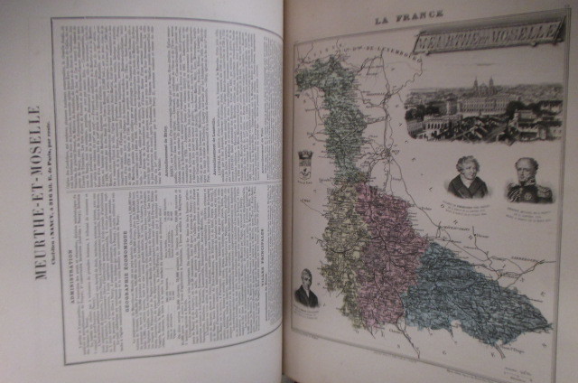
A. Martineau & H. Stein (textes) - Vuillemin, L. Thuillier, Ch Lacoste, J. Migeon (cartes)
LA FRANCE ET SES COLONIES. Atlas illustré de 108 cartes dressées d'après les cartes du dépôt de la guerre, des ponts et chaussés, de la marine, des travaux publics de l'intérieur et des eaux et forets.
1888 / non paginé environ 300 pages. Relié au format : 37 x 28 cm. Editions J. Migeon.
Referencia librero : GEO402M
|
|
|
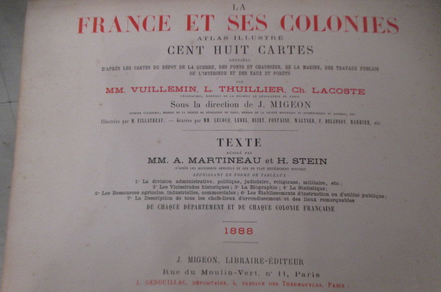
A. Martineau & H. Stein (textes) - Vuillemin, L. Thuillier, Ch Lacoste, J. Migeon (cartes)
LA FRANCE ET SES COLONIES. Atlas illustré de 108 cartes dressées d'après les cartes du dépôt de la guerre, des ponts et chaussés, de la marine, des travaux publics de l'intérieur et des eaux et forets.
1888 / non paginé environ 300 pages. Relié au format : 37 x 28 cm. Editions J. Migeon.
Referencia librero : GEO403M
|
|
|
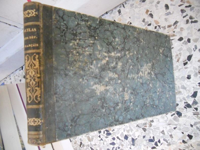
A. Perrot
Petit atlas des departements francais, des colonies, de l'Algerie, du bassin de la Mediterranee, ornee d'un texte geographique et d'une carte de France pour servir de tableau d'assemblage
A Paris, Langlois, 1841. Format oblong 22x13 cm, demi-reliure basane vert. Exemplaire usage, reliure frottee, page de titre tachee (voir photo), la carte de France (pour servir de tableau d'assemblage) est en tres grande partie absente, l'ensemble des cartes de departements est tres frais.Etat acceptable.
Referencia librero : 31655
|
|
|
A. Scobel (Hrsg.)
Geographisches Handbuch zu Andrees Handatlas mit besonderer Berücksichtigung der politischen, kommerziellen und statistischen Verhältnisse
Bielefeld/Leipzig Velhagen & Klasing, 1894. Original-Halblederband mit Lederecken, Gr.-8°, 687 Seiten.
Referencia librero : 75182
|
|
|
A.A.M. VAN DER HEYDEN, H.H. SCHULLARD (EDITED BY)
ATLAS OF THE CLASSICAL WORLD.
NELSON. 1963. In-Folio. Cartonnage d'éditeurs. Etat d'usage, Couv. légèrement passée, Coiffe en pied abîmée, Intérieur frais. 221 pages. Jaquette illustrée en couleurs, abîmée (déchirures). Nombreuses photos en noiret blanc et cartes illustrées en couleurs hors texte. Texte en anglais.. Avec Jaquette. . . Classification Dewey : 912-Atlas, cartes et plans
Referencia librero : R260121166
|
|
|
A.A.V.V.
1927 / 1928, LA SUISSE GUIDE DE L'AUTOMOBILISTE EDITE PAR LE TOURING-CLUB SUISSE, EDITION OFFICIELLE, OFFIZIELLE AUSGABE, FUHRER FUR AUTOMOBILFAHRER DIE SCHWEIZ HERAUSGEGBEN VOM SCHWEIZER TOURING- CLUB
In oblungo ; (26), (92) (con cartine ripiegate a doppia pagina), (2), 274, (42) pp. Bella legatura editoriale coeva in piena tela marrone con illustrazioni ai piatti e titolo al dorso (piccolo difetto al margine superiore del dorso e qualche scoloritura alle impressioni a secco ai piatti). Al piatto anteriore titolo, simbolo della svizzera ed immagine di un'automobile che si inerpica verso una montagna innevata. Al piatto posteriore bellissima pubblicità di un magnete della ditta Scintilla. All'interno moltissime immagini pubblicitarie. L'opera contiene centinaia di cartinine, la maggior parte ripiegate rappresentanti in modo minuzioso la Svizzera. Varie sono piante delle città svizzere. 274 pagine di testo completamente dedicate ad itinerari turistici nel territorio svizzero con descrizione delle principali attrative dei luoghi incontrati, ristoranti, hotel, distanze ecc. In fondo al volume una brossura contenitore pubblicitaria della Dunlop con all'interno alcune cartoline pubblicitarie di alcune località svizzere e una breve guida di 32 pp. con il regolamento per la circolazione delle automobili in Svizzera. All'interno in ottimo stato di conservazione con conservata anche la pubblicità segnalibro della Durol Olii per motore. NON COMUNE in queste condizioni di conservazione.
|
|
|
A.DEBAUVE
MANUEL DE L'INGENIEUR DES PONTS ET CHAUSSEES - ATLAS DU 19E FASCICULE - DES EAUX COMME MOYEN DE TRANSPORT NAVIGATION FLUVIALE ET MARITIME
1878 1878. In-Plano. Broché. Etat bon 129 planches en noir et blanc sur deux pages , interieur tres propre
Referencia librero : 7129

|
|
|
A.Erdmann
Exposé des formations quaternaires de la Suède - Atlas contenant 14 cartes générales.
P.A. Norstedt & fils. 1868. In-4. Relié. Etat d'usage, Coins frottés, Dos satisfaisant, Intérieur acceptable. 14 cartes en couleurs - cartes collationnées - 2 photos disponibles.. . . . Classification Dewey : 912-Atlas, cartes et plans
Referencia librero : R320116951
|
|
|
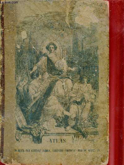
A.H.Dufour
La France illustrée - Atlas contenant tous les départements et les plans des chefs lieux.
Gustave Barba. non daté. In-4. Relié. Etat passable, Plats abîmés, Dos abîmé, Quelques rousseurs. 89 planches de cartes/plans en couleurs - quelques rousseurs à l'intérieur de l'ouvrage sans conséquence sur la lecture - coins, tranches frottés - plats défraîchie - manque sur le 1er plat - dos absent - plats partiellement désolidarisés.. . . . Classification Dewey : 912-Atlas, cartes et plans
Referencia librero : R320124793
|
|
|
AA,VV.
Germania Antiqua - Germany Southern Part. - Germany divided into Circles - Bohemia including Moravia
4 lotto di 4 carte in formati diversi, circa 24x34 cm., a colori, in inglese, ben conservate, molto interessanti.
|
|
|
AA.VV.
Carta ufficiale delle Poste Svizzere Foglio II
1 18x12,5 cm. fomato chiuso, 54x75 formato aperto, 18 riquadri su carta a colori su tre file applicati su tela, con scacco di Luzern, St. Gallen, Zurich, in tedesco, francese e italiano, buone condizioni.
|
|
|
AA.VV.
Gen?ve
1 35x45 cm., formato aperto, chiuso cm., 17,5x11, 8 riquadri su 2 file, su carta a colori, applicate su tela, scala 1:25.000, in francese, buone condizioni.
|
|
|
AA.VV.
Topographische Detailkarten: Zurich
1 57.5x40,5 cm., formato aperto, 19x10 cm., formato chiuso, 12 riquadri su tre file, su carta a colori applicati su tela, scala 1:200.000, in tedesco, buone condizioni.
|
|
|
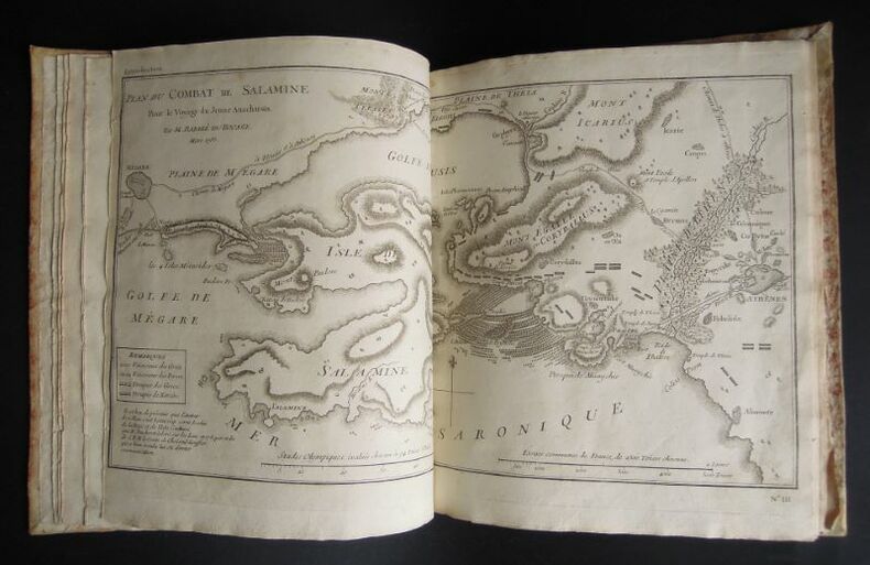
Abate BARTHELEMY [Abbé BARTHELEMY], BARBIE DU BOCAGE,
Atlante al viaggio del giovine Anacarsi in Grecia nella metà del quarto secolo avanti l'era vulgare [Atlas du Voyage du jeune Anacharsis en Grèce] - 1793
s. l. [Venise ?], s. n. [Zatta ?], 1793, 1 vol. in-4° (26,3 x 21,7 cm) se composant de : 1 db-f. de gardes blanches, 1 f. de titre, 1 f. de table des illustrations avec leur répartition dans les neufs premiers tomes de texte de l'édition correspondante. 31 illustrations y sont annoncées, toutes reliées à l'exception de la première qui est une grande carte dépliante, simplement repliée et glissée entre deux autres f., 1 db-f. de gardes blanches. Roman historique sur la vie dans la Grèce antique et l'Orient méditerranéen. Atlas vraisemblablement issu de l'édition de 1791-1793 menée par Zatta à Venise, bien que celle-ci, en 12 volumes, soit au format petit in-8°: comme dans d'autres éditions de cet ouvrage, l'atlas final a un format plus grand. Les éditions postérieures (début XIXème) sont majoritairement au format in-12. Les illustrations gravées sont réparties au long du texte. Or ici, comme dans l'édition originale (Paris, 1788), elles sont regroupées en un atlas venant clôturer les tomes de texte. Au regard de l'année de publication, on en conclut qu'il s'agit de l'édition originale italienne, le texte ayant été traduit du français. Notons que seuls les feuillets de titre et de sommaire sont traduits, les cartes et illustrations, quant à elles sont légendées en français. Cet altas comporte 31 gravures au burin, pleine page, de différents formats, intitulées comme suit : I - La Grèce et ses isles, II - Plan du passage des Thermo-Pyles, III - Plan du combat de Salamine, IV - Essai sur la Bataille de Platée , 1 - Carte du Palus Méoti?e et du Pont Euxin, 2 - Plan du Bosphore et de Thrace, 3 - L'Helles-Pont, 4 - Plan des Environs d'Athènes, 5 - L'Attique, la Mégarde et partie de l'Isle d'Eubée, 6 - Plan de l'Académie et de ses Environs, 7 - Plan d'une Palestre Grecque, 8 - Plan d'Athènes, 9 - Plan et Elévations des Propylées, 10 - Plan du Temple de Thésée, Elévation de la Façade du Parthénon, Vue du Parthénon, 11 - La Phocide et la Doride, 12 - Essai sur les Environs de Delphes, 13 - Plan d'une maison grecque, 14 - La Béotie, 15 - La Thessalie, 16 - La Corinthie, la Sicy?nie, la Philiasie et l'Achaie, 17 - L'Elide et la Triphylie, 18 - Essai sur la topographie d'Olympie, 19 - La Messénie, 20 - La Laconie et l'Isle de Cythère, 21 - Essai sur la topographie de Sparte et de ses environs, 22 - L'Arcadie, 23 - L'Argolide L'Epidaurie. La Trézénie L'Hermionide, l'Isle d'Egine et la Cynurie, 24 - Platon sur le cap Sunium au milieu de ses disciples, 25 - Ancien Théâtre grec, 26 - Les Cyclades, 27 et dernier - Médailles tirées du Cabinet du Roi. La plupart sont des cartes, les autres, des plans d'édifices ou encore des perspectives aériennes, ainsi qu'une planche de médailles. Jean-Jacques Barthélemy (1716-1795) : auteur, historien, abbé, poète, philosophe, hélléniste, numismate. Jean-Denis Barbié du Bocage (1760-1825) : cartographe. Antonio Zatta (1722-1804) : libraire. Tardieu : graveur.
Referencia librero : 127
|
|
|
ABBE DESPONT J.
Nouvel Atlas des Missions.
AUX BUREAUX DE L'OEUVRE DE LA PROPAGATION DE LA FOI. 15 mai 1951. In-4. Cartonné. Etat d'usage, Couv. légèrement passée, Mors fendus, Intérieur acceptable. 58 pages. Nombreuses planches de cartes en couleurs. Accompagné de documents dactylographiés. Coiffes usées.. . . . Classification Dewey : 912-Atlas, cartes et plans
Referencia librero : RO80160415
|
|
|
ABBE J. DESPONT
NOUVEL ATLAS DES MISSIONS
AUX BUREAUX DE L'OEUVRE DE LA PROPAGATION DE LA FOI. 1951. In-4. Cartonné. Bon état, Couv. légèrement passée, Coiffe en pied abîmée, Intérieur frais. 58 pages. Nombreuses cartes en couleur, hors texte.. . . . Classification Dewey : 912-Atlas, cartes et plans
Referencia librero : R240016619
|
|
|
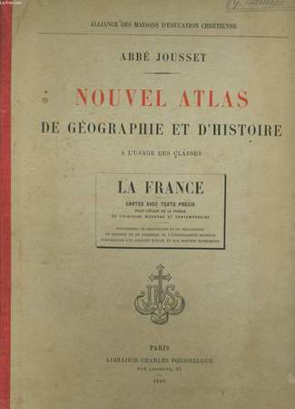
ABBE JOUSSET.
NOUVEL ATLAS DE GEOGRAPHIE ET D'HISTOIRE. LA FRANCE.
Poussielgue.. 1895.. In-4. Cartonnage d'éditeurs. Bon état, Couv. convenable, Dos satisfaisant, Intérieur acceptable. 39 pages. Nombreuses cartes en couleurs, dans le texte et hors texte. Ecriture au crayon à papier sur la 1ère et 2nde de couverture.. . . . Classification Dewey : 912-Atlas, cartes et plans
Referencia librero : RO20081746
|
|
|
ABBE.J.DESPONT
NOUVEL ATLAS DES MISSIONS
1951 .19 CARTES EN COULEUR . 59 PAGES .
Referencia librero : 7899
|
|
|
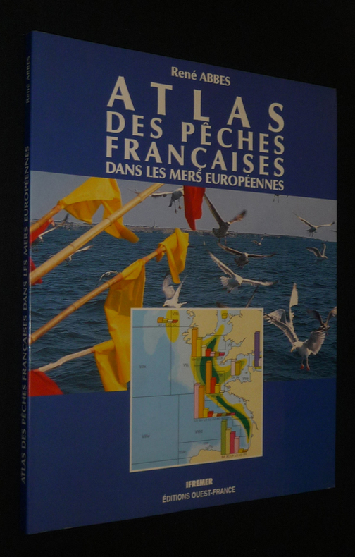
Abbes René
Atlas des pêches françaises dans les mers européennes
Ouest-France, Ifremer Dos carré collé 1991 In-4 (24,2 x 30 cm), dos carré collé, 94 pages, iconographie en couleurs ; Livraison a domicile (La Poste) ou en Mondial Relay sur simple demande.
Referencia librero : dc1116
|
|
|
Abbé D. Dupuy
Histoire naturelle des mollusques - Atlas
sd Editions non-renseignées - Sans date (Milieu XIXe, vers 1850) - In-4, reliure demi-chagrin, plats percalines, dos à 5 nerfs titré en doré - Ouvrage comprenant 31 planches lithographiées en N&B avec leur page d'explications
Referencia librero : 126381
|
|
|
ABDÜLKERIM ERDOGAN.
Mamak tarih ve kültür atlasi. 2 volumes set.
New English Original bdg. HC. In publisher's special box. 4to. (31 x 21 cm). In Turkish. 2 volumes set: (440 p.; 328 p.), color and b/w ills. Mamak tarih ve kültür atlasi. 2 volumes set.
|
|
|
Abensour (Léon).
Nouvel Atlas Larousse. Géographie Universelle Pittoresque.
Paris, Larousse, 1924. Un fort volume de format in 4° de 456 pp.; Nombreuses cartes en couleurs, et, pour chaque parties de nombreuses reproductions photographiques de l'époque. Reliure de l'éditeur en demi chagrin brun, plats vert"Larousse", titres dorés. Coins légèrement marqués, sinon bel état. Intérieur très frais quelques coupures de presse insérées.
|
|
|
ABENSOUR Léon
Nouvel Atlas Larousse
Larousse. 1924. In-4. Relié toile grenée. Bon état, Coins frottés, Dos satisfaisant, Intérieur frais. 456 pages. Texte sur deux colonnes. 1519 reproductions photographiques. 113 cartes ou dessins. 32 cartes hors texte en couleurs. 50 cartes hors texte e noir. 5 photographies hors texte. 9 tableaux statistiques. 2 index alphabétiques. Titre doré sur le dos et la couverture.. . . . Classification Dewey : 912-Atlas, cartes et plans
Referencia librero : ROD0013979
|
|
|
Abensour Léon
NOUVEL ATLAS LAROUSSE, GEOGRAPHIE UNIVERSELLE PITTORESQUE
LIBRAIRIE LAROUSSE, 1924. 456 Pages . 1519 reproductions photographiques - 113 cartes ou desins - 32 cartes hors texte en couleurs - 50 cartes hors texte en noir - 5 photographies hors texte - 9 tableaux statistiques - 2 index alphabetiques 1 volumes. 3500 g.
Referencia librero : ATLAS14M

|
|
|
ABENSOUR Léon
Nouvel atlas Larousse. Géographie Universelle Pittoresque.
Paris, Librairie Larousse, 1924 24 x 32, 454 pp., cartonnage d'édition, bon état
Referencia librero : 10514
|
|
|
ABENSOUR, L.
Nouvel ATLAS Larousse. 1519 reproductions photographiques.- 113 cartes ou dessins.- 32 cartes hors texte en couleurs.- 50 cartes hors texte en noir.- 5 photographies hors texte.
in-4° 456 pages, texte sur deux colonnes., tabl., index, relie demi-chagrin d'epoque, dos decor estamp., titre dore, plats decor estamp., tranches teintEes. Bon etat. Coins us. Dos satisfaisant. Interieur frais. [VU-6]
|
|
|
Accompagnes d'un Atlas In-4, Contenant 500 Sceaux
Extrait des Chartes Et Autres Actes Normands ou Anglo-Normands Qui Se Trouvent dans les Archives du Calvados Vol. 2 of 2
paperback. Good. Access codes and supplements are not guaranteed with used items. May be an ex-library book. paperback
Referencia librero : 0366091522.G ISBN : 0366091522 9780366091522
|
|
|
Accompanied by a Celestial Atlas
The Geography of the Heavens and Class Book of Astronomy
paperback. Good. Access codes and supplements are not guaranteed with used items. May be an ex-library book. paperback
Referencia librero : 1334032505.G ISBN : 1334032505 9781334032509

|
|
|
Accompanied by a New and Correct Atlas, Drawn and
Willetts' New and Improved School Geography
paperback. Good. Access codes and supplements are not guaranteed with used items. May be an ex-library book. paperback
Referencia librero : 1527749126.G ISBN : 1527749126 9781527749122

|
|
|
Acevado Latorre, Eduardo
Atlas de mapas antiguos de Colombia : siglos XVI a XIX recopiló y dirigió Eduardo Acevedo Latorre. 3. ed
Bogota', Colombia : Litografi'a Arco, 1986. 187 pages : color maps ; 46 cm, Bauchbinde beschädigt, gebundene Ausgabe, wattierter Pappband, sonst Exemplar in gutem Erhaltungszustand
Referencia librero : 47212

|
|
|
ACEVEDO LATORRE (Eduardo)
Atlas de mapas antiguos de Colombia. Siglos XVI a XIX. TERCERA EDITION.
Bogota LITOGRAFIA ARCO 1986 un volume in plano (330mm x 450mm), 187 pp. Reliure éditeur à la Bradel, plats illustrés en couleurs. (petit accroc aux plats, deux coins pincés). Atlas de la Colombie composé de 60 cartes anciennes, commentées, reproduites en noir et en couleurs dont plusieurs à double page et une sur triple page. Belle publication. Intérieur frais. Ouvrage lourd (2,6kg) et volumineux (prévoir des frais de port supplémentaires.
Referencia librero : 022472
|
|
|
Achille Meissas et Auguste Michelot
Atlas élémentaire de géographie moderne pour la nouvelle géographie méthodique de MM. Achille Meissas et Auguste Michelot : atlas A
1850 Chez l"auteur - Librairie L. Hachette et Cie,sd (vers 1850?) IN FOLIO . 8 doubles-planches de cartes en couleur. Plats abîmés avec petits manques. Couvertures,dos abscent, se détachant. 2e moitié du XIXe siècle. Mappe-monde. Europe. Asie.Amerique Oceanie,France
Referencia librero : 21436

|
|
|
Acosta Bono, Gonzalo
Atlas de Andalucía - 1. Cartografía general, 1:100. 000 [Texto impreso] [elaboración de textos coordinada por Gonzalo Acosta Bono ; mapa topográfico, Instituto de Cartografía de Andalucía ; ortoimágenes y mapas de usos del suelo, Servicio de Evaluación de Recursos Naturales (CMA)]" no encontró registros en ninguna biblioteca.
Sevilla : Junta de Andalucía, Consejería de Obras Públicas y Transportes 1998. 429 p ill y mapas col. 34 x 47 cm gebundene Ausgabe, Halbleinen, book in good condition, Exemplar in gutem Erhaltungszustand
Referencia librero : 21426

|
|
|
ADAMCZEWSKI JAN
CRACOVIE GUIDE ILLUSTRE
EDITIONS INTERPRESS. NON DATE. In-8. Broché. Etat d'usage, Coins frottés, Dos satisfaisant, Intérieur frais. 197 pages augmentées de nombreuses illustrations en couleurs dans et/ou hors texte - 1 plan de Cracovie en couleurs en début d'ouvrage - quelques rousseurs en début d'ouvrage.. . . . Classification Dewey : 912-Atlas, cartes et plans
Referencia librero : ROD0127534
|
|
|
ADHEMAR
COURS DE MATHEMATIQUES à l'usage de l'ingénieur civil. Applications de géométrie descriptive. COUPE DES PIERRES. ATLAS.
Paris Lacroix, Dunod, Hachette 1858. In folio 115 feuillets. Demi basane brune, dos lisse orné de filets dorés, rel époque. Atlas contenant 86 planches dont 26 sur double page et 3 se dépliant 4 fois, réunissant un grand nombre de sujets. Légère usure du papier des plats, rousseurs sur la planche 64, ancienne mouillure claire dans les fonds.
Referencia librero : GITa829
|
|
|
Adolf Stieler
Handatlas über alle Theile der Erde und das Weltgebäude
gotha 1876 Justus Perthes Hardcover
Referencia librero : 027011

|
|
|
ADOLPHE JOANNE
ATLAS TOPOGRAPHIQUE DE LA FRANCE - 95 CARTES REDUITES D'APRES LES CARTES DE L'ETAT MAJOR
Hachette. 1873. In-Folio. Relié. Bon état, Couv. convenable, Dos satisfaisant, Intérieur frais. 95 planches de cartes topographiques en couleurs augmentées d'une description/explication de la carte (double page explication-carte en regard); une carte découpée; une carte dépliante abîmée; cartonnage éditeur, titre doré sur plat et dos, motifs dorés sur dos, roulettes; dessiné par Alp. Mouraux, gravé chez Erhard.. . . . Classification Dewey : 912-Atlas, cartes et plans
Referencia librero : RO30008448
|
|

 Recibir por correo electrónico
 Descargar en documento PDF
 Flujo RSS
 Link permanente


