|
ERKÂN-I HARBIYE-I UMUMIYE].
[MAP of ALEXANDRETTA] Iskenderun - Tayakadin.
Very Good Turkish, Ottoman (1500-1928) Original color map on cloth. Folded. Wrinkled on paper. Stains on cloth. 12 sheets on paper. Oblong atlas folio. (50 x 60 cm). In Ottoman script.[MAP of ALEXANDRETTA] Iskenderun - Tayakadin. It shows villages and settlements in Tayakadin of Iskenderiye. Scale: 1/25.000. Hegira: 1329 = Gregorian: 1913. This is one the serie of the Bonn projection maps which are the first map series in modern techniques in Turkey and the Ottoman Empire. In order to produce these maps covering Turkish territory, Reconnaissance Branch was incorporated into The Mapping Commission. The maps were produced in the datum based on the latitude and longitude of Ayasofya Mosque in equal area Bonn Projection. The field works for the 123 sheets covering the country were conducted by 76 staff. The production was completed in 18 years starting from east west. Field works continued without stopping except in years 1914 and 1920. This map series called also reconnaissance maps contributed a lot to producing 1:25.000 scale maps. Not description on map-maker. A very detailed map. Extremely rare.
|
|
|
ERKÂN-I HARBIYE-I UMUMIYE].
[MAP of EAST & SOUTHEAST ANATOLIA] Maras - Elbistan - Birecik - Kilis.
Very Good Turkish, Ottoman (1500-1928) Original color map. Folded. Oblong atlas folio. (50 x 60 cm). In Ottoman script. Shows Eastern and Southeastern parts of Anatolia; Maras, Elbistan, Birecik and Kilis areas. Hegira: 1333 = Gregorian: 1917. Not description on map-maker.
|
|
|
ERKÂN-I HARBIYE-I UMUMIYE].
[MAP of EAST ANATOLIA and EAST BLACK SEA] Oltu, Artvin, Ispir, Hasankale.
Very Good Turkish, Ottoman (1500-1928) Original color map. Folded. Oblong atlas folio. (50 x 60 cm). In Ottoman script. [MAP of EAST ANATOLIA and ARTVIN] Oltu, Artvin, Ispir, Hasankale. Shows Artvin, Ispir, Hasankale and Kars city. Scale: 1/200.000. This is one the serie of the Bonn projection maps which are the first map series in modern techniques in Turkey and the Ottoman Empire. In order to produce these maps covering Turkish territory, Reconnaissance Branch was incorporated into The Mapping Commission. The maps were produced in the datum based on the latitude and longitude of Ayasofya Mosque in equal area Bonn Projection. The field works for the 123 sheets covering the country were conducted by 76 staff. The production was completed in 18 years starting from east west. Field works continued without stopping except in years 1914 and 1920. This map series called also reconnaissance maps contributed a lot to producing 1:25.000 scale maps. Hegira: 1332 = Gregorian: 1916. Not description on map-maker.
|
|
|
ERKÂN-I HARBIYE-I UMUMIYE].
[MAP of EAST ANATOLIA] Hozat, Dersim.
Very Good Turkish, Ottoman (1500-1928) Original color map. Folded. Oblong atlas folio. (50 x 60 cm). In Ottoman script. [MAP of EAST ANATOLIA] Hozat, Dersim. Shows Eastern parts of Anatolia; Dersim-Horat and border of Erzincan city; Divrigi; Harput (Kharpout); Kilis; and Munzur Mountains, et alli. Scale: 1/200.000. Hegira: 1330 = Gregorian: 1914. Not description on map-maker.
|
|
|
ERKÂN-I HARBIYE-I UMUMIYE].
[MAP of EAST BLACK SEA] Artvin, Rize, Oltu.
Good Turkish, Ottoman (1500-1928) Original color map. Folded. Tears in margins. Slightly stained. Otherwise a good copy. Oblong atlas folio. (50 x 60 cm). In Ottoman script. [MAP of EAST BLACK SEA] Artvin, Rize, Oltu. Shows Artvin and Georgian borders, Rize (Rizeon - Rizunda - Rizini) and Oltu cities and regions. Scale: 1/200.000. Hegira: 1330 = Gregorian: 1914. This is one the serie of the Bonn projection maps which are the first map series in modern techniques in Turkey and the Ottoman Empire. In order to produce these maps covering Turkish territory, Reconnaissance Branch was incorporated into The Mapping Commission. The maps were produced in the datum based on the latitude and longitude of Ayasofya Mosque in equal area Bonn Projection. The field works for the 123 sheets covering the country were conducted by 76 staff. The production was completed in 18 years starting from east west. Field works continued without stopping except in years 1914 and 1920. This map series called also reconnaissance maps contributed a lot to producing 1:25.000 scale maps. Not description on map-maker. Extremely rare.
|
|
|
ERKÂN-I HARBIYE-I UMUMIYE].
[MAP of EAST BLACK SEA] Trabzon, Giresun, Erzincan, Ispir.
Very Good Turkish, Ottoman (1500-1928) Original color map. Folded. Oblong atlas folio. (50 x 60 cm). In Ottoman script. [MAP of EAST BLACK SEA] Trabzon, Giresun, Erzincan, Ispir. Shows Trebizond, Cerasonte, Erzingan (Eriza), Suspiritis (Sper) of Erzurum (Erzeron city); mostly Black Sea shores of Trabzon and Giresun. . Scale: 1/200.000. This is one the serie of the Bonn projection maps which are the first map series in modern techniques in Turkey and the Ottoman Empire. In order to produce these maps covering Turkish territory, Reconnaissance Branch was incorporated into The Mapping Commission. The maps were produced in the datum based on the latitude and longitude of Ayasofya Mosque in equal area Bonn Projection. The field works for the 123 sheets covering the country were conducted by 76 staff. The production was completed in 18 years starting from east west. Field works continued without stopping except in years 1914 and 1920. This map series called also reconnaissance maps contributed a lot to producing 1:25.000 scale maps. Hegira: 1336 = Gregorian: 1920. Not description on map-maker. Extremely rare.
|
|
|
ERKÂN-I HARBIYE-I UMUMIYE].
[MAP of ISTANBUL / CONSTANTINOPLE] Küçükköy, Petnahor (Old Greek-Byzantine name of Göktürk), Makriköy, Kagidhane [Kagithane].
Very Good Turkish, Ottoman (1500-1928) Original color map on cloth. Oblong atlas folio. (49 x 60 cm). Toponyms in Turkish with Arabic letters. In Ottoman script. Scale: 1/25.000. [MAP of ISTANBUL / CONSTANTINOPLE] Küçükköy, Petnahor, Makriköy, Kagidhane [Kagithane]. A rare Istanbul map including some old Byzantine toponyms.
|
|
|
ERKÂN-I HARBIYE-I UMUMIYE].
[MAP of KONIA and ALAIYYA] Konya, Beysehir, Alaiyye.
Very Good Turkish, Ottoman (1500-1928) Original color map on cloth. Folded. Oblong atlas folio. (50 x 60 cm). In Ottoman script. Shows Konya city and around, Alaiye at south. Not description on map-maker. Scale: 1: 200.000. This is one the serie of the Bonn projection maps which are the first map series in modern techniques in Turkey and the Ottoman Empire. In order to produce these maps covering Turkish territory, Reconnaissance Branch was incorporated into The Mapping Commission. The maps were produced in the datum based on the latitude and longitude of Ayasofya Mosque in equal area Bonn Projection. The field works for the 123 sheets covering the country were conducted by 76 staff. The production was completed in 18 years starting from east west. Field works continued without stopping except in years 1914 and 1920. This map series called also reconnaissance maps contributed a lot to producing 1:25.000 scale maps. Rare.
|
|
|
ERKÂN-I HARBIYE-I UMUMIYE].
[MAP of MAGNESIA - AEGEAN REGION] Manisa - Soma, Izmir, Aydin.
Very Good Turkish, Ottoman (1500-1928) Original color map on cloth. Folded. Oblong atlas folio. (50 x 60 cm). In Ottoman script. [MAP of MAGNESIA - AEGEAN REGION] Manisa - Soma, Izmir, Aydin cities (Magnesia, Smyrna and Tralleis) in Aegean region. It shows villages and settlements in Tayakadin of Iskenderiye. Scale: 1/25.000. Hegira: 1328 = Gregorian: 1912. This is one the serie of the Bonn projection maps which are the first map series in modern techniques in Turkey and the Ottoman Empire. In order to produce these maps covering Turkish territory, Reconnaissance Branch was incorporated into The Mapping Commission. The maps were produced in the datum based on the latitude and longitude of Ayasofya Mosque in equal area Bonn Projection. The field works for the 123 sheets covering the country were conducted by 76 staff. The production was completed in 18 years starting from east west. Field works continued without stopping except in years 1914 and 1920. This map series called also reconnaissance maps contributed a lot to producing 1:25.000 scale maps. Not description on map-maker. A very detailed map showing lakes, rivers and mountains. Extremely rare.
|
|
|
ERKÂN-I HARBIYE-I UMUMIYE].
[OTTOMAN MAP of BIGA PENINSULA & TENEDOS] Biga Peninsula, Çanakkale Straight, Tenedos [Bozcaada], Edremit Bay.
Very Good Turkish, Ottoman (1500-1928) Original color map on cloth. Oblong atlas folio. (44 x 58 cm). Scale: 1/200.000. Toponyms in Ottoman script /Turkish with Arabic letters). Shows southwest of the Gallipoli Peninsula [and the Hellespont], Edremid Gulf, Tenedos, and North Aegean shores of Anatolia]. Folded. This is one of the series of the Bonn projection maps which are the first map series in modern techniques in Turkey and the Ottoman Empire. In order to produce these maps covering Turkish territory, Reconnaissance Branch was incorporated into The Mapping Commission. The maps were produced in the datum based on the latitude and longitude of the Ayasofya Mosque in equal area Bonn Projection. The field works for the 123 sheets covering the country were conducted by 76 staff. The production was completed in 18 years starting from east-west. Fieldworks continued without stopping except in the years 1914 and 1920. This map series called also reconnaissance maps contributed a lot to producing 1:25.000 scale maps. Hegira: 1336 = Gregorian: 1920. Not description on map-maker. Extremely rare.
|
|
|
ERKÂN-I HARBIYE-I UMÛMIYE HARITA MÜDÜRLÜGÜ].
[MAP of ARCHIPELAGO] Sisam (Vathy), Arki (Arkioi), Lipso (Leipsoi), Nekarya, Patmos, Istanköy (Kos), Forni (Fournoi) Islands and Izmir (Smyrna) shores. Mübde-i tûl: Dersaadet.
Very Good Turkish, Ottoman (1500-1928) Original chromolithograph folded map mounted on cloth. A good copy. Oblong atlas folio. (47 x 60 cm). In Ottoman script. Scale: 1/200.000. Shows Vathy, Arkioi, Leipsoi, Nekaria, Patmos, Kos, and Fournoi Islands in Greek archipelago with Smyrna shores at east. A decorative and rare map.
|
|
|
ERKÂN-I HARBIYE.
[MAP of EAST ANATOLIA - ERZERON] [Erzurum:] Oltu, Artvin, Hasankale, Ispir.
Very Good Turkish, Ottoman (1500-1928) Original color map. Folded. Oblong atlas folio. (50 x 60 cm). In Ottoman script. Scale: 1/200.000. [MAP of EAST ANATOLIA - ERZERON] [Erzurum:] Oltu, Artvin, Hasankale, Ispir. This is one the serie of the Bonn projection maps which are the first map series in modern techniques in Turkey and the Ottoman Empire. This is one the serie of the Bonn projection maps which are the first map series in modern techniques in Turkey and the Ottoman Empire. In order to produce these maps covering Turkish territory, Reconnaissance Branch was incorporated into The Mapping Commission. The maps were produced in the datum based on the latitude and longitude of Ayasofya Mosque in equal area Bonn Projection. The field works for the 123 sheets covering the country were conducted by 76 staff. The production was completed in 18 years starting from east west. Field works continued without stopping except in years 1914 and 1920. This map series called also reconnaissance maps contributed a lot to producing 1:25.000 scale maps. Not in Ataturk Library and TBMM Library.
|
|
|
ERKÂN-I HARBIYE].
[MAP of CAUCASUS] Demirhan - Sûra (Buynaksk).
Very Good Turkish, Ottoman (1500-1928) Original color map. Folded. Atlas folio. (82 x 57 cm). In Ottoman script. Scale: 1/400000. A clean copy. Including Azerbaijan, Dagestan, Mahaçkala, Tbilisi, Yerevan, Darband, et alli. A fine map of Caucasus and shores of Caspian Sea. Extremely rare.
|
|
|
Ermen, Eduard van
The United States in old Maps and Prints.
Wilmington, Atomium Books Inc., 1990. First Publishing. Edition: Atomium Books. First Publishing (1990). 144 Pages. Original Cloth-Volume (gilt Lettering on Spine and Front-Cover) with original Dust-jacket (titled, illustrated). Owner-Stamp on the Front-Endpaper. Volume and Dust-jacket otherwise in very good C
Referencia librero : 10138BB ISBN : 1561820156
|
|
|
ERNST, E. / KLINGSPORN, H
Hessen in Karte und Luftbild. Teil 1: Topograph. Atlas.
Neumünster: Wachholtz 1969. 182 S., Farbtaf., Karten. 4° Ln.mS.
Referencia librero : 53137
|
|
|
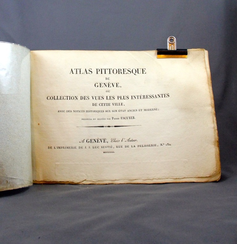
ESCUYER Pierre:
Atlas pittoresque de Genève, ou collection des vues les plus intéressantes de cette ville, avec des notices historiques sur son état ancien et moderne.
Genève, Chez l’auteur, 1822 (1826). 2 vol. oblongs (le premier 210x304 mm., le second 208x285 mm.) de 12 pages, un frontispice gravé, 20 planches + 20 planches, brochés, tel que parus, sous couverture de papier, l'un bleu, l'autre prune.
Referencia librero : 4496
|
|
|
ESCUYER Pierre:
Atlas pittoresque de Genève, ou collection des vues les plus intéressantes de cette ville, avec des notices historiques sur son état ancien et moderne.
Genève, Chez l’auteur, 1822 (1826). Un volume oblong relié en pleine percaline verte, titre doré au premier plat, tête dorée. Un frontispice gravé,12 pages, et 40 planches. Signature au crayon sur la p. de titre : Edouard Blondel.
Referencia librero : 11933

|
|
|
Escher, Felix; Ribbe, Wolfgang
Städtische Siedlungen im Mittelalter.
Berlin, New York, Walter de Gruyter, 1980. Gr.-8vo. Mit 1 mehrf. gef., farbigen Karte u. 2 weiteren Karten. 28 S. OBrosch. m. Deckeltitel.
Referencia librero : 24018

|
|
|
ESIT
SARDINIA
CHEZ L'AUTEUR. sans date. In-12. Broché. Bon état, Couv. convenable, Dos satisfaisant, Intérieur frais. Carnet dépliant. Carte dépliante en couleur en début d'ouvrage. Environ 10 fiches sur différents hôtels. Transparents superposables sur une carte en noir et blanc représentant différent itinéraires. Texte en anglais.. . . . Classification Dewey : 912-Atlas, cartes et plans
Referencia librero : RO30017962

|
|
|
ESPENHORST, Jurgen und KUMPEL, Erhard;
Diercke, Ein Atlas F r Generationen. Hintergr nde, Geschichte Und Bibliographische Daten Bis 1955.
, Schwerte, Pangaea Verlag, 1999, Gebunden, Frontispiz, 210 x 215mm., 119S., illustriert. ISBN 3 930401 50 9. ISBN 3930401509.
Referencia librero : 19480
|
|
|
ESPARZA TORRES HECTOR F.
MAPAS DE LOS ESTADOS, 20, PUEBLA
Libreria Patria. Non daté. In-8. En feuillets. Etat d'usage, Couv. convenable, Dos satisfaisant, Intérieur acceptable. Carte dépliable en couleur, recto-verso, d'env. 70/45 cm. Annotation en page de titre. Quelques petites déchirures aux pliures.. . . . Classification Dewey : 912-Atlas, cartes et plans
Referencia librero : RO60094107
|
|
|
ESPARZA TORRES HECTOR F.
MAPAS DE LOS ESTADOS, 28, TLAXCALA
Libreria Patria. Non daté. In-12. Broché. Etat d'usage, Couv. convenable, Dos satisfaisant, Intérieur acceptable. Carte dépliable en couleur, recto-verso, d'env. 65/45 cm. Quelques petites déchirures aux pliures.. . . . Classification Dewey : 912-Atlas, cartes et plans
Referencia librero : RO60094108
|
|
|
Esposito, V, J. (Ed.)
The West Point Atlas of American Wars. 1689-1900 Volume 1: 1689-1900. 5th printing.
New York: Praeger 1972. IX, 15 Kartenblatter + erl. Textseiten. Quer 4° HLn. *gutes Expl.*.
Referencia librero : 278113
|
|
|
ESSO TOURING SERVICE
2 CARTES DEPLIANTES COULEURS DE : Carte routiere de WESTERN EUROPE + AUSTRIA / + 3 depliants.
"ESSO TOURING SERVICE. VERS 1961. In-Plano. En feuillets. Bon état, Couv. convenable, Dos satisfaisant, Intérieur frais. DEPLIANTS : WESTERN EUROPE and Adjacent North Africa : carte routiere et guide illustré en couleur recto-verso 62 Cm x 95 Cm environ + OSTERREICH (Austria) , echelle 1 : 930000 - carte en couleur recto-verso, de dimension : 61 Cm X 41 Cm environ + 3 depliants : ""Votre itineraire"" + ""Avant de partir"" + 1 plaquette mulitlangue "" A la Station Service"" + 1 lettre dactylogaphiée de ESSO TOURING SERVICE + la lettre d'origine (salie) avec son attache metal au dos. 2 PHOTOS DISPONIBLES - . . . . Classification Dewey : 912-Atlas, cartes et plans"
Referencia librero : R320090498
|
|
|
ESSO
CARTE DE L ITALIE EN COULEUR 2.5 CM POUR 100 KM
SIGGLA EFFE. 1960. In-Plano. Broché. Bon état, Couv. convenable, Dos satisfaisant, Intérieur frais. Carte en couleur dépliante 46 x 65 cm. ECHELLE 2.5 CM POUR 100 KM. 2 photos disponibles.. . . . Classification Dewey : 912-Atlas, cartes et plans
Referencia librero : RO80171692
|
|
|
ESSO TOURING SERVICE
2 CARTES DEPLIANTES COULEURS DE : Carte routiere de WESTERN EUROPE + AUSTRIA / + 3 depliants.
ESSO TOURING SERVICE. VERS 1961. In-Plano Carré. En feuillets. Bon état. Couv. convenable. Dos satisfaisant. Intérieur frais. DEPLIANTS : WESTERN EUROPE and Adjacent North Africa : carte routiere et guide illustré en couleur recto-verso 62 Cm x 95 Cm environ + OSTERREICH (Austria) , echelle 1 : 930000 - carte en couleur recto-verso, de dimension : 61 Cm X 41 Cm environ + 3 depliants : "Votre itineraire" + "Avant de partir" + 1 plaquette mulitlangue " A la Station Service" + 1 lettre dactylogaphiée de ESSO TOURING SERVICE + la lettre d'origine (salie) avec son attache metal au dos. 2 PHOTOS DISPONIBLES -

|
|
|
ESTEBE Christian
Messe de Granit
Le temps qu'il faut. 1995. In-8. Cartonné. Etat du neuf, Couv. convenable, Dos satisfaisant, Intérieur frais. 121 pages.. . . . Classification Dewey : 912-Atlas, cartes et plans
Referencia librero : RO80000001
|
|
|
Ethnographic Atlas
An Ethnographic Atlas of The World
Hardback. New. hardcover
Referencia librero : B9781016083942 ISBN : 1016083947 9781016083942
|
|
|
Ethnographic atlas
An Ethnographic Atlas of The World
like new. unknown
Referencia librero : 45460783 ISBN : 1016083947 9781016083942
|
|
|
Ethnographic Atlas
An Ethnographic Atlas of The World
new. unknown
Referencia librero : 45352754-n ISBN : 1016088884 9781016088886
|
|
|
Ethnographic Atlas
An Ethnographic Atlas of The World
like new. unknown
Referencia librero : 45352754 ISBN : 1016088884 9781016088886
|
|
|
Eugène RIMLI et Umberto BONAPACE
Nouvel atlas mondial
Éditions STAUFFACHER, 1965, 500 cartes et illustrations. Cartonnage éditeur plastifié, "classeur vissé", 264 pages + 198 pages d'index.
Referencia librero : AIX-2041

|
|
|
Euloge (René)
Les derniers fils de l'ombre
1952 éditions de la Tigherme Marrakech 1952 In8 broché 190 pages 32 photographies de l'auteur
Referencia librero : 5824

|
|
|
EURO ATLAS
SHELL REISEATLAS
MAIR. 1991 1993. In-4. Relié. Etat d'usage, Couv. légèrement passée, Dos satisfaisant, Intérieur acceptable. Environ 300 pages. Nombreuses illustrations, cartes en couleurs dans et hors texte.. . . . Classification Dewey : 943-Allemagne, Autriche, Hongrie
Referencia librero : RO70124549
|
|
|
Euro Atlas
Euro-Reiseatlas 1:2 Mio Euro-Atlas German Edition
paperback. Good. Access codes and supplements are not guaranteed with used items. May be an ex-library book. paperback
Referencia librero : 357522854X.G ISBN : 357522854X 9783575228543
|
|
|
EWING:
Ewing's New general atlas; containing distinct maps of all the principal states and kingdoms throughout the world; a new edition including the most recent geographical discoveries, with preliminary illustrations.
Edinburgh, Oliver & Boyd, sans date. In-4 de [2]-15 pages, suivies des cartes. Demi-maroquin brodeaux à coin, dos lisse avec titre doré, doubles filets sur les plats de percaline, le premier orné d'une composition dorée.
Referencia librero : 15570

|
|
|
EXPANDET
Europa Touring Atlas. .
HALLWAG, Bern. Non daté. In-8. Broché. Bon état, Couv. convenable, Dos satisfaisant, Intérieur frais. Environ 125 pages. Nombreuses cartes en couleurs, hors-texte. Texte en anglais, français et allemand.. . . . Classification Dewey : 912-Atlas, cartes et plans
Referencia librero : RO80022771

|
|
|
EYSSERIC J.
NOUVELLE GEOGRAPHIE GENERALE.
Paris, Ch. Delagrave, 1901. In-8, cartonnage toilée, 82 cartes, 130 figures et 12 plans.
Referencia librero : 5427
|
|
|
F. MIOTTO, M.-S. PUTFIN et R. BELZACQ
ATLAS GISSEROT de FRANCE
Une plaquette de 32 pages, format 190 x 260 mm, illustrée, brochée couverture couleurs, publiée en 2011, Editions J.-P. Gisserot, bon état
Referencia librero : LFA-126713823
|
|
|
F. SCHRADER, F. PRUDENT, E. ANTHOINE
ATLAS DE GEOGRAPHIE MODERNE
HACHETTE. 1891. In-Folio. Cartonnage d'éditeurs. Etat d'usage, Couv. défraîchie, Dos abîmé, Intérieur acceptable. Coins et dos de cuir marron, papier roge sur les plats. 64 cartes en couleurs sur doubles pages, 2 pages de texte illustré en noir et blanc pour chaque carte. Lexique de 35 pages (pages abîmées en bordures avec quelques manques). Manque sur le revêtement des plats frottés et manques au dos. Ouvrage déboîté. Double page détachée.. . . . Classification Dewey : 912-Atlas, cartes et plans
Referencia librero : R240027869
|
|
|
F. T. P.
ATLAS-GEOGRAHIE OU NOUVEAU MANUEL DE GEOGRAPHIE GENERALE / COURS MOYEN / ENSEIGNEMENT PRIMAIRE ET SECONDAIRE
EMMANUEL VITTE. 1898. In-8. Cartonné. Etat d'usage, Couv. défraîchie, Dos abîmé, Intérieur frais. 64 pages - nombreuses gravures et cartes en noir et blanc et en couleurs dans et hors texte.. . . . Classification Dewey : 912-Atlas, cartes et plans
Referencia librero : RO20161760
|
|
|
F. T. D.
ATLAS-GEOGRAPHIE COMPRENANT 30 CARTES POLYCHROMES, 64 PAGES DE TEXTE, 50 GRAVURES OU CARTONS ET DE NOMBREUX DE VOIRS / ENSEIGNEMENT PRIMAIRE ET MODERNE - COURS MOYENS CONFORME AUX DIVERS PROGRAMMES DE L'ENSEIGNEMENT ET REDIGE D'APRES LES DOCUMENTS...
EMMANUEL VITTE. 1894. In-4. Cartonné. Etat d'usage, Coins frottés, Dos abîmé, Intérieur acceptable. 64 pages. Nombreuses illustrations en couleurs et en noir et blanc dans et hors texte. Texte sur 3 colonnes. Quelques pages désolidarisées.. . . . Classification Dewey : 912-Atlas, cartes et plans
Referencia librero : ROD0112866
|
|
|
F. SCHRADER, F. PRUDENT et E. ANTHOINE
ATLAS de GEOGRAPHIE MODERNE
Un fort ouvrage non paginé, format 240 x 380 mm, illustré de 600 cartes de détail, figures, diagrammes, relié cartonnage dos cuir, publié en 1892, Librairie Hachette et Cie (les 64 cartes en couleurs sont absentes de l'ouvrage)
Referencia librero : LFA-126738677
|
|
|
F. SCHRADER et L. GALLOUEDEC
ATLAS CLASSIQUE de GEOGRAPHIE ANCIENNE et MODERNE
Un ouvrage non paginé, format 220 x 330 mm, illustré de 343 cartes géographiques en couleurs, relié cartonnage, publié en 1931, Librairie Hachette, bon état
Referencia librero : LFA-126749700
|
|
|
F. De La Brugere
Dictionnaire général en une seule série alphabétique des communes de France et des colonies, comprenant la nomenclature complète des communes, donnant en plus les principaux villages, bourgs, hameaux, châteaux, écarts, lieux-dits, etc. + 1 volume de 95 cartes.
Avec : Le chiffre de la Population d'après le dernier recensement / Pour chaque commune, l'indication du département et du canton dont elle fait partie / Pour les principaux village, hameaux, lieux dits, etc., le nom de la commune, du département et du canton auxquels ils appartiennent / Tous les bureaux de poste et de télégraphie électrique / Pour les communes, la distance kilométrique au chef-lieu d'arrondissement et au chef-lieu du département / pour les chefs lieux d'arrondissement et de département, la distance de Paris / Les foires et marchés / Toutes les stations des chemins de fer / Les opérations commerciales, les richesses minéralogiques, les productions du sol, les manufactures / les curiosités naturelles ou artistiques. Contenant en plus 95 cartes géographiques ou plans des principales villes de France.
Referencia librero : GEO030M
|
|
|
F. A-M
Exercices cartographiques, cahier N°2.
Mame et fils, Librairie générale, De Gigord. début 20è. In-4. Broché. Bon état, Couv. convenable, Dos satisfaisant, Intérieur frais. 27 pages de cartes géographiques avec exercices.. . . . Classification Dewey : 912-Atlas, cartes et plans
Referencia librero : ROD0049737
|
|
|
F. F.
GEOGRAPHIE-ATLAS DU COURS SUPERIEUR, TEXTE ET CARTES
Alfred Mame & Fils - Ch. Poussièlgue. 1901. In-4. Relié. Etat passable, Plats abîmés, Dos abîmé, Intérieur bon état. 160 pages. Illustré de nombreuses cartes en couleur et gravures en noir et blanc dans le texte. Moitié du dos manquante. Petit manque en surface du 2e plat. Plats tachés et annotés. Couverture détachée.. . . . Classification Dewey : 912-Atlas, cartes et plans
Referencia librero : RO40103589

|
|
|
F. T. D.
GEOGRAPHIE-ATLAS COMPRENANT LA DESCRIPTION PHYSIQUE, ETNOGRAPHIQUE, POLITIQUE ET ECONOMIQUE DES CINQ PARTIES DU MONDE - ENSEIGNEMENT CONFORME AUX PROGRAMMES OFFICIELS / COURS SUPERIEUR CONTENANT 70 CARTES OU CARTONS POLYCHROMES, 62 CARTES OU CARTONS EN...
EMMANUEL VITTE. 1891. In-4. Cartonné. Etat d'usage, Tâchée, Dos abîmé, Intérieur acceptable. 191 pages. Nombreuses illustrations en couleurs et en noir et blanc dans et hors texte. Texte sur 3 colonnes. Plats désolidarisés. Coins abimés.. . . . Classification Dewey : 912-Atlas, cartes et plans
Referencia librero : ROD0112867
|
|
|
F. SCHRADER
L'ANNEE CARTOGRAPHIQUE, SUPPLEMENT ANNUEL A TOUTES LES PUBLICATIONS DE GEOGRAPHIE ET DE CARTOGRAPHIE. PREMIER SUPPLEMENT. OCTOBRE 1891. ASIE 1890/ AFRIQUE 1890. AMERIQUE 1890.
HACHETTE. 1891. In-Folio. En feuillets. Etat d'usage, Couv. partiel. décollorée, Dos satisfaisant, Intérieur frais. 3 doubles pages, texte à l'extérieur, cartes en couleurs au centre, contenus dans une chemise.. . . . Classification Dewey : 912-Atlas, cartes et plans
Referencia librero : R260129792
|
|
|
F. MANE et G. LEMOINE
La FRANCE et ses COLONIES
Un ouvrage de 94 pages, format 215 x 260 mm, illustré, relié cartonnage, publié en 1932, Librairie Ferran & Cie, bon état, peu courant
Referencia librero : LFA-126716733
|
|

 Recibir por correo electrónico
 Descargar en documento PDF
 Flujo RSS
 Link permanente


