|
Ehrensvärd, Ulla
Nordiska kartans historia. Fran myter till verklighet. (Inledning: Juha Nurminen).
(Helsingfors, Schildt, 2006). 375 S. Mit zahlr. tls. farb. Abb. u. Ktn. sowie 1 farb. Faltkte. als Beilage. 4to. 28,5 x 24,5 cm. Farb. illustr. OPp.
Referencia librero : 84018

|
|
|
Eidg Topogr. Bureau
Dierre - St. L?onard
2 33,5x41,5 cm., formato aperto, 17x14 fomato chiuso, su carta a colori tagliata a riquadri applicata su tela, in tedesco, frontespizio con titolo manoscritto, buone condizioni.
|
|
|
Eisler, Max (Hg.)
Historischer Atlas der Wiener Ansichten. Das barocke Wien. (= Arbeiten des I. Kunsthistorischen Instituts der Universität Wien, Bd. XXXIII).
Wien-Leipzig, Gerlach & Wiedling, 1925. Qu.-Fol. 79 S. Text u. 230 Tafeln in Lichtdruck, lose in OHLwd.-Mappe.
Referencia librero : 47466
|
|
|
Elaine Powers; Anderson Atlas
The Dragon of Nani Cave
CreateSpace Independent Publishing Platform 2016. Paperback. Very Good. Disclaimer:A copy that has been read but remains in excellent condition. Pages are intact and are not marred by notes or highlighting but may contain a neat previous owner name. The spine remains undamaged. At ThriftBooks our motto is: Read More Spend Less.Dust jacket quality is not guaranteed. CreateSpace Independent Publishing Platform paperback
Referencia librero : G1532945906I4N00 ISBN : 1532945906 9781532945908

|
|
|
Elborough, Travis
Atlas of improbable Places. A Journey to the World's Most Unusual Corners.
London, Aurum Press, 2016. Illustrierter Orig.-Pappband mit SU, 224 Seiten, 4°. Atlas mit englischsprachigem Text. Schutzumschlag mit ganz kleinen Läsuren. Sonst sauberes und sehr gut erhaltenes Exemplar. Mit zahlreichen Abbildungen und Karten.
Referencia librero : 007876

|
|
|
ELECTROCARDIOGRAPHIE par P.W. DUCHOSAL et J.R. GROSGURIN.
Atlas d'électrocardiographie et de vectocardiographie. Etude du ventriculogramme dans les conditions normales et pathologiques. Richement documenté (70 planches hors texte et 44 figures).
Ed. S. Karger 1959. Bel exemplaire relié, rel. pleine toile d'éd., pet in-4, 182 pages.
Referencia librero : AUB-5345
|
|
|
Elias, José Antonio
Atlas geografico, histórico y estadístico, de España y sus posesiones de ultramar.
Barcelona, Imprenta Hispana, 1848. 35,5 : 30 cm. 2 hojas, 46 tablas de doble página, 2 hojas 32 mapas grabadas de doble página, coloreado en los limites. Encuadernación de media piel. Parte primera.
Referencia librero : 10230AB

|
|
|
ELKHADEM Hossam
Het Theatrum Orbis Terrarum van Abraham Ortelius: ontstaan van de atlas
Brussel, Koninklijke Bibliotheek van België 1998 39pp. + 5 buitentekstills., 26cm., geïllustreerde omslag, mooie staat
Referencia librero : A68178
|
|
|
ELKHADEM Hossam
Het Theatrum Orbis Terrarum van Abraham Ortelius: ontstaan van de atlas
39pp. + 5 buitentekstills., 26cm., geïllustreerde omslag, mooie staat
|
|
|
ELLIS Henri
VOYAGE DE LA BAYE DE HUDSON, fait en 1746 et 1747, pour la découverte du passage de Nord-Ouest.
Ballard Fils Paris 1749 2 tomes reliés en 1 volume in-12 ( 165 X 100 mm ) de ( 2 ff. n.c. )-LVI ( chiffré LII )-182 pages et ( 2 ff.n.c. )-319 pages ( chiffré 317 ) plein veau fauve marbré, dos à nerfs ornés de caissons et fleurons dorés, pièce de titre en maroquin rouge, tranches brique ( Reliure de lépoque ). EDITION ORIGINALE française bien complète de sa carte dépliante en frontispice ( avec restauration au verso ) et de ses 10 planches dépliantes hors-texte. Coiffe de tête arasée. 2 ex-libris dont un armorié. BON EXEMPLAIRE.
Referencia librero : 596270

|
|
|
Elvin M., Blunden C.
Atlas de la Chine
Editions du Fanal Cartonné avec jaquette 1987 In-4 (24,5 x 30,8 cm), cartonnage d'éditeur de couleur marron sous jaquette illustrée en couleurs, 238 pages, 365 illustrations, 58 cartes géographiques en couleurs et noir et blanc in texte, une chronologie et une bibliographie ; quelques frottements à la jaquette, par ailleurs bon état. Livraison a domicile (La Poste) ou en Mondial Relay sur simple demande.
Referencia librero : gf943
|
|
|
EMMERICH, P. Henrici:
Atlas Missionum a sacra congregatione de propaganda fide dependentium.Cura editus eiusdem sacrae congregationis studio autem P. Henrici Emmerich S.V.D.
Ex Civitate Vaticana MDCCCCVLVIII, 1958, in-folio, 44 farbige Karten und beiliegend 27 Seiten "Data Statistica circumscriptionum ecclesiasticarum " von Lujo Schorer, weiterhin ein Blatt Atlanti Missionum + Addenda mutationes novissimae ann.1958-1962, Original-Leinenband.
Referencia librero : 108413aaf
|
|
|
ENCYCLOPEDIE ATLAS
Astronomie
atlas. 1983. In-8. Broché. Bon état, Couv. convenable, Dos satisfaisant, Intérieur frais. 101 fascicules du n°1 à 102 , il manque le n°95.26p. environ chacun illustrées de nombreuses photos couleur.La couverture du fascicule n°1 est déchirée.. . . . Classification Dewey : 520-Astronomie et sciences connexes
Referencia librero : RO20006786
|
|
|
ENCEL Frédéric
Atlas géopolitique d'Israël. Aspects d'une démocratie en guerre.
Couverture souple. Broché. 79 pages.
Referencia librero : 124973

|
|
|
ENCYCLOPEDIE GEOGRAPHIQUE
ENCYCLOPEDIE GEOGRAPHIQUE
La Pochotéque 1991, In La Pochotéque 1991, In-8 broché, 1113 pages. Avec index, et atlas des carte en couleurs. Bon état.
Referencia librero : 99916346 ISBN : 225305304
|
|
|
ENCYCLOPAEDIA UNIVERSALIS
Le grand atlas de géographie. Encyclopaedia universalis.
Couverture rigide. Cartonnage de l'éditeur. 225 + 192 pages. 27 x 37 cm.
Referencia librero : 91133
|
|
|
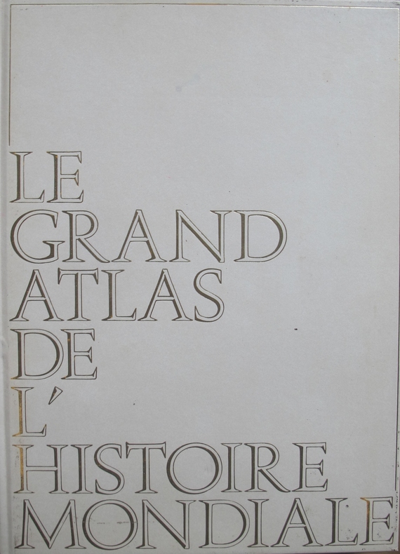
ENCYCLOPAEDIA UNIVERSALIS
Le grand atlas de l'histoire mondiale. Encyclopaedia universalis.
Couverture rigide. Reliure de l'éditeur. 370 pages. 27 x37 cm.
Referencia librero : 131259
|
|
|
ENCYCLOPAEDIA UNIVERSALIS - ATLAS
Le grand atlas de géographie. Encyclopaedia universalis.
Couverture rigide. Cartonnage de l'éditeur. 474 pages. 27 x 37 cm.
Referencia librero : 144434
|
|
|
ENCYCLOPEDIE GEOGRAPHIQUE
ENCYCLOPEDIE GEOGRAPHIQUE
La Pochotéque 1991, In-8 broché, 1113 pages. Avec index, et atlas des carte en couleurs. Bon état.
|
|
|
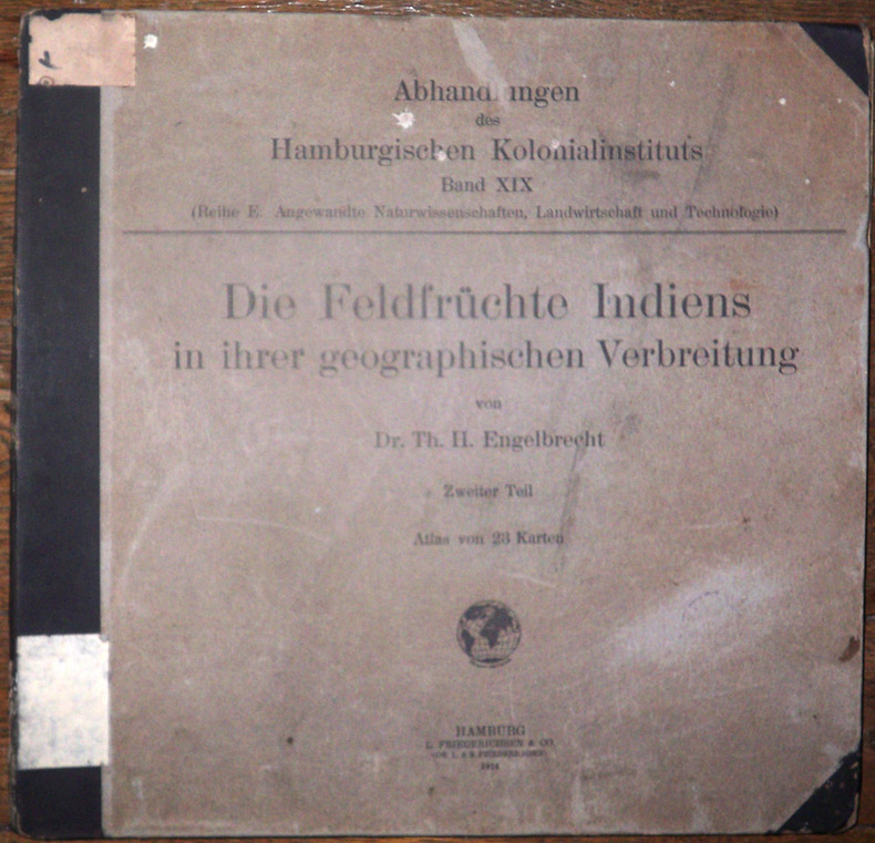
Engelbrecht, Thiess Hinrich
Die Feldfrüchte Indiens in ihrer geographischen Verbreitung. Zweiter Teil : Atlas von 23 Karten. (Abhandlungen des Hamburgischen kolonialinstituts Band. XIX. Reihe E. Angewandte naturwissenschaften, landwirtschaft und technologie, band 3)
1914 Hamburg, L. Friedrichsen & Co, 1914. 39,5 x 41 cm, in-folio, 3 ff. n. ch. - 23 cartes en couleurs dont l'une dépliante, montées sur onglets, cartonnage imprimé de l'éditeur.
Referencia librero : 2139
|
|
|
Eng. Atlas Mark
Kodi Simplified Installation Guide: 100% Simplified Manual With Pictures On How To Download & Install Kodi 17.6 & The Setting Up & Installation Of . Of Subtitle On Amazon Fire TV Or Fire TV.
2018-04-12. Good. Ships with Tracking Number! INTERNATIONAL WORLDWIDE Shipping available. May not contain Access Codes or Supplements. May be re-issue. May be ex-library. Shipping & Handling by region. Buy with confidence excellent customer service! unknown
Referencia librero : 1987774396 ISBN : 1987774396 9781987774399

|
|
|
Engraved by J & C. WALKER.
[PORTOLAN MAP of the BOSPHORUS] Bosphorus to Kerempeh. (Black Sea sheet IX).
Very Good English Original b/w portolan chart. Folded. A little foxing and some pencil markings and notes in Ottoman script in its period. Oblong double elephant folio. (70 x 102 cm). In English. Bosphorus to Kerempeh from the Russian survey of 1834 with additions and corrections by Commander W. J. L. Wharton., R. N. 1872-80. It's written 'London published according to Act of Parliament at the Hydrographic Office of the Admiralty Jare. 16th 1854. Also shows Killa Bay (Shile Bay) from a survey by Lieut. Comm. W. R. Pristen and the midshipmen of H. M. S. Royal Sovereign, 1920. Topography partly from a Turkish map. Up side of map, engraved a view from sea of entrance of the Bosphorus, Rumili (sic. Rumeli) Lighthouse and environment with several hills. And also shows Amastra (Ancient Amastris) from Russian surveys, 1834-41; Kosku Bay from a surbey by Capt. Spratt R. N. 1854; and Sungul Bay (Zonguldak) from the Heraclee Companys plans to 1915. A rare navigation chart.
|
|
|
Engraver: M. DE RIENZI.
[MAP of FRENCH POLYNESIA AND MICRONESIA] Polynesie et Micronesie; d'apres la classification et les divisions etablies par. M. de Rienzi.
Very Good French Original b/w map. Folded. Oblong 4to. (23 x 29 cm). In French. It shows New Zealand, Australia, and islands in Polynesia and Micronesia. [MAP of FRENCH POLYNESIA AND MICRONESIA] Polynesie et Micronesie; d'apres la classification et les divisions etablies par. M. de Rienzi.
|
|
|
ERARD / CARRE
Carte de Châlons N°50
DEPOT DE GUERRE. 1912. In-Plano. En feuillets. Bon état, Couv. convenable, Dos satisfaisant, Intérieur frais. Carte dépliante en noir et blanc, de 85/59cm. Pas de plats de couverture.. . . . Classification Dewey : 912-Atlas, cartes et plans
Referencia librero : RO80006327
|
|
|
ERARD, CARRE, BEAUPRE
Carte de Châlons . N°50
DEPOT DE LA GUERRE. 1911. In-Plano. En feuillets. Etat d'usage, Livré sans Couverture, Dos satisfaisant, Intérieur acceptable. Carte dépliante en noir et blanc de 59 / 84 cm. . . A l'italienne. Classification Dewey : 912-Atlas, cartes et plans
Referencia librero : RO80072076
|
|
|
ERARD / CARRE / BEAUPRE
Carte de Châlons.
OFFICIERS DE CORPS D'ETAT-MAJOR / DEPOT DE GUERRE. 1911. In-Plano. En feuillets. Bon état, Couv. convenable, Dos satisfaisant, Intérieur bon état. Carte en planche dépliante en noir et blanc de 84/59 cm. Pas de plats de couverture. Pliures.. . . A l'italienne. Classification Dewey : 912-Atlas, cartes et plans
Referencia librero : RO20040378
|
|
|
ERDOS LASZLO Nemes.
KATONAI EVKONYV 1936. AZ ÖSSZES ALLAMOK HADEREJÉNEK ISMERTETÉSE.
Budapest, Gergely, 1936. In-8, broché, 260 pages.
Referencia librero : 3789
|
|
|
ERHARD
1 CARTE PHYSIQUE POLITIQUE ET ADMINISTRATIVE DE LA FRANCE AVEC LE TRACE DES CHEMINS DE FER SOUS LA DIRECTION DE L. BONNEFONT
IMP. MONROCQ - 3° EDITION. 1883. In-Plano. En feuillets. Bon état, Couv. convenable, Dos satisfaisant, Intérieur frais. 1 carte entoilée de 58,4 x 65,5 cm, en couleurs. Echelle 1/2000000.. . . . Classification Dewey : 912-Atlas, cartes et plans
Referencia librero : RO30084085
|
|
|
ERHARD
1 CARTE ENTOILEE, EN COULEURS : MEDITERRANEE ORIENTALE
IMP. MONROCQ - ANDRE LESOT EDITEUR. 1883. In-Plano. En feuillets. Bon état, Couv. convenable, Dos satisfaisant, Intérieur frais. 1 carte entoilée de 127 x 98 cm, en couleurs. Echelle 1/2500000. . . . Classification Dewey : 912-Atlas, cartes et plans
Referencia librero : RO30084091
|
|
|
ERHARD
Carte du Kiang-Si (Chine)
LES MISSIONS CATHOLIQUES. 1875. In-8. En feuillets. Bon état, Couv. convenable, Dos satisfaisant, Intérieur frais. Carte en noir et blanc, de 44/30 cm. Pas de plats de couverture.. . . . Classification Dewey : 912-Atlas, cartes et plans
Referencia librero : RO80006288
|
|
|
ERHARD
Carte de France, Feuille 8 : Tours, Poitiers, Limoges, Bourges, Clermont-Ferrand.
DEPOT DES FORTIFICATIONS. Non daté. In-12. En feuillets. Bon état, Couv. convenable, Dos satisfaisant, Intérieur frais. Une carte entoilée dépliante, en couleurs, de 60 x 95 cm. Echelle : 1 / 500000e. . . A l'italienne. Classification Dewey : 912-Atlas, cartes et plans
Referencia librero : RO80117687
|
|
|
ERHARD FRERES
Plan Pratique de Bordeaux.
DELMAS. Début du siècle. In-Plano. En feuillets. Bon état, Couv. convenable, Dos satisfaisant, Intérieur frais. Carte dépliante en couleurs, de 50/40 cm.. . . . Classification Dewey : 912-Atlas, cartes et plans
Referencia librero : RO80003514
|
|
|
Erhard, graveur-géographe.
Baume-Les-Dames. Feuille XXV-19.
français Carte rempliée de 44,5x57 cm sous chemise rouge in-12 de l'éditeur. Gravée et imprimée par Erhard, dressée par ordre du Ministre de l'Intérieur.
|
|
|
Erhard, graveur-géographe.
Montbéliard. Feuille XXV-18.
français Carte rempliée de 45x56 cm sous chemise rouge in-12 de l'éditeur. Gravée et imprimée par Erhard, dressée par ordre du Ministre de l'Intérieur.
|
|
|
Erhard, graveur-géographe.
Tauves. Feuille XVII-26.
français Carte rempliée de 45x56,5 cm sous chemise rouge in-12 de l'éditeur. Gravée et imprimée par Erhard, dressée par ordre du Ministre de l'Intérieur.
|
|
|
Erin L. Kellogg - Coordinating Editor
The Rain Forests of Home: An Atlas of People and Place - Part I (One) Natural Forests and Native Languages of the Coastal Temperate Rain Forest
24 pages. List of sources. Colour map stored in pocked inside back cover. Includes many maps with considerable text. Usual library markings. Average wear. A sound copy. 17" x 11". Book

|
|
|
ERKÂN-I HARBIYE- UMUMIYE HARITA HEYETI [PREPARED BY THE MAP COMMITTEE].
[MAP of the BOSPHORUS and ENVIRONMENT] Istanbul Bogaz ve civar haritasi.
Very Good Turkish, Ottoman (1500-1928) Original cromolithograph mounted on cloth. Folded. Some foxing and slimming on creases. Oblong double elephant folio. (97 x 107 cm). In Ottoman script. Shows the Bosphorus, Istanbul city with detailed place names. Black Sea at North, Marmara Sea at South and the Princes' Islands seen at southwest area. Mapmaker not described usual like in Turkish military maps. An extremely rare the Bosphorus map with its unusual size. Not in TBBMM library (The Grand Assembly of Turkish Republic Liibrary). Not in Military Libraries in Turkey.
|
|
|
ERKÂN-I HARBIYE- UMUMIYE HARITA HEYETI [PREPARED BY THE MAP COMMITTEE].
[MAP of the BOSPHORUS] Bogaziçi; Kavaklar: Rumeli Kavagi, Belgrad, Hisarlar.
Very Good Turkish, Ottoman (1500-1928) Original cromolithograph color map. Repaired. A good copy. Oblong atlas folio. (50 x 60 cm). In Ottoman script. [MAP of the BOSPHORUS] Bogaziçi; Kavaklar: Rumeli Kavagi, Belgrad, Hisarlar. Shows Asian and European shores, topography with detailed place names in its Bosphorus part of Anadolu and Rumeli Kavagi of Istanbul. At east, Belgrad; at northeast, Black Sea. No information on mapmaker. Hegira:: 1327 = Gregorian: 1911. Scale: 1/25.000. Rare.
|
|
|
ERKÂN-I HARBIYE-I UMUMIYE.
[MAP of the BOSPHORUS / CONSTANTINOPLE] Kavaklar: Rumeli Kavagi, Hisarlar.
Very Good Turkish, Ottoman (1500-1928) Original color map. Folded. Chipped and slightly tears on extremities. Slightly stained and yellowing on paper. Oblong atlas folio. (50 x 60 cm). In Ottoman script. [MAP of the BOSPHORUS / CONSTANTINOPLE] Kavaklar: Rumeli Kavagi, Hisarlar. Shows the Bosphorus, and its Kavaklar and Hisarlar shores. Mapmaker is not described. Scale: 1/25.000. Mubde-i tul: Hagia Sophia. This is one the serie of the Bonn projection maps which are the first map series in modern techniques in Turkey and the Ottoman Empire. This is one the serie of the Bonn projection maps which are the first map series in modern techniques in Turkey and the Ottoman Empire. In order to produce these maps covering Turkish territory, Reconnaissance Branch was incorporated into The Mapping Commission. The maps were produced in the datum based on the latitude and longitude of Ayasofya Mosque in equal area Bonn Projection. The field works for the 123 sheets covering the country were conducted by 76 staff. The production was completed in 18 years starting from east west. Field works continued without stopping except in years 1914 and 1920. This map series called also reconnaissance maps contributed a lot to producing 1:25.000 scale maps. Hegira: 1328 = Gregorian: 1911. A good copy. Very scarce.
|
|
|
ERKÂN-I HARBIYE-I UMUMIYE.
[MAP of WEST ANATOLIA - SHORES of NORTH AEGEAN] Edremid Bay, The Dardanelles, Limni, Bozcaada (Tenedos), Balikesir, Ayvalik, Kal'a-yi Sultaniye.
Very Good Turkish, Ottoman (1500-1928) Original color map on cloth. Folded. A good copy. Oblong atlas folio. (50 x 60 cm). In Ottoman script. [MAP of WEST ANATOLIA] Edremid Bay, The Dardanelles, Limni, Bozcaada (Tenedos), Balikesir, Ayvalik, Kal'a-yi Sultaniye. Shows Northeast Anatolia; southwest entrance of the Dardanelles, Çanakkale, Balikesir cities, Ayvalik, Tenedos Island, shores of North Aegean, Bay of Edremit. Mapmaker is not described. Scale: 1/200.000. Mubde-i tul: Greenwich and Dersaadet. This is one the serie of the Bonn projection maps which are the first map series in modern techniques in Turkey and the Ottoman Empire. This is one the serie of the Bonn projection maps which are the first map series in modern techniques in Turkey and the Ottoman Empire. In order to produce these maps covering Turkish territory, Reconnaissance Branch was incorporated into The Mapping Commission. The maps were produced in the datum based on the latitude and longitude of Ayasofya Mosque in equal area Bonn Projection. The field works for the 123 sheets covering the country were conducted by 76 staff. The production was completed in 18 years starting from east west. Field works continued without stopping except in years 1914 and 1920. This map series called also reconnaissance maps contributed a lot to producing 1:25.000 scale maps. Hegira: 1327 = Gregorian: 1910. Slightly stained and yellowing on paper. Loose extremities. A good copy. Very scarce. One copy in TBMM Library Map Collection: 201102274.
|
|
|
ERKÂN-I HARBIYE-I UMUMIYE.
[OTTOMAN MAP of HASANKALE - ERZERON] Erzurum, Hasankale, Oltu, Hinis, Karakilise.
Very Good Turkish, Ottoman (1500-1928) Original color map. Oblong atlas folio. (51 x 61 cm). In Ottoman script. Folded. Topography and toponyms of East Anatolia: Shows Erzurum region, Hasankale (Pasinler), Oltu, Hinis, Karakilise and surroundings. Scale: 1: 200.000. This is one the serie of the Bonn projection maps which are the first map series in modern techniques in Turkey and the Ottoman Empire. In order to produce these maps covering Turkish territory, Reconnaissance Branch was incorporated into The Mapping Commission. The maps were produced in the datum based on the latitude and longitude of Ayasofya Mosque in equal area Bonn Projection. The field works for the 123 sheets covering the country were conducted by 76 staff. The production was completed in 18 years starting from east west. Field works continued without stopping except in years 1914 and 1920. This map series called also reconnaissance maps contributed a lot to producing 1:25.000 scale maps. Rare.
|
|
|
ERKÂN-I HARBIYE-I UMUMIYE].
[MAP of ALEXANDRETTA] Iskenderun - Tayakadin.
Very Good Turkish, Ottoman (1500-1928) Original color map on cloth. Folded. Wrinkled on paper. Stains on cloth. 12 sheets on paper. Oblong atlas folio. (50 x 60 cm). In Ottoman script.[MAP of ALEXANDRETTA] Iskenderun - Tayakadin. It shows villages and settlements in Tayakadin of Iskenderiye. Scale: 1/25.000. Hegira: 1329 = Gregorian: 1913. This is one the serie of the Bonn projection maps which are the first map series in modern techniques in Turkey and the Ottoman Empire. In order to produce these maps covering Turkish territory, Reconnaissance Branch was incorporated into The Mapping Commission. The maps were produced in the datum based on the latitude and longitude of Ayasofya Mosque in equal area Bonn Projection. The field works for the 123 sheets covering the country were conducted by 76 staff. The production was completed in 18 years starting from east west. Field works continued without stopping except in years 1914 and 1920. This map series called also reconnaissance maps contributed a lot to producing 1:25.000 scale maps. Not description on map-maker. A very detailed map. Extremely rare.
|
|
|
ERKÂN-I HARBIYE-I UMUMIYE].
[MAP of EAST & SOUTHEAST ANATOLIA] Maras - Elbistan - Birecik - Kilis.
Very Good Turkish, Ottoman (1500-1928) Original color map. Folded. Oblong atlas folio. (50 x 60 cm). In Ottoman script. Shows Eastern and Southeastern parts of Anatolia; Maras, Elbistan, Birecik and Kilis areas. Hegira: 1333 = Gregorian: 1917. Not description on map-maker.
|
|
|
ERKÂN-I HARBIYE-I UMUMIYE].
[MAP of EAST ANATOLIA and EAST BLACK SEA] Oltu, Artvin, Ispir, Hasankale.
Very Good Turkish, Ottoman (1500-1928) Original color map. Folded. Oblong atlas folio. (50 x 60 cm). In Ottoman script. [MAP of EAST ANATOLIA and ARTVIN] Oltu, Artvin, Ispir, Hasankale. Shows Artvin, Ispir, Hasankale and Kars city. Scale: 1/200.000. This is one the serie of the Bonn projection maps which are the first map series in modern techniques in Turkey and the Ottoman Empire. In order to produce these maps covering Turkish territory, Reconnaissance Branch was incorporated into The Mapping Commission. The maps were produced in the datum based on the latitude and longitude of Ayasofya Mosque in equal area Bonn Projection. The field works for the 123 sheets covering the country were conducted by 76 staff. The production was completed in 18 years starting from east west. Field works continued without stopping except in years 1914 and 1920. This map series called also reconnaissance maps contributed a lot to producing 1:25.000 scale maps. Hegira: 1332 = Gregorian: 1916. Not description on map-maker.
|
|
|
ERKÂN-I HARBIYE-I UMUMIYE].
[MAP of EAST ANATOLIA] Hozat, Dersim.
Very Good Turkish, Ottoman (1500-1928) Original color map. Folded. Oblong atlas folio. (50 x 60 cm). In Ottoman script. [MAP of EAST ANATOLIA] Hozat, Dersim. Shows Eastern parts of Anatolia; Dersim-Horat and border of Erzincan city; Divrigi; Harput (Kharpout); Kilis; and Munzur Mountains, et alli. Scale: 1/200.000. Hegira: 1330 = Gregorian: 1914. Not description on map-maker.
|
|
|
ERKÂN-I HARBIYE-I UMUMIYE].
[MAP of EAST BLACK SEA] Artvin, Rize, Oltu.
Good Turkish, Ottoman (1500-1928) Original color map. Folded. Tears in margins. Slightly stained. Otherwise a good copy. Oblong atlas folio. (50 x 60 cm). In Ottoman script. [MAP of EAST BLACK SEA] Artvin, Rize, Oltu. Shows Artvin and Georgian borders, Rize (Rizeon - Rizunda - Rizini) and Oltu cities and regions. Scale: 1/200.000. Hegira: 1330 = Gregorian: 1914. This is one the serie of the Bonn projection maps which are the first map series in modern techniques in Turkey and the Ottoman Empire. In order to produce these maps covering Turkish territory, Reconnaissance Branch was incorporated into The Mapping Commission. The maps were produced in the datum based on the latitude and longitude of Ayasofya Mosque in equal area Bonn Projection. The field works for the 123 sheets covering the country were conducted by 76 staff. The production was completed in 18 years starting from east west. Field works continued without stopping except in years 1914 and 1920. This map series called also reconnaissance maps contributed a lot to producing 1:25.000 scale maps. Not description on map-maker. Extremely rare.
|
|
|
ERKÂN-I HARBIYE-I UMUMIYE].
[MAP of EAST BLACK SEA] Trabzon, Giresun, Erzincan, Ispir.
Very Good Turkish, Ottoman (1500-1928) Original color map. Folded. Oblong atlas folio. (50 x 60 cm). In Ottoman script. [MAP of EAST BLACK SEA] Trabzon, Giresun, Erzincan, Ispir. Shows Trebizond, Cerasonte, Erzingan (Eriza), Suspiritis (Sper) of Erzurum (Erzeron city); mostly Black Sea shores of Trabzon and Giresun. . Scale: 1/200.000. This is one the serie of the Bonn projection maps which are the first map series in modern techniques in Turkey and the Ottoman Empire. In order to produce these maps covering Turkish territory, Reconnaissance Branch was incorporated into The Mapping Commission. The maps were produced in the datum based on the latitude and longitude of Ayasofya Mosque in equal area Bonn Projection. The field works for the 123 sheets covering the country were conducted by 76 staff. The production was completed in 18 years starting from east west. Field works continued without stopping except in years 1914 and 1920. This map series called also reconnaissance maps contributed a lot to producing 1:25.000 scale maps. Hegira: 1336 = Gregorian: 1920. Not description on map-maker. Extremely rare.
|
|
|
ERKÂN-I HARBIYE-I UMUMIYE].
[MAP of ISTANBUL / CONSTANTINOPLE] Küçükköy, Petnahor (Old Greek-Byzantine name of Göktürk), Makriköy, Kagidhane [Kagithane].
Very Good Turkish, Ottoman (1500-1928) Original color map on cloth. Oblong atlas folio. (49 x 60 cm). Toponyms in Turkish with Arabic letters. In Ottoman script. Scale: 1/25.000. [MAP of ISTANBUL / CONSTANTINOPLE] Küçükköy, Petnahor, Makriköy, Kagidhane [Kagithane]. A rare Istanbul map including some old Byzantine toponyms.
|
|
|
ERKÂN-I HARBIYE-I UMUMIYE].
[MAP of KONIA and ALAIYYA] Konya, Beysehir, Alaiyye.
Very Good Turkish, Ottoman (1500-1928) Original color map on cloth. Folded. Oblong atlas folio. (50 x 60 cm). In Ottoman script. Shows Konya city and around, Alaiye at south. Not description on map-maker. Scale: 1: 200.000. This is one the serie of the Bonn projection maps which are the first map series in modern techniques in Turkey and the Ottoman Empire. In order to produce these maps covering Turkish territory, Reconnaissance Branch was incorporated into The Mapping Commission. The maps were produced in the datum based on the latitude and longitude of Ayasofya Mosque in equal area Bonn Projection. The field works for the 123 sheets covering the country were conducted by 76 staff. The production was completed in 18 years starting from east west. Field works continued without stopping except in years 1914 and 1920. This map series called also reconnaissance maps contributed a lot to producing 1:25.000 scale maps. Rare.
|
|
|
ERKÂN-I HARBIYE-I UMUMIYE].
[MAP of MAGNESIA - AEGEAN REGION] Manisa - Soma, Izmir, Aydin.
Very Good Turkish, Ottoman (1500-1928) Original color map on cloth. Folded. Oblong atlas folio. (50 x 60 cm). In Ottoman script. [MAP of MAGNESIA - AEGEAN REGION] Manisa - Soma, Izmir, Aydin cities (Magnesia, Smyrna and Tralleis) in Aegean region. It shows villages and settlements in Tayakadin of Iskenderiye. Scale: 1/25.000. Hegira: 1328 = Gregorian: 1912. This is one the serie of the Bonn projection maps which are the first map series in modern techniques in Turkey and the Ottoman Empire. In order to produce these maps covering Turkish territory, Reconnaissance Branch was incorporated into The Mapping Commission. The maps were produced in the datum based on the latitude and longitude of Ayasofya Mosque in equal area Bonn Projection. The field works for the 123 sheets covering the country were conducted by 76 staff. The production was completed in 18 years starting from east west. Field works continued without stopping except in years 1914 and 1920. This map series called also reconnaissance maps contributed a lot to producing 1:25.000 scale maps. Not description on map-maker. A very detailed map showing lakes, rivers and mountains. Extremely rare.
|
|
 Recibir por correo electrónico
 Descargar en documento PDF
 Flujo RSS


