|
DE FER (Nicolas).
Dieppe. Ville de Normandie au Pays de Caux. port de Mer Située sur la Rivière que forme les 3 Ruisseaux de St Sens de Neuf-Chastel et d'Eaulne... Elle fut Bombardée par les Anglois l'An 1694.
Sans nom ni date (circa 1702). Gravure en noir, 345 x 256 mm, très bon état.
Référence libraire : 21653

|
|
|
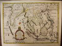
De Fer ; Edward Wells
A New Map of the East Indies Taken from Mr. de Fer's Map of Asia Shewing their Cheif sic Divisions Cities Towns Ports Rivers Mountains &c. / Dedicated to His Higness William Duke of Glocester
London c. 1700. Very Good. Notes: A late 17th Century map of South East Asia by Edward Wells based upon the previous work by De Fer. <br><br>The cartouche has the dedication in the coat of arms to the Duke of Gloucester. Size : 367x487 mm 14.45x19.17 Inches Coloring: Original Outline Coloring Category: Maps Asia South East; Maps Asia Central India & Sri Lanka / Ceylon; unknown
Référence libraire : M6975
|
|
|
de Fer de la Nouerre, Nicolas
de la Possibilité de Faciliter l'Établissement Général de la Navigation Intérieure Du Royaume: de Supprimer Les Corvées Et d'Introduire Dans Les . l'Économie Que l'On Désire French Edition
paperback. Good. Access codes and supplements are not guaranteed with used items. May be an ex-library book. paperback
Référence libraire : 2329295723.G ISBN : 2329295723 9782329295725
|
|
|
de Fer de la Nouerre, Nicolas
de la Possibilité de Faciliter l'Établissement Général de la Navigation Intérieure Du Royaume: de Supprimer Les Corvées Et d'Introduire Dans Les . Que l'On Désire. Tome 2 French Edition
paperback. Good. Access codes and supplements are not guaranteed with used items. May be an ex-library book. paperback
Référence libraire : 2329295731.G ISBN : 2329295731 9782329295732
|
|
|
De Fer MD FACP, Dr Thomas M M D
Internship Survival Guide
like new. unknown
Référence libraire : 32756516 ISBN : 1975113284 9781975113285

|
|
|
De Fer MD FACP, Dr Thomas M M D
Internship Survival Guide
new. unknown
Référence libraire : 32756516-n ISBN : 1975113284 9781975113285
|
|
|
De Fer MD FACP, Dr Thomas M M D
Manual Washington. Guía esencial para sobrevivir al internado Spanish Edition
paperback. Good. Access codes and supplements are not guaranteed with used items. May be an ex-library book. paperback
Référence libraire : 8417949151.G ISBN : 8417949151 9788417949150

|
|
|
De Fer MD FACP, Dr Thomas M M D
The Washington Manual Internship Survival Guide The Washington Manual Survival Guide Series
paperback. Good. Access codes and supplements are not guaranteed with used items. May be an ex-library book. paperback
Référence libraire : 1975113284.G ISBN : 1975113284 9781975113285
|
|
|
De Fer MD FACP, Dr Thomas M M D
The Washington Manual Internship Survival Guide
LWW 2018-07-18. Paperback. Good. Textbook May Have Highlights Notes and/or Underlining BOOK ONLYNO ACCESS CODE NO CD Ships with Emailed Tracking LWW paperback
Référence libraire : SKU0504285 ISBN : 1975113284 9781975113285
|
|
|
De Fer MD FACP, Dr Thomas M M D
The Washington Manual Internship Survival Guide The Washington Manual Survival Guide Series
Lippincott Williams & Wilkins 2018-07-18. Fifth. paperback. New. 4.30x0.60x7.10. Buy with confidence. Excellent Customer Service & Return policy. Lippincott Williams & Wilkins paperback
Référence libraire : DADAX1975113284 ISBN : 1975113284 9781975113285
|
|
|
de fer Nicolas
Description du pont du Gard et de l’amphithéâtre de Nîsme.
Eau-forte du XVIIIème siècle. 355x255 à la cuvette 390x270mm avec la marge. Accompagné du texte descriptif gravé 255x175 à la cuvette et 370x270 avec la marge
Référence libraire : 8656

|
|
|
De Fer Onana, Christophe
Agriculture et transport du monde rural camerounais: Déconstruction et reconstruction French Edition
New. Brand new and still unused unknown
Référence libraire : 6204950738 ISBN : 6204950738 9786204950730
|
|
|
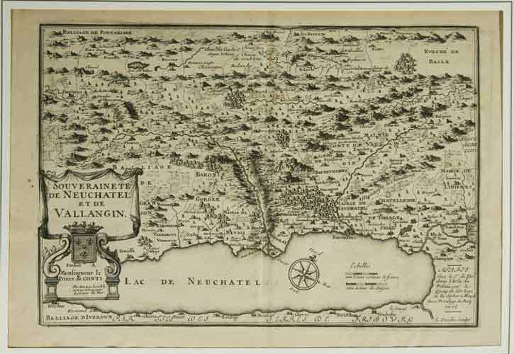
de FER Sr. / INSELIN C. sc. :
Carte de la ‘Souveraineté de Neuchâtel et de Valangin’.
A Paris chez le Sr. de Fer dans l’Isle du Palais sur le Quay de l’Horloge à la Sphère Royale Avec privilege du Roi, 1705, 23x33 cm, carte gravée sur cuivre, 1 feuille / 1 Blatt (27x41 cm),
Référence libraire : 104521aaf
|
|
|
DE FER, André
... une petite ville tranquille nommée ... Dachau
sd Editions Franck, Collection Le Livre Témoin - Sans date - In-8, broché - 319 p. - Un cahier de reproductions photographiques en N&B
Référence libraire : 106575

|
|
|
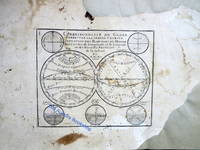
de Fer, N
CORRESPONDANCE DU GLOBE TERRESTRE A LA SPHERE CELESTE. SITUATION DES HABITANS DU MONDE DES CERCLES DE LONGITUDE ET DE LATITUDE ET DES DIVERSES POSITIONS DE LA SPHERE ATLAS
Paris: Published by the author 1705. First Edition . Hardcover. Very Good/No Jacket. Wide 8vo. An atlas comprising 19 maps 1. Des cercels de Longitude et de Latitude et des Diverses Positions de la Sphere; 2. Carte General du Globe Terrestre et Aquatiques ou Mappemonde en deux Plans-hemisphere 1705; 3. l'Europe Dresee sur diverse Relations; 4. L'Asie Dressee Sur Divers Relations 1705; 5. L'Aftique Dressez sur les dernieres Relations; 6. L'Amerique Meridionale; 7. L'Amerique Septentrionale et les Terres Polaires Arctique; 8. La France Avec Ses Acquisitions Insqu'a l'Annee 1705; 9. Les Environs de Paris 1705; 10. Les XVII Provinces des Pais Bas Divisees 1705; 11. Les Isles Britanniques ou Sont les Royaumes D'Angleterre D'Ecosse et D'Irleland avec les Costes Septentrionales de France et Celles de Pais Bas; 12. Suede Norvegue et Dannemarck 1705; 13. Les Estats de la Couronne de Pologne 1705; 14. L'Allemagne Divisee En Dix Cercles Dressee sur les Derniers memoires; 15. Estats du Grand Duc de Moscovie suivant les derniere relations; 16. Hongrie ou Partie Septent de la Turque en Europe; 17. L'Espagne Divisee en Galice Asturies Biscaye Navarre Leon Vielle et Nouvelle Castille Arragon Andalousie Mursie Valence et Catalogne avec Les Isles Majorque Minorque et Yvica au Roy d'Espagne; Le Portugal et L'Algarve avec Roy de Portugal; 18. L'Italie Divisee en ses Pricipaux Estats; 19. Partie Mediridionale de la Turquie D'Europe ou La Grece. Each map has a written descritpion in French. The first 2 pages are lacking the paper on the right-hand edge and have been repaired. The remainder of the maps and text are in very good original condition. A newer binding in 3/4 brown calf over brown boards with marbled endpapers with the bookplate of Antonio Barrette on the blank ffep. An excellent copy of a very scarce work. <br/> <br/> Published by the author hardcover
Référence libraire : 180573
|
|
|
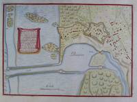
De Fer, Nicolas (1646 - 1720)
Ambleteuse - Colorierter Plan im Kupferstich
De Fer Paris um 1700. Maße: 27 cm x 195 cm. - Nicolas de Fer war einer der führenden französischen Kartographen und Kartenverleger - unknown
Référence libraire : 2n1783
|
|
|
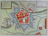
De Fer, Nicolas (1646 - 1720)
Beffort - Colorierter Plan im Kupferstich
De Fer Paris um 1700. Maße: 285 cm x 203 cm. - Nicolas de Fer war einer der führenden französischen Kartographen und Kartenverleger - unknown
Référence libraire : 2n1782
|
|
|
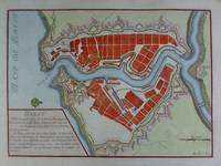
De Fer, Nicolas (1646 - 1720)
Brest - Colorierter Plan im Kupferstich
De Fer Paris 1692. Maße: 28 cm x 205 cm. - Nicolas de Fer war einer der führenden französischen Kartographen und Kartenverleger - unknown
Référence libraire : 2n1770
|
|
|
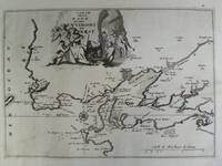
De Fer, Nicolas - Brest/Bretagne
Carte de la Rade et des Environs de Brest - Kupferstich mit dekorativer Kartusche
ca. 1692. Blattgröße: 365 cm x 275 cm. - kräftiger Abdruck / sauberes Blatt - unknown
Référence libraire : 2n1615
|
|
|
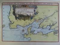
De Fer, Nicolas (1646 - 1720)
Carte de la Rade et des Environs de Brest - Colorierter Plan im Kupferstich
De Fer Paris 1705. Maße: 285 cm x 195 cm kleiner Einriß am oberen Blattrand. - Nicolas de Fer war einer der führenden französischen Kartographen und Kartenverleger - unknown
Référence libraire : 2n1775
|
|
|
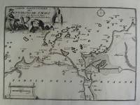
De Fer, Nicolas - Saint Malo/Bretagne
Carte Particuliere des Environs de St. Malo et des Entrées de la Riviere de Diman Comme ellas pa roissent aux plus Basses Marées - Kupferstich mit dekorativer Kartusche
ca. 1692. Blattgröße: 365 cm x 275 cm. - kräftiger Abdruck / sauberes Blatt - unknown
Référence libraire : 2n1616
|
|
|
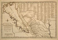
De Fer, Nicolas
Cette Carte de Californie et du Nouveau Mexique est Tiree de celle qui a ete Envoyee par un Grande d'Espagne pour etre Communiquee a Mrs. de l'Academie Royale des Sciences
Paris 1700. Early original color large map of California showing it as an island and based on the explorations of missionary Father Kino. From De Fer's Atlas Curieux. In great detail with 314 locations in New Mexico identified by a numbered key at the upper right portion of the map. Engraved by Charles Inselin. mage size: 13 1/2 x 8 7/8". Paper size: 16 1/2 x 11 1/2". With a small chip at lower edge; very faint damp staining at upper left corner toning to edges; otherwise very good. Tooley R. V. Amer P 126-7. unknown
Référence libraire : 15901
|
|
|
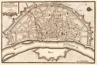
de Fer, Nicolaus
Cologne Cologne - Nicolaus de Fer ∑ Hand-Colored Original Copperplate Engraving ∑ Paris 1702
Paris: N. de Fer 1702. Other. One old crease in the paper else in very good condition. 232 by 349mm 9 by 13 inches. 232 by 349mm 9 by 13 inches. Hand-Colored Original Copperplate Engraving by Nicolaus de Fer depicting Cologne. Published Paris N. de Fer 1702. Sheet: 232 by 349mm 9 by 13 inches. A fine and original hand-colored example of de Fer's celebrated cartographic work documenting this region of Germany with the precision and decorative artistry characteristic of the 17000s. Nicolaus de Fer was a cartographer active in the 1700s working in the tradition of European copper-engraved cartography. Their maps are valued by collectors for their historical accuracy and decorative quality.This original copperplate engraving with original hand coloring depicts the region of Cologne published in Paris N. de Fer 1702. The map records the political and geographic boundaries of the region as understood in 1702 offering a fascinating window into the history of German territorial organization. Sheet measures 232 by 349mm 9 by 13 inches. In excellent condition. Ready to frame. N. de Fer unknown
Référence libraire : 19554
|
|
|
de Fer, Nicolas
GOUVERNMENT GENERAL DE NORMANDIE
A detailed map of Normandy also showing the islands of Guernsey Jersey and part of Brittany.<br /> From "L'Atlas Curieux ou le Monde Represente ans des Cartes Generales et Particulieres du Ciel et de la Terre..."
Référence libraire : M1429
|
|
|
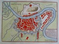
De Fer, Nicolas (1646 - 1720)
Grenoble - Colorierter Plan im Kupferstich
De Fer Paris um 1700. Maße: 26 cm x 19 cm. - Nicolas de Fer war einer der führenden französischen Kartographen und Kartenverleger - unknown
Référence libraire : 2n1779
|
|
|
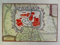
De Fer, Nicolas (1646 - 1720)
Haguenau - Colorierter Plan im Kupferstich
De Fer Paris um 1700. Maße: 25 cm x 17 cm. - Nicolas de Fer war einer der führenden französischen Kartographen und Kartenverleger - unknown
Référence libraire : 2n1784
|
|
|
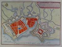
De Fer, Nicolas (1646 - 1720)
Havre de Grace - Colorierter Plan im Kupferstich
De Fer Paris um 1700. Maße: 28 cm x 205 cm. - Nicolas de Fer war einer der führenden französischen Kartographen und Kartenverleger - unknown
Référence libraire : 2n1781
|
|
|
De Fer, Nicolas
Histoire Des Rois De France Depuis Pharamond Jusqu'a Notre Auguste Monarque Louis Quinze 1722 French Edition
paperback. Good. Access codes and supplements are not guaranteed with used items. May be an ex-library book. paperback
Référence libraire : 1104763567.G ISBN : 1104763567 9781104763565
|
|
|
De Fer, Nicolas
Histoire Des Rois De France Depuis Pharamond Jusqu'a Notre Auguste Monarque Louis Quinze 1722 French Edition
paperback. Good. Access codes and supplements are not guaranteed with used items. May be an ex-library book. paperback
Référence libraire : 1166040615.G ISBN : 1166040615 9781166040611
|
|
|
De Fer, Nicolas
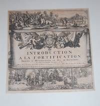
Introduction A La Fortification. Dediee A Monseigneur Le Duc De Bourgogne. TITLE PAGE.
Paris:: De Fer 1693. 19 x 20cm. Single leaf. Illustrated title page. Trimmed just outside borders clean. Mounted on larger plain leaf. Suitable for framing. De Fer, unknown
Référence libraire : 15226
|
|
|
De Fer, Nicholas
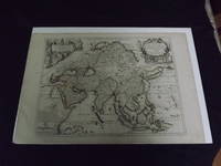
L' Asie dressee selon les dernieres Relations et Suivant les Nouvelles Decouverts…
<p>Engraved double page map 28" x 20" wide margins hand colored in outline two uncolored pictorial cartouches. Expert and nearly invisible repairs along centerfold normal aging; about near fine. Impression is bright and clean. Nicholas De Fer 1646-1720 was a highly respected and prolific French cartographer whose maps were valued for their decorative appeal. Around 1690 he was made the geographer to the Dauphin and published his first atlas. He would become geographer to other high-ranking individuals in French and Spanish society. The present map is detailed and attractive map of Asia with a cartouche showing Chinese at the upper left and Indians in the upper right. The map covers a lot of territory showing Arabia and the Persian Empire in the West and Japan in the east but goes as far south as the Isle of Borneo and Java. Part of Eastern Europe is also visible. Library missouri website.</p>
Référence libraire : biblio10
|
|
|
DE FER, Nicolas
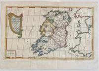
L'Irlande
Paris: Nicolas De Fer 1689. unbound. Map. Engraving with original hand outline color. Sheet measures 13" x 9.5". Image measures 12.75" x 7.25".<br/> <br/> This is a lovely 1689 map of Ireland by Nicolas De Fer. Depicts the Emerald Isle in its entirety color coded and subdivided into its four provinces of Ulster Connacht Leinster and Munster. Parts of Scotland the Isle of Man and England and Wales are also visible. Major towns lakes rivers and islands are noted in Ireland and mountains beautifully rendered in profile. The title cartouche represents the Celtic Harp. The map is in good condition with minor toning along the original fold. Original platemark visible.<br> <br> Nicolas de Fer 1646-1720 was a prolific cartographer engraver and publisher who took over the family map business from his mother when she retired in 1687. The business flourished and he gained a great reputation in his lifetime and was appointed 'Geographer to the King' in 1690. This map demonstrates his skill and provides a curious yet alluring mixture of history and geography.<br/> <br/> Nicolas De Fer unknown
Référence libraire : 322292
|
|
|
De Fer, Nicolas (1646 - 1720)
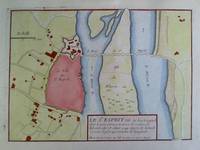
Le St. Esprit Pont-Saint-Esprit - Colorierter Plan im Kupferstich
De Fer Paris um 1700. Maße: 26 cm x 18 cm. - Nicolas de Fer war einer der führenden französischen Kartographen und Kartenverleger - unknown
Référence libraire : 2n1772
|
|
|
De Fer, Nicolas
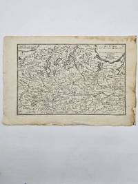
Les Estats du Duche de Milan. Italy. Map
Paris. 1705. Good old repair to right margin smoke stains to top margin no affecting the image short tears to lower margin. 26.5x29x0.1 cm. Image size: 21x32.2 to neatline. Uncolored engraved map of Duchy of Milan by the prolific French mapmaker. weight: 0.1 lb. unknown
Référence libraire : 356958
|
|
|
DE FER, Nicolas (1646 - 1720)
LISBOA Atlas Curieux
Paris 1700. Desencadernado / Disbound. Muito Bom/Very Good/Très Bien. 325 x 240 mm. A. Coquart Sculp. Fina gravura em chapa de cobre colorida a aguarela inserida no "Atlas Curieux ou le Monde Cca 1700. Representando três vistas de Lisboa em diferentes cartuxos: Uma vista razante do terreiro do Paço com a representação do antigo paço e do Convento de S. Domingos com uma vista do cais e do terreiro onde se desenrrolam cenas do quotidiano nomeadamente uma cena de equitação. Uma vista da Torre de Belém rodeada de barcos e navios e Uma planta das fortificações da cidade com identificação do castelo e do Palácio Real identificando um pântano "marais" ao norte da fortificação. Apresentada num passpartout de cartão pronta para encaixilhar. <br/> <br/> unknown
Référence libraire : 002589
|
|
|
de Fer, Nicholas
Mer Medi Terranee : Siracuse ou Siracous
Paris 1693. No Binding. Good. copper-plate print. uncoloured. fortification and Church jutting into mediterranean. cartouche with cherub like individuals and a sheep. Our orders are shipped using tracked courier delivery services. Paris unknown
Référence libraire : bp47
|
|
|
De Fer, Nicolas (1646 - 1720)
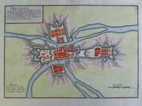
Meziers Charleville-Mézières - Colorierter Plan im Kupferstich
De Fer Paris um 1700. Maße: 27 cm x 19 cm Blattrand mit kleinen Knickspuren. - Nicolas de Fer war einer der führenden französischen Kartographen und Kartenverleger - unknown
Référence libraire : 2n1773
|
|
|
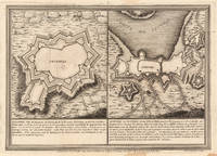
de Fer, Nicolaus
Olivenca - Setuval
Paris: N. de Fer 1704. Other. In very good condition. 244 by 345mm 9½ by 13½ inches. Copper engraving uncolored as published. N. de Fer unknown
Référence libraire : 23542
|
|
|
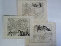
De Fer, Nicolas - Versailles
Partie du Nouveau Canal Fait pour la Conduitte de la Riviere d'Eure depuis Pontgouin jus ques a Versailles - 3 Kupferstiche mit je einer dekorativen Kartusche
ca. 1694. Blattgröße: 365 cm x 275 cm. kräftige Abdrucke / saubere Blätter - unknown
Référence libraire : 2n1617
|
|
|
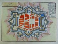
De Fer, Nicolas (1646 - 1720)
Phalsbourg - Colorierter Plan im Kupferstich
De Fer Paris um 1700. Maße: 285 cm x 205 cm. - Nicolas de Fer war einer der führenden französischen Kartographen und Kartenverleger - unknown
Référence libraire : 2n1776
|
|
|
De Fer, Nicolas:
Plan Des Villes De Londres et de Westminster et leurs Faubourgs avec le Bourg de Southwark
Paris 1700. Copper engraving 22.5 x 33.5 cms engraved by C. Inselin black and white slight soiling bottom right blank verso; the key lists 113 places of interest. This is the first version of the map before the date was amended. Howgego Printed Maps of London 44 1 unknown
Référence libraire : 8374
|
|
|
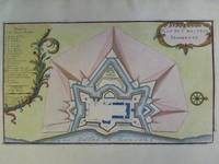
De Fer, Nicolas (1646 - 1720)
Plan du Chasteau Trompette Chateau Trompette Bordeaux - Colorierter Plan im Kupferstich
De Fer Paris um 1700. Maße: 28 cm x 165 cm. - Nicolas de Fer war einer der führenden französischen Kartographen und Kartenverleger - unknown
Référence libraire : 2n1785
|
|
|
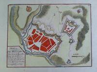
De Fer, Nicolas (1646 - 1720)
Prats de Moliou - Colorierter Plan im Kupferstich angefertigt von Bodenehr
De Fer Paris um 1700. Maße: 23 cm x 175 cm Blattrand gering fleckig und mit kleinem Einriß. - Nicolas de Fer war einer der führenden französischen Kartographen und Kartenverleger - unknown
Référence libraire : 2n1777
|
|
|
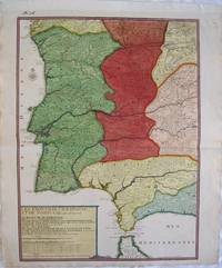
de Fer, Nicholas
The Frontiers of Spain and Portugal. "Les Frontiers d'Espagne et de Portugal ou se trouve Le royaume de Portugal divise en ses Cinq Grandes Provinces. Partie des Royaume de Grenade d'Andalouse de Castille
Europe: Paris de Fer. N 1705. Copper engraved map of Portugal and part of Spain by Nicholas de Fer from his "Atlas ou Recueil de Cartes Geographiques" Original old full wash colour; verso blank. The map shows the south western part of the Iberian peninsular: Portugal; the Algarve and parts of the kingdoms of Estramadura AndalusiaGrenada Leon and Castille extending down to the straits of Gibraltar. Good dark impression; colours bright; old ink number to upper blank margin; guard attached to upper margin; light diagonal creases towards centre fold other small printers creases/ wrinkles to centrefold; old ink title to verso. Nicholas de Fer 1646 - 1720 was the son of cartographer Antoine de Fer. Nicholas was established as an engraver cartographer and map publisher in Paris. De Fer was a prolific cartographer with over 600 maps and atlases to his credit. De Fer's work though replete with geographical errors earned a large following because of its considerable decorative appeal. In the late 17th century De Fer's fame culminated in his appointment as Geographe de le Dauphin a position that offered him unprecedented access to the most up to date new cartographic information. He would later be appointed Geographe de Roi to the kings of both France and Spain. Pastoureau FER II C 72. Europe Spain & Portugal Portugal Paris de Fer. N 1705 unknown
Référence libraire : 2539
|
|
|
de Fer, Nicolas
The Island of Martinique. "Isle de la Martinique
Americas: Paris de Fer Nicolas 1704. Copper engraved map of Martinique from Nicolas de Fer's "Alas Curieux" Original colour; verso blank. Detailed map engraved by P Starckman with long key identifying 63 places of interest Dark impression; upper margin trimmed to plate mark; crease to lower right corner;ink number to upper right corner. Nicolas de Fer 1646-1720 was the son of Antoine de Fer also a map engraver and colourist in his own right who had worked with Nicolas Berey and acted as an editor for Pierre Duval's "Cartes De Geographie ." of 1657. Nicolas began his career with an apprenticeship to the engraver Louis Spirinx in Paris. It soon became clear that his interest lay in the production of current maps recent discoveries and he was particularly interested in the topical production of military maps with town plans and their fortifications an especial interest. De Fer's first map was published in 1669 and was a rather unusual map of the Languedoc Canal with a phonetic title. Antoine died in 1673However it wasn't until 1687 that Nicolas took over the running of the family business. Over the next few years De Fer was able to make the publishing business flourish and in 1690 he was nominated as geographer to the Dauphin – their relationship had reciprocal benefits with De Fer producing in effect royal propaganda concerning the Dauphin's lands with each publication enhancing his own name and reputation as well as that of the Dauphin. When the Duke of Anjou ascended the throne in 1702 De Fer had the dual title of "geographe du roi d'Espagne et du Dauphin". De Fer published a number of atlases including the "Cotes de France" of 1690 containing Tassin's maps and the "Forces de l'Europe ou Introduction a la fortification" also of 1690 that reinforced his abilities and success with the buying public. Subsequent publications included the "Petit et Nouveau Atlas" which appeared in 1697 followed by the "Atlas Curieux". The "Atlas Curieux" was well-known and popular being expanded in successive editions between 1700 and 1705 and was re-edited in 1714 and 1716 under the title "Suite de l'Atlas Curieux". De Fer also produced a number of folio maps that appeared in the "Atlas ou Recueil de cartes" which was published in 1709. Americas Caribbean Martinique Paris de Fer, Nicolas 1704 unknown
Référence libraire : 2037
|
|
|
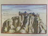
De Fer, Nicolas (1646 - 1720)
Veue du Chateau de Miolans en Savoye à deux Lieues au Nord-Est de Montmelian - Colorierter Kupferstich
De Fer Paris 1705. Maße: 19 cm x 122 cm. - Nicolas de Fer war einer der führenden französischen Kartographen und Kartenverleger - unknown
Référence libraire : 2n1788
|
|
|
DE FER, Nicolas
Roüen Ville Capitale de Normandie [ Carte - Plan ]. A 15 degrez 45 minutes de Longitude et a 49 degrez 30 minutes de Latitude.
Carte gravée au format 60 x 46 cm, Chez le Sr Danet, Gendre de l'Auteur sur le Pont Notre Dame à la Sphère Royale, 1724, à l'échelle de 500 pas communs
Référence libraire : 26462

|
|
|
de Fer, Nicolas (1646-1720):
Plan de la ville de Paris. 1705. Le Plan de la Ville cité et université de Paris capitale du royaume de France- Paris Plan Stadtplan / Ile-de-France Frankreich
1705 Paris, 1705 - Blatt-Maße: ca. 27 x 38 cm. -- gut erhalten. || Original copper engraved map from 1714.
Référence libraire : 27962
|
|
|
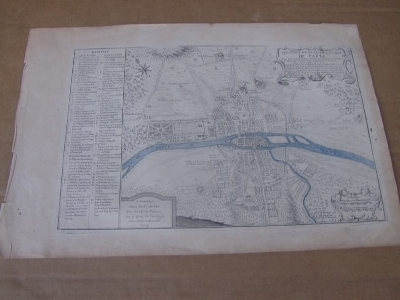
de Fer, Nicolas (1646-1720):
Quatrieme Plan de la Ville de Paris - Paris Plan Stadtplan / Ile-de-France Frankreich
1714 Paris, 1714 - Blatt-Maße: ca. 27 x 38 cm. -- gut erhalten. || Original copper engraved map from 1714.
Référence libraire : 27921
|
|
|
de Fer, Nicolas (1646-1720):
SEPTIEME Plan de la Ville de Paris - Paris Plan Stadtplan / Ile-de-France Frankreich
1714 Paris, 1714 - Blatt-Maße: ca. 27 x 38 cm. -- gut erhalten. || Original copper engraved map from 1714.
Référence libraire : 27961
|
|

 Recevoir par e-mail
 Télécharger en PDF
 Flux RSS
 Lien permanent


