|
Sanson - Pol André
Mémoires de Sanson Exécuteur des Jugements Criminels
Paris, sd, in-8, 390pp, broché, Quelques défauts mineurs sinon très bel exemplaire! 390pp
Referenz des Buchhändlers : 34930
|
|
|
Sanson - Vaugondy
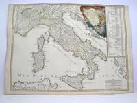
L'Italieet ses Isles circonvoisines Sicile Sardaigne Corse & exactement divisees en leurs Etats Royaumes Republiques
Paris: Delamarche 1778. Very Good. Size : 515x685 mm 20.25x27 Inches Coloring: Original Outline Coloring Category: ; Maps Europe Italy Delamarche unknown
Referenz des Buchhändlers : M3888
|
|
|
SANSON / MARIETTE
CARTE DE L'ISLE DE FRANCE - «Gouvernement Général de l'ISLE DE France et Pays Circonvoisins, par le Sr SANSON d'Abbeville Géographe Du Roy, à Paris chez Pierre Mariette, Rue St Jacques à l'Espérance, avec privilège du Roy pour vingt ans, 1651.» Carte gravée, sur papier vergé. Limites coloriées. Cartouche de titre en bas à droite.
Paris Pliure centrale. Format 43x58 cm marges comprises. Carte fraîche et sans accidents. Carte conservée roulée.
Referenz des Buchhändlers : 86020
|
|
|
SANSON [D'ABBEVILLE, Nicolas].
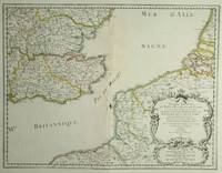
Anciens Royaumes De Kent D'Essex et De Sussex ou sont Aujourdhuy les Comtés Kent D'Essex Middlessex Et Hartford De Sussex Et Surrey. Avecq le Pas De Calais et Partie des Costes du Pays Bas de Picardie et Normandie.
Paris: Sanson. 1654. 36.6 x 48 cm. Original outline colour. Double page map of the south east England shown with the adjacent coastline of France and Belgium. Title cartouche to lower right corner. Blank on verso. Wear to centrefold with some loss Paris: (Sanson). 1654 unknown
Referenz des Buchhändlers : 28812
|
|
|
SANSON A
ALIMENTATION RAISONNEE DES ANIMAUX MOTEURS ET COMESTIBLES / BIBLIOTHEQUE DU CULTIVATEUR / 2e EDITION.
LIBRAIRIE AGRICOLE DE LA MAISON RUSTIQUE. 1892. In-12. Broché. Etat d'usage, Couv. légèrement passée, Dos satisfaisant, Intérieur acceptable. 172 pages - Renfort adhésif en coiffes en tete et pied.. . . . Classification Dewey : 636.089-Art vétérinaire
Referenz des Buchhändlers : R320041470
|
|
|
SANSON A
LES MOUTONS - HISTOIRE NATURELLE ET ZOOTECHNIE / BIBLIOTHEQUE DU CULTIVATEUR.
LIBRAIRIE AGRICOLE DE LA MAISON RUSTIQUE. 1894. In-12. Broché. Bon état, Couv. convenable, Dos satisfaisant, Intérieur frais. VI + 167 pages - Nombreuses figures en noir in texte et en 1er plat.. . . . Classification Dewey : 636.3-Ovins
Referenz des Buchhändlers : R320041080
|
|
|
SANSON A.
NOTIONS USUELLES DE MEDECINE VETERINAIRE
LIBRAIRIE AGRICOLE DE LA MAISON RUSTIQUE. NON DATE. In-12. Broché. Etat d'usage, Tâchée, Dos abîmé, Papier jauni. 468 pages. Quelques rousseurs. Quelques illustrations en noir et blanc, dans et hors texte. 1er plat désolidarisée.. . . . Classification Dewey : 590-Zoologie
Referenz des Buchhändlers : R200096325
|
|
|
SANSON ABBE
LE PARADIS DE LA TERRE OU LE VRAI MOYEN DE TROUVER LE BONHEUR EN RELIGION
LECOFFRE FILS ET CIE. 1867. In-12. Broché. Etat d'usage, Couv. convenable, Mors fendus, Quelques rousseurs. 460 pages -. . . . Classification Dewey : 200-RELIGION
Referenz des Buchhändlers : RO30145676
|
|
|
SANSON Abbé
Le Bonheur des maisons religieuses ou avis propres à diriger dans le choix des sujets, la formation des novices et le gouvernement d'une communauté tirés des meilleurs auteurs ascétiques, et d'un grand nombre de règles et de constitutions religieuses.
Gustave Martin 1842 In-12, plein-maroquin violine, dos lisse, filets bruns, dentelles dorées, dentelles d’encadrement des plats, VI- 348 pp. Infimes frottements. Très bon exemplaire.
Referenz des Buchhändlers : 42435
|
|
|
SANSON abbé
Le paradis de la terre, ou le vrai moyen de trouver le bonheur en religion, d'après les principes des maitres de la morale, de la vie spirituelle et religieuse, et les exemples des saints
Paris, Gustave Martin 1843 vi + 480pp., 18cm., reliure cart. (dos en cuir avec titre et décorations dorées, plats marbrés), feuilles de garde marbrées, rousseurs (mais le texte est toujours bien lisible), R100686
Referenz des Buchhändlers : R100686
|
|
|
SANSON ALPHONSE
DES ABCES SYMPTOMATIQUES - THESES SOUTENUE A LA FACULTE DE MEDECINE DE PARIS EN DECEMBRE 1832 - CONCOURS POUR L'AGREGATION EN CHIRURGIE.
IMP. LACHEVARDIERE. 1832. In-8. Broché. Etat d'usage, Livré sans Couverture, Dos abîmé, Intérieur frais. 16 pages - livré sans couverture - quelques rousseurs naturelles sur la page de titre.. . . . Classification Dewey : 610-Sciences médicales. Médecine
Referenz des Buchhändlers : RO20205669
|
|
|
SANSON ANDRE
TRAITE DE ZOOTECHNIE - TOME 1 - BIBLIOTHEQUE AGRICOLE - Zoologie et zootechnie générales - organisations, fonctions physiologiques et hygiène des machines animales
LIBRAIRIE AGRICOLE DE LA MAISON RUSTIQUE. 1893. In-8. Relié. Etat d'usage, Coins frottés, Dos satisfaisant, Intérieur frais. XVII + 401 pages augmentées de nombreuses figures en noir et blanc dans le texte - auteur, titre, tomaison et filets dorés sur le dos - plats et contre plats jaspés. . . . Classification Dewey : 590-Zoologie
Referenz des Buchhändlers : RO30139274
|
|
|
SANSON ANDRE
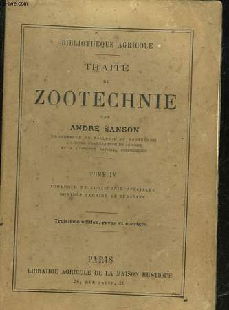
TRAITE DE ZOOTECHNIE - TOME 4 - ZOOLOGIE ET ZOOTECHNIE SPECIALES - BOVIDES TAURINS ET BUBALINS
LIBRAIRIE AGRICOLE DE LA MAISON RUSTIQUE - 3° EDITION. 1888. In-16. Broché. Etat d'usage, Couv. légèrement passée, Dos satisfaisant, Quelques rousseurs. 363 pages. Quelques gravures en noir et blanc dans le texte. Petites rousseurs sur la couverture.. . . . Classification Dewey : 590-Zoologie
Referenz des Buchhändlers : RO30064548
|
|
|
SANSON André
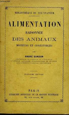
Alimentation raisonnée des Animaux moteurs et comestibles.
LA MAISON RUSTIQUE. 2ème édition. 1892. In-12. Broché. Bon état, Couv. légèrement passée, Dos satisfaisant, Intérieur frais. 170 pages.. . . . Classification Dewey : 590-Zoologie
Referenz des Buchhändlers : RO80034277
|
|
|
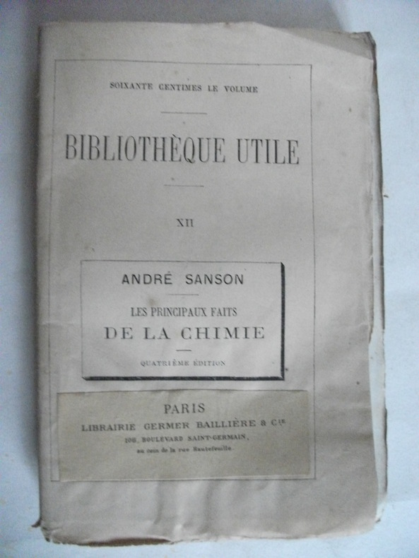
SANSON André
les principaux faits de la chimie
in 12 broché,mention de 4ème édition.Titre,192 pages,Germer-Baillière & Cie Bibliothèque utile XII.Rousseurs éparses. Sinon très bon état
Referenz des Buchhändlers : 5298
|
|
|
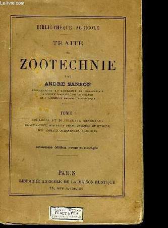
SANSON André
Traité de zootechnie. TOME I
MAISON RUSTIQUE. 3ème édition. 1882. In-12. Broché. Bon état, Couv. convenable, Dos satisfaisant, Rousseurs. 448 pages. Quelques illustrations en noir et blanc dans le texte. Pages non coupées.. . . . Classification Dewey : 590-Zoologie
Referenz des Buchhändlers : RO80026312
|
|
|
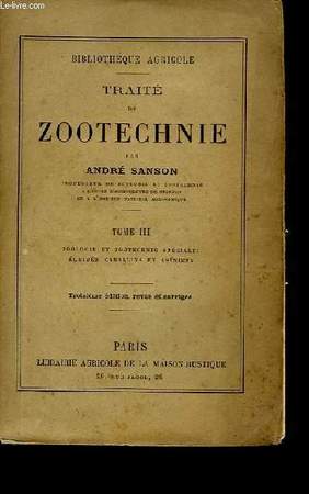
SANSON André
Traité de Zootechnie. TOME III
LA MAISON RUSTIQUE. 3ème édition. 1888. In-12. Broché. Bon état, Couv. légèrement passée, Dos satisfaisant, Quelques rousseurs. 382 pages. Quelques illustrations en noir et blanc dans le texte.. . . . Classification Dewey : 590-Zoologie
Referenz des Buchhändlers : RO80029762
|
|
|
SANSON André (SECRÉTAIRE -ADJOINT DE LA SOCIÉTÉ IMPÉRIALE. ET CENTRALEDE MÉDECINE VÉTÉRINAIRE )
LE MEILLEUR PRESERVATIF CONTRE LA RAGE : étude de la physionomie des chiens et des chats enragés, lésions, causes, degré de contagion du virus; remèdes antirabiques par A. Sanson
Paris Bureaux de la Science Pittoresque et Bureaux de la Culture 1860 -in-12 demi-chagrin un volume, reliure demi-chagrin chocolat in-douze (binding half shagreen in-12)(20 x 13 cm), dos à nerfs (spine with raised bands) décoré "or" et à froid (gilt and blind stamping decoration), titre et auteur frappés "or" (gilt title), filet à froid de part et d'autre des nerfs et en tête et en pied, papier marbré marron et jaune aux plats (cover with marbled paper), toute tranches lisses, marque-page en tissu (bookmark in tissue), orné d'une gravure in-texte en noir + une figure de notation musicale in-texte en noir, 84 pages, 1860 Paris Bureaux de la Science Pittoresque et Bureaux de la Culture Editeurs,
Referenz des Buchhändlers : 23500
|
|
|
SANSON André .-
Les moutons.-
Histoire naturelle et zootechnie. 5°édition. 56 gravures. Paris. Maison Rustique. 1894. In-12 (120 x 186mm) broché, couverture jaune imprimée, ornée d'un mouton, VI, 167 pages et catalogue de la librairie, 48 pages. Gravures en noir dans le texte.
Referenz des Buchhändlers : ORD-9689
|
|
|
SANSON André.
TRAITE DE ZOOTECHNIE OU ECONOMIE DU BETAIL.
Paris, Librairie agricole de la maison rustique, 1877-82. 4 vol. in-12, demi-reliure.
Referenz des Buchhändlers : 5102
|
|
|
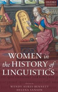
SANSON AYRES-BENNETT
WOMEN IN HISTORY OF LINGUISTICS C
Hardcover. New. New Book; Fast Shipping from UK; Not signed; Not First Edition; This volume offers a ground-breaking investigation into women's contribution to the description analysis and codification of languages across a wide range of linguistic and cultural traditions. The chapters explore a variety of sphere hardcover
Referenz des Buchhändlers : ria9780198754954_inp ISBN : 0198754957 9780198754954
|
|
|
SANSON C.J.
UN HIVER A MADRID (ROMAN)
DE NOYELLES. 2008. In-8. Broché. Bon état, Couv. convenable, Dos satisfaisant, Intérieur frais. 505 pages.. . . . Classification Dewey : 820-Littératures anglaise et anglo-saxonne
Referenz des Buchhändlers : R200082302
|
|
|
Sanson Carrasco
Colecci n de Art culos: Con Una Introducci n Classic Reprint Spanish Edition
hardcover. Good. Access codes and supplements are not guaranteed with used items. May be an ex-library book. hardcover
Referenz des Buchhändlers : 0331540630.G ISBN : 0331540630 9780331540635
|
|
|
Sanson Carrasco
Colección de Artículos: Con una Introducción Classic Reprint Spanish Edition
paperback. Good. Access codes and supplements are not guaranteed with used items. May be an ex-library book. paperback
Referenz des Buchhändlers : 0282758410.G ISBN : 0282758410 9780282758417
|
|
|
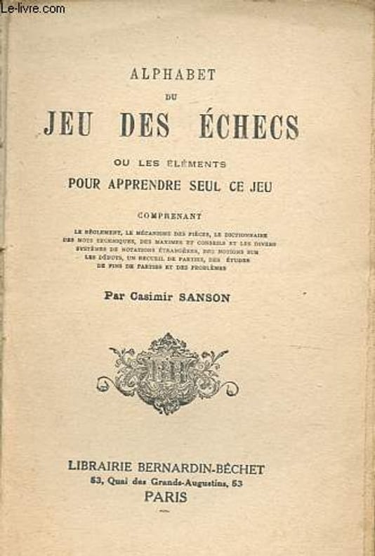
Sanson Casimir
Alphabet du jeu des échecs ou les éléments pour apprendre seul ce jeu.
Librairie Bernardin-Béchet. non daté. In-12. Broché. A relier, 1er plat abîmé, Dos abîmé, Quelques rousseurs. 142 pages, nombreuses illustrations en noir et blanc dans et hors texte - papier jauni, 1er plat manquant, pliure et déchirure sur le 2e plat, dos partiellement manquant, ouvrage désolidarisé, déchirure et tampon en page de faux-titre.. . . . Classification Dewey : 794.1-Echecs
Referenz des Buchhändlers : R200139717
|
|
|
Sanson Casimir
Alphabet du jeu des échecs ou éléments pour apprendre seul le jeu
Deux-Trois Broché In-12 (19*12), dos broché, couverture souple illustrée, 142pp., explications des termes techniques, notions de jeu, reproductions de parties, rousseurs, dos abîmé, état correct. Livraison a domicile (La Poste) ou en Mondial Relay sur simple demande.
Referenz des Buchhändlers : bf3466
|
|
|
SANSON Casimir.
Alphabet du Jeu des Echecs.
DEUX-TROIS / BERNARDIN-BECHET. Non daté. In-12. Broché. Etat d'usage, Couv. légèrement passée, Manque en coiffe de pied, Intérieur frais. 142 pages. Nombreuses figures en noir et blanc. Coiffe en tête abîmée, avec charnières fendues.. . . . Classification Dewey : 794.1-Echecs
Referenz des Buchhändlers : RO80019263
|
|
|
SANSON CHARLES HENRI
LA REVOLUTION FRANCAISE VUE PAR SON BOURREAU.
L'INSTANT. 1988. In-8. Broché. Etat d'usage, Coins frottés, Dos satisfaisant, Intérieur frais. 340 pages - illustration en noir et blanc sur le 1er plat - petite annotation au stylo bleu sur la page de faux titre.. . . . Classification Dewey : 944.04-Révolution de 1789
Referenz des Buchhändlers : R240084465
|
|
|
Sanson Charles-Henri
La révolution française vue par son bourreau - Collection griffures.
L'instant. 1989. In-8. Broché. Bon état, Couv. convenable, Dos satisfaisant, Intérieur frais. 339 pages.. . . . Classification Dewey : 944.04-Révolution de 1789
Referenz des Buchhändlers : R100066675

|
|
|
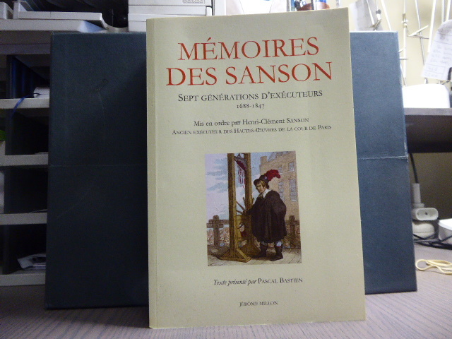
SANSON Charles-Henri
MEMOIRES DES SANSON. Sept générations d'exécuteurs 1688-1847. Mis en ordre par Charles-Henri SANSON ancien Exécuteur des Hautes Oeuvres de la Cour de Paris.
Jérôme Millon Grenoble 2013 Fort in-8 ( 240 X 160 mm ) de 1247 pages, broché sous couverture illustrée en couleurs. Très bel exemplaire de cette édition épuisée.Mémoires apocryphes, rédigés par le journaliste d'OLBREUSE d'après des documents originaux. Récit de toutes les grandes exécutions ( Tulard 1316 - Fierro 1315 ).
Referenz des Buchhändlers : 19541
|
|
|
SANSON CHARLES-HENRI. (1739-1806).
MEMOIRES DE SANSON, EXECUTEUR DES JUGEMENTS CRIMINELS. AVEC UNE INTRODUCTION, DES NOTES ET DES COMMENTAIRES PAR LE BIBLIOPHILE POL ANDRE. NOMBREUSES GRAVURES DANS LE TEXTE ET HORS-TEXTE, D’APRES DES DOCUMENTS DE L’EPOQUE.
PARIS. ALBIN MICHEL, EDITEUR. SANS DATE (1911). IN-8 (14,5 X 21,5 X 3,5 CENTIMETRES ENVIRON) DE (4) + 390 PAGES, RELIURE D’EPOQUE 1/2 CHAGRIN VERT, DOS A QUATRE NERFS ORNE D’UN DECOR A FROID AVEC FILETS ET FLEURONS DORES, TITRE ET TETE DORES, COUVERTURE ILLUSTREE CONSERVEE. BEL EXEMPLAIRE.
Referenz des Buchhändlers : 2499
|
|
|
SANSON CHRISTIANE
MARIE DE LA TRINITE - DE L ANGOISSE A LA PAIX
CERF HISTOIRE. 2005. In-8. Broché. Etat du neuf, Couv. remarquable, Dos impeccable, Intérieur frais. 316 pages augmentées de planches de photos en noir et blanc.. . . . Classification Dewey : 230-Christianisme. Théologie chrétienne
Referenz des Buchhändlers : RO80165512
|
|
|
SANSON CHRISTIANE
MARIE DE LA TRINITE DE L'ANGOISSE A LA PAIX
CERF. 2003. In-8. Broché. Etat passable, Couv. convenable, Dos satisfaisant, Intérieur frais. 317 pages - quelques planches photos en noir et blanc.. . . . Classification Dewey : 922-Religieux
Referenz des Buchhändlers : RO20163673
|
|
|
SANSON Christiane
Une religion peuple - Mère Marie de Saint-Jean (1876-1969) et les origines des Dominicaines missionnaires des campagnes
Paris, Cerf 1989 xvi + 708gr., 24cm., br.orig., Thèse de doctorat, cachet au verso de la p.d.t., texte frais, poids: 1.1kg., R109655
Referenz des Buchhändlers : R109655
|
|
|
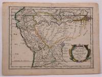
Sanson d"Abbeville, Nicolas
LE PEROU ET LE COURS DE LA RIVRE AMAZONE
Paris: Chez Sanson 1657. Image is 8 1/8 inches by 11 inches on a folded sheet measuring 9 inches by 12 13/16 inches. Original hand-colored copper-engraved map from Sanson's atlas of maps of the Americas: L'Amerique en Plusieurs Cartes. It is a map of the Viceroyalty of Peru that displays the Amazon River and its many tributaries. Nicolas Sanson 1600-1667 was the official geographer for the king of France. His map of Peru and the Amazon became the standard that was copied by almost all geographers/cartographers--even reproduced by Bion for his 1700 treatise on globes. Cintra and Oliveira argue that Sanson's map was a scientific one that holds up well even when compared to 21st century maps of the region. The map is in about very good condition: clean with bright original outline color; minimal foxing ; some edgewear and soiling in the margins. . First Edition. Single Sheet. Very Good-. 8 1/8 inches by 11 Inches. Map. Chez Sanson
Referenz des Buchhändlers : W2347
|
|
|
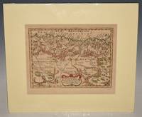
Sanson d'Abbeville, Nicolas
"Partie de la Barbarie ou est le Royaume d'Alger divise en les Provinces. Parie du Biledulgerid." Map of Northern Africa. Attractive and detailed coastal map of North Africa with Algeria. Antique Engraved Hand-Coloured Map.
Paris Sanson d'Abbeville Nicolas Ca 1660. In ivory mount. Mount size 16 x 13.5 inches 40.5cm x 35cm Engraved size 28cm x 22cm 11 x 8.5 inches In very good condition. Laid Down. Paris Sanson d'Abbeville, Nicolas Ca 1660 unknown
Referenz des Buchhändlers : 92217
|
|
|
Sanson d'Abbeville, Nicholas
Brazil Brasil waar van de Kust door de Portugeezen bezeten .
Americas: Amsterdam Francois Halma 1705. Copper engraved map of Brazil by N. Sanson from Halma's Algemeene Werelde Beschryving Vol. 3 Black and white; title in Dutch; verso blank; Attractive small map of Brazil; title cartouche surrounded by garland of leaves in centre of country. This map appeared in Algemeene Weereld-Beschryving nae de Rechte Verdeeling der Landschappen Plaetsen Zeeën Rivieren &c. Geographisch Politisch Historisch Chronologisch en Genealogisch a Dutch edition of A. Phérotée de la Croix's Nouvelle Methode Pour Apprendre Facilement la Geographie Universelle which first appeared in 1690. Dark impression; minor dampstain at top of centre fold. Nicolas Sanson d'Abbeville.1600-67 ' father of the French cartography' and founder of the Sanson firm. Atlas ' Cartes générales de toutes les parties du Monde' 1658-70 and a pocket atlas in 4 parts 1652-1705. Sanson's small maps from A. Phérotée de la Croix's Nouvelle Methode Pour Apprendre Facilement la Geographie Universelle. first published in 1652 and engraved by A. Peyrounin were copied several times by various map publishers. Johann David Zunners made copies of Sanson's maps for his German translation of Die Gantze Erd-Kugel in 1679. Johannes Ribbius and Simon de Vries published copies in 1682 and 1683 with new maps engraved by Antoine d'Winter. The plates were later sold to Francois Halma who used them in 1699 and then again in 1705 with the titles re-engraved in Dutch. François Halma 1653 - 1722 Dutch publisher/printer; dealer/auction house. Cartographer and publisher of maps active in Utrecht Amsterdam Franeker and Leeuwarden. Published 'Description de l'Univers' 1700; 'Algemene Wereldtbescrijving' 1705; 'Corpus Inscriptionum' 1707 and 'Lexicon Philosophicum' 1713. Keoman: Hal 1; Phillips 528. Americas South America Brazil Amsterdam Francois Halma 1705 unknown
Referenz des Buchhändlers : 3249
|
|
|
Sanson d'Abbeville, Nicholas
Canada of New France. Canada of Niew Vrankryk. Getrokken uit verschiede Franche Engelsche en en Hollandsche Beschrivingern enz. .
Americas: Amsterdam Francois Halma 1705. Copper engraved map of Canada by N. Sanson from Halma's Algemeene Werelde Beschryving Vol. 3 Black and white; title in Dutch; verso blank; strapwork title cartouche. Attractive small map of Canada and the Great Lakes a reduced version of one of the most influential seventeenth century maps of the French and English colonies in North America. It concentrates on the region of greatest French interest. The entire Great Lakes basin and the St. Lawrence River are shown in great detail. The most important aspect of the map is the first appearance of L. Erie ou du Chat as a recognizable lake on an atlas map. This delineation influenced the cartography of the region for more than 100 years and was not superceded until Delisle's "Carte du Canada" in 1703. The map is also an outstanding source for Indian tribal names and locations. Two names:Aouentsiouaeron and Attiouandarons appear here for the first time. Lake Superior and Michigan Lac du Puans are left open-end to the west. Embellished with a nice title cartouche and engraved by Anthoine d'Winter. This is the third state. Published in Francois Halma's Dutch edition of A. Pherotee de la Croix's Nouvelle Methode Pour Apprendre facilement la Geographie Universelle. Dark impression; dampstaining to lower margin just entering plate; centrefold and 2 further folds to fit in binding. Nicolas Sanson d'Abbeville.1600-67 ' father of the French cartography' and founder of the Sanson firm. Atlas ' Cartes générales de toutes les parties du Monde' 1658-70 and a pocket atlas in 4 parts 1652-1705. Sanson's small maps from A. Phérotée de la Croix's Nouvelle Methode Pour Apprendre Facilement la Geographie Universelle. first published in 1652 and engraved by A. Peyrounin were copied several times by various map publishers. Johann David Zunners made copies of Sanson's maps for his German translation of Die Gantze Erd-Kugel in 1679. Johannes Ribbius and Simon de Vries published copies in 1682 and 1683 with new maps engraved by Antoine d'Winter. The plates were later sold to Francois Halma who used them in 1699 and then again in 1705 with the titles re-engraved in Dutch. François Halma 1653 - 1722 Dutch publisher/printer; dealer/auction house. Cartographer and publisher of maps active in Utrecht Amsterdam Franeker and Leeuwarden. Published 'Description de l'Univers' 1700; 'Algemene Wereldtbescrijving' 1705; 'Corpus Inscriptionum' 1707 and 'Lexicon Philosophicum' 1713. Keoman: Hal 1; Phillips 528; Burden #575; Kershaw #138; McCorkle #683.5. Americas Canada Great Lakes New France Niew Vrankryk Amsterdam Francois Halma 1705 unknown
Referenz des Buchhändlers : 3239
|
|
|
Sanson d'Abbeville, Nicolas (1600-1667); Francois Chauveau, (1613-1676); R Cordier d'Abbeville, engraver
Carte generale du tres-haut tres-puissant et tres chrestien royaume de France et de tous les pays circom-voisins. Présentée a Sa Majesté Tres Chrest ien Louis XIIII / Par son tres humble tres obeissant et tres-fidele serviteur et suject N. Sanson d'Abbeville geographe ordinaire de sa Majesté . ;Gravé par R. Cordier d'Abbeville. First edition of the Atlas with 18 maps.
Paris: 1653. Folio. 30 x 43.2cm. Defective contemporary thick paper covers. Title page and dedication page with losses. Handcolored in outline. One map with loss in lower right corner and one map with tear in lower right corner Sixteen double page maps complete some with waterstains visible verso.Rare to find such a large ensemble of Sanson's maps. Reference: Bibliothèque nationale de France; ark:/12148/btv1b530780775/; Bibliothèque nationale de France département Cartes et plans GE A-592 RES . Paris: 1653. unknown
Referenz des Buchhändlers : 16-6140
|
|
|
Sanson d'Abbeville, Nicholas
Chili. Chili Getrokken uit Alfonso de Oualle Jesuit en in Dertien Rechts-Gebieden Verdeelt.
Americas: Amsterdam Francois Halma 1705. Copper engraved map of Chili by N. Sanson from Halma's Algemeene Werelde Beschryving Vol. 3 Black and white; title in Dutch; verso blank; strapwork title cartouche. Small version of Sanson's important map of Chili showing the Cuyo provinces. The map is based on the descriptions of Alfonso de Ovalle. This map appeared in Algemeene Weereld-Beschryving nae de Rechte Verdeeling der Landschappen Plaetsen Zeeën Rivieren &c. Geographisch Politisch Historisch Chronologisch en Genealogisch a Dutch edition of A. Phérotée de la Croix's Nouvelle Methode Pour Apprendre Facilement la Geographie Universelle which first appeared in 1690. Dark impression. Nicolas Sanson d'Abbeville.1600-67 ' father of the French cartography' and founder of the Sanson firm. Atlas ' Cartes générales de toutes les parties du Monde' 1658-70 and a pocket atlas in 4 parts 1652-1705. Sanson's small maps from A. Phérotée de la Croix's Nouvelle Methode Pour Apprendre Facilement la Geographie Universelle. first published in 1652 and engraved by A. Peyrounin were copied several times by various map publishers. Johann David Zunners made copies of Sanson's maps for his German translation of Die Gantze Erd-Kugel in 1679. Johannes Ribbius and Simon de Vries published copies in 1682 and 1683 with new maps engraved by Antoine d'Winter. The plates were later sold to Francois Halma who used them in 1699 and then again in 1705 with the titles re-engraved in Dutch. François Halma 1653 - 1722 Dutch publisher/printer; dealer/auction house. Cartographer and publisher of maps active in Utrecht Amsterdam Franeker and Leeuwarden. Published 'Description de l'Univers' 1700; 'Algemene Wereldtbescrijving' 1705; 'Corpus Inscriptionum' 1707 and 'Lexicon Philosophicum' 1713. Keoman: Hal 1; Phillips 528. Americas South America Chili Amsterdam Francois Halma 1705 unknown
Referenz des Buchhändlers : 3251
|
|
|
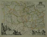
SANSON D'ABBEVILLE, N[icolas].
Diocese du Mans Divisee Par Doyennes Ruraux.
Paris: Pierre Mariette. c. 1658. 37.4 x 49.5 cm. Original outline colour. Double page map of Maine northern France. Title cartouche to lower left corner dedication cartouche to Christophe de Justel to upper right corner with the coat of arms of his family. Blank on verso. Small tears without loss to left and lower margins. Light stains to lower margin otherwise in good condition. Paris: Pierre Mariette. [c. 1658] unknown
Referenz des Buchhändlers : 28798
|
|
|
Sanson d'Abbeville, Nicholas
Florida. Florida zoo als het van de Spaanschen en Franschen wordt bezeten. .
Americas: Amsterdam Francois Halma 1705. Copper engraved map of Florida by N. Sanson from Halma's Algemeene Werelde Beschryving Vol. 3 Black and white; title in Dutch; verso blank; strapwork title cartouche. This influential map shows the Spanish and French possessions in the southern part of the United States. The map extends from the southernmost part of Virginia to the coast of what is now Texas. When first introduced by Sanson in 1657 this map was the first to use the name L. Erie in an atlas and to introduce several new rivers in Virginia. The French claims in the Carolinas are reasserted with the region named Floride Francoise despite the region not having had any French presence for nearly 100 years. The place name Caroline is not related to the future English colony of Carolina. Instead it is a confusion between the French Fort Caroline on the St. Johns River and Charlefort that was located near Port Royal. According to Burden this is the third state of the map. Published in Francois Halma's Dutch edition of A. Pherotee de la Croix's Nouvelle Methode Pour Apprendre facilement la Geographie Universelle. Dark impression; pin hole paper fault to upper right below latitude 40. Nicolas Sanson d'Abbeville.1600-67 ' father of the French cartography' and founder of the Sanson firm. Atlas ' Cartes générales de toutes les parties du Monde' 1658-70 and a pocket atlas in 4 parts 1652-1705. Sanson's small maps from A. Phérotée de la Croix's Nouvelle Methode Pour Apprendre Facilement la Geographie Universelle. first published in 1652 and engraved by A. Peyrounin were copied several times by various map publishers. Johann David Zunners made copies of Sanson's maps for his German translation of Die Gantze Erd-Kugel in 1679. Johannes Ribbius and Simon de Vries published copies in 1682 and 1683 with new maps engraved by Antoine d'Winter. The plates were later sold to Francois Halma who used them in 1699 and then again in 1705 with the titles re-engraved in Dutch. François Halma 1653 - 1722 Dutch publisher/printer; dealer/auction house. Cartographer and publisher of maps active in Utrecht Amsterdam Franeker and Leeuwarden. Published 'Description de l'Univers' 1700; 'Algemene Wereldtbescrijving' 1705; 'Corpus Inscriptionum' 1707 and 'Lexicon Philosophicum' 1713. Keoman: Hal 1; Phillips 528; Burden #546; Cumming SE #53. Americas Florida Amsterdam Francois Halma 1705 unknown
Referenz des Buchhändlers : 3240
|
|
|
Sanson d'Abbeville, Nicholas
Guatemala. Landstreek van Guatemala .
Americas: Amsterdam Francois Halma 1705. Copper engraved map of Guatemala by N. Sanson from Halma's Algemeene Werelde Beschryving Vol. 3 Black and white; title in Dutch; verso blank; strapwork title cartouche. This map appeared in Algemeene Weereld-Beschryving nae de Rechte Verdeeling der Landschappen Plaetsen Zeeën Rivieren &c. Geographisch Politisch Historisch Chronologisch en Genealogisch a Dutch edition of A. Phérotée de la Croix's Nouvelle Methode Pour Apprendre Facilement la Geographie Universelle which first appeared in 1690. Dark impression. Nicolas Sanson d'Abbeville.1600-67 ' father of the French cartography' and founder of the Sanson firm. Atlas ' Cartes générales de toutes les parties du Monde' 1658-70 and a pocket atlas in 4 parts 1652-1705. Sanson's small maps from A. Phérotée de la Croix's Nouvelle Methode Pour Apprendre Facilement la Geographie Universelle. first published in 1652 and engraved by A. Peyrounin were copied several times by various map publishers. Johann David Zunners made copies of Sanson's maps for his German translation of Die Gantze Erd-Kugel in 1679. Johannes Ribbius and Simon de Vries published copies in 1682 and 1683 with new maps engraved by Antoine d'Winter. The plates were later sold to Francois Halma who used them in 1699 and then again in 1705 with the titles re-engraved in Dutch. François Halma 1653 - 1722 Dutch publisher/printer; dealer/auction house. Cartographer and publisher of maps active in Utrecht Amsterdam Franeker and Leeuwarden. Published 'Description de l'Univers' 1700; 'Algemene Wereldtbescrijving' 1705; 'Corpus Inscriptionum' 1707 and 'Lexicon Philosophicum' 1713. Keoman: Hal 1; Phillips 528; B Americas Central America Guatemala Amsterdam Francois Halma 1705 unknown
Referenz des Buchhändlers : 3244
|
|
|
Sanson d'Abbeville, Nicholas
Guyana. Guiana verdeelt Guina en Caribana.
Americas: Amsterdam Francois Halma 1705. Copper engraved map of Guyana by N. Sanson from Halma's Algemeene Werelde Beschryving Vol. 3 Black and white; title in Dutch; verso blank; strapwork title cartouche. The map shows a large lake or inland sea Lac ou Mer que les Caribes appellent Parime les Iaoyi Roponowini. and located on its shores the mythical city of El Dorado or Manoa. Lake Parime or Lake Parima is a legendary lake located in South America. It was reputedly the location of the fabled city of El Dorado also known as Manoa much sought-after by European explorers. Repeated attempts to find the lake failed to confirm its existence and it was dismissed as a myth along with the city. The search for Lake Parime led explorers to map the rivers and other features of southern Venezuela northern Brazil and southwestern Guyana before the lake's existence was definitively disproved in the early 19th century. Some explorers proposed that the seasonal flooding of the Rupununi savannah may have been misidentified as a lake. Recent geological investigations suggest that a lake may have existed in northern Brazil but that it dried up some time in the 18th century. Both "Manoa" Arawak language and "Parime" Carib language are believed to mean "big lake". This map appeared in Algemeene Weereld-Beschryving nae de Rechte Verdeeling der Landschappen Plaetsen Zeeën Rivieren &c. Geographisch Politisch Historisch Chronologisch en Genealogisch a Dutch edition of A. Phérotée de la Croix's Nouvelle Methode Pour Apprendre Facilement la Geographie Universelle which first appeared in 1690. Dark impression. Nicolas Sanson d'Abbeville.1600-67 ' father of the French cartography' and founder of the Sanson firm. Atlas ' Cartes générales de toutes les parties du Monde' 1658-70 and a pocket atlas in 4 parts 1652-1705. Sanson's small maps from A. Phérotée de la Croix's Nouvelle Methode Pour Apprendre Facilement la Geographie Universelle. first published in 1652 and engraved by A. Peyrounin were copied several times by various map publishers. Johann David Zunners made copies of Sanson's maps for his German translation of Die Gantze Erd-Kugel in 1679. Johannes Ribbius and Simon de Vries published copies in 1682 and 1683 with new maps engraved by Antoine d'Winter. The plates were later sold to Francois Halma who used them in 1699 and then again in 1705 with the titles re-engraved in Dutch. François Halma 1653 - 1722 Dutch publisher/printer; dealer/auction house. Cartographer and publisher of maps active in Utrecht Amsterdam Franeker and Leeuwarden. Published 'Description de l'Univers' 1700; 'Algemene Wereldtbescrijving' 1705; 'Corpus Inscriptionum' 1707 and 'Lexicon Philosophicum' 1713. Keoman: Hal 1; Phillips 528. Americas South America Guyana Guiana Amsterdam Francois Halma 1705 unknown
Referenz des Buchhändlers : 3247
|
|
|
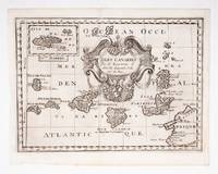
SANSON D'ABBEVILLE, Guillaume
Isles Canaries
c.1700. Original engraved map 19 x26.5 cm. overall sheet size 22 x 29 cm. of the Canaries with inset of Madeira. Central vertical fold. [c.1700] unknown
Referenz des Buchhändlers : 53608
|
|
|
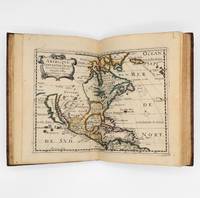
Sanson D'Abbeville, Nicolas
L'Amerique en Plusieurs Cartes & en divers Traittes de Geographie et d'Histoire
Paris: Chez L'Autheur 1657. 15 engraved double-page maps hand colored in outline. 4 40 of 42 unpaginated text leaves lacks final two leaves of text. 4to. Contemporary mottled calf gilt raised spine bands repairs at joints. Lacks final two leaves of text after the map of Brazil. 15 engraved double-page maps hand colored in outline. 4 40 of 42 unpaginated text leaves lacks final two leaves of text. 4to. First edition of important and quite handsome 17th-century French atlas of the Americas. This atlas was first published in 1657 and stands as a beautiful cartographic record of America for the 17th century. Sanson was official cartographer to the King. The maps include detailed charts of North South and Central America the West Indies Canada Mexico Florida and the southeast and a map of New Mexico showing most of the Spanish southwest territory with California depicted as an island. An impressive and detailed atlas for the time. The maps are titled as follows:<br /> 1 Americque Septentriole<br /> 2 Le Canada ou Nouvelle France &c.<br /> 3 La Floride<br /> 4 Audience de Mexico<br /> 5 Audience de Guadalajara Nouveau Mexique Californie &c.<br /> 6 Audience de Guatimala<br /> 7 Les Isles Antilles &c.<br /> 8 Amerique Meridionale<br /> 9 Terre Ferme Nouveau royme de Grenade &c.<br /> 10 Guiane divisee en Guiane et Caribane<br /> 11 Le Perou et le cours de la rivre Amazone<br /> 12 Le Chili<br /> 13 Le Brasil<br /> 14 Le Paraguay subdivise en ses principales parties suivant les dernieres relaons<br /> 15 Destroit de Magellan Terre et Isles Magellanicques &c. Sabin 76708; Phillips Atlases 1151; Streeter sale 68 undated edition; Leighley California as an Island plate 9 Chez L'Autheur unknown
Referenz des Buchhändlers : 375003
|
|
|
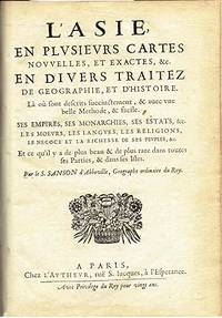
Sanson d'Abbeville, S
L'Asie en plusieurs cartes nouvelles et exactes &c. en divers traités de geographie et d'histoire. Là où sont descrits succinctement & avec une belle methode & facile. Ses empires ses monarchies ses estats &c. .
Paris: Chez L'autheur 1662. Book. Good. Full-Leather. 4to - over 9¾" - 12" tall. 104 pages. Text only lacking all maps. Sound leather binding a little war at the top of the spine. No publication date assumed 1662. Chez L'autheur Hardcover
Referenz des Buchhändlers : 6235
|
|
|
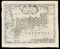
SANSON D'ABBEVILLE, Nicolas (I) and HALMA, Francois
Les Isles dv Iapon
Amsterdam: Chez Arnout van Ravenstein 1699. 222 by 272mm. 8.75 by 10.75 inches. Engraved map. Second state of the plate first published in Halma's pirated edition of Sanson's 'L'Asie en plvsiers cartes nouvelles et exactes;
' as part of 'L'Europe; L'Asie; L'Amerique
en Pluiers Cartes' 1683. A direct copy of Sanson's map of 1652 the only differences being the lack of a privilege and a date in the cartouche the addition of the signature of the engraver Antoine de Winter in the lower left corner. This issue is distinguished by the addition of mountains added in 'Isle de Corey' and 'Terre de Iesso'; and the 'Mer de Japan' above 'Oriental'. Francois Halma 1653-1722 set up his printing business in Utrecht in 1674 where he issued a number of pirated maps and atlases. In this instance since Sanson was dead Halma may have felt that there no harm and much profit to be gained from re-printing his work. The engraver Antoine de Winter c1652-1700 achieved some notoriety for plagiarizing Petter Gedda's charts of the Baltic Sea selling them on to Loots and Doncker for inclusion in their atlases who were subsequently sued and ordered to surrender the plates and pay a fine of 300 florins. Sanson originally credited "Caardin sic Varenius" and 'others' for his map. Generally the geography follows that of Moreira/Blancus only a small portion of the eastern coast of Korea is shown without stating whether it is an island or not and there is only a hint of Hokkaido in the far northeast corner with the place name Matzumay. Varenius or Bernhard Varen fl1622-1650 was a German physician geographer and natural historian. He settled in Amsterdam and was a friend of the Blaeu family. He published 'Descriptio regni Japonia
' in 1649 and came to be known as 'the father of physical geography' Hubbard. Sanson 1600-1667 was a French mapmaker. He supposedly began to make maps to supplement his study of history and a map of Ancient Gaul made early in his career brought him to the attention of Cardinal Richelieu. This foothold in the French court allowed him to rise to the position of Geographe du Roi teaching both Louis XIII and Louis XIV. Louis XIII even made him a counsellor of state. Sanson produced an atlas 'Cartes Generales de Toutes les Parties du Monde' which contained important maps of the post roads and waterways of France. He also produced two major maps of North America: 'Amerique Septentrionale' 1650 was the first map to show the Great Lakes in a recognisable form aided by Sanson's access to The Jesuit Relations a collection of accounts by French missionaries to the area. The map was also drawn on a sinusoidal projection which Sanson was the first to use. In 1656 he made 'Le Canada ou Nouvelle France' which showed the Great Lakes in greater detail and included accurate representations of the Hudson Bay area the Delaware and the Gulf of Saint Lawrence. After Sanson's death the business was carried on by his two surviving sons and grandson in partnership with Hubert Jaillot. Sanson family members were revered among the foremost map makers in France for nearly a century. A leading exemplar of the French school of seventeenth-century cartography Nicholas Sanson I is widely regarded as the founder of modern geography and it is generally held that the so called "Great Age" of French cartography originated with his publications Hubbard 51.2. Chez Arnout van Ravenstein, unknown
Referenz des Buchhändlers : 15831
|
|
|
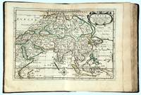
SANSON D'ABBELVILLE, Nicolas
L’Asie en plussieurs cartes nouvelles et exactes: & en divers traitses de geographie et d’histoire
Paris: chez l’Autheur 1662. SECOND EDITION. Complete with 17 double-page engraved maps hand-colored in outline. Contemporary mottled calf corner edges neatly repaired interior has some minor dampstaining mainly on text and on blank verso of maps last blank leaf torn on lower fore-edge. A contemporary signature on first blank leaf. Similar to L’Amerique this atlas of the continent of Asia was first printed in 1652 and reprinted here with a new title page. The maps are all dated 1652 with only one dated 1653 and do not include the address of Mariette. The atlas features maps of India Persia China Japan the Maldives Arabia and the Philippines among others. <br /> <br /> Just prior to publication of this series of works which also included atlases of Europe and Africa Sanson formed a partnership with Pierre Mariette an engraver and printseller. Pursuant to their contract Sanson drew the maps and Mariette engraved and printed them. Each maintained possession of half of the plates and they were allowed to exchange and/or buy from one another. Some bore the address of Sanson others Mariette. But Sanson allowed Mariette to store his plates and Mariette without prior agreement started placing his address on Sanson’s plates. In time a lawsuit which had been prosecuted was settled when both died and their respective sons took over the business.<br /> <br /> This atlas is a fine examples of French mapping by the foremost French cartographer of the seventeenth century. Sanson 1600-1667 “Geographe Ordinaire du Roi†to Louis XIII is considered the founder of French cartography and is generally acknowledged as the originator of the great age of French cartography. chez l’Autheur unknown
Referenz des Buchhändlers : 16493
|
|
|
Sanson d'Abbeville, Nicholas
Magellanica. De Straat van Magellanes met het Magellanisch Landt en d'Eilanden.
Americas: Amsterdam Francois Halma 1705. Copper engraved map of Peru by N. Sanson from Halma's Algemeene Werelde Beschryving Vol. 3 Black and white; title in Dutch; verso blank; strapwork title cartouche. Small map of Tierra del Fuego showing both the Strait of Magellan and Le Maire Strait. Inland detail is confined to a mountain range and several rivers and the mythical Destroit de Browers is labeled at far right. This map appeared in Algemeene Weereld-Beschryving nae de Rechte Verdeeling der Landschappen Plaetsen Zeeën Rivieren &c. Geographisch Politisch Historisch Chronologisch en Genealogisch a Dutch edition of A. Phérotée de la Croix's Nouvelle Methode Pour Apprendre Facilement la Geographie Universelle which first appeared in 1690. Dark impression. Nicolas Sanson d'Abbeville.1600-67 ' father of the French cartography' and founder of the Sanson firm. Atlas ' Cartes générales de toutes les parties du Monde' 1658-70 and a pocket atlas in 4 parts 1652-1705. Sanson's small maps from A. Phérotée de la Croix's Nouvelle Methode Pour Apprendre Facilement la Geographie Universelle. first published in 1652 and engraved by A. Peyrounin were copied several times by various map publishers. Johann David Zunners made copies of Sanson's maps for his German translation of Die Gantze Erd-Kugel in 1679. Johannes Ribbius and Simon de Vries published copies in 1682 and 1683 with new maps engraved by Antoine d'Winter. The plates were later sold to Francois Halma who used them in 1699 and then again in 1705 with the titles re-engraved in Dutch. François Halma 1653 - 1722 Dutch publisher/printer; dealer/auction house. Cartographer and publisher of maps active in Utrecht Amsterdam Franeker and Leeuwarden. Published 'Description de l'Univers' 1700; 'Algemene Wereldtbescrijving' 1705; 'Corpus Inscriptionum' 1707 and 'Lexicon Philosophicum' 1713. Halma acquired many of the plates for Algemeene Weereld-Beschryving from Joannes Ribbius who had enlisted the services of engraver Antoine de Winter to make copies of the maps in Nicolas Sanson's quarto atlases of the four continents. De Winter made very few geographical changes and maintained the attribution to Sanson on the newly engraved plates. Halma supplemented the Sanson maps with about a dozen new maps engraved in the same style as Sanson's without any attribution on the maps as well as 23 panoramic views of famous cities around the world. Keoman: Hal 1; Phillips 528. Americas South America Tierra del Fuego Magellanica Strait of Magellan Amsterdam Francois Halma 1705 unknown
Referenz des Buchhändlers : 3253
|
|

 Per e-mail erhalten
 Als pdf-Dokument herunterladen
 RSS feed
 Permanenter link


