|
ARMY MAP SERVICE [USA] U S A
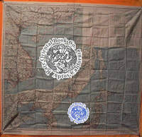
A.A.F. CLOTH MAP ASIATIC SERIES: No. C 52 & No. C 53. No. C 52 JAPAN & SOUTH CHI
Washington D.C. 1945 Army Map Service U.S. Army. Silk map folds down to ca. 12.5 x 14.5 cm. opens up to 83.5 x 83.5 cm. color printed 2 sides bright superbly clean unused copy as issued two maps in all like "NEW'. O B S C U R E . . . ORIGINAL WORLD WAR 2 SURVIVAL & EVASION MAP . .SHOWING A VERY LONG EAST COAST OF RUSSIA GULF OF SAKHALIN . . TARTARY STRAIGHT SOUTH DOWN THE COAST AMUR RIVER . . VLADIVOSTOK ALL OF MANCHURIA KOREA MUKDEN HSINKING . . DAIREN GULF OF CHILI BEIJING SHANGHAI WEIHAIWEI . . TSINGTAU NORTH HOKKAIDO & HONSHU KURIL ISLANDS AMOY . . SWATOW HONG KONG MACAO CANTON KWANGCHOW HAINAN . . YUNNAN KUNMING GUILIN LIUZHOU NANNING HANOI DOWN . . THE COAST TO VIETNAM LAOS CAMBODIA S. HONSHU KYUSHU . . TAIWAN PHILIPPINES HANGZHOU SUCHOW NANKING NINGBO . . FOOCHOW AMOY OKINAWA & TOO MANY OTHERS TO LIST . . SHOWING GREAT DETAILS: ROADS RAILROADS AND RIVERS . U.S.A.A.F. United States Army Air Force issue one on each side one sheet = 2 maps. in all printed in full color. . No. C-52: JAPAN AND SOUTH CHINA SEAS. Shows Yunnan Fu Kunming City in the uppermost left corner at about 24.5 degrees by 103 degrees; then Kweilin Guilin at 110 degrees and Amoy Xiamen Shanghai Nanking Nanjing Foochow and the edge of the Pescadores on the Tropic of Cancer at the north end of the map. . Includes the large operational area of the "FLYING TIGERS" "A.V.G." & the FOURTEENTH AIR FORCE in China. Including important airbase cities: Nanning Liuzhou Kweilin & Kunming. . Below these areas from the left or extreme west Laos Cambodia Phnom Penh Saigon Hanoi all of Indo-China Vietnam down to Paulau Condor sic Paolo Condor Island and the tip of Vietnam at 8 degrees. Hainan Island Macao Hong Kong up the coast to Shantou. . No. C-53: EAST CHINA SEAS: Shows Yenchowfu and Changtse upper left Part of Korea at 35 degrees Japan from Sendai down to Okinawa all of Formosa to the Philippines Baguio Manila all of that area down to Albay. Including Shanghai Nanjing Qingdao Hangzhou most of the east coast of China Taiwan & Korea. . The large inset to the right shows Sakhalin the Kuril Islands Hokkaido Northern tip of Honshu Aomori down to Kanazawa Choshi at about 36 degrees. The Amur River and much of extreme eastern Russia Vladivostok down the Pacific coast Manchuria Mukden Korea Port Arthur Dairen Gulf of Chili Beijing Paotingfu down to Suzhou at 34 degrees. Up the coast of the Yellow Sea Qingdao and that area. . The back side shows the balance of the map are from the front side. From the left Tsinan Yenchowfu Weihaiwei down the Yellow Sea along the Pacific coast to Nanjing Shanghai Hangzhou Ningbo Taichofu Wenchow Funing fu Lienkong Fuzhou Xiamen down to Yunsiaoh across the Formosa Straits to all of Taiwan Formosa South to the Philippines Bataan the main island of Luzon Manila down to almost 13 degrees south ending at Sorsogon Gubat. The rest of the right east portion shows the Marianas Islands Guam at the extreme lower right the Ogasawara Kanzan groups with Korea at the upper middle from about 37 degrees showing all from Shunsen Keijo Seoul down to Kanra San the southern island. Showing much of Japan from where the other map left off: Sakata on Honshu all of Japan Shikoku Kyushu Tokara Group the island chains Amami Okinawa groups Naha Ryukyu Islands/Okinawa down to Taiwan. . INSET MAPS: No. C-52: has one very large inset of N. Russia & N. Sakhalin south down to Korea Tsingtau and Chowfu. And Hokkaido Honshu down to Urawa 36 degrees south. . A second inset shows the key & legend to lines on the map currents winds scale 1/4000000 or 1/4m. heights in meters with 'Location Index" which is a key and guide to other adjacent maps in this series and this geographical area. . All part of the basic combat operation region for the U.S. A.A.F. U.S. Navy war against Japan. With ocean currents noted for possible air crew survival back to land. . USED BY THE "FLYING TIGERS:" This map and many similar to it were part of the "E & E" survival items issued to "FLYING TIGER" and "A.V.G." "AMERICAN VOLUNTEER GROUP" pilots. They were often tied around the neck by pilots and air crew while flying combat missions. . The map also has an Annual Magnetic Change compass miles scale kilometers nautical miles 1:1000 000 altitudes of land mass legend or key to symbols roads towns cities rivers mountains and an index to boundaries. . This map was part of the U.S. Army Air Force & Naval flyers "E & E" Escape and Evasion survival kit printed on thick silk parachute cloth. These maps were often worn by fighter and other air crew members as scarves to insure they would be with the downed airman if/when his plane or he had to parachute out into the sea or over land. Each air crew member carried among other survival supplies a .38 caliber pistol survival knife a signal mirror stainless steel or glass compass and some basic food rations fishing kit water purification tablets along with minor medical supplies; the whole kit was tucked into the pants pocket of the flight suit. . The majority of these perishable maps have been lost during World War II and very few survived the attrition of war time and humid climates. This map was considered the "LAST HOPE" for safe return to Allied lines. Given to fliers in the Pacific war against Japan. . Color photos are posted to our website. . . unknown
Référence libraire : 38000902
|
|
|
ARMY MAP SERVICE [USA] U S A
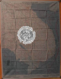
A.A.F. CLOTH MAP ASIATIC SERIES: No. 32 & No. 33. NO. 32 FRENCH INDO CHINA & NO
Washington D.C. 1943-44 U. S. Army Map Service. Silk map folds circa 10.3 x 7 cm.opens to ca. 51 x 65 cm.very good clean excellent copy2 color maps2 sides glossarylegend magnetic compass & current flows. FIRST EDITION FIRST ISSUE . . . ISSUED BY U.S. A.A.F. ARMY AIR FORCE . . "A.V.G." AMERICAN VOLUNTEER GROUP" & "FLYING TIGERS" . . & THE FOURTEENTH AIR FORCE IN CHINA & BURMA "CBI" . . . . AN ORIGINAL WORLD WAR2 SURVIVAL & EVASION MAP . . FOR "E. & E." & "FLYING TIGER" PILOTS FIGHTING JAPAN . . A SUPERB MAP OF SOUTHERN CHINA FROM KUNMING TO KWANGCHOW . . BAY JUST ABOVE HAINAN . . GUANGXI NANNING LIUZHOU GUILIN FROM CHONGQIN . . FRENCH INDO-CHINA HANOI . . FROM NORTH VIETNAM SOUTH & DOWN TO SAIGON . . INCLUDING THAILAND CAMBODIA & LAOS . This excellent and detailed cloth map was used by the "A.V.G." "AMERICAN VOLUNTEER GROUP" known as the "FLYING TIGERS" in the "I.E." "CHINA-BURMA-INDIA" theater throughout World War 2 in China Burma & Indo China. . This "E & E" "Escape & Evasion" cloth map was carried by pilots & air crew on combat missions and attacks on Japanese assets. This map was valuable to downed pilots and crew behind hostile and enemy lines. . It was first carried by the "A.V.G." fighter pilots in early 1942 when they first attacked the Japanese Air Force over Burma: air combat over Rangoon Touongoo and Southwest China Kunming Chiang Mai Thailand Hanoi and the strike against Japanese air planes parked at Noi Bai airfield. . The famous "Battle of Toungoo" Burma March 19-March 29 1942 was one of the key battles in the Battle of Yunnan-Burma Road in the Burma Campaign of World War II and Second Sino-Japanese War. The failure to hold the city of Toungoo opened up the route for the Japanese to make their lunge to Lashio around the allied flank and into the Chinese rear. The "A.V.G." fighter pilots performed brilliantly downing a substantial number of Japanese planes with minor losses to themselves. . This map and others like it for the adjacent areas were commonly worn on fighter pilot's neck or put in the pocket of the flight jacket survival vest or in the flight suit pant leg pocket. . MAP NO. 32 FRENCH INDO CHINA: A.A.F. Army Air Force issue. A pair of maps one on each side in color. Shows most of old Vietnam from just above 19 degrees north down to just below 9 degrees South and from 101 degrees at the West to 110 degrees to the West about half of Hainan Island the whole coast line from North to South down to Nga Ba Hoc Nang including Poulo Condore Saigon Nha Trang Tourane part of Thailand the West Cambodia and Laos Vientiane. . MAP NO. 33 CENTRAL CHINA: Shows: Ch'ung Ch'ching Chungqing down to Yunnan province and Kunming. Guangxi province: Guilin Liuzhou Nanning and points south to French Indo China. . Hanoi Kwangchow and the South China Sea with the North tip of Hainan Island the Gulf of Tonkin and the border between China & North Vietnam. . This area was all part of the basic combat region for the "A.V.G." & "FLYING TIGERS" later for the FOURTEENTH AIR FORCE. The Americans prosecuted the war against Japanese forces throughout this area. . With ocean currents noted for survival back to land. The map also has other important information for downed pilots such as an Annual Magnetic Change compass miles & kilometer scale nautical miles 1:1000 000 altitudes of land mass legend & key to symbols roads towns cities rivers mountains and an index to international boundaries. . This map was part of the U.S. Army Air Force & Naval flyers "E & E" Escape and Evasion survival kit printed on thick silk parachute or other indelible cloth. Each air crew member carried among other survival supplies a .38 caliber pistol survival knife a signal mirror stainless steel or glass compass and some survival food rations fishing kit water purification tablets along with minor medical supplies; the whole kit was tucked into flight suit pocket survival vest or flyers sheepskin jacket or trouser pockets. . The majority of these perishable maps have been lost during WW2 and very few survived. This map was a fliers "Last Hope" to get back to friendly forces once they parachuted our of their plane or after an unexpected landing behind Japanese lines. . CONDITION: In excellent clean condition folded as usual no soil or other issues. . Color photos are posted to our website. . REFERENCE: . BALDWIN R.E. et al.: LAST HOPE THE BLOOD CHIT STORY. DOLL John G.: CLOTH MAPS CHARTS AND BLOOD CHITS OF WORLD WAR 2. wikipedia-org/wiki/Battle_of_Toungoo . . unknown
Référence libraire : 38006901
|
|
|
ARMY MAP SERVICE [USA] U S A
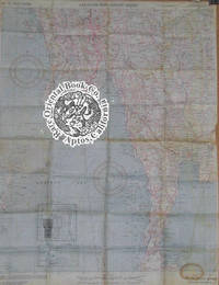
A.A.F. CLOTH MAP ASIATIC SERIES: No. C 43 & C 44. No. C 43 MINDANAO ISLAND And
Washington D.C. 1944 Army Map Service U.S. Army. Silk map folds down to be ca. 8.5 x 13.5 cm. opens up to ca. 95 x 52 cm. color printed flawless bright and superb copy as new condition directional magnetic compass 12 maps in all. . . . . ORIGINAL WORLD WAR 2 SURVIVAL & EVASION MAP . A.A.F.= Army Air Force. This silk cloth has two maps one per side. The first map shows Mindanao Basilan Island at the top the lower tip of Negros Siquijor as well as the Camigiun Islands & at the bottom or South end Jolo Island with an index inset showing a larger area map with this map located in the big picture. There is also an inset of a close-up of Mindanao Siargao and Panaon Islands. . The back side shows at the top the Southern part of Balbac Island and a good part of North Borneo down to Sibuko Bay the Tawitawi Group & the Jolo Island group to the extreme East. The Sulu Archipelago is at the lower right corner with an inset index to the larger area of the South China Sea. With an Annual Magnetic Change compass scale in miles kilometers nautical miles 1:1000000 legend or key to symbols roads towns cities rivers mountains and an index to the boundaries. . USED BY THE FLYING TIGERS: This map and many similar to it were part of the items issued to FLYING TIGER pilots and A.V.G. AMERICAN VOLUNTEER GROUP pilots. They were often tied around the neck to keep them warm while flying. . This map was part of the U.S. Army Air Force and Naval flyers "E & E" survival kit Escape & Evasion printed on silk parachute cloth. These maps were often worn by fighter and other air crew members as scarves to insure they would be with the downed airman if/when his plane or he had to parachute out into the sea or over land. . Each air crew member carried among other survival supplies a .38 caliber pistol survival knife a signal mirror stainless steel or glass compass & some basic food rations fishing kit water purification tablets along with minor medical supplies; the whole kit was tucked into the pant pocket of the flight suit. The mass majority of these maps have perished during World War II & few if any others survived the attrition rate of war time & climate prevented many from ever being brought back home. This map and others like it were issued to all fight crews in the Pacific war against Japan to insure that downed fliers had some chance to navigate their way back to friendly forces. . . unknown
Référence libraire : 25041301
|
|
|
ARMY MAP SERVICE [USA] U S A
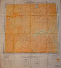
A.A.F. CLOTH CHART. No. NL 50 & No. NL 51. EASTERN ASIA. NL 50 BUIR NOR & NL. 51
Washington D.C. 1943-1944 Army Map Service.Silk maps color printed two sides exceptionally clean bright copy opens to 55 x 63 cm. folds to 14.5 x 17 cm. NL 50: 1944; NL 51: 1943 type AMS 2 both maps are the OBSCURE FIRST EDITIONS. . . . . MAP OF EASTERN ASIA . . . ORIGINAL WORLD WAR 2 "E & E" "ESCAPE & EVASION" . . . SURVIVAL MAP . . . USED BY "U.S. ARMY AIR FORCES A.A.F. "FLYING TIGERS" . . . PILOTS & AIR CREW OF THE 14TH & 23 AIR FORCES . . . THROUGHOUT CHINA 1942-1945 . This is one of the more obscure maps on An obscure map of North China Mongolia Manchuria the Great Wall & Heilongjiang formerly Lung-Chiang . This silk cloth map is color printed on both sides. . No.NL 50: BUIR NOR: shows from 48 degrees North to 44 South; 114 West to 120. From the North or top it shows Manchuria Buir Nor lake North Hsingan South down to Inner Mongolia Chahar West Hsingan. Three magnetic compasses. FIRST EDITION 1944 AMS 2. . No. NL 51 TSITSIHAR Lung-Chiang as in Heilongjiang: from 48 degrees North to 44 South; 120 West to 126 East. Shows the Great Wall from the great city of Lung-Chiang Black Dragon River down to Nung-an and much of the Sungari River. With three magnetic compasses. FIRST EDITION 1943 AMS 2. . INDEX OF COVERAGE: . NL 50: Manchuria Outer Mongolia Khalkha Mongols Silingol League Inner Mongolia Chahar Jo-odo League & West Hsingan. . NL 51: Hsing-an-tung Sheng Hsing-an-nan Sheng Pei-an Sheng Lung-Chiang Sheng Pin-Chiang Sheng Manchuria Hsing-an-Hsi Sheng Chi-lin Sheng & China. . With legend keys to map symbols. . INDEX TO ADJOINING SHEETS glossary scale: 1:1000000 with distance scale in miles kilometers and nautical miles altitude tints: key to heights by colors. . This map shows a good portion of the areas held by the Japanese during the Sino-Japanese war 1937-August 1945. . CONDITION: The maps are in excellent unused condition there are no stains or other flaws. Like "NEW" in collector's fine condition. . SURVIVAL MAP: . This map was part of the U.S. Army Air Force A.A.F. & Naval flyers "E & E" Escape and Evasion survival kit printed on thick silk parachute cloth. . These maps were often worn as neck scarves by fighter pilots and other air crew members as scarves for warmth and to insure if they went down the map would be available as their "Last Hope" to evade and escape the Japanese enemy. . Each air crew member carried among other survival supplies a .38 or .45 caliber pistol survival knife a signal mirror stainless steel or glass compass and basic food rations fishing kit water purification tablets minor medical supplies; the whole kit was tucked into the pant pocket of the flight suit. . The majority of these perishable maps have been lost during World War 2. Few survived the attrition rate of war time and sultry Asian climates. This map was given to American fliers in the Pacific war against Japan. It was the "last hope" & chance for downed fliers to navigate their way back to friendly forces. . REFERENCES: . BALDWIN R.E. et al.:LAST HOPE THE BLOOD CHIT STORY. DOLL John G.: CLOTH MAPS CHARTS AND BLOOD CHITS OF WORLD WAR 2. oth_escape_maps.htm#3.___Asiatic_Series . . unknown
Référence libraire : 27066501
|
|
|
ARMY MAP SERVICE [USA] U S A
A.A.F. CLOTH MAP ASIATIC SERIES: No. 34 & No. 35. No. 34 SOUTHEAST CHINA & No
Washington D.C. 1944 Army Map Service U.S. Army. Silk map folds down: 8.5 x 13.5 cm. opens up to 64.5 x 52 cm.clean flawless bright & excellent copy color 2 maps folded as issued. EXCELLENT EXAMPLE . . . . ORIGINAL WORLD WAR 2 "E & E" "ESCAPE & EVASION" . . . SURVIVAL CLOTH MAP USED BY :"FLYING TIGERS" & "A.V.G." . . . "AMERICAN VOLUNTEER GROUP" THROUGHOUT CHINA: . . . NANJING SHANGHAI HONG KONG MACAO CANTON XIAMEN . . FORMOSA TAIWAN FOOCHOW HANGCHOW HANKOW CHAOCHOU . . SWATOW NANKING NANJING KAI-FENG . . AND OTHER POINTS NORTH & SOUTH . A.A.F.= Army Air Force issue this pair of maps shows all the major parts of China from a bit above 38 degrees at the North and 109 degrees from the West to 123 degrees at the East and South down to just below 22 degrees including the South China sea the last island is one more degree South below Canton Hong Kong and Macao with a nice inset of all of Taiwan. This was the basic combat region for the Pacific war against Japan. . USED BY THE "A.V.G." & FLYING TIGERS THROUGHOUT CHINA: . This map and many similar to it were part of the items issued to FLYING TIGER pilots and A.V.G. AMERICAN VOLUNTEER GROUP pilots. They were often tied around the neck to keep them warm while flying. . A CLOTH MAP COLOR PRINTED ON TWO SIDES: . Number 34 SOUTHEAST CHINA: Sshows from Nan-Ching Nanking or Nanjing this city is also shown on both sides of this maps to North down to Tao-chuang-fou St. John Island with Macau Hong Kong Canton. To the right is an inset map showing all of Formosa Taiwan. The whole Eastern coast of China from Tao-chuang-fou up to just above Shanghai. . Number 35 NORTHEAST CHINA: From Miao Lieh-tao island Lai-chou Wan at the far East and Li-ch-eng city to the Great Wall at extreme West at the Yellow River. Down South to Hankow Hang-chow area. K'ai-feng is about in the center of this map. With an inset of and index to the other maps in this area and series sea currents key guide to symbols. . A detailed map showing a substantial number of small towns big cities lakes rivers train routes roads major highways &c. With seasonal ocean currents noted for possible survival back to land. The map also has an index inset to related other area silk maps. Miles scale kilometers nautical miles legend or key to symbols roads towns cities rivers & mountains. This map was part of the U. S. Army Air Force & Naval flyers "E & E" survival kit "Escape and Evasion" printed on thick silk parachute cloth. . These maps were often worn by fighter pilots and other air crew members as scarves to insure they would be with the downed airman if/when his plane or he had to parachute out into the sea or over land. Each air crew member carried among other survival supplies a .38 or .45 caliber pistol survival knife a signal mirror stainless steel or glass compass and some basic food rations fishing kit water purification tablets along with minor medical supplies; the whole kit was tucked into the pant pocket of the flight suit. . The majority of these perishable maps have been lost during World War 2 and few if any others survived the attrition rate of war time and climate prevented many from ever being brought back home. This map was given to fliers in the Pacific war against Japan to insure downed fliers had some chance to navigate their way back to friendly forces. These maps are truly RARE and seldom found on the market. . Color photos are posted to our website. . . unknown
Référence libraire : 25041203
|
|
|
Army Map Service, US-Army (Editor)
A.M.S. 1106. 20/4/1947/ENGR. BASE PLANT/1442.
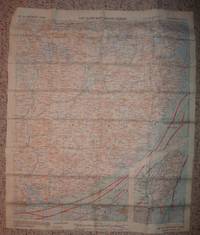
1944. Washington. AMS. 1944/47. ca. 91 x 88 cm. 1 map English Language. Original map folded with title to front cover. Low signs of use a bit browning at the back. Appropriate to its age in good condition. Die vorliegende Karte beinhaltet den geographischen Stand bis 1945. Sie zeigt Europa Asien Afrika und den Großteil Ozeaniens. Sie trägt oben den Hinweis: "For use by War and Navy Department Agencies only". / The military map shows Europe Asia Africa and wide parts of Australia. The map contains the geographic status up to 1945 and contains the note "For use by War and Navy Department Agencies only". unknown
Référence libraire : 8061C
|
|
|
Army Map Service
AAF Cloth Map -- Asiatic Series / No. 34 Southeast China; No. 35 Northeast China
Washington DC: Army Map Service. Very Good with no dust jacket. 1944. Map. This is a survival map issued to airman on missions which might result in going down in or near China. It contains information on wind and currents along with the usual feature of a physical map. It is printed on 26.5" x 20" silk-like fabric two maps back to back and folded to a 3"x5" size. The maps were compiled in 1943 and are dated 1944. This map shows no signs of use and is in very good condition. . Army Map Service unknown
Référence libraire : 870171
|
|
|
ARMY MAP SERVICE - CORPS OF THE ENGINEERS US ARMY U S
Belvoir VA. ; MD. Fort Belvoir and vicinity. Refer to this map as: Sheet 5561 II NW
Washington: Army Map Service ca. 1956.- Es un mapa a escala 1 : 25.000 en colores y plegado de 71 x 544 cm; Texto en inglés.- Al verso tiene la totografÃa aérea del área cartografiada en el mapa. Excelente estado. GEOGRAFÃA GUÃAS Y ATLAS DEL EXTRANJERO Book in english Army Map Service paperback
Référence libraire : 48005
|
|
|
Army Map Service
Charlottesville
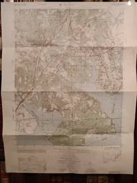
U.S. Geological Survey 1961. Scale 1:250000. V.g. Flat map 81 cm w. 56 cm h. Topographic map showing the town of Charlottesville the Blue Ridge mountains and the Great Appalachian Valley. Tracing paper overlay included. U.S. Geological Survey unknown
Référence libraire : 19595
|
|
|
Army Map Service
Conakry West Africa. NC 28-9 AMS Series G 501
Washington DC: Army Map Service 1947. Tri-color map 25 x 38 in. 1:250k scale; showing roads settlements elevation etc.; some short closed tears at edges one old fold University of Chicago discard stamps on verso very good. While Conakry is present on the map the focus is on the greater region stretching out into Sierra Leone. University of Minnesota only in OCLC. Army Map Service unknown
Référence libraire : 70125
|
|
|
Army Map Service
Dalan-Dzadagad. AMS map series 1301 NK-48
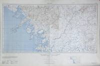
Washington D.C.: Army Map Service 1950. First edition broadside map 16 x32 in. 1:1000000 scale; showing roads boundaries settlements boundaries elevation etc.; fine. Dalanzadgad is a city in south-central Mongolia. This map was produced as part of the International Map of the World project. The project was the cartographical brain child of Albrecht Penck who in the late 19th century conceived of a series of maps uniformly produced that would cover the whole of the Earth's land mass. To accomplish this the planet was divided into 2500 segments and each segment was to be produced independently by various governments and NGOs. The project was envisioned to be strictly apolitical but this meant that buy-in was slow for governmental bodies and the lack of thematic information frustrated potential contributors in industry and led to University of Wisconsin cartographer Arthur Robinson declaring the resulting maps "cartographic wallpaper." When government agencies did contribute they did so as here in service to a bald political interest in a given region. Army Map Service unknown
Référence libraire : 70445
|
|
|
Army Map Service
Detroit sheet NK 17-4
U.S. Geological Survey 1952. Scale 1:250000. V.g. Flat map 74 cm w. 61 cm h. Topographic map showing Lake St. Clair and part of Lake Erie. Enlarged plans of Flint Pontiac Ann Arbor and Detroit on rear of map. U.S. Geological Survey unknown
Référence libraire : 19617
|
|
|
Army Map Service
Las Vegas Western United States series
U.S. Geological Survey 1962. Scale 1:250000. V.g. Flat map 81 cm w. 56 cm h. Topographic map showing the city of Las Vegas part of Lake Mead and the Spring and Virgin Mountains. U.S. Geological Survey unknown
Référence libraire : 19594
|
|
|
ARMY MAP SERVICE - CORPS OF ENGINEERS, U S ARMY
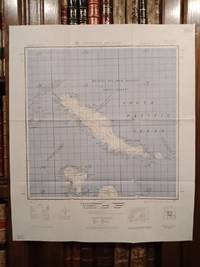
Mapa de CHOISEUL ISLAND Melanesia
Washington: Army Map Service ca. 1959.- Mapa en colores plegado de 645 x 55 cm Scale 1: 500.000; Refer to this map as: SHEET SB 57-4 Series X401; Texto en inglés. Tan solo tiene los nombres de algunos pueblos o zonas costeras manuscritos a bolÃgrafo azul. Por lo demás en perfecto estado. GEOGRAFÃA GUÃAS Y ATLAS DEL EXTRANJERO Book in english Army Map Service paperback
Référence libraire : 48007
|
|
|
ARMY MAP SERVICE - CORPS OF ENGINEERS, U S ARMY
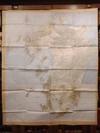
Mapa de FUKUOKA - KORURA Japan
Washington: Army Map Service ca. 1954.- Mapa en colores plegado de 142 x 1153 cm Scale 1: 250.000; Texto en inglés. Los bordes están reforzados con papel adhesivo. Salvo esto el mapa en buen estado. GEOGRAFÃA GUÃAS Y ATLAS DEL EXTRANJERO Book in english Army Map Service paperback
Référence libraire : 48009
|
|
|
ARMY MAP SERVICE - CORPS OF ENGINEERS, U S ARMY
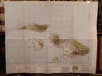
Mapa de MAUI Hawiian Islands
Washington: Army Map Service ca. 1952.- Mapa en colores plegado de 545 x 682 cm Scale 1: 250.000 Location diagram for NF 4-16; Texto en inglés. Excelente estado. GEOGRAFÃA GUÃAS Y ATLAS DEL EXTRANJERO Book in english Army Map Service paperback
Référence libraire : 48006
|
|
|
ARMY MAP SERVICE - CORPS OF ENGINEERS, U S ARMY
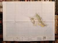
Mapa de OAHU = HONOLULU Hawaiian Islands
Washington: Army Map Service ca. 1952.- Mapa en colores plegado de 555 x 725 cm Scale 1: 250.000 Location diagram for NF 4-11; Texto en inglés. Excelente estado. GEOGRAFÃA GUÃAS Y ATLAS DEL EXTRANJERO Book in english Army Map Service paperback
Référence libraire : 48008
|
|
|
Army Map Service
Road map of India. A.M.S. 5206
Washington DC: Army Map Service 1944. Third edition color map 44 x 32 in. 50 miles to 1 in. scale; Includes roads railroads places of possible delay and places with available lodging. Two insets for the eastern and western extremities; two closed tears at top edge not reaching border a little bit of creasing one old fold withdraw stamps from the University of Chicago Library on verso very good. "Prepared under the direction of the Chief of Engineers by the Army Map Service ; reproduced . from pulls of a Survey of India 1942 edition map. Army Map Service unknown
Référence libraire : 70121
|
|
|
Army Map Service
Sioelakmoekei. West Sumatra
Washington DC: Army Map Service 1943. First edition broadside topographical map 24 x 20 in. 1:100000 scale printed in blue and black; a detailed map with a legend including hedges ruins warehouses fences telephone lines etc. Fine. AMS T614 Sheet XIV. OCLC lists one copy at the National Library of Indonesia. Army Map Service unknown
Référence libraire : 70141
|
|
|
Army Map Service
The world / compiled and drawn under the direction of the Chief of Engineers by the Army Map Service SN U.S. Army Washington D.C. Large Pull Down Map
Army Map Service 1943. Maps. Very Good. 138 x 265 cm. Color map mounted on muslin rods top and bottom. Hanging hooks broken. Scale 1:11000000. 1 in.=174 mi. at the equator ; Mercator projection W 15--W 15/N 85--S 67. Includes capitals large cities shipping and nautical miles between principal ports. "Boundaries of Europe as of August 31 1939." A.M.S. 1101. <br> Note: This is a large heavy map. Additional postage will apply depending on delivery location Army Map Service unknown
Référence libraire : 2312170013
|
|
|
ARMY MAP SERVICE - CORPS OF ENGINEERS, U S ARMY
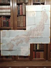
Two maps CENTRAL JAPAN and SOUTHERN JAPAN
Washington: Army Map Service ca.1957.- Two color maps folded 102 x 64 cm Central and 71 x 755 cm Southern; Scale 1:1.000.000; Texto en inglés. Tienen en los bordes señales de haber estado pegados con papel celofán adhesivo. En general buen estado. GEOGRAFÃA GUÃAS Y ATLAS DEL EXTRANJERO Book in english Army Map Service paperback
Référence libraire : 48010
|
|
|
Army Map Service
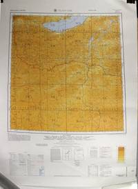
Ulan-Ude. AMS map series 1301 NM 48
Washington DC: Army Map Service 1964. Second edition first printing color broadside maps 28¾" x 22"; 1:1000000 scale; displaying boundaries roadways settlements and elevations; fine. Ulan-Ude is a Russian city close to the Mongolian border near Lake Baikal. This map was produced as part of the International Map of the World project. The project was the cartographical brain child of Albrecht Penck who in the late 19th century conceived of a series of maps uniformly produced that would cover the whole of the Earth's land mass. To accomplish this the planet was divided into 2500 segments and each segment was to be produced independently by various governments and NGOs. The project was envisioned to be strictly apolitical but this meant that buy-in was slow for governmental bodies and the lack of thematic information frustrated potential contributors in industry and led to University of Wisconsin cartographer Arthur Robinson declaring the resulting maps "cartographic wallpaper." When government agencies did contribute they did so as here in service to a bald political interest in a given region. Army Map Service unknown
Référence libraire : 70441
|
|
|
Army Map Service
Western United States 1: 250000 - Tularosa NM- NI 13-7 Series V502P
Washington D.C: Corps of Engineers US Army 1957. Edition 1-AMS First Printing 7-57 . No Binding. Near Fine/No Jacket. Elephant Folio - over 15" - 23" tall. Map; 21x33" plastic relief map. Molded in 1957 from aerial photography taken 1954. "1955 magnetic declination for this sheet varies from 13degrees00' easterly for the center of the west edge to 12degrees45' easterly for the center of the east edge. Mean annual change is 0degees02' westerly. <br/> <br/> Corps of Engineers, US Army unknown
Référence libraire : 045476
|
|
|
Army Map Service
Western United States 1: 250000 - Silver City NM - NI 12-12 Series V502P
Washington D.C: Corps of Engineers US Army 1964. Edition 2-AMS . No Binding. Near Fine/No Jacket. Elephant Folio - over 15" - 23" tall. Map; 21x34" plastic relief map. Molded in 1964 from aerial photography taken 1954. "1960 magnetic declination from true north for this sheet varies from 13degrees 230 mils easterly for the center of the west edge to 12&1/2degrees 220 mils easterly for the center of the east edge." Stock No. V502PNI1212 <br/> <br/> Corps of Engineers, US Army unknown
Référence libraire : 045475
|
|
|
Army Map Service, US-Army (Editor)
A.M.S. 1106. 20/4/1947/ENGR. BASE PLANT/1442. Reproduced under the direction of the Chief of Engineers by the Army Map Service, U.S. Army, Washington, D.C., 1944.
Washington., AMS., 1944/47. (ca. 91 x 88 cm). 1 map (English Language). Original map, folded, with title to front cover. Low signs of use, a bit browning at the back. Appropriate to its age in good condition.
Référence libraire : 8061C
|
|
|
Army Map Service, US-Army (Editor):
A.M.S. 1106. 20/4/1947/ENGR. BASE PLANT/1442. Reproduced under the direction of the Chief of Engineers by the Army Map Service, U.S. Army, Washington, D.C., 1944.
(ca. 91 x 88 cm). 1 map (English Language). Original map, folded, with title to front cover. Low signs of use, a bit browning at the back. Appropriate to its age in good condition. Die vorliegende Karte beinhaltet den geographischen Stand bis 1945. Sie zeigt Europa, Asien, Afrika und den Großteil Ozeaniens. Sie trägt oben den Hinweis: "For use by War and Navy Department Agencies only". / The military map shows Europe, Asia, Africa and wide parts of Australia. The map contains the geographic status up to 1945 and contains the note "For use by War and Navy Department Agencies only".
|
|
|
ARMY MATERIEL COMMAND ALEXANDRIA VA
A Guide for Soldiers: Quality Information for a Quality Force
PN. New. 1997. . Soft Cover. Date is original print. This is a reprint edition . PN paperback
Référence libraire : 299242
|
|
|
ARMY MATERIEL COMMAND ALEXANDRIA VA
Annual Historical Review FY89
PN. New. 1991. Soft Cover. Date is original print. This is a reprint edition . PN paperback
Référence libraire : 243593
|
|
|
ARMY MATERIEL COMMAND ALEXANDRIA VA
Biotechnology: Opportunities to Enhance Army Capabilities
PN. New. 1989. Soft Cover. Date is original print. This is a reprint edition. . PN paperback
Référence libraire : 798108
|
|
|
ARMY MATERIEL COMMAND ALEXANDRIA VA
Debriefing Handbook: A Practical Guide for Conducting Post-Award Debriefings. Volume 6
PN. New. 1995. Soft Cover. Date is original print. This is a reprint edition . PN paperback
Référence libraire : 274970
|
|
|
ARMY MATERIALS RESEARCH AGENCY WATERTOWN MA
Defense Conference on Nondestructive Testing
PN. New. 1966. Soft Cover. Date is original print. This is a reprint edition. . PN paperback
Référence libraire : 730572
|
|
|
ARMY MATERIEL COMMAND ALEXANDRIA VA
Department of Defense In-House RDT&E Activities
PN. New. 1986. Soft Cover. Date is original print. This is a reprint edition. . PN paperback
Référence libraire : 777398
|
|
|
ARMY MATERIEL DEVELOPMENT AND READINESS COMMAND ALEXANDRIA VA
Department of Defense In-House RDT&E Activities
PN. New. 1984. Soft Cover. Date is original print. This is a reprint edition. . PN paperback
Référence libraire : 772918
|
|
|
ARMY MATERIEL COMMAND ALEXANDRIA VA
Department of Defense In-House RDT and E Activities. Management Analysis Report
PN. New. 1988. Soft Cover. Date is original print. This is a reprint edition. . PN paperback
Référence libraire : 787530
|
|
|
ARMY MATERIEL DEVELOPMENT AND READINESSCOMMAND ALEXANDRIA VA
Department of Defense In-House RDT&E Activities
PN. New. 1983. Soft Cover. Date is original print. This is a reprint edition. . PN paperback
Référence libraire : 769948
|
|
|
ARMY MATERIEL COMMAND ALEXANDRIA VA
Department of Defense In-House RDT and E Activities. Management Analysis Report
PN. New. 1987. Soft Cover. Date is original print. This is a reprint edition. . PN paperback
Référence libraire : 780256
|
|
|
ARMY MATERIEL COMMAND ALEXANDRIA VA
ENGINEERING DESIGN HANDBOOK. BALLISTIC MISSILE SERIES STRUCTURES
PN 1963-01-01. Paperback. Good. 0x0x0. AMCP 706-286 1963. Pamphlet PN paperback
Référence libraire : 190928001
|
|
|
ARMY MATERIEL COMMAND ALEXANDRIA VA
ENGINEERING DESIGN HANDBOOK. DESIGN OF AERODYNAMICALLY STABILIZED FREE ROCKETS
PN 1968-01-01. Paperback. Good. 0x0x0. Slight moisture stain on back cover and last few pages PN paperback
Référence libraire : 191114001
|
|
|
ARMY MATERIEL COMMAND ALEXANDRIA VA
Engineering Design Handbook. Experimental Statistics. Section 3. Planning and Analysis of Comparative Experiments
PN. New. 1969. Soft Cover. Date is original print. This is a reprint edition. . PN paperback
Référence libraire : 738724
|
|
|
ARMY MATERIEL COMMAND ALEXANDRIA VA
Engineering Design Handbook. SABOT Technology Engineering
PN. New. 1972. Soft Cover. Date is original print. This is a reprint edition. . PN paperback
Référence libraire : 744765
|
|
|
ARMY MATERIEL COMMAND ALEXANDRIA VA
ENGINEERING DESIGN HANDBOOK. MILITARY PYROTECHNICS SERIES. PART FIVE - BIBLIOGRAPHY
PN. New. 1966. Soft Cover. Date is original print. This is a reprint edition. . PN paperback
Référence libraire : 730541
|
|
|
ARMY MATERIEL COMMAND ALEXANDRIA VA
Engineering Design Handbook. Criteria for Environmental Control of Mobile Systems.
PN. New. 1971. Soft Cover. Date is original print. This is a reprint edition. . PN paperback
Référence libraire : 742214
|
|
|
ARMY MATERIEL DEVELOPMENT AND READINESSCOMMAND ALEXANDRIA VA
Engineering Design Handbook. Army Weapon Systems Analysis. Part 2
PN. New. 1979. Soft Cover. Date is original print. This is a reprint edition. . PN paperback
Référence libraire : 759646
|
|
|
ARMY MATERIEL COMMAND ALEXANDRIA VA
ENGINEERING DESIGN HANDBOOK. MILITARY PYROTECHNICS SERIES. PART THREE. PROPERTIES OF MATERIALS USED IN PYROTECHNIC COMPOSITIONS
PN. New. 1963. Soft Cover. Date is original print. This is a reprint edition. . PN paperback
Référence libraire : 723309
|
|
|
ARMY MATERIEL COMMAND ALEXANDRIA VA
Engineering Design Handbook System Analysis and Cost-Effectiveness.
PN. New. 1971. Soft Cover. Date is original print. This is a reprint edition. . PN paperback
Référence libraire : 741447
|
|
|
ARMY MATERIEL COMMAND ALEXANDRIA VA
ENGINEERING DESIGN HANDBOOK. AMMUNITION SERIES SECTION 5 INSPECTION ASPECTS OF ARTILLERY AMMUNITION DESIGN
PN. New. 1966. Soft Cover. Date is original print. This is a reprint edition. . PN paperback
Référence libraire : 728861
|
|
|
ARMY MATERIEL COMMAND ALEXANDRIA VA
ENGINEERING DESIGN HANDBOOK. AMMUNITION SERIES. SECTION 4. DESIGN FOR PROJECTION
PN. New. 1964. Soft Cover. Date is original print. This is a reprint edition. . PN paperback
Référence libraire : 725003
|
|
|
ARMY MATERIEL DEVELOPMENT AND READINESS COMMAND ALEXANDRIA VA
Engineering Design Handbook. Metric Conversion Guide.
PN. New. 1976. Soft Cover. Date is original print. This is a reprint edition. . PN paperback
Référence libraire : 752429
|
|
|
ARMY MATERIEL COMMAND ALEXANDRIA VA
Engineering Design Handbook: Military Vehicle Electrical Systems.
PN. New. 1974. Soft Cover. Date is original print. This is a reprint edition. . PN paperback
Référence libraire : 748446
|
|
|
ARMY MATERIEL COMMAND ALEXANDRIA VA
Engineering Design Handbook. Military Vehicle Power Plant Cooling
PN. New. 1975. Soft Cover. Date is original print. This is a reprint edition. . PN paperback
Référence libraire : 750228
|
|

 Recevoir par e-mail
 Télécharger en PDF
 Flux RSS
 Lien permanent


