|
|
|
ORDNANCE SURVEY
Ordnance Survey Road Map of Carlisle. Sheet 2. Layers. Scale: Half-Inch to One Mile. BRIGHT, CLEAN COPY OF THE 1929 ISSUE
Folding coloured map on cloth measuring 22 x 30 ins (approx. 56 x 76 cms) folding in 21 panels to 7.0 x 4.0 ins (approx. 17.7 x 10.1 cms); original pictorial card wrappers, neat stamp on rear wrapper, a very good, bright, clean copy The Half-Inch Layered series with striking 'car and signpost' cover by Ellis Martin was first issued in in 1913; Sheet 2 was first published in that year. The cover is 'car and signpost' in green and brown with green sheet name. This is the 1929 revision. SCARCE IN THIS CONDITION. Browne, 12.2a.

|
|
|
ORDNANCE SURVEY
Ordnance Survey Road Map of Liverpool, Manchester and Chester. Sheet 12. Layers. Scale: Half-Inch to One Mile. BRIGHT, CLEAN COPY OF THE WWII ISSUE
Folding coloured map on cloth measuring 22 x 30 ins (approx. 56 x 76 cms) folding in 21 panels to 7.0 x 4.0 ins (approx. 17.7 x 10.1 cms); original pictorial card wrappers, neat stamp on rear wrapper, a very good, bright, clean copy The Half-Inch Layered series with striking 'car and signpost' cover by Ellis Martin was first issued in in 1913; Sheet 12 was first published in that year. The cover is 'car and signpost' in green and brown with green sheet name. This is the 1938 revision with roads corrected to 1937. SCARCE IN THIS CONDITION. Browne, 12.2a.

|
|
|
ORDNANCE SURVEY
Ordnance Survey Road Map of North Devon. Sheet 31. Layers. Scale: Half-Inch to One Mile NEAR FINE COPY
Folding coloured map on cloth measuring 32 x 29 ins (approx. 81.25 x 73.6 cms) folding in 21 panels to 7.5 x 4.5 ins (approx. 19.05 x 10.75 cms); original pictorial card wrappers, a remarkably well-preserved, bright, near fine copy. Superb example of Ellis Martin's famous 'car with signpost' cover. This is the green and brown variant used for district maps in 1919. Revised issue of a map first published in 1915. Browne 12.2a.

|
|
|
ORDNANCE SURVEY
Ordnance Survey Road Map of North Devon. Sheet 31. Scale: Half-Inch to One Mile. BRIGHT, CLEAN COPY
Folding coloured map on cloth measuring 29.5 x 22 ins (approx. 65 x 56 cms) folding in 21 panels to 7.5 x 4.5 ins (approx. 19 x 12 cms), a few contemporary annotations in ink in a neat hand; original pictorial card wrappers, a very good, bright, clean copy. The Half-Inch series began in 1919; this is a 1920s reissue. The cover is Ellis Martin's 'car passing signpost' in green and brown. Browne, 12.2.a

|
|
|
ORDNANCE SURVEY
Ordnance Survey Road Map of Norwich and Great Yarmouth. Sheet 19. Layers. Scale: Half-Inch to One Mile. BRIGHT, CLEAN COPY OF THE WWII ISSUE
Folding coloured map on cloth measuring 22 x 30 ins (approx. 56 x 76 cms) folding in 21 panels to 7.0 x 4.0 ins (approx. 17.7 x 10.1 cms); original pictorial card wrappers, neat stamp on rear wrapper, a very good, bright, clean copy The Half-Inch Layered series with striking 'car and signpost' cover by Ellis Martin was first issued in in 1913; Sheet 19 was first published in 1914. The cover is 'car and signpost' in green and brown with green sheet name. This is the 1938 revision with roads corrected to 1937. SCARCE IN THIS CONDITION. Browne, 12.2a.

|
|
|
ORDNANCE SURVEY
Ordnance Survey Road Map of Oxford and Swindon. Sheet 28. Layers. alf Inch to One Mile. [Ellis Martin cover]. BRIGHT, CLEAN COPY
Folding coloured map on paper measuring 22 x 30 ins (approx. 56.0 x 76.0 cms) folding in 21 panels to 7.5 x 4.25 ins (approx. 19.0 x 11.0 cms); original pictorial card wrappers, wrappers lightly age-soiled else a very good, bright, clean copy. The Half Inch series was first issued in 1919 with striking 'motorist' artwork by Ellis Martin. The present copy is the 1935 revision; the covers are the green and brown variant with green sheet name. Browne, 12.2.a

|
|
|
ORDNANCE SURVEY
Ordnance Survey Road Map of Sheffield. Sheet 13. Hill-Shaded. Scale: Half-Inch to One Mile. BRIGHT, CLEAN COPY OF THE 1915 ISSUE
Folding coloured map on cloth measuring 21 x 30 ins (approx. 56 x 76 cms) folding in 24 panels to 7.0 x 4.0 ins (approx. 17.7 x 10.1 cms); original pictorial card wrappers, neat stamp on rear wrapper, a very good, bright, clean copy The Half-Inch Layered series with striking 'car and signpost' cover by Ellis Martin was first issued in in 1913; Sheet 13 was first published in 1915. The cover is 'car and signpost' in green and brown with green sheet name. SCARCE IN THIS CONDITION. Browne, 12.2a.

|
|
|
ORDNANCE SURVEY
Ordnance Survey Road Map of Sheffield. Sheet 13. Layers. Half-Inch to One Mile. [Ellis Martin cover].
Folding coloured map on cloth measuring 22 x 30 ins (approx. 55.5 x 76.0 cms) folding in 21 panels to 7.5 x 4.25 ins (approx. 19.0 x 11.0 cms); original pictorial card wrappers, neat contemporary signature on front wrapper, wrappers lightly age-soiled else a very good, bright, clean copy. With the trade ticket of Moyse of Sheffield on rear wrapper. The Half Inch series was first published in 1919 with striking 'motorist' artwork by Ellis Martin. The present copy is the 1939 revision; the covers are the green and brown variant with green sheet name. Browne, 12.2.a

|
|
|
ORDNANCE SURVEY
Ordnance Survey Road Map of Weymouth, Yeovil and Taunton. Sheet 37. Layers. Scale 1/2 Inch to One Mile. BRIGHT, CLEAN COPY
Folding coloured map on cloth measuring 22 x 29 ins (approx. 59 x 74 cms) folding in 21 panels to 7.5 x 4.5 ins (approx. 17.7 x 10.5 cms), original pictorial card wrappers, a very good, bright, clean copy First issued in 1928. This is the 1937 reissue with minor corrections. The cover is Ellis Martin's 'car passing signpost' in green and brown. Browne, 12.2.a.

|
|
|
ORDNANCE SURVEY
Ordnance Survey Road Map of Whitby and Scarborough. Sheet 7. Layers. Scale: Half-Inch to One Mile. BRIGHT, CLEAN COPY OF THE 1915 ISSUE
Folding coloured map on cloth measuring 22 x 30 ins (approx. 56 x 76 cms) folding in 21 panels to 7.0 x 4.0 ins (approx. 17.7 x 10.1 cms); original pictorial card wrappers, neat stamp on rear wrapper, a very good, bright, clean copy The Half-Inch Layered series with striking 'car and signpost' cover by Ellis Martin was first issued in in 1913; Sheet 7 was first published in 1915. The cover is 'car and signpost' in green and brown with green sheet name. SCARCE IN THIS CONDITION. Browne, 12.2a.

|
|
|
ORDNANCE SURVEY
Ordnance Survey Two and a Half Inch Map. [Petersfield. Chichester. Worthing]. Sheet 41/90. Scale: 1: 25,000. Two and a Half Inches to One Mile. BRIGHT, CLEAN COPY
Folding coloured map on cloth measuring 21.0 x 18.0 ins (approx. 53 x 45 cms) folding in 12 panels to 9.0 x 5.0 ins (approx. 22 x 13 cms), one or two tears at folds; original pictorial card wrappers, some light dust-soiling else a good, bright, clean copy. The 1:25000 Provision Edition was published from 1945 onwards. The cover is Vann's 'Six Lines' in blue and black with index map on buff. . Browne, 98.1.

|
|
|
ORDNANCE SURVEY
Ordnance Survey. [Carlisle. Newcastle upon Tyne]. Sheet 1. Scale: Quarter Inch to One Mile. BRIGHT, SOUND COPY WITH SCARCE ADHESIVE COVER
Folding coloured map on cloth measuring 27.0 x 34.0 ins (approx. 68 x 86 cms) folding in 36 panels to 7.0 x 4.0 ins (approx. 17.7 x 10.0 cms), some mild age-soiling; ORIGINAL PRINTED LINEN COVER (present but detached), covers mildly age-soiled else a good, sound copy. The Quarter Inch Second Edition series began in 1909. Sheet 1 filled in with Scotland was published in 1915. The cover is the original 'Ordnance Survey' with location map, first adopted around 1910. THIS IS THE SCARCE ADHESIVE LINEN COVER (present but detached; the adhesive generally fails with age). SCARCE. Browne, 4.2.

|
|
|
ORDNANCE SURVEY
Ordnance Survey. Canterbury. Sheet 40. Scale: 2 Miles to One Inch. BRIGHT, CLEAN COPY OF THE 1909 REVISION
Folding coloured map on cloth measuring 26.5 x 24.5 ins (approx. 67 x 62 cms) folding in 28 panels to 7.5 x 4.5 ins (approx. 19.0 x 12.0 cms); original pictorial card wrappers, some light dust-soiling, small neat signature on front card, a very good, bright, clean copy. The cover is the redrawn 'Ordnance Survey' with official Royal Arms. Sheet 40 was first published in 1906. This is the 1909 revision. SCARCE IN THIS CONDITION. Browne, 7.1.b.

|
|
|
ORDNANCE SURVEY
Ordnance Survey. St. Albans. (Large Sheet Series with Layers). Sheet 29. Scale: Two Miles to One Inch.
Folding coloured map on cloth measuring 20.5 x 28.5 ins (approx. 52.0 x 72.0 cms) folding in 24 panels to 7.0 x 3.75 ins (approx. 17.75 x 9.5 cms), some mild age-soiling; original white cloth wrappers blocked and lettered in black, wrappers mildly age-soiled and lightly frayed at extremities else a good, clean copy.

|
|
|
ORDNANCE SURVEY
Ordnance Survey.Quarter-Inch Map. The Eastern Highlands. Fourth Edition with National Grid. Sheet 5. [Scale: Quarter-Inch to One Mile]. BRIGHT, CLEAN COPY OF THE 1946 ISSUE
Folding coloured map on paper measuring 24.0 x 35.0 ins (approx. 61 x 89 cms) folding in 16 panels to 12.5 x 5.0 ins (approx. 32.0 x 13 cms); printed card covers, a very good, bright, clean copy. The cover is Ellis Martin's 'Medallion Royal Arms' with blue border and location map, in long format. The generic form of this design became the first standard post-war OS cover. Browne, 96.2.a.

|
|
|
ORDNANCE SURVEY
Quarter-Inch Map of Great Britain. Sheet 2. England, North Central. Fourth Edition with National Grid. [Scale: Quarter-Inch to One Mile]. BRIGHT, CLEAN COPY OF THE 1946 ISSUE
Folding coloured map on paper measuring 24.0 x 35.0 ins (approx. 61 x 89 cms) folding in 16 panels to 12.5 x 5.0 ins (approx. 32.0 x 13 cms); printed card covers, a very good, bright, clean copy. With small institutional stamp on front cover and inner wrapper [only]. The cover is Ellis Martin's 'Medallion Royal Arms' with blue border and location map, in long format. The generic form of this design became the first standard post-war OS cover. The survey is based on the full revision of 1921 with later corrections. Browne, 96.2.a.
|
|
|
ORDNANCE SURVEY
Quarter-Inch Map of Great Britain. Sheet 3. The Forth, Clyde and Tay. Fourth Edition with National Grid. [Scale: Quarter-Inch to One Mile]. BRIGHT, CLEAN COPY OF THE 1945 ISSUE
Folding coloured map on cloth measuring 24.0 x 35.0 ins (approx. 61 x 89 cms) folding in 16 panels to 12.5 x 5.0 ins (approx. 32.0 x 13 cms); printed card covers, a very good, bright, clean copy. With small institutional stamp on front cover and inner wrapper [only]. The cover is Ellis Martin's 'Medallion Royal Arms' with blue border and location map, in long format. The generic form of this design became the first standard post-war OS cover. The survey is based on the full revision of 1923 with later corrections. Browne, 96.2.a.
|
|
|
ORDNANCE SURVEY
Quarter-Inch Map of Great Britain. Sheet 6. North Midlands and Lincolnshire. Fourth Edition with National Grid. [Scale: Quarter-Inch to One Mile]. BRIGHT, CLEAN COPY OF THE 1946 ISSUE
Folding coloured map on cloth measuring 24.0 x 35.0 ins (approx. 61 x 89 cms) folding in 16 panels to 12.5 x 5.0 ins (approx. 32.0 x 13 cms); printed card covers, a very good, bright, clean copy. With small institutional stamp on front cover and inner wrapper [only]. The cover is Ellis Martin's 'Medallion Royal Arms' with blue border and location map, in long format. The generic form of this design became the first standard post-war OS cover. The survey is based on the full revision of 1920 with later corrections. Browne, 96.2.a.
|
|
|
ORDNANCE SURVEY
Wales and the Marches. Quarter Inch Map. [Quarter-Inch Fifth Series Special Sheet. Scale: Quarter-Inch to One Mile]. BRIGHT, CLEAN COPY OF THE FIRST ISSUE WITH UNIQUE COVER
Folding coloured map on cloth measuring 41 x 32 ins (approx. 104 x 81 cms) folding in 36 panels to 8.25 x 5.0 ins (approx. 21.0 x 13.0 cms); original pictorial card wrappers, some light dust-soiling, small closed tear in rear wrapper else a very good, bright, clean copy. Fifth Series Special Sheets were produced for a relatively small number of selected regions, and not included in the numbered sheet series. The cover is Reeves' 'Five Lines' in blue landscape format with Welsh Dragon in red. THIS COVER DESIGN IS UNIQUE, AND SCARCE IN THIS CONDITION. Browne, 100.2.

|
|
|
Organisation, Topographie und Statistik
Die Deutsche Grenzmark Elsass-Lothringen Vol. 1
paperback. Good. Access codes and supplements are not guaranteed with used items. May be an ex-library book. paperback
Référence libraire : 0428096824.G ISBN : 0428096824 9780428096823
|
|
|
ORME A. R.
The Raised Beaches and Strandlines of South Devon. BRIGHT, CLEAN COPY
8vo., with 9 full-page illustrations, maps and diagrams in the text; laminated printed wrappers, wire-stitched as issued, a very good, clean copy. Reprinted from Field Studies Vol. 1, No. 2 (June 1960).

|
|
|
ORNANCE SURVEY
Ordnance Survey Map of South London and Environs. Third Edition. One Inch. [Stanford cover]. IN STANFORD COVER
Folding coloured map on cloth measuring 21.5 x 30.5 ins (approx. 54.5 x 77.5 cms) folding in 21 panels to 7.0 x 4.5 ins (approx. 17.75 x 11.5 cms), lightly age-soiled as usual ; original marbled wrappers, upper wrapper with printed paper label, two folds neatly reinforced with tape, wrappers mildly age-faded else a very good, clean copy. The survey for the Third Edition (the second revision of the New Series) was carried out between 1901 and 1912. Coverage extends to Reigate in the south. Scarce in the Stanford cover, immediately predating the first of the OS-branded covers published in 1914.
|
|
|
Orth (auch Orthus), Zacharias
Des M. Zacharias Orthus, geborenen Stralsunders und gekrönten Dichters Lobgedicht auf Stralsund. Einleitung, lateinische Urschrift, Übersetzung, Anmerkung und Anhang von Ernst Heinrich Zober, Gymnasiallehrer und Stadtbibliothekar in Stralsund, Mitglied der Gesellschaft für pommersche Geschichte und Althertumskunde.
Stralsund, Löffler, 1831. Inclytae urbis Stralsundae origo et res gestae. X, 152 SS., ohne die Ansicht von Stralsund. 4°, kein Einband, Interimsbindung, der Umschlag fleckig und angegraut.
Référence libraire : 20108
|
|
|
OSBORN J. Lee
Malmesbury. BRIGHT, CLEAN COPY
Sm. 8vo., First [Sole?] Edition, with frontispiece and 6 plates, text margins faintly browned; original printed wrappers, a remarkably bright, unworn copy. A PRESENTATION COPY FROM THE AUTHOR WITH HIS HOLOGRAPH INSCRIPTION ON FRONT COVER. With publisher's printed corrigenda slip at p.33. Scarce. Goddard, p.156
|
|
|
OSBORN J. Lee
The Homeland Handbooks. Volume 91. Worthing with its Surroundings. [Second Edition]. BRIGHT, CLEAN COPY
8vo., Second Edition, with frontispiece, 3 sepia-toned plates, numerous illustrations in the text and a double-page street plan, fore-edges and first and last few leaves lightly age-marked; original series binding of photographic wrappers printed in yellow and red, sewed as issued, sewing a little loose (but binding entirely sound), a good, clean copy. Homeland Handbooks, vol. 91. With numerous trade advertisements, many illustrated, at front and rear. A RARE SURVIVAL.

|
|
|
Osborn, Captain Sherard.
Japanese Fragments, with Facsimiles of Illustrations by Artists of Yedo.
Octavo. Pp. 139. Plus 6 hand-coloured plates including frontispiece. Many monochromatic illustrations including full-page plates. Hardcover, bound in contemporary green three-quarters calf and marbled boards, richly gilt decorated spine, gilt-ruled sides, marbled endpapers, marbled edges; joints mended and endpapers partly adhered over inner hinges for support, bit stiff to open. Light foxing to frontispiece and title-page else a very good interior, perfectly clean, with all the plates bright and fresh. ~ First edition.
|
|
|
OSENBRÜGGEN, Ed. (Eduard) (geb. 1809):
Das Hochgebirge der Schweiz. Prachtwerk mit 72 der interessantesten Ansichten aus dem Alpen-, Felsen- und Gletschergebiete. Originalzeichnungen in Stahl radiert von C. Huber. 3., erweiterte Auflage.
Basel, Chr. Krüsi, o.J. (ca. 1880), gr. in-4°, 4 Bl. + 410 Spalten (205 S.) + 73 Original-Stiche einschliesslich gestoch. Titel, vereinzelt stockfleckig, Original-Leinenband mit Gold- und Tiefprägung.
Référence libraire : 119033aaf
|
|
|
Osservatorio Geofisico Sperimentale.
SEISMOLOGICAL BULLETIN. W.W.S.S. Station TRI 117 (seven issues 1981: January - February - March - April - May - June - July)
(Codice GL/0147) Set of 7 monthly bulletins covering the first 7 months of the year 1981. English text. Total pages: 347. Softcovers, little white labels to red cloth spines. Fine conditions. ~~~ SPEDIZIONE IN ITALIA SEMPRE TRACCIATA

|
|
|
OSSETT
Diamond Jubilee Souvenir Handbook, 1890-1950. Issued by Authority of Ossett Corporation. BRIGHT, CLEAN COPY
8vo., First Edition, with photographs (a number full-page) in the text; original pictorial wrappers, wire-stitched as issued, wrappers lightly age-soiled else a very good, clean copy. With numerous trade advertisements (several full-page) throughout. A SCARCE SURVIVAL.

|
|
|
Osterhausen, Johann Karl und Georg Christian Wilder (beide Hrsg.)
Neues Taschenbuch von Nürnberg. Enthaltend eine topographisch-statistische Beschreibung der Stadt nebst einer geschichtlichen Einleitung und einem vollständigen Sach- und Namensregister. Nürnberg, Riegel und Wießner, 1819-1822. 2 Bände.
o.J. LXVIII, 206 SS., 1 Bl.; 4 Bll. XX, 300 SS. Mit 2 Kupfertiteln mit Vignette, gefalteter gestochener Ansicht, 16 ganzs. Kupfern (vier weitere im Text), gestochenem Faltplan und grenzkolorierter Kupferstichkarte. 8° (17 x 10,5 cm). Lithographisch illustrierte Orig.-Pappbände (1 Band mit Goldschnitt und im Schuber). Einband von Band 2 etw. angegraut. Vollständige Bändchen.
Référence libraire : 22341
|
|
|
Osterhausen, Johann Karl und Georg Christian Wilder (beide Hrsg.)
Neues Taschenbuch von Nürnberg. Enthaltend eine topographisch-statistische Beschreibung der Stadt nebst einer geschichtlichen Einleitung und einem vollständigen Sach- und Namensregister.
Nürnberg, Riegel und Wießner, 1819 - 1822. 2 Bände. LXVIII, 206 SS., 1 Bl.; 4 Bll. XX, 300 SS. Mit 2 Kupfertiteln mit Vignette, gefalteter gestochener Ansicht, 16 ganzseitigen Kupfern (und weiteren 4 im Text), gestochenem Faltplan und grenzkolorierter Kupferstichkarte. 8° (17 x 10,5 cm). Lithographisch illustrierte Orig.-Pappbände (Ein Band mit Goldschnitt). Einbände berieben, angegraut und mit Gebrauchsspuren
Référence libraire : 23290
|
|
|
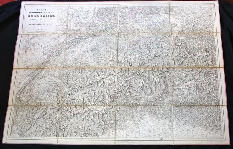
OSTERWALD [OSTERVALD] Jean Frédéric d':
Carte topographique et routière de la Suisse et des contrées limitrophes.
Paris, Imprimerie L. Martinet, sans date. Carte entoilée au format ouvert de 72 x 98 cm., en 16 parties, sous étui de carton bleu, avec large vignette de titre contrecollée au premier plat. Bords de l'étui frotté, avec manque, rousseurs à la vignette de titre, et à la toile de 2 des parties de la carte.
Référence libraire : 12499
|
|
|
OSTERWALD, Jean Frédéric d’.
Carte topographique et routière de la Suisse et des contrées limitrophes. Dressée et dessinée par Jean Frédéric d’Osterwald. Gravée à Paris par Delsol.
Paris, sans date, vers 1850, 250x180mm, format de la carte 97x72cm., toilé, sous étui en percaline, feuille de titre collée sur le plat supérieur, frontières coloriées. Bel exemplaire.
Référence libraire : 53428

|
|
|
Osterzee, Penny van and Reg Morrison (Photos)
The Centre. The Natural History of Australia's Desert Regions.
Chatswood, Australia, Reed, 1991. (EUREKA - Winner University of NSW Press Science Book Prize.) 172 SS., 2 Bll., sehr schön und zahlreich farbig bebildert. 4° (ca. 28 x 21 cm), illustr. original Paperback.
Référence libraire : 24362
|
|
|
OTLEY
Official Guide to Otley. Historic Market Town. Issued by Authority of Otley Town Council. [Second Edition.] NEAR FINE COPY
8vo., Second Edition, with numerous photographs (a number full-page) in the text and a large folding street plan; original pictorial wrappers, wire-stitched as issued, a near fine copy. With numerous trade advertisements at front and rear.

|
|
|
Ottavio Fabri
L'USO DELLA SQUADRA MOBILE con la quale per teorica, & pratica si misura geometricamente ogni distanza, altezza, e profondità; s'impara à perticare, liuellare, & pigliare in disegno le città, paesi & prouincie.
Un volume (15x20,5 cm) di 56-(4) carte (cioè 120 pagine) con 26 tavole incise in rame nel testo e 1 grande carta ripiegata ft titolata Braccio Mobile e Braccio Stabile, che quasi sempre manca. (“Il tutto con le sue dimostrationi intagliate in rame” è scritto al titolo). Legatura moderna in piena pergamena rigida con titolo manoscritto al dorso. Il foglio 4 è rifilato in testa con taglio che tocca i caratteri tipografici. Una antica firma di possesso al titolo. Peraltro ottime condizioni. Si tratta della seconda edizione dell'opera fondamentale del Bari, ma anche la più rara, perchè per la prima volta viene inserita la tavola ripiegata del Braccio Mobile, datata 1606, e necessaria, come spiega lo stesso Fabri, alla costruzione dello strumento di misurazione. Di conseguenza la tavola veniva quasi sempre asportata, e poche sono le copie che come questa la contengono. Della prima edizione del 1598, Venezia, Barilleti, questa edizione conserva in parte la pagina di titolo calcografica: resta cioè la cornice architettonica, mentre al centro vengono inserito il nuovo titolo con le nuove indicazioni tipografiche. Riccardi,I,434.
|
|
|
OTTAVIO VALLECCHI
ESEMPLARI DI DISEGNO CARTOGRAFICO
IN 16° ( cm.16 X 10,5 ), pp.XII + 64 TAVV. A DOPPIA pag. CON ESEMPI DI DISEGNO CARTOGRAFICO DI ISOLE, COSTE, ECC. COPERTINA EDITORIALE IN BROSSURA TELATA<BR>CON TITOLO SU FONDO MARRONE. E' IL VOL.n° 347 - 348 DELLA BIBLIOTECA DEGLI STUDENTI. NOTIZIE DI STORIA, DI LETTERE, DI SCIENZE E D'ARTE. QUARTA EDIZIONE.<BR>OTTIMA CONSERVAZIONE. ID 1244<BR>

|
|
|
OTTE, FRIEDR. WILHELM.
Oekonomisch-Statistische Beschreibung der Insel Fehmern.
Schleswig, 1796. Cont.hcalf. XVI,398 pp. a. 6 fold. Tables + Verzeichn.d.Subscribenten(8) pp. A wormhole in lower margin of Verz.d.Subscr.,otherwise fine.
|
|
|
OTTE, FRIEDR. WILHELM.
Oekonomisch-Statistische Beschreibung der Insel Fehmern.
Schleswig, 1796. Cont.hcalf. XVI,398 pp. a. 6 fold. Tables + Verzeichn.d.Subscribenten(8) pp. A wormhole in lower margin of Verz.d.Subscr.,otherwise fine.
Référence libraire : 3298
|
|
|
OTTER VALLEY
The Lower Otter Valley. Sketches on Local History. NEAR FINE COPY
Sm. 4to., First Edition, with illustrations, maps and diagrams (a number full-page) in the text; original printed wrappers, cloth back, a near fine copy.
|
|
|
OTTEWELL D.
Old Retford.
Oblong 4to., First Edition, with very numerous full-page photographs in the text; original photographic wrappers, a near fine copy.
|
|
|
OTTO LASIUS Georg Sigismund.
Topographische des Harz Gebirges.
OTTO LASIUS Georg Sigismund. Topographische des Harz Gebirges. Im Verlag WEIMAR des industrie- Comptoirs 1798. Caret topographique des montagnes du HAZRZ pris et dessinée par Georg Sigismund Otto Lasius. Belle carte en couleurs, entoilée, format 525 x810mm 180x105 pliée.
Référence libraire : 13339

|
|
|
OUDIETTE (Charles)
Dictionnaire topographique des environs de Paris.
1817 À Paris, chez l’Auteur, 1817.
Référence libraire : 446

|
|
|
OUDIETTE, Charles.
Description géographique et topographique du Département de la Dyle en forme de Dictionnaire (An VII-An VIII).- Avec un supplement sur la reunion des Cantons en Arrondissemens, et une Carte de Demarcation.
grand in-8°, 200 + 8 pp., carte, broche, couv. A l'etat de NEUF. [AGR*][CA28-1][AGR-4] Reproduction photomécanique de l'édition : Gaborria, An VII [i.e. 1798/99].
|
|
|
OVER Luke
The Royal Hundred of Bray. [Illustrated by C. Tyrell].
Oblong 4to., First Edition, with numerous illustrations and maps (several full-page) in the text, page edges browning slightly; original orange cloth, gilt back, a near fine copy in unclipped dustwrapper.

|
|
|
Overbeck, Bernhard und Ludwig Pauli (Mitarb.)
Geschichte des Alpenrheintals in römischer Zeit auf Grund der archäologischen Zeugnisse. Teil 1: Topographie, Fundvorlage und historische Auswertung. [Von Bernhard Overbeck, unter Mitarbeit von Ludwig Pauli]. (= Münchner Beiträge zur Vor- und Frühgeschichte, Band 20). Einzelband, in sich geschlossen.
München: C. H. Beck 1982. 268, (62) Seiten. Mit 71 Abbildungen im Text und 45 Tafeln. 4° (30 x 22 cm). Orig.-Leinenband mit Titelprägung auf dem Rücken. [Hardcover / fest gebunden].
Référence libraire : 2122512

|
|
|
OWEN (ed.) Dorothy M.
[Devon and Cornwall Record Society. New Series, Vol. 20]. Historical Manuscripts Commission JP22. John Lydford's Book. Edited, with an Introduction by Dorothy M. Owen.
8vo., First Edition, with a frontispiece, small scuff marks on cover; original printed wrappers, sewed as issued, a near fine copy. The publication of this important fourteenth-century MS was shared between the Devon and Cornwall Record Society and the Historical Manuscripts Commission. Lydford was a successful canon lawyer whose text covers the officiality of Winchester, Oxford and Exeter. Brockett 18910.
|
|
|
OWEN T.M.
Welsh Folk Customs [Second Edition]. elsh Folk Customs [Second Edition].
8vo., Second Edition, with 16 plates, some mild offsetting from fold-ins to free endpapers; cloth, gilt back, a very good, bright, clean copy in unclipped dustwrapper. A detailed study and standard reference, first published in 1959.

|
|
|
OXFORD
The Oxford University and City Guide, on a New Plan. Containing a full Description of the Colleges, Halls, Public Buildings, Libraries, Gardens, Walks, Pictures and Statues, in Oxford [with] a Guide to Blenheim. IN PUBLISHER'S PICTORIAL CLOTH
12mo., New Edition, with an engraved frontispiece, engraved and printed titles, 8 steel-engraved plates and an engraved folding map, some negligible age-staining; original ribbed red pictorial cloth, upper board elaborately blocked in gilt, back with five flat bands, second compartment lettered in gilt, red sprinkled edges, lemon endpapers, very neatly recased with original endpapers, a remarkably well-preserved, bright, crisp copy. Slatter & Rose was first published in 1818. IN THIS CONDITION, A SCARCE SURVIVAL. Anderson, p.242; Cordeaux & Merry 310.
|
|
|
OXFORD HISTORICAL SOCIETY
Collectanea Fourth Series. [Vol. XLVII]. Edited by the Committee of the Society.
8vo.,First Edition, on laid paper, with a plate and 2 fine folding facsimiles on japon, free endpapers moderately offset; original series binding of cloth blocked in gilt and blind, gilt back, uncut and largely unopened, a near fine copy in original tissue dustwrapper. Oxford Historical Society, vol. XLVII. With the errata leaf relating to vol. XLV loosely inserted as issued. Includes a description of Oxford from the Hundred Rolls of 1279 (ed. Graham), Symonds' Oxford Church Notes 1643-4 (ed. Graham), Consecrations of Lincoln, Brasenose and Queen's College chapels (ed. Clark, Madan and Magrath respectively), Baskerville's account of Oxford 1683-6 (ed. Baskerville), Oxford's bill for the coronation of George IV in 1821(ed. Williams) , and 'Coaching In and Out of Oxford from 1820 to 1840' by William Bayzand writing as 'A Chip off the Old Block'. Cordeaux & Merry, 74 (Graham), 4613 (Symonds), 7496 (Clark), 6909 (Madan), 8224 (Magrath), 1114 (Williams), 446 (Bayzand).

|
|
|

 Recevoir par e-mail
 Télécharger en PDF
 Flux RSS
 Lien permanent


