|
|
|
[ETAT-UNIS ] - BLAYE (Edouard de ) -
Etat-unis l'ouest et le centre.
, Guide arthaud , 1990 ; in-8, 665 pp., broché, couverture illustr.
Référence libraire : 201009135
|
|
|
[ETHNOLOGIE] - BAUMANN (Peter), PATZELT (Erwin) -
Mémoires d'un coupeur de tetes en amazonie.
Paris, Seghers, 1979 ; in-8, 244 pp., cartonnage d'éditeur avec jaquette.
Référence libraire : 200906758
|
|
|
[ETHNOLOGIE] - GABUS (Jean) -
IGLOUS - vie des Esquimaux-Caribou.
Neuchatel, Editions Victor Attinger, s.d. ; in-12, 259 pp., broché, couverture illustr. Mission ethnographique suisse à la baie d'Hudson 1938-39 avec 2 cartes et de nombreuses illustrations.
Référence libraire : 200609240
|
|
|
[ETHNOLOGIE] - MANNINEN (E.-N.) -
TOUNDRA.
Paris, EDITIONS VICTOR ATTINGER, s.d. ; grand in-12, 239 pp., broché, couverture illustr (ptes usures ). Traduit du Finlandaisn par R. Petterson avec 20 illustrations hors-texte.
Référence libraire : 200808140
|
|
|
[Europe].
Map of Europe. [Italy, ca. 1900].
Colour-lithographed map, 425 x 635 mm. Orthographic azimuthal projection. Topographical map of Europe including Asia Minor and the northwestern coast of Africa. The orthographic projection shows Europe distorted but realistically as the upper part of a sphere in space. Place names are identified in Italian, and the volcanoes Vesuvius and Etna are marked with red dots. - Traces of folds; some old tears. Some browning and foxing throughout.
|
|
|
[EXPLORATEURS] - MALTHUISIEULX (H.-M. de) -
Explorateurs et terres lointaines.
Tours, Editions Mame - collection pour tous, s.d. ; in-12, 294 pp., cartonnage de l'éditeur (usures et reliure salis). Rousseurs- vendu dans l'état - n° 83 de la série.
Référence libraire : 200704275
|
|
|
[EXPLORATEURS] - PEISSEL (Michel) -
ITZA ou le mystère du naufrage Maya.
Paris, Robert Laffont, 1989 ; in-8, 250 pp., broché, couverture illustr.
Référence libraire : 200704232
|
|
|
[Exploration & Travel]
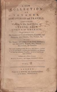
A New Collection of Voyages Discoveries and Travels: Containing Whatever is worthy of Notice in Europe Asia Africa and America: In Respect to The Situation and Extent of Empires Kingdoms and Provinces; their Climates Soil Produce &c. Volume III
London: Printed by J. Knox 1767. Hardcover. Poor. Octavo. Volume III only. 2 520 pages. Illustrated with fold out chart map of the southern section of South America and a chart map of the Pacific Ocean. Binding in poor condition. Marbled paper covered boards are detached. Text block split into two sections. Spine is dry and cracked with no title label. Boards extremely worn. Text is untrimmed. Light staining and fading to the the title page. Previous owner ink name stamp on page 1. A persistent brown stain in the upper gutter of the text partly affecting the Pacific Ocean fold out map in the margins. Page 214 torn in the margin with no loss of print. Some doodles in the margins of a few pages. Light toning to the contents. A poor copy. <br /> <br /> Contents include voyage accounts of Captain William Dampier Captain Woodes Rogers and Anson's voyage around the world The Pacific Ocean map shows California and parts of the Philippines. The map has some brown stains in the margins. Printed by J. Knox hardcover
Référence libraire : 36492
|
|
|
[Exploration & Travel] [Arctic] [Harper & Brothers]
Narrative of Discovery and Adventure in the Polar Seas and Regions: With illustrations of Their Climate Geology and Natural History
New York: Harper and Brothers 1836. Harper's Stereotype Edition. Hardcover. Good. 16mo. 2 373 pages 1. Folding frontispiece map. Illustrated. Brown cloth hardcover with gilt title on the spine. Light wear and fading to the cloth. Light toning and scattered foxing to the text. Bookplate of "Athens Georgia Mechanics' Mutual Aid Association located on the front paste down. Harper and Brothers hardcover
Référence libraire : 35304
|
|
|
[Exploration & Travel] Fremont, Brevet Captain J C (of the Topographical Engineers)
Narrative of the Exploring Expedition to the Rocky Mountains In the Year 1842 And to Oregon and North California In the Years 1843-44
London: Wiley and Putnam 1846. First English edition. Hardcover. Good. Octavo. iv 5-324 pages. Illustrated with large folding map backed by linen two frontispiece engravings and two engraved plates in text. Green cloth hardcover ruled in blind on the covers with blind stamped eagle and shield illustration on the front cover. Gilt title and blind stamped decorations on the spine. Cloth lightly chipped head of the spine and edge worn base of the spine. Corners bumped. A few light repairs made to this copy including a front hinge repair and a tissue repair to the title page. A very small puncture on the title page. A few pages with very brief pencil notes or underlining. Light foxing to the blank verso of the linen backed map. Armorial bookplate of "Sir G. E. Hammond Bt. K.C.B." on the front paste down. A good copy. <br /> <br /> Howes 370 Notation for entry reads - "Eng. ed. with omissions and different pls 'a' Contains his first and second expeditions"; Reference Graff 1433 Syracuse edition. Wiley and Putnam hardcover
Référence libraire : 35386
|
|
|
[Exploration & Travel] [Asia] Hawks, Francis L D D LLD L D
Narrative of the Expedition of an American Squadron to the China Seas and Japan Performed in the Years 1852 1853 and 1854 Under the Command of Commodore M. C. Perry United States Navy
New York: D. Appleton and Company 1857. Later printing. Hardcover. Very good. Quarto. 1 vii viii blank 624 pages 1. Fine binding. Brownish marbled paper covered boards with brown leather corners and spine. Gilt title decorations and raised bands on the spine. Marbled end papers. Marbled text edges. Illustrated with frontispiece engraving steel engravings illustrated plates in text illustrations and 11 folding maps. Text maps and illustrations in very good condition. Occasional light foxing to a few of the steel engravings and the protective tissue. Light rubs to the board edges with light shelf wear to the covers. Binding is very sturdy and uniform. First edition in three volumes was published in 1856. D. Appleton and Company hardcover
Référence libraire : 35540
|
|
|
[Exploration & Travel] [France] [Jean Baptiste Labat]
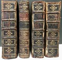
Nouveau voyage aux isles de l'Amérique contenant l'histoire naturelle de ces pays l'origine les mœurs la religion et le gouvernement des habitans anciens et modernes
A La Haye: Chez P. Husson; E. Johnson Printers 1724. Later printing. Leather bound. Fair. 12mos. Incomplete set. 4 volumes. Volumes 2456. Speckled brown calf leather bindings with raised bands on the spines. Gilt decorations on the spines. A few title labels remain. Bindings are sturdy. Illustrated. <br /> <br /> Condition of the leather varies with cracked joints damp staining and dryness. <br /> <br /> Volume II: 5 598 pages. Illustrated with 21 plates of which 4 are folding including 8" x 6.5" map of "Isle De La Guadeloupe". Leather is cracked on the joints and has some damp staining. Text block is uniform but cracked in the middle at page 265. Text and illustrations are in good condition with light toning to the contents. <br /> <br /> Volume IV: 5 539 pages 1 page blank 1. Illustrated with 13 plates of which 5 are folding including plans of "Isle De La Barbade" and "Plan du Port du Fort et du Bourg de la Grenade". Slight damp staining and warping of the boards. Text and illustrations in good condition. <br /> <br /> Volume V: 5 504 pages 1. Illustrated with 6 plates 2 folding including 10" x 6.5" "Carte De Lisle De Saint Christophle" and "L'Isle St. Domingue". Leather joints cracked with moderate damp staining on the rear board. Text and illustrations in good condition. <br /> <br /> Volume VI: 4 514 pages 1 58 pages 'Table Des Matieres Pour Les Six Volumes' 2. Illustrated with 6 plates of which 2 are folding including "Plan du Fort et d'une partie du Bourg de la Guadeloupe. Attiquee par les Anglais en 1703". Leather is damp stained and chipped. Joints cracked. Text block a bit warped. Some page corners creased. Text is clean and in good condition. Each volume has an armorial bookplate of "Elden Hall" on the front paste downs. <br /> <br /> Sabin 38411. Chez P. Husson; E. Johnson, Printers unknown
Référence libraire : 35371
|
|
|
[EXPLORATION] - CASTILLAN (Marcel) -
20 grands récits d'exploration (prehistoire- afrique- asie).
Casablanca, Société chrétienne de publication et d edition, 1956 ; in-8, 507 pp., cartonnage de l'éditeur. Avec jaquette.
Référence libraire : 201305592
|
|
|
[EXPOSITION COLONIALE INTERNATIONALE PARIS 1931] COLLECTIF
PORTUGAL - COLONIE DE MOÇAMBIQUE : LE PORT DE LOURENÇO MARQUES
Lourenço Marquès Imprimerie Nationale 1931 -in-8 broché une plaquette, brochée bordeaux grand in-octavo Editeur (paperback in-octavo Editor) (24,7 x 17 cm), dos muet, 1ère de couverture imprimée en noir, toutes tranches lisses, orné d'une carte en couleurs du Port et des voies de chemins de fer de Lourenço Marquès + 7 photographies in-texte en noir + 3 planches photographiques dépliantes en bleuté ou bistre, 26 pages, 1931 Lourenço Marquès Imprimerie Nationale Editeur,
Référence libraire : 24252
|
|
|
[FAR-WEST] PORCHER (R.).
En route pour L'Amérique du Nord. Croquis Américains.
Alphonse Picard et Fils, Éditeurs, 1893. In-12 br. Récit d'un voyage en Amérique du Nord dans la seconde moitié du 19 ème. siècle. Année de l'E.O.
Référence libraire : L5060
|
|
|
[FARE (Henri-Amédée-Emmanuel)]
Ministère des Finances. - Direction générale des forêts. Reboisement des montagnes. Rapport au ministre des finances (21 mars 1876)
Paris, Imprimerie Nationale, 1876 in-4, [4]-83 pp., demi-chagrin aubergine à coins, dos à nerfs, double filet doré sur les plats, tête dorée (reliure de l'époque). Dos un peu insolé, des épidermures.
Référence libraire : 198985
|
|
|
[Faure (Félix)] Belon (Paul), Gers (Paul)
Voyage de M. le Président de la République en Bretagne. Août 1896.
Paris Berthaud s.d. [1896] Un fascicule in-8, 48 pages, nombreuses illustrations in-texte, sous chemise bleue, titre doré. Chemise réparée, intérieur frais.
Référence libraire : 5941
|
|
|
[FENELON François de Salignac de la Mothe].
Les Aventures de Télémaque, fils d'Ulysse.
"Nouvelle édition, augmentée de l'Histoire d'Aristonoüs & Sophronime". A Bruxelles. Chez François Foppens. 1700 (l'E.O. a paru en 1699). Deux tomes en un volume. 95 x 160 mm. 246 pages. Reliure du temps en plein veau havane ; dos à nerfs, pièce de titre en maroquin rouge, tranches rouges. Coins un peu émoussés, mais bon exemplaire.
Référence libraire : 80
|
|
|
[Fermanel de Favery, Luc].
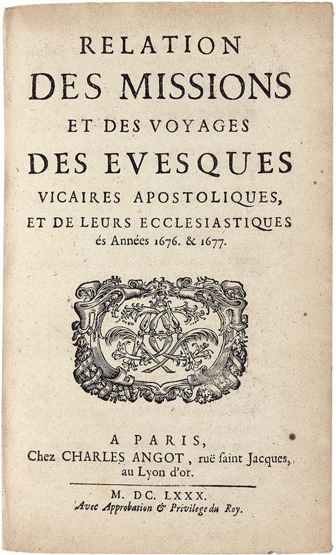
Relation des missions et des voyages des evesques vicaires apostoliques, et de leurs ecclesiastiques és Années 1676. & 1677. Edition originale « très rare » de cette relation des missions à la Cochinchine, au Tonkin, à la Chine, au Cambodge, à Ciampa, aux Indes et au Royaume de Siam.
Précieuse édition originale de ce récit des « missions de la Cochinchine, du Tonkin, Siam et Cambodge. Très rare » (Chadenat, II, 4391). Paris, Charles Angot, 1680. In-8 de (8) ff., 242 pp., (1) f. de privilège. Plein veau brun granité, dos à nerfs orné, roulette dorée sur les coupes. Reliure de l’époque. 187 x 116 mm.
Référence libraire : LCS-18085
|
|
|
[FEYDEL, Gabriel]
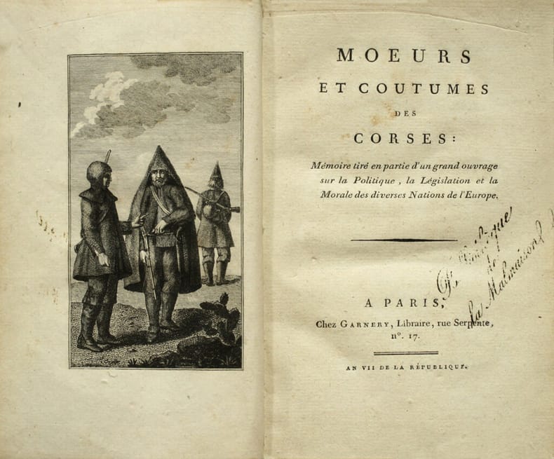
Mœurs et coutumes des Corses : Mémoire tiré en partie d’un grand ouvrage sur la Politique, la Législation et la Morale des diverses Nations de l’Europe. Remarquable exemplaire à la provenance particulièrement croustillante : de la Bibliothèque de la Malmaison.
Edition originale de cet intéressant traité sur les Corses en France. Paris, Garnery, An VII (1798-99). Grand in-8 de (4) ff., 1 frontispice, 112 pp. Relié en pleine basane fauve, roulette dorée encadrant les plats, dos lisse orné de fleurons dorés, chiffre P B frappé or en pied du dos, pièce de titre en maroquin rouge, roulette dorée sur les coupes, tranches dorées sur marbrures. Dos légèrement frotté. Reliure de l’époque. 198 x 122 mm.
Référence libraire : LCS-17457
|
|
|
[Flags].
Bansen kishou zu (Pictures of foreign ship flags). [Japan, ca. 1850s].
34 pp., accordion-bound, containing a double-page map of the world and 182 hand-coloured images of flags. Text in Japanese. Speckled stiff paper boards with original title label. Arranged by continent, the naval flags here depicted represent mostly European countries, though the Americas, Russia, Australia, Tunis, and Morocco are also present. Probably published soon after Commodore Perry's expedition enforced the opening of Japan to the West in 1854. Rare: a single copy located in libraries worldwide (Tokyo Imperial Palace; shelfmark 274,662). - Title label rubbed, some worming throughout.

|
|
|
[FLEURIAU D’ARMENONVILLE]
Nouveaux Mémoires des Missions de la Compagnie de Jésus dans le Levant.
"P., Nicolas Le Clerc, 1715-1723. Trois volumes in 12 veau marbré, dos orné à nerfs, tranches rouges, (petits défauts aux coiffes); (1) 135 pp.-173 pp.-(1), une planche dépliante (Santorin); (2) 288 pp.-125-(1), avec deux planches dépliantes; (3) 482 pp.-(1), avec une carte dépliante."
Référence libraire : 7826
|
|
|
[FOUCHER D'OBSONVILLE]
Essais philosophiques sur les moeurs de divers animaux étrangers
avec des observations relatives aux principes & usages de plusieurs peuples. Ou extraits des voyages de M. en Asie. 1783. Paris ,Couturier Fils , In 12 relié plein papier d'époque .5 ff.n.ch1 planche allégorique hors texte gravée par De Launay d'après Marillier,400 pp.Quérard III ,174 .Barbier 5888 .
Référence libraire : 14164
|
|
|
[Fra Mauro Mappa Mundi - Carlo Naya].
Life-size 1871 photograph of the Fra Mauro map of the world. Venice, Carlo Naya, ca. 1871.
Hand-coloured photograph of the Fra Mauro mappamundi, ca. 223 x 223 cm. A life-sized, hand-coloured photograph of the famous world map made around 1450 by Fra Mauro, the greatest medieval map of the world: an astonishing accomplishment of art history, cartography, and photography. In its day one of the largest photos ever made, the "Naya Fra Mauro" belongs to a class of colossal early photographs that includes Eadweard Muybridge's 13-sheet panorama of San Francisco (1878) and George R. Lawrence's photograph of the Alton Limited on an 8 × 4.5-foot glass plate (1899). It also appears to be the first large-format map produced with photography. - Fra Mauro's map is "considered the greatest memorial of medieval cartography" (Almagià). Containing hundreds of detailed illustrations and some 3000 descriptive texts, it was the most detailed representation of the world so far produced. It remains one of the most important works in the history of cartography, marking the end of Bible-based geography in Europe and the new embrace of more scientific methods which placed accuracy ahead of religious or traditional beliefs. Strikingly, it is oriented with south at the top, recalling the Arab tradition and more specifically al-Idrisi's famous 12th century world map, copies of which Fra Mauro may have known: Europe is shown at the bottom, and Africa and Asia dominate the image, with Arabia (not Jerusalem) at the centre. Fra Mauro incorporated "the discoveries of Marco Polo and the Portuguese", also showing "many countries later known, which the learned monk doubtless shaped after ideas gathered from the oral narratives of occasional travellers" (Müller). Much of the map's novel information was lost to early modern cartographers when printed Ptolemy atlases proliferated in the final decades of the 15th century, replacing the manuscript mappamundi tradition. - Today the original Fra Mauro Map, drawn on vellum, is held by the Biblioteca Nazionale Marciana in Venice and shown at the Museo Correr. An impressive manuscript facsimile, now in the British Library, was prepared in 1804 by the British antiquarian William Frazer; a large engraving was made in Paris in 1849, and in 1869 the Venetian bookseller Münster produced the first photographic reproduction, albeit at a much smaller scale, measuring a mere 62 × 68 cm. Carlo Naya's monumental Fra Mauro photograph renders the map in its full original size. Although it is mentioned in a number of books on early Italian photography, it was always extremely rare: the only photographic copies of the map ever to have surfaced in the trade were that of Münster (lot 1581 at the 1884 sale of the library of Henry C. Murphy, U.S. ambassador to the Netherlands under Lincoln) and the more common four-print photofacsimile published in 1879 by Ongania (E. P. Goldschmidt, London 1930: cat. 22, lot 32). By contrast, Naya's magnum opus was never sold except through his own concern. The Royal Geographical Society was presented with a specimen in 1873 (the gift of John Benjamin Heath, once Governor of the Bank of England), and the British Library holds another, as does the Marciana (all uncoloured). A very fragile and faded example, cut into 16 sheets and backed onto modern board, is kept at the National Library of Wales, Aberystwyth. - Carlo Naya (1816-82) was an Italian photographer known for his fine views of Venice. He settled there in 1856, opening a photo studio that catered to Grand Tourists who wished to take home mementoes of the city's spectacular art and architecture. His "mappa mundi" photograph was prepared around 1871 under the supervision of the Venice-based English historical scholar Rawdon Brown (1806-83), a friend of Ruskin's. Naya exhibited his photograph at the 1873 World's Fair in Vienna, winning a medal for it. In the 1880s the Nayas were still advertising the map, the pride of the company, as a "fac-simile of the Planisphere of Fra Mauro A.D. 1459, the largest photograph hitherto made (a square 7 Ft. 4 inch)". It was priced at a stupendous 200 francs. After Naya's death, his studio was continued by his wife, then by her second husband, for three and a half decades. - Provenance: the reverse has ink stamps of the publisher Osvaldo Böhm, who bought most of Naya's archive when the family closed the shop in 1918. Later in the collection of Dr. Edward Luther Stevenson (1858-1944), one of the most important scholars of early cartography active at the end of the 19th and the first half of the 20th century. Stevenson was responsible for numerous carto-bibliographic books, including the first translation of Ptolemy into English, as well as a series of impressive facsimile maps. Stevenson, who viewed reproductions as integral to the study of early cartography, committed himself to building an unparalleled collection of photographs of early maps and globes. Much of his collection was donated to Yale University after his death, but the present item comes from a large corpus of photos, manuscripts, and related material retained by the family. A. Müller, Venice. Her Art-Treasures and Historical Associations. A Guide to the City (Venice 1873), p. 113. I. Zannier, Venice: the Naya Collection (Venice, 1981). P. Becchetti, Fotografi e Fotografia in Italia 1839-1880 (Roma 1978), p. 124. R. Almagià, Monumenta cartographica vaticana, vol. 1 (Città del Vaticano, 1944). P. Falchetta, Storia del Mappamondo di Fra' Mauro (Rimini, 2016).
|
|
|
[Fra Mauro Mappa Mundi - Zurla, Placido (ed.)].
Abbozzo del mappamondo di F. Mauro Camaldolese. Cosmografo incomparabile alla Meta des Sec. XV. [Venice, Picotti, 1806].
Engraved map, 394 x 404 mm. Framed. Rare, early 19th century Italian engraved facsimile of the greatest medieval map of the world: the famous world map made around 1450 by Fra Mauro, "considered the greatest memorial of medieval cartography" (Almagià). At the time it was the most detailed representation of the world ever produced, and it remains one of the most important works in the history of cartography, marking the new embrace of scientific method which placed accuracy ahead of religious or traditional beliefs. Strikingly, it is oriented with south at the top, recalling the Arab tradition and more specifically al-Idrisi's famous 12th century world map, copies of which Fra Mauro may have known: Europe is shown at the bottom, and Africa and Asia dominate the image, with Arabia (not Jerusalem) at the centre and America as yet missing. Fra Mauro incorporated "the discoveries of Marco Polo and the Portuguese", also showing "many countries later known, which the learned monk doubtless shaped after ideas gathered from the oral narratives of occasional travellers" (Müller). Much of the map's novel information was lost to early modern cartographers when printed Ptolemy atlases proliferated in the final decades of the 15th century, replacing the manuscript mappamundi tradition. - Today the original Fra Mauro Map, drawn on vellum, is held by the Biblioteca Nazionale Marciana in Venice and shown at the Museo Correr. An impressive manuscript facsimile, now in the British Library, was prepared in 1804 by the British antiquarian William Frazer; a large engraving was made in Paris in 1849, and in 1869 the Venetian bookseller Münster produced the first photographic reproduction. The present edition of the map was issued with Placido Zurla's book "Il Mappamondo di Fra Mauro Camaldolese" (1806), the first study of Fra Mauro's map ever published and indeed the only substantial early work on the map. (Later, Zurla would also include the engraving in his 1818 study "Di Marco Polo e degli altri viaggiatori veneziani più illustri dissertazioni"). Rarely encountered on the market, this is at the same time a very early example of world map facsimiles in general. - A repaired tear to the left edge, touching the engraved border, otherwise in perfect condition. OCLC 163267775. For Zurla's book cf. Cicogna 3323. For the mappamundi cf. A. Müller, Venice. Her Art-Treasures and Historical Associations. A Guide to the City (Venice 1873), p. 113; R. Almagià, Monumenta cartographica vaticana, vol. 1 (Città del Vaticano, 1944); P. Falchetta, Storia del Mappamondo di Fra' Mauro (Rimini, 2016).
|
|
|
[Fra Mauro Mappa Mundi] - Zurla, Placido.
Il Mappamondo di Fra Mauro Camaldolese descritto ed illustrato. Venice, [Picotti], 1806.
Folio (237 x 380 mm). 164 pp. With an engraved plate; folding engraved map in lower cover pocket. Modern red quarter morocco, title gilt to spine. Marbled endpapers. The first substantial study and reproduction of Fra Mauro's famous mappa mundi, considered the supreme medieval map of the world and the "greatest memorial of medieval cartography" (Almagià). The most detailed representation of the world ever seen when it was produced around 1450, it remains one of the most important works in the history of cartography, marking the new embrace of scientific method which placed accuracy ahead of religious or traditional beliefs. Strikingly, it is oriented with south at the top, recalling the Arab tradition and more specifically al-Idrisi's famous 12th century world map, copies of which Fra Mauro may have known. Europe is shown at the bottom, with Arabia (not Jerusalem) at the centre and America as yet missing. Fra Mauro incorporated "the discoveries of Marco Polo and the Portuguese", also showing "many countries later known, which the learned monk doubtless shaped after ideas gathered from the oral narratives of occasional travellers" (Müller). He was able, by personal intercourse, to gather additional information from Nicolo de' Conti, who had returned from the east in 1440, and his work is also of special interest for showing that, at least forty years before the Portuguese reached India, Arab sailing directions covering the east coast of Africa, India, and the seas beyond to the vicinity of Sumatra, were available in western Europe. - Placido Zurla's handsome work, the earliest study of the map, was the first to include a reproduction of it in book form. Zurla (1769-1834) had unique insight into Mauro's monumental achievement, as he served as librarian to the same Camaldolese order as the geographer and so had access to the original map itself. - Occasional foxing, mainly confined to margins, a little stronger in the title-page. An untrimmed, wide-margined copy preserving the deckle edges; the folding map reproduction in loosely inserted in a custom-made lower cover pouch. Cicogna 3323. Cf. A. Müller, Venice. Her Art-Treasures and Historical Associations. A Guide to the City (Venice 1873), p. 113; R. Almagià, Monumenta cartographica vaticana, vol. 1 (Città del Vaticano, 1944).
|
|
|
[France, Anatole - Gréard]
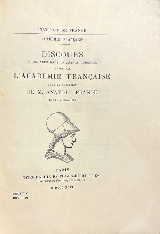
Académie Française. Discours prononcés dans une séance publique tenue par l’Académie Française pour la réception de M. Anatole France, le 24 décembre 1896.
Paris, Firmin-Didot, 1896 ; in-4, broché ; 54 pp., (1) f. blanc et couverture verte imprimée.
Référence libraire : 5289
|
|
|
[France]
Le Visage de la France [2 volumes]. Introduction d’Henri de Régnier...
Paris, Horizons de France 1927 2 volumes. In-4 33 x 25 cm. Reliures éditeur demi-chagrin bleu-marine, report du titre doré sur les dos lisses et les premiers platssos lisses, [6]-575 pp. en pagination continue, nombreuses illustrations en sépia dont 19 planches hors texte. Bon exemplaire.
Référence libraire : 114679
|
|
|
[France] DUCLOS (professeur de statistique)
Dictionnaire des villes, bourgs, villages et hameaux de la France, et des principales des pays étrangers et des colonies cont+enant la nomenclature complète des 37153 communes de France et de leurs écarts ; l’indication de leur chef-lieu de canton, du bureau de poste qui seul les dessert, et du nombre de leurs habitans ; par Duclos, ingénieur-géographe
Paris, Au Bureau central des Dictionnaires 1836 In-4 28 x 19 cm. Reliure de l’époque demi-basane havane, dos lisse orné de petits fers encadrés de roulettes dorées, 656-LIV pp. Reliure défraîchie, intérieur correct.
Référence libraire : 98756
|
|
|
[France] TASTU, Amable
Voyage en France. / par Mme Amable Tastu. Nouvelle édition revue et augmentée.
Tours, Ad. Mame et Cie 1872 In-4 25 x 15,5 cm. Reliure demi-chagrin violine, dos à nerfs encadrés de fers dorés, tranches dorées, 563 pp., nombreuses figures dans le texte, 4 gravures hors-texte sous serpentes, 1 carte de France repliée in fine, table. Intérieur très frais, gouttière régulière.
Référence libraire : 109881
|
|
|
[Francisci, Erasmus; Pseud.:] Theophilus Urbinus.
Türckisches Städt-Büchlein: Darinn Hundert und etliche der auserlesensten Städte, Vestungen und Schlösser, so der Ottomannischen Herrschafft, theils im Königreich Ungarn, theils in andern Reichen und Theilen der Welt, unterworffen; Samt deren Belägerung, Eroberung, Schlachten, Antiquitäten [...]. Nuremberg, Johann Hofmann, 1664.
12mo. (20), 455, (1) pp. With separate double-page-sized engraved title and 24 engraved plates (mostly views). - (Bound after) II: Grundmann, Martin. Geist- und Weltliche Geschichtschule, oder ergetzliche nutz- und lehrreiche Geschichte, Beyspiele und Begebnüsse von mancherley wunderbare[n] Verhengnüssen, Gerichten, Wolthaten und Straffen Gottes, als auch seltsamen Zufällen, Eigenschafften und denckwürdigen Tugend- und Lasterthaten der Menschenkinder. Auß bewährten, gelährter Leute Geschicht- Zeit- und Kunstbüchern zusammenbracht. Dresden, Andreas Löffler, 1655. (12), 405, (11) pp. With separate engraved title page and a numismatic plate opposite p. 185. Contemporary vellum. Early, rare German-language gazetteer of the Ottoman Empire, describing many cities and places throughout the Middle East, the Mediterranean and Eastern Europe, including 17th-century accounts of Aden, Mecca and Medina in Arabia. The bird's eye views and plates include Aden, Alexandria, Algiers, and Rhodes; Constantinople; Buda, Pest, Kanizsa, Eger, Esztergom, and Temesvar, as well as Muhammad's grave in Medina. Prefixed to the work is an index of sources from whom this compilation has been drawn (including several Muslim and oriental authors). - Bound first is the first edition of Grundmann's historical manual, with alphabetical articles about the lives or rulers and saints, rare and fantastic plants and beasts, exotic godheads, historical events, commendable traits of character, etc. The fine engraved title includes eight emblematic vignettes. - Old stamps to titles of Grundmann's work; altogether a finely preserved specimen. I: VD 17, 23:315597C. Dünnhaupt 11 (citing only 22 plates). Nebehay/Wagner 1051 (citing only 17 plates). Jöcher II, 704. Will I, 463. Not in Aboussouan, Atabey, Blackmer. - II: VD 17, 39:119939P.
|
|
|
[Frankreich - Polemik].
Eröffnete frantzösische geheime Raths-Stube, worinnen die Consilia über jetzigen Zustand zusammen getragen worden, wie die Cron Franckreich bey schweren Conjuncturen sich zu verhalten, damit Sie aus dem Labyrinth mit Manier kommen möchte. O. O. u. Dr., 1673.
27 unnum. Bll. Mit Holzschnittvignette am Titel. Pergamentband der Zeit. Bindebänder fehlen. 4to. Streitschrift im Kontext des Niederländischen Kriegs, den Frankreich gegen die Generalstaaten im Bündnis mit dem Reich, Brandenburg, Österreich und Spanien führte. Eine von 3 Druckvarianten im Jahr der Erstausgabe. - Papierbedingt durchgehend etwas gebräunt bzw. braunfleckig. Einige kl. Randläsuren; in Bl. Cii größerer Eckausriß (mit Textverlust). VD 17, 3:608354K.

|
|
|
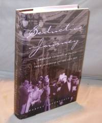
[French Travel] Levenstein, Harvey
Seductive Journey: American Tourists in France from Jefferson to the Jazz Age.
<p>Chicago :: University of Chicago Press 1998. First Printing of the First US Edition. A Fine tight copy in a Fine bright dust jacket. The author begins this social history of American tourism in France in 1786 with Thomas Jefferson's journey toward self-improvement through the cultural tourism of the 1800's to the devastating effects of the First World War and it aftermath resulting in the Golden Age of French expatriation known as the the Roaring Twenties.</p> University of Chicago Press, hardcover
Référence libraire : 23323 ISBN : 0226473767 9780226473765
|
|
|
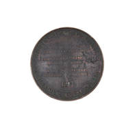
[FREYCINET: URANIE VOYAGE] LOUIS XVIII
Bronze Medal for the Voyage of the Uranie. Obverse: profile portrait of Louis XVIII. Reverse: "Hémisphère Austral. Physique Astronomie. La Corvette l'Uranie Mr. Ls. de Freycinet Commandt. S.A.R.M. Le Duc d'Angoulême Amiral de France -- M. le Vte. du Bouchage Ministre de la Marine
Paris: Puymaurin & Andrieu 1817. Somewhat aged but authentic issued condition. Bronze medal 41 mm. <p><p>A good example of the medal struck to commemorate the departure of the Uranie for Australia and the Pacific in 1817 under Louis de Freycinet.</p> <p>The Uranie landed at Shark Bay on the West Coast of Australia on 12 September 1818 where an observatory was set up. After visiting Timor and the Hawaiian Islands they reached Port Jackson in November 1818. They left on Boxing Day that year on a course for Cape Horn but on 13 February 1820 the ship was wrecked off the Falkland Islands. However all the crew and most of the records of the voyage and natural history specimens were saved and the voyage was completed on the Physicienne.</p> <p>The voyage was organised by the French government to make observations on geography magnetism and meteorology and became noteworthy for its natural history discoveries. This scientific bent is reflected in the detailed lettering on the obverse which has the main caption 'Hemisphere Austral. Physique Astronomie'. The design for this side of the medal is signed Puymaurin. The reverse of the medal shows the bust of Louis XVIII designed by F. Andrieu.</p> </p> . Puymaurin & Andrieu unknown
Référence libraire : 4204892
|
|
|
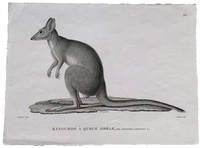
[FREYCINET VOYAGE] PREVOST, A; engraved by Jean Louis-Denis COUTANT
Kanguroo à queue grèle Mâle: Kangurus lepturus. N." Proof engraving before substantial changes for plate 10 in the Atlas Zoologie 1824 of the Freycinet account of the Uranie voyage "Voyage autour du monde fait par ordre du Roi sur les corvettes de Sa Majesté l'Uranie et la Physicienne pendant les années 1817 1818 1819 et 1820
Paris: Langlois 1824. Fine. Black and white engraving 320 x 238mm. <p><p>Very rare early proof for an engraving of a potoroo in the zoological Atlas of the Freycinet voyage account: the engraving as finally published would include a further taxonomical detail in the form of added detail of the animal's skull titled "Son crâne" and the caption would be entirely changed renaming the animal completely from Kangurus lepturus as shown here to Hypsiprymnus white. These are names given to different specimens of Gaimard's Rat-Kangaroo collected by the Freycinet voyage zoologists Jean Rene Constant Quoy and Joseph Paul Gaimard. We are not aware of the reasoning that led to this change of name but such a substantial change from proof to finished engraving is noteworthy.</p> <p>In the text of the Zoologie section Quoy and Gaimard equate the "petit kanguroo ou le kanguroo-rat des habitans du Port-Jackson" with those shown in the First Fleet accounts of Phillip plate 47 and White plate 60 and tell a sad story of the live specimen that they collected: "Notre individu a vécu quelques jours à bord de l'Uranie: il devint victime de la férocité d'un chien que nous avions pris aux îles des Papous et qui l'étrangla au moment où il s'avançait vers lui en cherchant à le caresser." The dog ate our potoroo.</p> <p>They also describe coming across potoroos in the Blue Mountains: "Ces petits animaux sont d'un naturel très-doux et moins timides que les kanguroos. Dans un voyage que nous fîmes dans l'intérieur des Montagnes-bleues de la Nouvelle-Hollande nous eûmes occasion d'en voir un venir enlever familièrement au milieu de la case en terre qui nous servoit d'abri des restes d'alimens et s'enfuir par un trou à la manière des rats. Nous croyons que c'est une variété de l'espèce que nous venons de décrire".</p> <p>The index to the publication lists the animal as "Potoroo White du Port Jackson"."A French voyage in 1816 under the command of Louis Freycinet brought back to Paris a wealth of new specimens information and sketches of kangaroos. The published account of the natural history of the voyage which included striking plates of the 'Kanguroo Laineux' and the 'Potoroo White' was overseen by Georges Cuvier the leading French naturalist of the day" Des Cowley and Brian Hubber "Distinct Creation: Early European Images of Australian Animals" in The La Trobe Journal 66 Spring 2000; online resource. Perhaps we can assume that Cuvier enforced the name change.</p> </p> . [Langlois] unknown
Référence libraire : 4505062
|
|
|
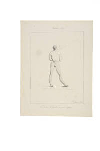
[FREYCINET VOYAGE] ARAGO, Jacques
Original drawing captioned "M le curé d'Agana en petit negligé
Guam 1819. In fine original condition. Original ink drawing 310 x 245 mm. fully signed and dated framed. <p><p>Jacques Arago artist on board Freycinet's Uranie during the French circumnavigation of 1817-20 drew this intimate portrait of Brother Ciriaco the curé in Agana the capital of Guam during the visit there of the Uranie expedition between March and June 1819. This is a charming and unusual portrait of a figure who likely expected to be taken more seriously: the cleric is shown in his "at home" attire his petit negligé smoking. His relaxed stance dressed in a vest and daringly striped leggings is further enriched by the addition of the most delicate slippers. </p> <p>Arago 1790-1855 was not only the most accomplished of the artists who made the voyage aboard the Uranie but was one of the most intriguing of the early travellers. The wonders of the long expedition stayed with him for the rest of his life and he continued writing and drawing about the Pacific right up until he lost his sight. In 1822 he published his own well-regarded account of the voyage Promenade Autour du Monde which was published in an English version in 1823. Over the ensuing decades he wrote more differing versions of this interesting account. </p> <p>The Freycinet expedition stayed for a long time in Agana where they were well received by the Spanish Governor Don Jose Medinilla. Agana modern Hagåtña is the capital of Guam and thus the westernmost state or territorial city of the United States despite its modern population numbering only about a thousand.</p> <p>As several of the Uranie crew had recently died from dysentery Louis de Freycinet took this opportunity to rest his men for several months. Here in the Marianas the Spanish missionaries were both powerful and respected and the sailors were required to attend holy week services. Arago was particularly known for his lively and arresting images of the people he encountered with a distinct preference for the unusual or the grotesque. Whether the priest knew that Arago was drawing him at this intimate moment is not known but it seems more likely that Arago captured this image surreptitiously and certainly the satirical tone of the caption - with its reference to the curé and his informal attire - suggests that this delightful vision of the priest off his guard was not meant to be shared. </p> <p>Although unpublished though fully signed and dated the drawing remained in the archives of Louis de Freycinet and his descendants which perhaps indicates that it was at least considered for publication in the massive official account of the voyage.</p> <p>---</p> <p>Arago's textual description</p> <p>In his own books Arago writes at some length various versions and editions including Voyage autour du Monde Paris 1840 vol. II pp. 141-5 and more briefly in his English version Narrative of a Voyage Round the World in the Uranie. commanded by Captain Freycinet. London 1823 pp. 248-50 about the primitive state of religion in the Marianas and the notably pragmatic approach to questions of morality in Agana. He singles out the curé Brother Ciriaco:</p> <p>"Nowhere perhaps is there so much and so little religion as at Guam. The women bestow their favours for a rosary. The men do not blush to offer you a sister or some other of their relations and will immediately after prostrate themselves at the foot of the altar. In the churches the two sexes are separate; and if you see few girls without a veil you also see few men gaze at them. In church the people behave like Christians; in the city and in the country like savages.</p> <p>"Here as in Spain the husbands are very jealous of their wives; lovers of their mistresses: but these excepted you may pay your court if you please to their sisters and friends; what is it to them What is not appropriated to themselves is no concern of theirs: and you will find men shameless enough to offer you as soon as you enter their houses one of their relations for fear you should cast an eye on their wives. At the same time you may be assured that if you please the wife you will not long sigh in vain.</p> <p>"We should be astonished at the prodigious number of processions and religious ceremonies with which the people are amused at Guam if we were not aware that the zeal of devotees and even the carelessness of the indifferent are beneficial to the church and particularly to the priest who takes advantage of every thing. Collections are made at the houses; requisitions are ordered; and there are few of the inhabitants who can escape that sort of tax. Such as have no money of which there is very little in the settlement provide fruit vegetables and meat to fill the stores of the priest who probably distributes a considerable portion among the poor. . . But I saw no poor at Guam!</p> <p>"I imagined the processions would cease when Lent was over and that the people would have a few days respite. By no means: they went on more sedulously than ever: and all things considered these poor people to whom the church prescribes rest or prohibits labour half the week are not so much to blame for devoting three-fourths of their lives to idleness. Is it not even from excess of zeal that the land is so neglected I cannot tell but I fear I was too severe in my first conjectures. Let me be more circumspect in future.</p> <p>.</p> <p>"It is truly painful to see a people who might so easily be guided aright given-up to the darkness in which they are enveloped and even in the present day adopting with blind confidence the absurd narratives of pretended daily miracles with which they are amused every hour of the day. Our learned Abbé de Quelen whose paternal cares are not confined to the instruction of the crew with whom he has made so long a voyage has had many conversations with the priest of Agagna; and he is convinced that the poor man can scarcely instruct his flock in the simplest lessons of the catechism as he is himself ignorant of the fundamental principles of our religion. As to Latin which he told us he had studied from his earliest infancy under the ablest professors at Manilla our chaplain who speaks it with the greatest fluency could scarcely make him understand a few words by turning and varying his phrases: and for my own part I am convinced that as long as such pastors as friar Ciriaco are sent to the Marianne islands religion will be little honoured there and the morals of the people will not be in the slightest degree improved".</p> </p> . Provenance: Until the 1960s in Freycinet family ownership subsequently in a private collection. unknown
Référence libraire : 4504053
|
|
|
[Friend, Washington].
The Falls of Niagara: Being a Complete Guide to all the Points of Interest Around and in the Immediate Neighbourhood of the Great Cataract. New York, T. Nelson and Sons, [ca. 1875].
Oblong 12mo. 40 pp. With 12 tinted wood-engravings. Original illustrated red cloth covers; 1 wood-engraved illustration mounted to upper cover. Somewhat later edition (first published in 1858) showing 12 pretty wood-engraved illustrations of Niagara Falls (after drawings by W. Friend and photographs). - Light inkstaining to front free endpaper (with slight bleeding to title-page). Binding slightly wavy; cover illustration somewhat soiled and scuffed; views well preserved. OCLC 10361199. Cf. Sabin 55116. Not in Howes.

|
|
|
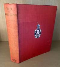
[Frobisher, Martin] [George Best] edited by Stefansson, Vilhjalmur
The Three Voyages of Martin Frobisher. In Search of a Passage to Cathay and India by the North-West A.D. 1576-8. From the Original 1578 Text of George Best. Together with Numerous Other Versions Additions Etc. Now Edited with Preface Introduction Notes Appendixes and Bibliography by Vilhjalmur Stefansson
London: The Argonaut Press 1938. Limited Edition . Hardcover. Very Good. Two Volumes bound as one limited to 475 copies. This copy unnumbered. Quarto. Vol.I. cxxx166 pgs. Vol.II. 293 pgs. with index. Complete with all maps diagrams illustrations. Gently used with light fading to red cloth. Small bookplate to front endpaper. No other names or marks. Excellent overall. <br/> <br/> The Argonaut Press hardcover
Référence libraire : 010727
|
|
|
[GADD (Cyril John)]
Assyrian sculptures in the British Museum. From Shalmaneser III to Sennacherib
Londres, British Museum, 1938 in-4, 19 pp. de texte et 69 planches en noir, toile bleue, encadrements à froid sur les plats (reliure de l'éditeur).
Référence libraire : 220885
|
|
|
[GALILÉE] - SHOUFANI (Émile) -
Voyage en Galilée.
Paris, Albin Michel, 1999 ; in-4, 125 pp., br. Broché très bon état.
Référence libraire : 201207553
|
|
|
[GALLAND (Antoine)]
Les Mille et une nuits
Paris, La librairie des bibliophiles, 1881. 10 vol in-12, demi-maroquin à coins rouge, doubles filets dorés sur les plats, dos à nerfs orné de caissons dorés, tête dorée, couverture conservée (minuscules épidermures).
Référence libraire : 19215

|
|
|
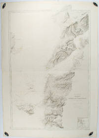
[GALLIPOLI - ANTIQUE MAP] DUMAS-VORZET, E; GERIN, A (ENGRAVER); GERMAIN, A (HYDROGRAPHER)
Abords et Entrée des Dardanelles. Mer Mediterranée.
Paris.: Service hydrographique et océanographique de la marine. 1883 but1894. Engraved hydrographical chart on watermarked double sheet 99 x 63 cm soundings in metres lighthouses picked out in yellow and red inset map of the port and town of Tenedos central fold a few very slight edge tears to the generous margins light spotting and surface soiling but in very good condition. Fine and impressive large naval chart of this strategically important strait then still under the control of the Ottoman Empire. <br> <br>From a private collection; "Lord John Fitzroy Royal Yacht Squadron" in manuscript on the verso. . Service hydrographique et océanographique de la marine unknown
Référence libraire : 178272
|
|
|
[GARNIER (E.)]
Nouvel abrégé de tous les voyages autour du monde depuis Magellan jusqu'à Durville et Laplace (1519-1832). 9eme ed. orné de seize gravures en taille-douce.
1859 reliure prune éditeur, fer de lycée sur le Ier plat. 2 vol. in-12, 2 front., 6 gravures sur acier, Tours Mame 1859,
Référence libraire : 8707
|
|
|
[GASCOGNE] - TAMIZEY de LARROQUE (Ph.).-
Voyage à Jérusalem de Philippe de Voisins, Seigneur de Montaut publié pour la Société historique de Gascogne.
P., Champion, Auch, Cocharaux, 1883, in 8° broché, 60 pages.
Référence libraire : 40067
|
|
|
[GAVARNI] - LA BEDOLLIERE (Emile de).-
Londres et les anglais illustrés par GAVARNI.
P., Barba, sans date (1862), très grand in 8° relié demi basane bleue, 380 pages ; rousseurs éparses ; frottis d'usage à la reliure ; dos insolé.
Référence libraire : 60985
|
|
|
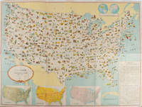
[GENERAL DRAFTING COMPANY]. ネラル・ドラーフティング株式会社.
アメリカ合衆國.主要地方資源産物及び風景絵入り地図. Amerika Gasshūkoku. Shuyō chihō shigen sanbutsu oyobi fūkei eiri chizu. Pictorial Map of the United States of America Showing Principal Regional Resources Products and Natural Features.
Washington D.C.: 国務省. Kokumishō. No date. circa1955. Large folding Japanese coloured map of the United States with 3 inset maps at foot of map showing main railways air and highway routes and hemispheres at the top right. Some browning mainly visible on reverse still a good copy. 66 x 81cm. An intricate and detailed pictorial map of the United States published in Japanese by the US State Department. The same type of map had been published since 1945 in English and subsequently in other languages. The Japanese language map is hard to find. The map is undated but was probably produced in the 1950's. The images include depictions of women board riders in two piece swimsuits of the sort popular in the 1950s but the inset text lists Alaska and Hawaii as external territories of the US indicating that the map was produced before they attained statehood in 1959. <br> <br>An inset panel provides information on the area and population of the US the population of major American cities mineral and other resources climate and topography. A note at the bottom right hand corner of the map states that copies of the map can be obtained free of charge from your nearest US Information Office. <br> <br>Every region of the country is decorated with an illustration of the natural resources industries or cultural or historical resources associated with that particular place. These include images of early colonial settlers the birthplaces of Mark Twain and Woodrow Wilson Booker T. Washington's house and Abraham Lincoln's grave; images of major dams oil fields coal mines cotton plantations etc. various animals and crops and images of ships cars and public buildings including the Statue of Liberty located rather oddly far out at sea. . 国務省. [Kokumishō]. unknown
Référence libraire : 172003
|
|
|
[GEOGRAPHIE]
Selections de connaissance du monde.
Paris, Société continentale d'éditions modernes illustrées, 1960 ; in-8, 240 pp., pleine toile d'éditeur avec rhodoide. Tirage réservé au bibliophiles de l'aventure.
Référence libraire : 200815540
|
|
|
[GEOGRAPHIE]
Selections de connaissance du monde.
Paris, Société continentale d'éditions modernes illustrées, 1960 ; in-8, 112 pp., pleine toile d'éditeur avec rhodoide. Tirage réservé au bibliophiles de l'aventure.
Référence libraire : 200815539
|
|
|
[GEOGRAPHIE]
Selections de connaissance du monde.
Paris, Société continentale d'éditions modernes illustrées, 1960 ; in-8, 112 pp., pleine toile d'éditeur avec rhodoide. Tirage réservé au bibliophiles de l'aventure.
Référence libraire : 200815538
|
|
|
[GEOGRAPHIE]
Selections de connaissance du monde.
Paris, Société continentale d'éditions modernes illustrées, 1959 ; in-8, 112 pp., pleine toile d'éditeur. Tirage réservé au bibliophiles de l'aventure.
Référence libraire : 200815537
|
|
|

 Recevoir par e-mail
 Télécharger en PDF
 Flux RSS
 Lien permanent


