|
|
|
Homanns Erben und Johann Matthias Hase
Imperii Russici et Tartariae Universae ... opera Ioh. Mathiae Hasii Math. P.P. ... Impensis Homannianorum Heredum Norib. A 1730. Alt grenzkolorierte Kupferstich-Karte mit zwei Kartuschen, oben mit Porträt von Anna Iwanowna (auch: Anna Ioannowna, Kaiserin von 1730-1740)..
Nürnberg, Homanns Erben [Homann], 1730. 48 x 57 cm. Blattgröße 52,5 x 62,8 cm. Leicht gebräunt, Ränder stärker u. teils fleckig bzw. abgegriffen. Der obere Rand feuchtigkeitsspurig u. stockfleckig.
Référence libraire : 32787AB

|
|
|
Homer
Homers Odüßee [Odyssee] übersezt [übersetzt] von Johann Heinrich Voß.
Hamburg, Auf Kosten des Verfassers, 1781. 469 S. Neuerer Halbpergamentband mit goldbedrucktem Papier-Rückenschildchen und unter Verwendung der marmorpapierbezogenen Deckel des ursprünglichen Halbpergamentbandes der Zeit. Nach längerer Diskussion über die Übersetzbarkeit des Epos entschloß sich Voß nach dem Vorbild von Klopstocks "Gelehrtenrepublik" zu einer Ausgabe gegen Vorauszahlung. Jedoch gelang es ihm erst nach über einem Jahr und nachdem er den Preis gesenkt hatte und auf Vorauszahlung verzichtete, die nötigen 1240 Vorbesteller zu finden. Seine Übertragung gilt bis heute als klassisch und überstrahlt den Ruhm seiner eigenen Schriften bei weitem. Es fehlen die 8 Blatt "Verzeichniß der Pränumeranten und Subskribenten" sowie die beweglichen Vorsatzpapiere. Das Titelblatt und die ersten Seiten gering fingerfleckig. Das Titelblatt am oberen Rand zur Stabilisierung zudem mit einem schmalen Papierstreifen hinterklebt und die Deckel berieben. Trotz der Gebrauchsspuren insgesamt noch gutes Exemplar. Erste Ausgabe.
Référence libraire : 000139
|
|
|
Homer
The Iliad &[and] Odyssey / of Homer. Retold for children by Barbara Leonie Picard. Ill. by Joan Kiddell-Monroe.
Littlehampton Book Services Ltd, 1986. XI, 483 pp. 8°. New ed. Orig. cloth with gold-stamping on spine, and DJ.
Référence libraire : 30926
|
|
|
Homer / Friedrich Leopold Graf zu Stolberg und Johann Heinrich Voß (Übersetzer) / Abraham Voß (Hrsg.)
Homers sämmtliche Werke übersetzt von Stolberg und Voss. Herausgegeben von Abraham Voss. Erster Theil: Homers Ilias übersetzt von Friedrich Leopold Graf zu Stolberg. Neuer Abdruck. Zweiter Theil: Homers Odyssee übersetzt von Joh. Heinr. Voß. Erste Übersetzung, neuer Abdruck, vermehrt mit erläuternden Anmerkungen aus den hinterlassenen Papieren des Übersetzers. Zusammen 2 Bände.
Leipzig, Immanuel Müller, 1843. Titelblatt, 3 Blatt, 512 S.; VIII, 464 S. Halbleinenbände der Zeit mit dekorativer Romantiker-Goldprägung auf den Rücken. Abraham Voß hatte die erste Fassung von seines Vaters Odysseeübertragung (Hamburg, auf Kosten des Verfassers 1781) erstmals 1837 um dessen nachgelassene Anmerkungen vermehrt herausgegeben und ergänzt sie hier um Stolbergs Iliasübersetzung (Leipzig 1778), auf die J. H. Voß sich in seinem vorangestellten Widmungsgedicht bezieht. Theil 2 ohne Wiederholung des Reihentitels, sonst schönes, fleckenfreies Exemplar mit nur geringen Gebrauchsspuren.
Référence libraire : 006569
|
|
|
Homerus
Ilias / Odyssee / Homer. In d. Übers. von Johann Heinrich Voß. Nach d. Text d. Erstausgaben (Ilias Hamburg 1793, Odyssee Hamburg 1781), mit e. Nachw. von Wolf Hartmut Friedrich.
Stuttgart : Dt. Bücherbund, 1971. 835 S. 8°. Dünndruckausg. - Vollständ. Ausg. - Lizenzausg. OLwd mit Goldpräg. u. transparentem OFolienumschlag.
Référence libraire : 41068
|
|
|
Homerus
Ilias und Odyssee / Homer. In d. Übers. von Johann Heinrich Voss. Mit e. Geleitw. von Max Rychner.
Gütersloh : Bertelsmann Lesering, [1960]. 692 S. 8°. Dünndruckausg. - Lizenzausg. OHPergament mit grauem Kopfschnitt. (Buch ; 2865)
Référence libraire : 7213
|
|
|
Homerus
Ilias und Odyssee / Homer. Nacherz. von Walter Jens. Bilder von Alice u. Martin Provensen.
Ravensburg : Maier, [2009]. 96 S. : zahlr. Ill. 4°. Bibl.- Einbd. (Ravensburger)
Référence libraire : 46311
|
|
|
HOMET, Johannes B
Mit Frankreich gegen die "Barbaren". Tageuch eines argentinischen Soldaten im Weltkriege.
Breslau,Korn (ca.1920). 6.-10.Aufl. 86 S. Okart., Schutzumschlag fehlt, Vortitel- und Titelblatt mit Bibliotheksstempel, sonst gut erhalten.
Référence libraire : R1497-02

|
|
|
HOMMEL Luc
Marie de Bourgogne ou le grand héritage
368pp.+ planches hors-texte & 1 carte dépliante, non coupé, 25cm.
|
|
|
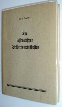
Hommel, Emil
Die Bessarabische Brudergemeinschaften
Germany: Publisher Unknown 1953. Book. Very Good. Hardcover. First Edition. 8vo - over 7¾" - 9¾" tall. 184 pages plus several pages of black and white photographic plates. Text in German. Clean and unmarked. Light wear. Dust jacket preserved in archival-grade Brodart cover. Very nice copy. Publisher Unknown Hardcover
Référence libraire : 742a5245
|
|
|
Hommel, Emil
Die Bessarabische Brudergemeinschaften
184 pages plus several pages of black and white photographic plates. Text in German. Clean and unmarked. Light wear. Dust jacket preserved in archival-grade Brodart cover. Very nice copy. Book

|
|
|
Hommel, F
Geschichte Babyloniens u. Assyriens.
Berlin, Grote, 1885. M. zahlr. Ktn., Taf. u. Textholzschn. VI, 802 S. Hlwd. M. Rsign. Einbd. etwas berieben u. angestaubt. Bind. bei Vors. etwas sichtbar. St. a. Tit. (Oncken, All. Gesch. in Einzeldarst. 1,2)
Référence libraire : 204717
|
|
|
Homo, LA©on
ESSAI SUR LE RÈGNE DE L'EMPEREUR AURÉLIEN
Thorin Et Fils Albert Fontemoing. 1904. Hardcover. Very Good. Bound in gorgeous Half-cloth marbled boards with gilt lettering to spine. Light tanning to pages. Pages uncut. Map has been repaired.; French biography of Emperor Trajan. 18 ills. map & 2 plans folded in.; Bibliothèque Des Écoles Françaises D'Athénes Et De Rome Fasc. 89; 390 pages . Thorin Et Fils Albert Fontemoing hardcover
Référence libraire : 4645
|
|
|
Homo, Leon. Translated By V. Gordon Childe
Primitive Italy and the Beginnings of Roman Imperialism (History of Civilization)
Very good 1968 reissue hardcover in like, unclipped plastic-protected dustjacket.
|
|
|
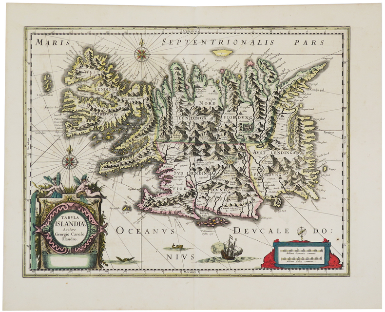
HONDIUS (Jodocus).
[ISLANDE] Tabula Islandiæ Auctore Georgio Carolo Flandro.
[Amsterdam, 1639-1649]. 379 x 494 mm.
Référence libraire : LBW-5447
|
|
|
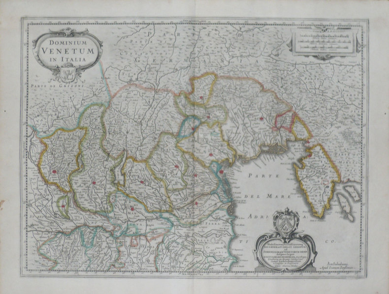
HONDIUS (Henricus);
[VENETIE] Dominium venetum in Italia.
Amsterdam 1639-1649 378 x 498 mm.
Référence libraire : LBW-1468
|
|
|
Honegger, R.E.
Amphibiens et reptiles menacés en Europe.
1978 Strasbourg, Conseil de l'Europe, 1978 : In-4 Carré, Broché. 127 pp., collection "sauvegarde de la nature" n° 15 Très bon état, Couv. convenable, Dos satisfaisant, Intérieur frais.
Référence libraire : VR32264

|
|
|
Hongrie Europe
Europe n°411-412 07 08-1963 littérature hongroise [Unknown Binding]
Juillet - août 1963. Aspect jauni, pliures en dos de couverture, in térieur propre.
Référence libraire : LN6165 ISBN : 9
|
|
|
Hont Istvan
Jealousy Of Trade: International Competition And The Nation State In Historical Perspective
The Belknap Press 2005 541 pages 16 26x4 83x23 62cm. 2005. Cartonné jaquette. 541 pages. Le livre analyse le concept de 'jalousie du commerce' comme phénomène historique où le succès dans le commerce international devient une question de survie militaire et politique des nations. Il explore les théories du XVIIIe siècle sur la concurrence des marchés internationaux en commençant par l'ajout de la notion de 'commerce' à l'état de nature de Hobbes par Samuel Pufendorf puis examine l'économie politique néo-machiavélienne britannique après la Glorieuse Révolution
Référence libraire : 100147118 ISBN : 674010388

|
|
|
HON LE, H.:
L'homme fossile en Europe. Son industrie, ses moeurs, ses oeuvres d'art. "Temps antédiluviens et préhistoriques". Deuxième édition corrigée & considérablement augmentée.
cParis, C. Reinwald, / Bruxelles , C. Muquardt, 1868, gr. in-8vo, 360 p., ill. de cent gravures brochure originale. Dos fendillé (ex. a relier).
Référence libraire : 130750aaf
|
|
|
HONDIUS Jodocus (Amsterdam 1563 - 1612)
Aniou
Carta tratta dalla prima edizione della "Cosmographia Universalis" di Paul Merula , stampata ad Amsterdam nel 1605. Le mappe usate per illustrare la prima edizione della Cosmografia di Merula sono realizzate nel 1598 da Jodocus Hondius e Pieter Van den Keere (Kaerius) e quidni utilizzate dall'editore Cornelis Claesz per illustrare lavori di Apian, Linschoten e Merula. Incisione in rame, inserita uin una pagina di testo, in perfette condizioni. Taken from the first edition of "Cosmographia Universalis" by Paul Merula, printed in Amsterdam in 1605.The map was first issued in 1598 by Cornelis Claesz and engraved and realized by Jodocus Hondius and Pietre vand den Keere (Kaerius). Claesz used the plate to illustrate various works he published by Peter Apian, Jan van Linschoten, Paul Merula and others. Copperplate, inset in a page text, very good conditions. King pp 80/81

|
|
|
HONDIUS Jodocus (Amsterdam 1563 - 1612)
Biturigum
Carta tratta dalla prima edizione della "Cosmographia Universalis" di Paul Merula , stampata ad Amsterdam nel 1605. Le mappe usate per illustrare la prima edizione della Cosmografia di Merula sono realizzate nel 1598 da Jodocus Hondius e Pieter Van den Keere (Kaerius) e quidni utilizzate dall'editore Cornelis Claesz per illustrare lavori di Apian, Linschoten e Merula. Incisione in rame, inserita uin una pagina di testo, in perfette condizioni. Taken from the first edition of "Cosmographia Universalis" by Paul Merula, printed in Amsterdam in 1605.The map was first issued in 1598 by Cornelis Claesz and engraved and realized by Jodocus Hondius and Pietre vand den Keere (Kaerius). Claesz used the plate to illustrate various works he published by Peter Apian, Jan van Linschoten, Paul Merula and others. Copperplate, inset in a page text, very good conditions. King pp 80/81

|
|
|
HONDIUS Jodocus (Amsterdam 1563 - 1612)
Burgundia Comitatus
Mappa tratta dall’Atlas minor Gerardi Mercatoris a I. Hondio plurimis aeneis tabulis auctus et illustratus. Apparso per la prima volta nel 1607, l'atlante Mercator-Hondius-Mercator fu un successo a livello europeo, con edizioni pubblicate sia in latino che in diverse altre lingue. Le varie edizioni furono curate da Jodocus Hondius e poi da Jan Janssonius, e contenevano un numero crescente di mappe. "Shortly after the publication of the big folio-atlases the need was apparantly felt for a smaller-sized atlas, one that would be handier, and, above all, cheaper, so that a larger public might have access to the use of maps. The publication of the Atlas Minor appeared to be a great success for Hondius; the first Latin edition was in great demand. The copperplates of the first atlases minor were most almost certainly engraved by Jodocus Hondius himself. After 1621, the copperplates of the Atlas Minor were sold to a London editor. Firstly, they appeared in Purchas his Pilgrinies, printed in 1625 by William Stansby for Henry Featherstone. Next they were used for the translation of the Mercator-atlas, printed in small folio under the title Historia mundi, or Mercators atlas, by Thomas Cotes for Michael Sparke and Samuel Cartwight in 1635". (cf. Koeman II Me 191). "As with the Theatrum of Abraham Ortelius, Jodocus Hondius planned a reduced size version of Gerard Mercator's folio atlas. Just one year after his first edition he published his Latin text Atlas Minor in collaboration with Jan Jansz. and Cormelis Claesz. The arrangement between these three is not understood clearly but Hondius is believed to have been the owner of the copperplates. Cartographically this is taken directly from the folio maps by Hondius in 1606 [..]. with the inevitable loss of detail due to the reduction” (cf. Burden, The Mapping of North America, 153). Incisione su rame, finemente colorata a mano, in buone condizioni. Bibliografia Koeman II Me 191; cfr. Phillips 426; cfr. Burden 153. Map taken from Atlas minor Gerardi Mercatoris a I. Hondio plurimis aeneis tabulis auctus et illustratus. Appearing first in 1607, the Hondius-Mercator ‘smaller’ atlas was a Europe-wide success, with editions published both in Latin and in several vernaculars. The various editions were edited by Jodocus Hondius and then Jan Janssonius, and contained an increasing number of maps. "Shortly after the publication of the big folio-atlases the need was apparantly felt for a smaller-sized atlas, one that would be handier, and, above all, cheaper, so that a larger public might have access to the use of maps. The publication of the Atlas Minor appeared to be a great success for Hondius; the first Latin edition was in great demand. The copperplates of the first atlases minor were most almost certainly engraved by Jodocus Hondius himself. After 1621, the copperplates of the Atlas Minor were sold to a London editor. Firstly, they appeared in Purchas his Pilgrinies, printed in 1625 by William Stansby for Henry Featherstone. Next they were used for the translation of the Mercator-atlas, printed in small folio under the title Historia mundi, or Mercators atlas, by Thomas Cotes for Michael Sparke and Samuel Cartwight in 1635". (cf. Koeman II Me 191). "As with the Theatrum of Abraham Ortelius, Jodocus Hondius planned a reduced size version of Gerard Mercator's folio atlas. Just one year after his first edition he published his Latin text Atlas Minor in collaboration with Jan Jansz. and Cormelis Claesz. The arrangement between these three is not understood clearly but Hondius is believed to have been the owner of the copperplates. Cartographically this is taken directly from the folio maps by Hondius in 1606 [..]. with the inevitable loss of detail due to the reduction” (cf. Burden, The Mapping of North America, 153). Copperplate with fine colouring, good conditions. Bibliografia Koeman II Me 191; cf. Phillips 426; cf. Burden 153.

|
|
|
HONDIUS Jodocus (Amsterdam 1563 - 1612)
Burgundiae Com
Carta tratta dalla prima edizione della "Cosmographia Universalis" di Paul Merula , stampata ad Amsterdam nel 1605. Le mappe usate per illustrare la prima edizione della Cosmografia di Merula sono realizzate nel 1598 da Jodocus Hondius e Pieter Van den Keere (Kaerius) e quidni utilizzate dall'editore Cornelis Claesz per illustrare lavori di Apian, Linschoten e Merula. Incisione in rame, inserita uin una pagina di testo, in perfette condizioni. Taken from the first edition of "Cosmographia Universalis" by Paul Merula, printed in Amsterdam in 1605.The map was first issued in 1598 by Cornelis Claesz and engraved and realized by Jodocus Hondius and Pietre vand den Keere (Kaerius). Claesz used the plate to illustrate various works he published by Peter Apian, Jan van Linschoten, Paul Merula and others. Copperplate, inset in a page text, very good conditions. King pp.80/81

|
|
|
HONDIUS Jodocus (Amsterdam 1563 - 1612)
Burgundiae Ducatus
Carta tratta dalla prima edizione della "Cosmographia Universalis" di Paul Merula , stampata ad Amsterdam nel 1605. Le mappe usate per illustrare la prima edizione della Cosmografia di Merula sono realizzate nel 1598 da Jodocus Hondius e Pieter Van den Keere (Kaerius) e quidni utilizzate dall'editore Cornelis Claesz per illustrare lavori di Apian, Linschoten e Merula. Incisione in rame, inserita uin una pagina di testo, in perfette condizioni. Taken from the first edition of "Cosmographia Universalis" by Paul Merula, printed in Amsterdam in 1605.The map was first issued in 1598 by Cornelis Claesz and engraved and realized by Jodocus Hondius and Pietre vand den Keere (Kaerius). Claesz used the plate to illustrate various works he published by Peter Apian, Jan van Linschoten, Paul Merula and others. Copperplate, inset in a page text, very good conditions. King pp.80/81

|
|
|
HONDIUS Jodocus (Amsterdam 1563 - 1612)
Caletensium et Bononiesium def
Carta tratta dalla prima edizione della "Cosmographia Universalis" di Paul Merula , stampata ad Amsterdam nel 1605. Le mappe usate per illustrare la prima edizione della Cosmografia di Merula sono realizzate nel 1598 da Jodocus Hondius e Pieter Van den Keere (Kaerius) e quidni utilizzate dall'editore Cornelis Claesz per illustrare lavori di Apian, Linschoten e Merula. Incisione in rame, inserita uin una pagina di testo, in perfette condizioni. Taken from the first edition of "Cosmographia Universalis" by Paul Merula, printed in Amsterdam in 1605.The map was first issued in 1598 by Cornelis Claesz and engraved and realized by Jodocus Hondius and Pietre vand den Keere (Kaerius). Claesz used the plate to illustrate various works he published by Peter Apian, Jan van Linschoten, Paul Merula and others. Copperplate, inset in a page text, very good conditions. King pp. 80/81

|
|
|
HONDIUS Jodocus (Amsterdam 1563 - 1612)
Descriptio Comitatus Nassovi Cattimeliboci
Carta geografica tratta dal Tabularum Geographicarum contractarum libri septem di Petrus Bertius, edizione latina del 1616. L'opera contiene 219 carte che illustrano questa nuova versione della geografia del Bertius, per la prima volta pubblicata nel 1612 con le carte di Barent Langenes. Le carte derivano dal grande atlante di Mercator/Hondius, delle quali molte rappresentano una semplice riduzione. "After the death of Cornelis Claesz in 1609, Jodocus Hondius II became the new publisher of the work, composed by 7 parts in 1, with engraved title-page and 220 full-page engraved maps in text. All the maps were newly engraved and slightly larger in size, because Hondius was not able to acquire the original plates. With the new plates the work was definitely improved and enjoyed a growing demand of the public, which at that time had the choice between the Atlas Minor by Mercator and Bertius' Tabularum Geographicarum. The 219 plates, with the oval world map appearing twice, were produced to illustrate a new version of the geography of Bertius, published in 1616. According to King, their correct attribution is by Hondius, after Mercator and Hondius, taken from Bertius, who was only responsible for revising his text again" [cfr. G. King, Miniature Antique Maps]. Incisione in rame, perfette condizioni A superior rival to the pocket Ortelius atlas appeared about 1598, under the imprint of Barent Langenes and Cornelis Claesz. Claesz also published the Tabularum Geographicarum contractarum libri septem, edition with texy by Petrus Bertius, in 1600. After the death of Cornelis Claesz in 1609, Jodocus Hondius II became the new publisher of the work, composed by 7 parts in 1, with engraved title-page and 220 full-page engraved maps in text. All the maps were newly engraved and slightly larger in size, because Hondius was not able to acquire the original plates. With the new plates the work was definitely improved and enjoyed a growing demand of the public, which at that time had the choice between the Atlas Minor by Mercator and Bertius' Tabularum Geographicarum. The 219 plates, with the oval world map appearing twice, were produced to illustrate a new version of the geography of Bertius, published in 1616. According to King, their correct attribution is by Hondius, after Mercator and Hondius, taken from Bertius, who was only responsible for revising his text again. "After the death of Cornelis Claesz in 1609, Jodocus Hondius II became the new publisher of the work, composed by 7 parts in 1, with engraved title-page and 220 full-page engraved maps in text. All the maps were newly engraved and slightly larger in size, because Hondius was not able to acquire the original plates. With the new plates the work was definitely improved and enjoyed a growing demand of the public, which at that time had the choice between the Atlas Minor by Mercator and Bertius' Tabularum Geographicarum. The 219 plates, with the oval world map appearing twice, were produced to illustrate a new version of the geography of Bertius, published in 1616. According to King, their correct attribution is by Hondius, after Mercator and Hondius, taken from Bertius, who was only responsible for revising his text again" [cf. G. King, Miniature Antique Maps]. Copperplate, in very good conditions. Koeman p. 42; King p. 96/99.

|
|
|
HONDIUS Jodocus (Amsterdam 1563 - 1612)
Europa
Carta tratta dalla prima edizione della "Cosmographia Universalis" di Paul Merula , stampata ad Amsterdam nel 1605. Le mappe usate per illustrare la prima edizione della Cosmografia di Merula sono realizzate nel 1598 da Jodocus Hondius e Pieter Van den Keere (Kaerius) e quidni utilizzate dall'editore Cornelis Claesz per illustrare lavori di Apian, Linschoten e Merula. Incisione in rame, inserita uin una pagina di testo, in perfette condizioni. Taken from the first edition of "Cosmographia Universalis" by Paul Merula, printed in Amsterdam in 1605.The map was first issued in 1598 by Cornelis Claesz and engraved and realized by Jodocus Hondius and Pietre vand den Keere (Kaerius). Claesz used the plate to illustrate various works he published by Peter Apian, Jan van Linschoten, Paul Merula and others. Copperplate, inset in a page text, very good conditions. King pp. 80/81

|
|
|
HONDIUS Jodocus (Amsterdam 1563 - 1612)
Gallia
Carta tratta dalla prima edizione della "Cosmographia Universalis" di Paul Merula , stampata ad Amsterdam nel 1605. Le mappe usate per illustrare la prima edizione della Cosmografia di Merula sono realizzate nel 1598 da Jodocus Hondius e Pieter Van den Keere (Kaerius) e quidni utilizzate dall'editore Cornelis Claesz per illustrare lavori di Apian, Linschoten e Merula. Incisione in rame, inserita uin una pagina di testo, in perfette condizioni. Taken from the first edition of "Cosmographia Universalis" by Paul Merula, printed in Amsterdam in 1605.The map was first issued in 1598 by Cornelis Claesz and engraved and realized by Jodocus Hondius and Pietre vand den Keere (Kaerius). Claesz used the plate to illustrate various works he published by Peter Apian, Jan van Linschoten, Paul Merula and others. Copperplate, inset in a page text, very good conditions. King pp. 80/81

|
|
|
HONDIUS Jodocus (Amsterdam 1563 - 1612)
Galliae Narbonesis descriptio
Carta tratta dalla prima edizione della "Cosmographia Universalis" di Paul Merula , stampata ad Amsterdam nel 1605. Le mappe usate per illustrare la prima edizione della Cosmografia di Merula sono realizzate nel 1598 da Jodocus Hondius e Pieter Van den Keere (Kaerius) e quidni utilizzate dall'editore Cornelis Claesz per illustrare lavori di Apian, Linschoten e Merula. Incisione in rame, inserita uin una pagina di testo, in perfette condizioni. Taken from the first edition of "Cosmographia Universalis" by Paul Merula, printed in Amsterdam in 1605.The map was first issued in 1598 by Cornelis Claesz and engraved and realized by Jodocus Hondius and Pietre vand den Keere (Kaerius). Claesz used the plate to illustrate various works he published by Peter Apian, Jan van Linschoten, Paul Merula and others. Copperplate, inset in a page text, very good conditions. King pp.80/81

|
|
|
HONDIUS Jodocus (Amsterdam 1563 - 1612)
Normandia
Carta tratta dalla prima edizione della "Cosmographia Universalis" di Paul Merula , stampata ad Amsterdam nel 1605. Le mappe usate per illustrare la prima edizione della Cosmografia di Merula sono realizzate nel 1598 da Jodocus Hondius e Pieter Van den Keere (Kaerius) e quidni utilizzate dall'editore Cornelis Claesz per illustrare lavori di Apian, Linschoten e Merula. Incisione in rame, inserita uin una pagina di testo, in perfette condizioni. Taken from the first edition of "Cosmographia Universalis" by Paul Merula, printed in Amsterdam in 1605.The map was first issued in 1598 by Cornelis Claesz and engraved and realized by Jodocus Hondius and Pietre vand den Keere (Kaerius). Claesz used the plate to illustrate various works he published by Peter Apian, Jan van Linschoten, Paul Merula and others. Copperplate, inset in a page text, very good conditions. King pp. 80/81

|
|
|
HONDIUS Jodocus (Amsterdam 1563 - 1612)
Picardia
Carta tratta dalla prima edizione della "Cosmographia Universalis" di Paul Merula , stampata ad Amsterdam nel 1605. Le mappe usate per illustrare la prima edizione della Cosmografia di Merula sono realizzate nel 1598 da Jodocus Hondius e Pieter Van den Keere (Kaerius) e quidni utilizzate dall'editore Cornelis Claesz per illustrare lavori di Apian, Linschoten e Merula. Incisione in rame, inserita uin una pagina di testo, in perfette condizioni. Taken from the first edition of "Cosmographia Universalis" by Paul Merula, printed in Amsterdam in 1605.The map was first issued in 1598 by Cornelis Claesz and engraved and realized by Jodocus Hondius and Pietre vand den Keere (Kaerius). Claesz used the plate to illustrate various works he published by Peter Apian, Jan van Linschoten, Paul Merula and others. Copperplate, inset in a page text, very good conditions. King pp. 80/81

|
|
|
HONDIUS Jodocus (Amsterdam 1563 - 1612)
Poictou
Carta tratta dalla prima edizione della "Cosmographia Universalis" di Paul Merula , stampata ad Amsterdam nel 1605. Le mappe usate per illustrare la prima edizione della Cosmografia di Merula sono realizzate nel 1598 da Jodocus Hondius e Pieter Van den Keere (Kaerius) e quidni utilizzate dall'editore Cornelis Claesz per illustrare lavori di Apian, Linschoten e Merula. Incisione in rame, inserita uin una pagina di testo, in perfette condizioni. Taken from the first edition of "Cosmographia Universalis" by Paul Merula, printed in Amsterdam in 1605.The map was first issued in 1598 by Cornelis Claesz and engraved and realized by Jodocus Hondius and Pietre vand den Keere (Kaerius). Claesz used the plate to illustrate various works he published by Peter Apian, Jan van Linschoten, Paul Merula and others. Copperplate, inset in a page text, very good conditions. King pp 80/81

|
|
|
HONDIUS Jodocus (Amsterdam 1563 - 1612)
Provinciae, Regionis Galliae, vera exactissimaq. descriptio…
Questa magnifica e decorative mappa della Provenza è basata sulla mappa di Pierre-Jean de Bompar’s del 1591. Incisa dal noto incisore olandese Baptista van Doetichum, che la decorò secondo il suo stile caratteristico, con accesi cartigli, un’elaborata rosa dei venti, velieri e mostri marini. La mappa copre l’area da Avignone al delta del Rodano fino a Saluzzo e Sanremo. Nel 1604, Jodocus Hondius (1563-1612) - probabilmente tramite Cornelis Claesz - acquistò le matrici in rame dell'Atlas sive cosmographicae meditationes de fabrica mundi di Gerard Mercator all’asta. Aggiunse circa 40 mappe, comprese nuove mappe dei continenti e importanti mappe regionali delle Americhe, prima di pubblicare una nuova edizione dell’opera, nel 1606, in concorrenza con il Theatrum Orbis Terrarum di Ortelius. Poiché molte delle mappe erano più aggiornate, la raccolta di Mercator & Hondius sostituì effettivamente il Theatrum di Ortelius. L’atlante del 1606 include tutte le 107 mappe dell’edizione del 1595, oltre a 37 nuove mappe, abilmente incise dallo stesso Hondius. La seconda edizione della raccolta seguì già nel 1607/08, mentre la prima edizione in un’altra lingua, il francese, fu messa sul mercato nel 1609. Apparentemente questa fu considerata come la terza edizione, perché nel 1611 apparve l'Editio Quarta, con un totale di 150 mappe. Dopo la morte di Jodocus Hondius (1612) la sua vedova e i suoi figli continuarono la stampa dell’atlante. Jodocus Junior ( o Jodocus II, 1594-1629) produsse diverse ristampe tra il 1613 e il 1619, sempre con le stesse 150 mappe; nel 1619 furono invece aggiunte sei nuove mappe. Dopo il 1620 la pubblicazione venne curata da Hendrick (Henricus) Hondius (1597-1651), il secondo figlio di Jodocus senior. Varie edizioni apparvero, nel 1623, 1628 e 1630. Hendrick fu il primo ad apportare dei veri cambiamenti: nell’edizione del 1628 firmò alcune mappe di Mercatore con il proprio nome. Nel 1630, quando probabilmente stava già collaborando con suo cognato Johannes Janssonius, aggiunse nove nuove carte. Incisione su rame, impressione molto scura, testo latino al verso, in ottime condizioni. This superb, decorative map of Provence was based on Pierre-Jean de Bompar's map of 1591. It was engraved by the famous Dutch copperplate engraver Baptista van Doetichum who embellished it in his distinctive style with bold cartouches, an elaborate compass rose, sailing ships and sea monsters. The map covers the region from Avignon and the Rhone delta to Saluzzo and San Remo in Italy. Map taken from the Atlas sive cosmographicae meditationes de fabrica mundi edited by Hendrick Hondius and based on the work by Giovanni Antonio Magini. In 1604, Jodocus Hondius (1563-1612) – probably trought Cornelis Claesz - bought the copperplates of Mercator’s Atlas sive cosmographicae meditationes de fabrica mundi at the auction of Gerard Jr.’s effects. He added about 40 maps, including new maps of the Continents and important regional maps of the Americas, before publishing a new edition of the Atlas, in 1606, in competition with Ortelius’ Theatrum Orbis Terrarum. As many of the maps were more up-to-date, the Mercator-Hondius Atlas effectively superseded Ortelius’ Theatrum. This atlas from 1606 include all 107 maps from the 1595 edition, as well as 37 new maps, skillfully engraved by Hondius, of various authors. The second edition of the Mercator-Hondius atlas followed as soon as 1607/08. The first edition in another language, French, was put on the market in 1609. Apparently this one was regarded as the third edition, because in 1611 Editio Quarta appeared with a total of 150 maps. After the death of Jodocus Hondius in 1612 his widow and sons continued the publication of the Atlas. For instance Jodocus Junior (1594-1629) produced several new editions of the Editio Quarta between 1613 and 1619, each with the same 150 maps. Finally in 1619 the last edition of this atlas followed, to which six new maps were added. After 1620 the publication of the Atlas was continued by Henricus Hondius (ca. 1596/97-1651), the second son of Jodocus senior. Various editions appeared, in 1623, 1628 and 1630. Henricus Hondius was the first to make some real changes: in the 1628 edition he provided some Mercator maps with his own name. In 1630, when he was probably already cooperating with his brother-in- law Johannes Janssonius, Henricus added nine new maps. Copperplate, a great dark impression, good condition. Koeman I, 4700:1A. Van der Krogt (Vol. I) #4700:1A.

|
|
|
HONDIUS Jodocus (Amsterdam 1563 - 1612)
Russia cum Confinijs
Mappa tratta dall’Atlas minor Gerardi Mercatoris a I. Hondio plurimis aeneis tabulis auctus et illustratus. Apparso per la prima volta nel 1607, l'atlante Mercator-Hondius-Mercator fu un successo a livello europeo, con edizioni pubblicate sia in latino che in diverse altre lingue. Le varie edizioni furono curate da Jodocus Hondius e poi da Jan Janssonius, e contenevano un numero crescente di mappe. "Shortly after the publication of the big folio-atlases the need was apparantly felt for a smaller-sized atlas, one that would be handier, and, above all, cheaper, so that a larger public might have access to the use of maps. The publication of the Atlas Minor appeared to be a great success for Hondius; the first Latin edition was in great demand. The copperplates of the first atlases minor were most almost certainly engraved by Jodocus Hondius himself. After 1621, the copperplates of the Atlas Minor were sold to a London editor. Firstly, they appeared in Purchas his Pilgrinies, printed in 1625 by William Stansby for Henry Featherstone. Next they were used for the translation of the Mercator-atlas, printed in small folio under the title Historia mundi, or Mercators atlas, by Thomas Cotes for Michael Sparke and Samuel Cartwight in 1635". (cf. Koeman II Me 191). "As with the Theatrum of Abraham Ortelius, Jodocus Hondius planned a reduced size version of Gerard Mercator's folio atlas. Just one year after his first edition he published his Latin text Atlas Minor in collaboration with Jan Jansz. and Cormelis Claesz. The arrangement between these three is not understood clearly but Hondius is believed to have been the owner of the copperplates. Cartographically this is taken directly from the folio maps by Hondius in 1606 [..]. with the inevitable loss of detail due to the reduction” (cf. Burden, The Mapping of North America, 153). Incisione su rame, finemente colorata a mano, in buone condizioni. Bibliografia Koeman II Me 191; cfr. Phillips 426; cfr. Burden 153. Map taken from Atlas minor Gerardi Mercatoris a I. Hondio plurimis aeneis tabulis auctus et illustratus. Appearing first in 1607, the Hondius-Mercator ‘smaller’ atlas was a Europe-wide success, with editions published both in Latin and in several vernaculars. The various editions were edited by Jodocus Hondius and then Jan Janssonius, and contained an increasing number of maps. "Shortly after the publication of the big folio-atlases the need was apparantly felt for a smaller-sized atlas, one that would be handier, and, above all, cheaper, so that a larger public might have access to the use of maps. The publication of the Atlas Minor appeared to be a great success for Hondius; the first Latin edition was in great demand. The copperplates of the first atlases minor were most almost certainly engraved by Jodocus Hondius himself. After 1621, the copperplates of the Atlas Minor were sold to a London editor. Firstly, they appeared in Purchas his Pilgrinies, printed in 1625 by William Stansby for Henry Featherstone. Next they were used for the translation of the Mercator-atlas, printed in small folio under the title Historia mundi, or Mercators atlas, by Thomas Cotes for Michael Sparke and Samuel Cartwight in 1635". (cf. Koeman II Me 191). "As with the Theatrum of Abraham Ortelius, Jodocus Hondius planned a reduced size version of Gerard Mercator's folio atlas. Just one year after his first edition he published his Latin text Atlas Minor in collaboration with Jan Jansz. and Cormelis Claesz. The arrangement between these three is not understood clearly but Hondius is believed to have been the owner of the copperplates. Cartographically this is taken directly from the folio maps by Hondius in 1606 [..]. with the inevitable loss of detail due to the reduction” (cf. Burden, The Mapping of North America, 153). Copperplate with fine colouring, good conditions. Bibliografia Koeman II Me 191; cf. Phillips 426; cf. Burden 153.

|
|
|
HONDIUS Jodocus (Amsterdam 1563 - 1612)
Saltzburg et Carinthie
Mappa tratta dall’Atlas minor Gerardi Mercatoris a I. Hondio plurimis aeneis tabulis auctus et illustratus. Apparso per la prima volta nel 1607, l'atlante Mercator-Hondius-Mercator fu un successo a livello europeo, con edizioni pubblicate sia in latino che in diverse altre lingue. Le varie edizioni furono curate da Jodocus Hondius e poi da Jan Janssonius, e contenevano un numero crescente di mappe. "Shortly after the publication of the big folio-atlases the need was apparantly felt for a smaller-sized atlas, one that would be handier, and, above all, cheaper, so that a larger public might have access to the use of maps. The publication of the Atlas Minor appeared to be a great success for Hondius; the first Latin edition was in great demand. The copperplates of the first atlases minor were most almost certainly engraved by Jodocus Hondius himself. After 1621, the copperplates of the Atlas Minor were sold to a London editor. Firstly, they appeared in Purchas his Pilgrinies, printed in 1625 by William Stansby for Henry Featherstone. Next they were used for the translation of the Mercator-atlas, printed in small folio under the title Historia mundi, or Mercators atlas, by Thomas Cotes for Michael Sparke and Samuel Cartwight in 1635". (cf. Koeman II Me 191). "As with the Theatrum of Abraham Ortelius, Jodocus Hondius planned a reduced size version of Gerard Mercator's folio atlas. Just one year after his first edition he published his Latin text Atlas Minor in collaboration with Jan Jansz. and Cormelis Claesz. The arrangement between these three is not understood clearly but Hondius is believed to have been the owner of the copperplates. Cartographically this is taken directly from the folio maps by Hondius in 1606 [..]. with the inevitable loss of detail due to the reduction” (cf. Burden, The Mapping of North America, 153). Incisione su rame, finemente colorata a mano, in buone condizioni. Bibliografia Koeman II Me 191; cfr. Phillips 426; cfr. Burden 153. Map taken from Atlas minor Gerardi Mercatoris a I. Hondio plurimis aeneis tabulis auctus et illustratus. Appearing first in 1607, the Hondius-Mercator ‘smaller’ atlas was a Europe-wide success, with editions published both in Latin and in several vernaculars. The various editions were edited by Jodocus Hondius and then Jan Janssonius, and contained an increasing number of maps. "Shortly after the publication of the big folio-atlases the need was apparantly felt for a smaller-sized atlas, one that would be handier, and, above all, cheaper, so that a larger public might have access to the use of maps. The publication of the Atlas Minor appeared to be a great success for Hondius; the first Latin edition was in great demand. The copperplates of the first atlases minor were most almost certainly engraved by Jodocus Hondius himself. After 1621, the copperplates of the Atlas Minor were sold to a London editor. Firstly, they appeared in Purchas his Pilgrinies, printed in 1625 by William Stansby for Henry Featherstone. Next they were used for the translation of the Mercator-atlas, printed in small folio under the title Historia mundi, or Mercators atlas, by Thomas Cotes for Michael Sparke and Samuel Cartwight in 1635". (cf. Koeman II Me 191). "As with the Theatrum of Abraham Ortelius, Jodocus Hondius planned a reduced size version of Gerard Mercator's folio atlas. Just one year after his first edition he published his Latin text Atlas Minor in collaboration with Jan Jansz. and Cormelis Claesz. The arrangement between these three is not understood clearly but Hondius is believed to have been the owner of the copperplates. Cartographically this is taken directly from the folio maps by Hondius in 1606 [..]. with the inevitable loss of detail due to the reduction” (cf. Burden, The Mapping of North America, 153). Copperplate with fine colouring, good conditions. Bibliografia Koeman II Me 191; cf. Phillips 426; cf. Burden 153.

|
|
|
HONDIUS Jodocus (Amsterdam 1563 - 1612)
Thuringia
Mappa tratta dall’Atlas minor Gerardi Mercatoris a I. Hondio plurimis aeneis tabulis auctus et illustratus. Apparso per la prima volta nel 1607, l'atlante Mercator-Hondius-Mercator fu un successo a livello europeo, con edizioni pubblicate sia in latino che in diverse altre lingue. Le varie edizioni furono curate da Jodocus Hondius e poi da Jan Janssonius, e contenevano un numero crescente di mappe. "Shortly after the publication of the big folio-atlases the need was apparantly felt for a smaller-sized atlas, one that would be handier, and, above all, cheaper, so that a larger public might have access to the use of maps. The publication of the Atlas Minor appeared to be a great success for Hondius; the first Latin edition was in great demand. The copperplates of the first atlases minor were most almost certainly engraved by Jodocus Hondius himself. After 1621, the copperplates of the Atlas Minor were sold to a London editor. Firstly, they appeared in Purchas his Pilgrinies, printed in 1625 by William Stansby for Henry Featherstone. Next they were used for the translation of the Mercator-atlas, printed in small folio under the title Historia mundi, or Mercators atlas, by Thomas Cotes for Michael Sparke and Samuel Cartwight in 1635". (cf. Koeman II Me 191). "As with the Theatrum of Abraham Ortelius, Jodocus Hondius planned a reduced size version of Gerard Mercator's folio atlas. Just one year after his first edition he published his Latin text Atlas Minor in collaboration with Jan Jansz. and Cormelis Claesz. The arrangement between these three is not understood clearly but Hondius is believed to have been the owner of the copperplates. Cartographically this is taken directly from the folio maps by Hondius in 1606 [..]. with the inevitable loss of detail due to the reduction” (cf. Burden, The Mapping of North America, 153). Incisione su rame, finemente colorata a mano, in buone condizioni. Bibliografia Koeman II Me 191; cfr. Phillips 426; cfr. Burden 153. Map taken from Atlas minor Gerardi Mercatoris a I. Hondio plurimis aeneis tabulis auctus et illustratus. Appearing first in 1607, the Hondius-Mercator ‘smaller’ atlas was a Europe-wide success, with editions published both in Latin and in several vernaculars. The various editions were edited by Jodocus Hondius and then Jan Janssonius, and contained an increasing number of maps. "Shortly after the publication of the big folio-atlases the need was apparantly felt for a smaller-sized atlas, one that would be handier, and, above all, cheaper, so that a larger public might have access to the use of maps. The publication of the Atlas Minor appeared to be a great success for Hondius; the first Latin edition was in great demand. The copperplates of the first atlases minor were most almost certainly engraved by Jodocus Hondius himself. After 1621, the copperplates of the Atlas Minor were sold to a London editor. Firstly, they appeared in Purchas his Pilgrinies, printed in 1625 by William Stansby for Henry Featherstone. Next they were used for the translation of the Mercator-atlas, printed in small folio under the title Historia mundi, or Mercators atlas, by Thomas Cotes for Michael Sparke and Samuel Cartwight in 1635". (cf. Koeman II Me 191). "As with the Theatrum of Abraham Ortelius, Jodocus Hondius planned a reduced size version of Gerard Mercator's folio atlas. Just one year after his first edition he published his Latin text Atlas Minor in collaboration with Jan Jansz. and Cormelis Claesz. The arrangement between these three is not understood clearly but Hondius is believed to have been the owner of the copperplates. Cartographically this is taken directly from the folio maps by Hondius in 1606 [..]. with the inevitable loss of detail due to the reduction” (cf. Burden, The Mapping of North America, 153). Copperplate with fine colouring, good conditions. Bibliografia Koeman II Me 191; cf. Phillips 426; cf. Burden 153.

|
|
|
HONDIUS Jodocus (Amsterdam 1563 - 1612)
Veromadui
Carta tratta dalla prima edizione della "Cosmographia Universalis" di Paul Merula , stampata ad Amsterdam nel 1605. Le mappe usate per illustrare la prima edizione della Cosmografia di Merula sono realizzate nel 1598 da Jodocus Hondius e Pieter Van den Keere (Kaerius) e quidni utilizzate dall'editore Cornelis Claesz per illustrare lavori di Apian, Linschoten e Merula. Incisione in rame, inserita uin una pagina di testo, in perfette condizioni. Taken from the first edition of "Cosmographia Universalis" by Paul Merula, printed in Amsterdam in 1605.The map was first issued in 1598 by Cornelis Claesz and engraved and realized by Jodocus Hondius and Pietre vand den Keere (Kaerius). Claesz used the plate to illustrate various works he published by Peter Apian, Jan van Linschoten, Paul Merula and others. Copperplate, inset in a page text, very good conditions. King pp. 80/81

|
|
|
HONDIUS Jr. Jodocus (Amsterdam 1594 -1629)
Alsatia
Carta geografica tratta dal Tabularum Geographicarum contractarum libri septem di Petrus Bertius, edizione latina del 1616. L'opera contiene 219 carte che illustrano questa nuova versione della geografia del Bertius, per la prima volta pubblicata nel 1612 con le carte di Barent Langenes. Le carte derivano dal grande atlante di Mercator/Hondius, delle quali molte rappresentano una semplice riduzione. "After the death of Cornelis Claesz in 1609, Jodocus Hondius II became the new publisher of the work, composed by 7 parts in 1, with engraved title-page and 220 full-page engraved maps in text. All the maps were newly engraved and slightly larger in size, because Hondius was not able to acquire the original plates. With the new plates the work was definitely improved and enjoyed a growing demand of the public, which at that time had the choice between the Atlas Minor by Mercator and Bertius' Tabularum Geographicarum. The 219 plates, with the oval world map appearing twice, were produced to illustrate a new version of the geography of Bertius, published in 1616. According to King, their correct attribution is by Hondius, after Mercator and Hondius, taken from Bertius, who was only responsible for revising his text again" [cfr. G. King, Miniature Antique Maps]. Incisione in rame, perfette condizioni. A superior rival to the pocket Ortelius atlas appeared about 1598, under the imprint of Barent Langenes and Cornelis Claesz. Claesz also published the Tabularum Geographicarum contractarum libri septem, edition with texy by Petrus Bertius, in 1600. After the death of Cornelis Claesz in 1609, Jodocus Hondius II became the new publisher of the work, composed by 7 parts in 1, with engraved title-page and 220 full-page engraved maps in text. All the maps were newly engraved and slightly larger in size, because Hondius was not able to acquire the original plates. With the new plates the work was definitely improved and enjoyed a growing demand of the public, which at that time had the choice between the Atlas Minor by Mercator and Bertius' Tabularum Geographicarum. The 219 plates, with the oval world map appearing twice, were produced to illustrate a new version of the geography of Bertius, published in 1616. According to King, their correct attribution is by Hondius, after Mercator and Hondius, taken from Bertius, who was only responsible for revising his text again. "After the death of Cornelis Claesz in 1609, Jodocus Hondius II became the new publisher of the work, composed by 7 parts in 1, with engraved title-page and 220 full-page engraved maps in text. All the maps were newly engraved and slightly larger in size, because Hondius was not able to acquire the original plates. With the new plates the work was definitely improved and enjoyed a growing demand of the public, which at that time had the choice between the Atlas Minor by Mercator and Bertius' Tabularum Geographicarum. The 219 plates, with the oval world map appearing twice, were produced to illustrate a new version of the geography of Bertius, published in 1616. According to King, their correct attribution is by Hondius, after Mercator and Hondius, taken from Bertius, who was only responsible for revising his text again" [cf. G. King, Miniature Antique Maps]. Copperplate, in very good conditions. Koeman p. 42; King p. 96/99.

|
|
|
HONDIUS Jr. Jodocus (Amsterdam 1594 -1629)
Aniou et Lemaine
Carta geografica tratta dal Tabularum Geographicarum contractarum libri septem di Petrus Bertius, edizione latina del 1616. L'opera contiene 219 carte che illustrano questa nuova versione della geografia del Bertius, per la prima volta pubblicata nel 1612 con le carte di Barent Langenes. Le carte derivano dal grande atlante di Mercator/Hondius, delle quali molte rappresentano una semplice riduzione. "After the death of Cornelis Claesz in 1609, Jodocus Hondius II became the new publisher of the work, composed by 7 parts in 1, with engraved title-page and 220 full-page engraved maps in text. All the maps were newly engraved and slightly larger in size, because Hondius was not able to acquire the original plates. With the new plates the work was definitely improved and enjoyed a growing demand of the public, which at that time had the choice between the Atlas Minor by Mercator and Bertius' Tabularum Geographicarum. The 219 plates, with the oval world map appearing twice, were produced to illustrate a new version of the geography of Bertius, published in 1616. According to King, their correct attribution is by Hondius, after Mercator and Hondius, taken from Bertius, who was only responsible for revising his text again" [cfr. G. King, Miniature Antique Maps]. Incisione in rame, perfette condizioni. A superior rival to the pocket Ortelius atlas appeared about 1598, under the imprint of Barent Langenes and Cornelis Claesz. Claesz also published the Tabularum Geographicarum contractarum libri septem, edition with texy by Petrus Bertius, in 1600. After the death of Cornelis Claesz in 1609, Jodocus Hondius II became the new publisher of the work, composed by 7 parts in 1, with engraved title-page and 220 full-page engraved maps in text. All the maps were newly engraved and slightly larger in size, because Hondius was not able to acquire the original plates. With the new plates the work was definitely improved and enjoyed a growing demand of the public, which at that time had the choice between the Atlas Minor by Mercator and Bertius' Tabularum Geographicarum. The 219 plates, with the oval world map appearing twice, were produced to illustrate a new version of the geography of Bertius, published in 1616. According to King, their correct attribution is by Hondius, after Mercator and Hondius, taken from Bertius, who was only responsible for revising his text again. "After the death of Cornelis Claesz in 1609, Jodocus Hondius II became the new publisher of the work, composed by 7 parts in 1, with engraved title-page and 220 full-page engraved maps in text. All the maps were newly engraved and slightly larger in size, because Hondius was not able to acquire the original plates. With the new plates the work was definitely improved and enjoyed a growing demand of the public, which at that time had the choice between the Atlas Minor by Mercator and Bertius' Tabularum Geographicarum. The 219 plates, with the oval world map appearing twice, were produced to illustrate a new version of the geography of Bertius, published in 1616. According to King, their correct attribution is by Hondius, after Mercator and Hondius, taken from Bertius, who was only responsible for revising his text again" [cf. G. King, Miniature Antique Maps]. Copperplate, in very good conditions. Koeman p. 42; King p. 96/99.

|
|
|
HONDIUS Jr. Jodocus (Amsterdam 1594 -1629)
Austria
Carta geografica tratta dal Tabularum Geographicarum contractarum libri septem di Petrus Bertius, edizione latina del 1616. L'opera contiene 219 carte che illustrano questa nuova versione della geografia del Bertius, per la prima volta pubblicata nel 1612 con le carte di Barent Langenes. Le carte derivano dal grande atlante di Mercator/Hondius, delle quali molte rappresentano una semplice riduzione. "After the death of Cornelis Claesz in 1609, Jodocus Hondius II became the new publisher of the work, composed by 7 parts in 1, with engraved title-page and 220 full-page engraved maps in text. All the maps were newly engraved and slightly larger in size, because Hondius was not able to acquire the original plates. With the new plates the work was definitely improved and enjoyed a growing demand of the public, which at that time had the choice between the Atlas Minor by Mercator and Bertius' Tabularum Geographicarum. The 219 plates, with the oval world map appearing twice, were produced to illustrate a new version of the geography of Bertius, published in 1616. According to King, their correct attribution is by Hondius, after Mercator and Hondius, taken from Bertius, who was only responsible for revising his text again" [cfr. G. King, Miniature Antique Maps]. Incisione in rame, perfette condizioni. A superior rival to the pocket Ortelius atlas appeared about 1598, under the imprint of Barent Langenes and Cornelis Claesz. Claesz also published the Tabularum Geographicarum contractarum libri septem, edition with texy by Petrus Bertius, in 1600. After the death of Cornelis Claesz in 1609, Jodocus Hondius II became the new publisher of the work, composed by 7 parts in 1, with engraved title-page and 220 full-page engraved maps in text. All the maps were newly engraved and slightly larger in size, because Hondius was not able to acquire the original plates. With the new plates the work was definitely improved and enjoyed a growing demand of the public, which at that time had the choice between the Atlas Minor by Mercator and Bertius' Tabularum Geographicarum. The 219 plates, with the oval world map appearing twice, were produced to illustrate a new version of the geography of Bertius, published in 1616. According to King, their correct attribution is by Hondius, after Mercator and Hondius, taken from Bertius, who was only responsible for revising his text again. "After the death of Cornelis Claesz in 1609, Jodocus Hondius II became the new publisher of the work, composed by 7 parts in 1, with engraved title-page and 220 full-page engraved maps in text. All the maps were newly engraved and slightly larger in size, because Hondius was not able to acquire the original plates. With the new plates the work was definitely improved and enjoyed a growing demand of the public, which at that time had the choice between the Atlas Minor by Mercator and Bertius' Tabularum Geographicarum. The 219 plates, with the oval world map appearing twice, were produced to illustrate a new version of the geography of Bertius, published in 1616. According to King, their correct attribution is by Hondius, after Mercator and Hondius, taken from Bertius, who was only responsible for revising his text again" [cf. G. King, Miniature Antique Maps]. Copperplate, in very good conditions. Koeman p. 42; King p. 96/99.

|
|
|
HONDIUS Jr. Jodocus (Amsterdam 1594 -1629)
Belsia
Carta geografica tratta dal Tabularum Geographicarum contractarum libri septem di Petrus Bertius, edizione latina del 1616. L'opera contiene 219 carte che illustrano questa nuova versione della geografia del Bertius, per la prima volta pubblicata nel 1612 con le carte di Barent Langenes. Le carte derivano dal grande atlante di Mercator/Hondius, delle quali molte rappresentano una semplice riduzione. "After the death of Cornelis Claesz in 1609, Jodocus Hondius II became the new publisher of the work, composed by 7 parts in 1, with engraved title-page and 220 full-page engraved maps in text. All the maps were newly engraved and slightly larger in size, because Hondius was not able to acquire the original plates. With the new plates the work was definitely improved and enjoyed a growing demand of the public, which at that time had the choice between the Atlas Minor by Mercator and Bertius' Tabularum Geographicarum. The 219 plates, with the oval world map appearing twice, were produced to illustrate a new version of the geography of Bertius, published in 1616. According to King, their correct attribution is by Hondius, after Mercator and Hondius, taken from Bertius, who was only responsible for revising his text again" [cfr. G. King, Miniature Antique Maps]. Incisione in rame, perfette condizioni. A superior rival to the pocket Ortelius atlas appeared about 1598, under the imprint of Barent Langenes and Cornelis Claesz. Claesz also published the Tabularum Geographicarum contractarum libri septem, edition with texy by Petrus Bertius, in 1600. After the death of Cornelis Claesz in 1609, Jodocus Hondius II became the new publisher of the work, composed by 7 parts in 1, with engraved title-page and 220 full-page engraved maps in text. All the maps were newly engraved and slightly larger in size, because Hondius was not able to acquire the original plates. With the new plates the work was definitely improved and enjoyed a growing demand of the public, which at that time had the choice between the Atlas Minor by Mercator and Bertius' Tabularum Geographicarum. The 219 plates, with the oval world map appearing twice, were produced to illustrate a new version of the geography of Bertius, pblished in 1616. According to King, their correct attribution is by Hondius, after Mercator and Hondius, taken from Bertius, who was only responsible for revising his text again. "After the death of Cornelis Claesz in 1609, Jodocus Hondius II became the new publisher of the work, composed by 7 parts in 1, with engraved title-page and 220 full-page engraved maps in text. All the maps were newly engraved and slightly larger in size, because Hondius was not able to acquire the original plates. With the new plates the work was definitely improved and enjoyed a growing demand of the public, which at that time had the choice between the Atlas Minor by Mercator and Bertius' Tabularum Geographicarum. The 219 plates, with the oval world map appearing twice, were produced to illustrate a new version of the geography of Bertius, published in 1616. According to King, their correct attribution is by Hondius, after Mercator and Hondius, taken from Bertius, who was only responsible for revising his text again" [cf. G. King, Miniature Antique Maps]. Copperplate, in very good conditions. Koeman p. 42; King p. 96/99.

|
|
|
HONDIUS Jr. Jodocus (Amsterdam 1594 -1629)
Benearnia et Bigornia
Carta geografica tratta dal Tabularum Geographicarum contractarum libri septem di Petrus Bertius, edizione latina del 1616. L'opera contiene 219 carte che illustrano questa nuova versione della geografia del Bertius, per la prima volta pubblicata nel 1612 con le carte di Barent Langenes. Le carte derivano dal grande atlante di Mercator/Hondius, delle quali molte rappresentano una semplice riduzione. "After the death of Cornelis Claesz in 1609, Jodocus Hondius II became the new publisher of the work, composed by 7 parts in 1, with engraved title-page and 220 full-page engraved maps in text. All the maps were newly engraved and slightly larger in size, because Hondius was not able to acquire the original plates. With the new plates the work was definitely improved and enjoyed a growing demand of the public, which at that time had the choice between the Atlas Minor by Mercator and Bertius' Tabularum Geographicarum. The 219 plates, with the oval world map appearing twice, were produced to illustrate a new version of the geography of Bertius, published in 1616. According to King, their correct attribution is by Hondius, after Mercator and Hondius, taken from Bertius, who was only responsible for revising his text again" [cfr. G. King, Miniature Antique Maps]. Incisione in rame, perfette condizioni. A superior rival to the pocket Ortelius atlas appeared about 1598, under the imprint of Barent Langenes and Cornelis Claesz. Claesz also published the Tabularum Geographicarum contractarum libri septem, edition with texy by Petrus Bertius, in 1600. After the death of Cornelis Claesz in 1609, Jodocus Hondius II became the new publisher of the work, composed by 7 parts in 1, with engraved title-page and 220 full-page engraved maps in text. All the maps were newly engraved and slightly larger in size, because Hondius was not able to acquire the original plates. With the new plates the work was definitely improved and enjoyed a growing demand of the public, which at that time had the choice between the Atlas Minor by Mercator and Bertius' Tabularum Geographicarum. The 219 plates, with the oval world map appearing twice, were produced to illustrate a new version of the geography of Bertius, published in 1616. According to King, their correct attribution is by Hondius, after Mercator and Hondius, taken from Bertius, who was only responsible for revising his text again. "After the death of Cornelis Claesz in 1609, Jodocus Hondius II became the new publisher of the work, composed by 7 parts in 1, with engraved title-page and 220 full-page engraved maps in text. All the maps were newly engraved and slightly larger in size, because Hondius was not able to acquire the original plates. With the new plates the work was definitely improved and enjoyed a growing demand of the public, which at that time had the choice between the Atlas Minor by Mercator and Bertius' Tabularum Geographicarum. The 219 plates, with the oval world map appearing twice, were produced to illustrate a new version of the geography of Bertius, published in 1616. According to King, their correct attribution is by Hondius, after Mercator and Hondius, taken from Bertius, who was only responsible for revising his text again" [cf. G. King, Miniature Antique Maps]. Copperplate, in very good conditions. Koeman p. 42; King p. 96/99.

|
|
|
HONDIUS Jr. Jodocus (Amsterdam 1594 -1629)
Biturigum Borbonium et Turena in Gallia Aqui.
Carta geografica tratta dal Tabularum Geographicarum contractarum libri septem di Petrus Bertius, edizione latina del 1616. L'opera contiene 219 carte che illustrano questa nuova versione della geografia del Bertius, per la prima volta pubblicata nel 1612 con le carte di Barent Langenes. Le carte derivano dal grande atlante di Mercator/Hondius, delle quali molte rappresentano una semplice riduzione. "After the death of Cornelis Claesz in 1609, Jodocus Hondius II became the new publisher of the work, composed by 7 parts in 1, with engraved title-page and 220 full-page engraved maps in text. All the maps were newly engraved and slightly larger in size, because Hondius was not able to acquire the original plates. With the new plates the work was definitely improved and enjoyed a growing demand of the public, which at that time had the choice between the Atlas Minor by Mercator and Bertius' Tabularum Geographicarum. The 219 plates, with the oval world map appearing twice, were produced to illustrate a new version of the geography of Bertius, published in 1616. According to King, their correct attribution is by Hondius, after Mercator and Hondius, taken from Bertius, who was only responsible for revising his text again" [cfr. G. King, Miniature Antique Maps]. Incisione in rame, perfette condizioni. A superior rival to the pocket Ortelius atlas appeared about 1598, under the imprint of Barent Langenes and Cornelis Claesz. Claesz also published the Tabularum Geographicarum contractarum libri septem, edition with texy by Petrus Bertius, in 1600. After the death of Cornelis Claesz in 1609, Jodocus Hondius II became the new publisher of the work, composed by 7 parts in 1, with engraved title-page and 220 full-page engraved maps in text. All the maps were newly engraved and slightly larger in size, because Hondius was not able to acquire the original plates. With the new plates the work was definitely improved and enjoyed a growing demand of the public, which at that time had the choice between the Atlas Minor by Mercator and Bertius' Tabularum Geographicarum. The 219 plates, with the oval world map appearing twice, were produced to illustrate a new version of the geography of Bertius, published in 1616. According to King, their correct attribution is by Hondius, after Mercator and Hondius, taken from Bertius, who was only responsible for revising his text again. "After the death of Cornelis Claesz in 1609, Jodocus Hondius II became the new publisher of the work, composed by 7 parts in 1, with engraved title-page and 220 full-page engraved maps in text. All the maps were newly engraved and slightly larger in size, because Hondius was not able to acquire the original plates. With the new plates the work was definitely improved and enjoyed a growing demand of the public, which at that time had the choice between the Atlas Minor by Mercator and Bertius' Tabularum Geographicarum. The 219 plates, with the oval world map appearing twice, were produced to illustrate a new version of the geography of Bertius, published in 1616. According to King, their correct attribution is by Hondius, after Mercator and Hondius, taken from Bertius, who was only responsible for revising his text again" [cf. G. King, Miniature Antique Maps]. Copperplate, in very good conditions. Koeman p. 42; King p. 96/99.

|
|
|
HONDIUS Jr. Jodocus (Amsterdam 1594 -1629)
Bohemia
Carta geografica tratta dal Tabularum Geographicarum contractarum libri septem di Petrus Bertius, edizione latina del 1616. L'opera contiene 219 carte che illustrano questa nuova versione della geografia del Bertius, per la prima volta pubblicata nel 1612 con le carte di Barent Langenes. Le carte derivano dal grande atlante di Mercator/Hondius, delle quali molte rappresentano una semplice riduzione. "After the death of Cornelis Claesz in 1609, Jodocus Hondius II became the new publisher of the work, composed by 7 parts in 1, with engraved title-page and 220 full-page engraved maps in text. All the maps were newly engraved and slightly larger in size, because Hondius was not able to acquire the original plates. With the new plates the work was definitely improved and enjoyed a growing demand of the public, which at that time had the choice between the Atlas Minor by Mercator and Bertius' Tabularum Geographicarum. The 219 plates, with the oval world map appearing twice, were produced to illustrate a new version of the geography of Bertius, published in 1616. According to King, their correct attribution is by Hondius, after Mercator and Hondius, taken from Bertius, who was only responsible for revising his text again" [cfr. G. King, Miniature Antique Maps]. Incisione in rame, perfette condizioni. A superior rival to the pocket Ortelius atlas appeared about 1598, under the imprint of Barent Langenes and Cornelis Claesz. Claesz also published the Tabularum Geographicarum contractarum libri septem, edition with texy by Petrus Bertius, in 1600. After the death of Cornelis Claesz in 1609, Jodocus Hondius II became the new publisher of the work, composed by 7 parts in 1, with engraved title-page and 220 full-page engraved maps in text. All the maps were newly engraved and slightly larger in size, because Hondius was not able to acquire the original plates. With the new plates the work was definitely improved and enjoyed a growing demand of the public, which at that time had the choice between the Atlas Minor by Mercator and Bertius' Tabularum Geographicarum. The 219 plates, with the oval world map appearing twice, were produced to illustrate a new version of the geography of Bertius, published in 1616. According to King, their correct attribution is by Hondius, after Mercator and Hondius, taken from Bertius, who was only responsible for revising his text again. "After the death of Cornelis Claesz in 1609, Jodocus Hondius II became the new publisher of the work, composed by 7 parts in 1, with engraved title-page and 220 full-page engraved maps in text. All the maps were newly engraved and slightly larger in size, because Hondius was not able to acquire the original plates. With the new plates the work was definitely improved and enjoyed a growing demand of the public, which at that time had the choice between the Atlas Minor by Mercator and Bertius' Tabularum Geographicarum. The 219 plates, with the oval world map appearing twice, were produced to illustrate a new version of the geography of Bertius, published in 1616. According to King, their correct attribution is by Hondius, after Mercator and Hondius, taken from Bertius, who was only responsible for revising his text again" [cf. G. King, Miniature Antique Maps]. Copperplate, in very good conditions. Koeman p. 42; King p. 96/99.

|
|
|
HONDIUS Jr. Jodocus (Amsterdam 1594 -1629)
Burgudia Comitatus
Carta geografica tratta dal Tabularum Geographicarum contractarum libri septem di Petrus Bertius, edizione latina del 1616. L'opera contiene 219 carte che illustrano questa nuova versione della geografia del Bertius, per la prima volta pubblicata nel 1612 con le carte di Barent Langenes. Le carte derivano dal grande atlante di Mercator/Hondius, delle quali molte rappresentano una semplice riduzione. "After the death of Cornelis Claesz in 1609, Jodocus Hondius II became the new publisher of the work, composed by 7 parts in 1, with engraved title-page and 220 full-page engraved maps in text. All the maps were newly engraved and slightly larger in size, because Hondius was not able to acquire the original plates. With the new plates the work was definitely improved and enjoyed a growing demand of the public, which at that time had the choice between the Atlas Minor by Mercator and Bertius' Tabularum Geographicarum. The 219 plates, with the oval world map appearing twice, were produced to illustrate a new version of the geography of Bertius, published in 1616. According to King, their correct attribution is by Hondius, after Mercator and Hondius, taken from Bertius, who was only responsible for revising his text again" [cfr. G. King, Miniature Antique Maps]. Incisione in rame, perfette condizioni. A superior rival to the pocket Ortelius atlas appeared about 1598, under the imprint of Barent Langenes and Cornelis Claesz. Claesz also published the Tabularum Geographicarum contractarum libri septem, edition with texy by Petrus Bertius, in 1600. After the death of Cornelis Claesz in 1609, Jodocus Hondius II became the new publisher of the work, composed by 7 parts in 1, with engraved title-page and 220 full-page engraved maps in text. All the maps were newly engraved and slightly larger in size, because Hondius was not able to acquire the original plates. With the new plates the work was definitely improved and enjoyed a growing demand of the public, which at that time had the choice between the Atlas Minor by Mercator and Bertius' Tabularum Geographicarum. The 219 plates, with the oval world map appearing twice, were produced to illustrate a new version of the geography of Bertius, published in 1616. According to King, their correct attribution is by Hondius, after Mercator and Hondius, taken from Bertius, who was only responsible for revising his text again. "After the death of Cornelis Claesz in 1609, Jodocus Hondius II became the new publisher of the work, composed by 7 parts in 1, with engraved title-page and 220 full-page engraved maps in text. All the maps were newly engraved and slightly larger in size, because Hondius was not able to acquire the original plates. With the new plates the work was definitely improved and enjoyed a growing demand of the public, which at that time had the choice between the Atlas Minor by Mercator and Bertius' Tabularum Geographicarum. The 219 plates, with the oval world map appearing twice, were produced to illustrate a new version of the geography of Bertius, published in 1616. According to King, their correct attribution is by Hondius, after Mercator and Hondius, taken from Bertius, who was only responsible for revising his text again" [cf. G. King, Miniature Antique Maps]. Copperplate, in very good conditions. Koeman p. 42; King p. 96/99.

|
|
|
HONDIUS Jr. Jodocus (Amsterdam 1594 -1629)
Burgundia Ducatus
Carta geografica tratta dal Tabularum Geographicarum contractarum libri septem di Petrus Bertius, edizione latina del 1616. L'opera contiene 219 carte che illustrano questa nuova versione della geografia del Bertius, per la prima volta pubblicata nel 1612 con le carte di Barent Langenes. Le carte derivano dal grande atlante di Mercator/Hondius, delle quali molte rappresentano una semplice riduzione. "After the death of Cornelis Claesz in 1609, Jodocus Hondius II became the new publisher of the work, composed by 7 parts in 1, with engraved title-page and 220 full-page engraved maps in text. All the maps were newly engraved and slightly larger in size, because Hondius was not able to acquire the original plates. With the new plates the work was definitely improved and enjoyed a growing demand of the public, which at that time had the choice between the Atlas Minor by Mercator and Bertius' Tabularum Geographicarum. The 219 plates, with the oval world map appearing twice, were produced to illustrate a new version of the geography of Bertius, published in 1616. According to King, their correct attribution is by Hondius, after Mercator and Hondius, taken from Bertius, who was only responsible for revising his text again" [cfr. G. King, Miniature Antique Maps]. Incisione in rame, perfette condizioni. A superior rival to the pocket Ortelius atlas appeared about 1598, under the imprint of Barent Langenes and Cornelis Claesz. Claesz also published the Tabularum Geographicarum contractarum libri septem, edition with texy by Petrus Bertius, in 1600. After the death of Cornelis Claesz in 1609, Jodocus Hondius II became the new publisher of the work, composed by 7 parts in 1, with engraved title-page and 220 full-page engraved maps in text. All the maps were newly engraved and slightly larger in size, because Hondius was not able to acquire the original plates. With the new plates the work was definitely improved and enjoyed a growing demand of the public, which at that time had the choice between the Atlas Minor by Mercator and Bertius' Tabularum Geographicarum. The 219 plates, with the oval world map appearing twice, were produced to illustrate a new version of the geography of Bertius, published in 1616. According to King, their correct attribution is by Hondius, after Mercator and Hondius, taken from Bertius, who was only responsible for revising his text again. "After the death of Cornelis Claesz in 1609, Jodocus Hondius II became the new publisher of the work, composed by 7 parts in 1, with engraved title-page and 220 full-page engraved maps in text. All the maps were newly engraved and slightly larger in size, because Hondius was not able to acquire the original plates. With the new plates the work was definitely improved and enjoyed a growing demand of the public, which at that time had the choice between the Atlas Minor by Mercator and Bertius' Tabularum Geographicarum. The 219 plates, with the oval world map appearing twice, were produced to illustrate a new version of the geography of Bertius, published in 1616. According to King, their correct attribution is by Hondius, after Mercator and Hondius, taken from Bertius, who was only responsible for revising his text again" [cf. G. King, Miniature Antique Maps]. Copperplate, in very good conditions. Koeman p. 42; King p. 96/99.

|
|
|
HONDIUS Jr. Jodocus (Amsterdam 1594 -1629)
Caletum et Bolonia
Carta geografica tratta dal Tabularum Geographicarum contractarum libri septem di Petrus Bertius, edizione latina del 1616. L'opera contiene 219 carte che illustrano questa nuova versione della geografia del Bertius, per la prima volta pubblicata nel 1612 con le carte di Barent Langenes. Le carte derivano dal grande atlante di Mercator/Hondius, delle quali molte rappresentano una semplice riduzione. "After the death of Cornelis Claesz in 1609, Jodocus Hondius II became the new publisher of the work, composed by 7 parts in 1, with engraved title-page and 220 full-page engraved maps in text. All the maps were newly engraved and slightly larger in size, because Hondius was not able to acquire the original plates. With the new plates the work was definitely improved and enjoyed a growing demand of the public, which at that time had the choice between the Atlas Minor by Mercator and Bertius' Tabularum Geographicarum. The 219 plates, with the oval world map appearing twice, were produced to illustrate a new version of the geography of Bertius, published in 1616. According to King, their correct attribution is by Hondius, after Mercator and Hondius, taken from Bertius, who was only responsible for revising his text again" [cfr. G. King, Miniature Antique Maps]. Incisione in rame, perfette condizioni. A superior rival to the pocket Ortelius atlas appeared about 1598, under the imprint of Barent Langenes and Cornelis Claesz. Claesz also published the Tabularum Geographicarum contractarum libri septem, edition with texy by Petrus Bertius, in 1600. After the death of Cornelis Claesz in 1609, Jodocus Hondius II became the new publisher of the work, composed by 7 parts in 1, with engraved title-page and 220 full-page engraved maps in text. All the maps were newly engraved and slightly larger in size, because Hondius was not able to acquire the original plates. With the new plates the work was definitely improved and enjoyed a growing demand of the public, which at that time had the choice between the Atlas Minor by Mercator and Bertius' Tabularum Geographicarum. The 219 plates, with the oval world map appearing twice, were produced to illustrate a new version of the geography of Bertius, published in 1616. According to King, their correct attribution is by Hondius, after Mercator and Hondius, taken from Bertius, who was only responsible for revising his text again. "After the death of Cornelis Claesz in 1609, Jodocus Hondius II became the new publisher of the work, composed by 7 parts in 1, with engraved title-page and 220 full-page engraved maps in text. All the maps were newly engraved and slightly larger in size, because Hondius was not able to acquire the original plates. With the new plates the work was definitely improved and enjoyed a growing demand of the public, which at that time had the choice between the Atlas Minor by Mercator and Bertius' Tabularum Geographicarum. The 219 plates, with the oval world map appearing twice, were produced to illustrate a new version of the geography of Bertius, published in 1616. According to King, their correct attribution is by Hondius, after Mercator and Hondius, taken from Bertius, who was only responsible for revising his text again" [cf. G. King, Miniature Antique Maps]. Copperplate, in very good conditions. Koeman p. 42; King p. 96/99.

|
|
|
HONDIUS Jr. Jodocus (Amsterdam 1594 -1629)
Comit. Avenionensis
Carta geografica tratta dal Tabularum Geographicarum contractarum libri septem di Petrus Bertius, edizione latina del 1616. L'opera contiene 219 carte che illustrano questa nuova versione della geografia del Bertius, per la prima volta pubblicata nel 1612 con le carte di Barent Langenes. Le carte derivano dal grande atlante di Mercator/Hondius, delle quali molte rappresentano una semplice riduzione. "After the death of Cornelis Claesz in 1609, Jodocus Hondius II became the new publisher of the work, composed by 7 parts in 1, with engraved title-page and 220 full-page engraved maps in text. All the maps were newly engraved and slightly larger in size, because Hondius was not able to acquire the original plates. With the new plates the work was definitely improved and enjoyed a growing demand of the public, which at that time had the choice between the Atlas Minor by Mercator and Bertius' Tabularum Geographicarum. The 219 plates, with the oval world map appearing twice, were produced to illustrate a new version of the geography of Bertius, published in 1616. According to King, their correct attribution is by Hondius, after Mercator and Hondius, taken from Bertius, who was only responsible for revising his text again" [cfr. G. King, Miniature Antique Maps]. Incisione in rame, perfette condizioni. A superior rival to the pocket Ortelius atlas appeared about 1598, under the imprint of Barent Langenes and Cornelis Claesz. Claesz also published the Tabularum Geographicarum contractarum libri septem, edition with texy by Petrus Bertius, in 1600. After the death of Cornelis Claesz in 1609, Jodocus Hondius II became the new publisher of the work, composed by 7 parts in 1, with engraved title-page and 220 full-page engraved maps in text. All the maps were newly engraved and slightly larger in size, because Hondius was not able to acquire the original plates. With the new plates the work was definitely improved and enjoyed a growing demand of the public, which at that time had the choice between the Atlas Minor by Mercator and Bertius' Tabularum Geographicarum. The 219 plates, with the oval world map appearing twice, were produced to illustrate a new version of the geography of Bertius, published in 1616. According to King, their correct attribution is by Hondius, after Mercator and Hondius, taken from Bertius, who was only responsible for revising his text again. "After the death of Cornelis Claesz in 1609, Jodocus Hondius II became the new publisher of the work, composed by 7 parts in 1, with engraved title-page and 220 full-page engraved maps in text. All the maps were newly engraved and slightly larger in size, because Hondius was not able to acquire the original plates. With the new plates the work was definitely improved and enjoyed a growing demand of the public, which at that time had the choice between the Atlas Minor by Mercator and Bertius' Tabularum Geographicarum. The 219 plates, with the oval world map appearing twice, were produced to illustrate a new version of the geography of Bertius, published in 1616. According to King, their correct attribution is by Hondius, after Mercator and Hondius, taken from Bertius, who was only responsible for revising his text again" [cf. G. King, Miniature Antique Maps]. Copperplate, in very good conditions. Koeman p. 42; King p. 96/99.

|
|
|
HONDIUS Jr. Jodocus (Amsterdam 1594 -1629)
Connatia
Carta geografica tratta dal Tabularum Geographicarum contractarum libri septem di Petrus Bertius, edizione latina del 1616. L'opera contiene 219 carte che illustrano questa nuova versione della geografia del Bertius, per la prima volta pubblicata nel 1612 con le carte di Barent Langenes. Le carte derivano dal grande atlante di Mercator/Hondius, delle quali molte rappresentano una semplice riduzione. "After the death of Cornelis Claesz in 1609, Jodocus Hondius II became the new publisher of the work, composed by 7 parts in 1, with engraved title-page and 220 full-page engraved maps in text. All the maps were newly engraved and slightly larger in size, because Hondius was not able to acquire the original plates. With the new plates the work was definitely improved and enjoyed a growing demand of the public, which at that time had the choice between the Atlas Minor by Mercator and Bertius' Tabularum Geographicarum. The 219 plates, with the oval world map appearing twice, were produced to illustrate a new version of the geography of Bertius, published in 1616. According to King, their correct attribution is by Hondius, after Mercator and Hondius, taken from Bertius, who was only responsible for revising his text again" [cfr. G. King, Miniature Antique Maps]. Incisione in rame, perfette condizioni. A superior rival to the pocket Ortelius atlas appeared about 1598, under the imprint of Barent Langenes and Cornelis Claesz. Claesz also published the Tabularum Geographicarum contractarum libri septem, edition with texy by Petrus Bertius, in 1600. After the death of Cornelis Claesz in 1609, Jodocus Hondius II became the new publisher of the work, composed by 7 parts in 1, with engraved title-page and 220 full-page engraved maps in text. All the maps were newly engraved and slightly larger in size, because Hondius was not able to acquire the original plates. With the new plates the work was definitely improved and enjoyed a growing demand of the public, which at that time had the choice between the Atlas Minor by Mercator and Bertius' Tabularum Geographicarum. The 219 plates, with the oval world map appearing twice, were produced to illustrate a new version of the geography of Bertius, published in 1616. According to King, their correct attribution is by Hondius, after Mercator and Hondius, taken from Bertius, who was only responsible for revising his text again. "After the death of Cornelis Claesz in 1609, Jodocus Hondius II became the new publisher of the work, composed by 7 parts in 1, with engraved title-page and 220 full-page engraved maps in text. All the maps were newly engraved and slightly larger in size, because Hondius was not able to acquire the original plates. With the new plates the work was definitely improved and enjoyed a growing demand of the public, which at that time had the choice between the Atlas Minor by Mercator and Bertius' Tabularum Geographicarum. The 219 plates, with the oval world map appearing twice, were produced to illustrate a new version of the geography of Bertius, published in 1616. According to King, their correct attribution is by Hondius, after Mercator and Hondius, taken from Bertius, who was only responsible for revising his text again" [cf. G. King, Miniature Antique Maps]. Copperplate, in very good conditions. Koeman p. 42; King p. 96/99.

|
|
|

 Recevoir par e-mail
 Télécharger en PDF
 Flux RSS
 Lien permanent


