|
|
|
ZATTA Antonio (Venezia 1722 - 1804)
La Lapponia Russia con governi di Olonechoi, Carella, Bielozero, ed Ingria nella Russia Europea
Interessante e dettagliata mappa della Russia occidentale con la Lapponia e la Finlandia, tra cui le città di San Pietroburgo, Kola e Helsinki. Con grande cartiglio pittorico decorativo completamente colorato. Carta geografica tratta dall’Atlante novissimo, illustrato ed accresciuto sulle osservazioni e scoperte fatte dai più celebri e più recenti geografi. Stampato in quattro volumi da Antonio Zatta tra il 1779 ed il 1785. Atlante fra i più belli e completi mai pubblicati in Italia nel XVIII secolo, l'opera più famosa dello Zatta. L’Atlante Novissimo, come si specifica anche nel titolo, è “accresciuto sulle osservazioni scoperte fatte dai più celebri e più recenti geografi”. Tra le novità più significative vi è la comparsa delle nuove isole scoperte nell'Oceano Pacifico da James Cook e la prima carta italiana della Nuova Zelanda. Le illustrazioni furono ideate e disegnate dai suoi collaboratori Giovanni Marco Pitteri, Anton Friedrich Busching, Pietro Antonio Novelli ed incise da Giuliano Zuliani. Il primo tomo dell’atlante è introdotto da un breve saggio di geografia generale dove l’autore definisce in modo sintetico e preciso gli elementi che compongono i reticoli eclittico ed equatoriale usati nelle tavole. Interessante la sezione dove si sofferma a descrivere il fenomeno della precessione degli equinozi e quello della variazione ciclica dell'obliquità dell'eclittica. Acquaforte, stampata su carta vergata coeva, coloritura coeva dei contorni, in buone condizioni. An attractive and detailed map of Western Russia with Lapland and Finland, including the towns of St. Petersburg, Kola, and Helsinki. Decorative and large pictorial cartouche is fully coloured. Map from the Atlante novissimo, illustrato ed accresciuto sulle osservazioni e scoperte fatte dai più celebri e più recenti geografi. Printed in four volumes by Antonio Zatta between 1779 and 1785. Atlas among the most beautiful and complete ever published in Italy in the eighteenth century, the most famous work of Zatta. The Atlante Novissimo, as also specified in the title, is “increased on the observations made by the most famous and most recent geographers”. Among the most significant innovations there is the appearance of the new islands discovered in the Pacific Ocean by James Cook and the first Italian map of New Zealand. The illustrations were designed and drawn by his collaborators Giovanni Marco Pitteri, Anton Friedrich Busching, Pietro Antonio Novelli and engraved by Giuliano Zuliani. The first volume of the atlas is introduced by a brief essay of general geography where the author defines in a concise and precise way the elements that make up the ecliptic and equatorial grids used in the tables. Interesting is the section where he pauses to describe the phenomenon of precession of the equinoxes and the cyclical variation of the obliquity of the ecliptic. Etching, printed on contemporary laid paper, contemporary outline coloring, in good condition.

|
|
|
ZATTA Antonio (Venezia 1722 - 1804)
La Moravia divisa ne suoi Circoli Di Nuova Proiezione
Carta geografica tratta dall’Atlante novissimo, illustrato ed accresciuto sulle osservazioni e scoperte fatte dai più celebri e più recenti geografi. Stampato in quattro volumi da Antonio Zatta tra il 1779 ed il 1785. Atlante fra i più belli e completi mai pubblicati in Italia nel XVIII secolo, l'opera più famosa dello Zatta. L’Atlante Novissimo, come si specifica anche nel titolo, è “accresciuto sulle osservazioni scoperte fatte dai più celebri e più recenti geografi”. Tra le novità più significative vi è la comparsa delle nuove isole scoperte nell'Oceano Pacifico da James Cook e la prima carta italiana della Nuova Zelanda. Le illustrazioni furono ideate e disegnate dai suoi collaboratori Giovanni Marco Pitteri, Anton Friedrich Busching, Pietro Antonio Novelli ed incise da Giuliano Zuliani. Il primo tomo dell’atlante è introdotto da un breve saggio di geografia generale dove l’autore definisce in modo sintetico e preciso gli elementi che compongono i reticoli eclittico ed equatoriale usati nelle tavole. Interessante la sezione dove si sofferma a descrivere il fenomeno della precessione degli equinozi e quello della variazione ciclica dell'obliquità dell'eclittica. Acquaforte, stampata su carta vergata coeva, coloritura coeva dei contorni, in buone condizioni. Map from the Atlante novissimo, illustrato ed accresciuto sulle osservazioni e scoperte fatte dai più celebri e più recenti geografi. Printed in four volumes by Antonio Zatta between 1779 and 1785. Atlas among the most beautiful and complete ever published in Italy in the eighteenth century, the most famous work of Zatta. The Atlante Novissimo, as also specified in the title, is “increased on the observations made by the most famous and most recent geographers”. Among the most significant innovations there is the appearance of the new islands discovered in the Pacific Ocean by James Cook and the first Italian map of New Zealand. The illustrations were designed and drawn by his collaborators Giovanni Marco Pitteri, Anton Friedrich Busching, Pietro Antonio Novelli and engraved by Giuliano Zuliani. The first volume of the atlas is introduced by a brief essay of general geography where the author defines in a concise and precise way the elements that make up the ecliptic and equatorial grids used in the tables. Interesting is the section where he pauses to describe the phenomenon of precession of the equinoxes and the cyclical variation of the obliquity of the ecliptic. Etching, printed on contemporary laid paper, contemporary outline coloring, in good condition.

|
|
|
ZATTA Antonio (Venezia 1722 - 1804)
La Piccola Tartaria colla Crimea
Mappa regionale molto dettagliata della parte settentrionale del Mar Nero e parte dell'Ucraina, con cartiglio decorativo con titolo in basso a sinistra. Carta geografica tratta dall’Atlante novissimo, illustrato ed accresciuto sulle osservazioni e scoperte fatte dai più celebri e più recenti geografi. Stampato in quattro volumi da Antonio Zatta tra il 1779 ed il 1785. Atlante fra i più belli e completi mai pubblicati in Italia nel XVIII secolo, l'opera più famosa dello Zatta. L’Atlante Novissimo, come si specifica anche nel titolo, è “accresciuto sulle osservazioni scoperte fatte dai più celebri e più recenti geografi”. Tra le novità più significative vi è la comparsa delle nuove isole scoperte nell'Oceano Pacifico da James Cook e la prima carta italiana della Nuova Zelanda. Le illustrazioni furono ideate e disegnate dai suoi collaboratori Giovanni Marco Pitteri, Anton Friedrich Busching, Pietro Antonio Novelli ed incise da Giuliano Zuliani. Il primo tomo dell’atlante è introdotto da un breve saggio di geografia generale dove l’autore definisce in modo sintetico e preciso gli elementi che compongono i reticoli eclittico ed equatoriale usati nelle tavole. Interessante la sezione dove si sofferma a descrivere il fenomeno della precessione degli equinozi e quello della variazione ciclica dell'obliquità dell'eclittica. Acquaforte, stampata su carta vergata coeva, coloritura coeva dei contorni, in buone condizioni. Map from the Atlante novissimo, illustrato ed accresciuto sulle osservazioni e scoperte fatte dai più celebri e più recenti geografi. Printed in four volumes by Antonio Zatta between 1779 and 1785. Atlas among the most beautiful and complete ever published in Italy in the eighteenth century, the most famous work of Zatta. The Atlante Novissimo, as also specified in the title, is “increased on the observations made by the most famous and most recent geographers”. Among the most significant innovations there is the appearance of the new islands discovered in the Pacific Ocean by James Cook and the first Italian map of New Zealand. The illustrations were designed and drawn by his collaborators Giovanni Marco Pitteri, Anton Friedrich Busching, Pietro Antonio Novelli and engraved by Giuliano Zuliani. The first volume of the atlas is introduced by a brief essay of general geography where the author defines in a concise and precise way the elements that make up the ecliptic and equatorial grids used in the tables. Interesting is the section where he pauses to describe the phenomenon of precession of the equinoxes and the cyclical variation of the obliquity of the ecliptic. Etching, printed on contemporary laid paper, contemporary outline coloring, in good condition.

|
|
|
ZATTA Antonio (Venezia 1722 - 1804)
La Russia Europea divisa ne suoi Governi e Provincie, Tratta dall'Atlante Russo
Carta geografica tratta dall’Atlante novissimo, illustrato ed accresciuto sulle osservazioni e scoperte fatte dai più celebri e più recenti geografi. Stampato in quattro volumi da Antonio Zatta tra il 1779 ed il 1785. Atlante fra i più belli e completi mai pubblicati in Italia nel XVIII secolo, l'opera più famosa dello Zatta. L’Atlante Novissimo, come si specifica anche nel titolo, è “accresciuto sulle osservazioni scoperte fatte dai più celebri e più recenti geografi”. Tra le novità più significative vi è la comparsa delle nuove isole scoperte nell'Oceano Pacifico da James Cook e la prima carta italiana della Nuova Zelanda. Le illustrazioni furono ideate e disegnate dai suoi collaboratori Giovanni Marco Pitteri, Anton Friedrich Busching, Pietro Antonio Novelli ed incise da Giuliano Zuliani. Il primo tomo dell’atlante è introdotto da un breve saggio di geografia generale dove l’autore definisce in modo sintetico e preciso gli elementi che compongono i reticoli eclittico ed equatoriale usati nelle tavole. Interessante la sezione dove si sofferma a descrivere il fenomeno della precessione degli equinozi e quello della variazione ciclica dell'obliquità dell'eclittica. Acquaforte, stampata su carta vergata coeva, coloritura coeva dei contorni, in buone condizioni. Map from the Atlante novissimo, illustrato ed accresciuto sulle osservazioni e scoperte fatte dai più celebri e più recenti geografi. Printed in four volumes by Antonio Zatta between 1779 and 1785. Atlas among the most beautiful and complete ever published in Italy in the eighteenth century, the most famous work of Zatta. The Atlante Novissimo, as also specified in the title, is “increased on the observations made by the most famous and most recent geographers”. Among the most significant innovations there is the appearance of the new islands discovered in the Pacific Ocean by James Cook and the first Italian map of New Zealand. The illustrations were designed and drawn by his collaborators Giovanni Marco Pitteri, Anton Friedrich Busching, Pietro Antonio Novelli and engraved by Giuliano Zuliani. The first volume of the atlas is introduced by a brief essay of general geography where the author defines in a concise and precise way the elements that make up the ecliptic and equatorial grids used in the tables. Interesting is the section where he pauses to describe the phenomenon of precession of the equinoxes and the cyclical variation of the obliquity of the ecliptic. Etching, printed on contemporary laid paper, contemporary outline coloring, in good condition.

|
|
|
ZATTA Antonio (Venezia 1722 - 1804)
La Slesia Inferiore divisa ne Suoi Principati di Nuova Proiezione
Carta geografica tratta dall’Atlante novissimo, illustrato ed accresciuto sulle osservazioni e scoperte fatte dai più celebri e più recenti geografi. Stampato in quattro volumi da Antonio Zatta tra il 1779 ed il 1785. Atlante fra i più belli e completi mai pubblicati in Italia nel XVIII secolo, l'opera più famosa dello Zatta. L’Atlante Novissimo, come si specifica anche nel titolo, è “accresciuto sulle osservazioni scoperte fatte dai più celebri e più recenti geografi”. Tra le novità più significative vi è la comparsa delle nuove isole scoperte nell'Oceano Pacifico da James Cook e la prima carta italiana della Nuova Zelanda. Le illustrazioni furono ideate e disegnate dai suoi collaboratori Giovanni Marco Pitteri, Anton Friedrich Busching, Pietro Antonio Novelli ed incise da Giuliano Zuliani. Il primo tomo dell’atlante è introdotto da un breve saggio di geografia generale dove l’autore definisce in modo sintetico e preciso gli elementi che compongono i reticoli eclittico ed equatoriale usati nelle tavole. Interessante la sezione dove si sofferma a descrivere il fenomeno della precessione degli equinozi e quello della variazione ciclica dell'obliquità dell'eclittica. Acquaforte, stampata su carta vergata coeva, coloritura coeva dei contorni, in buone condizioni. Map from the Atlante novissimo, illustrato ed accresciuto sulle osservazioni e scoperte fatte dai più celebri e più recenti geografi. Printed in four volumes by Antonio Zatta between 1779 and 1785. Atlas among the most beautiful and complete ever published in Italy in the eighteenth century, the most famous work of Zatta. The Atlante Novissimo, as also specified in the title, is “increased on the observations made by the most famous and most recent geographers”. Among the most significant innovations there is the appearance of the new islands discovered in the Pacific Ocean by James Cook and the first Italian map of New Zealand. The illustrations were designed and drawn by his collaborators Giovanni Marco Pitteri, Anton Friedrich Busching, Pietro Antonio Novelli and engraved by Giuliano Zuliani. The first volume of the atlas is introduced by a brief essay of general geography where the author defines in a concise and precise way the elements that make up the ecliptic and equatorial grids used in the tables. Interesting is the section where he pauses to describe the phenomenon of precession of the equinoxes and the cyclical variation of the obliquity of the ecliptic. Etching, printed on contemporary laid paper, contemporary outline coloring, in good condition.

|
|
|
ZATTA Antonio (Venezia 1722 - 1804)
La Svezia divisa ne' suoi Regni
Carta geografica tratta dall’Atlante novissimo, illustrato ed accresciuto sulle osservazioni e scoperte fatte dai più celebri e più recenti geografi. Stampato in quattro volumi da Antonio Zatta tra il 1779 ed il 1785. Atlante fra i più belli e completi mai pubblicati in Italia nel XVIII secolo, l'opera più famosa dello Zatta. L’Atlante Novissimo, come si specifica anche nel titolo, è “accresciuto sulle osservazioni scoperte fatte dai più celebri e più recenti geografi”. Tra le novità più significative vi è la comparsa delle nuove isole scoperte nell'Oceano Pacifico da James Cook e la prima carta italiana della Nuova Zelanda. Le illustrazioni furono ideate e disegnate dai suoi collaboratori Giovanni Marco Pitteri, Anton Friedrich Busching, Pietro Antonio Novelli ed incise da Giuliano Zuliani. Il primo tomo dell’atlante è introdotto da un breve saggio di geografia generale dove l’autore definisce in modo sintetico e preciso gli elementi che compongono i reticoli eclittico ed equatoriale usati nelle tavole. Interessante la sezione dove si sofferma a descrivere il fenomeno della precessione degli equinozi e quello della variazione ciclica dell'obliquità dell'eclittica. Acquaforte, stampata su carta vergata coeva, coloritura coeva dei contorni, in buone condizioni. Map from the Atlante novissimo, illustrato ed accresciuto sulle osservazioni e scoperte fatte dai più celebri e più recenti geografi. Printed in four volumes by Antonio Zatta between 1779 and 1785. Atlas among the most beautiful and complete ever published in Italy in the eighteenth century, the most famous work of Zatta. The Atlante Novissimo, as also specified in the title, is “increased on the observations made by the most famous and most recent geographers”. Among the most significant innovations there is the appearance of the new islands discovered in the Pacific Ocean by James Cook and the first Italian map of New Zealand. The illustrations were designed and drawn by his collaborators Giovanni Marco Pitteri, Anton Friedrich Busching, Pietro Antonio Novelli and engraved by Giuliano Zuliani. The first volume of the atlas is introduced by a brief essay of general geography where the author defines in a concise and precise way the elements that make up the ecliptic and equatorial grids used in the tables. Interesting is the section where he pauses to describe the phenomenon of precession of the equinoxes and the cyclical variation of the obliquity of the ecliptic. Etching, printed on contemporary laid paper, contemporary outline coloring, in good condition.

|
|
|
ZATTA Antonio (Venezia 1722 - 1804)
Li Governi di Borgogna, della Franca Contea e del Lyonoise di nuova proiezione
Carta geografica tratta dall’Atlante novissimo, illustrato ed accresciuto sulle osservazioni e scoperte fatte dai più celebri e più recenti geografi. Stampato in quattro volumi da Antonio Zatta tra il 1779 ed il 1785. Atlante fra i più belli e completi mai pubblicati in Italia nel XVIII secolo, l'opera più famosa dello Zatta. L’Atlante Novissimo, come si specifica anche nel titolo, è “accresciuto sulle osservazioni scoperte fatte dai più celebri e più recenti geografi”. Tra le novità più significative vi è la comparsa delle nuove isole scoperte nell'Oceano Pacifico da James Cook e la prima carta italiana della Nuova Zelanda. Le illustrazioni furono ideate e disegnate dai suoi collaboratori Giovanni Marco Pitteri, Anton Friedrich Busching, Pietro Antonio Novelli ed incise da Giuliano Zuliani. Il primo tomo dell’atlante è introdotto da un breve saggio di geografia generale dove l’autore definisce in modo sintetico e preciso gli elementi che compongono i reticoli eclittico ed equatoriale usati nelle tavole. Interessante la sezione dove si sofferma a descrivere il fenomeno della precessione degli equinozi e quello della variazione ciclica dell'obliquità dell'eclittica. Acquaforte, stampata su carta vergata coeva, coloritura coeva dei contorni, in buone condizioni. Map from the Atlante novissimo, illustrato ed accresciuto sulle osservazioni e scoperte fatte dai più celebri e più recenti geografi. Printed in four volumes by Antonio Zatta between 1779 and 1785. Atlas among the most beautiful and complete ever published in Italy in the eighteenth century, the most famous work of Zatta. The Atlante Novissimo, as also specified in the title, is “increased on the observations made by the most famous and most recent geographers”. Among the most significant innovations there is the appearance of the new islands discovered in the Pacific Ocean by James Cook and the first Italian map of New Zealand. The illustrations were designed and drawn by his collaborators Giovanni Marco Pitteri, Anton Friedrich Busching, Pietro Antonio Novelli and engraved by Giuliano Zuliani. The first volume of the atlas is introduced by a brief essay of general geography where the author defines in a concise and precise way the elements that make up the ecliptic and equatorial grids used in the tables. Interesting is the section where he pauses to describe the phenomenon of precession of the equinoxes and the cyclical variation of the obliquity of the ecliptic. Etching, printed on contemporary laid paper, contemporary outline coloring, in good condition.

|
|
|
ZATTA Antonio (Venezia 1722 - 1804)
Li Governi di Linguadoca, Di Foix e di Rossiglione con il Rouergue di nuova proiezione
Carta geografica tratta dall’Atlante novissimo, illustrato ed accresciuto sulle osservazioni e scoperte fatte dai più celebri e più recenti geografi. Stampato in quattro volumi da Antonio Zatta tra il 1779 ed il 1785. Atlante fra i più belli e completi mai pubblicati in Italia nel XVIII secolo, l'opera più famosa dello Zatta. L’Atlante Novissimo, come si specifica anche nel titolo, è “accresciuto sulle osservazioni scoperte fatte dai più celebri e più recenti geografi”. Tra le novità più significative vi è la comparsa delle nuove isole scoperte nell'Oceano Pacifico da James Cook e la prima carta italiana della Nuova Zelanda. Le illustrazioni furono ideate e disegnate dai suoi collaboratori Giovanni Marco Pitteri, Anton Friedrich Busching, Pietro Antonio Novelli ed incise da Giuliano Zuliani. Il primo tomo dell’atlante è introdotto da un breve saggio di geografia generale dove l’autore definisce in modo sintetico e preciso gli elementi che compongono i reticoli eclittico ed equatoriale usati nelle tavole. Interessante la sezione dove si sofferma a descrivere il fenomeno della precessione degli equinozi e quello della variazione ciclica dell'obliquità dell'eclittica. Acquaforte, stampata su carta vergata coeva, coloritura coeva dei contorni, in buone condizioni. Map from the Atlante novissimo, illustrato ed accresciuto sulle osservazioni e scoperte fatte dai più celebri e più recenti geografi. Printed in four volumes by Antonio Zatta between 1779 and 1785. Atlas among the most beautiful and complete ever published in Italy in the eighteenth century, the most famous work of Zatta. The Atlante Novissimo, as also specified in the title, is “increased on the observations made by the most famous and most recent geographers”. Among the most significant innovations there is the appearance of the new islands discovered in the Pacific Ocean by James Cook and the first Italian map of New Zealand. The illustrations were designed and drawn by his collaborators Giovanni Marco Pitteri, Anton Friedrich Busching, Pietro Antonio Novelli and engraved by Giuliano Zuliani. The first volume of the atlas is introduced by a brief essay of general geography where the author defines in a concise and precise way the elements that make up the ecliptic and equatorial grids used in the tables. Interesting is the section where he pauses to describe the phenomenon of precession of the equinoxes and the cyclical variation of the obliquity of the ecliptic. Etching, printed on contemporary laid paper, contemporary outline coloring, in good condition.

|
|
|
ZATTA Antonio (Venezia 1722 - 1804)
Li Governi di Normandia del Maine e Perche Di Nuova Proiezione
Carta geografica tratta dall’Atlante novissimo, illustrato ed accresciuto sulle osservazioni e scoperte fatte dai più celebri e più recenti geografi. Stampato in quattro volumi da Antonio Zatta tra il 1779 ed il 1785. Atlante fra i più belli e completi mai pubblicati in Italia nel XVIII secolo, l'opera più famosa dello Zatta. L’Atlante Novissimo, come si specifica anche nel titolo, è “accresciuto sulle osservazioni scoperte fatte dai più celebri e più recenti geografi”. Tra le novità più significative vi è la comparsa delle nuove isole scoperte nell'Oceano Pacifico da James Cook e la prima carta italiana della Nuova Zelanda. Le illustrazioni furono ideate e disegnate dai suoi collaboratori Giovanni Marco Pitteri, Anton Friedrich Busching, Pietro Antonio Novelli ed incise da Giuliano Zuliani. Il primo tomo dell’atlante è introdotto da un breve saggio di geografia generale dove l’autore definisce in modo sintetico e preciso gli elementi che compongono i reticoli eclittico ed equatoriale usati nelle tavole. Interessante la sezione dove si sofferma a descrivere il fenomeno della precessione degli equinozi e quello della variazione ciclica dell'obliquità dell'eclittica. Acquaforte, stampata su carta vergata coeva, coloritura coeva dei contorni, in buone condizioni. Map from the Atlante novissimo, illustrato ed accresciuto sulle osservazioni e scoperte fatte dai più celebri e più recenti geografi. Printed in four volumes by Antonio Zatta between 1779 and 1785. Atlas among the most beautiful and complete ever published in Italy in the eighteenth century, the most famous work of Zatta. The Atlante Novissimo, as also specified in the title, is “increased on the observations made by the most famous and most recent geographers”. Among the most significant innovations there is the appearance of the new islands discovered in the Pacific Ocean by James Cook and the first Italian map of New Zealand. The illustrations were designed and drawn by his collaborators Giovanni Marco Pitteri, Anton Friedrich Busching, Pietro Antonio Novelli and engraved by Giuliano Zuliani. The first volume of the atlas is introduced by a brief essay of general geography where the author defines in a concise and precise way the elements that make up the ecliptic and equatorial grids used in the tables. Interesting is the section where he pauses to describe the phenomenon of precession of the equinoxes and the cyclical variation of the obliquity of the ecliptic. Etching, printed on contemporary laid paper, contemporary outline coloring, in good condition.

|
|
|
ZATTA Antonio (Venezia 1722 - 1804)
Li Regni d'Inghilterra e d'Irlanda Di nuova Proiezione
Carta geografica tratta dall’Atlante novissimo, illustrato ed accresciuto sulle osservazioni e scoperte fatte dai più celebri e più recenti geografi. Stampato in quattro volumi da Antonio Zatta tra il 1779 ed il 1785. Atlante fra i più belli e completi mai pubblicati in Italia nel XVIII secolo, l'opera più famosa dello Zatta. L’Atlante Novissimo, come si specifica anche nel titolo, è “accresciuto sulle osservazioni scoperte fatte dai più celebri e più recenti geografi”. Tra le novità più significative vi è la comparsa delle nuove isole scoperte nell'Oceano Pacifico da James Cook e la prima carta italiana della Nuova Zelanda. Le illustrazioni furono ideate e disegnate dai suoi collaboratori Giovanni Marco Pitteri, Anton Friedrich Busching, Pietro Antonio Novelli ed incise da Giuliano Zuliani. Il primo tomo dell’atlante è introdotto da un breve saggio di geografia generale dove l’autore definisce in modo sintetico e preciso gli elementi che compongono i reticoli eclittico ed equatoriale usati nelle tavole. Interessante la sezione dove si sofferma a descrivere il fenomeno della precessione degli equinozi e quello della variazione ciclica dell'obliquità dell'eclittica. Acquaforte, stampata su carta vergata coeva, coloritura coeva dei contorni, in buone condizioni. Map from the Atlante novissimo, illustrato ed accresciuto sulle osservazioni e scoperte fatte dai più celebri e più recenti geografi. Printed in four volumes by Antonio Zatta between 1779 and 1785. Atlas among the most beautiful and complete ever published in Italy in the eighteenth century, the most famous work of Zatta. The Atlante Novissimo, as also specified in the title, is “increased on the observations made by the most famous and most recent geographers”. Among the most significant innovations there is the appearance of the new islands discovered in the Pacific Ocean by James Cook and the first Italian map of New Zealand. The illustrations were designed and drawn by his collaborators Giovanni Marco Pitteri, Anton Friedrich Busching, Pietro Antonio Novelli and engraved by Giuliano Zuliani. The first volume of the atlas is introduced by a brief essay of general geography where the author defines in a concise and precise way the elements that make up the ecliptic and equatorial grids used in the tables. Interesting is the section where he pauses to describe the phenomenon of precession of the equinoxes and the cyclical variation of the obliquity of the ecliptic. Etching, printed on contemporary laid paper, contemporary outline coloring, in good condition.

|
|
|
ZATTA Antonio (Venezia 1722 - 1804)
Li Regni di Svezia, Danimarca e Norvegia con le confinanti provincie Russe
Carta geografica tratta dall’Atlante novissimo, illustrato ed accresciuto sulle osservazioni e scoperte fatte dai più celebri e più recenti geografi. Stampato in quattro volumi da Antonio Zatta tra il 1779 ed il 1785. Atlante fra i più belli e completi mai pubblicati in Italia nel XVIII secolo, l'opera più famosa dello Zatta. L’Atlante Novissimo, come si specifica anche nel titolo, è “accresciuto sulle osservazioni scoperte fatte dai più celebri e più recenti geografi”. Tra le novità più significative vi è la comparsa delle nuove isole scoperte nell'Oceano Pacifico da James Cook e la prima carta italiana della Nuova Zelanda. Le illustrazioni furono ideate e disegnate dai suoi collaboratori Giovanni Marco Pitteri, Anton Friedrich Busching, Pietro Antonio Novelli ed incise da Giuliano Zuliani. Il primo tomo dell’atlante è introdotto da un breve saggio di geografia generale dove l’autore definisce in modo sintetico e preciso gli elementi che compongono i reticoli eclittico ed equatoriale usati nelle tavole. Interessante la sezione dove si sofferma a descrivere il fenomeno della precessione degli equinozi e quello della variazione ciclica dell'obliquità dell'eclittica. Acquaforte, stampata su carta vergata coeva, coloritura coeva dei contorni, in buone condizioni. Map from the Atlante novissimo, illustrato ed accresciuto sulle osservazioni e scoperte fatte dai più celebri e più recenti geografi. Printed in four volumes by Antonio Zatta between 1779 and 1785. Atlas among the most beautiful and complete ever published in Italy in the eighteenth century, the most famous work of Zatta. The Atlante Novissimo, as also specified in the title, is “increased on the observations made by the most famous and most recent geographers”. Among the most significant innovations there is the appearance of the new islands discovered in the Pacific Ocean by James Cook and the first Italian map of New Zealand. The illustrations were designed and drawn by his collaborators Giovanni Marco Pitteri, Anton Friedrich Busching, Pietro Antonio Novelli and engraved by Giuliano Zuliani. The first volume of the atlas is introduced by a brief essay of general geography where the author defines in a concise and precise way the elements that make up the ecliptic and equatorial grids used in the tables. Interesting is the section where he pauses to describe the phenomenon of precession of the equinoxes and the cyclical variation of the obliquity of the ecliptic. Etching, printed on contemporary laid paper, contemporary outline coloring, in good condition.

|
|
|
ZATTA Antonio (Venezia 1722 - 1804)
Parte del Regno d’Irlanda cioè le Provincie di Connaught e Munster
Carta geografica tratta dall’Atlante novissimo, illustrato ed accresciuto sulle osservazioni e scoperte fatte dai più celebri e più recenti geografi. Stampato in quattro volumi da Antonio Zatta tra il 1779 ed il 1785. Atlante fra i più belli e completi mai pubblicati in Italia nel XVIII secolo, l'opera più famosa dello Zatta. L’Atlante Novissimo, come si specifica anche nel titolo, è “accresciuto sulle osservazioni scoperte fatte dai più celebri e più recenti geografi”. Tra le novità più significative vi è la comparsa delle nuove isole scoperte nell'Oceano Pacifico da James Cook e la prima carta italiana della Nuova Zelanda. Le illustrazioni furono ideate e disegnate dai suoi collaboratori Giovanni Marco Pitteri, Anton Friedrich Busching, Pietro Antonio Novelli ed incise da Giuliano Zuliani. Il primo tomo dell’atlante è introdotto da un breve saggio di geografia generale dove l’autore definisce in modo sintetico e preciso gli elementi che compongono i reticoli eclittico ed equatoriale usati nelle tavole. Interessante la sezione dove si sofferma a descrivere il fenomeno della precessione degli equinozi e quello della variazione ciclica dell'obliquità dell'eclittica. Acquaforte, stampata su carta vergata coeva, coloritura coeva dei contorni, in buone condizioni. Map from the Atlante novissimo, illustrato ed accresciuto sulle osservazioni e scoperte fatte dai più celebri e più recenti geografi. Printed in four volumes by Antonio Zatta between 1779 and 1785. Atlas among the most beautiful and complete ever published in Italy in the eighteenth century, the most famous work of Zatta. The Atlante Novissimo, as also specified in the title, is “increased on the observations made by the most famous and most recent geographers”. Among the most significant innovations there is the appearance of the new islands discovered in the Pacific Ocean by James Cook and the first Italian map of New Zealand. The illustrations were designed and drawn by his collaborators Giovanni Marco Pitteri, Anton Friedrich Busching, Pietro Antonio Novelli and engraved by Giuliano Zuliani. The first volume of the atlas is introduced by a brief essay of general geography where the author defines in a concise and precise way the elements that make up the ecliptic and equatorial grids used in the tables. Interesting is the section where he pauses to describe the phenomenon of precession of the equinoxes and the cyclical variation of the obliquity of the ecliptic. Etching, printed on contemporary laid paper, contemporary outline coloring, in good condition.

|
|
|
ZATTA Antonio (Venezia 1722 - 1804)
Parte Meridionale dell'Inghilterra e del Principato di Galles Di Nuova Projezione.
Carta geografica tratta dall’Atlante novissimo, illustrato ed accresciuto sulle osservazioni e scoperte fatte dai più celebri e più recenti geografi. Stampato in quattro volumi da Antonio Zatta tra il 1779 ed il 1785. Atlante fra i più belli e completi mai pubblicati in Italia nel XVIII secolo, l'opera più famosa dello Zatta. L’Atlante Novissimo, come si specifica anche nel titolo, è “accresciuto sulle osservazioni scoperte fatte dai più celebri e più recenti geografi”. Tra le novità più significative vi è la comparsa delle nuove isole scoperte nell'Oceano Pacifico da James Cook e la prima carta italiana della Nuova Zelanda. Le illustrazioni furono ideate e disegnate dai suoi collaboratori Giovanni Marco Pitteri, Anton Friedrich Busching, Pietro Antonio Novelli ed incise da Giuliano Zuliani. Il primo tomo dell’atlante è introdotto da un breve saggio di geografia generale dove l’autore definisce in modo sintetico e preciso gli elementi che compongono i reticoli eclittico ed equatoriale usati nelle tavole. Interessante la sezione dove si sofferma a descrivere il fenomeno della precessione degli equinozi e quello della variazione ciclica dell'obliquità dell'eclittica. Acquaforte, stampata su carta vergata coeva, coloritura coeva dei contorni, in buone condizioni. Map from the Atlante novissimo, illustrato ed accresciuto sulle osservazioni e scoperte fatte dai più celebri e più recenti geografi. Printed in four volumes by Antonio Zatta between 1779 and 1785. Atlas among the most beautiful and complete ever published in Italy in the eighteenth century, the most famous work of Zatta. The Atlante Novissimo, as also specified in the title, is “increased on the observations made by the most famous and most recent geographers”. Among the most significant innovations there is the appearance of the new islands discovered in the Pacific Ocean by James Cook and the first Italian map of New Zealand. The illustrations were designed and drawn by his collaborators Giovanni Marco Pitteri, Anton Friedrich Busching, Pietro Antonio Novelli and engraved by Giuliano Zuliani. The first volume of the atlas is introduced by a brief essay of general geography where the author defines in a concise and precise way the elements that make up the ecliptic and equatorial grids used in the tables. Interesting is the section where he pauses to describe the phenomenon of precession of the equinoxes and the cyclical variation of the obliquity of the ecliptic. Etching, printed on contemporary laid paper, contemporary outline coloring, in good condition.

|
|
|
ZATTA Antonio (Venezia 1722 - 1804)
Parte occidentale del Regno di Boemia di nuova proiezione
Carta geografica tratta dall’Atlante novissimo, illustrato ed accresciuto sulle osservazioni e scoperte fatte dai più celebri e più recenti geografi. Stampato in quattro volumi da Antonio Zatta tra il 1779 ed il 1785. Atlante fra i più belli e completi mai pubblicati in Italia nel XVIII secolo, l'opera più famosa dello Zatta. L’Atlante Novissimo, come si specifica anche nel titolo, è “accresciuto sulle osservazioni scoperte fatte dai più celebri e più recenti geografi”. Tra le novità più significative vi è la comparsa delle nuove isole scoperte nell'Oceano Pacifico da James Cook e la prima carta italiana della Nuova Zelanda. Le illustrazioni furono ideate e disegnate dai suoi collaboratori Giovanni Marco Pitteri, Anton Friedrich Busching, Pietro Antonio Novelli ed incise da Giuliano Zuliani. Il primo tomo dell’atlante è introdotto da un breve saggio di geografia generale dove l’autore definisce in modo sintetico e preciso gli elementi che compongono i reticoli eclittico ed equatoriale usati nelle tavole. Interessante la sezione dove si sofferma a descrivere il fenomeno della precessione degli equinozi e quello della variazione ciclica dell'obliquità dell'eclittica. Acquaforte, stampata su carta vergata coeva, coloritura coeva dei contorni, in buone condizioni. Map from the Atlante novissimo, illustrato ed accresciuto sulle osservazioni e scoperte fatte dai più celebri e più recenti geografi. Printed in four volumes by Antonio Zatta between 1779 and 1785. Atlas among the most beautiful and complete ever published in Italy in the eighteenth century, the most famous work of Zatta. The Atlante Novissimo, as also specified in the title, is “increased on the observations made by the most famous and most recent geographers”. Among the most significant innovations there is the appearance of the new islands discovered in the Pacific Ocean by James Cook and the first Italian map of New Zealand. The illustrations were designed and drawn by his collaborators Giovanni Marco Pitteri, Anton Friedrich Busching, Pietro Antonio Novelli and engraved by Giuliano Zuliani. The first volume of the atlas is introduced by a brief essay of general geography where the author defines in a concise and precise way the elements that make up the ecliptic and equatorial grids used in the tables. Interesting is the section where he pauses to describe the phenomenon of precession of the equinoxes and the cyclical variation of the obliquity of the ecliptic. Etching, printed on contemporary laid paper, contemporary outline coloring, in good condition.

|
|
|
ZATTA Antonio (Venezia 1722 - 1804)
Parte orientale del Regno di Boemia di Nuova Projezione
Carta geografica tratta dall’Atlante novissimo, illustrato ed accresciuto sulle osservazioni e scoperte fatte dai più celebri e più recenti geografi. Stampato in quattro volumi da Antonio Zatta tra il 1779 ed il 1785. Atlante fra i più belli e completi mai pubblicati in Italia nel XVIII secolo, l'opera più famosa dello Zatta. L’Atlante Novissimo, come si specifica anche nel titolo, è “accresciuto sulle osservazioni scoperte fatte dai più celebri e più recenti geografi”. Tra le novità più significative vi è la comparsa delle nuove isole scoperte nell'Oceano Pacifico da James Cook e la prima carta italiana della Nuova Zelanda. Le illustrazioni furono ideate e disegnate dai suoi collaboratori Giovanni Marco Pitteri, Anton Friedrich Busching, Pietro Antonio Novelli ed incise da Giuliano Zuliani. Il primo tomo dell’atlante è introdotto da un breve saggio di geografia generale dove l’autore definisce in modo sintetico e preciso gli elementi che compongono i reticoli eclittico ed equatoriale usati nelle tavole. Interessante la sezione dove si sofferma a descrivere il fenomeno della precessione degli equinozi e quello della variazione ciclica dell'obliquità dell'eclittica. Acquaforte, stampata su carta vergata coeva, coloritura coeva dei contorni, in buone condizioni. Map from the Atlante novissimo, illustrato ed accresciuto sulle osservazioni e scoperte fatte dai più celebri e più recenti geografi. Printed in four volumes by Antonio Zatta between 1779 and 1785. Atlas among the most beautiful and complete ever published in Italy in the eighteenth century, the most famous work of Zatta. The Atlante Novissimo, as also specified in the title, is “increased on the observations made by the most famous and most recent geographers”. Among the most significant innovations there is the appearance of the new islands discovered in the Pacific Ocean by James Cook and the first Italian map of New Zealand. The illustrations were designed and drawn by his collaborators Giovanni Marco Pitteri, Anton Friedrich Busching, Pietro Antonio Novelli and engraved by Giuliano Zuliani. The first volume of the atlas is introduced by a brief essay of general geography where the author defines in a concise and precise way the elements that make up the ecliptic and equatorial grids used in the tables. Interesting is the section where he pauses to describe the phenomenon of precession of the equinoxes and the cyclical variation of the obliquity of the ecliptic. Etching, printed on contemporary laid paper, contemporary outline coloring, in good condition.

|
|
|
ZATTA Antonio (Venezia 1722 - 1804)
Parte Settentrionale dell'Istria di Giovanni Valle Giustinopolitano di nuova Projezione / Parte Meridionale dell'Istria di G
Carta geografica in due fogli tratta dall’Atlante novissimo, illustrato ed accresciuto sulle osservazioni e scoperte fatte dai più celebri e più recenti geografi. Stampato in quattro volumi da Antonio Zatta tra il 1779 ed il 1785. Atlante fra i più belli e completi mai pubblicati in Italia nel XVIII secolo, l'opera più famosa dello Zatta. L’Atlante Novissimo, come si specifica anche nel titolo, è “accresciuto sulle osservazioni scoperte fatte dai più celebri e più recenti geografi”. Tra le novità più significative vi è la comparsa delle nuove isole scoperte nell'Oceano Pacifico da James Cook e la prima carta italiana della Nuova Zelanda. Le illustrazioni furono ideate e disegnate dai suoi collaboratori Giovanni Marco Pitteri, Anton Friedrich Busching, Pietro Antonio Novelli ed incise da Giuliano Zuliani. Il primo tomo dell’atlante è introdotto da un breve saggio di geografia generale dove l’autore definisce in modo sintetico e preciso gli elementi che compongono i reticoli eclittico ed equatoriale usati nelle tavole. Interessante la sezione dove si sofferma a descrivere il fenomeno della precessione degli equinozi e quello della variazione ciclica dell'obliquità dell'eclittica. Acquaforte, stampata su carta vergata coeva, coloritura coeva dei contorni, in buone condizioni. Due fogli da 420x325 mm cad. Map in two sheets from the Atlante novissimo, illustrato ed accresciuto sulle osservazioni e scoperte fatte dai più celebri e più recenti geografi. Printed in four volumes by Antonio Zatta between 1779 and 1785. Atlas among the most beautiful and complete ever published in Italy in the eighteenth century, the most famous work of Zatta. The Atlante Novissimo, as also specified in the title, is “increased on the observations made by the most famous and most recent geographers”. Among the most significant innovations there is the appearance of the new islands discovered in the Pacific Ocean by James Cook and the first Italian map of New Zealand. The illustrations were designed and drawn by his collaborators Giovanni Marco Pitteri, Anton Friedrich Busching, Pietro Antonio Novelli and engraved by Giuliano Zuliani. The first volume of the atlas is introduced by a brief essay of general geography where the author defines in a concise and precise way the elements that make up the ecliptic and equatorial grids used in the tables. Interesting is the section where he pauses to describe the phenomenon of precession of the equinoxes and the cyclical variation of the obliquity of the ecliptic. Etching, printed on contemporary laid paper, contemporary outline coloring, in good condition. Two sheets of 420x325 mm cad.

|
|
|
ZATTA Antonio (Venezia 1722 - 1804)
Piano dell'Assedio della Fortezza Turchesca di Oczakow Presa d'Assalto da' Russi nel mese di Decembre 1788
Rarissima pianta raffigurante l'assedio di Očakiv, in Ucraina, pubblicata - foglio singolo o stampa d'occasione - da Antonio Zatta.Il secondo assedio di Očakiv, fu uno degli eventi più rilevanti della Guerra russo-turca (1787-1792), durante il quale fu posto l'assedio alla città di Očakiv nel 1788. Nel 1788 l'esercito russo guidate dal principe Grigorij Potëmkin e dal generale Aleksandr Suvorov assediarono la città, controllata dall'esercito ottomano sotto il comando di Hasan Pasha. Nonostante Suvorov insistesse per un attacco immediato a Očakiv, Potëmkin circondò con le proprie forze la città, cannoneggiandola e impedendo al nemico di rifornirsi di cibo e munizioni. Pur essendo accusato dai suoi generali di codardia, Potëmkin, evitando lo scontro diretto, riuscì con successo a minimizzare le perdite.Acquaforte, coloritura coeva dei contorni, tracce di colla nel margine sinistro, per il resto in buono stato di conservazione. A very rare plan of Ochakiv (Ukraine) published by Antonio Zatta. Below the engraving (151x243mm.) is a numbered key, 1-19 showing the points of interest to this siege of Ochavik by the Russian army in December 1788.The Second Siege of Ochakov (now Ochakiv, Ukraine) was one of the major events of the Russo-Turkish War (1787–1792). It was known as "Özi Kuşatması" in Turkish. In 1788, Russian forces led by Prince Grigory Potemkin and General Alexander Suvorov besieged the city, held by Ottoman troops commanded by Hasan Pasha. Despite Suvorov's urging to storm the city immediately, Potemkin had the Russian forces encircled Ochakov (Özi), bombarding the city and cutting off the defenders' supply of food and ammunition. By keeping his soldiers out of direct battle, Potemkin minimized Russian casualties, though he was accused by his generals of cowardice. The argument about storming continued in the Russian headquarters during the entirety of the siege. Also, the Russians captured strategically important Pirezin Island on July 18, 1788.Several foldings, as issued. Good condition.

|
|
|
ZATTA Antonio (Venezia 1722 - 1804)
Provincia di Essex di nuova proiezione
Carta geografica tratta dall’Atlante novissimo, illustrato ed accresciuto sulle osservazioni e scoperte fatte dai più celebri e più recenti geografi. Stampato in quattro volumi da Antonio Zatta tra il 1779 ed il 1785. Atlante fra i più belli e completi mai pubblicati in Italia nel XVIII secolo, l'opera più famosa dello Zatta. L’Atlante Novissimo, come si specifica anche nel titolo, è “accresciuto sulle osservazioni scoperte fatte dai più celebri e più recenti geografi”. Tra le novità più significative vi è la comparsa delle nuove isole scoperte nell'Oceano Pacifico da James Cook e la prima carta italiana della Nuova Zelanda. Le illustrazioni furono ideate e disegnate dai suoi collaboratori Giovanni Marco Pitteri, Anton Friedrich Busching, Pietro Antonio Novelli ed incise da Giuliano Zuliani. Il primo tomo dell’atlante è introdotto da un breve saggio di geografia generale dove l’autore definisce in modo sintetico e preciso gli elementi che compongono i reticoli eclittico ed equatoriale usati nelle tavole. Interessante la sezione dove si sofferma a descrivere il fenomeno della precessione degli equinozi e quello della variazione ciclica dell'obliquità dell'eclittica. Acquaforte, stampata su carta vergata coeva, coloritura coeva dei contorni, in buone condizioni. Map from the Atlante novissimo, illustrato ed accresciuto sulle osservazioni e scoperte fatte dai più celebri e più recenti geografi. Printed in four volumes by Antonio Zatta between 1779 and 1785. Atlas among the most beautiful and complete ever published in Italy in the eighteenth century, the most famous work of Zatta. The Atlante Novissimo, as also specified in the title, is “increased on the observations made by the most famous and most recent geographers”. Among the most significant innovations there is the appearance of the new islands discovered in the Pacific Ocean by James Cook and the first Italian map of New Zealand. The illustrations were designed and drawn by his collaborators Giovanni Marco Pitteri, Anton Friedrich Busching, Pietro Antonio Novelli and engraved by Giuliano Zuliani. The first volume of the atlas is introduced by a brief essay of general geography where the author defines in a concise and precise way the elements that make up the ecliptic and equatorial grids used in the tables. Interesting is the section where he pauses to describe the phenomenon of precession of the equinoxes and the cyclical variation of the obliquity of the ecliptic. Etching, printed on contemporary laid paper, contemporary outline coloring, in good condition.

|
|
|
ZATTA Antonio (Venezia 1722 - 1804)
Provincia di Kent di nuova proiezione
Carta geografica tratta dall’Atlante novissimo, illustrato ed accresciuto sulle osservazioni e scoperte fatte dai più celebri e più recenti geografi. Stampato in quattro volumi da Antonio Zatta tra il 1779 ed il 1785. Atlante fra i più belli e completi mai pubblicati in Italia nel XVIII secolo, l'opera più famosa dello Zatta. L’Atlante Novissimo, come si specifica anche nel titolo, è “accresciuto sulle osservazioni scoperte fatte dai più celebri e più recenti geografi”. Tra le novità più significative vi è la comparsa delle nuove isole scoperte nell'Oceano Pacifico da James Cook e la prima carta italiana della Nuova Zelanda. Le illustrazioni furono ideate e disegnate dai suoi collaboratori Giovanni Marco Pitteri, Anton Friedrich Busching, Pietro Antonio Novelli ed incise da Giuliano Zuliani. Il primo tomo dell’atlante è introdotto da un breve saggio di geografia generale dove l’autore definisce in modo sintetico e preciso gli elementi che compongono i reticoli eclittico ed equatoriale usati nelle tavole. Interessante la sezione dove si sofferma a descrivere il fenomeno della precessione degli equinozi e quello della variazione ciclica dell'obliquità dell'eclittica. Acquaforte, stampata su carta vergata coeva, coloritura coeva dei contorni, in buone condizioni. Map from the Atlante novissimo, illustrato ed accresciuto sulle osservazioni e scoperte fatte dai più celebri e più recenti geografi. Printed in four volumes by Antonio Zatta between 1779 and 1785. Atlas among the most beautiful and complete ever published in Italy in the eighteenth century, the most famous work of Zatta. The Atlante Novissimo, as also specified in the title, is “increased on the observations made by the most famous and most recent geographers”. Among the most significant innovations there is the appearance of the new islands discovered in the Pacific Ocean by James Cook and the first Italian map of New Zealand. The illustrations were designed and drawn by his collaborators Giovanni Marco Pitteri, Anton Friedrich Busching, Pietro Antonio Novelli and engraved by Giuliano Zuliani. The first volume of the atlas is introduced by a brief essay of general geography where the author defines in a concise and precise way the elements that make up the ecliptic and equatorial grids used in the tables. Interesting is the section where he pauses to describe the phenomenon of precession of the equinoxes and the cyclical variation of the obliquity of the ecliptic. Etching, printed on contemporary laid paper, contemporary outline coloring, in good condition.

|
|
|
ZATTA Antonio (Venezia 1722 - 1804)
Provincia di Middlesex di nuova proiezione
Carta geografica tratta dall’Atlante novissimo, illustrato ed accresciuto sulle osservazioni e scoperte fatte dai più celebri e più recenti geografi. Stampato in quattro volumi da Antonio Zatta tra il 1779 ed il 1785. Atlante fra i più belli e completi mai pubblicati in Italia nel XVIII secolo, l'opera più famosa dello Zatta. L’Atlante Novissimo, come si specifica anche nel titolo, è “accresciuto sulle osservazioni scoperte fatte dai più celebri e più recenti geografi”. Tra le novità più significative vi è la comparsa delle nuove isole scoperte nell'Oceano Pacifico da James Cook e la prima carta italiana della Nuova Zelanda. Le illustrazioni furono ideate e disegnate dai suoi collaboratori Giovanni Marco Pitteri, Anton Friedrich Busching, Pietro Antonio Novelli ed incise da Giuliano Zuliani. Il primo tomo dell’atlante è introdotto da un breve saggio di geografia generale dove l’autore definisce in modo sintetico e preciso gli elementi che compongono i reticoli eclittico ed equatoriale usati nelle tavole. Interessante la sezione dove si sofferma a descrivere il fenomeno della precessione degli equinozi e quello della variazione ciclica dell'obliquità dell'eclittica. Acquaforte, stampata su carta vergata coeva, coloritura coeva dei contorni, in buone condizioni. Map from the Atlante novissimo, illustrato ed accresciuto sulle osservazioni e scoperte fatte dai più celebri e più recenti geografi. Printed in four volumes by Antonio Zatta between 1779 and 1785. Atlas among the most beautiful and complete ever published in Italy in the eighteenth century, the most famous work of Zatta. The Atlante Novissimo, as also specified in the title, is “increased on the observations made by the most famous and most recent geographers”. Among the most significant innovations there is the appearance of the new islands discovered in the Pacific Ocean by James Cook and the first Italian map of New Zealand. The illustrations were designed and drawn by his collaborators Giovanni Marco Pitteri, Anton Friedrich Busching, Pietro Antonio Novelli and engraved by Giuliano Zuliani. The first volume of the atlas is introduced by a brief essay of general geography where the author defines in a concise and precise way the elements that make up the ecliptic and equatorial grids used in the tables. Interesting is the section where he pauses to describe the phenomenon of precession of the equinoxes and the cyclical variation of the obliquity of the ecliptic. Etching, printed on contemporary laid paper, contemporary outline coloring, in good condition.

|
|
|
ZATTA Antonio (Venezia 1722 - 1804)
Regno di Boemia Ducato di Silesia, e Marchesati di Moravia e Lusazia Di Nuova Proiezione
Carta geografica tratta dall’Atlante novissimo, illustrato ed accresciuto sulle osservazioni e scoperte fatte dai più celebri e più recenti geografi. Stampato in quattro volumi da Antonio Zatta tra il 1779 ed il 1785. Atlante fra i più belli e completi mai pubblicati in Italia nel XVIII secolo, l'opera più famosa dello Zatta. L’Atlante Novissimo, come si specifica anche nel titolo, è “accresciuto sulle osservazioni scoperte fatte dai più celebri e più recenti geografi”. Tra le novità più significative vi è la comparsa delle nuove isole scoperte nell'Oceano Pacifico da James Cook e la prima carta italiana della Nuova Zelanda. Le illustrazioni furono ideate e disegnate dai suoi collaboratori Giovanni Marco Pitteri, Anton Friedrich Busching, Pietro Antonio Novelli ed incise da Giuliano Zuliani. Il primo tomo dell’atlante è introdotto da un breve saggio di geografia generale dove l’autore definisce in modo sintetico e preciso gli elementi che compongono i reticoli eclittico ed equatoriale usati nelle tavole. Interessante la sezione dove si sofferma a descrivere il fenomeno della precessione degli equinozi e quello della variazione ciclica dell'obliquità dell'eclittica. Acquaforte, stampata su carta vergata coeva, coloritura coeva dei contorni, in buone condizioni. Map from the Atlante novissimo, illustrato ed accresciuto sulle osservazioni e scoperte fatte dai più celebri e più recenti geografi. Printed in four volumes by Antonio Zatta between 1779 and 1785. Atlas among the most beautiful and complete ever published in Italy in the eighteenth century, the most famous work of Zatta. The Atlante Novissimo, as also specified in the title, is “increased on the observations made by the most famous and most recent geographers”. Among the most significant innovations there is the appearance of the new islands discovered in the Pacific Ocean by James Cook and the first Italian map of New Zealand. The illustrations were designed and drawn by his collaborators Giovanni Marco Pitteri, Anton Friedrich Busching, Pietro Antonio Novelli and engraved by Giuliano Zuliani. The first volume of the atlas is introduced by a brief essay of general geography where the author defines in a concise and precise way the elements that make up the ecliptic and equatorial grids used in the tables. Interesting is the section where he pauses to describe the phenomenon of precession of the equinoxes and the cyclical variation of the obliquity of the ecliptic. Etching, printed on contemporary laid paper, contemporary outline coloring, in good condition.

|
|
|
ZATTA, ANTONIO.
Li Palatinati di Minsk, Mscislaw, Polok, e Witebsk nella Littuania.
Antonio Zatta, Venezia, 1781. Dall’ “Atlante Polacco” del Rizzi Zanoni. Incisione in rame, confini in colore d’epoca, cm 32,9 x 42,3 (alla lastra), disegnata da G. Zuliani e incisa da G. Pitteri, piccola vignetta nel titolo. Decorativa e in buono stato.

|
|
|
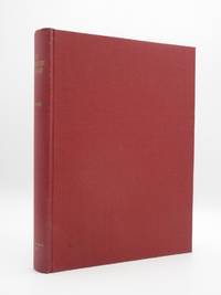
Zbigniew Dmochowski
The Architecture of Poland: An Historical Survey
London: The Polish Research Centre 1956. 1st Edition . Hardback. Printed pages: xxvi 429. Very Good Plus. 7.75 x 10 inches 19.5 x 25 cm. Lacking jacket. Red cloth binding. A little light foxing to page edges otherwise excellent. Scarce. Overall condition is Very Good Plus. Please Note: This is a heavy item and international postage will be more than the standard rate for non-European destinations. Actual Royal Mail postage costs are: USA £21.00; Oceania £30.00; Rest of World £30.00. A postage supplement will be requested after the order has been placed. Size: 7.75 x 10 inches 19.5 x 25 cm. The Polish Research Centre hardcover
Referenz des Buchhändlers : 1210E017
|
|
|
Zecchini, Giuseppe
CESARE E IL MOS MAIORUM
Franz Steiner Verlag. 2001. Softcover. Very Good. Minor wear to 1 corner of wraps and base of spine. Light shelfwear.; Historia - Einzelschriften 151; 180 pages . 3515078630 . Franz Steiner Verlag paperback
Referenz des Buchhändlers : 26701 ISBN : 3515078630 9783515078634
|
|
|
Zedrosser, Thomas:
Die Stadt Friesach in Kärnten. Ein Führer durch ihre Geschichte, Bau= und Kunstdenkmäler.
22 x 14,5 cm.131 Seiten mit 40 Abb. Orig.-Halbleinen. *Ausgeschiedene Bibliotheksdublette mit den üblichen Stempeln sowie Papieraufkleber auf dem Buchrücken. Innen sauber und noch ordentlich erhalten. Bücher de
|
|
|
Zedtwitz, Franz
Der Pelzjäger : Abenteuer im hohen Norden / Franz Graf Zedtwitz.
Stuttgart : Union Dt. Verl.-Ges., 1955. 188 S. : Ill. 8°. 28. - 35. Tsd. OHLwd. mit ill. Einbd. u. SU.
Referenz des Buchhändlers : 36937
|
|
|
Zedtwitz, Franz
Der Untergang des Sonnenreiches : d. Schicksalsweg d. alten Peru.
Stuttgart : Union Dt. Verl.-Ges., 1951. 256 S. 8°. 1. - 20. Tsd. Ill. OPpbd.
Referenz des Buchhändlers : 38950
|
|
|
Zeeb-Lanz, Andrea und Andy Reymann
Löwenmenschen und Schamanen. Magie in der Vorgeschichte. (= Archäologie in Deutschland Sonderheft 16 2019)
Darmstadt : wbg Theiss, [2019]. 112 Seiten : Illustrationen ; 28 cm Orig.-Broschur;
Referenz des Buchhändlers : 144109

|
|
|
Zeeden, Enrnst Walter
Weltbild-Geschichte Europas 1556 - 1648 Hegemonialkriege und Glaubenskämpfe
Augsburg : Weltbild, 2005. 466 S. 8° , Softcover/Paperback
Referenz des Buchhändlers : 139777

|
|
|
Zeeden, Ernst Walter
Hegemonialkriege und Glaubenskämpfe 1556 - 1648. (= Propyläen-Geschichte Europas Band 2).
Berlin : Propyläen-Verlag, 1980. 2. Aufl., 469 S. mit zahlreichen Abbildungen; gebunden, Orig.-Halbleder; Kopffarbschnitt;
Referenz des Buchhändlers : 136027

|
|
|
Zeeden, Ernst Walter
Propyläen Geschichte Europas - Hegemonialkriege und Glaubenskämpfe : 1556 - 1648. Ungekürzter fotomechanischer Nachdruck des 1980 in 2. Auflage erschienenen 2. Band.
Berlin : Propyläen-Verlag, 1998. 466 S. : Ill., graph. Darst., 23 cm. OPp., gebundene Ausgabe, SU.
Referenz des Buchhändlers : 165101

|
|
|
Zeeden, Ernst Walter
Propyläen-Geschichte Europas. Bd. 2.: Hegemonialkriege und Glaubenskämpfe 1556 - 1648. Ernst Walter Zeeden. [Die Erarbeitung d. Dokumentation unterstützten: Eberhard Bohm ... Die Landkt. u. Graphiken zeichn.: Erhard Bechtluft ... Die Bibliogr. stellte zusammen: Günter Scholz] 2. Auflage
Berlin : Propyläen-Verl., 1980. 469 S. : Ill. (z.T. farb.), graph. Darst. Halbleder, mit Schutzumschlag, Farbkopfschnitt
Referenz des Buchhändlers : 137148

|
|
|
Zeev Sternhell
Neither Right Nor Left: Fascist Ideology in France
Berkeley: Univ of California Pr 1986. First edition. hardcover. very good/very good. 8vo. pp.416.previous owners name on title page Univ of California Pr hardcover
Referenz des Buchhändlers : 327523 ISBN : 0520052072 9780520052079

|
|
|
Zehntbauer, Richard.
Verfassungswandlungen im neueren Österreich.
IV, 192 S. Etwas späterer Halblederband mit Rückentitel. *Erste Ausgabe. - Stempel der Bibl. Fürstenberg. Bücher de
|
|
|
Zeitalter der Menschheit - Eine Weltkulturgeschichte
Gerald Simons und die Redaktion der Time-Life Bücher: Die Geburt Europas. Mit einer Einführung von Albrecht Timm. Aus dem Englischen von Helmut und Christel Wiemken. Mit vielen meist farbigen Abbildungen im Text und auf Tafeln und einer Chronologie.
Amsterdam, Time-Life Bücher., 1982. 4°. [22,2 : 27,5 cm = B/H]. 192 Seiten. Mit einer Bibliographie und einem Register. Farbig illustrierter Originalhalbleinenband mit goldgeprägter Titelei. - Ein sehr gut erhaltenes, neuwertiges Exemplar ohne Eintragungen. = 7. Auflage. Zeitalter der Menschheit. Eine Weltkulturgeschichte.
Referenz des Buchhändlers : 65524AB

|
|
|
Zeitschrift:
Schweizer Heim. Heft Nr. 1 - Nr. 52. [Kompletter Jahrgang in einem Band.]
1704 Seiten mit zahlreichen Abbildungen. Quart. Halbleinenband der Zeit. *Mit zahlreichen Artikeln zu Mode, Bergen, Hobbys, Kochen, Rätsel, Landeskunde, Geschichte etc. aus der unmittelbaren Nachkriegszeit der Schweiz. - Sauber und gut erhalten. Bücher de
|
|
|
Zeitschriften - KREMZ, Willibald (Chefredakeur)
Schwäbisches Bilderblatt. Wochenbeilage zu Ausgabe B des Neuen Tagblatts, Stuttgart 6. Jahrgang 1913 Heft 1 bis Heft 52 (somit komplett),
Stuttgart 3. Januar 1913 bis 24. Dezember 1913. Zusammen 416. Mit sehr zahlreichen fotografischen Abbildungen. Dunkelroter Leinwand-Einband der Zeit in guter Erhaltung. (Papier qualitätsbedingt etwas gebräunt. Wenige Bll. fachmännisch repariert). 31x24 cm
Referenz des Buchhändlers : 137025

|
|
|
ZEKI TEZ.
Yasakli sanat olarak minyatür, resim ve grafik tarihi.
New Turkish Paperback. Roy. 8vo. (23 x 16 cm). In Turkish. 359 p., b/w ills. Yasakli sanat olarak minyatür, resim ve grafik tarihi. History of miniature, painting and graphic as a forbidden art.
|
|
|
Zelger, Franz
Luzern im Spiegel alter Reiseschilderungen 1757-1835.
Luzern, Eugen Haag 1933. * Mit 21 Ansichten und 14 Porträts in Platindruck auf Tafeln. 144 Seiten. 23 x 16 cm. Blauer Original-Leinenband (oberes Kapital etwas berieben).
Referenz des Buchhändlers : 100115

|
|
|
Zelger, Franz:
Studien und Forschungen zur Geschichte der Freiherren von Rotenburg-Wolhusen sowie des Amtes und des Fleckens Rotenburg. Ein Beitrag zur Geschichte des Kantons Luzern aus Anlass des 7. Centariums der Entstehung des Städtchens und Fleckens Rotenburg.
26 x 18,5 cm. XVII, 456 Seiten. Leinenband mit Deckeltitel und farbigem Wappen. *Einband am Rücken leicht verblasst. Insgesamt sehr gut erhalten. Bücher de
|
|
|
Zelinka Timoteus Cestmír.
PRAZSKA PREDMESTI
(Codice VR/0699) In 8° 125 pp. Czeck language, 97 b/w photos. Original hardcover, cloth (fine), chipped/browned dust jacket. Coloured top edge, signet. Very good. ~~~ SPEDIZIONE IN ITALIA SEMPRE TRACCIATA

|
|
|
ZELLENTIN, Gerda (Hrsg.)
Formen der Willensbildung in den europäischen Organisationen.
Frankfurt, Athenäum, 1965. VIII, 131 S. Mit Tabellen. OKart.
Referenz des Buchhändlers : 3291730
|
|
|
Zeller-Werdmüller, Heinrich:
Denkmäler der Feudalzeit im Lande Uri. (Das Kästchen von Attinghusen.) Mittheilungen der Antiquarischen Gesellschaft (Der Gesellschaft für Vaterländische Atlerthümer) in Zürich. Band XXI, Heft 5.
30 x 23 cm. 32 S., 3 Tafeln (farbige Lithographie). Orig.-Broschur. Sehr gut erhalten. Bücher de
|
|
|
Zeller-Wertmüller, H.:
Die heraldische Ausschmückung einer zürcherischen Ritterwohnung (= Mittheilungen der Antiquarischen Gesellschaft in Zürich, XXXVIII).
30 x 23,5 cm. 18 Seiten (108-122) und IV farbige Wappentafeln. Orig.-Broschur mit Deckeltitel. *Einband am Rücken fachmännisch geklebt. Seiten unregelmäßig beschnitten.Text sauber, insgesamt gut erhalten. Bücher de
|
|
|
Zellner, Wolfgang / Dunay, Pál
Ungarns Außenpolitik 1990-1997. Zwischen Westintegration, Nachbarschafts- und Minderheitenpolitik.
Baden-Baden, Nomos, 1998. 8°, 490 Seiten. Orig.Karton.
Referenz des Buchhändlers : 19207
|
|
|
Zellweger, Joh. Caspar.
Geschichte der diplomatischen Verhältnisse der Schweiz mit Frankreich, von 1698 bis 1784. Ein Versuch, die Einwirkung dieser Verhältnisse auf den sittlichen, ökonomischen und politischen Zustand der Schweiz darzustellen. 1. Band (= Alles Erschienene), 1. (von 2) Abteilung.
X, 360 S. und 102 S., 1 Bl. Beilagen. Marmorierter Pappband d. Zt. *ADB 45, 43. Erste Ausgabe des zweiten Hauptwerkes Zellwegers. Dievorhandene 1. Abt.reicht chronologisch von 1444 bis 1708. - Die 2. Abteilung des ersten Bandes erschien 1849, ein zweiter Band ist nicht mehr erschienen. - Aus der Bibl. Fürstenberg. Bücher de
|
|
|
ZELONI, Chevalier
Leben der Prinzessin Guendaline Borghese gebornen Talbot Shrewsbury. Auf Anregung des Verf. ins Dt. übers. v. F.Frh.v.Seckendorf. Mit e. Sonnetten-Kranz in 15 Sprachen.
Wien,Mechitaristen-Congr. 1865. XII,164,(18) S. Mit Titelportr. Obrosch., unaugeschn., etw. stockfl. u. angestaubt. - Verein zur Verbreitung guter katholischer Schriften XXIII.Jg., 4.Heft
Referenz des Buchhändlers : R0056-96

|
|
|
ZEMMRICH, J(ohannes)
Verbreitung und Bewegung der Deutschen in der französischen Schweiz.
Stgt.,Engelhorn 1894. gr.8°. S. 363-405. Mit 1 Kte. Obrosch., unaufgeschnitten, gering bestoßen u. angestaubt, sonst gut erhaltenes Exemplar. - Forschungen zur deutschen Landes- und Volkskunde 8.Bd., Heft 5
Referenz des Buchhändlers : R0341-00

|
|
|
Zemon Davies, Natalie
Fiction in the Archives: Pardon Tales and Their Tellers in Sixteenth-Century France
Cambridge: Polity Press 1988. Hardcover with unclipped dust jacket in good condition. Jacket is worn and edges are creased and nicked. Board edges are slightly sunned and spine ends are a little bumped. Binding is sound and pages are clear. LW. Hardcover. Good/Good. Used. Polity Press Hardcover
Referenz des Buchhändlers : 545185 ISBN : 0745605311 9780745605319

|
|
|
Zenner, Klaus
Schweig, Kamanas : ein Hethiter-Roman / Klaus Sebastian [Pseud.].
Gütersloh : S. Mohn, 1967. 349 S., 1 Kt. 8°. Bibl.- Einbd.
Referenz des Buchhändlers : 16278
|
|
|

 Per e-mail erhalten
 Als pdf-Dokument herunterladen
 RSS feed
 Permanenter link


