|
WAHLEN Auguste
MOEURS , USAGES ET COUTUMES DE TOUS LES PEUPLES DU MONDE.
Bruxelles , Librairie historique - artistique , 1844 , in4° 1/2 chagrin , dos orné , 361 pp . 48 planches hors texte . Quelques rousseurs . Langue: Français
Référence libraire : M17509
|
|
|
Wahlen, Auguste
Moeurs, usages et costumes de tous les peuples du monde, d'apès des documents authentiques et les voyages les plus récents. Afrique. Amérique. Europe. Asie. Océanie. 4 in 3 vols.
Bruxelles, Librairie Historique-Artistique, 1843-1844. Large 8vo. (2), 368; (2), 591; (2), 365, (2); (2), 361, (2)pp. With 4 handcoloured title-vignettes and 206 handcoloured woodcut plates. Contemp. half calf, gilt.
Référence libraire : 44858AB
|
|
|
Wahlöö, Claes und Margareta Alin
Kulturen 1998: Metropolis Daniae - Ett stycke Europa - Kulturen 1998 en arsbok till medlemmarna av kulturhistoriska föreningen för södra sverige
Lund, Tryck och repro: BTJ Tryck AB, 1998. 222 Seiten , 21 cm, Hardcover/Pappeinband
Référence libraire : 43465 ISBN : 4545915

|
|
|
Wain John
Un cielo più piccolo
trad. di Bruno Fonzi n. 268 tela edit. con sovrac. ill.
|
|
|
Wainwright, A
Fellwalking with Wainwright - 18 of the Author's Favourite Walks in Lakeland
U.K.: Michael Joseph 1985. Book. Illus. by Brabbs Derry photographer. Fine. Hardcover. Reprint. 8vo - over 7¾" - 9¾" tall. 223 pages. "A unique portrait of England's countryside in all its moods a wonderful memento for those who have 'retired' from fellwalking or who live too far away and will treasure the memories invoked by this book and the many fortunate people who still have the excitement of the high places before them." - from dust jacket. Gift greetings upon illustrated front endpaper else clean bright and unmarked. Virtually zero wear to book. Very light wear to dust jacket. Lovely copy. Michael Joseph Hardcover
Référence libraire : 74203265 ISBN : 0718124286 9780718124281

|
|
|
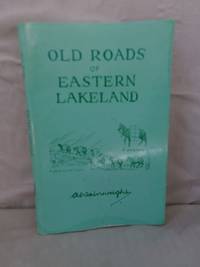
Wainwright, A
Old Roads of Eastern Lakeland
Westmorland Gazette 1985. Paperback. Good paperback. Light edgewear small pale spots on back cover and some tiny spots to front. Contents clean and unmarked. Stapled booklet with green laminated card wraps. Illustrated. The image on this listing page is of the actual book for sale. Westmorland Gazette paperback
Référence libraire : 61761
|
|
|
Wainwright, A.
Fellwalking with Wainwright - 18 of the Author's Favourite Walks in Lakeland
223 pages. "A unique portrait of England's countryside in all its moods, a wonderful memento for those who have 'retired' from fellwalking or who live too far away and will treasure the memories invoked by this book, and the many fortunate people who still have the excitement of the high places before them." - from dust jacket. Gift greetings upon illustrated front endpaper else clean, bright and unmarked. Virtually zero wear to book. Very light wear to dust jacket. Lovely copy. Book
|
|
|
WAINWRIGHT, Tom
Narconomics. Ein Drogenkartell erfolgreich führen.
(Mchn.),Blessing (2016). 351 S. Opbd. mit farbig illustr. OU., Schutzumschlag mit leichten Kratzspuren, sonst sehr gut erh.
Référence libraire : 0170-22

|
|
|
WALCH Johann Kempten 1757 - Augsburg 1815)
Boehmen Mahren, Schlefien, und die Lausitz
Carta geografica tratta dall'atlante edito ad Augsburg circa nel 1820. Incisione in rame, coloritura coeva, leggere ossidazioni, per il resto in buone condizioni. Non comune. Map taken form the Atlas printed in Augsburg, circa 1820.Copperplate, original colouring, good condition.

|
|
|
WALCH Johann Kempten 1757 - Augsburg 1815)
Charte vom Koenigreich Polen nach seinen ehemahligen (1773) und demahligen Grenzen 1820
Rarissima carta della Polonia e Lituania, stampata ad Ausburg (Augusta) da Johannes Walch nel 1820. Si tratta del sesto, sconosciuto stato della carta – la carto bibliografia “Imago Polonia” (Varsavia, 2002), che descrive l’incredibile collezione Niewodniczanski contempla solo 5 stati della carta, di cui l’ultimo stampato nel 1807 – per la prima volta edita nel 1793.Incisione in rame, coloritura coeva dei contorni, piccole macchie di umidità negli angoli inferiori, altrimenti in perfetto stato di conservazione.La città imperiale di Augusta era un importante centro di produzione di mappe per l'Europa centrale nel XVIII secolo. Gli incisori più noti erano i residenti Johann Stridbeck e Gabriel Bodenehr, e gli editori d'arte Matthäus Seutter e il suo successore Tobias Conrad Lotter, e Johann Michael Probst, tutti specializzati nella pubblicazione di cartografica e topografica. La graduale recessione economica di Augusta ha lasciato il segno sulla fiorente attività di tipografia ed editoria. Solo Johann Martin Will e soprattutto Johannes Walch hanno impedito la completa scomparsa della produzione di mappe alla fine del XVIII secolo. La continuità della casa editrice Walch fino al momento attuale, tuttavia, non garantisce ampi archivi per la stesura di una cronologia dettagliata dell’editore di mappe tedesco. La casa editrice bruciò durante la seconda guerra mondiale e la maggior parte dei documenti scritti e stampati furono distrutti.Johannes Walch divenne attivo dal 1790 circa come incisore dei propri disegni di carte, sposando la figlia dell’altro editore John Martin Will. Le mappe in formato folio sono l'obiettivo principale del lavoro cartografico di Walch. Alcuni di loro prendono il titolo in modo molto specifico, vale a dire promozione delle vendite, riferimento agli attuali eventi di guerra, come ad esempio la “Neue General-Kriegs- Karte des Rheinstrohms” (3 tavole, 1793), la “Kriegstheater oder Graenzkarte zwischen Frankreich und Italien” (1786) e la “Polen nach seiner ersten, und lezten, oder gaenzlichen Theilung” (1796). Walch, tenendo conto del gusto del tempo, rinunciava completamente agli ornamenti. Le sue carte sono chiare e belle. Sono scritti principalmente in tedesco, in parte anche nell'allora francese alla moda. Le carte del Walch, non essendo parte di un atlante, sono assolutamente rare nel mercato antiquario. A very rare map of Poland and Lithuania by Johannes Walch, first published in 1793, here in his sixt – unknown – state, dated 1820. Imago Poloniae (the carthobibliography of the maps form the Niewodniczanski collection, Warsaw 2002) listed only 5 states of the map, the latest with the date 1807.Copperplate, with fine original outline colouring, light waterstains at the lower corners, otherwise very good condition.The imperial city of Augsburg was a leading center of map production for Central Europe in the 18th Century. Many of the resident copper engravers such as Johann Stridbeck and Gabriel Bodenehr, and the art publishers Matthäus Seutter and his successor Tobias Conrad, and Johann Michael Probst were specialized in the publication of cartographica and topographica.The gradual economic recession of Augsburg left its mark on the once flourishing printing and Publishing business. Only Johann Martin Will and especially Johannes Walch prevented the complete disappearance of map production at the end of the 18th Century. The continuity of the Publishing house Walch up until the present time, however, does not guarantee extensive archives for writing a detailed history of a German map publisher. The Publishing house burned down during World War II and most of the written and printed documents were destroyed.Although Walch and Will also acted as independent publishers in the future, there seems to have been an intimate business combination between the two companies, especially in the area of map production.Johannes Walch became active from about 1790 as engraver of his own map designs. He published his own sheets, but they also appeared partly in Will. In some cases, both names are equal in the map titles. For example, Walch becomes author and publisher, Will called as publisher. So early on, the agreement seems to have existed that Walch would be the publisher's successor to his father-in-law. This is also supported by the common home and business address of the two publishers and in particular the fact that Will does not male successor and his inheritance would have to fall anyway to his daughter and her husband Walch. Maps in folio format are the main focus of Walch's cartographic work. Some of them take in the title very specifically, that is sales-promoting, reference to current events of war, such as Poland after its first, and last, or total division - 1796. Soon, however, his publishing house also found a broad standard program of maps from the regional to the hemispheric map. His engravings are almost entirely editions of foreign originals, and he confessed this only in a few cases in the card title Far more often Walch claimed to have designed a map according to the latest astronomical location rules, most reliable travelogues and most valued resources to have. Walch, taking into account the taste of the time, completely renounced ornamentation. His maps are clear and fine. They are mostly written in German, partly also in the then fashionable French language. The large maps by Walch are not part of an Atlas, so they are quite rare on the antiquarian market. Cfr. Imago Poloniae (2002), vol. II, pp. 123-124, K55 77/11 (ed. 1793-1807) Michael Ritter, Cartographica Helvetica: Fachzeitschrift für Kartengeschichte, nr. 25-26, 2002

|
|
|
Walch Johannes edit.
Karte von Europa
Coloritura coeva. Macchie

|
|
|
Walchegger, Johann.
Brixen, Geschichtsbild und Sehenswürdigkeiten.
141 S., 1 Bl. Mit 1 Tafel und 42 Illustr. Halbleder der Zeit (leicht fleckig, Stempel auf Titel, innen sauber). Bücher de
|
|
|
Walcher - Moltheim, A
Burg Kreuzenstein (an der Donau).
Wien, Eckart, ca. 1930. Gr.8°. 58 Seiten. Mit zahlr., teils farbigen Abb. im Text Farb. ill. OHLn.
Référence libraire : 491A
|
|
|
WALCKENAER baron
Géographie ancienne, historique et comparée des Gaules cisalpine et transalpine, suivie de l'analyse géographique des itinéraires anciens et accompagnée d'un atlas de neuf carte [3 tomes + 1 atlas]
Complet en 3 tomes & 1 atlas; [vi] 566 + 520 + lxiv,204 pp., Atlas: 2pp. + 9 grandes cartes dépliantes, les 3 tomes de texte sont en brochure originale, l'atlas (35cm.) est cartonnée avec dos en percament, peu de rousseurs, bel ensemble, peu commun
|
|
|
WALCKENAER baron
Géographie ancienne, historique et comparée des Gaules cisalpine et transalpine, suivie de l'analyse géographique des itinéraires anciens et accompagnée d'un atlas de neuf carte [3 tomes + 1 atlas]
Paris, Dufart 1839 Complet en 3 tomes & 1 atlas; [vi] 566 + 520 + lxiv,204 pp., Atlas: 2pp. + 9 grandes cartes dépliantes, les 3 tomes de texte sont en brochure originale, l'atlas (35cm.) est cartonnée avec dos en percament, peu de rousseurs, bel ensemble, peu commun
Référence libraire : G51787
|
|
|
Walczak, W
Pod Snieznikiem. Szkice z dziejów przemian krajobrazu Sudetów Klodzkich.
Wroclaw, 1964. M. 29 Abb. a. Taf. u. 8 Skizzen. 141 S. (Wiedza o Ziemi Naszej 7).
Référence libraire : 807967
|
|
|
Waldburger, A
Die Thermalbäder von Ragaz-Pfäfers. 26.-50. Tsd.
Ragaz 1909. Mit zahlr. Fotos, Ktn. u. Tab. i.T. u. 1 Faltplan. 64 S. geheftet 18x12 cm.
Référence libraire : 6412

|
|
|
Waldburger, A
Plan von Ragaz mit Spaziergängen und den Anfängen der Wegmarkierung.
Ragaz 1909. 1 mehrfarb. Faltplan m. Textteil. 18x12 cm (35x45 cm). [2 Warenabbildungen]
Référence libraire : 6413

|
|
|
Waldburger, A
Ragaz und Umgebung.
Ragaz 1910. Karte mit vollst. Wegmarkierung. 1:25 000. Landkarte 55x59 cm, Faltmaß 19x12 cm. [2 Warenabbildungen]
Référence libraire : 6414

|
|
|
WALDEGG, RICHARD.
Sittengeschichte von Wien. Band I. Von der Gründung Vindobonas bis zum Ausbruch des 1. Weltkrieges.
Mit Fotos.
|
|
|
Waldemar, Charles
Jung durch Bioenergie.
Vaduz, Progress Handels Anstalt, 1999. 440 S. Gr.-8° Groß-Oktav, Softcover/Paperback
Référence libraire : 94933

|
|
|
Waldis, Alfred
Illustriertes Reisehandbuch. Die Schweiz.
1957. Verbandsdruckerei, Bern, 22. Auflage. OLeinen, 368 S..
Référence libraire : 19416
|
|
|
Waldman, Diane
TRANSFORMATIONS IN SCULPTURE. Four Decades of American and European Art. [Guggenheim International Exhibition VII].
New York., The Solomon R. Guggenheim Foundation., 1995. 272 S. OKarton., 68464B Auflage: 4000 Exemplare. Einbandkanten teilweise stärker berieben, sonst gutes Exemplar.
Référence libraire : 68464BB ISBN : 892070528

|
|
|
WALDMANN, Emil
Griechische Originale.
Lpz.,Seemann 1914. gr.8°. 80 S. Text, 207 Bildaf. mit Erläuterungen. Ohpgmt., Exlibris eingekl., schönes Expl.
Référence libraire : 2830-95
|
|
|
WALDSEEMULLER Martin (1470 ca. - 1518)
Tabula Europ. Sexta Italiae
Rara ed importante carta della penisola, tratta dalla prima edizione della Geographie Opus Novissima Traductione e Grecorum Archetypis curata dal Waldseemuller ed edita da Johannes Schott nel 1513.L’opera è considerata come il primo atlante moderno, preparato usando la traduzione dal greco di Mathias Ringmann; si tratta di una delle più importanti edizioni del Tolomeo, contenente molte nuove mappe della regioni. Sono 20 le carte aggiunte, basate sulle nuove scoperte e conoscenze, oltre al consueto corpo di 27 carte che compongono la Geografia di Tolomeo, basate sull’atlante edito a Ulm nel 1482.Xilografia, con pieni margini, in perfetto stato di conservazione.Splendido esemplare di un'opera rara ed importante. A rare and important map of the peninsula, taken from the first edition of the Geographie Opus Novissima Traductione e Grecorum, 1513. The first modern atlas, prepared by Martin Waldseemuller using the translation of Mathias Ringmann.This is one of the most important editions of ptolemy, containing many new regional maps. Twenty new maps based on contemporary knowledge were included in addition to the traditional body of twenty - seven Ptolemaic maps derived from the 1482 Ulm edition. Schott's edition was commenced by the most famous of all early sixteenth - century cosmographers, Martin Waldseemuller and his associate Mathias Ringmann, partly at the expense of Duke Rene of Lorraine. It was brought to completion by Jacobus Eszler and Georgius Ubelin.Woodcut, with full margins, very fine condition.

|
|
|
Waldstein,Charles; Leonard Shoobridge
Herculaneum: Past Present and Future
London: Macmillan and Co. Very Good with no dust jacket. 1908. First Printing. Hard Cover. Publisher's full black cloth gilt lettering on spine gilt Hermes medallion on cover t.e.g. Illustrated with numerous full-page B&W photographs tissue-protected color frontispiece photograph two color maps Campania and Herculaneum and color fold-out plan of the Villa Suburbana. . Covers rubbed light foxing on several pages all illustrations bright and clean unmarked tight and square. VERY GOOD. Color frontispiece Color and B&W Plates and Maps. 4to 11" - 13" tall. xxii i 324 pp . Macmillan and Co. hardcover
Référence libraire : 8123

|
|
|
WALDTEUFEL (Edouard)
Six mois de paix armée. L'Allemagne. L'Autriche-Hongrie. L'Italie. Toulon. Paris
Paris, Savine, s.d. in-12, VIII-454 pp., index, bradel demi-percaline rouge, couv. cons. (reliure de l'époque). Ex-libris de la Bibliothèque de la Cie de l'Ouest.
Référence libraire : 664232
|
|
|
WALEY, Daniel.
Les Républiques médiévales italiennes.
in-12, 255 pp., illustrations en noir et en couleurs, broché, couverture illustree. Etat proche du NEUF. [BL-10]
|
|
|
Walgenbach, Martin
Die Dimension "Europa". Eine historische Diskursanalyse der Volkskunde / Europäischen Ethnologie.
Würzburg, 2010. Veröffentlichungen zur Volkskunde und Kulturgeschichte. Hrsg. v. Heidrun Alzheimer und Klaus Reder. 160 SS. 8°, rote orig.-Broschur.
Référence libraire : 22822
|
|
|
Waliszewski K
Autour d'un trone – Catherine II° de Russie – ses amis- ses favoris- ses collaborateurs – Russia
Ottima copia
|
|
|
Walker Jennie
24 per 3 (stampa 2010)
trad. di Emilia Sala in 16°, bross. edit. ill. con bandelle
|
|
|
WALKER John (1787 - 1873)
Baltic Sea. Eastern sheet. Compiled by Swedish, German and Russian Government Surveyes
Carta nautica del Mar Baltico e delle coste orientali della Svezia, con l'isola di Gotlandia e le coste settentrionali di Lithuania, Lettonia e Polonia. Pubblicata per la prima volta a Londra nel 1862 dall'editore J. D. Potter, sotto la suèervisione della Marina Britannica. Esemplare aggiornato al 1912. Incisione, alcune annotazioni manoscritte, nel complesso in buono stato di conservazione. Carta nautica del Mar Baltico e delle coste orientali della Svezia, con l'isola di Gotlandia e le coste settentrionali di Lithuania, Lettonia e Polonia. Pubblicata per la prima volta a Londra nel 1862 dall'editore J. D. Potter, sotto la suèervisione della Marina Britannica. Esemplare aggiornato al 1912. Incisione, alcune annotazioni manoscritte, nel complesso in buono stato di conservazione.

|
|
|
WALKER John (1787 - 1873)
Entrace to the Gulf of Finland
Carta nautica del Golfo di Finlandia.Pubblicata per la prima volta a Londra nel 1862 dall'editore J. D. Potter, sotto la suèervisione della Marina Britannica. Esemplare aggiornato al 1907. Incisione, alcune annotazioni manoscritte, nel complesso in buono stato di conservazione. Carta nautica del Golfo di Finlandia.Pubblicata per la prima volta a Londra nel 1862 dall'editore J. D. Potter, sotto la suèervisione della Marina Britannica. Esemplare aggiornato al 1907. Incisione, alcune annotazioni manoscritte, nel complesso in buono stato di conservazione.

|
|
|
WALKER John (1787 - 1873)
The Northern Provinces of Sweden and Norway with Part 1, of Russia.
Pubblicato dalla Society for the Diffusion of Useful Knowledge.Bordi colorati a mani. In ottime condizioni.Mappa realizzata da J. e C. Walker, tratta da "Scandinavia and Imperial Atlas of Russia in Europe" di Fossell. Published by the Society for the Diffusion of Useful Knowledge.Outline Hand colouring. Piano key border. Very good. Realized by J. e C. Walker. From Fossell’s Scandinavia and Imperial Atlas of Russia in Europe.

|
|
|
Walker, Alexander
Rudolph Valentino.
New York, NY [etc.] : Penguin (Non-Classics), 1977. 127 pp. Gr. 8°. 1st Penguin ed. Orig. ill. pb.
Référence libraire : 29031
|
|
|
Walker, Geoffrey J.
Spanish Politics and Imperial Trade, 1700-1789
Hardcover. Jacket is lightly edgeworn, and a little sunned in places. Marks and one insignificant dent on page block. Text is clear throughout; pages are sound and clean. TS Used
|
|
|
WALKER, Mack (ed.).
METTERNICH'S EUROPE. 1813-1848.
20x14. 352p. Col. Documentary History of Western Civilization, N. 1361.

|
|
|
Walla, Leopold:
Chronik von Rydultau. (Kreis Rybnik, Oberschlesien) mit Bildanhang. Geordnet und überarbeitet von Ulrich Becke. (= Veröffentlichungen der Ostdeutschen Forschungsstelle im Lande Nordrhein-Westfalen. Reihe B. Nr. 19).
30 x 21 cm. 80 Seiten und 27 Tafeln mit Abb. Kartonierter Einband (Rücken mit durchsichtigem Klebestreifen überzogen, titelblatt gestempelt). Bücher de
|
|
|
Wallace Edgar
Bosambo il mondo del fiume a cura di Giovanni Gandini (stampa 1975)
trad. di Gastone Rossi bross. edit. ill.
|
|
|
Wallace, Donald Mackenzie
Russland. Vom Verfasser durchgesehene, durch ein Kapitel über "Geheime Gesellschaften in Russland" vermehrte deutsche Ausgabe. Nach der siebenten Auflage des Originals übersetzt von Ernst Röttger. D. Mackenzie Wallace M. A. 3. vermehrte Aufl.,
Leipzig, ln Commission bei E.F. Steinacker, 1880 1880. XVI, 767 S., Gr.-8°, letzte Seite des Register fehlt (T-Z) gebundene Ausgabe, Halbleinen, Exemplar in gutem Erhaltungszustand
Référence libraire : 40061

|
|
|
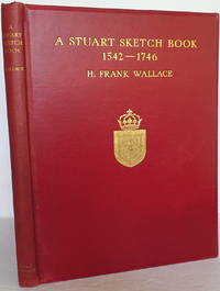
Wallace, H Frank
A Stuart Sketch Book 1542 - 1746
London: Eyre & Spottiswoode. Hard cover in original cloth. Published London: Eyre & Spottiswoode no date. 4to. 8 3/4" x 11 1/4" 120pp. illus. color frontis and 18 additional color plates b/w drawings by the author and Lionel Edwards. Crimson red cloth with gilt titles and cover crest bevelled edges top edge gilting. Some small areas of fade to the cloth minor foxing on rear endpaper last few sheets. Very good plus clean bright attactive. . Very Good Plus. Hard. Eyre & Spottiswoode unknown
Référence libraire : 010528
|
|
|
Wallace-Hadrill, Andrew
Herculaneum: Past and Future
London: Frances Lincoln Ltd. As New in As New dust jacket. 2011. 1st Edition. First Printing. Hardcover. 0711231427 . Publisher's full gray cloth silver lettering on spine photographic endpapers. Profusely illustrated with over 300 newly taken color photographs as well as maps architectural plans graphs and archive illustrations showing the early stages of the excavations. "This significant addition to the few available books focusing on Herculaneum is the first major study of the spectacular archaeological findings there since Joseph Jay Deiss' book published in 1966 and last revised in 1993. It is based on the latest excavation work and incorporates much new material that has revolutionized our understanding of the site. Illustrated with 300 recent color photographs it is the definitive overview for the general public of what we know and understand about Herculaneum of what is still unknown and mysterious and of the potential for future discoveries in both archaeological and political contexts." "One could hardly ask for a clearer more comprehensive and better illustrated guide to Herculaneum." - Publishers Weekly. Winner of the Felicia A Holton Book Award 2013 from the Archaeological Institute of America. Both the volume and the unclipped dust jacket are in perfect pristine condition; unread unmarked tight square and clean. A large heavy book six pounds - additional shipping charges may apply. AS NEW/AS NEW. Color Photographs maps and drawings. Folio 13" - 23" tall. 352 pp . Frances Lincoln, Ltd. hardcover
Référence libraire : 30020 ISBN : 0711231427 9780711231429

|
|
|
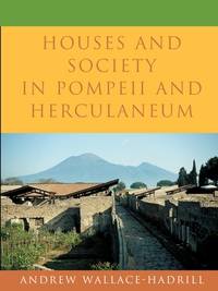
Wallace-Hadrill, Andrew
HOUSES AND SOCIETY IN POMPEII AND HERCULANEUM
Princeton University Press. 1994. Hardcover. Good in Very Good- dust jacket. Scholar's name to ffep Robert Brown. Underlining in pen to pages. Small stain to top of front panel of DJ. A few scratches to back panel of DJ .; Few sources reveal the life of the ancient Romans as vividly as do the houses preserved by the eruption of Vesuvius. Wealthy Romans lavished resources on shaping their surroundings to impress their crowds of visitors. The fashions they set were taken up and imitated by ordinary citizens. In this illustrated book Andrew Wallace-Hadrill explores the rich potential of the houses of Pompeii and Herculaneum to offer new insights into Roman social life. Exposing misconceptions derived from contemporary culture he shows the close interconnection of spheres we take as discrete: public and private family and outsiders work and leisure. Combining archaeological evidence with Roman texts and comparative material from other cultures Wallace-Hadrill raises a range of new questions. How did the organization of space and the use of decoration help to structure social encounters between owner and visitor man and woman master and slave What sort of "households" did the inhabitants of the Roman house form How did the world of work relate to that of entertainment and leisure How widely did the luxuries of the rich spread among the houses of craftsmen and shopkeepers Through analysis of the remains of over two hundred houses Wallace-Hadrill reveals the remarkably dynamic social environment of early imperial Italy and the vital part that houses came to play in defining what it meant "to live as a Roman."; 244 pages . 0691069875 . Princeton University Press hardcover
Référence libraire : 25261 ISBN : 0691069875 9780691069876
|
|
|
Wallace-Hadrill, Andrew
SUETONIUS; The Scholar and His Caesars
London: Duckworth. 1983. Hardcover. Very Good in Very Good dust jacket. Some pencil marginalia mostly checkmarks especially to first 60pp ink smudge in margin of 2 pages. Very light bump to 1 corner.; Ix 216pp.; 216 pages; Suetonius a Roman historian was the author of "The Lives of the Caesars". This biography sets the historian's career and his method of dealing with his subject matter in the context of Roman society in the early Empire and draws a picture of the coherence of Suetonius's life appointments scholarship and literary activities. Seutonius is presented as a man of learning rather than as a failed narrative historian. This portrait takes account of evidence concerning his life and seeks to clarify the character of "The Lives of the Caesars" as a description of emperors and Roman imperial society by a scholarly biographer who himself was in the service of a scholarly Caesar . 0715617478 . Duckworth hardcover
Référence libraire : 22894 ISBN : 0715617478 9780715617472
|
|
|
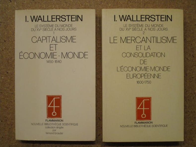
WALLERSTEIN Immanuel
Capitalisme et économie-monde, 1450-1640 / Le mercantilisme et la consolidation de l'économie-monde européenne, 1600-1750 (Le système du monde du XVe siècle a nos jours, tomes 1 et 2) (2 volumes)
Flammarion Nouvelle Bibliothèque Scientifique 1980-1985 Flammarion, Coll. Nouvelle Bibliothèque Scientifique, 1980-1985, 331-503 pp, brochés, environ 22x14cm. Un dos insolé, bon état.
Référence libraire : 119513
|
|
|
Wallerstein, Immanuel Maurice
Das moderne Weltsystem : kapitalist. Landwirtschaft u.d. Entstehung d. europ. Weltwirtschaft im 16. Jh. Aus d. Amerikan. von Angelika Schweikhart
Frankfurt am Main : Syndikat, 1986. Dt. Erstausg. 595 S. : 8 Ill. ; 23 cm broschiert
Référence libraire : 46870
|
|
|
WALLERSTEIN, Immanuel; CARL DE KEYZER.
CARL DE KEYZER. EUROPA, Evropa.
Ghent, Ludion, 2000 Gebonden, z/w foto-kartonomslag met goudopdruk, 165 x 280mm., XXIXpp. gevolgd door niet gepagineerd aantal z/w foto's. ISBN 9789055442874.
Référence libraire : 24047
|
|
|
Wallimann-Huber, Jos.:
Biobibliographie des Michelsamtes. Separatdruck aus dem 1. Teil: "Die Bürgergeschlechter von Beromünster".
360 Seiten. Orig.-Broschur (unaufgeschnitten). *Enthält die Namen und genealogischen Daten aller historischen Bürgergeschlechter von Beromünster in alphabetischer Reihenfolge. - Dublettenstempel auf dem Frontdeckel, sehr gut erhalten. Bücher de
|
|
|
Wallis - Dolder, Willi und Ursula Dolder
Das Wallis : der Südwesten der Schweiz: Kunst und Kultur im Schatten der Viertausender. Willi und Ursula Dolder. Mit einer Einf. von Ludwig Imesch, DuMont-Dokumente : DuMont-Kunst-Reiseführer 3. Aufl.
Köln : DuMont 1993. 370 S. : zahlr. Ill., graph. Darst., Kt. ; 21 cm kart., Softcover/Paperback, Exemplar in gutem Erhaltungszustand
Référence libraire : 2619

|
|
|
Wallis, B C [Ed ]
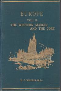
EUROPE TWO VOLUME SET; Vol 1: the Peninsula. Vol. 2: the Western Margin and the Core
London: Edwin Stanford Ltd. . New Issue. Hardcover. Very Good. Vol. 2: Hinges started. Else a nice and tight set with very well preserved green decorative boards with gilt lettering and pictorial design ; Editor Wallis examines the influence of the geography of the region on the history of Europe. This series is a great source and full of color maps tables and b&w photographs. Nd. Preface dated 1924 Vol. 1: 43 maps 120 illustrations. Vol. 2: 26 maps and 66 illustrations. ; Stanford's Compendium of Geography and Travel; 8vo 8" - 9" tall; xxiii 763; xxvi 777 pages . Edwin Stanford, Ltd. hardcover
Référence libraire : 6831
|
|

 Recevoir par e-mail
 Télécharger en PDF
 Flux RSS
 Lien permanent


