|
Baedeker, K
SOUTHERN GERMANY AND AUSTRIA Including the Eastern Alps. Handbook for Travellers
Boards with light rubbing to extremities. Spine and front hinge professionally repaired. Small closed tear to front map. Slight tanning and foxing to first and last few pages. Pencil notes in front and back. A nice and tight copy ; With 28 Maps and 27 Plans. Biedermeier boards ; 16mo 6" - 7" tall; 516 pages
|
|
|
Baedeker, K
SÜDDEUTSCHLAND Oberrhein, Baden, Wuerttemberg, Bayern Und Die Angrenzenden Theile Von Oesterreich. Handbuch Fuer Reisende
Spine darkened. First and last few pages browned and brittle. Hinges started. Two maps torn ; 19 Karten und 26 Plaene ; 16mo 6" - 7" tall; 396 pages
|
|
|
Baedeker, K
SÜDDEUTSCHLAND Oberrhein, Baden, Württenberg, Bayern Und Die Angrenzenden Teile Von Österreich. Handbuch Für Reisende
Boards lightly rubbed. Spine outer covering loosening. First and last few pages brittle and with a few closed tears. Front free endpaper detached but present. ; 28 Maps and 29 Plans ; 16mo 6" - 7" tall; 396 pages
|
|
|
Baedeker, K
THE RHINE FROM ROTTERDAM TO CONSTANCE Handbook for Travellers
Boards darkened. Hinges cracked. First few pages browned and brittle ; With 36 maps and 22 plans ; 16mo 6" - 7" tall; 386 pages
|
|
|
Baedeker, K
THE RHINE FROM ROTTERDAM TO CONSTANCE Handbook for Travellers
Boards and spine sunned. Front free endpaper detached but present and brittle. Hinges cracked and gapping (but holding together) ; With 36 maps and 22 plans ; 16mo 6" - 7" tall; 386 pages
|
|
|
Baedeker, K
THE RHINE From Rotterdam to Constance. Handbook for Travellers
Spine sunned. Boards with very light dampstains. Front hinge cracked. Otherwise a great copy with marbled edges intact. Internally NF - clean and tight copy; With 36maps and 22 plans ; 16mo 6" - 7" tall; 386 pages
|
|
|
Baedeker, K.
ALLEMAGNE DU SUD ET AUTRICHE Manuel Du Voyageur
Boards darkened. Some rubbing to spine ends. Small chips to front endpaper. Rear endpaper out; 16mo; 326 pages
|
|
|
Baedeker, K.
ALLEMAGNE DU SUD ET AUTRICHE Manuel Du Voyageur
Boards darkened. Hinges started. First and last few pages browned and frail. ; 16mo; 326 pages
|
|
|
Baedeker, K.
ALLEMAGNE DU SUD ET AUTRICHE Manuel Du Voyageur
Light rubbing to boards. Some single pages with faint waterstains. Large tear to front map; 16mo; 432 pages
|
|
|
Baedeker, K.
ALLEMAGNE DU SUD ET AUTRICHE Manuel Du Voyageur
Light rubbing to extremities. One small tear to bottom spine. Hinges started. Small tear to map at rear ; 16mo; 432 pages
|
|
|
BAEDEKER, K.
Allemagne du sud et Autriche. Manuel du voyageur. Avec 40 cartes et 36 plans de villes.
Leipzig, Karl Baedeker, 1902, 16 x 11'5 cm., tela original, 432 págs.
|
|
|
Baedeker, K.
DIE RHEINLANDE VON DER SCHWEIZER BIS ZUR HOLLÄNDISCHEN GRENZE. Handbuch Für Reisende
Boards a bit faded. Front hinge gapping (but holding together). Former owner's name on front free endpaper. Else a tight copy with all maps in NF condition. Edges a bit browned but with marbled edges still nicely showing ; Mit 41 Karten, 22 Stadtplänen und mehreren Grundrissen; 16mo 6" - 7" tall; 448 pages
|
|
|
Baedeker, K.
LE MIDI DE LA FRANCE Depuis L'Auvergne Et Y Compris Les Alpes. Manuel Du Voyageur
Spine a bit browned and boards a bit faded. Hinges started. Small stamp to front endpaper. First few pages a bit browned. Small tear to fold out map at rear. Else a great copy with clean pages and binding tight; 16mo; 436 pages
|
|
|
Baedeker, K.
LES BORDS DU RHIN De La Frontiere Suisse a La Frontiere De Hollande
Minor rubbing to extremities. Marbled edges a bit faded ; 16mo; 365 pages
|
|
|
Baedeker, K.
LES BORDS DU RHIN De La Frontiere Suisse a La Frontiere De Hollande
DJ chipped and browned (as usual) and with 1" top spine missing. Hinges weakening. Else an excellent copy with binding tight and clean pages; Avec 48 cartes, 19 plans hors texte et plusieurs autres plans ; 16mo; 331 pages
|
|
|
Baedeker, K.
NORTHERN GERMANY As Far As the Bavarian and Austrian Frontiers. Handbook for Travellers
Boards worn and darkened. Front map with 2" closed tear. Internally otherwise a nice and clean copy ; With 32 Maps and 56 plans ; 16mo; 422, 11 pages
|
|
|
Baedeker, K.
NORTHERN GERMANY As Far As the Bavarian and Austrian Frontiers. with Excursions to Copenhagen and the Danish Islands. Handbook for Travellers
Hinges cracked. First few pages brittle and detached but present. DJ fragmental; With 35 Maps and 54 plans. Including addendum at rear: Index of Streets and Plans of Berlin; 16mo; 453, 10 pages
|
|
|
Baedeker, K.
NORTHERN GERMANY As Far As the Bavarian and Austrian Frontiers. with Excursions to Copenhagen and the Danish Islands. Handbook for Travellers
Boards with light rubbing to extremities. Spine lettering faded. Front hinge started. Front free endpaper soiled and with writing. A tight copy with light marginal wear to some maps. ; With 35 Maps and 54 plans. Including addendum at rear: Index of Streets and Plans of Berlin; 16mo; 453, 10 pages
|
|
|
Baedeker, K.
NORTHERN GERMANY Handbook for Travellers
Spine sunned. Spine top lightly frayed. First few pages browned and a bit frail. Else a very attractive, tight copy ; With 15 Maps and 27 plans ; 16mo; 332 pages
|
|
|
Baedeker, K.
SOUTHERN GERMANY AND AUSTRIA Including Hungary and Transylvania. Handbook for Travellers
Boards faded and with moderate wear. Ink stains to front boards. Front hinge gapping, rear hinge started - holding strongly together. Closed tear to front free endpaper and also to front map. Internally a handsome copy with tight binding and maps in VG+ condition. ; With 14 maps and 30 plans ; 16mo; 441 pages
|
|
|
Baedeker, K.
SOUTHERN GERMANY AND AUSTRIA Including Hungary and Transylvania. Handbook for Travellers
Hinges cracked. Front free endpaper out. Front map detached but present. Notes to rear endpaper ; With 13 Maps and 28 Plans; 16mo 6" - 7" tall; 410 pages
|
|
|
Baedeker, K.
SOUTHERN GERMANY AND AUSTRIA Including Hungary and Transylvania
Boards a bit soiled. Front hinge gapping, but holding strongly together. Former owner's notes on front free endpaper. Small hole to first couple of pages. Closed tear to front map. ; With 14 maps and 30 plans. This edition is from the very short period when Baedeker tried out a pinkish color for his boards. ; 16mo 6" - 7" tall; 441 pages
|
|
|
Baedeker, K.
SOUTHERN GERMANY AND AUSTRIA Including Hungary, Dalmatia and Bosnia. Handbook for Travellers
Light rubbing and bumping to boards. Spine darkened and with small chip to top spine. Former owner's name on front free endpaper. ; Internally a tight and handsome copy ; 16mo; 495 pages
|
|
|
Baedeker, K.
SOUTHERN GERMANY AND AUSTRIA Including Hungary, Dalmatia and Bosnia
Boards darkened and with light apparent waterstaining. Top spine browned and with one small chip. Former owner's name on front free endpaper. Back of front fold out map nicely repaired. ; Internally a tight and handsome copy ; 16mo; 495 pages
|
|
|
Baedeker, K.
SUEDBAYERN TIROL UND SALZBURG Ober- Und Nieder-Oesterreich, Steiermark, Kaernten Und Krain. Handbuch Fuer Reisende
Spine sunned. First few pages browned. Tiny closed tear to front map. A very handsome and tight copy ; Mit 48 Karten, 11 Plaenen und 8 Panoramen; 16mo 6" - 7" tall; 607 pages
|
|
|
Baedeker, K.
SUEDBAYERN TIROL UND SALZBURG Ober- Und Nieder-Oesterreich, Steiermark, Kaernten Und Krain. Handbuch Fuer Reisende
Hinges started. Front free endpaper out; Mit 48 karten, 10 Plaenen und 7 Panoramen; 16mo 6" - 7" tall; 572 pages
|
|
|
Baedeker, K.
THE RHINE FROM ROTTERDAM TO CONSTANCE Handbook for Travellers
Boards a bit rubbed and with spine a bit sunned. ; 15 maps and 16 plans; 16mo - 6" to 7" tall; 290 pages
|
|
|
Baedeker, K.
THE RHINE FROM ROTTERDAM TO CONSTANCE Handbook for Travellers
Light rubbing to spine ends. Top edge a bit tanned. ; 29 maps and 21 plans. A nice and tight copy; 16mo - 6" to 7" tall; 390 pages
|
|
|
Baedeker, Karl
ALLEMAGNE DU NORD Manuel Du Voyageur
Minor rubbing to extremities. Hinges weakening ; 16mo; 368 pages
|
|
|
Baedeker, Karl
Allemagne du Nord.
Leipzig u. Paris, Baedeker U. Ollendorf, 1909 (1912). XXXIV, 368 S. Mit 21 Karten u. 69 Plänen. OLn., 50218A.jpg 13. Aufl. (gering bestoßen).
Référence libraire : 50218AB

|
|
|
Baedeker, Karl
Allemagne du Nord. Manuel du voyageur. Onzieme Edition.
Leipzig, Baedeker, 1900. 8°. Avec 18 cartes et 37 plans de villes. XXXIV, 292 p., reliure de toile. Reliure un peu abimee. Papier un peu bruni. En total en bon etat.
Référence libraire : 26986

|
|
|
BAEDEKER, Karl
Allemagne du Sud et Autriche
Leipzig, Karl Baedeker Editeur/Paris, Ollendorff, 1902- Percaline rouge éditeur - Petit in-octavo - Percaline décorée à froid sur les plats et le dos (on the cover and spine percale with blind-stamping decoration), titre frappé or sur le dos et le premier plat (gilt title on the spine and the front cover), marque-page en tissu (bookmark in tissue), tranches peignées (painting edges) - 432 pages - Usagé Autre exemplaire bon état 35 €
|
|
|
BAEDEKER, Karl
Allemagne du Sud et Autriche
Leipzig, Karl Baedeker Editeur/Paris, Ollendorff, 1902- Percaline rouge éditeur - Petit in-octavo - Percaline décorée à froid sur les plats et le dos (on the cover and spine percale with blind-stamping decoration), titre frappé or sur le dos et le premier plat (gilt title on the spine and the front cover), marque-page en tissu (bookmark in tissue), tranches peignées (painting edges) - 432 pages - Usagé
Référence libraire : 21593
|
|
|
Baedeker, Karl
ALLEMAGNE Manuel Du Voyageur
Boards a bit rubbed. Front endpapers browned. First few pages detached but present. 2" tear to front map. Small dampstain to blank page at rear; Including supplement "Plans de Berlin" at rear ; 16mo; 563 pages
|
|
|
BAEDEKER, Karl
Allemagne Partie Meridionale. Appendice a L'Allemagne du Nord.
CHEZ L'AUTEUR. In-12. Broché, sous le cartonnage originale de l'éditeur, 510 pages. Avec 9 cartes, 23 plans de villes et 6 plans de musées.
Référence libraire : BDK49M

|
|
|
BAEDEKER, Karl
Allemagne Partie Meridionale. Appendice a L'Allemagne du Nord.
CHEZ L'AUTEUR. In-12. Broché, sous le cartonnage originale de l'éditeur, 510 pages. Avec 9 cartes, 23 plans de villes et 6 plans de musées.
Référence libraire : BDK50M

|
|
|
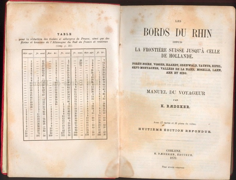
BAEDEKER, Karl
Allemagne. Bords du Rhin depuis Bale jusqu'a La Frontiere de Hollande. Foret-Noire, Vosges, Haardt, Odenwald, Taunus, Eifel, Sept-Montagnes, Vallees de La Nahe, Moselle, Lahn, Ahr, Sieg, Wupper et Ruhr.
1870 Karl Baedeker, Coblenz 1870.8e edition. xxvi, 317pp, one general map, 15 maps, 13 town plans, a very good bright copy.
Référence libraire : 10368
|
|
|
Baedeker, Karl
AUTOFÜHRER DEUTSCHES REICH (Ohne Das Land Oesterreich). Offizieller Führer Des Deutschen Automobil-Clubs
This rare pre-WWII Baedeker is a snapshot of a dark period of history. The word "Reich" appears practically in every other sentence. Very rare, especially in this condition; 16mo - 6" to 7" tall; 813 pages
|
|
|
Baedeker, Karl
Baedeker Freiburg : Kurzer Stadtführer. 5. Aufl.
Ostfildern-Kemnat : Baedeker, 1978. 108 S. : Ill., Kt. ; 15,5 cm; kart.
Référence libraire : 1158652

|
|
|
Baedeker, Karl
BAEDEKERS AUTOFÜHRER. BAND 1. DEUTSCHES REICH (OHNE DAS LAND OESTERREICH) Offizieller Führer Des Deutschen Automobil-Clubs
Very light bumping to one corner. One map with light edgewear; A very handsome copy with boards in NF condition. Clubausgabe. "Mit 60 Stadtplänen". This rare edition reminds us of a dark side of German history. Including the DDAC seal on title page with inserted swastika. ; 16mo 6" - 7" tall; 632 pages
|
|
|
Baedeker, Karl
BAEDEKERS AUTOFÜHRER. DEUTSCHES REICH (GROSSDEUTSCHLAND) Offizieller Führer Des Deutschen Automobil-Clubs
Open and closed tears to DJ. ; The famous, rare pre WWII edition, that is part of a dark history. Extremely rare (and never seen before) with the DJ and in this book condition. Bright marbled edges; 16mo 6" - 7" tall; 813 pages
|
|
|
Baedeker, Karl
BAEDEKERS AUTOFÜHRER. DEUTSCHES REICH (GROSSDEUTSCHLAND) Offizieller Führer Des Deutschen Automobil-Clubs
Small open and closed tears to DJ. Former owner's name on front free endpaper. ; The famous, rare pre WWII edition, that is part of a dark history. Extremely rare (and never seen before) with the DJ and in this book condition. Bright marbled edges; 16mo 6" - 7" tall; 813 pages
|
|
|
Baedeker, Karl
Baedekers Autoreiseführer Deutschland - Die Bundesrepublik"
Baedekers Verlag 12,5 x 22,5 Stuttgart 1956 416 p.Offizieller Führer des allgemeinen deutschen Automobil-Clubs, mit 50 Karten und Plänen und 100 Zeichnungen, bearbeitet von Oskar Steinheil. Vierte Auflage. Reliure rouge éditeur, en parfait état, un coin leg. usé, titre doré sur le premier plat, bien complet des trois cartes dépliantes en fin de guide, intérieur parfait.(C95) Livre
Référence libraire : 134
|
|
|
Baedeker, Karl
Baedekers Autoreiseführer Deutschland - Die Bundesrepublik"
Baedekers Verlag 12,5 x 22,5 Stuttgart 1956 416 p.Offizieller Führer des allgemeinen deutschen Automobil-Clubs, mit 50 Karten und Plänen und 100 Zeichnungen, bearbeitet von Oskar Steinheil. Vierte Auflage. Reliure rouge éditeur, en parfait état, un coin leg. usé, titre doré sur le premier plat, bien complet des trois cartes dépliantes en fin de guide, intérieur parfait.(C95) Livre
Référence libraire : 134
|
|
|
Baedeker, Karl
Baedekers Nordwest-Deutschland. (von der Elbe und der Westgrenze Sachsens an).
Leipzig, Baedeker, 1892. 24. Aufl. 8°. XXX, 292 S. Mit 24 v. 25 Ktn. u. 28 Plänen. Or.-Ln. Ber. u. best. Gelenke lose u. starken Gebrauchssp. 24
Référence libraire : 37616AB
|
|
|
Baedeker, Karl
Baedekers Tirol, Vorarlberg, Etschland. Westliche Teile von Salzburg und Kärnten. Handbuch für Reisende
Leipzig: Verlag von Karl Baedeker, 1929. 16 cm ; Leinen
Référence libraire : 82635

|
|
|
Baedeker, Karl
Berlin - Handbook for Travellers
Freiburg Karl Baedeker, 1971. 127 S. Kl. 8° Klein-Oktav Brosch.
Référence libraire : 10388

|
|
|
Baedeker, Karl
BERLIN AND ITS ENVIRONS Handbook for Travellers
Usual browning to edges as well as first and last few pages. Bookseller label. Former owner's name on half title page. A very handsome copy ; 4 maps and 19 plans; 16mo; 250 pages
|
|
|
Baedeker, Karl
BERLIN AND ITS ENVIRONS Handbook for Travellers
Boards a bit darkened and with minor rubbing to extremities. Neat underlining on a few single pages. Former owner's name on front endpaper. Light edgewear to maps. ; 4 maps and 19 plans; 16mo; 247 pages
|
|
|
Baedeker, Karl
BERLIN Handbook for Travellers
Gilt lettering a bit faded. ; With 26 maps and plans and 128 sketches ; 16mo 6" - 7" tall; 316, 20 pages
|
|

 Recevoir par e-mail
 Télécharger en PDF
 Flux RSS
 Lien permanent


