|
Nono & Smod:
Nono & Smod - Petite sérigraphie signée.
Lausanne, La Marge. Sérigraphie en noir, au format 21 x 11 cm.
Bookseller reference : 26142

|
|
|
Nono & Smod:
Petite sérigraphie en noir, sans titre.
Lausanne, La Marge. Petite sérigraphie au format 21 x 11 cm.
Bookseller reference : 26118

|
|
|
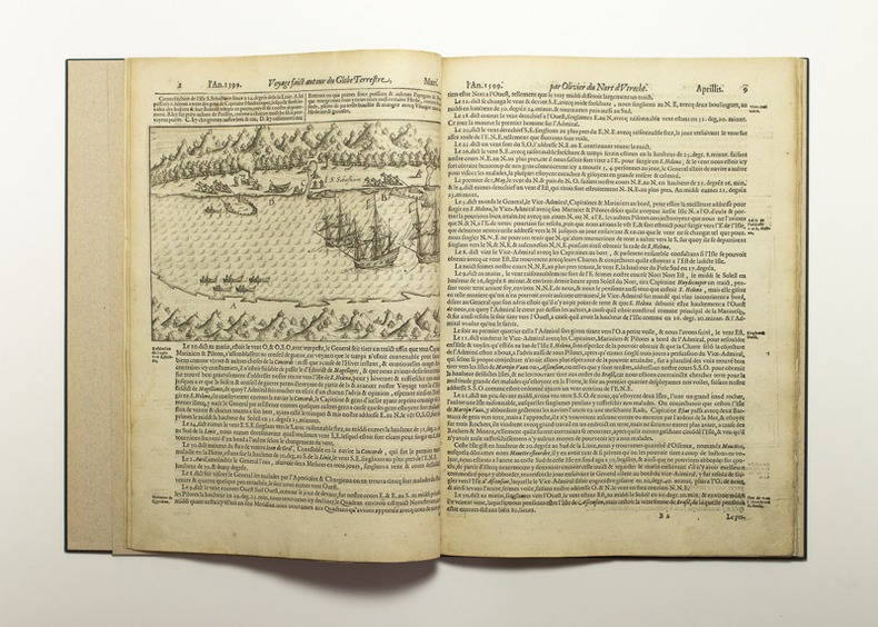
NOORT Olivier van:
Description du penible voyage faict entour de l’Univers ou globe terrestre, par Sr. Olivier du Nort d’Utrecht, Général de quattre navires, assavoir : de celle dicte Mauritius avecq laquelle il est retourne comme Admiral, l’aultre de Henrÿ fils de Fredericq Vice-Admiral, la troisiesme dicte la Concorde, avecq la quatriesme nomme l’Esperance, bien montees dequipage de guerre & Vivres, ayant 248. Hommes en icelles, pour traversant le desctroict de Magellanes, descouvrir les Costes de Cica, Chili & Peru, & y traffiquer & puis passant le Molucques, & circumnavigant le Globe du Monde retourner a la Patrie. Elles singlerent de Rotterdame le 2. Juillet 1598. Et l’An 1601. d’Aougst y tourna tant seulement la sus- dicte navire Mauritius. Ou sont deduictes ses estranges adventures, & pourtraict au vif en diverses Figures, plusieurs cas estranges a luy advenus, qu’il y a rencontrez & veus. Le tout translaté du Flamand en Franchois, a service de ceulx qui sont curieux & se delectent de nouvelles remarquables & dignes de memoire.
Imprimé à Amstelredam [sic], chez Cornille Claessz sur l'Eau au Livre à Ecrire, l'an 1602. In-folio de [2]-61 pages (A-H4), cartonnage noir à la Bradel, signé Honegger. Restauration mineure à quelques feuillets.
Bookseller reference : 11790
|
|
|
NORD-POL KARTE - NORTH POLE MAP.
Neueste Handkarte der Gebiete um den Nordpol. Breiten- Massstab 1:20 000 000. Nach zuverlässige Quellen bearbeitet von A. Herrich.
Glogau, Carl Flemming (ca. 1900). Orig. printed clothbacked boards. Map in colour (42 x 48 cm.) inserted and folded.
Bookseller reference : 55490
|
|
|
NORD-POL KARTE - NORTH POLE MAP.
Neueste Handkarte der Gebiete um den Nordpol. Breiten- Massstab 1:20 000 000. Nach zuverlässige Quellen bearbeitet von A. Herrich.
Glogau, Carl Flemming (ca. 1900). Orig. printed clothbacked boards. Map in colour (42 x 48 cm.) inserted and folded.
|
|
|
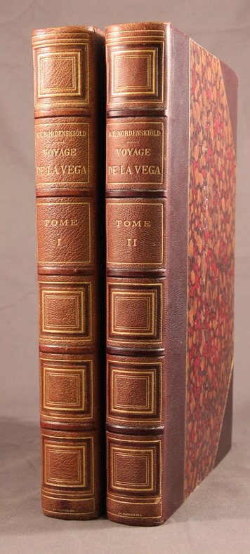
NORDENSKIOLD A.E.; RABOT Charles (trad.); LALLEMAND Charles (trad.):
Voyage de La Vega autours de l’Asie et de l’Europe. Accompagné d’un résumé des voyages précédemment effectués le long des côtes septentrionales de l’ancien continent.
Paris, Lib. Hachette et Cie, 1883. 2 vol. grand in-8 de IV-481 + 478 pages, demi-maroquin marron à coins ornés d’un double filet doré, dos à nerfs ornés, têtes dorées. Dos passés, quelques rares rousseurs. Ch. Magnier.
Bookseller reference : 2206
|
|
|
Nordhagen, Rolf
NORSK FLORA Illustrasjonsbind. Annet Hefte Enfrobladete Monocotyeldoneae
Oslo: H. Aschehoug & Co 1948. Book. Fine. Hardcover. 8vo. b/w plates 65-380 covering the monocotyledons. Original green cloth binding with gilt lettering fine with minimal wear gitl slightly dulled. Contents clean and tight minimal pencil annotation referencing the plates otherwise unmarked. A fine tight copy. H. Aschehoug & Co Hardcover
Bookseller reference : 018924
|
|
|
NORGE - JAN JANSSONIUS.
Regni Norvegiae. Nova et Accurata descriptio.
Amsterdam omkr. 1664. 42,5x53. Tæt skåret indtil pladenranden, men intet tab. Kobberstukket og i samtidig håndkolorering. Kartouche med skovarbejdere, kompasrose, skibe i søen.orienteret med øst øverst.
|
|
|
NORGE - JAN JANSSONIUS.
Regni Norvegiae. Nova et Accurata descriptio.
Amsterdam omkr. 1664. 42,5x53. Tæt skåret indtil pladenranden, men intet tab. Kobberstukket og i samtidig håndkolorering. Kartouche med skovarbejdere, kompasrose, skibe i søen.orienteret med øst øverst.
Bookseller reference : 44306
|
|
|
NORMA L.
La véritable cartomancie par la célèbre sybille française mise en tableaux.
Paris, Guy Le Prat éditeur, 1975. 17 x 13, 152 pp., très nombreux tableaux, broché, bon état.
Bookseller reference : 35139
|
|
|
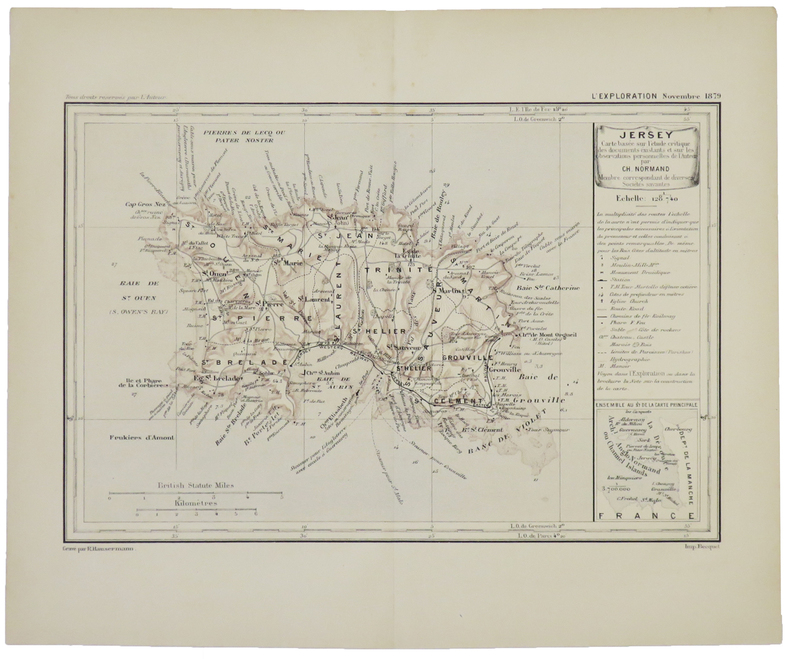
NORMAND (Charles).
[JERSEY] Jersey.
[1880]. 165 x 248 mm.
Bookseller reference : LBW-5046
|
|
|
NORMANDIE
Carte touristique couleurs au 1/250 000?.
Une feuille 120x92 cm.
|
|
|
NORTHUMBERLAND
Engraved County map of Northumberland. BRIGHT COPY WITH GOOD CONTEMPORARY COLOURING
Engraved map on paper measuring 9.0 x 7.0 ins (approx. 23 x 18 cms), COLOURED BY HAND IN FRAME AND OUTLINE, small loss at bottom (blank) left-hand corner else a very good, bright, clean copy.

|
|
|
NORVEGE
Carte de poche au 1/1 500 000e.
1 feuille repli?e. 55x75 cm.
|
|
|
Not Cited
PHILIPS JUNIOR HISTORICAL ATLAS Prepared Under the Direction of the Historical Association
London: George Philip & Son Limited 1929. Book. Very Good. Paperback. Fifth Edition. 4to. 40 colour maps. Cloth backed card covers good with some general wear a little grubby. Contents tight some general reading wear and finger marks title page somewhat marked with a small scuff mark. A good to very good copy. George Philip & Son Limited Paperback
Bookseller reference : 006602
|
|
|
NOTEBOOK, maps
Minsk Belarus Notebook: City Map Notebook for Travelers Diary Writing Subject Memo Book Planner with Lined Paper 6x9 Inches College Ruled 120 Lined Pages
Independently published 2020. Paperback. New. 120 pages. 9.00x6.00x0.30 inches. Independently published paperback
Bookseller reference : 2-1658556216 ISBN : 1658556216 9781658556217
|
|
|
NOTEBOOK, Maps
Tashkent Uzbekistan Notebook: City Map Notebook for Travelers Diary Writing Subject Memo Book Planner with Lined Paper 6x9 Inches College Ruled 120 Lined Pages
Independently published 2020. Paperback. New. 120 pages. 9.00x6.00x0.30 inches. Independently published paperback
Bookseller reference : 2-1658562143 ISBN : 1658562143 9781658562140
|
|
|
NOUVEL Jean
"Horizons" Quartier île Seguin-rives de Seine Boulogne-Billancourt
Paris Ateliers Jean Nouvel - Hines - Gecina 2006 In-4 carré Cartonnage toilé illustré et étui éditeur Signé par l'illustrateur
Bookseller reference : 012552
|
|
|
NSW. GOVERNMENT TOURIST BUREAU & NATIONAL ROADS AND MOTORISTS ASSOCIATION with maps drawn by H. E. C. Robinson Ltd N. S.
MOTOR ROAD GUIDE TO SOUTHERN AND NEAR WESTERN N.S.W. - With Through Routes to and from Melbourne
The Australian Guide Book Co. Sydney c. 1927. 333 pp 208 maps 'key map' at front advertisements cloth spine faded and worn chips to board edges and corners else very good copy in illustrated papered boards. The Australian Guide Book Co., Sydney, c. 1927 hardcover
Bookseller reference : 232038
|
|
|
NUSRET.
[ATLAS OF ROUTES OF VESSELS / NAVIGATION] Martin'in manevra levhasiyla Batenberg'in rota müs'irinin sûret-i istimaline mahsûs talimat. [i.e. Martin's maneuvering plate and Batenberg's instruction for the use of the route master].
Fine Turkish, Ottoman (1500-1928) Modern light brown cloth bdg. gilt lettering on the front board. [1], 99 p., 36 numbered maps printed in black and red ink, 5 numbered folded plates. A fine copy. First and only edition of this extremely rare atlas in user guide form including the instructions and descriptions of the routes of vessels by an advisor of the British naval officer and German prince related to the British royal family, Prince Louis Alexander of Battenberg (1854-1921), who was the first Marquess of Milford Haven, commanded the Atlantic Fleet from 1908 to 1910 and became first sea lord in 1912. This book was translated by Nusret, who was a lieutenant in the Ottoman Naval Forces in its period and prepared only for use of Turkish naval officers. The plates include the maneuver plate of an officer named "Martin", who is not able to be recognized. Every map and plate depending on the current position of the ship has its own descriptive text. Özege 12270.; Not in OCLC and Library Hub.
|
|
|
NUSSBAUM, Fritz.
Les Pyrénées dans l'ancien cartographie selon la Collection de Cartes de la Bibliothèque de la Ville de Berne, Suisse.
Zaragoza, 1952 [Separata de "Actas del Primer Congreso Internacional del Pirineo"]. 4to. mayor; 26 pp., con 14 reproducciones entre el texto y 8 láminas fotográficas aparte. Edición limitada de 500 ejemplares. Cubiertas originales.

|
|
|
O'Hara, Lucy Hudgins) James, Katie O'Hara (editor)b/w Photos; maps on end Papers
Yorktown As I Remember Yorktown Virginia
Verona VA: McClure Printing Co 1981. 1st . Hardcover. Near Fine/Near Fine. 8vo. b/w Photos; maps on end Papers. 1st printing; dj in mylar; blue c w/gilt decorations/titles; 78 clean unmarked pages/index <br/> <br/> McClure Printing Co hardcover
Bookseller reference : 115414
|
|
|
O. Akbulatova (ed.) N. Vernova
Peterhof (Treasures of Russia)
No marks or inscriptions. Crease to lower corner of rear cover. A very clean very tight copy with bright unmarked boards and no bumping to corners. 82pp. A guide to the sumptuous Palace and gardens of Peterhof in St. Petersburg, Russia. Very scarce in the UK.

|
|
|
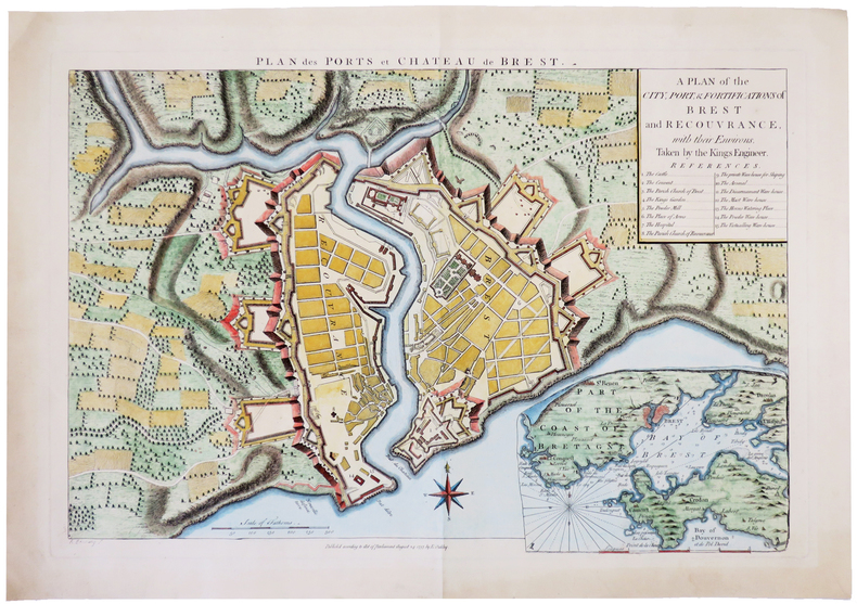
OAKLEY (Edward).
[BREST] Plan des ports et château de Brest. A plan of the city, port, & fortifications of Brest and Recouvrance, with their environs, taken by the Kings engineer.
1757. 345 x 506 mm.
Bookseller reference : LBW-4984
|
|
|
OCCIDENT ROMAIN par Louis HARMAND.
L'occident romain. Gaule ; Espagne ; Bretagne ; Afrique du Nord (31 av. J.-C. à 235 ap. J.-C.). Racines celtiques et structures romaines d'une communauté ... Contient 15 cartes de l'auteur.
Ed. Payot 1960. Bel exemplaire broché, fort in-8, 494 pages avec tables.
Bookseller reference : AUB-6182
|
|
|
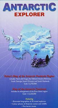
Ocean Explorer Maps
Antarctic Explorer Map; Ocean Explorer Maps
map. Good. Access codes and supplements are not guaranteed with used items. May be an ex-library book. unknown
Bookseller reference : 0954371763.G ISBN : 0954371763 9780954371760
|
|
|
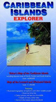
Ocean Explorer Maps
Caribbean Islands explorer map Ocean Explorer Maps
map. Good. Access codes and supplements are not guaranteed with used items. May be an ex-library book. unknown
Bookseller reference : 0954371704.G ISBN : 0954371704 9780954371708
|
|
|
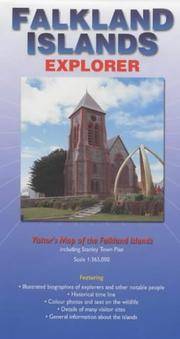
Ocean Explorer Maps
Falkland Islands Explorer Map
map. Good. Access codes and supplements are not guaranteed with used items. May be an ex-library book. unknown
Bookseller reference : 0953861880.G ISBN : 0953861880 9780953861880
|
|
|
Ocean Explorer maps
Falkland Islands Explorer Map
map. Good. Access codes and supplements are not guaranteed with used items. May be an ex-library book. unknown
Bookseller reference : 0954371747.G ISBN : 0954371747 9780954371746
|
|
|
Ocean Explorer maps
Falkland Islands Explorer Map
Ocean Explorer Maps 2007-02-22. map. New. 3.70x0.12x8.66. Buy with confidence. Excellent Customer Service & Return policy. Ocean Explorer Maps unknown
Bookseller reference : DADAX0954371747 ISBN : 0954371747 9780954371746
|
|
|
Ocean Explorer Maps
Galapagos Islands : Explorer Ocean Explorer Maps
map. Good. Access codes and supplements are not guaranteed with used items. May be an ex-library book. unknown
Bookseller reference : 0954371771.G ISBN : 0954371771 9780954371777

|
|
|
Ocean Explorer Maps
Mediterranean Explorer Ocean Explorer Maps
map. Good. Access codes and supplements are not guaranteed with used items. May be an ex-library book. unknown
Bookseller reference : 0954371739.G ISBN : 0954371739 9780954371739
|
|
|
Ocean Explorer Maps
South Georgia : Explorer Ocean Explorer Maps
map. Good. Access codes and supplements are not guaranteed with used items. May be an ex-library book. unknown
Bookseller reference : 0957002807.G ISBN : 0957002807 9780957002807
|
|
|
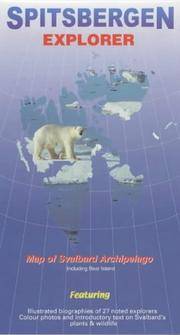
Ocean Explorer Maps
Spitsbergen Explorer Map by Ocean Explorer Maps
map. Good. Access codes and supplements are not guaranteed with used items. May be an ex-library book. unknown
Bookseller reference : 0953861813.G ISBN : 0953861813 9780953861811
|
|
|
OCEAN PACIFIQUE
Oc?an pacifique et ses principaux archipels. Carte couleur.
1 feuille 80 x 67 cm.
|
|
|
Odgers, Sally Farrell; Hinch, Jennifer (maps).
Tasmania - A Guide.
Sydney Kenthurst: Kangaroo Press 1991. Reprint ed. Paperback trade very good condition black & white text-photos maps minor edgewear. 224 pp. This comprehensive book looks at places of historic and scenic interest and includes a number of tourist attractions specifically designed for young travellers. Sally Farrell Odgers a Tasmanian herself has travelled most of the routes and explored many of the places she writes about here. Kangaroo Press paperback
Bookseller reference : 28527 ISBN : 0864172362 9780864172365
|
|
|
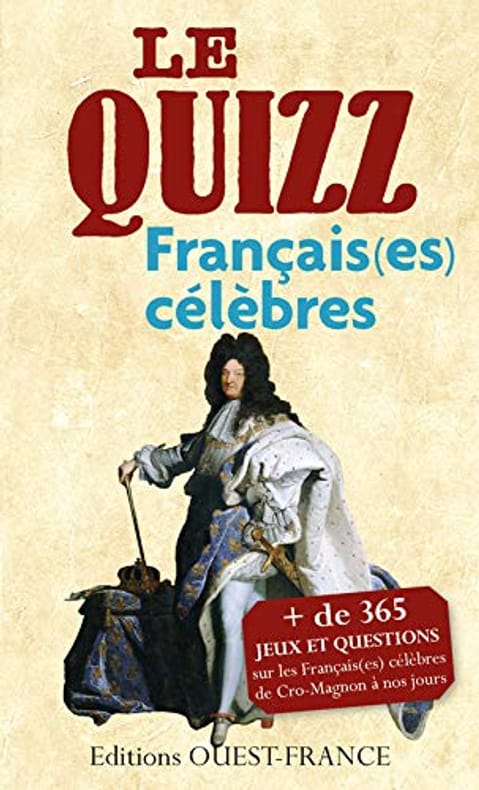
Odile LOZACHMEUR
QUIZZ DES FRANCAIS(ES) CELEBRES: De Cro-Magnon à nos jours
OUEST-FRANCE 2026 200 pages 10 8x2 2x17 6cm. 2026. Broché. 200 pages.
Bookseller reference : 500034956
|
|
|
Oehser P. ed. and b & w Photos Maps
National Geographic Society Research Reports: 1964 Projects
Hardcover. Very Good. National Geographic Society 1969 hardcover. 1964 Projects volume. Cover contents binding like-new. Dust jacket shows minor wear. hardcover
Bookseller reference : C4-MJNY-G1GB
|
|
|
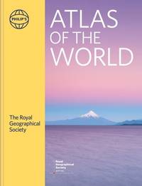
Of British Geographers, Institute (Author)/ Philip's Maps (Author)/ Chabluk, Stefan (Illustrator)/ Donohoe, William (Illustrator
Philip's RGS Atlas of the World: 2024 edition Philip's World Atlas
Philip's 2024. Hardcover. New. 448 pages. 11.26x1.50x14.49 inches. Philip's hardcover
Bookseller reference : __1849077002 ISBN : 1849077002 9781849077002
|
|
|
OGÉE (Jean-Baptiste).
[BRETAGNE] Carte géométrique de la province de Bretagne.
Nantes, chez l'auteur, 1771. En 4 feuilles coupées en 9 sections montées sur toile et repliées, pouvant être jointes pour former une carte de 1,13 x 1,56 m ; étiquettes au dos de l'éditeur parisien Roch-Joseph Julien, renseignées du numéro de la feuille et des villes correspondantes en manuscrit ; sous étui de papier bleu de l'époque, dentelle dorée en encadrement sur les plats, titre doré "Bretagne" sur le premier plat.
Bookseller reference : LBW-8915

|
|
|
ohne Autor
(Ekuador) Guia general del Ecuador.
Guayaquil, Publicistas, 1959. Mehrfach gefaltete Farbkarte.
Bookseller reference : 4624
|
|
|
ohne Autor
(Mexiko) Las Carreteras de Mexico. Road Map of/Carta de Caminos Mexico.
ohne Ort, Rand McNally (ohne Jahr). Mehrfach gefaltete Straßenkarte.
Bookseller reference : 4647
|
|
|
Olami, Ya'aqov ; Sender, Shlomo ; Oren, Eldad
Archaeological Survey of Israel: Map of Yagur (27)
Contains a map. 24x17 cm. 102+72 pages. Softcover. In good condition.
|
|
|
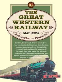
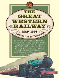
Old House Books & Maps
Great Western Railway Map 1924
map. Good. Access codes and supplements are not guaranteed with used items. May be an ex-library book. unknown
Bookseller reference : 190840230X.G ISBN : 190840230X 9781908402301
|
|
|
Old House Books & Maps
Great Western Railway Map 1924
Paperback. Very Good. paperback
Bookseller reference : GOR006296571 ISBN : 190840230X 9781908402301
|
|
|
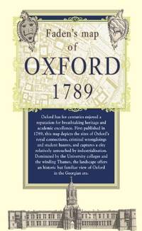
Old House Books & Maps
Map of Oxford 1789
Paperback. Very Good. paperback
Bookseller reference : GOR005421721 ISBN : 1908402202 9781908402202
|
|
|
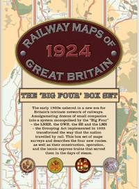
Old House Books & Maps
Railway Maps of Great Britain 1924: The âBig Fourâ Box-set
Paperback. Very Good. paperback
Bookseller reference : GOR006268288 ISBN : 1908402318 9781908402318
|
|
|
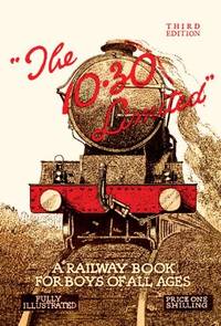
Old House Books & Maps
The 10.30 Limited: A Railway Book for Boys of All Ages
hardcover. Good. Access codes and supplements are not guaranteed with used items. May be an ex-library book. hardcover
Bookseller reference : 1908402172.G ISBN : 1908402172 9781908402172

|
|
|
Old House Books & Maps
The 10.30 Limited: A Railway Book for Boys of All Ages
2012-04-01. hardcover. Used: Good. 7.99x10.00x1.85. Buy with confidence. Excellent Customer Service & Return policy. hardcover
Bookseller reference : SONG1908402172 ISBN : 1908402172 9781908402172
|
|
|
Old House Books & Maps
The 10.30 Limited: A Railway Book for Boys of All Ages
Paperback. Very Good. paperback
Bookseller reference : GOR004122453 ISBN : 1908402172 9781908402172
|
|
 Receive by email
 Download as PDF document
 RSS feed


