|
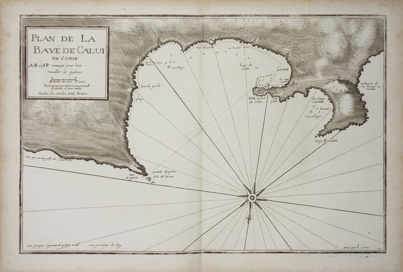
AYROUARD (Jacques).
[CORSE/CALVI] Plan de la baye de Calvi en Corse.
[circa 1730]. 287 x 450 mm.
Référence libraire : LBW002c0
|
|
|
AYROUARD (Jacques).
[CORSE/SAINT-FLORENT] Plan du golfe de St. Fiorenzo en lisle de Corse.
[circa 1730]. 298 x 456 mm.
Référence libraire : LBW-3329

|
|
|
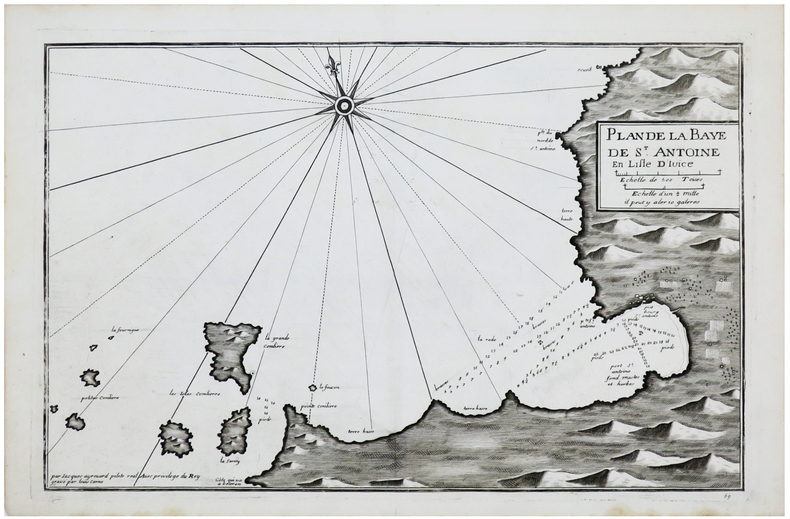
AYROUARD (Jacques).
[IBIZA] Plan de la baye de S.t Antoine en lisle d'Ivice.
[circa 1730]. 289 x 450 mm.
Référence libraire : LBW-6149
|
|
|
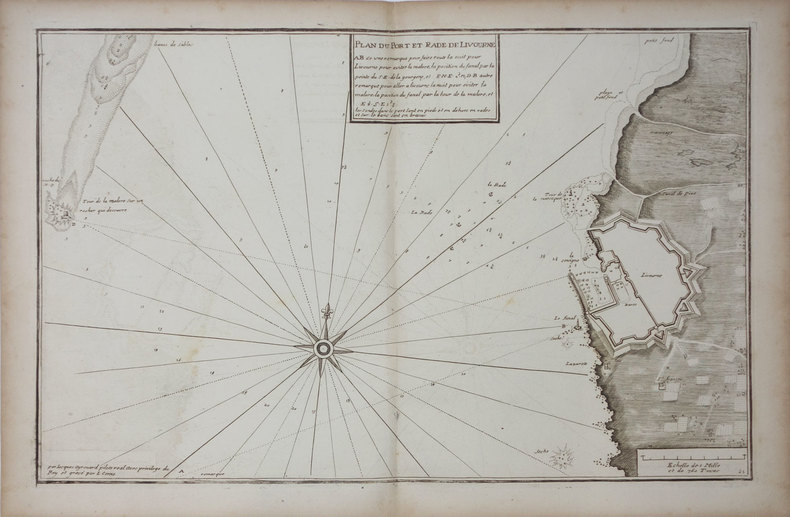
AYROUARD (Jacques).
[LIVOURNE] Plan du port et rade de Livourne.
[circa 1730]. 290 x 450 mm.
Référence libraire : LBW0025b
|
|
|
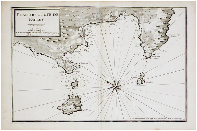
AYROUARD (Jacques).
[NAPLES] Plan du golfe de Naples.
[circa 1730]. 290 x 445 mm.
Référence libraire : LBW-6850
|
|
|
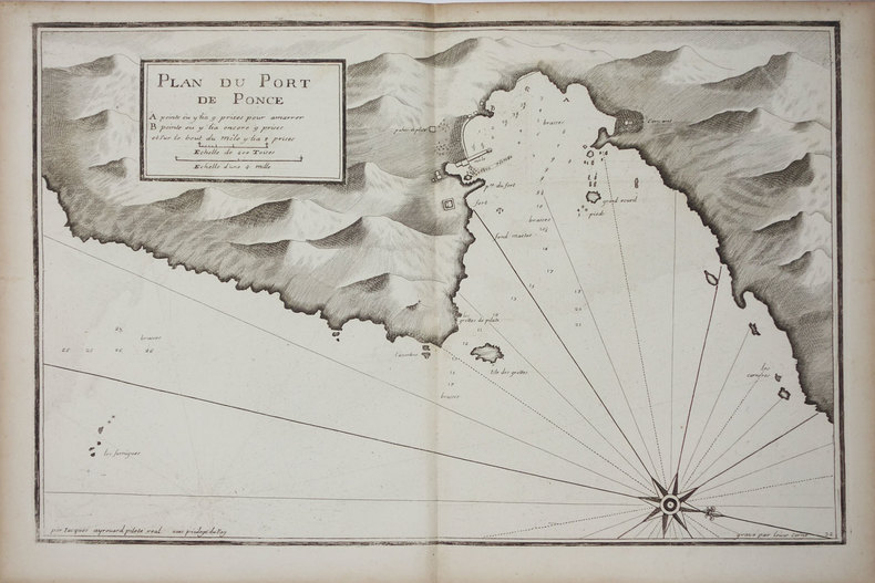
AYROUARD (Jacques).
[PONZA] Plan du port de Ponce.
[circa 1730]. 299 x 457 mm.
Référence libraire : LBW002c9
|
|
|
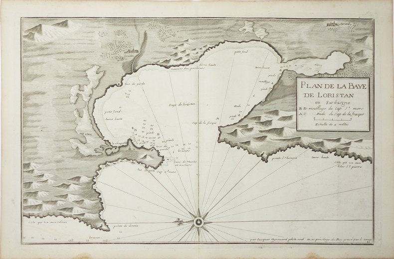
AYROUARD (Jacques).
[SARDAIGNE] Plan de la baye de Loristan.
[circa 1730]. 290 x 450 mm.
Référence libraire : LBW00269
|
|
|
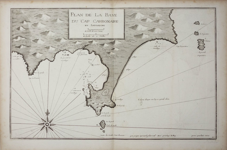
AYROUARD (Jacques).
[SARDAIGNE] Plan de la baye du cap Carbonaire en Sardaigne.
[circa 1730]. 290 x 450 mm.
Référence libraire : LBW0025a
|
|
|
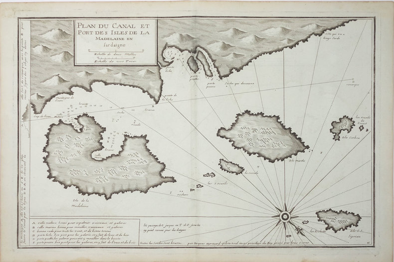
AYROUARD (Jacques).
[SARDAIGNE] Plan du canal et port des isles de la Madelaine en Sardaigne.
[circa 1730]. 293 x 454 mm.
Référence libraire : LBW-3327
|
|
|
AYROUARD (Jacques).
[SARDAIGNE] Plan du passage entre lisle Azinara et le cap Azinara de Sardaigne.
[circa 1730]. 291 x 452 mm.
Référence libraire : LBW0025f

|
|
|
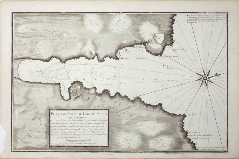
AYROUARD (Jacques).
[SARDAIGNE] Plan du port de Longo Sardo en Sardaigne.
[circa 1730]. 292 x 452 mm.
Référence libraire : LBW00267
|
|
|
AYROUARD (Jacques).
[ST-TROPEZ] Plan du golfe et des caps de St. Tropez.
[circa 1730]. 299 x 457 mm.
Référence libraire : LBW004e9

|
|
|
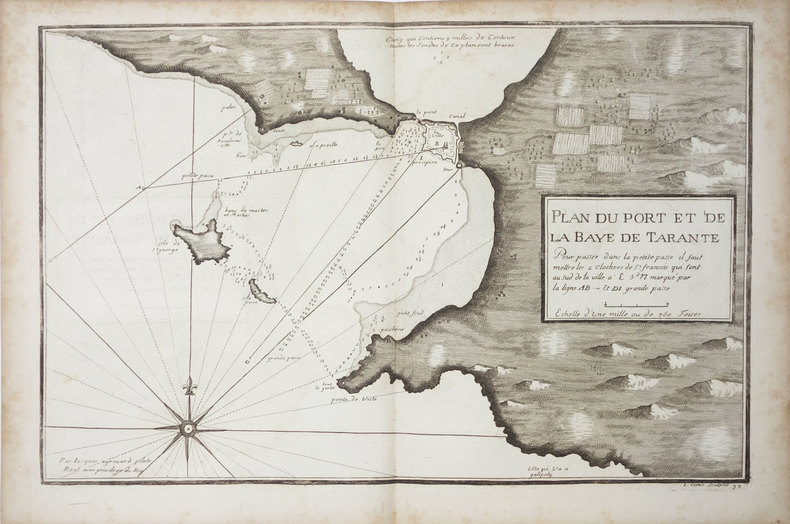
AYROUARD (Jacques).
[TARANTO] Plan du port et de la baye de Tarante.
[circa 1730]. 290 x 452 mm.
Référence libraire : LBW0027f
|
|
|
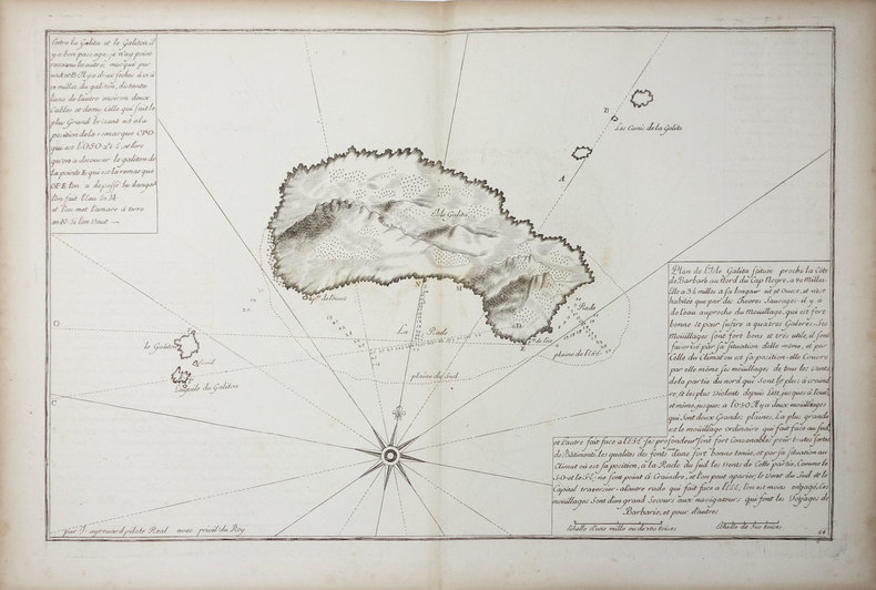
AYROUARD (Jacques).
[TUNISIE] Isle Galita.
[circa 1730]. 299 x 457 mm.
Référence libraire : LBW01b45
|
|
|
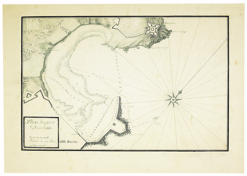
AYROUARD (Jacques). MANUSCRIT.
Plan du port d’Antibe.
[circa 1750]. 304 x 458, monté sur papier fort.
Référence libraire : LBW-4142
|
|
|
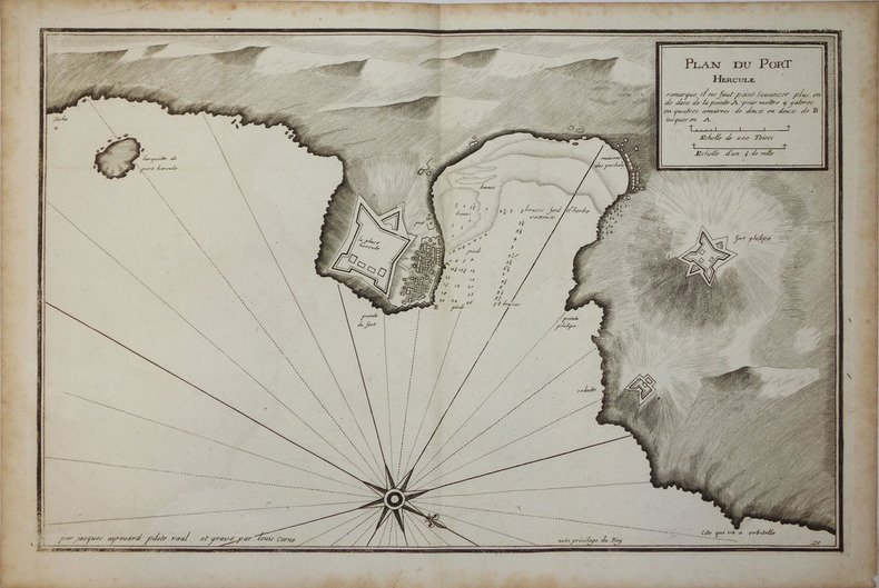
AYROUARD (Jacques);
[PORTO ERCOLE] Plan du Port Hercule.
circa 1730 296 x 458 mm.
Référence libraire : LBW00259
|
|
|
AZ maps
Great Britain A-Z Super Scale Road Atlas 2022 A3 Spiral
Geographers A-Z Map Co Ltd 05/13/2021. Spiral_bound. Used; Good. WE SHIP WITHIN 24 HRS FROM LONDON UK 98% OF OUR ORDERS ARE RECEIVED WITHIN 7-10 DAYS. We believe you will be completely satisfied with our quick and reliable service. All orders are dispatched as swiftly as possible! Buy with confidence! Greener Books. Geographers A-Z Map Co Ltd unknown
Référence libraire : 5029390 ISBN : 0008445087 9780008445089
|
|
|
AZ maps
Great Britain A-Z Handy Road Atlas 2022 A5 Spiral
Geographers A-Z Map Co Ltd. Spiral-bound. Used; Very Good. Simply Brit welcome to our online used book store where affordability meets great quality. Dive into a world of captivating reads without breaking the bank. We take pride in offering a wide selection of used books from classics to hidden gems ensuring theres something for every literary palate. All orders are shipped within 24 hours and our lightning fast-delivery within 48 hours coupled with our prompt customer service ensures a smooth journey from ordering to delivery. Discover the joy of reading with us your trusted source for affordable books that do not compromise on quality. 05/13/2021 Geographers A-Z Map Co Ltd unknown
Référence libraire : 3757746 ISBN : 0008445060 9780008445065
|
|
|
AZ maps
Great Britain A-Z Road Atlas 2022 A4 Spiral
Geographers A-Z Map Co Ltd 05/13/2021. Spiral-bound. Used; Good. WE SHIP WITHIN 24 HRS FROM LONDON UK 98% OF OUR ORDERS ARE RECEIVED WITHIN 7-10 DAYS. We believe you will be completely satisfied with our quick and reliable service. All orders are dispatched as swiftly as possible! Buy with confidence! Greener Books. Geographers A-Z Map Co Ltd unknown
Référence libraire : 4243351 ISBN : 0008445079 9780008445072
|
|
|
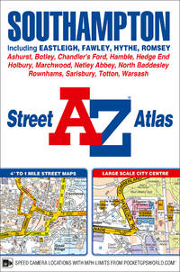
AZ maps
Southampton A-Z Street Atlas
Geographers A-Z Map Co Ltd. New Eighth edition. Paperback. Used; Good. Simply Brit welcome to our online used book store where affordability meets great quality. Dive into a world of captivating reads without breaking the bank. We take pride in offering a wide selection of used books from classics to hidden gems ensuring theres something for every literary palate. All orders are shipped within 24 hours and our lightning fast-delivery within 48 hours coupled with our prompt customer service ensures a smooth journey from ordering to delivery. Discover the joy of reading with us your trusted source for affordable books that do not compromise on quality. 06/15/2018 Geographers A-Z Map Co Ltd paperback
Référence libraire : 3280120 ISBN : 1782572589 9781782572589
|
|
|
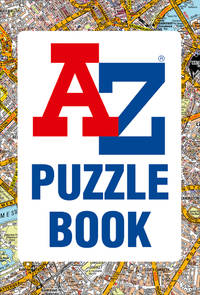
AZ maps & Moore, Dr Gareth
A-Z Puzzle Book Geographers a-Z Maps
Geographers A-Z Map Co Ltd 05/16/2019. Flexibound. Used; Very Good. WE SHIP WITHIN 24 HRS FROM LONDON UK 98% OF OUR ORDERS ARE RECEIVED WITHIN 7-10 DAYS. We believe you will be completely satisfied with our quick and reliable service. All orders are dispatched as swiftly as possible! Buy with confidence! Greener Books. Geographers A-Z Map Co Ltd unknown
Référence libraire : 4421900 ISBN : 0008351759 9780008351755
|
|
|
AZ maps & Moore, Dr Gareth
A-Z Puzzle Book Geographers a-Z Maps
Geographers A-Z Map Co Ltd. Flexibound. Used; Very Good. Simply Brit welcome to our online used book store where affordability meets great quality. Dive into a world of captivating reads without breaking the bank. We take pride in offering a wide selection of used books from classics to hidden gems ensuring theres something for every literary palate. All orders are shipped within 24 hours and our lightning fast-delivery within 48 hours coupled with our prompt customer service ensures a smooth journey from ordering to delivery. Discover the joy of reading with us your trusted source for affordable books that do not compromise on quality. 05/16/2019 Geographers A-Z Map Co Ltd unknown
Référence libraire : 3625517 ISBN : 0008351759 9780008351755
|
|
|
AZ maps & A-Z Maps
Great Britain A-Z Road Atlas 2021 A4 Spiral
Geographers A-Z Map Co Ltd. Spiral-bound. Used; Good. Simply Brit welcome to our online used book store where affordability meets great quality. Dive into a world of captivating reads without breaking the bank. We take pride in offering a wide selection of used books from classics to hidden gems ensuring theres something for every literary palate. All orders are shipped within 24 hours and our lightning fast-delivery within 48 hours coupled with our prompt customer service ensures a smooth journey from ordering to delivery. Discover the joy of reading with us your trusted source for affordable books that do not compromise on quality. 06/11/2020 Geographers A-Z Map Co Ltd unknown
Référence libraire : 3406204 ISBN : 0008388164 9780008388164
|
|
|
AZ maps & A-Z Maps
London A-Z Street Atlas
Geographers A-Z Map Co Ltd. Paperback. Used; Good. Simply Brit welcome to our online used book store where affordability meets great quality. Dive into a world of captivating reads without breaking the bank. We take pride in offering a wide selection of used books from classics to hidden gems ensuring theres something for every literary palate. All orders are shipped within 24 hours and our lightning fast-delivery within 48 hours coupled with our prompt customer service ensures a smooth journey from ordering to delivery. Discover the joy of reading with us your trusted source for affordable books that do not compromise on quality. 03/05/2020 Geographers A-Z Map Co Ltd paperback
Référence libraire : 3210342 ISBN : 0008387990 9780008387990

|
|
|
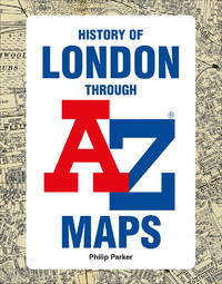
AZ maps & Parker, Philip & Collins Books
The A-Z History of London
Geographers A-Z Map Co Ltd 10/03/2019. Hardcover. Used; Good. WE SHIP WITHIN 24 HRS FROM LONDON UK 98% OF OUR ORDERS ARE RECEIVED WITHIN 7-10 DAYS. We believe you will be completely satisfied with our quick and reliable service. All orders are dispatched as swiftly as possible! Buy with confidence! Greener Books. Geographers A-Z Map Co Ltd hardcover
Référence libraire : 3842367 ISBN : 0008351767 9780008351762
|
|
|
Azelt Johann (1654 -?)
Barhaste abbildung de unnergleichlichen statt Rom…
Rarissima veduta panoramica della città da Monte Mario, edita a Francoforte da Johann Azelt verso la fine del XVII secolo. "In questa stampa gli edifici sono ben poco riconoscibili ed il Tevere segue un errato percorso sotto Trinità dei Monti, riproponendo un errore comune a molti panorami di quest'epoca editi nel nord Europa ed evidentemente copiati uno dall'altro.. Il prototipo iniziale per questa tipologia di panorami è identificabile nel panorama inciso da Israel Silvestre nel 1642" (cfr. Marigliani p. 199). Incisione in rame, in perfetto stato di conservazione. Rarissima. A very rare panoramic view of the city from Monte Mario, published in Frankfurt by Johann Azelt towards the end of the 17th century. In this print the buildings are hardly recognisable and the Tiber follows a wrong path under Trinità dei Monti, repeating an error common to many panoramas of this period published in northern Europe and evidently copied from one another. The initial prototype for this type of panorama can be identified in the panorama engraved by Israel Silvestre in 1642"(cf. Marigliani p. 199). Copper engraving, in perfect condition. Very rare. Marigliani, "Le Piante di Roma nelle collezioni private" p. 199, 104 (erroneamente attibuita).

|
|
|
AZIZ OGAN, (One of the first Turkish archaeologists andthe founder of the Izmir Archaeological Museum and the director of Istanbul Archaeological Museums), (1888-1956).
Typescript document signed 'Aziz Ogan'.
Very Good Turkish Original TLS document signed 'Aziz Ogan' as 'the general director of Istanbul Archaeological Museums'. 32,5x21 cm. In Turkish. 1 p. Full. Typescript document with autograph corrections and signature. Including request of the photographs of listed 25 Seljuk and Ottoman architectural buildings such as mosques, fountains, hans, tombs etc. Dated 12-9-1939. Addressed to Nuri [Ebussuudoglu from the member board of the Turkish Antiquities Protection Council. Letterhead 'TC Istanbul Müzeleri Genel Direktörlügü' [i.e. The General Directory of Istanbul Museums]. Ogan was a Turkish archaeologist and museologist. He was the one of the earliest archaeologists of the Turkish Republic. He founded Izmir Archeology Museum and was the director of Istanbul Archeology Museums. He is the father of the first Turkish female archaeologist Jale Inan.
|
|
|
A–Z maps
Cardiff A-Z Street Atlas
Geographers’ A-Z Map Co Ltd 2021. Paperback. New. seventh edition edition. 192 pages. 8.46x5.87x0.32 inches. Geographers’ A-Z Map Co Ltd paperback
Référence libraire : __0008445192 ISBN : 0008445192 9780008445195
|
|
|
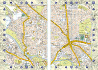
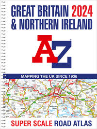
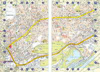
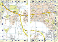
A–Z maps
Great Britain A-Z Super Scale Road Atlas 2024 A3 Spiral
Geographers’ A-Z Map Co Ltd 2023. Spiral-bound. New. 248 pages. 14.88x11.30x0.67 inches. Geographers’ A-Z Map Co Ltd unknown
Référence libraire : 2-0008597650 ISBN : 0008597650 9780008597658
|
|
|
A–Z maps
Nottingham A-Z Street Atlas
pp. 128 9th Edition . Papeback. New. unknown
Référence libraire : 6384734590 ISBN : 0008445184 9780008445188
|
|
|
A–Z maps
Nottingham A-Z Street Atlas
Geographers’ A-Z Map Co Ltd 2021. Paperback. New. ninth edition edition. 128 pages. 8.46x5.75x0.43 inches. Geographers’ A-Z Map Co Ltd paperback
Référence libraire : __0008445184 ISBN : 0008445184 9780008445188
|
|
|
A–Z maps
Portsmouth A-Z Street Atlas
pp. 96 9th Edition . Papeback. New. unknown
Référence libraire : 6384734589 ISBN : 0008445222 9780008445225
|
|
|
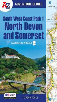
A–Z maps
South West Coast Path – North Devon & Somerset: with Ordnance Survey mapping A-Z Adventure Series
Paperback / softback. New. paperback
Référence libraire : A9780008707651 ISBN : 0008707650 9780008707651
|
|
|
A–Z maps
Southampton A-Z Street Atlas
pp. 80 9th Edition . Papeback. New. unknown
Référence libraire : 6384734588 ISBN : 0008445206 9780008445201
|
|
|
A�Z Maps
A A-Z BRISTOL & BATH HIDDEN WALKS: Discover 20 routes in and around the cities
NEW. unknown
Référence libraire : BIB-NOV-14-2025-234997 ISBN : 0008496358 9780008496357

|
|
|
A�Z Maps
A A-Z OXFORD HIDDEN WALKS: Discover 20 routes in and around the city
NEW. unknown
Référence libraire : BIB-NOV-14-2025-249999 ISBN : 0008496323 9780008496326

|
|
|
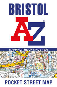
A�Z Maps
Bristol A-Z Pocket Street Map
NEW. unknown
Référence libraire : BIB-NOV-15-2025-587054 ISBN : 0008560471 9780008560478
|
|
|
A�Z maps
Great Britain A-Z Road Atlas 2022 A4 Spiral
Geographers� A-Z Map Co Ltd 13/05/2021 00:00:01. spiral_bound. Very Good. 1.3989 in x 27.5790 in x 21.1839 in. Geographers� A-Z Map Co Ltd unknown
Référence libraire : mon0000476531 ISBN : 0008445079 9780008445072
|
|
|
A�Z Maps
Lake District A-Z Visitors Map
NEW. unknown
Référence libraire : BIB-NOV-14-2025-123989 ISBN : 0008653127 9780008653125

|
|
|
A�Z Maps
Nottingham Pocket Street Map
NEW. unknown
Référence libraire : BIB-NOV-15-2025-215947 ISBN : 0008445338 9780008445331
|
|
|
A�Z Maps
Scotland A-Z Road Atlas
NEW. unknown
Référence libraire : BIB-NOV-14-2025-62227 ISBN : 0008652848 9780008652845
|
|
|
A�Z maps,Compton-Davies, Ruby,Ankcorn, Robert
A-Z Birmingham Hidden Walks: Discover 20 routes in and around the city
like new. unknown
Référence libraire : 42704917 ISBN : 0008496307 9780008496302

|
|
|
A�Z maps,Compton-Davies, Ruby,Ankcorn, Robert
A-Z Birmingham Hidden Walks: Discover 20 routes in and around the city
new. unknown
Référence libraire : 42704917-n ISBN : 0008496307 9780008496302
|
|
|
A�Z maps,Weir, Simon
A -Z Britain for Bikers: 100 scenic routes around the UK
like new. unknown
Référence libraire : 43044468 ISBN : 0008496293 9780008496296

|
|
|
B & B Maps Canada
The Illustrated Winnipeg GuideMap Atlas : A Complete Street Guide and Index of Greater Winnipeg
Canada: B & B Maps Canada 1983 General age but unmarked and in overall good to very good condition B & B Maps Canada paperback
Référence libraire : 019491
|
|
|
B.C. Hydro and Power Authority Gas Engineering Division
Corridor and Route Nomination for Vancouver Island Natural Gas System
22 pages plus 6 large, detailed fold-out maps. Summary volume of a report entitled 'Corridor and Route Nomination for Vancouver Island Natural Gas System' which described B.C. Hydro's proposed project to provide natural gas service to Vancouver Island residents and industry. Explains the reasons for nomination of a preferred corridor, and preferred route within that corridor, for a natural gas pipeline to and on Vancouver Island. This summary provides basic technical, environmental, and land use information on the routing B.C. Hydro nominated. Contents include: Introduction - Natural Gas for Vancouver Island; Reasons for the Project; Initial Route Studies; Corridor Nomination; Route Nomination; Public Consultation. Maps entitle: Existing Natural Gas Fields and Transmission Lines in B.C.; Major options for Gas Transmission System to Serve Southwestern B.C.; Bathymetry of Georgia Strait and Other Features Affecting Location of Submarine Pipelines; Factors Affecting Corridor Location; Proposed Gas Distribution Areas; Important Environmental Concerns with Nominated Corridor and Route. Unmarked. Very light wear. Excellent copy. Book
|
|
|
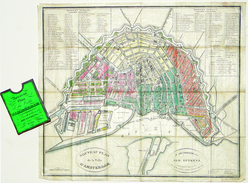
BAARSEL (Willem Cornelis van).
[AMSTERDAM] Nouveau plan de la ville d'Amsterdam.
Amsterdam, Joh. Guykens, 1839. 335 x 385 mm, imprimé sur soie et replié dans son étui d'éditeur.
Référence libraire : LBW-2777
|
|
|
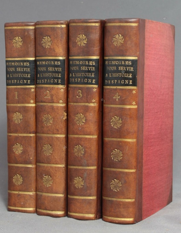
BACALLAR Y SANNA Vincent, Marquis de Saint-Philippe; [MEDAVE Louis Laurent de Féderbe comte de (trad.)]:
Mémoires pour servir à l'histoire d'Espagne, sous le règne de Philippe V. Traduits de l'espagnol.
A Amsterdam, Chez Zacharie Chatelain, 1756. 4 volumes in-12 de [8]-XXXIV-405; [2]-IV-483; [4]-437 et [4]-495 pages, demi-veau brun à coins, dos lisses ornés de fleurons, filets, étoiles et tomaison dorés, étiquettes de titre noires, tranches jaunes. Tout petit choc au dos du tome 2, rares rousseurs. Le relieur a inversé les faux-titres des volumes 3 et 4.
Référence libraire : 9756
|
|
|
Bachelier Charles Claude
Rome Vue Prise du Monte-Pincio/Roma Vista tomada del Monte-Pincio
Stampa litografica originale eseguita alla matita, impressa in nero e ocra, dalla bella acquerellatura coeva e con rialzi di vernice à la gomme. Sotto la parte figurata didascalie degli edifici principali della raffigurazione, indicazione dello stampatore e del litografo, nonché titolo in francese e in spagnolo. Al di sopra dell'immagine, titolo della serie di cui il foglio fa parte. Ampia veduta prospettica di Roma, colta dal Pincio, con un'accurata descrizione di Piazza del Popolo in primo piano e con la cupola di San Pietro sull sfondo. La tavola è edita a Parigi da Turgis nel 1860 circa.Charles Claude Bachelier abile artista francese paesaggista e litografo, attivo a Parigi dove espose ai Salons del 1834, 1836 e 1852. Esemplare in ottimo stato conservativo, con bellissima coloritura d'epoca. Original lithograph executed in pencil, engraved in black and ocher, in original colors.Under the image, some captions of the of the main buildings represented; the name of the printer and the lithographer, and title in French and Spanish. On top of the image, the title of the series. Large perspective view of Rome, captured from the Pincio, with an accurate description of the Piazza del Popolo in the foreground, and the St. Peter dome in the background. The plate was published in Paris by Turgis in about 1860.Charles Claude Bachelier, a French landscape artist and litograpgher, active in Paris where he exhibited at the Salons of 1834, 1836 and 1852.Example in very good condition.

|
|
|
BACHMANN (John).
[VERSAILLES] Palais et jardins de Versailles.
Paris, Lemiere, [1840]. 460 x 560 mm.
Référence libraire : LBW-6516

|
|
 Recevoir par e-mail
 Télécharger en PDF
 Flux RSS


