|
United Nations; Maps, Charts, Graphs [Illustrator]
Proceedings of the Symposium on the Development of Petroleum Resources of Asia and the Far East
United Nations 1959-01-01. Rebound hardcover. Read but in good condition. 0x0x0. Rebound hardcover maroon cover has shelfwear and rubbed corners and edges heavy foxing on the inside covers text is unmarked binding is tight. Brick and mortar bookshop since 1975! United Nations hardcover
Référence libraire : 160305008slt
|
|
|
Maps, Philip's, Philip's Maps and Atlases Staff
Philip's World Atlas : Paperback
Used - Good. Ships from the UK. Former library book; may include library markings. Used book that is in clean average condition without any missing pages. unknown
Référence libraire : 54309655-20 ISBN : 1849073945 9781849073943
|
|
|
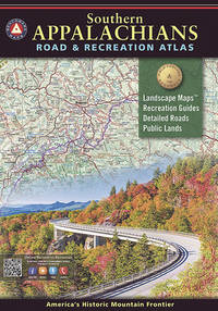
Benchmark Maps and Atlases
Southern Appalachians Road and Recreation Atlas
Benchmark LLC. Used - Good. Former library book; may include library markings. Used book that is in clean average condition without any missing pages. Benchmark LLC unknown
Référence libraire : 54309706-6 ISBN : 1734315008 9781734315004
|
|
|
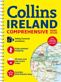
Collins Maps
Comprehensive Road Atlas Ireland New Edition New
Collins May 2021. Unknown. Near Fine. No markings. Spiral binding. Collins unknown
Référence libraire : 324270 ISBN : 0008412812 9780008412814
|
|
|
Philip's Maps
Philip's Complete Road Atlas Britain and Ireland 2017: Spiral binding
Philip's 2016-06-23. Paperback. New. 1.3959 29.5685 22.5888. Philip's paperback
Référence libraire : mon0000462159 ISBN : 1849074127 9781849074124

|
|
|
Collins Maps
Collins World Atlas: Paperback Edition
paperback. Good. Access codes and supplements are not guaranteed with used items. May be an ex-library book. paperback
Référence libraire : 0008696098.G ISBN : 0008696098 9780008696092
|
|
|
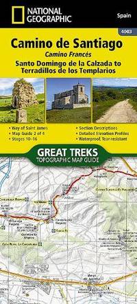
National Geographic Maps
Camino de Santiago - Camino Frances Map 2 of 4
Other cartographic. New. New Book; Fast Shipping from UK; Not signed; Not First Edition; Waterproof Tear-Resistant Topographic Map. unknown
Référence libraire : ria9781566959209_inp ISBN : 1566959209 9781566959209
|
|
|
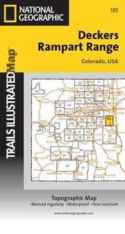
National Geographic Maps
Rampart Range: Deckers Folded Topographical Map
paperback. Good. Access codes and supplements are not guaranteed with used items. May be an ex-library book. paperback
Référence libraire : 0925873551.G ISBN : 0925873551 9780925873552
|
|
|
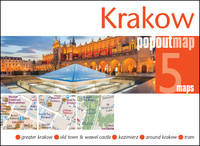
Maps, Popout
Krakow PopOut Map Popout Maps
map. Good. Access codes and supplements are not guaranteed with used items. May be an ex-library book. unknown
Référence libraire : 1914515722.G ISBN : 1914515722 9781914515729
|
|
|
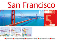
Maps Popout
San Francisco PopOut Map Popout Maps
map. Good. Access codes and supplements are not guaranteed with used items. May be an ex-library book. unknown
Référence libraire : 1914515706.G ISBN : 1914515706 9781914515705
|
|
|
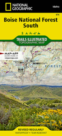
National Geographic Maps - Trails Illustrated
Boise National Forest South Map National Geographic Trails Illustrated Map 876
map. Good. Access codes and supplements are not guaranteed with used items. May be an ex-library book. unknown
Référence libraire : 1566958245.G ISBN : 1566958245 9781566958240
|
|
|
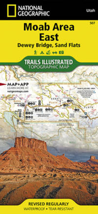
National Geographic Maps - Trails Illustrated
Moab Area East: Dewey Bridge Sand Flats Map National Geographic Trails Illustrated Map 507
map. Good. Access codes and supplements are not guaranteed with used items. May be an ex-library book. unknown
Référence libraire : 1566959020.G ISBN : 1566959020 9781566959025
|
|
|
Philip's Maps and Atlases Staff
Europe - Philip's 2018 Complete Road Atlas
Octopus Publishing Group. Used - Very Good. Ships from the UK. Former library book; may include library markings. Used book that is in excellent condition. May show signs of wear or have minor defects. Octopus Publishing Group unknown
Référence libraire : 37476386-6 ISBN : 1849074232 9781849074230
|
|
|
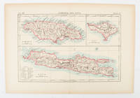
[JAMAICA AND JAVA AND BALI - MAP].
Jamaica and Java and Bali.
London and New York.: Encyclopedia Britannica. circa1900. Map in three insets after W & AK Johnston engravers with printed outline colour 18.9 x 28.9 cm central fold paper age-toned but in very good condition. Interesting map which first appeared in the ninth edition of Encyclopedia Britannica. . [Encyclopedia Britannica] unknown
Référence libraire : 174875
|
|
|
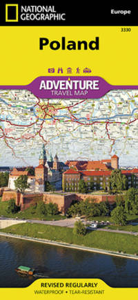
National Geographic Maps - Adventure
Poland Map National Geographic Adventure Map 3330
map. Good. Access codes and supplements are not guaranteed with used items. May be an ex-library book. unknown
Référence libraire : 1566957613.G ISBN : 1566957613 9781566957618
|
|
|
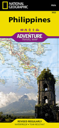
National Geographic Maps Adventure
Philippines Map National Geographic Adventure Map 3022
map. Good. Access codes and supplements are not guaranteed with used items. May be an ex-library book. unknown
Référence libraire : 1566956153.G ISBN : 1566956153 9781566956154
|
|
|
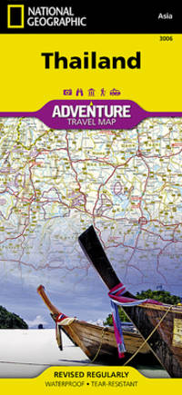
National Geographic Maps - Adventure
Thailand Map National Geographic Adventure Map 3006
map. Good. Access codes and supplements are not guaranteed with used items. May be an ex-library book. unknown
Référence libraire : 1566955262.G ISBN : 1566955262 9781566955263
|
|
|
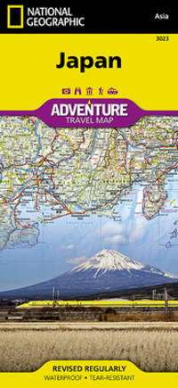
National Geographic Maps Adventure
Japan Map National Geographic Adventure Map 3023
map. Good. Access codes and supplements are not guaranteed with used items. May be an ex-library book. unknown
Référence libraire : 1566956161.G ISBN : 1566956161 9781566956161
|
|
|
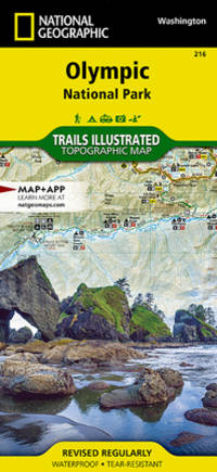
National Geographic Maps - Trails Illustrated
Olympic National Park Map National Geographic Trails Illustrated Map 216
map. Good. Access codes and supplements are not guaranteed with used items. May be an ex-library book. unknown
Référence libraire : 1566954029.G ISBN : 1566954029 9781566954020
|
|
|
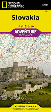
National Geographic Maps - Adventure
Slovakia Map National Geographic Adventure Map 3323
map. Good. Access codes and supplements are not guaranteed with used items. May be an ex-library book. unknown
Référence libraire : 1566956420.G ISBN : 1566956420 9781566956420
|
|
|
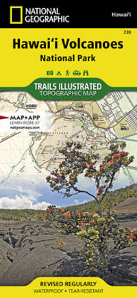
National Geographic Maps Trails Illustrated
Hawaii Volcanoes National Park Map National Geographic Trails Illustrated Map 230
map. Good. Access codes and supplements are not guaranteed with used items. May be an ex-library book. unknown
Référence libraire : 1566953294.G ISBN : 1566953294 9781566953290
|
|
|
Harvey Maps
The The Munros The Complete Collection of Maps
Harvey Map Services Ltd 2019. Hardcover. New. 240 pages. 9.84x8.27x0.98 inches. Harvey Map Services Ltd hardcover
Référence libraire : 2-1851376283 ISBN : 1851376283 9781851376285
|
|
|
Maps International
Gin distilleries UK Collect & Scratch
Maps International 2017. Map. New. 1 pages. 12.60x1.97x1.34 inches. Maps International unknown
Référence libraire : __1912203952 ISBN : 1912203952 9781912203956
|
|
|
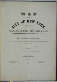
New York City; Upper West Side; Maps Sackersdorff Otto
Map of the City of New York. Parts I & II. Showing the Streets Avenues Roads Public Squares & Places Laid Out Established Widened and Retained the New Pier and Bulkhead Lines Laid Out and Established by the Board of Commissioners of the Central Park. Atlas
New York 1872. Hardcover. Very good condition. Maps of Manhattan's west side prior to the completion of Central Park which was finished in 1876. The maps were compiled by longtime New York City Department of Public Works map clerk and city surveyor Otto Sackersdorff noted for his 'Maps of Farms Commonly called The Blue Book 1815". The Blue Book was not published until 1868 as a demonstration of northern economic might at the end of the Civil War. <br /> <br /> The real estate maps show property lines existing roads parks shorelines wetlands and the Manhattan grid extending from west of 8th Avenue at 59th Street and Columbus Circle up to 222nd Street and Spuyten Duyvil & Kingsbridge. Parks and major thoroughfares include: Central Park St. Nicholas Avenue Fort Washington Park Kingsbridge Road and High Bridge Park.<br /> <br /> Folio 15 x 20 1/2" 14 maps in total: 1 full page and 13 double page 28 x 20" hand colored lithographed map sheets. Each map contiguous with one another. Period quarter green gilt leather and dark green buckram boards. Spine gently rubbed; the maps exceptionally bright and clean. <br /> <br /> Previous owner inscription in pencil E. B. Van Winkle from Chas. H. Myers July 1875. Van Winkle was a civil engineer with an interest in road construction and drainage having written a report on the drainage of the 23rd & 24th wards of New York City. Myers was an Assistant Engineer in Charge of Sewers for New York City.<br /> <br /> OCLC: 41175506 at Princeton and OCLC: 40671892 at Columbia and the New York Public Library. hardcover
Référence libraire : 26020
|
|
|
Clarke, Edward Daniel (Text by); S. I. Neele, H. Mutlow (Maps and plans engraved by); Joseph Skelton, R. Pollard, Laetitia and E
Travels in Various Countries of Europe Asia and Africa: Part The First Russia Tartary and Turkey 1810; Part The Second Section The First Greece Egypt and The Holy Land 1812; Part The Second Section The Second Greece Egypt and The Holy Land 1814; Part The Second Section The Third Greece Egypt and The Holy Land To Which is Added a Supplement Respecting the Author's Journey from Constantinople to Vienna. Containing His Account of the Gold Mines of Transylvania and Hungary 1816; Part The Third Section The First Scandinavia 1819; Part The Third Section The Second Scandinavia 1823. WITH 185 COPPER PLATES AND 157 VIGNETTES AND CUTS. 6-vol. set Complete
London: T. Cadell and W. Davies 1823. First edition. Hardcover. g to vg. Large quarto 11 1/4 x 9". 2 xxviii xxiii 1 812pp; xix 13 715pp 1pp Errata 2pp Publisher's advertisement; 2 xv 12 20 822pp; 2 xx 14 735pp 1pp Errata; xii 14 763pp 1pp Errata; 2 iv 14 555 1pp. Modern half black morocco over dark grey cloth with gold lettering and ruling to spines. Raised bands. First volume with a striking tissue-guarded frontispiece portrait of the author engraved by Richard Golding after a painting by John Opie. Tissue-guarded engraved frontispiece in each volume.<br /> <br /> First edition of Edward Daniel Clarke's magnum opus "Travels in Various Countries of Europe Asia and Africa" the author's personal account of a fascinating journey throughout three continents. <br /> <br /> Following a tour of Scandinavia in 1799 Edward Daniel Clarke 1769-1822 travelled through Russia and the Crimea before proceeding to Constantinople Rhodes and afterwards Egypt and Palestine. Greece was the country next visited. While touring this country Clarke as a mineralogist and antiquary collected marbles coins and vases and purchased a large ancient statue at Eleusis. From Athens he proceeded by land to Constantinople and after a short stay in that city directed his course homewards through Rumelia Austria Germany and France.<br /> <br /> Each of the six volumes is lavishly illustrated throughout with numerous in-text vignettes and woodcuts as well as full-page copper plates many folded depicting views monuments natives in traditional costume ceremonies and processions antiquities etc. Includes several folded maps and charts. All the 185 copper plates and 157 vignettes and cuts are accounted for.<br /> <br /> Plates engraved by Joseph Skelton R. Pollard Laetitia and Elizabeth Byrne F. R. Hay J. Fittler and R. Cooper after illustrations by E. D. Clarke Angelica Clarke Guarenghi Martin Dreier W. Havell Camporesi J. B. Lusieri Morritt W. Harraden Grelot Fauvel G. Wilkins Henry Wrighte and Preaux. Most of the delightful vignettes were engraved by Elizabeth and Laetitia Byrne. The maps and plans were engraved by S. I. Neele and H. Mutlow.<br /> <br /> Some offsetting to text pages facing plates. Moderate to heavy foxing to plates throughout. Minor foxing to text pages. Sporadic clear water-staining along edges of plates in second volume Part 2 section 1. Ex-library copy with perforating library stamp to each title page and small reference stamp at inner gutter of the first text leaf of each volume not affecting lettering. Bindings in overall very good interior in good to very good condition. T. Cadell and W. Davies hardcover
Référence libraire : 42750

|
|
|
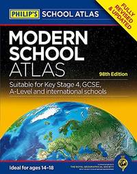
Philip's Maps and Atlases Staff
Philip's Modern School Atlas : 98th Edition
Used - Very Good. Ships from the UK. Former library book; may include library markings. Used book that is in excellent condition. May show signs of wear or have minor defects. unknown
Référence libraire : GRP87158054 ISBN : 1849073538 9781849073530
|
|
|
Conrotto Eugene L.; with 91 maps by Norton Allen
Lost Desert Bonanzas
<p>Palm Desert California: Desert-Southwest Publishers 1963. Fine condition in a Good dust jacket. Square and tight. Sharp corners. NOT a library discard. NO owner's name or bookplate. NOT a remainder. Pages are crisp clean and unmarked -- apparently seldom if ever read. Illustrated with 91 full page maps by Norton Allen. Index. Bound in the original gilt-stamped green cloth. Complete with dust jacket. 7" wide by 10.25" tall. From the dust jacket: "The known facts on more than 100 lost mines and buried treasures described during the past quarter century i.e 1937 -1962 in the pages of Desert Magazine.". 1st ed No additional printings listed. Hardcover. Fine condition/Good dust jacket. Illus. by NOT a library discard. 278 pages. Great Packaging Fast Shipping.</p> Desert-Southwest Publishers hardcover
Référence libraire : 031537
|
|
|
Cartes, Kate
Toddler Discipline: This Book Includes: Potty Training Positive Discipline. The Complete Guide to Use Potty and Help your Toddler to Gro
Kate Cartes 2021. Paperback. Good. Pages can have notes/highlighting. Spine may show signs of wear. ~ ThriftBooks: Read More Spend Less.Dust jacket quality is not guaranteed. Kate Cartes paperback
Référence libraire : G1802239049I3N00 ISBN : 1802239049 9781802239041

|
|
|
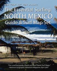
Blue Planet Surf Maps
The Essential Surfing: North Mexico- Guide & Surf Map Set
CreateSpace Independent Publishing Platform 2008. Paperback. Very Good. May have limited writing in cover pages. Pages are unmarked. ~ ThriftBooks: Read More Spend Less.Dust jacket quality is not guaranteed. CreateSpace Independent Publishing Platform paperback
Référence libraire : G1441407693I4N00 ISBN : 1441407693 9781441407696
|
|
|
Thomas Bros Maps
Thomas Guide 2002 San Diego County Including Portions of Imperial County: Street Guide and Directory
Thomas Brothers Maps 2001-07-01. Spiral-bound. Good. 1.1000 10.9000 8.9000. Thomas Brothers Maps unknown
Référence libraire : mon0003772025 ISBN : 1581743505 9781581743500

|
|
|
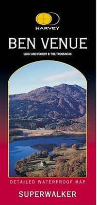
Harvey Maps
Ben Venue: Loch Ard Forest and the Trossachs Superwalker
map. Good. Access codes and supplements are not guaranteed with used items. May be an ex-library book. unknown
Référence libraire : 1851374612.G ISBN : 1851374612 9781851374618
|
|
|
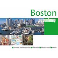
Compass Maps
Boston Popout Map Popout Map
paperback. Good. Access codes and supplements are not guaranteed with used items. May be an ex-library book. paperback
Référence libraire : 1845876067.G ISBN : 1845876067 9781845876067
|
|
|
Harvey Maps
Brecon Beacons East : The Black Mountains Ultramap XT40
new. unknown
Référence libraire : 46507069-n ISBN : 1851376720 9781851376728
|
|
|
Harvey Maps
MacGillycuddy's Reeks & Killarney National Park; Superwalker 1:30 000: XT30
new. unknown
Référence libraire : 46234315-n ISBN : 1851376585 9781851376582
|
|
|
Harvey Maps
Cycle Rides in the Yorkshire Dales Harvey
map. Good. Access codes and supplements are not guaranteed with used items. May be an ex-library book. unknown
Référence libraire : 1851374019.G ISBN : 1851374019 9781851374014

|
|
|
Harvey Maps
Snowdonia South Superwalker - 1:2500 Map: Cadair Idris & Dolgellau Superwalker XT25
Harvey Maps 2024. Map. New. 1st ed march 2024 edition. 1 pages. 10.39x5.08x0.35 inches. Harvey Maps unknown
Référence libraire : __185137681X ISBN : 185137681X 9781851376810
|
|
|
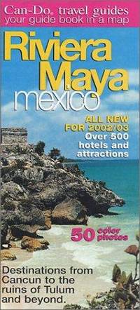
Can-Do Maps
2008 Riviera Maya Guide & Map by Can-Do
map. Good. Access codes and supplements are not guaranteed with used items. May be an ex-library book. unknown
Référence libraire : 0966037715.G ISBN : 0966037715 9780966037715
|
|
|
Maps, PopOut
Amsterdam PopOut Map PopOut Maps
map. Good. Access codes and supplements are not guaranteed with used items. May be an ex-library book. unknown
Référence libraire : 1845879759.G ISBN : 1845879759 9781845879754

|
|
|
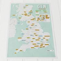
Maps International
Gin Collect and Scratch Print
Wallchart. New. New Book; Fast Shipping from UK; Not signed; Not First Edition; Sample the gin scratch off the print. An inspired fun gift! unknown
Référence libraire : ria9781912203956_inp ISBN : 1912203952 9781912203956
|
|
|
Franko Maps
California Delta Map by Franko
map. Good. Access codes and supplements are not guaranteed with used items. May be an ex-library book. unknown
Référence libraire : 160190133X.G ISBN : 160190133X 9781601901330
|
|
|
Harvey Maps
Cotswold Way XT40 Route Map
map. Good. Access codes and supplements are not guaranteed with used items. May be an ex-library book. unknown
Référence libraire : 1851374183.G ISBN : 1851374183 9781851374182
|
|
|
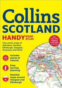
Collins Maps
Collins Scotland Handy Road Atlas
Collins 2017. Paperback. Good. Pages can have notes/highlighting. Spine may show signs of wear. ~ ThriftBooks: Read More Spend Less.Dust jacket quality is not guaranteed. Collins paperback
Référence libraire : G000823275XI3N00 ISBN : 000823275X 9780008232757
|
|
|
Philip's Maps
Philip's Local Explorer Street Atlas Oxfordshire: Spiral Edition Philip's Street Atlas
new. unknown
Référence libraire : 45612111-n ISBN : 1849076324 9781849076326
|
|
|
Philip's Maps
Philip's Local Explorer Street Atlas Buckinghamshire and Milton Keynes: Spiral Edition Philip's Street Atlas
new. unknown
Référence libraire : 45612113-n ISBN : 1849076340 9781849076340
|
|
|
Harvey Maps
Crieff & Comrie Ultramap XT40 1:40000 - Doune Dunblane
new. unknown
Référence libraire : 45750844-n ISBN : 185137664x 9781851376643
|
|
|
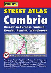
Philip's Maps
Philip's Street Atlas Cumbria Street Atlases
paperback. Good. Access codes and supplements are not guaranteed with used items. May be an ex-library book. paperback
Référence libraire : 0540092061.G ISBN : 0540092061 9780540092062
|
|
|
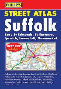
Philip's Maps
Philip's Street Atlas Suffolk Philip's Street Atlases
paperback. Good. Access codes and supplements are not guaranteed with used items. May be an ex-library book. paperback
Référence libraire : 0540089974.G ISBN : 0540089974 9780540089970
|
|
|
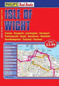
Philip's Maps
Philip's Red Books Isle of Wight Local Street Atlases
paperback. Good. Access codes and supplements are not guaranteed with used items. May be an ex-library book. paperback
Référence libraire : 0540094544.G ISBN : 0540094544 9780540094547
|
|
|
Philip's Maps
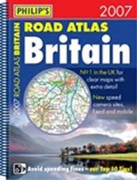
Philip's Road Atlas Britain
spiral_bound. Good. Access codes and supplements are not guaranteed with used items. May be an ex-library book. unknown
Référence libraire : 0540088854.G ISBN : 0540088854 9780540088850
|
|
|
Philip's Maps
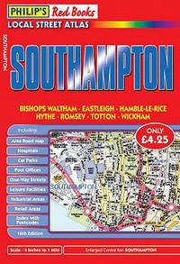
Philip's Red Books Southampton Local Street Atlases
paperback. Good. Access codes and supplements are not guaranteed with used items. May be an ex-library book. paperback
Référence libraire : 0540093920.G ISBN : 0540093920 9780540093922
|
|
 Recevoir par e-mail
 Télécharger en PDF
 Flux RSS


