|
National Geographic Maps
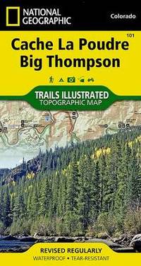
Cache La Poudre/big Thompson: Trails Illustrated
Sheet map folded. New. unknown
Referenz des Buchhändlers : A9781566953900 ISBN : 1566953901 9781566953900
|
|
|
National Geographic Maps
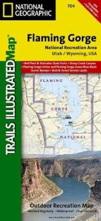
Flaming Gorge/east Uintas: Trails Illustrated Other Rec. Areas
Sheet map folded. New. unknown
Referenz des Buchhändlers : A9781566954143 ISBN : 1566954142 9781566954143
|
|
|
National Geographic Maps
World Satellite Laminated: Wall Maps World
Sheet map. New. unknown
Referenz des Buchhändlers : A9780792283027 ISBN : 0792283023 9780792283027

|
|
|
National Geographic Maps
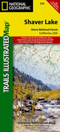
Shaver Lake/sierra National Forest: Trails Illustrated Other Rec. Areas
Sheet map folded. New. unknown
Referenz des Buchhändlers : A9781566952422 ISBN : 1566952425 9781566952422
|
|
|
National Geographic Maps
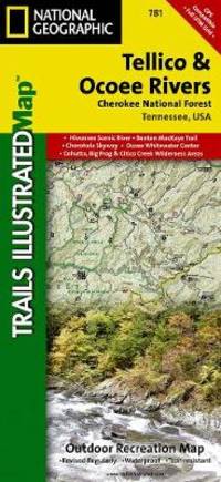
Tellico And Ocoee Rivers Cherokee National Forest: Trails Illustrated Other Rec. Areas
Sheet map folded. New. unknown
Referenz des Buchhändlers : A9781566954235 ISBN : 1566954231 9781566954235
|
|
|
Japanese Hand Coloured Wood Block Printing; Maps and Atlases; Tokyo Map Hyoshiya Ichirobe
A WOODBLOCK HAND-COLOURED MAP OF TOKYO; JAPAN EIRI EDO OEZU Illustrated Edo
Edo Tokyo: Hyoshiya Ichirobe Hayashi-shi Yoshinaga First month 1684 But Third month 1680. A large woodcut map of Edo Tokyo with fine handcolouring on joined and folded paper. The map is breathtaking in its detail and features many paintings of important landmarks temples bridges and people who are often pictured working or fishing from boats on the waterways running through Tokyo. A stunning and very rare woodblock map beautifully and unusually handcoloured. Roads blocks buildings open areas canals and waterways are all vividly laid out on this huge and most impressive map. 123.5 by 149.5 cm. folded within paper covers folds to 28 by 18 cm now preserved in a fine clamshell box. A remarkably well preserved and very rare item with some light rubbing due to age and as to be expected. A bit of old worming or light soiling and occasional small repairs but in all quite astonishing in its quality and beautifully preserved with bright and vivid colour and detail. AN EXTRAORDINARY ITEM REMARKABLE FOR BOTH ITS CARTOGRAPHIC DETAIL AND ITS ARTISTIC BEAUTY. The wood block printing shows land tenures of Daimyo and Hatamoto. It also shows temples and shrines includes a distance chart and descriptive listing of Daimyo showing crests and halberds. There is also a inset of the eastern portion of Edo. Hyoshiya Ichirobe (Hayashi-shi Yoshinaga) unknown
Referenz des Buchhändlers : 24285

|
|
|
Riley Maps
Riley Maps: Brownsville Texas
Map Link 2005-06-30. Map. Very Good. Map. Very Good. Clean and unmarked. Map Link unknown
Referenz des Buchhändlers : MAN01735 ISBN : 1932011307 9781932011302

|
|
|
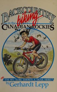
Gerhardt Lepp; Jo Ann Draper maps; Colynn Kerr drawings
Backcountry Biking in the Canadian Rockies
Calgary: Rocky Mountain Books 1988. Paper bound second printing illustrated with over 40 maps Pp188. Includes index. As new. 275 grams. All books in stock and available for immediate shipment from Winnipeg Manitoba. Calgary: Rocky Mountain Books, 1988 unknown
Referenz des Buchhändlers : 21973 ISBN : 0969003889 9780969003885
|
|
|
Rowland Kenney; JF. Horrabin (maps) J. F.
The Northern Tangle: Scandinavia and the Post-War World
London: J.M. Dent 1946. Hard bound in red cloth 1st edition bright gilt titles to spine illustrated with maps xii Pp255. Includes index. A fine copy but without a dust jacket. 430 grams. London: J.M. Dent, 1946 hardcover
Referenz des Buchhändlers : 5303
|
|
|
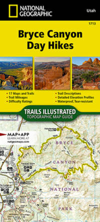
National Geographic Maps - Trails Illustrated
Bryce Canyon National Park Day Hikes Map National Geographic Topographic Map Guide 1713
map. Good. Access codes and supplements are not guaranteed with used items. May be an ex-library book. unknown
Referenz des Buchhändlers : 1566959098.G ISBN : 1566959098 9781566959094
|
|
|
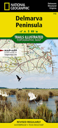
National Geographic Maps - Trails Illustrated
Delmarva Peninsula Map National Geographic Trails Illustrated Map 772
Natl Geographic Society Maps 2023-01-01. map. Like New. 4x0x8. Map. Natl Geographic Society Maps unknown
Referenz des Buchhändlers : 2509160111 ISBN : 1566954908 9781566954907
|
|
|
National Geographic Maps - Trails Illustrated
Delmarva Peninsula Map National Geographic Trails Illustrated Map 772
Natl Geographic Society Maps 2023-01-01. map. New. 4x0x8. Map. Natl Geographic Society Maps unknown
Referenz des Buchhändlers : 2509160110 ISBN : 1566954908 9781566954907
|
|
|
Savage, Katharine, Illustrated by Photo's and Maps & Photo's and Maps
The Story of the Common Market
Henry Z. Walck. Good in Good dust jacket. 1970. Hardcover. 8vo 8" - 9" tall . Henry Z. Walck hardcover
Referenz des Buchhändlers : 5893

|
|
|
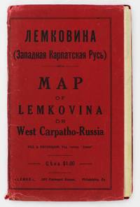
[Eastern European Immigration]. [Maps]
Lemkovina: Map of Lemkovina or West Carpatho-Russia
Philadelphia: Lemko Press 1929. Very good. Lithographed folding map approximately 32 x 40 inches printed in pink and black. Housed in original red wrappers printed in black. Modest wear along folds a couple of small separations at crossfolds light marginal toning. Wrappers with minor spine and edge wear. An extremely rare map of "Lemkovina" the homeland of the Lemko an Eastern Slavic people from the Central Carpathian Mountains where Poland Slovakia and Ukraine meet in the present day. From the late-19th century to the 1920s tens of thousands of Lemkos immigrated to the Unites States and Canada -- fleeing war oppression and seeking better economic opportunities. Once in the United States Lemko intellectuals founded institutions to preserve and promote Lemko culture in the New World and to lobby for sovereignty of the Lemko homeland. The present large-format map is an intriguing artifact of the Lemko-American immigrant experience. The map was drafted by the Lemko-American activist Dmitriy Vislocky and published by the Lemko Press in Philadelphia in 1929; it showcases the areas where the Lemko population prevailed as well as areas of mixed Lemko-Slovakian and Lemko-Polish demographics; while it does not explicitly define Lemkovina as a sovereign state its rhetorical direction is nevertheless clear.<br /> <br /> The Lemko are an Eastern Slavic people who originate from a large area along both slopes of the Central Carpathian Mountains in a region traditionally often referred to as "West Carpatho-Russia" located along the eastern stretch of today's border of Poland and Slovakia and extending slightly east into Ukraine. The Lemko language is akin to Ukrainian and is written in Cyrillic. Traditionally many consider the Lemkos to be a subgroup of Russians or Ukrainians although many Lemkos have tended to self-identify as a distinct ethnicity. The Lemkos have vibrant and sophisticated cultural traditions with distinct music folklore clothing and customs. Most Lemkos are Eastern rite or Byzantine-rite Catholics although some have converted to the Eastern Orthodox faith. The period leading up to during and after World War I was traumatic for the Lemkos. The group splintered their loyalties with some supporting the Russians both Red and White factions while others were sympathetic to Ukrainian nationalism and some either voluntarily or under coercion were allied with Austria-Hungary. Lemkos caught on the wrong side of events often met with cruel fates. In the aftermath of the war Lemkos who supported the Red Russians formed the "Lemko-Rusyn People's Republic" which existed from December 1918 to March 1920 a state that took in part of the northern slope of the Central Carpathians of Lemkovina. Meanwhile further to the east was the pro-Ukrainian "Eastern Lemko Republic" November 1918 to January 24 1919. However these republics were soon extinguished with all Lemkovina being divided between Czechoslovakia and Poland. The Lemkos in Poland would have a very difficult time as the Polish state considered them disloyal. Eventually they were forcibly displaced from their homeland. <br /> <br /> Lemkos began to immigrate to the United States and Canada in the late 19th century in good part due to economic opportunities. The greatest center of activity for Lemko peoples in North America was in Pennsylvania although large communities could be found across the American Northeast and Midwest as well as in places such as Toronto Canada. Many Lemkos found decent jobs initially in the burgeoning manufacturing industry. Smaller but still significant Lemko communities developed as far away as Colorado and Alberta where they were engaged in the ranching and mining industries. Today hundreds of thousands of North Americans count Lemko ancestry. Lemkos adjusted very well to life across the Atlantic and generally met with success. The most famous of all Lemko-Americans was the artist Andy Warhol 1928-1987 who was born in Pittsburgh the son of Lemko immigrant parents. In the 1920s Lemko intellectuals in America largely based in Pennsylvania formed a movement to preserve Lemko culture while lobbying for the eventual resurrection of an autonomous if not sovereign Lemko homeland – Lemkovina. However there was a great deal of internecine dispute over the nature of this proposed state as some favored a pro-Ukraine sovereign entity while others wanted it to be Soviet satellite yet the dream of a future sovereign Lemko nation of any sort was never to be realized as powers ranging from the Czechoslovak and Polish governments to Hitler and Stalin would never allow it. Lemko culture flourished in the U.S. and Canada centered around Lemko halls and churches and beginning in the 1920s a handful of small printing presses were established to serve and educate the community issuing Lemko-language almanacs primers newspapers and pamphlets. One of the most important of these houses was the Lemko Press of Philadelphia which under the leadership of Dmitriy Vislocky published the Lemko Gazette. The circle of the Lemko Press had a pronounced Ukrainophone allegiance and was at odds with some other Lemko-North American groups.<br /> <br /> As a major part of their campaign to define "Lemkovina" and call for its eventual nationhood presumably as a pro-Ukrainian sovereign state in opposition to both the Soviets and Poland Dmitriy Vislocky and the Lemko Press produced the present map. As best as we are aware it is the only large format map of the period to specifically show Lemkovina as a distinct entity and being published in Philadelphia it stands as a remarkable feat of Lemko-American immigrant cartography. The large format map executed to the ample scale of 1:200000 with text in Cyrillic and lithographed from a hand-drawn template shows the Polish-Slovakian frontier region which today extends east into Ukraine along the Central Carpathian Mountains an area traditionally sometimes known as "West Carpatho-Russia." A very rugged and rural area it is roughly framed by the the Dunajec River in the west and the San and Uzh Rivers in the east and with the cities of Nowy S cz Poland to the northwest and Košice Slovakia to the southeast. The map delineates all major rivers roads and railways and locates cities towns and villages. The legend below the title explains the color-coding employed to define demographic areas. Territory shaded in bold pink are of majority ‘Russian’ meaning Lemko and Rusyn population i.e. core Lemkovina while the areas covered by southwest-northeast hashed lines are of mixed Lemko/Rusyn-Slovakian population and the areas with northwest-southeast hashed lines are of mixed Lemko/Rusyn-Polish population. Beyond are labeled the lands of Poland to the north Slovakia to the south Eastern Galicia to the northeast and Sub-Karpatsky Russia Ukraine to the southwest while the map defines the Polish-Czechoslovak border as it was then internationally recognized. While the map does not explicitly state that Lemkovina is a country Dmitriy Vislocky’s sovereignist direction of travel is nevertheless clear.<br /> <br /> The present map is extremely rare. It was likely issued in only a small print run and the survival rate of such fragile ephemeral American immigrant publications is very low. We can trace only a single institutional example of the map held by the David Rumsey Map Collection at Stanford University. Beyond that we are aware of only a single other example as having appeared on the market in the last twenty-five years.<br /> David Rumsey Map Collection Stanford University: 11153.000. Lemko Press unknown
Referenz des Buchhändlers : 5372
|
|
|
Collins Maps
Fragile Earth
hardcover. Good. Access codes and supplements are not guaranteed with used items. May be an ex-library book. hardcover
Referenz des Buchhändlers : 0007455232.G ISBN : 0007455232 9780007455232

|
|
|
National Geographic Maps
Wilderness Areas of the United States Map National Geographic Destination Map
map. Good. Access codes and supplements are not guaranteed with used items. May be an ex-library book. unknown
Referenz des Buchhändlers : 1566959586.G ISBN : 1566959586 9781566959582

|
|
|
Harvey Maps
Brecon Beacons East : The Black Mountains Ultramap XT40
Harvey Maps 2023. Map. New. september 2023 edition. 1 pages. 7.40x0.32x3.62 inches. Harvey Maps unknown
Referenz des Buchhändlers : __1851376720 ISBN : 1851376720 9781851376728
|
|
|
International Travel Maps
Mexico North Map
map. Good. Access codes and supplements are not guaranteed with used items. May be an ex-library book. unknown
Referenz des Buchhändlers : 1553415639.G ISBN : 1553415639 9781553415633

|
|
|
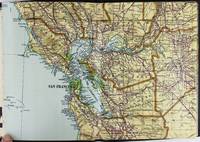
California. Maps. Heald Ralph P. compiler
Heald-Menerey's Geographical Commercial and Recreational Map of California
San Francisco and Los Angeles: The Heald-Menerey Company 1928. Very good. Large color map measuring 44 x 64 inches cut into eight sections and folded into book form. Original black limp textured cloth yapp edges titled in pale yellow on front cover. Moderate edge wear titles on front cover almost completely worn away. Internally clean. A rare portable version of the large and impressive Heald-Menerey's Geographical Commercial and Recreational Map of California produced in the late-1920s. According to the sheet of instructions bound before the map: "The first of its kind ever devised for desk home or automobile use. It consists of the California Survey 44 x 64 inches in size cut into eight strips and folded to make a book of 64 pages. Page No. 1 is the extreme northwest corner of our Survey and page No. 64 is the extreme southwest corner." The instructions proceed to inform the user on how to locate points on the map given its form as a book. The verso of the instructions page is a county index keyed to the pages of the map. The cover title begins "California Survey" but the remainder is rubbed beyond readability.<br /> <br /> The map was produced by the Schmidt Lithograph Company of San Francisco. The legend of the map contains symbols representing roads trails railroads streams springs swamps aqueducts lighthouses county and state boundary lines national forests mountain peaks township and range lines base and meridian lines and more. There are also two inset maps - one showing San Francisco and vicinity and the other Los Angeles and its immediate surroundings. OCLC records just a handful of copies of this book-form map published between 1928 and 1933. The Heald-Menerey Company unknown
Referenz des Buchhändlers : 2443
|
|
|
Collins Maps
Collins World Atlas: Reference Edition
hardcover. Good. Access codes and supplements are not guaranteed with used items. May be an ex-library book. hardcover
Referenz des Buchhändlers : 0008436150.G ISBN : 0008436150 9780008436155

|
|
|
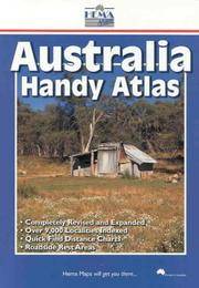
Hema Maps (Firm)
Australia Handy Atlas
paperback. Good. Access codes and supplements are not guaranteed with used items. May be an ex-library book. paperback
Referenz des Buchhändlers : 186500037X.G ISBN : 186500037X 9781865000374
|
|
|
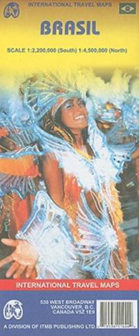
International Travel maps
Brasil
map. Good. Access codes and supplements are not guaranteed with used items. May be an ex-library book. unknown
Referenz des Buchhändlers : 1553411447.G ISBN : 1553411447 9781553411444
|
|
|
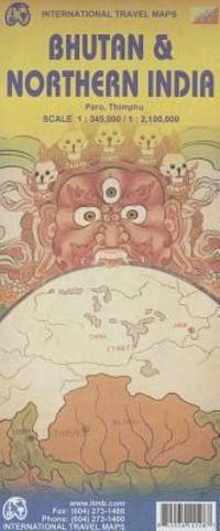
International Travel maps
Bhutan & Northern India 1:345 000/1:2 100 000
map. Good. Access codes and supplements are not guaranteed with used items. May be an ex-library book. unknown
Referenz des Buchhändlers : 1553411528.G ISBN : 1553411528 9781553411529
|
|
|
A?Z Maps
Greater Glasgow A-Z Street Atlas
paperback. Good. Access codes and supplements are not guaranteed with used items. May be an ex-library book. paperback
Referenz des Buchhändlers : 0008560439.G ISBN : 0008560439 9780008560430

|
|
|
A?Z Maps
Bristol and Bath A-Z Street Atlas
paperback. Good. Access codes and supplements are not guaranteed with used items. May be an ex-library book. paperback
Referenz des Buchhändlers : 0008560447.G ISBN : 0008560447 9780008560447

|
|
|
Franklin Maps (Firm)
Metro street atlas of Lehigh & Northampton counties in Pennsylvania Metro street atlas series
paperback. Good. Access codes and supplements are not guaranteed with used items. May be an ex-library book. paperback
Referenz des Buchhändlers : 187791195X.G ISBN : 187791195X 9781877911958
|
|
|
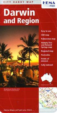
HEMA Maps
Darwin and Region City Map by Hema
map. Good. Access codes and supplements are not guaranteed with used items. May be an ex-library book. unknown
Referenz des Buchhändlers : 1865002909.G ISBN : 1865002909 9781865002903
|
|
|
Compass Maps
Prague InsideOut City Guides
Compass Maps 05/30/2003. Paperback. Used; Very Good. WE SHIP WITHIN 24 HRS FROM LONDON UK 98% OF OUR ORDERS ARE RECEIVED WITHIN 7-10 DAYS. We believe you will be completely satisfied with our quick and reliable service. All orders are dispatched as swiftly as possible! Buy with confidence! Greener Books. Compass Maps paperback
Referenz des Buchhändlers : 2691154 ISBN : 1841398802 9781841398808

|
|
|
Philip's Maps
Philip's Orkney and Shetland: Leisure and Tourist Map: Leisure and Tourist Map Philip's Red Books
Philip's 2022. Map. New. 9.29x4.96x0.55 inches. Philip's unknown
Referenz des Buchhändlers : 2-1849075751 ISBN : 1849075751 9781849075756
|
|
|
Maps International
Canada
Maps International Ltd 2006. Map. New. 1 pages. 41.73x2.68x2.44 inches. Maps International Ltd unknown
Referenz des Buchhändlers : 2-190489237X ISBN : 190489237X 9781904892373
|
|
|
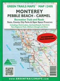
Maps, Green Trails
Monterey Pebble Beach Carmel CA No. 1240SX Green Trails Maps 1240S
map. Good. Access codes and supplements are not guaranteed with used items. May be an ex-library book. unknown
Referenz des Buchhändlers : 1680514245.G ISBN : 1680514245 9781680514247
|
|
|
Bartholomew John (Maps)
The Comparative Atlas of Physical and Political Geography. 24th Edition
Meiklejohn & Son Ltd 1934-01-01. Hardcover. Acceptable. 0.9992 in x 27.9787 in x 21.9833 in. Ex-library book usual markings. Well read with some wear but still very useable. Broken spine does not affect reading good for its age. Meiklejohn & Son Ltd hardcover
Referenz des Buchhändlers : mon0000301234
|
|
|
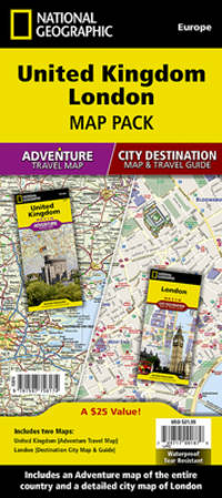
National Geographic Maps - Adventure
United Kingdom London Map Pack Bundle National Geographic Adventure Map
map. Good. Access codes and supplements are not guaranteed with used items. May be an ex-library book. unknown
Referenz des Buchhändlers : 1597756172.G ISBN : 1597756172 9781597756174
|
|
|
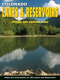
Outdoor Books & Maps
Colorado Lakes & Reservoirs: Fishing and Boating Guide
perfect. Good. Access codes and supplements are not guaranteed with used items. May be an ex-library book. unknown
Referenz des Buchhändlers : 0930657543.G ISBN : 0930657543 9780930657543
|
|
|
International Travel maps
1. Ontario Travel Reference Map 1:1M/1:155M 2009
map. Good. Access codes and supplements are not guaranteed with used items. May be an ex-library book. unknown
Referenz des Buchhändlers : 1553418190.G ISBN : 1553418190 9781553418191
|
|
|
International Travel Maps
Costa Rica Map Paper Version
map. Good. Access codes and supplements are not guaranteed with used items. May be an ex-library book. unknown
Referenz des Buchhändlers : 1553411781.G ISBN : 1553411781 9781553411789

|
|
|
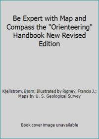
Kjellstrom, Bjorn; Illustrated by Rigney, Francis J.; Maps by U. S. Geological Survey
Be Expert with Map and Compass the Orienteering Handbook New Revised Edition
Charles Scribner's Sons 1967. Paperback. Good. Pages can have notes/highlighting. Spine may show signs of wear. ~ ThriftBooks: Read More Spend Less.Dust jacket quality is not guaranteed. Charles Scribner's Sons paperback
Referenz des Buchhändlers : GB001ENYZNAI3N00
|
|
|
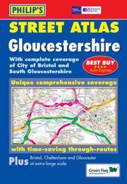
Philip's Maps
Philip's Street Atlas Gloucestershire Philip's Street Atlases
paperback. Good. Access codes and supplements are not guaranteed with used items. May be an ex-library book. paperback
Referenz des Buchhändlers : 0540087610.G ISBN : 0540087610 9780540087617
|
|
|
International Travel Maps
Russia International Travel Maps
map. Good. Access codes and supplements are not guaranteed with used items. May be an ex-library book. unknown
Referenz des Buchhändlers : 1553413784.G ISBN : 1553413784 9781553413783
|
|
|
Maps, International Travel
Senegal Map
map. Good. Access codes and supplements are not guaranteed with used items. May be an ex-library book. unknown
Referenz des Buchhändlers : 1553413911.G ISBN : 1553413911 9781553413912
|
|
|
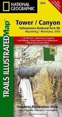
National Geographic Maps
Yellowstone Ne/tower/canyon: Trails Illustrated National Parks
Sheet map folded. New. unknown
Referenz des Buchhändlers : A9781566954358 ISBN : 1566954355 9781566954358
|
|
|
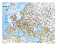
National Geographic Maps
North America Classic Enlarged & Tubed: Wall Maps Continents
Sheet map rolled. New. unknown
Referenz des Buchhändlers : A9780792281023 ISBN : 0792281020 9780792281023

|
|
|
Heron Maps
Leeds and Liverpool Canal - Foulridge to Sowerby Bridge: Aire and Calder and Calder and Hebble Navigations from Leeds to Knottingley and Castleford to Sowerby Bridge
Sheet map folded. New. unknown
Referenz des Buchhändlers : A9781908851093 ISBN : 1908851090 9781908851093

|
|
|
MAPS., Midwestern M. A. P. S.
1984 Cedar County Plat Book Iowa
Oelwein IA: M.A.P.S. Midwestern 1984. Staple-bound. Very Good. Clean pages; securely stapled binding; soft cover shows only a short gray streak at the right front some foxing across the lower rear and minor corner wear otherwise sound. 32pp. County map ownership maps by township and a directory of landowners and tenants divided into properties of less than 20 acres and properties of larger acreage.; 4to. M.A.P.S., Midwestern unknown
Referenz des Buchhändlers : 066087

|
|
|
Gecko Maps
Santorini Topographic Map French English Spanish Italian and German Edition
map. Good. Access codes and supplements are not guaranteed with used items. May be an ex-library book. unknown
Referenz des Buchhändlers : 3906593266.G ISBN : 3906593266 9783906593265
|
|
|
[EARLY MEIJI MAPS OF KYOTO AND ITS SURROUNDINGS].
改正京都府管轄便覽. Kaisei Kyōtofu kankatsu binran. Revised Guide for Kyoto Prefecture Area.
京都. Kyoto.: 村上勘兵衛. Murakami Kanbei. Meiji 5 1873. Black and white woodblock maps and city plan 22 x 15.3cm 17 double-folded leaves 4 hole string binding. Covers worn and soiled chop on upper cover. This guide to Kyoto and its surroundings includes two double-page and twelve single-page pictorial maps published around Meiji 5 1873. Each map highlights geographical features place names and major buildings such as Buddhist temples within Kyoto and its surrounding areas. The latter section covers three counties of the Tanba region offering a detailed look at the area beyond Kyoto itself. . 村上勘兵衛. [Murakami Kanbei]. unknown
Referenz des Buchhändlers : 216097

|
|
|
National Geographic Learning, National Geographic Maps - Reference
Nonfiction Reading and Writing Workshop a: Making Inferences: Guided Instruction Book
National Geographic Maps. Used - Good. Used book that is in clean average condition without any missing pages. National Geographic Maps unknown
Referenz des Buchhändlers : 49883401-6 ISBN : 0792250168 9780792250166
|
|
|
Compass Maps Staff PopOut Products Staff
Inside Out - Barcelona
Globe Pequot Press The. Used - Good. Ships from the UK. Used book that is in clean average condition without any missing pages. Globe Pequot Press, The unknown
Referenz des Buchhändlers : 49978641-20 ISBN : 1845878043 9781845878047

|
|
|
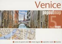
PopOut Maps
Venice PopOut Map: pop-up city street map of Venice city center - folded pocket size travel map Popout Maps
Used - Good. Used book that is in clean average condition without any missing pages. unknown
Referenz des Buchhändlers : 49994195-6 ISBN : 1845879368 9781845879365
|
|
|
Maps, Collins
Collins School Atlas 4th Edition
HarperCollins Publishers Limited. Used - Very Good. Ships from the UK. Former library book; may include library markings. Used book that is in excellent condition. May show signs of wear or have minor defects. HarperCollins Publishers Limited unknown
Referenz des Buchhändlers : 12799391-6 ISBN : 0008146764 9780008146764

|
|
 Per e-mail erhalten
 Als pdf-Dokument herunterladen
 RSS feed


