|
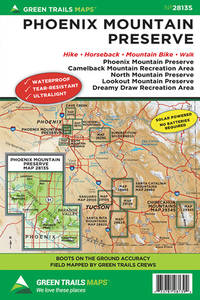
Green Trails Maps
Phoenix Mountain Preserve Az Map Green Trails Maps
map. Good. Access codes and supplements are not guaranteed with used items. May be an ex-library book. unknown
Référence libraire : 168051461X.G ISBN : 168051461X 9781680514612
|
|
|
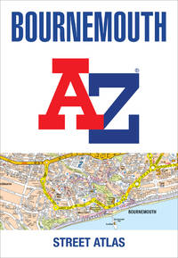
A-Z Maps
Bournemouth A-Z Street Atlas
paperback. Good. Access codes and supplements are not guaranteed with used items. May be an ex-library book. paperback
Référence libraire : 0008496366.G ISBN : 0008496366 9780008496364
|
|
|
Thomas Bros. Maps
Montgomery County & the Beltway
Thomas Brothers Maps. Used - Acceptable. Acceptable condition. 1998 edition. Includes fold-out map at rear. Maryland Montgomery County Maps A readable intact copy that may have noticeable tears and wear to the spine. All pages of text are present but they may include extensive notes and highlighting or be heavily stained. Includes reading copy only books. Thomas Brothers Maps unknown
Référence libraire : Q10B-02609 ISBN : 088130882x 9780881308822

|
|
|
Hema Maps
Bangkok: Country Map
map. Good. Access codes and supplements are not guaranteed with used items. May be an ex-library book. unknown
Référence libraire : 1865003735.G ISBN : 1865003735 9781865003733
|
|
|
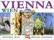
Compass Maps
Vienna Europe Popout Maps
map. Good. Access codes and supplements are not guaranteed with used items. May be an ex-library book. unknown
Référence libraire : 1841392669.G ISBN : 1841392669 9781841392660
|
|
|
Harvey Maps
Peak District North Ultramap
Harvey Map Services Ltd 2016. Map. New. 1 pages. 7.32x3.78x0.31 inches. Harvey Map Services Ltd unknown
Référence libraire : 2-1851375732 ISBN : 1851375732 9781851375738
|
|
|
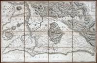
[MAPS -- ROME]. SICKLER, F.[riedrich] Ch.[Carl] L.[udwig].
Plan topographique de la Campagne de Rome dessine et explique. . . a l’usage des voyageurs. . . ; Plan topographique de la Campagne de Rome consideree sous le rapport de la geologie et des antiquites dessine et explique. . . ; Pantogramma ou vue descriptive generale de la Campagne de Rome dessine et explique. . . .
Rome: Venance Monaldini Librarie Place d’Espagne No. 79 1816-1821. Four works. 1st -- Large dissected copper-engraved map dissected & mounted on linen 35.5 x 22.75 in. slight foxing edgewear closed tears at corner folds a couple folds w/ archival repair tape on verso over linen; 2nd & 3rd - 8vo. 63 1; 15 1 pp. With large folding copper-engraved frontisp. highlighting section of the pantogram. Original marbled wrappers very slight chipping head & foot of spine; 4th -- large 3-sheet “Pantogram†or panoramic view of Rome 63 x 8.75 in. all preserved together in open-backed slipcase wrapped in patterned blue paper printed cover label manuscript pricing information & title in ink some scuffing & edgewear still an overall VG set. Second edition of the large dissected map of Rome and surrounding countryside fourth edition of the two-in-one handbook illustrating the coast along the Tyrrhenian Sea from Lake Bracchiano to Mount Circe and inland to the Central Apennines foothills. Sickler’s 1773-1836 Panoramic elevated view of Rome with text key above identifying churches monuments and historical locations in 19th-Century Rome together with the map and handbooks here were key references for those taking the Grand Tour following the Napoleonic Wars which had devastated much of the Continent. Pietro Ruga 1772-1850 was a noted Italian engraver printmaker furniture designer and architectural draftsman best remembered for his maps and pocket panoramic views of Rome. Venance Monaldini Librarie, Place d’Espagne, No. 79, unknown
Référence libraire : 60225
|
|
|
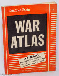
Fry Varian; maps by Emil Herlin
War Atlas: A Handbook of Maps and Facts
New York: The Foreign Policy Association 1940. Pamphlet. 96p. stapled wraps 5.5x7.5 inches maps small stain on top edge of textblock else very good condition. Headline Books No. 23. The Foreign Policy Association unknown
Référence libraire : 318067
|
|
|
Meysels, Theodor F., in collaboration with Lucian O. Meysels. Lay-out and cover by LF. Toby. Maps by Zvi Friedlaender L. F.
Israel in Your Pocket A Ramblers' Guide. Volume One: Northern Israel Second revised and enlarged Edition 1954 -with- Volume Two: Central Israel and Jerusalem's Old City Bethlehem & Jericho 1953 -with- Volume Three: Southern Israel
Jerusalem: Ben-Dor Israel Publishing Co. Ltd 1955. Paperback. Respectively 129 xxvi 127-280 xxiv 281-398 xxiv. Matching small softbounds in upright paper covers 6.5x3.5 inches diverse monochrome colors for each installment. Later issues were bound together in a singleton booklet. Our set a second printing and two firsts are edgeworn with faint abrasion to outer joints. These volumes are quite sound but the text paper is acidic toned and beginning to get fragile. We detect a line of penciling to terminal leaf of v.I else good copies of this complete set all in about the same shape. Ben-Dor Israel Publishing Co. Ltd paperback
Référence libraire : 312611

|
|
|
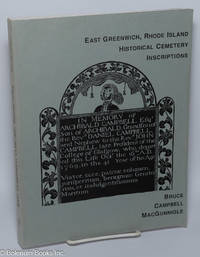
MacGunnigle, Bruce Campbell, text and maps
East Greenwich Rhode Island Historical Cemetery Inscriptions Recorded 1977-1978 in honor of the Tercentenary of the 1677 Founding of the Town
East Greenwich RI: East Greenwich Preservation Society and John Peck Rathbun Chapter #4 Sons of the American Revolution 1991. Paperback. Unpaginated preliminaries foreword intro 268p. illustrated with a cover rubbing of the most significant of the gravestones plus a couple of line maps and a great number of diagrammatic location plats softbound first edition in 10.5x8 inch decorated grey wraps. Mild edgewear with tiny turns to cover corner-tips smudge to the blank back-cover else entirely sound clean and unmarked. Laid in is compiler's descriptive and how-to-order leaf. East Greenwich Preservation Society and John Peck Rathbun Chapter #4, Sons of the American Revolution paperback
Référence libraire : 301175
|
|
|
Fajana A. & B. J. Biggs illustrations by C. Pearson maps by G. Woodman
Nigeria in history
Ikeja: Longman Nigeria Ltd 1977. Paperback. viii 230p. preface appendices illustrations maps lightly-worn reprint trade paperback in red pictorial wraps. Longman Nigeria Ltd paperback
Référence libraire : 170527 ISBN : 0582602424 9780582602427

|
|
|
[Proust, Marcel] George D. Painter, with illustrations, maps drawn by Samuel H. Bryant
Proust; the early years
Boston: Atlantic Monthly Press/Little Brown and Company 1959. Hardcover. xvii 435p. 8p. photos later printing cloth edgeworn dj. Atlantic Monthly Press/Little, Brown and Company hardcover
Référence libraire : 94939

|
|
|
Hema Maps
Austria Country Map by Hema English French Italian and German Edition
map. Good. Access codes and supplements are not guaranteed with used items. May be an ex-library book. unknown
Référence libraire : 1875992286.G ISBN : 1875992286 9781875992287
|
|
|
CARTES POSTALES: RIVIERE DU LOUP:
Souvenir view folder of Riviere du Loup Quebec Canada.
Rivière-du-Loup S. Belle Éditeur 1933. Lot de 10 cartes postales sous chemise cartonnée avec texte et timbre 1 cent. Bonne condition. unknown
Référence libraire : 67931
|
|
|
CARTES POSTALES: ARVIDA:
The Saguenay Inn Arvida Que.
Sans éditeur sans date. Carte en très bonne condition avec texte et timbres 1 cent et deux de deux cents à recevoir. unknown
Référence libraire : 67928
|
|
|
CARTES POSTALES: POINTE AU PERE:
Hotel de touristes Pointe au Pere Father Point Quebec.
1959. Carte en très bonne condition avec texte et timbre 5 cents. unknown
Référence libraire : 67930
|
|
|
CARTES POSTALES: SAINT-GABRIEL DE BRANDON:
Hôtel de Ville St. Gabriel de Brandon Québec.
1953. Carte en très bonne condition avec texte et timbre 3 cents. unknown
Référence libraire : 67929
|
|
|
Harvey Maps
Crieff & Comrie Ultramap XT40 1:40000 - Doune Dunblane
Harvey Maps 2023. Map. New. 1st ed march 2023 edition. 2 pages. 5.98x2.91x0.43 inches. Harvey Maps unknown
Référence libraire : __185137664X ISBN : 185137664X 9781851376643
|
|
|
Outdoor Books & Maps
Best of Rocky Mountain National Park Hiking Trails
paperback. Good. Access codes and supplements are not guaranteed with used items. May be an ex-library book. paperback
Référence libraire : 093065739X.G ISBN : 093065739X 9780930657390
|
|
|
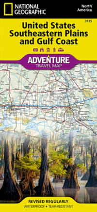
National Geographic Maps
United States Southeastern Plains and Gulf Coast Map National Geographic Adventure Map 3125
map. Good. Access codes and supplements are not guaranteed with used items. May be an ex-library book. unknown
Référence libraire : 1566957192.G ISBN : 1566957192 9781566957199
|
|
|
A-Z Maps
Midlands A-Z Road Atlas
paperback. Good. Access codes and supplements are not guaranteed with used items. May be an ex-library book. paperback
Référence libraire : 000865283X.G ISBN : 000865283X 9780008652838

|
|
|
A Z Maps
Brighton A-Z Pocket Street Map
map. Good. Access codes and supplements are not guaranteed with used items. May be an ex-library book. unknown
Référence libraire : 0008657378.G ISBN : 0008657378 9780008657376

|
|
|
Franko Maps Ltd.
Hawaii The Big Island Adventure Map Franko Maps Laminated Poster
map. Good. Access codes and supplements are not guaranteed with used items. May be an ex-library book. unknown
Référence libraire : 1601901070.G ISBN : 1601901070 9781601901071
|
|
|
maps
Etablissement Militaire de St. Bernard. Atlas des batiments
c. early 19th century. Hardcover. Very Good. Half cloth and marbled paper over boards handwritten label on upper board; oblong folio 460 x 360 mm; entirely handwritten and drawn in black ink on the rectos only with "tableau des batiments militaires" and 7 maps. Boards heavily scuffed; binding shaken; some dusty finger-smudges here and there. Sold as is. <br/><br/> hardcover
Référence libraire : LD7400
|
|
|
Savander O. Sederholm J. J. Saliskapet for Finlands geografi. Neovius Eduard Rudolf.
ATLAS OFVER FINLAND.
Helsingfors: Aktiebolaget F. Tilgmanns Bok-Och Stentryckeri 1899. First Edition. Hardcover. Very Good. Charts. Octavo quarter calf various paginations. Scarce: not uncommonly found separately from the atlas volume. <br/><br/>This is the Text volume only which was designed to accompany the 70 leaves of maps in the Atlas volume. This volume contains about forty essays by various experts about the maps. . Illustrated with 10 plates 84 figures charts graphs. Aktiebolaget F. Tilgmanns Bok-Och Stentryckeri hardcover
Référence libraire : 004976
|
|
|
Collins Maps (Author)
"Collins World Wall Laminated Map Map – March 31 2022 "
<p>New. Never used book</p>
Référence libraire : 0008492549 ISBN : 0008492549 9780008492540
|
|
|
Harvey Maps Services ltd
Coast to Coast Trail Maps XT40
Harvey Map Services Ltd 2021. Map. New. 1 pages. 9.49x4.61x0.28 inches. Harvey Map Services Ltd unknown
Référence libraire : 2-1851376186 ISBN : 1851376186 9781851376186
|
|
|
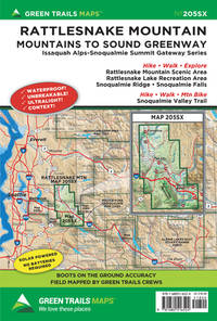
Maps Green Trails
Rattlesnake Mountain WA 205SX Green Trails Maps 205SX
map. Good. Access codes and supplements are not guaranteed with used items. May be an ex-library book. unknown
Référence libraire : 1680516523.G ISBN : 1680516523 9781680516524
|
|
|
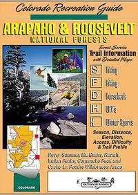
Outdoor Books & Maps
Arapaho & Roosevelt National Forest Recreation Guide
paperback. Good. Access codes and supplements are not guaranteed with used items. May be an ex-library book. paperback
Référence libraire : 093065708X.G ISBN : 093065708X 9780930657086
|
|
|
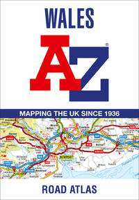
A Z Maps
Wales A-Z Road Atlas
map. Good. Access codes and supplements are not guaranteed with used items. May be an ex-library book. unknown
Référence libraire : 0008560552.G ISBN : 0008560552 9780008560553
|
|
|
National Geographic Maps
Pennsylvania GuideMap
map. Good. Access codes and supplements are not guaranteed with used items. May be an ex-library book. unknown
Référence libraire : 1572624094.G ISBN : 1572624094 9781572624092

|
|
|
Costain, Thomas B. (Bertram); Maps on End Papers [Illustrator]
The Darkness and the Dawn
Doubleday & Co 1959-01-01. Hardcover. Very Good. Doubleday & Co hardcover
Référence libraire : 201122063
|
|
|
Benchmark Maps
Washington Recreation Map
map. Good. Access codes and supplements are not guaranteed with used items. May be an ex-library book. unknown
Référence libraire : 078349968X.G ISBN : 078349968X 9780783499680

|
|
|
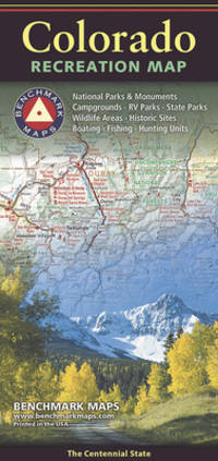
Benchmark Maps
Colorado Recreation Map
map. Good. Access codes and supplements are not guaranteed with used items. May be an ex-library book. unknown
Référence libraire : 0783499655.G ISBN : 0783499655 9780783499659
|
|
|
Lim (8), Mind Maps Journal
Mind Maps Journal: Blank Mind Map BookBrainstorm Notebook Help You Organize Your Thoughts & Take Notes 100 Pages
Independently published 2019. Paperback. New. 102 pages. 11.00x8.50x0.23 inches. Independently published paperback
Référence libraire : 2-1713091461 ISBN : 1713091461 9781713091462
|
|
|
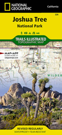
National Geographic Maps
Joshua Tree National Park National Geographic Trails Illustrated Map National Geographic Trails Illustrated Map 226
National Geographic Maps. New. Special order direct from the distributor National Geographic Maps unknown
Référence libraire : ING9781566953009 ISBN : 1566953006 9781566953009
|
|
|
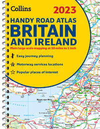
Collins Maps
2023 Collins Handy Road Atlas Britain and Ireland: A5 Spiral Collins Road Atlas
spiral_bound. Good. Access codes and supplements are not guaranteed with used items. May be an ex-library book. unknown
Référence libraire : 0008528764.G ISBN : 0008528764 9780008528768
|
|
|
Survey Production Centre
TOWN PLAN OF MEDAN HIND 1051 Restricted Map Dated Sept. 1945
S. E. Asia: Survey Production Centre 1945. Map. Good. Unframed. First Edition. Scale 1: 8164 or 7.76 inches to Mile Approx. 62 x 94cm. Printed in black blue and grey some outlining and marks in in blue pencil a few creases and general wear but no splits or tears. A good/very good copy. Survey Production Centre unknown
Référence libraire : 020562

|
|
|
A. Van Opstraet, (Uitgever; Editeur)
BELGIE IN VOGELVLUCHT GEZIEN 1915 VUE DE LA BELGIQUE A VOL D'OISEAU
Antwerpen: Willem Seghers Litho-Grav. 1915. Map. Good. Unframed. First Edition. 120x86cm. A substantial map 120 x 86cm colour printed in two halves and joined on the back. A few edge tears and a few splits to the central folds a couple of splits repaired to the verso with paper tape several light creases. A good copy. Seemingly scarce. Willem Seghers, Litho-Grav. unknown
Référence libraire : 015456
|
|
|
CARTE DE ROYAUME DE FRANCE Divisee En 86 Departmens Comprenant Les Chefs lieux Les Sous Prefectures et Les Chefs Lieux De Cantons
Paris - 21 Quai Voltaire: Rosselin 1830. Map. Fine. Map. A fine map hand-coloured in outline folding into original marbled paper boards with title label to the front board. Boards rubbed conrners worn. The map measures 74 x 55cm and is in very good condition with the paper bright. A very good to fine copy of this rare map. Rosselin hardcover
Référence libraire : 009582

|
|
|
Huggins, K. H. Et al
COLLINS-LONGMANS STUDY ATLAS
London 1965. Atlas. Very Good. Hardcover. Fifteenth Edition. 4to. Fifteenth Edition with Colour photograph colour maps throughout. Dust jacket good with some general wear and some chipping and associated creasing to edges 3cm missing from top of spine now protected in an archival sleeve and looks good. Original red cloth binding with gilt lettering excellent having been protected by the dust jacket. Contents clean and tight. A very good copy in a good dust jacket. Hardcover
Référence libraire : 006383
|
|
|
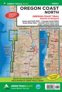
Maps, Green Trails
Oregon Coast North OR No. 356SX
map. Good. Access codes and supplements are not guaranteed with used items. May be an ex-library book. unknown
Référence libraire : 1680515683.G ISBN : 1680515683 9781680515688
|
|
|
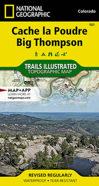
National Geographic Maps
Cache la Poudre Big Thompson Map National Geographic Trails Illustrated Map 101
map. Good. Access codes and supplements are not guaranteed with used items. May be an ex-library book. unknown
Référence libraire : 1566953901.G ISBN : 1566953901 9781566953900
|
|
|
HG. Wells; Postgate Raymond (Revised); JF. Horrabin (maps and plans) [Illustrator] H. G. J. F.
The Outline of History Volume II
Doubleday & Company 1961-01-01. Hardcover. Very Good. Doubleday & Company hardcover
Référence libraire : 210926103
|
|
|
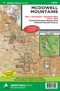
Maps Green Trails
McDowell Mountains AZ No. 2815S Green Trails Maps
map. Good. Access codes and supplements are not guaranteed with used items. May be an ex-library book. unknown
Référence libraire : 1680514199.G ISBN : 1680514199 9781680514193
|
|
|
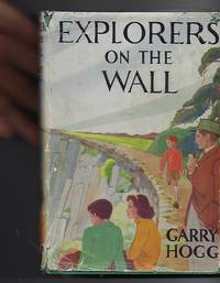
Hogg, Garry & Haigh, Molly (Illus) Tony (Add. Sketches & Maps)
Explorers on the Wall
London: Nelson. Very Good in Good dust jacket. 1948. Second Printing. Hardcover. A scarce title in the Explorers Awheel Series with an extremely scarce dustwrapper. The book is in green cloth boards with white lettering to spine. Maps to endpapers. A prize presentation inscription on blank endpaper ; The Explorers; 8vo 8" - 9" tall . Nelson, hardcover
Référence libraire : 100515
|
|
|
Jeux de societe & de Cartes Editions
Le Baccalauréat - Le Jeu ! - Carnet de grilles AVEC THEMES !: Bloc note de 100 feuilles de score pour jouer au jeu le plus simple et amusant ! De 5 à 99 ans en famille ou entre amis !
Independently published 2020. Paperback. New. 100 pages. French language. 11.69x8.27x0.23 inches. Independently published paperback
Référence libraire : 2-1658563115 ISBN : 1658563115 9781658563116
|
|
|
[Ulback, Sylvia] Sylvia Of Hollywood; Russell Patterson (Pictorial Maps)
Streamline Your Figure
New York: MacFadden Book Co. Very Good-. 1939. First Edition. Hardcover. B & W photos; 12mo 7" - 7½" tall; 119 pages; 1939 MacFadden Book Co. HC 1st edition. Soundly bound in original pebbled blue cloth with pictorial panel in gold and black and titles in black to cover and spine. Sylvia Ulback gained a reputation in 1920's Hollywood as a fitness and diet guru and gained notoriety as the source for the tell-all books "Hollywood Undressed." She continued to publish diet and exercise titles into the 30's and 40's including this volume. Illustrated with pictorial endpaper maps of Hollywood by Russell Patterson. Exercise poses recorded with b&w photos. Cloth rubbed a little at edges and surfaces. mild shelf bumping to boards at corner tips. Prior owner name inked neatly to front endpage. An old resale price in pen to the blank recto of the frontis photograph. VG- . MacFadden Book Co. hardcover
Référence libraire : 54690
|
|
|
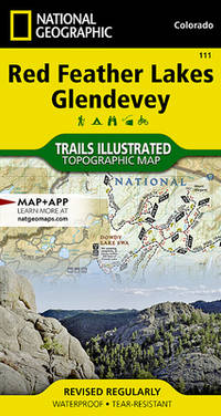
National Geographic Maps
Red Feather Lakes Glendevey Map National Geographic Trails Illustrated Map 111
map. Good. Access codes and supplements are not guaranteed with used items. May be an ex-library book. unknown
Référence libraire : 1566952832.G ISBN : 1566952832 9781566952835
|
|
|
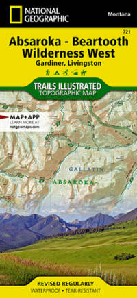
National Geographic Maps
Absaroka-Beartooth Wilderness West Map Gardiner Livingston National Geographic Trails Illustrated Map 721
map. Good. Access codes and supplements are not guaranteed with used items. May be an ex-library book. unknown
Référence libraire : 1566955815.G ISBN : 1566955815 9781566955812
|
|
 Recevoir par e-mail
 Télécharger en PDF
 Flux RSS


