|
Philip's Maps
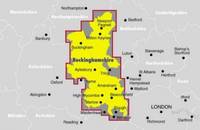
Ordnance Survey Buckinghamshire Street Atlas
Paperback. Acceptable. paperback
Referenz des Buchhändlers : GOR002234479 ISBN : 0540074675 9780540074679
|
|
|
Philip's Maps
Philip's Street Atlas Cardiff Swansea and the Valleys
Paperback. Very Good. paperback
Referenz des Buchhändlers : GOR002237377 ISBN : 0540091650 9780540091652

|
|
|
Compass Maps
Bath UK Popout Maps S.
Paperback. Very Good. paperback
Referenz des Buchhändlers : GOR002260816 ISBN : 1841391085 9781841391083

|
|
|
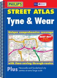
Philip's Maps
Philip's Street Atlas Tyne and Wear
Paperback. Good. paperback
Referenz des Buchhändlers : GOR002088708 ISBN : 0540087521 9780540087525
|
|
|
Pharus-Atlas deutscher und Auslands-Städte mit Pharusplänen. Ausgabe 1912/17. Verantwortlicher Redakteur Ernst Thom Hamburg Bieberhaus.
Hamburg Deutsche Verlags-Gesellschaft D.V.G. 1912. . Außentitel "Pharus Atlas deutscher Städte". - Aachen Berlin Bremen Breslau Coblenz Cöln a. Rh. Darmstadt Dresden Duisburg Düsseldorf Frankfurt a.M. Hamburg Hannover Kiel Leipzig Lübeck Magdeburg München Stettin Stuttgart sowie Brüssel London Paris Wien. Mit illustrierten Bäder- und Kurort-Anzeigen und Führer von Heidelberg Hildesheim Osnabrück und Rendsburg von diesen Städten keine Pläne vorgesehen sowie internationalem Hotel-Register und einem Mitgliederverzeichnis des Internationalen Möbel-Transport-Verbandes. Mit einem Sonderanhang "Schweiz". Besonders interessant durch die zahlreichen schön gestalteten Anzeigen der Zeit viele davon ganzseitig. - Berieben wenig bestoßen innen nur vereinzelt etwas fleckig wenige Blätter eingerissen 1 Blatt m. großem Einriß. Hamburg, Deutsche Verlags-Gesellschaft D.V.G. 1912]. unknown
Referenz des Buchhändlers : 58305

|
|
|
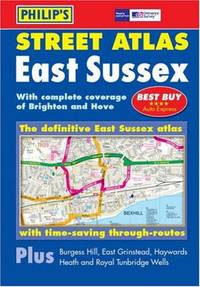
Philip's Maps
Street Atlas East Sussex
Hardback. Good. hardcover
Referenz des Buchhändlers : GOR001982024 ISBN : 0540086487 9780540086481
|
|
|
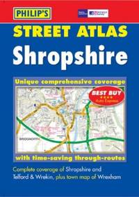
Philip's Maps
Philip's Street Atlas Shropshire: Pocket
Paperback. Good. paperback
Referenz des Buchhändlers : GOR001840081 ISBN : 0540083399 9780540083398
|
|
|
Compass Maps
New York USA PopOut Maps S.
Paperback. Very Good. paperback
Referenz des Buchhändlers : GOR001571328 ISBN : 1841392537 9781841392530

|
|
|
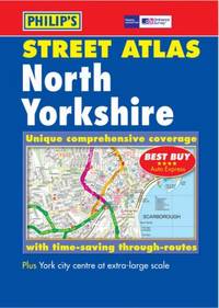
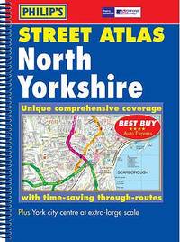
Philip's Maps
Philip's Street Atlas North Yorkshire
Paperback. Very Good. paperback
Referenz des Buchhändlers : GOR001352468 ISBN : 0540087645 9780540087648
|
|
|
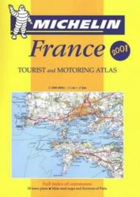
Maps Michelin
France Michelin Tourist and Motoring Atlases
Paperback. Very Good. paperback
Referenz des Buchhändlers : GOR001435001 ISBN : 2060002699 9782060002699
|
|
|
Kelter, Edmund.
Eine Elbkarte des 16. Jahrhunderts im Museum für Hamburgische Geschichte.
Hamburg in Komm. bei Otto Meissner 1919. . Ecken etw. gestaucht sonst gut erhalten. - Möller/Tecke I 441. Hamburg, in Komm. bei Otto Meissner, 1919. unknown
Referenz des Buchhändlers : 18167

|
|
|
Bildliche Darstellung der Kartenzeichen in den amtlichen deutschen Karten. Kartenfibel. D. Luft 1802 / H. Dv. 271.
Gotha Justus Perthes 1941. . Umschlag tlw. verblaßt. - Diese Anleitung soll das Kartenlesen dadurch erleichtern "daß neben dem Kartenzeichen der durch dieses dargestellte Gegenstand Brücken Tunnel Laub- u. Nadelwald Bahnhöfe etc. in seiner natürlichen Gestalt abgebildet ist. So sollen Kartenzeichen u. Natur begrifflich in Einklang gebracht werden" Vorwort. Gotha, Justus Perthes, 1941. unknown
Referenz des Buchhändlers : 49761

|
|
|
(Schlieben, Wilhelm Ernst August von).
Atlas von Europa nebst den Kolonien für Geschäftsmänner Zeitungsleser und Besitzer des Conversations-Lexicons in einer Folge von Charten und einem alphabetisch eingerichteten Texte. LIEFERUNG 15 von 15 apart: Das BRITISCHE REICH.
Leipzig Georg Joachim Göschen 1830. . Verlags-Bibliographie Göschen 1785-1838 Nr. 1027. Vgl. Studien zur Verlagsgeschichte u. zur Verlegertypologie der Goethezeit S. 190. - Einband stark beschabt Textteil gebräunt/stockfl.; erste Karte gebräunt sonst nur gelegentlich stockfleckig im weißen Kartenrand. - Allgemeine Übersicht. Topographie der vorzüglichsten Orte von A-Z. Grenzkolorierte Karten von Königreiche ENGLAND SCHOTTLAND u. IRLAND; Gibraltar Malta Helgoland Ionien; die Kolonien: Britisch-Ostindien Kap-Kolonie Westindien afrikanische Westküste Goldküste Guinea Mauritius St. Helena Nordamerika Hopparo Britisch-Guyana Australien. - Der königlich sächsische Kammerrat W. E. A. v. Schlieben 1781-1839 Statistiker u. Oberlandfeldmesser war Mitbegründer des Statischen Vereins in Sachsen 1831-1850 u. Leiter des Zentralkomitees des Vereins. Leipzig, Georg Joachim Göschen, 1830. unknown
Referenz des Buchhändlers : 51860
|
|
|
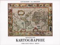
Bagrow, Leo / Skelton, Raleigh Ashlin.
Meister der Kartographie. 6. Aufl.
Berlin Gebr. Mann 1994. . Von den Karten primitiver Völker bis ins 18. Jhdt. Mit Erläuterungen zu den Abbildungen von Heinrich Winter Anmerkungen Verzeichnis der abgebildeten Karten Verzeichnis der Kartographen u. ihrer Werke Literaturverzeichnis u. Sachregister mit ca. 1500 Stichworten. - Gutes sauberes Exempöar Berlin, Gebr. Mann, (1994). unknown
Referenz des Buchhändlers : 52158
|
|
|
Aust, Albert (Hrsg.).
Die Elbkarte des Melchior Lorichs vom Jahre 1568. Gekürzte und vollständig umgearbeitete Auflage des 1847 erschienenen Werkes von Johann Martin Lappenberg.
Hamburg 1927. . Möller/Tecke I 443. - Der Hrsg. war Inhaber der Hamburg-Stade-Altländer Linie. - Rücken wenig verblaßt. Gutes Exemplar. Hamburg, 1927. unknown
Referenz des Buchhändlers : 30692

|
|
|
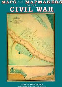
McElfresh, Earl B.
MAPS AND MAPMAKERS OF THE CIVIL WAR
New York: Abrams Image 1999. Paper-covered Boards. Very Fine/Very Fine. Large 4to. 272pp. Biblio & index. 180 illustrations including 150 color plates. History Book Cub edition. <br/> <br/> Abrams Image hardcover
Referenz des Buchhändlers : 16280 ISBN : 0810934302 9780810934306
|
|
|
Terrain Maps
Anafi
map. Good. Access codes and supplements are not guaranteed with used items. May be an ex-library book. unknown
Referenz des Buchhändlers : 9609456138.G ISBN : 9609456138 9789609456135
|
|
|
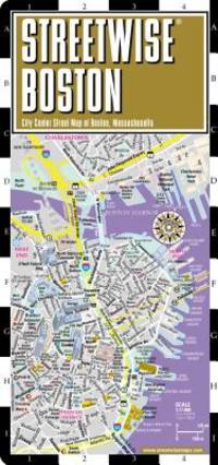
Streetwise Maps
Streetwise Boston Map - Laminated City Center Street Map of Boston Massachusetts - Folding pocket size travel map with MBTA subway map & trolley lines
Streetwise Maps. Used - Very Good. Very Good condition. A copy that may have a few cosmetic defects. May also contain light spine creasing or a few markings such as an owner’s name short gifter’s inscription or light stamp. Streetwise Maps unknown
Referenz des Buchhändlers : Q12I-00584 ISBN : 0935039082 9780935039085
|
|
|
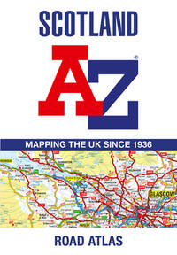
AaZ Maps
Scotland A-Z Road Atlas
Geographersâ A-Z Map Co Ltd 2024-10-01. paperback. Good. 6x0x9. Geographersâ A-Z Map Co Ltd paperback
Referenz des Buchhändlers : 0008652848-3-34659640 ISBN : 0008652848 9780008652845
|
|
|
Irish Discovery Maps 77
Wexford: Loch Garman
Ordnance Survey 2021. Sheet Map Folded. New. 1 pages. 7.76x4.61x0.39 inches. Ordnance Survey unknown
Referenz des Buchhändlers : __1912140136 ISBN : 1912140136 9781912140138
|
|
|
Collins Maps
Collins World Atlas: Paperback Edition
Collins 2016-05-01. Twelfth Edition 12th edition. paperback. Good. 12.2X8.9X0.3. Buy with confidence. Excellent Customer Service & Return policy. Collins paperback
Referenz des Buchhändlers : ANAIS-0008158517 ISBN : 0008158517 9780008158514

|
|
|
color maps throughout
The Prentice-Hall American world atlas
Prentice-Hall Inc. hardcover. Good. Buy with confidence. Excellent Customer Service & Return policy. Prentice-Hall, Inc hardcover
Referenz des Buchhändlers : ANAIS-0136950248 ISBN : 0136950248 9780136950240

|
|
|
Philip's Maps
Philip's Germany & Netherlands Road Map Philip's Sheet Maps
Paperback. Very Good. paperback
Referenz des Buchhändlers : GOR014597259 ISBN : 1849076812 9781849076814
|
|
|
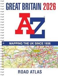
A-Z Maps
Great Britain A-Z Road Atlas 2026 A4 Spiral: Easy to read map of Great Britain in A4 size with spiral binding
Paperback. Very Good. paperback
Referenz des Buchhändlers : GOR014600736 ISBN : 0008719195 9780008719197
|
|
|
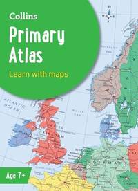
Collins Maps
Collins Primary Atlas: Ideal for learning at school and at home Collins School Atlases
Paperback. Very Good. paperback
Referenz des Buchhändlers : GOR014660686 ISBN : 000871651X 9780008716516
|
|
|
Streetwise Maps
Streetwise Boston Map - Laminated City Center Street Map of Boston Massachusetts - Folding pocket size travel map with MBTA subway map & trolley lines
Streetwise Maps 2014. Map. Like New. 4x0x8. Paperback. Cover shows very minor shelving wear otherwise an unblemished copy.; 100% Satisfaction Guaranteed! Ships same or next business day! Streetwise Maps unknown
Referenz des Buchhändlers : 132512160004 ISBN : 0935039082 9780935039085
|
|
|
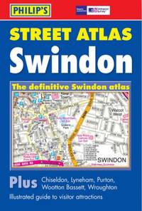
Philip's Maps
Philip's Street Atlas Swindon: Pocket
Paperback. Acceptable. paperback
Referenz des Buchhändlers : GOR014663502 ISBN : 0540089788 9780540089789
|
|
|
National Geographic Maps - Trails Illustrated
Big Bend National Park Map
National Geographic Maps. Very Good. 2023. Map. 1566952891 . Map is gently used. ; National Geographic Trails Illustrated Map 225; 4.1 X 0.3 X 8.9 inches; 2 pages . National Geographic Maps unknown
Referenz des Buchhändlers : 10GW25-969-090 ISBN : 1566952891 9781566952897

|
|
|
Guthrie, William, [Maps by Thomas Kitchen]
A NEW GEOGRAPHICAL HISTORICAL AND COMMERCIAL GRAMMER OF THE PRESENT STATE OF THE SEVERAL KINGDOMS OF THE WORLD
G.G.J. and J. Robinson in Pater-noster Row.: Charles Dilly in the Poultry 1790. Hardcover. Very Good. 101-928pp. Worn original full calf binding with the front board detached but present. LACKING THE REAR BOARD. Illustrated with a correct set of maps by Mr Kitchen. Double page folding maps three with colour BY A YOUNG HAND!. Unlisted chart of the world showing the latest Captain Cook's discoveries bound in at p867. finis. LACKING THE BACK BOARD But a complete text block and plates.215x130mm. 21 plates and the Sphere plate present. A couple of plates hand coloured in outline. An additional CHART OF THE WORLD bound in at the rear. Most maps map two or three creased. A NICE COLLECTION <br/> <br/> Charles Dilly in the Poultry hardcover
Referenz des Buchhändlers : CC136
|
|
|
[MAPS] [San Francisco]
FUTURE DEVELOPMENT OF THE SAN FRANCISCO BAY AREA 1960-2020
<p>1st and only edition. 4to softcover 9 x11" Pages: xxi 94 Appendices. Approximately 130 pp. in all. Accompanied by 23 large folded maps in slipcase.</p><p>The booklet is subtitled "<strong>Economic Aspects of Comprehensive Survey of San Francisco Bay and Tributaries."</strong> It contains research data concerning land use population distribution freeway development employment and economic growth as well as a decade-by-decade chart for growth management. Most of the maps are 36"x42" some two-tone others in brilliant colors.</p><p>CONDITION: <strong>The maps are FINE</strong> folded to size with the appearance of never having been opened. <strong>The booklet is Good</strong>; a clean copy overall but with some discoloration to spine toning to rear cover and one rusted staple. The slipcase is well worn with substantial dampstaining not affecting the contents.</p> U.S. Army Corps of Engineers / U.S. Dept. of Commerce, 1957
Referenz des Buchhändlers : k251217i

|
|
|
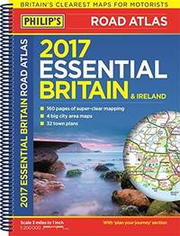
Philip's Maps
Philip's Big Easy to Read France Spain & Portugal Road Atlas
Spiral bound. New. New Book; Fast Shipping from UK; Not signed; Not First Edition; The Philip's Big Easy to Read France Spain and Portugal Road Atlas in a large spiral A3 format is the must-have large type travelling atlas for anyone who needs the big picture for moving around these countries. unknown
Referenz des Buchhändlers : ria9781849077217_inp ISBN : 1849077215 9781849077217

|
|
|
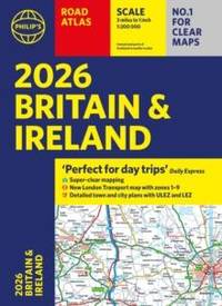
Philip's Maps
2026 Philip’s Road Atlas Britain & Ireland
Paperback / softback. New. New Book; Fast Shipping from UK; Not signed; Not First Edition; 2026 Philip's Road Atlas of Britain and Ireland is a top-of-the-range A4-sized paperback atlas featuring fully updated maps from the Philip's digital database. The maps have enhanced clarity and have been voted Britain's clearest and paperback
Referenz des Buchhändlers : ria9781849077163_inp ISBN : 1849077169 9781849077163
|
|
|
PopOut Maps
Oxford PopOut Map: pocket-size pop up city map of Oxford city centre including top sights not to be missed
Sheet map folded. New. Experience the elegant university city of Oxford with this handy pop-up map. This genuinely pocket-sized city map of Oxford features a detailed street map of Oxford as well as advice on the top things to see while you’re there. Ideal to pop in a pocket or bag for quick reference while exploring this gorgeous city. unknown
Referenz des Buchhändlers : A9781917131452 ISBN : 1917131453 9781917131452

|
|
|
PopOut Maps
Amsterdam PopOut Map - pocket size pop up map of Amsterdam city centre: Includes transport map
Sheet map folded. New. Explore vibrant Amsterdam with this handy pop-up map. This genuinely pocket-sized Amsterdam map includes 2 PopOut maps - a street map of central Amsterdam a map of historic Amsterdam as well as a map of the museum district and a transport map. Ideal to pop in a pocket or bag for quick reference. unknown
Referenz des Buchhändlers : A9781917131322 ISBN : 1917131321 9781917131322

|
|
|
PopOut Maps
Copenhagen PopOut Map - pocket size pop up map of Copenhagen city centre
Sheet map folded. New. Step into the Danish capital city of Copenhagen with this handy pop-up map. This genuinely pocket-sized Copenhagen city map includes a PopOut map featuring central Copenhagen as well as a locator map and transit maps. Ideal to pop in a pocket or bag for quick reference while exploring the city. unknown
Referenz des Buchhändlers : A9781917131360 ISBN : 1917131364 9781917131360

|
|
|
Franko Maps Ltd
St. Lucia Dive Map & Reef Creatures Guide Franko Maps Laminated Fish Card
Franko Maps Ltd 2011-12-31. map. Good. 8x5x0. Franko Maps Ltd unknown
Referenz des Buchhändlers : 1601903820-3-34257090 ISBN : 1601903820 9781601903822
|
|
|
Philip's Maps
Philip's Street Atlas North Yorkshire: Pocket
Philip's 10/11/2005 00:00:01. paperback. Good. 1.2690 in x 20.3046 in x 14.2092 in. Philip's paperback
Referenz des Buchhändlers : mon0000486452 ISBN : 0540087653 9780540087655
|
|
|
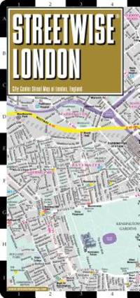
Streetwise Maps
Streetwise London Map - Laminated City Center Street Map of London England
Streetwise Maps. Used - Very Good. Very Good condition. A copy that may have a few cosmetic defects. May also contain light spine creasing or a few markings such as an owner’s name short gifter’s inscription or light stamp. Streetwise Maps unknown
Referenz des Buchhändlers : B18A-03106 ISBN : 0935039279 9780935039276
|
|
|
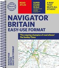
Philip's Maps
Philip's Navigator Britain Easy-use format: 'The reigning champion of Road Atlases' Philip's Road Atlases
Philip's 2024-11-07. spiral_bound. New. 10.31x0.79x12.13. Buy with confidence. Excellent Customer Service & Return policy. Philip's unknown
Referenz des Buchhändlers : DADAX1849076545 ISBN : 1849076545 9781849076548
|
|
|
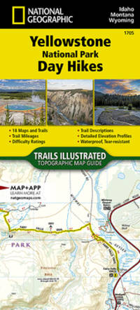
National Geographic Maps - Trails Illustrated
Yellowstone National Park Day Hikes Map National Geographic Topographic Map Guide 1705
National Geographic 2023-01-01. 2023. map. New. 4.10x0.20x9.20. Buy with confidence. Excellent Customer Service & Return policy. National Geographic unknown
Referenz des Buchhändlers : DADAX1566958040 ISBN : 1566958040 9781566958042
|
|
|
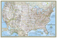
National Geographic Maps - Reference
National Geographic United States Wall Map - Classic - Laminated Poster Size: 36 x 24 in National Geographic Reference Map
National Geographic 2019-03-01. 2019. map. Used: Good. 3.25x3.25x37.00. Buy with confidence. Excellent Customer Service & Return policy. National Geographic unknown
Referenz des Buchhändlers : SONG1597752185 ISBN : 1597752185 9781597752183
|
|
|
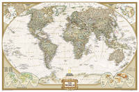
National Geographic Maps - Reference
National Geographic World Wall Map - Executive - Laminated Poster Size: 36 x 24 in National Geographic Reference Map
National Geographic 2022-01-01. 2022. map. Used: Good. 37.00x3.00x3.00. Buy with confidence. Excellent Customer Service & Return policy. National Geographic unknown
Referenz des Buchhändlers : SONG1597752096 ISBN : 1597752096 9781597752091
|
|
|
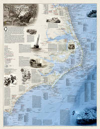
National Geographic Maps
National Geographic Shipwrecks of the Outer Banks Wall Map 28 x 36 in National Geographic Reference Map
National Geographic 2012-06-29. 2012. map. New. 36.22x28.35x2.76. Buy with confidence. Excellent Customer Service & Return policy. National Geographic unknown
Referenz des Buchhändlers : DADAX1597754994 ISBN : 1597754994 9781597754996
|
|
|
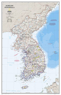
National Geographic Maps - Reference
National Geographic Korean Peninsula Wall Map - Classic - Laminated 23.25 x 35.75 in National Geographic Reference Map
National Geographic 2022-09-01. 2022. map. New. 3.25x3.25x37.00. Buy with confidence. Excellent Customer Service & Return policy. National Geographic unknown
Referenz des Buchhändlers : DADAX1597755664 ISBN : 1597755664 9781597755665
|
|
|
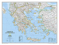
National Geographic Maps
National Geographic Greece Wall Map - Classic 30.25 x 23.5 in National Geographic Reference Map
National Geographic 2022-01-19. 2022. map. New. 3.00x3.00x27.00. Buy with confidence. Excellent Customer Service & Return policy. National Geographic unknown
Referenz des Buchhändlers : DADAX0792249690 ISBN : 0792249690 9780792249696
|
|
|
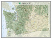
National Geographic Maps
National Geographic Washington Wall Map 40.5 x 30.25 in National Geographic Reference Map
National Geographic 2019-01-01. 2019. map. New. 40.50x30.25x0.00. Buy with confidence. Excellent Customer Service & Return policy. National Geographic unknown
Referenz des Buchhändlers : DADAX1597752495 ISBN : 1597752495 9781597752497
|
|
|
Philip's Maps
Philip's 2018 Multiscale Road Atlas Europe: A4 Spiral binding Philips Road Atlas
Philip's 06/04/2017 00:00:01. spiral_bound. Very Good. 1.3989 in x 29.9772 in x 22.5828 in. Philip's unknown
Referenz des Buchhändlers : mon0000488968 ISBN : 1849074216 9781849074216
|
|
|
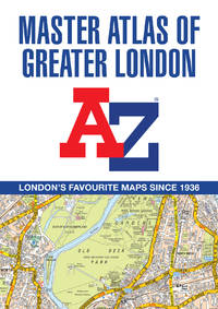
A-Z Maps
-Z Master Atlas Of Greater London: Detailed And Accurate Iconic Street Map Of London
Harpercollins Publishers 2025. Paperback / Softback. New. 19 revised edition edition. 436 pages. 8.27x0.87x11.69 inches. Harpercollins Publishers paperback
Referenz des Buchhändlers : __0008724512 ISBN : 0008724512 9780008724511
|
|
|
Philip's Maps
Philip's Essential Road Atlas Britain and Ireland 2017: Spiral
Philip's 2016-06-23. Spiral-bound. New. 1.3959 29.7716 22.5888. Philip's unknown
Referenz des Buchhändlers : mon0000461798 ISBN : 1849074143 9781849074148
|
|
|
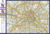
A-Z Maps
Manchester A-Z Pocket Street Map: Accurate Street Map For Easy Navigation
Harpercollins Publishers 2025. Sheet Map Folded. New. 2 pages. 3.54x0.16x5.51 inches. Harpercollins Publishers unknown
Referenz des Buchhändlers : __0008725462 ISBN : 0008725462 9780008725464
|
|
 Per e-mail erhalten
 Als pdf-Dokument herunterladen
 RSS feed


