|
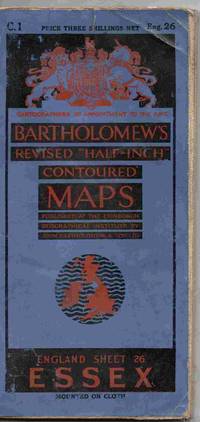
Bartholomew's Revised "Half-Inch" Contoured Maps. England Sheet 26. Essex
Edinburgh: John Bartholomew & Co 1933. Map. Fair/No Jacket as published. A map mounted on cloth depicting an area of eastern England. Print code is B33. Some wear and folds starting to fail but all still in one piece. A few annotations and marks to the map. All orders processed and shipped promptly from the UK. Please call or email with your questions. <br/> <br/> John Bartholomew & Co unknown
Bookseller reference : 027583
|
|
|
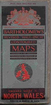
Bartholomew's Revised "Half-Inch" Contoured Maps. England Sheet 11. North Wales
Edinburgh: John Bartholomew & Co 1932. Map. Fair/No Jacket as published. A map dissected and mounted on cloth depicting an area of Wales despite the title!. Print code is B32. Some light wear and a few marks to the map. All orders processed and shipped promptly from the UK. Please call or email with your questions. <br/> <br/> John Bartholomew & Co unknown
Bookseller reference : 027582
|
|
|
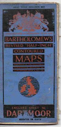
Bartholomew's Revised "Half-Inch" Contoured Maps. England Sheet 36. Dartmoor
Edinburgh: John Bartholomew & Co 1930. Map. Good/No Jacket as published. A map mounted on cloth depicting an area of the south west England print code is A30. Some wear through use. Previous owner's name and address on reverse of map. All orders processed and shipped promptly from the UK. Please email with your questions. <br/> <br/> John Bartholomew & Co unknown
Bookseller reference : 027586
|
|
|
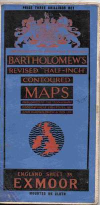
Bartholomew's Revised "Half-Inch" Contoured Maps. England Sheet 35. Exmoor
Edinburgh: John Bartholomew & Co 1929. Map. Good/No Jacket as published. A map mounted on cloth depicting an area of the south west England print code is A29. Some wear through use. Previous owner's name and address on reverse of map. All orders processed and shipped promptly from the UK. lease call or email with your questions. <br/> <br/> John Bartholomew & Co unknown
Bookseller reference : 027585
|
|
|
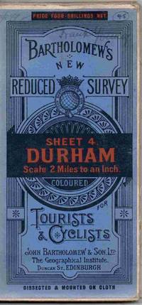
Bartholomew's New Reduced Survey. Sheet 4. Durham. Scale 2 Miles to an Inch. Coloured for Tourists and Cyclists
Edinburgh: John Bartholomew & Son Ltd 1920. 1st Edition . Map. Good/No Jacket as published. 4" x 7.5. A dissected map mounted on cloth depicting an area of NE England. Has the print code B20. Some wear to the edges of the blue folded cover but the map is on cloth and in good order minor evidence of previous ownership on the front cover. All orders processed and shipped promptly from the UK. <br/> <br/> John Bartholomew & Son Ltd unknown
Bookseller reference : 027603
|
|
|
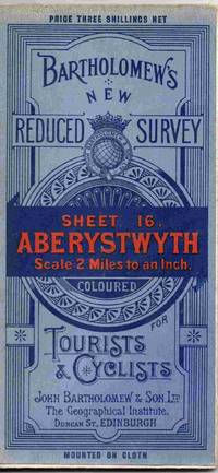
Bartholomew's New Reduced Survey. Sheet 16. Aberystwyth. Scale 2 Miles to an Inch. Coloured for Tourists and Cyclists
Edinburgh: John Bartholomew & Son Ltd 1921. Map. Good/No Jacket as published. 4" x 7.5. A map on cloth depicting an area of Wales. Has the print code A21. Some wear to the edges of the blue folded cover but the map is on cloth and in good order. All orders processed and shipped promptly from the UK. <br/> <br/> John Bartholomew & Son Ltd unknown
Bookseller reference : 027605
|
|
|
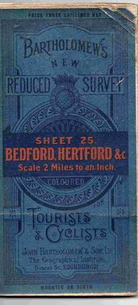
Bartholomew's New Reduced Survey. Sheet 25. Bedford Hertford & C. Scale 2 Miles to an Inch. Coloured for Tourists and Cyclists
Edinburgh: John Bartholomew & Son Ltd 1920. Map. Fair/No Jacket as published. 4" x 7.5. A map on cloth depicting an area of England. Dated to 1920 from the date code A20. Some wear from usage but the map is on cloth and in tidy order apart from one long fold has failed. All orders processed and shipped promptly from the UK. <br/> <br/> John Bartholomew & Son Ltd unknown
Bookseller reference : 027608
|
|
|
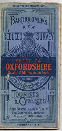
Bartholomew's New Reduced Survey. Sheet 24. Oxfordshire. Scale 2 Miles to an Inch. Coloured for Tourists and Cyclists
Edinburgh: John Bartholomew & Son Ltd. Map. Good/No Jacket as published. 4" x 7.5. A map on cloth depicting an area of England.Not dated but believed to be early 1920s. Some wear from usage but the map is on cloth and in tidy order. All orders processed and shipped promptly from the UK. <br/> <br/> John Bartholomew & Son Ltd unknown
Bookseller reference : 027607
|
|
|
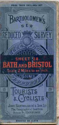
Bartholomew's New Reduced Survey. Sheet 28. Bath and Bristol. Scale 2 Miles to an Inch. Coloured for Tourists and Cyclists
Edinburgh: John Bartholomew & Son Ltd 1919. Map. Fair/No Jacket as published. 4" x 7.5. A map on cloth depicting an area of England. Dated to 1919 from the date code B19. Some wear from usage but the map is on cloth and in tidy order. All orders processed and shipped promptly from the UK. <br/> <br/> John Bartholomew & Son Ltd unknown
Bookseller reference : 027609
|
|
|
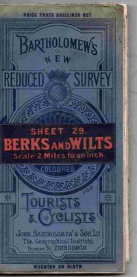
Bartholomew's New Reduced Survey. Sheet 29. Berks and Wilts. Scale 2 Miles to an Inch. Coloured for Tourists and Cyclists
Edinburgh: John Bartholomew & Son Ltd 1920. Map. Fair/No Jacket as published. 4" x 7.5. A map on cloth depicting an area of England. Dated to 1920 from the date code B20. Some wear from usage but the map is on cloth and in tidy order. All orders processed and shipped promptly from the UK. <br/> <br/> John Bartholomew & Son Ltd unknown
Bookseller reference : 027610
|
|
|
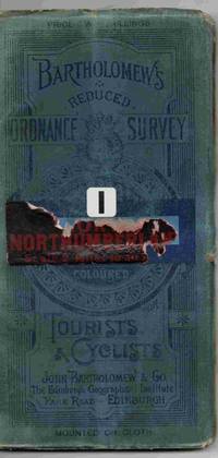
Bartholomew's Reduced Ordnance Survey. Sheet 1. Northumberland. Scale 2 Miles to an Inch. Coloured for Tourists & Cyclists.
Edinburgh: John Bartholomew & Co. 1st Edition . Map. Good/No Jacket as published. 4" x 7.5. A map mounted on cloth depicting an area of northern England not dated but thought to be from around 1900. Some wear to the edges of the blue folded cover the map is clean an tidy and usable. Some damage to the title label on the front cover. All orders processed and shipped promptly from the UK. <br/> <br/> John Bartholomew & Co unknown
Bookseller reference : 027624
|
|
|
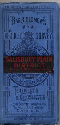
Bartholomew's New Reduced Survey. Salisbury Plain District. Scale 2 Miles to an Inch. Coloured for Tourists and Cyclists
Edinburgh: John Bartholomew & Son Ltd 1915. Map. Fair/No Jacket as published. 4" x 7.5. A map on cloth depicting an area of England. Dated to 1915 from the date code A15. Some wear from usage but the map is on cloth and in tidy order. All orders processed and shipped promptly from the UK. <br/> <br/> John Bartholomew & Son Ltd unknown
Bookseller reference : 027636
|
|
|
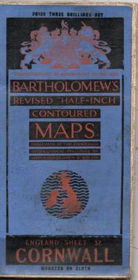
Bartholomew's Revised "Half-Inch" Contoured Maps. England Sheet 37. Cornwall
Edinburgh: John Bartholomew & Co 1927. Map. Good/No Jacket as published. A map mounted on cloth depicting an area of the south west England print code is A27. Some wear through use. Previous owner's name and address on reverse of map. All orders processed and shipped promptly from the UK. Please call or email with your questions. <br/> <br/> John Bartholomew & Co unknown
Bookseller reference : 027637
|
|
|
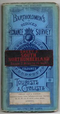
Bartholomew's Reduced Ordnance Survey. Sheet 2. South Northumberland. Scale 2 Miles to an Inch. Coloured for Tourists & Cyclists.
Edinburgh: John Bartholomew & Co. 1st Edition . Map. Good/No Jacket as published. 4" x 7.5. A map mounted on cloth depicting an area of northern England not dated but thought to be from around 1900. Some wear to the edges of the blue folded cover the map is clean an tidy and usable. Some damage to the title label on the front cover. All orders processed and shipped promptly from the UK. <br/> <br/> John Bartholomew & Co unknown
Bookseller reference : 027635
|
|
|
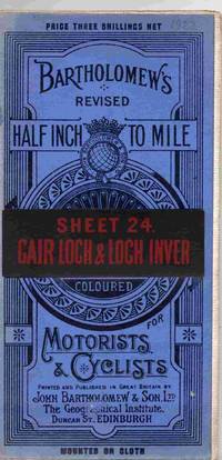
Bartholomew's Revised Half Inch To Mile Coloured for Motorists and Cyclists. Sheet 24. Cair Loch & Loch Inver
Edinburgh: John Bartholomew & Co 1922. Map. Good/No Jacket as published. A map mounted on cloth depicting this area of Scotland. Print date is B22. Some light wear / signs of handling but the map is in good order. All orders processed and shipped promptly from the UK. Please call or email with your questions. <br/> <br/> John Bartholomew & Co unknown
Bookseller reference : 027557
|
|
|
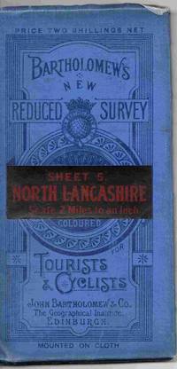
Bartholomew's New Reduced Survey. Sheet 5. North Lancashire. Scale 2 Miles to an Inch. Coloured for Tourists and Cyclists
Edinburgh: John Bartholomew & Co. 1st Edition . Map. Good/No Jacket as published. 4" x 7.5. A map on linen depicting an area of north west England not dated but thought to be from the first quarter of the 20th century. Some wear to the edges of the blue folded cover but the map is on cloth and in good order. All orders processed and shipped promptly from the UK. <br/> <br/> John Bartholomew & Co unknown
Bookseller reference : 027462
|
|
|
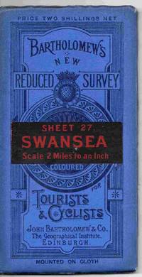
Bartholomew's New Reduced Survey. Sheet 27. Swansea Scale 2 Miles to an Inch. Coloured for Tourists and Cyclists
Edinburgh: John Bartholomew & Co. 1st Edition . Map. Good/No Jacket as published. 4" x 7.5. A map on linen depicting an area of south Wales not dated but thought to be from the first quarter of the 20th century. Some wear to the edges of the blue folded cover but the map is on cloth and in good order. All orders processed and shipped promptly from the UK. <br/> <br/> John Bartholomew & Co unknown
Bookseller reference : 027459
|
|
|
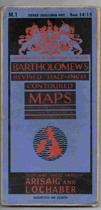
Bartholomew's Revised "Half-Inch" Contoured Maps. Scotland Sheet 14/15. Arisag and Lochaber
Edinburgh: John Bartholomew & Co. Map. Good/No Jacket as published. A map mounted on cloth depicting this area of western Scotland. Not dated but from the period 1922 - 1952. Some light wear / signs of handling but the map is in good order. All orders processed and shipped promptly from the UK. Please call or email with your questions. <br/> <br/> John Bartholomew & Co unknown
Bookseller reference : 024931
|
|
|
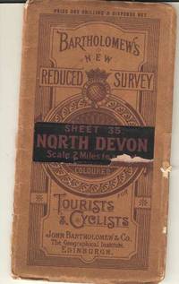
Bartholomew's New Reduced Survey. Sheet 35. North Devon Scale 2 miles to one inch. Coloured for Tourists and Cyclists
Edinburgh: John Bartholomew & Co. Map. Fair/No Jacket as published. 4" x 7.5. A coloured map on paper depicting the English county of Devon not dated but thought to be from the first quarter of the 20th century. Some wear to the edges of the brown folded cover which has lost part of the stick on label but the map is on paper and in one piece but some of the folds are failing. All orders processed and shipped promptly from the UK. <br/> <br/> John Bartholomew & Co unknown
Bookseller reference : 023261
|
|
|
Bartholomew's New Reduced Survey. Sheet 36. South Devon Scale half Inch to a Mile. Coloured for Tourists and Cyclists
Edinburgh: John Bartholomew & Co. Map. Fair/No Jacket as published. 4" x 7.5. A map on linen depicting the English county of Devon not dated but thought to be from the first quarter of the 20th century. Some wear to the edges of the blue folded cover which has lost the stick on label but the map is on cloth and in good order. All orders processed and shipped promptly from the UK. <br/> <br/> John Bartholomew & Co unknown
Bookseller reference : 022936
|
|
|
Bartholomew's New Reduced Survey Sheet 5: North Lancashire: Scale 2 Miles to an Inch. Coloured For Tourists & Cyclists
Edinburgh: John Bartholomew & Co. 1900. Paperback fold-out map in very good condition for age. This book does not have a publication date. It was not published in 1900. Dissected and mounted on cloth. Original price: two shillings & sixpence net. Covers are lightly marked worn and faded. Bookshop sticker on front cover. Cloth is lightly stained and frayed on edges. Map squares are lightly marked tanned and warped. Minor nicks in between squares. Contents are clear throughout. HCW. paperback. Very Good. Used. John Bartholomew & Co. Paperback
Bookseller reference : 495900

|
|
|
Bartholomew's New Reduced Survey Sheet 1: North Northumberland: Scale 2 Miles to an Inch. Coloured For Tourists & Cyclists
Edinburgh: John Bartholomew & Co. 1900. Paperback fold-out map in very good condition for age. This book does not have a publication date. It was not published in 1900. Dissected and mounted on cloth. Original price: four shillings net. Covers are lightly marked worn and faded with light creases. Cloth is lightly foxed and frayed on edges. Map squares are lightly marked tanned and warped. Five centimetre tear on upper edge of map. Contents are clear throughout. HCW. paperback. Very Good. Used. John Bartholomew & Co. Paperback
Bookseller reference : 495897

|
|
|
Bartholomew's New Reduced Survey Sheet 3: Cumberland: Scale 2 Miles to an Inch. Coloured For Tourists & Cyclists
Edinburgh: John Bartholomew & Co. 1900. Paperback fold-out map in very good condition for age. This book does not have a publication date. It was not published in 1900. Dissected and mounted on cloth. Original price: two shillings & sixpence net. Covers are lightly marked worn and faded. Cloth is lightly foxed and frayed on edges. Map squares are lightly marked tanned and warped. Splits between some map squares but map remains intact. Contents are clear throughout. HCW. paperback. Very Good. Used. John Bartholomew & Co. Paperback
Bookseller reference : 495899

|
|
|
Bartholomew's Revised "Half-Inch" Contoured Maps: England Sheet 29. Berkshire
Edinburgh: John Bartholomew & Son Ltd. 1900. Paperback fold-out map in very good condition for age. This book does not have a publication date. It was not published in 1900. Dissected and mounted on cloth. Original price: four shillings net. Bookseller's label on front cover. Map is lightly marked tanned and edge-worn. Contents are clear throughout. HCW. paperback. Very Good. Used. John Bartholomew & Son Ltd. Paperback
Bookseller reference : 495941

|
|
|
Bartholomew's New Reduced Survey Sheet 18. Birmingham District: Scale 2 Miles to an Inch. Coloured for Tourists & Cyclists
Edinburgh: John Bartholomew & Co. 1900. Paperback fold-out map in very good condition for age. This book does not have a publication date. It was not published in 1900. Dissected and mounted on cloth. Original price: two shillings & sixpence net. Bookseller's sticker on front cover. Map is marked and tanned with nicked and frayed edges. Contents are clear throughout. HCW. paperback. Very Good. Used. John Bartholomew & Co. Paperback
Bookseller reference : 495931

|
|
|
Bartholomew's New Reduced Survey Sheet 14. Lincoln Fens: Scale 2 Miles to an Inch Coloured for Tourists & Cyclists
Edinburgh: John Bartholomew & Co. 1900. Paperback fold-out map in very good condition for age. This book does not have a publication date. It was not published in 1900. Dissected and mounted on cloth. Original price: three shillings & sixpence net. Map is lightly marked and tanned. Map edges are slightly frayed with one or two nicks. Contents are clear throughout. HCW. paperback. Very Good. Used. John Bartholomew & Co. Paperback
Bookseller reference : 495927

|
|
|
Bartholomew's Revised "Half-inch" Contoured Maps: England Sheet 11. North Wales
Edinburgh: John Bartholomew & Son Ltd 1900. Paperback fold-out map in very good condition for age. This book does not have a publication date. It was not published in 1900. Dissected and mounted on cloth. Original price: four shillings net. Covers are lightly marked. Bookseller's sticker on front cover. Map is lightly marked and edge-worn. Minor fraying on edges and in creases. Contents are clear throughout. HCW. paperback. Very Good. Used. John Bartholomew & Son Ltd Paperback
Bookseller reference : 495924

|
|
|
Bartholomew's New Reduced Survey Sheet 7: York and Scarborough: Scale 2 Miles to an Inch. Coloured For Tourists & Cyclists
Edinburgh: John Bartholomew & Co. 1900. Paperback fold-out map in very good condition for age. This book does not have a publication date. It was not published in 1900. Dissected and mounted on cloth. Original price: two shillings & sixpence net. Covers are lightly marked worn and faded. Minor chip on front cover title plate. Bookseller's sticker on front cover. Map is lightly marked tanned and nicked. Contents are clear throughout. HCW. paperback. Very Good. Used. John Bartholomew & Co. Paperback
Bookseller reference : 495920

|
|
|
Bartholomew's New Reduced Survey Sheet 6: Harrogate: Scale 2 Miles to an Inch. Coloured For Tourists & Cyclists
Edinburgh: John Bartholomew & Co. 1900. Paperback fold-out map in very good condition for age. This book does not have a publication date. It was not published in 1900. Dissected and mounted on cloth. Original price: two shillings net. Covers are lightly marked worn and faded. Cover edges are creased and nicked. Map is lightly marked tanned and nicked. Contents are clear throughout. HCW. paperback. Very Good. Used. John Bartholomew & Co. Paperback
Bookseller reference : 495919

|
|
|
Bartholomew's New Reduced Survey Sheet 25. Bedford Hertford&c: Scale 2 Miles to an Inch. Coloured for Tourists & Cyclists
Edinburgh: John Bartholomew & Co. 1900. Paperback fold-out map in very good condition for age. This book does not have a publication date. It was not published in 1900. Dissected and mounted on cloth. Original price: two shillings net. Title plate on front cover is chipped. Map is lightly marked and tanned. Map edges are slightly creased and nicked. Contents are clear throughout. HCW. paperback. Very Good. Used. John Bartholomew & Co. Paperback
Bookseller reference : 495937

|
|
|
Bartholomew's New Reduced Survey Sheet 13. Derby & Notts: Scale 2 Miles to an Inch Coloured for Tourists & Cyclists
Edinburgh: John Bartholomew & Co. 1900. Paperback fold-out map in very good condition for age. This book does not have a publication date. It was not published in 1900. Dissected and mounted on cloth. Original price: three shillings net. Map is lightly marked and tanned. Map edges are slightly creased and frayed with one or two nicks. Contents are clear throughout. HCW. paperback. Very Good. Used. John Bartholomew & Co. Paperback
Bookseller reference : 495926

|
|
|
Bartholomew's New Reduced Survey Sheet 15. Norfolk: Scale 2 Miles to an Inch Coloured for Tourists & Cyclists
Edinburgh: John Bartholomew & Co. 1900. Paperback fold-out map in very good condition for age. This book does not have a publication date. It was not published in 1900. Dissected and mounted on cloth. Original price: four shillings net. Bookseller's sticker on front cover. Map is lightly marked and tanned with frayed edges. Contents are clear throughout. HCW. paperback. Very Good. Used. John Bartholomew & Co. Paperback
Bookseller reference : 495928

|
|
|
Bartholomew's Revised "Half-Inch" Contoured Maps: England Sheet 31. Kent
Edinburgh: John Bartholomew & Son Ltd. 1900. Paperback fold-out map in very good condition for age. This book does not have a publication date. It was not published in 1900. Dissected and mounted on cloth. Original price: four shillings net. Bookseller's label on front cover. Map is lightly marked and tanned. Map edges are slightly frayed and creased. Contents are clear throughout. HCW. paperback. Very Good. Used. John Bartholomew & Son, Ltd. Paperback
Bookseller reference : 495943

|
|
|
Bartholomew's New Reduced Survey Sheet 32. Sussex: Scale 2 Miles to an Inch. Coloured for Tourists & Cyclists
Edinburgh: John Bartholomew & Co. 1900. Paperback fold-out map in very good condition for age. This book does not have a publication date. It was not published in 1900. Dissected and mounted on cloth. Original price: four shillings net. Bookseller's label and minor crayon on front cover. Map is lightly marked and tanned. Map edges are slightly frayed and bumped. Contents are clear throughout. HCW. paperback. Very Good. Used. John Bartholomew & Co. Paperback
Bookseller reference : 495944

|
|
|
Bartholomew's Revised Half Inch to Mile Sheet 26. Essex: Coloured for Motorists & Cyclists
Edinburgh: John Bartholomew & Son Ltd. 1900. Paperback fold-out map in very good condition for age. This book does not have a publication date. It was not published in 1900. Dissected and mounted on cloth. Original price: four shillings net. Bookseller's label on front cover. Map is lightly marked tanned and creased. Map edges are slightly frayed. Contents are clear throughout. HCW. paperback. Very Good. Used. John Bartholomew & Son, Ltd. Paperback
Bookseller reference : 495938

|
|
|
Bartholomew's Revised "Half-Inch" Contoured Maps: England Sheet 36. Dartmoor
Edinburgh: John Bartholomew & Son Ltd. 1900. Paperback fold-out map in very good condition for age. This book does not have a publication date. It was not published in 1900. Dissected and mounted on cloth. Original price: four shillings net. Bookseller's label on front cover. Map is lightly marked and tanned. Map edges are slightly frayed and bumped. Contents are clear throughout. HCW. paperback. Very Good. Used. John Bartholomew & Son, Ltd. Paperback
Bookseller reference : 495948

|
|
|
Bartholomew's Revised "Half-inch" Contoured Maps: England Sheet 16. Central Wales
Edinburgh: John Bartholomew & Son Ltd 1900. Paperback fold-out map in very good condition for age. This book does not have a publication date. It was not published in 1900. Dissected and mounted on cloth. Original price: four shillings net. Bookseller's sticker on front cover. Map is lightly marked and tanned with frayed edges. Contents are clear throughout. HCW. paperback. Very Good. Used. John Bartholomew & Son Ltd Paperback
Bookseller reference : 495929

|
|
|
Bartholomew's New Reduced Survey Sheet 8: Liverpool and Manchester: Scale 2 Miles to an Inch. Coloured For Tourists & Cyclists
Edinburgh: John Bartholomew & Co. 1900. Paperback fold-out map in very good condition for age. This book does not have a publication date. It was not published in 1900. Dissected and mounted on cloth. Original price: two shillings & sixpence net. Covers are lightly marked worn and faded. Map is lightly marked and tanned with slightly warped and frayed edges. Contents are clear throughout. HCW. paperback. Very Good. Used. John Bartholomew & Co. Paperback
Bookseller reference : 495921

|
|
|
Bartholomew's Revised "Half-inch" Contoured Maps: England Sheet 17. Shropshire
Edinburgh: John Bartholomew & Son Ltd 1900. Paperback fold-out map in very good condition for age. This book does not have a publication date. It was not published in 1900. Dissected and mounted on cloth. Original price: four shillings net. Bookseller's sticker on front cover. Map is lightly marked and tanned with slightly frayed edges. Contents are clear throughout. HCW. paperback. Very Good. Used. John Bartholomew & Son Ltd Paperback
Bookseller reference : 495930

|
|
|
Bartholomew's Revised Half Inch to Mile Sheet 35. Exmoor: Coloured for Motorists & Cyclists
Edinburgh: John Bartholomew & Son Ltd. 1900. Paperback fold-out map in very good condition for age. This book does not have a publication date. It was not published in 1900. Dissected and mounted on cloth. Original price: four shillings net. Bookseller's label on front cover. Map is lightly marked and tanned. Map edges are slightly frayed and bumped. Contents are clear throughout. HCW. paperback. Very Good. Used. John Bartholomew & Son, Ltd. Paperback
Bookseller reference : 495947

|
|
|
Bartholomew's Revised "Half-inch" Contoured Maps: England Sheet 12. Cheshire
Edinburgh: John Bartholomew & Son Ltd 1900. Paperback fold-out map in very good condition for age. This book does not have a publication date. It was not published in 1900. Dissected and mounted on cloth. Original price: four shillings net. Bookseller's sticker on front cover. Map is lightly marked and edge-worn. Contents are clear throughout. HCW. paperback. Very Good. Used. John Bartholomew & Son Ltd Paperback
Bookseller reference : 495925

|
|
|
Bartholomew's New Reduced Survey Sheet 24. Oxfordshire: Scale 2 Miles to an Inch. Coloured for Tourists & Cyclists
Edinburgh: John Bartholomew & Co. 1900. Paperback fold-out map in very good condition for age. This book does not have a publication date. It was not published in 1900. Dissected and mounted on cloth. Original price: two shillings & sixpence net. Bookseller's sticker on front cover. Map is lightly marked and tanned with slightly creased and frayed edges. Contents are clear throughout. HCW. paperback. Very Good. Used. John Bartholomew & Co. Paperback
Bookseller reference : 495936

|
|
|
Bartholomew's Revised "Half-Inch" Contoured Maps: England Sheet 22. Carmarthen
Edinburgh: John Bartholomew & Son Ltd. 1900. Paperback fold-out map in very good condition for age. This book does not have a publication date. It was not published in 1900. Dissected and mounted on cloth. Original price: four shillings net. Bookseller's sticker on front cover. Map is lightly marked tanned and edge-worn. Contents are clear throughout. HCW. paperback. Very Good. Used. John Bartholomew & Son, Ltd. Paperback
Bookseller reference : 495950

|
|
|
Bartholomew's New Reduced Survey Sheet 10: Lincoln Wolds: Scale 2 Miles to an Inch. Coloured For Tourists & Cyclists
Edinburgh: John Bartholomew & Co. 1900. Paperback fold-out map in very good condition for age. This book does not have a publication date. It was not published in 1900. Dissected and mounted on cloth. Original price: two shillings & sixpence net. Covers are lightly marked worn and faded. Bookseller's sticker on front cover. Map is lightly marked and tanned. Map edges are slightly creased frayed and nicked. Contents are clear throughout. HCW. paperback. Very Good. Used. John Bartholomew & Co. Paperback
Bookseller reference : 495923

|
|
|
Bartholomew's New Reduced Survey Sheet 37. Cornwall: Scale 2 Miles to an Inch. Coloured for Tourists & Cyclists
Edinburgh: John Bartholomew & Co. 1900. Paperback fold-out map in very good condition for age. This book does not have a publication date. It was not published in 1900. Dissected and mounted on cloth. Original price: four shillings net. Bookseller's label on front cover. Map is lightly marked and tanned. Map edges are slightly frayed and bumped. Contents are clear throughout. HCW. Paperback. Very Good. Used. John Bartholomew & Co. Paperback
Bookseller reference : 495949

|
|
|
Bartholomew's Revised "Half-Inch" Contoured Maps: England Sheet 21. Pembroke
Edinburgh: John Bartholomew & Son Ltd 1900. Paperback fold-out map in very good condition for age. This book does not have a publication date. It was not published in 1900. Dissected and mounted on cloth. Original price: four shillings net. Bookseller's sticker on front cover. Map is lightly marked tanned and edge-worn. Contents are clear throughout. HCW. paperback. Very Good. Used. John Bartholomew & Son Ltd Paperback
Bookseller reference : 495934

|
|
|
Bartholomew's Revised "Half-Inc" Contoured Maps: Great Britain Sheet 2: Dartmoor
Edinburgh: John Bartholomew & Son. Ltd 1900. Paperback fold-out map in good condition. This book does not have a publication date. It was not published in 1900. 'By appointment to the late King George V'. Scale: half-inch to the mile. Original price: 2/6 net. Map is lightly marked edge-worn and nicked. Contents are clear throughout. HCW. Paperback. Good. Used. John Bartholomew & Son. Ltd Paperback
Bookseller reference : 496007

|
|
|
Bartholomew's "Half-Inch to Mile" Map of England & Wales: Sheet 8 Merseyside Liverpool to Manchester
Edinburgh: John Bartholomew 1926. Paperback. Very Good. Scale: 2 Miles to an Inch." 1 folded color map 76 x 57 cm. linen-backed; green paper front and back when folded. Hugh Rees London bookseller on front and back. No date of publication; code in upper left-hand corner of map is "A26" meaning printed in the first half of 1926. Attached on the front over the sheet number is a strip of green paper with handwritten notation: "N. Cheshire 28 S. Lancashire." In Very Good Condition: edges lightly rubbed; covers lightly soiled; one corner creased; map is intact clean and bright. John Bartholomew paperback
Bookseller reference : 005309

|
|
|
Bartholomew's New Reduced Survey Sheet 10: Lincoln Wolds: Scale 2 Miles to an Inch. Coloured For Tourists & Cyclists
Paperback fold-out map in very good condition for age. This book does not have a publication date. It was not published in 1900. Dissected and mounted on cloth. Original price: two shillings & sixpence net. Covers are lightly marked, worn and faded. Bookseller's sticker on front cover. Map is lightly marked and tanned. Map edges are slightly creased, frayed and nicked. Contents are clear throughout. HCW Used

|
|
|
Bartholomew's New Reduced Survey Sheet 1: North Northumberland: Scale 2 Miles to an Inch. Coloured For Tourists & Cyclists
Paperback fold-out map in very good condition for age. This book does not have a publication date. It was not published in 1900. Dissected and mounted on cloth. Original price: four shillings net. Covers are lightly marked, worn and faded, with light creases. Cloth is lightly foxed and frayed on edges. Map squares are lightly marked, tanned and warped. Five centimetre tear on upper edge of map. Contents are clear throughout. HCW Used

|
|
 Receive by email
 Download as PDF document
 RSS feed


