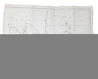
Beretning til Kaartet over Sonda Stræde samt Batavia Rehd Translated from the French: "Mémoire sur une carte du détroit de la Sonde et de la rade de Batavia" - DANISH MANUSCRIPT TRANSLATION OF KRUSENSTERN'S "STRAIT OF SUNDA" INCLUDING THE MAP
1820réf. 58819København 1820 Original work published St. Pétersburg 1813 4to 190 x 258 mm. In later half cloth. Gilt lettering and stamp to front board. Two stamps to title-page. Manuscript in brown ink by Danish Rear Admiral Lövenørn. Fine and clean with text in very good and legible condition. 6 32 pp. coloured manuscript map of Strait of Sunda. Copy of Krusensterns 1813-map. 590 x 460 mm Danish Manuscript translation of Krusenstern's commentary to his of map of the Strait of Sunda and Batavia habour from 1813. We have been able to locate only one other copy of this work also a Danish translation from 1815 but lacking the map manuscript and printed in Danish Swedish or Norwegian. Despite the fact that the Strait of Sunda was sailed relatively frequently by European sailors Krusenstern's 1813-memoir is one of the earliest reliable pilots to this strait. From the present memoire: "Although a strait so important as that of Sunda frequented every year by more than 50 European ships ought to be as one would naturally suppose perfectly well known; notwithstanding which after having examined the charts of these coasts reputed the best I venture to say that I have been convinced that there does not exit one with which one can be entirely satisfied". Rear admiral Lövenørn became the first director of Royal Danish Nautical Charts Archive in 1784. hardcover