|
VANDEL Philippe
POURQUOI ?
JC Lattès. 1993. In-8. Broché. Bon état, Couv. convenable, Dos satisfaisant, Intérieur frais. 272 pages.. . . . Classification Dewey : 0-GENERALITES
Referenz des Buchhändlers : R160000823

|
|
|
VANDEL PHILIPPE
POURQUOI ? - LE LIVRE DES POURQUOI.
LE GRAND LIVRE DU MOIS. 1993. In-8. Broché. Etat d'usage, Couv. convenable, Dos satisfaisant, Intérieur acceptable. 272 pages augmentées de nombreuses figures en noir et blanc dans le texte. Dos déboité. OUVRAGE EN 2 PARTIES.. . . . Classification Dewey : 156-Psychologie comparée
Referenz des Buchhändlers : ROD0123065
|
|
|
VANDEL Philippe
Pourquoi ? Le Livre des pourquoi.
JC LATTES. 1993. In-8. Broché. Bon état, Couv. convenable, Dos satisfaisant, Intérieur frais. 272 pages. Nombreux dessins en noir et blanc hors-texte. Quelques traces d'humidité en marges.. . . . Classification Dewey : 300-SCIENCES SOCIALES
Referenz des Buchhändlers : RO80033748
|
|
|
Vandel Philippe
Pourquoi ? Tome 1 : Pourquoi
Jean-Claude Lattès 1993 272 pages 24x15x2cm. 1993. Broché. 272 pages.
Referenz des Buchhändlers : 50886

|
|
|
VANDEL PHILIPPE
POURQUOI ENCORE DES POURQUOI
JC LATTES. 1994. In-8. Broché. Bon état, Couv. convenable, Dos satisfaisant, Intérieur frais. 334 Pages - BANDEAU EDITEUR. . . . Classification Dewey : 156-Psychologie comparée
Referenz des Buchhändlers : R160151133
|
|
|
VANDEL PHILIPPE
POURQUOI LE LIVRE DES POURQUOI
JC LATTES / LE GRAND LIVRE DU MOIS. 1994. In-8. Broché. Bon état, Couv. convenable, Dos satisfaisant, Intérieur frais. 272 Pages - Nombreuses illustrations en noir et blanc dans et hors texte. . . . Classification Dewey : 156-Psychologie comparée
Referenz des Buchhändlers : R160151135
|
|
|
Vandel Philippe
Pourquoi le livre des pourquoi
Le Grand livre du mois 1993 275 pages in8. 1993. Broché. 275 pages.
Referenz des Buchhändlers : 212886

|
|
|
VANDEL PHILIPPE - DUHAMEL JEROME
LE GRAND BAZAR DU PIRE ET DU N'IMPORTE QUOI
CANAL + EDITIONS. 1996. In-8. Broché. Etat d'usage, Couv. convenable, Dos satisfaisant, Intérieur frais. 209 pages - nombreuses photos en noir et blanc hors texte - quelques traces de mouillure sur le 2ème plat au niveau de la tranche en pied sans consequence pour la lecture.. . . . Classification Dewey : 847-Satire, humour
Referenz des Buchhändlers : RO20174402
|
|
|
VANDEL PHILIPPE / COLUCHE
"COLUCHE PAR COLUCHE - Entretiens présentés par Philippe Vandel / COLLECTION ""SUCCES DU LIVRE"""
DE LA SEINE. 2005. In-8. Broché. Bon état, Couv. convenable, Dos satisfaisant, Intérieur frais. 238 pages.. . . . Classification Dewey : 847-Satire, humour
Referenz des Buchhändlers : R200092824
|
|
|
VANDEL Philippe / DUHAMEL Jérôme
Le grand bazar du pire et du n'importe quoi.
CANAL +. 1996. In-8. Broché. Bon état, Couv. légèrement passée, Dos satisfaisant, Intérieur frais. 209 pages. Nombreuses planches de photos en noir et blanc hors-texte.. . . . Classification Dewey : 847-Satire, humour
Referenz des Buchhändlers : RO20036397 ISBN : 228611028
|
|
|
VANDEL PHILIPPE.
"""C EST MON AVIS ET JE LE PARTAGE"". LE DICO DES POLITIQUES."
GRASSET.. 1995. In-8. Broché. Bon état, Couv. convenable, Dos satisfaisant, Intérieur frais. 248 pages. Couverture souple illustrée.. . . . Classification Dewey : 320-Science politique
Referenz des Buchhändlers : R150129639

|
|
|
VANDEL PHILIPPE.
COLUCHE PAR COLUCHE.
LE CHERCHE MIDI.. 2004.. In-8. Broché. Bon état, Couv. convenable, Dos satisfaisant, Intérieur frais. 238 pages. 1ère de couverture illustrée en couleurs.. . . . Classification Dewey : 847-Satire, humour
Referenz des Buchhändlers : R150024409

|
|
|
Vandel, Philippe
C'est mon avis et je le partage French Edition
paperback. Good. Access codes and supplements are not guaranteed with used items. May be an ex-library book. paperback
Referenz des Buchhändlers : 2246510619.G ISBN : 2246510619 9782246510611

|
|
|
Vandel, Philippe
Les pourquoi en images 2014
paperback. Good. Access codes and supplements are not guaranteed with used items. May be an ex-library book. paperback
Referenz des Buchhändlers : 2366580606.G ISBN : 2366580606 9782366580600

|
|
|
Vandenberg, Philippe
Philippe Vandenberg
new. unknown
Referenz des Buchhändlers : 29885688-n ISBN : 3906915042 9783906915043

|
|
|
Vandenberg, Philippe (Contributor)/ Davidts, Wouter (Editor)/ Anfam, David/ Welchman, John
Philippe Vandenberg: Absence Etc.
Hauser & Wirth 2017. Paperback. New. 236 pages. 11.00x9.00x0.75 inches. Hauser & Wirth paperback
Referenz des Buchhändlers : x-3906915042 ISBN : 3906915042 9783906915043
|
|
|
Vandenberg, Philippe
Philippe Vandenberg : Crossing the Circle
MER. Paper Kunsthalle. New. 2016. Paperback. 9492321408 . - IN STOCK AND IMMEDIATELY AVAILABLE FOR SHIPMENT - BRAND NEW FLAWLESS COPY NEVER OPENED - with a bonus offer-- . MER. Paper Kunsthalle paperback
Referenz des Buchhändlers : 129402 ISBN : 9492321408 9789492321404

|
|
|
Vandenberg, Philippe
Philippe Vandenberg. Kamikaze. herausgegeben von Brigitte Kölle (Hamburger Kunsthalle) & Felicity Lunn (Kunsthaus Pasquart)
[Veurne] : Hannibal Publishing - London : Koenig Books, [2018]. 271 S. Mit zahlr. auch farb. Abb. Originalhardcover.
Referenz des Buchhändlers : 1131706

|
|
|
Vandenberg, Philippe
Philippe Vandenberg. Oeuvre 2000-2006: La Folie Ne Laisse Pas D'oeuvre / L'important c'est le kamikaze: oeuvre, 2000-2006.
Ghent], On Line, 2006 softcover, 205 pages, Illustrated. 23x16cm. text Frans, Engels. fine. ISBN 9789078547013.
Referenz des Buchhändlers : 67117
|
|
|
VANDER MAELEN Philippe.
Dictionnaire géographique de la Province de Hainaut.
A l'établissement Géographique, Bruxelles, 1833. Un volume relié (15 x 23 cm) de 396 pages, 527 pages et 18 tableaux dépliants en fin de volume sur les routes existantes, les routes en construction, les rivières canalisées par écluses à sas et par barrages, les rivières non navigables. Reliure demi chagrin vert, dos lisse, tire doré. Reliure légèrement usée, trace de frottements, épidermures, coins émoussés, dos décoloré, mais reliure encore solide. Intérieur en bon état.
Referenz des Buchhändlers : 3109

|
|
|
VANDER MAELEN Philippe.
Dictionnaire géographique de la Province de Hainaut.
A l'établissement Géographique, Bruxelles, 1833. Un volume relié (15 x 23 cm) de 396 pages, 527 pages et 18 tableaux dépliants en fin de volume sur les routes existantes, les routes en construction, les rivières canalisées par écluses à sas et par barrages, les rivières non navigables. Reliure demi chagrin vert, dos lisse, tire doré. Reliure légèrement usée, trace de frottements, épidermures, coins émoussés, dos décoloré, mais reliure encore solide. Intérieur en bon état.
Referenz des Buchhändlers : 3109
|
|
|
VANDERBERG PHILIPPE.
NEFERTITI. LA PREMIERE BIOGRAPHIE ARCHEOLOGIQUE.
BELFOND.. 1976.. In-8. Broché. Bon état, Couv. convenable, Dos satisfaisant, Intérieur frais. 287 pages. 1ère de couverture illustrée en couleurs.. . . . Classification Dewey : 830-Littératures des langues germaniques
Referenz des Buchhändlers : R150016993

|
|
|
VANDERBERG PHILIPPE.
TOUTANKHAMON.
BELFOND.. 1979.. In-8. Broché. Bon état, Couv. convenable, Dos satisfaisant, Intérieur frais. 270 pages. 1ère de couverture illustrée en couleurs. Nombreuses illustrations en noir et blanc, hors texte.. . . . Classification Dewey : 830-Littératures des langues germaniques
Referenz des Buchhändlers : R150016994

|
|
|
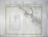
Vandermaelen, Philippe Marie Guillaume
Amer. Sep. Partie du Guatemala. No. 76.
Bruselles 1827. Excellent. Size : 464x557 mm 18.25x21.875 Inches Coloring: Original Outline Coloring Category: ; Maps Central America unknown
Referenz des Buchhändlers : M2904
|
|
|
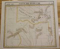
Vandermaelen, Philippe Marie Guillaume
Amer. Sep. Partie des Etats Unis No. 55.
Bruxelles 1827. Good; some worming on the upper and lower parts of the fold. Notes: From Vandermaelen's "Atlas Universel de Geographie Physique Politique Statistique et Mineralogique" Brusseles 1827.<br><br>"The map trade in the 1820s had taekn notice of the enormous interest in Texas and had begun to supply maps catering to it. In 1827 Phillipe van der Maelen's 'Atlas Universel' the most lavish and detailed cartographic production of the decade and the first major lithographed atlas included five maps depicting parts of Texas. These maps were based primarily on the outmoded models of Humboldt and Pike and contributed no new knowledge." Martin & Martin 32 Size : 470x515 mm 18.5x20.25 Inches Coloring: Original Outline Coloring Reference: Martin & Martin 32 Category: ; Maps United States South Texas unknown
Referenz des Buchhändlers : M2726
|
|
|
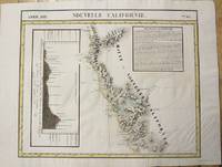
Vandermaelen, Philippe Marie Guillaume
Amer. Sep. Nouvelle Californie. No. 46.
Bruxelles 1827. Very Good; several wormholes on the upper and lower parts of the fold. Notes: From Vandermaelen's "Atlas Universel de Geographie Physique Politique Statistique et Mineralogique" Brusseles 1827. Size : 472x572 mm 18.625x22.5 Inches Coloring: Original Outline Coloring Category: Maps United States West California unknown
Referenz des Buchhändlers : M2722
|
|
|
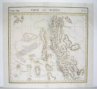
Vandermaelen, Philippe Marie Guillaume
Amer. Sep. Partie du Mexique. No. 54.
Bruxelles 1827. Good; some worming on the upper and lower parts of the fold wormholes professionally filled. Notes: From Vandermaelen's "Atlas Universel de Geographie Physique Politique Statistique et Mineralogique" Brusseles 1827. Size : 468x490 mm 18.375x19.25 Inches Coloring: Original Outline Coloring Category: Maps United States West States; unknown
Referenz des Buchhändlers : M2724
|
|
|
Vandermaelen, Philippe Marie Guillaume
Amer. Sep. Parties des Etats - Unis et du Nouveau Mexique. No. 48.
Bruxelles 1827. Very Good; several wormholes on the upper and lower parts of the fold. Notes: From Vandermaelen's "Atlas Universel de Geographie Physique Politique Statistique et Mineralogique" Brusseles 1827. Size : 460x554 mm 18.125x21.75 Inches Coloring: Original Outline Coloring Category: Maps United States West States; unknown
Referenz des Buchhändlers : M2720
|
|
|
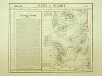
Vandermaelen, Philippe
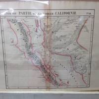
Amer. Sep. Partie de la Vieille Californie. No. 47
Bruxelles: Ph. Vandermaelen 1827. First edition. A very good sharp copy. 1 sheet. Hand-colored lithographic map. 47 x 57 cm. Shows the ranges of eight Indian tribes. Covers parts of Utah Colorado and northern Arizona and New Mexico. Includes text: Note sur le Mexique. At a time when American map publishers were virtually ignoring the western United States Vandermaelen's large scale work -which includes sections of Utah Wyoming Arizona and Nevada then still considered part of Mexico along with the location of Indian tribes and shows Lake Timpanagos- was a landmark in the history the cartography of the Transmississippi West. Large text box on the left entitled: Note sur le Mexique by A. Delavault. From Phillipe Vandermaelen Atlas universel de geographie physique politique statistique et mineralogique. a magnificent and ground breaking six volume atlas of the entire world which was the first atlas to use lithography to show the entire world using such a large uniform scale approximately 26 miles to the inch and which was designed to be joined together into a three-dimensional globe with a diameter of approximately 25 feet. Wheat Transmississippi 378. Sabin 43762. Phillips 749. [Ph. Vandermaelen] unknown
Referenz des Buchhändlers : 40379
|
|
|
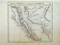
Vandermaelen, Philippe Humboldt, Alexander von
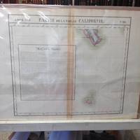
Amer. Sep. Partie de la Vieille Californie. No. 58. and No. 65
Bruxelles: Ph. Vandermaelen 1827. First edition. Very good bright copies a few minor spots or marginal finger soiling. 2 sheets. Hand-colored lithographic maps. 46 x 51 cm and 46 x 54 cm. Large scale map of Baja. Map 58 includes parts of Baja California Sonora Sinaloa and Chihuahua. Map 65 includes the tip of Baja California and the "Iles Revillagigedo" and a text box: Note sur le Mexique . de Humboldt. Sheets from Phillipe Vandermaelen Atlas universel de geographie physique politique statistique et mineralogique. a magnificent and ground breaking six volume atlas of the entire world which was the first Atlas to use lithography to show the entire world using such a large uniform scale approcimately 26 miles to the inch and which was designed to be joined together into a three-dimensional globe with a diameter of approximately 25 feet. Phillips 749. Sabin 43762. [Ph. Vandermaelen] unknown
Referenz des Buchhändlers : 40378
|
|
|
Vandermaelen, Philippe Marie Guillaume
AMER. SEP. DECOUVERTES BOREALES No. 8 c. 1827
18.5" x 22"-46.9 x 55.8 cm. . Colour. A nice crisp copy with wide margins. An interesting topographical chart showing the profile of the Canal of Huehuetca in Mexico and its funciotn of preserving flooding in Mexico city. unknown
Referenz des Buchhändlers : 842
|
|
|
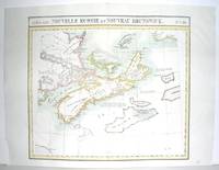
Vandermaelen, Philippe Marie Guillaume
Amer.Sep. Nouvelle Ecosse et Nouveau Brunswick. No. 44.
Bruxelles 1827. Excellent. Size : 470x530 mm 18.5x20.875 Inches Coloring: Original Outline Coloring Category: ; Maps Canada East Nova Scotia; Maps Canada East Prince Edward Island; Maps Canada East New Brunswick; Maps Canada East Newfoundland unknown
Referenz des Buchhändlers : M2906
|
|
|
Vandermaelen, Philippe Marie Guillaume
Amer.Sep. Partie de l'Amerique Russe. No. 13.
Bruxelles 1827. Excellent. Size : 482x565 mm 19x22.25 Inches Coloring: Original Outline Coloring Category: Maps Polar Arctic Regions Alaska Greenland Iceland; unknown
Referenz des Buchhändlers : M2907
|
|
|
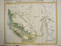
Vandermaelen, Philippe Marie Guillaume
Amer.Sep. Partie de la Nouvelle Hanovre. No. 31
Bruxelles 1825. Excellent;. Notes: The first atlas of the world on a uniform scale. If assembled as a globe gores forms a very large globe.<br><br>The map shows British Columbia and extends as far north and the Straits of Queen Charlotte. The map also notes the location of different Native tribes of the area. Finally this map shows the route that MacKenzie took to the Pacific from the Frasier River. Size : 472x561 mm 18.625x22.125 Inches Coloring: Original Hand Coloring Category: Maps Canada West British Columbia; unknown
Referenz des Buchhändlers : M3339
|
|
|
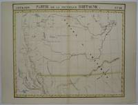
Vandermaelen, Philippe Marie Guillaume
Amer.Set. Partie de la Nouvelle Bretagne. No. 32.
Bruxelles 1825. Very Good. Notes: An uncommon map of South Alberta. The map clearly shows the location of Fort Edmonton and other major establishment. From the first atlas of the World on an uniform scale. If assembled as a globe gores forms a very large globe. Size : 470x563 mm 18.5x22.125 Inches Coloring: Hand Colored Category: Maps Canada West Alberta unknown
Referenz des Buchhändlers : M3340
|
|
|
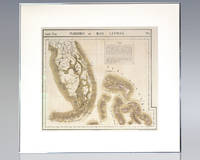
Vandermaelen, Philippe Marie
AmeÌrique Septentrionale. Florides et Iles Lucayes. No. 62. Map of Florida and the Bahamas.
Brussels: Lithographed by H. Ode 1825. Rare hand-colored lithograph map of South Florida the Keys and the Bahamas from renowned 19th century Belgian cartographer Philippe Vandermaelen's Atlas Universel. One page the map displays South Florida and the Bahamas including major cities as of 1825 with numerous Native American trails and roads recorded and an inset text regarding the flora and fauna of the Everglades. Matted and framed. The entire piece measures 29 inches by 27 inches. Published in 1827 and consisting of approximately 380 conically projected sheets of maps in six volumes Belgian geographer's Vandermaelen's Atlas Universel was the first atlas produced using the method of lithography and the first to use the same large uniform scale for all of the maps included in its pages. Regarded as one of the most important and remarkable innovations in the private enterprise of cartography the maps were uniquely designed to be joined into a three-dimensional terrestrial globe with a diameter of approximately 25 feet. Lithographed by H. Ode unknown
Referenz des Buchhändlers : 137108
|
|
|
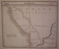
VANDERMAELEN, Philippe Marie
Anzico. Afrique. No. 38
Brussels: Vandermaelen Philippe Marie 1827. unbound. very good. Map. Large format lithograph of West Africa with original hand coloring. Image measures 18.5" x 22.25".<br/> <br/> Includes the Congo Congo River and Gabon. Double page with centerfold. From Vandermaelen's 6 volume "Atlas universel de geographie physique politique statistique et mineralogique sur l'echelle de 1/16411836". Can be combined as gores to form an immense globe. The atlas was the first to map the world on a uniform scale.<br/> <br/> Vandermaelen, Philippe Marie unknown
Referenz des Buchhändlers : 202217
|
|
|
VANDERMAELEN, Philippe Marie
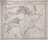
Asie. Partie de la Chine. No. 59
Brussels: Vandermaelen Phillipe Marie 1827. unbound. very good. Map. Large format lithograph with original hand outline color. Image measures 18.75" x 19 1/8". Sheet measures 21" x 27". Shows some foxing and a few tears to edges.<br/> <br/> Beautifully detailed map that shows Bejing "Pekin" and surrounding provinces. Mountains are delicately treated with hachure marks and major rivers and waterways are also shown. From Vandermaelen's 6 volume "Atlas universel de geographie physique politique statistique et mineralogique sur l'echelle de 1/16411836". The atlas was the first to map the world on a uniform scale; maps were meant to join together to form a huge globe.Phillippe Marie Vandermaelen 1795-1869 was a Belgian cartographer and publisher. This map is a fine example of his work.<br/> <br/> Vandermaelen, Phillipe Marie unknown
Referenz des Buchhändlers : 283421
|
|
|
VANDERMAELEN, Philippe Marie
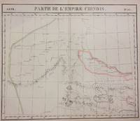
Asie. Partie de la Chine. Nos. 57 & 58
Brussels: Phillippe Marie Vandermaelen 1827. unbound. very good. Map diptych. Two double-page lithographs with original hand outline color. Each image measures 18.75" x 19 1/8". Sheets measure 21" x 27". Both show some foxing and some chips and tears to edges.<br/> <br/> Beautifully detailed map that shows northwest China including parts of the Silk Road. Mountains are delicately treated with hachure marks and major rivers and waterways are also shown. From Vandermaelen's 6 volume "Atlas universel de geographie physique politique statistique et mineralogique sur l'echelle de 1/16411836". The atlas was the first to map the world on a uniform scale; maps were meant to join together to form a huge globe.<br> <br> Phillippe Marie Vandermaelen 1795-1869 was a Belgian cartographer and publisher. This map is a fine example of his work.<br/> <br/> Phillippe Marie Vandermaelen unknown
Referenz des Buchhändlers : 283424
|
|
|
VANDERMAELEN, Philippe
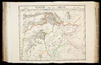
Atlas universel de geographie physique politique statistique et mineralogique
Brussels 1827. 540 by 410mm. 21.25 by 16.25 inches. 6 volumes. Folio 6 letterpress half-titles and title-pages dedication leaf 42 pages of text 'Statistique de l'Europe' 7 lithographed index maps one of comparative heights with contemporary hand-colour in full and 382 numbered double-page maps by Henri Ode with contemporary hand-colour in outline some very occasional spotting; contemporary half tree calf drab paper boards some wear. The maps in the atlas make up the first map of the world on a uniform scale constructed as a modified conical projection and if assembled forming a globe with a diameter of 7.75 metres although only one such was known to have been made by the author himself and requiring a specially designed room. "Philippe Vandermaelen was born in Brussels in 1795 the son of a rich soap manufacturer. After his father's death in 1816 he devoted himself to maps and eleven years later produced this quite remarkable atlas. It was totally at his own expense and like so many innovations in the past it came about through the single-minded efforts of a man who could afford failure. It offered the largest picture of the earth's surface available in the nineteenth century thereby giving the lesser known areas such as Australia South Africa and the West coast of America all developing countries a much greater coverage than before. And perhaps most importantly of all it was the first atlas to be produced by lithography" Wardington Catalogue. cf. Koeman III Vdm 1; NMM 3:179; Philips Atlases 749 hardcover
Referenz des Buchhändlers : 15962
|
|
|
Vandermaelen, Philippe
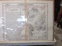
Atlas Universel De Geographie Physique Politique Et Mineralogique North America - Map of Eastern Nevada and Utah Partie Du Mexique
Brussels Belgium: Lithographed By H. Ode. Very Good. 1827. Map. Map # 47 A Very Good primitive and early map of eastern Nevada the State of Utah also including part of northern Arizona and the Grand Canyon. The Great Salt Lake is shown but further south and west than later surveyed to be. Of course almost all localities shown are French or Indian names. Another large lake is shown probably Bear Lake is shown in Nevada. The atlas from which this is extracted is extremely rare and originally composed 6 volumes this map being from the North America volume. Lithographer Ode and Cartographer Vandermaelen produced the first lithographed atlas ever done. Condition is overall Very Good. Browning to the centerfold crease caused by glue used in attaching the tab to the original volume the two page spread measures 21" x 26 1/2" when opened out. Approximately 1/3 of the map consists of a lengthy description in French of the Mexican territory which comprised Nevada and Utah. Other contiguous maps are shown as parts of the "New Mexico territory" but this map describes itself as part of Mexico as was California in 1824. Topigraphical features are accentuated see image. Shipping will require extra care and cost due to insurance. Photo available upon request. ; 21" x 26 1/2"; 1 pages . Lithographed By H. Ode unknown
Referenz des Buchhändlers : 36233
|
|
|
Vandermaelen, Philippe
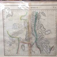
Atlas Universel De Geographie Physique Politique Et Mineralogique North America - Map of Present Day New Mexico Partie Du Mexique
Brussels Belgium: Lithographed By H. Ode. Very Good. 1827. Map. Map #54 Very Good The map includes present day New Mexico a small part of Northern Mexico and some of very northwestern Texas. It is double page 3 color and black and white topographical features are accentuated. A fifteen line description in French is super imposed on the left side of the map - covers about 6" x 1 3/4". The condition is very good. Darkening appears along the centerfold where map was attached by a tab to the atlas. Scale of the map is 26 miles per one inch. Lithograpy was done by Henri Ode. In conjunction with cartographer Philippe Vandermaelen they produced the first lithographed atlas ever done. It provides on a large scale a picture of many newly explored areas as in this case the Western United States. Photo available upon request. ; 21" x 26 1/2"; 1 pages . Lithographed By H. Ode unknown
Referenz des Buchhändlers : 36234
|
|
|
Vandermaelen, Philippe
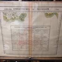
Atlas Universel De Geographie Physique Politique Et Mineralogique North America - Map of the Mouth of the Mississippi River Embouchers Du Mississipi
Brussels Belgium: Lithographed By H. Ode. Very Good. 1827. Map. Map # 61 A Very Good primitive and early map showing the mouth of the Mississippi river shows the New Orleans delta area and also Appalachee Bay of Florida with Port St. Joseph. There is an inset in French with Tables of Population for 1823. Latitude of the map is 24 degrees to 30 degrees and longitude is 86 degrees to 94 degrees. Of course almost all localities shown are French or Indian names. The atlas from which this is extracted is extremely rare and originally composed 6 volumes this map being from the North America volume. Lithographer Ode and Cartographer Vandermaelen produced the first lithographed atlas ever done. Condition is overall Very Good. Browning to the centerfold crease caused by glue used in attaching the tab to the original volume the two page spread measures 21" x 26 1/2" when opened out. Topigraphical features are accentuated see image. Shipping will require extra care and cost due to insurance. Photo available upon request. ; 21" x 26 1/2"; 1 pages . Lithographed By H. Ode unknown
Referenz des Buchhändlers : 36245
|
|
|
Vandermaelen, Philippe
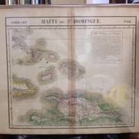
Atlas Universel De Geographie Physique Politique Et Mineralogique North America - Map of the Bahama Islands and Haiti Haiti Ou St. Dominque
Brussels Belgium: Lithographed By H. Ode. Very Good. 1827. Map. Map # 68 A Very Good primitive and early map of the Bahama Islands and the Island of Haiti or Santo Domingo also shows the eastern tip of Cuba. Latitude of the map is 18 degrees to 24 degrees and longitude is 70 degrees to 78 degrees. Of course almost all localities shown are French or Indian names. The atlas from which this is extracted is extremely rare and originally composed 6 volumes this map being from the North America volume. Lithographer Ode and Cartographer Vandermaelen produced the first lithographed atlas ever done. Condition is overall Very Good. Browning to the centerfold crease caused by glue used in attaching the tab to the original volume the two page spread measures 21" x 26 1/2" when opened out. Topigraphical features are accentuated see image. Shipping will require extra care and cost due to insurance. Photo available upon request. ; 21" x 26 1/2"; 1 pages . Lithographed By H. Ode unknown
Referenz des Buchhändlers : 36243
|
|
|
Vandermaelen, Philippe
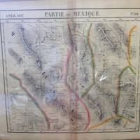
Atlas Universel De Geographie Physique Politique Et Mineralogique North America - Map of Northwest Mexico and Southwest Texas Partie Du Mexique
Brussels Belgium: Lithographed By H. Ode. Very Good. 1827. Map. Map # 59 A Very Good primitive and early map of northwest Mexico and southwest Texas includes Chihuahua ans the southern tip of the Baja Peninsula. Latitude of the map is 24 degrees to 30 degrees and longitude is 102 degrees to 110 degrees. Of course almost all localities shown are French or Indian names. The atlas from which this is extracted is extremely rare and originally composed 6 volumes this map being from the North America volume. Lithographer Ode and Cartographer Vandermaelen produced the first lithographed atlas ever done. Condition is overall Very Good. Browning to the centerfold crease caused by glue used in attaching the tab to the original volume the two page spread measures 21" x 26 1/2" when opened out. Topigraphical features are accentuated see image. Shipping will require extra care and cost due to insurance. Photo available upon request. ; 21" x 26 1/2"; 1 pages . Lithographed By H. Ode unknown
Referenz des Buchhändlers : 36238
|
|
|
Vandermaelen, Philippe
Atlas Universel De Geographie Physique Politique Et Mineralogique North America - Map of Baja Peninsula and Western Coast of Mexico Partie De La Vielle Californie
Brussels Belgium: Lithographed By H. Ode. Very Good. 1827. Map. Map # 58 A Very Good primitive and early map of the Baja Peninsula and the western coast of Mexico showing the province of Sonora. Latitude of the map is 24 degrees to 30 degrees and longitude is 110 degrees to 118 degrees. Of course almost all localities shown are French or Indian names. The atlas from which this is extracted is extremely rare and originally composed 6 volumes this map being from the North America volume. Lithographer Ode and Cartographer Vandermaelen produced the first lithographed atlas ever done. Condition is overall Very Good. Browning to the centerfold crease caused by glue used in attaching the tab to the original volume the two page spread measures 21" x 26 1/2" when opened out. Topigraphical features are accentuated see image. Shipping will require extra care and cost due to insurance. Photo available upon request. ; 21" x 26 1/2"; 1 pages . Lithographed By H. Ode unknown
Referenz des Buchhändlers : 36242
|
|
|
Vandermaelen, Philippe
Atlas Universel De Geographie Physique Politique Et Mineralogique North America - Map of Southernmost Baja and Iles Revillagigedo Partie De La Vielle Californie
Brussels Belgium: Lithographed By H. Ode. Very Good. 1827. Map. Map # 63 A Very Good primitive and early map of the southernmost tip of the Baja Peninsula and the Iles Revillagigedo showing Cabo San Lucas. Latitude of the map is 18 degrees to 24 degrees and longitude is 110 degrees to 118 degrees. There is a large inset note in French about Mexico. Of course almost all localities shown are French or Indian names. The atlas from which this is extracted is extremely rare and originally composed 6 volumes this map being from the North America volume. Lithographer Ode and Cartographer Vandermaelen produced the first lithographed atlas ever done. Condition is overall Very Good. Browning to the centerfold crease caused by glue used in attaching the tab to the original volume the two page spread measures 21" x 26 1/2" when opened out. Topigraphical features are accentuated see image. Shipping will require extra care and cost due to insurance. Photo available upon request. ; 21" x 26 1/2"; 1 pages . Lithographed By H. Ode unknown
Referenz des Buchhändlers : 36241
|
|
|
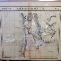
Vandermaelen, Philippe
Atlas Universel De Geographie Physique Politique Et Mineralogique North America - Map of Western and Southern Oregon Territory Partie Des Etats Unis
Brussels Belgium: Lithographed By H. Ode. Very Good. 1827. Map. Map # 38 A Very Good primitive and early map of western and southern Oregon territory including southern Washington state. It especially emphasizes the coast. Latitude of the map is 42 degrees to 48 degrees and longitude is 120 degrees to 130 degrees. Of course almost all localities shown are French or Indian names. The atlas from which this is extracted is extremely rare and originally composed 6 volumes this map being from the North America volume. Lithographer Ode and Cartographer Vandermaelen produced the first lithographed atlas ever done. Condition is overall Very Good. Browning to the centerfold crease caused by glue used in attaching the tab to the original volume the two page spread measures 21" x 26 1/2" when opened out. Topigraphical features are accentuated see image. Shipping will require extra care and cost due to insurance. Photo available upon request. ; 21" x 26 1/2"; 1 pages . Lithographed By H. Ode unknown
Referenz des Buchhändlers : 36239
|
|
|
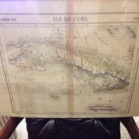
Vandermaelen, Philippe
Atlas Universel De Geographie Physique Politique Et Mineralogique North America - Map of the Island of Cuba Ile De Cuba
Brussels Belgium: Lithographed By H. Ode. Very Good. 1827. Map. Map # 67 A Very Good primitive and early map of the Island of Cuba also shows Jamaica and Grande Cayman. There is an inset in French with the history of Cuba. Latitude of the map is 18 degrees to 24 degrees and longitude is 78 degrees to 86 degrees. Of course almost all localities shown are French or Indian names. The atlas from which this is extracted is extremely rare and originally composed 6 volumes this map being from the North America volume. Lithographer Ode and Cartographer Vandermaelen produced the first lithographed atlas ever done. Condition is overall Very Good. Browning to the centerfold crease caused by glue used in attaching the tab to the original volume the two page spread measures 21" x 26 1/2" when opened out. Topigraphical features are accentuated see image. Shipping will require extra care and cost due to insurance. Photo available upon request. ; 21" x 26 1/2"; 1 pages . Lithographed By H. Ode unknown
Referenz des Buchhändlers : 36244
|
|
|
Vandermaelen, Philippe
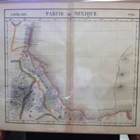
Atlas Universel De Geographie Physique Politique Et Mineralogique North America - Map of Southeastern Mexican Coast Partie Du Mexique
Brussels Belgium: Lithographed By H. Ode. Very Good. 1827. Map. Map # 65 A Very Good primitive and early map of the southeastern Mexican coast along the Gulf of Mexico showing Vera Cruz and approaching the Yucatan. Latitude of the map is 18 degrees to 24 degrees and longitude is 92 degrees to 104 degrees. Very nice color. Of course almost all localities shown are French or Indian names. The atlas from which this is extracted is extremely rare and originally composed 6 volumes this map being from the North America volume. Lithographer Ode and Cartographer Vandermaelen produced the first lithographed atlas ever done. Condition is overall Very Good. Browning to the centerfold crease caused by glue used in attaching the tab to the original volume the two page spread measures 21" x 26 1/2" when opened out. Topigraphical features are accentuated see image. Shipping will require extra care and cost due to insurance. Photo available upon request. ; 21" x 26 1/2"; 1 pages . Lithographed By H. Ode unknown
Referenz des Buchhändlers : 36240
|
|

 Per e-mail erhalten
 Als pdf-Dokument herunterladen
 RSS feed
 Permanenter link


